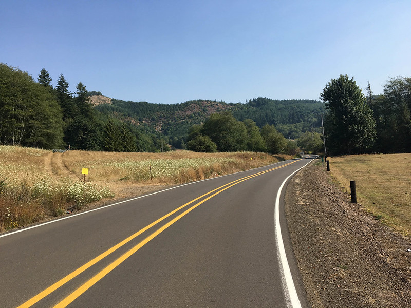
Nestucca River Road is a fantastic way to get from Portland to the coast.
(Photos: J. Maus/BikePortland)
Riding to the coast from the city is something of a rite of passage for many Portlanders. Getting there via Nestucca River Road is a privilege.
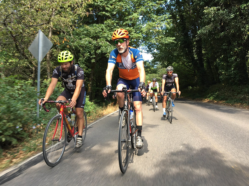
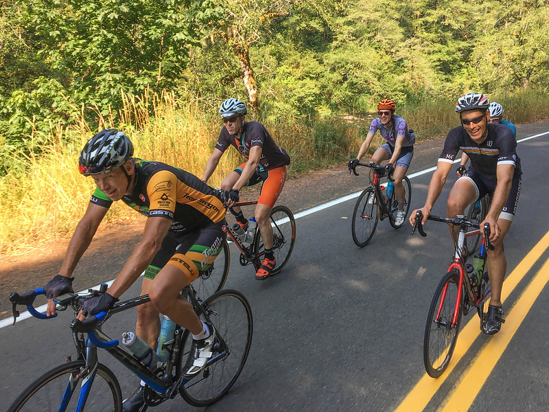
This past Sunday I was lucky enough to try it for the first time as part of the Dirty Sellwood ride. The ride was the fifth annual epic ride collaboration between two great bike shops and their owners: Erik Tonkin of Sellwood Cycle Repair in Portland and Mitchell Buck of Dirty Fingers Bikes in Hood River.
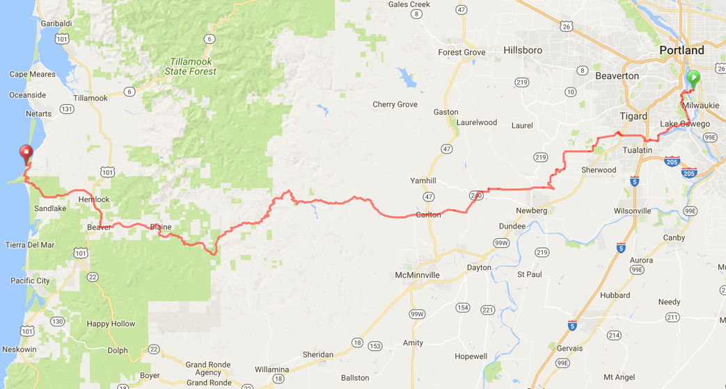
Dirty Sellwood V was billed as an overnighter with 200+ miles of riding from Portland to Cape Lookout State Park and back. (View and download routes at RideWithGPS.com.)
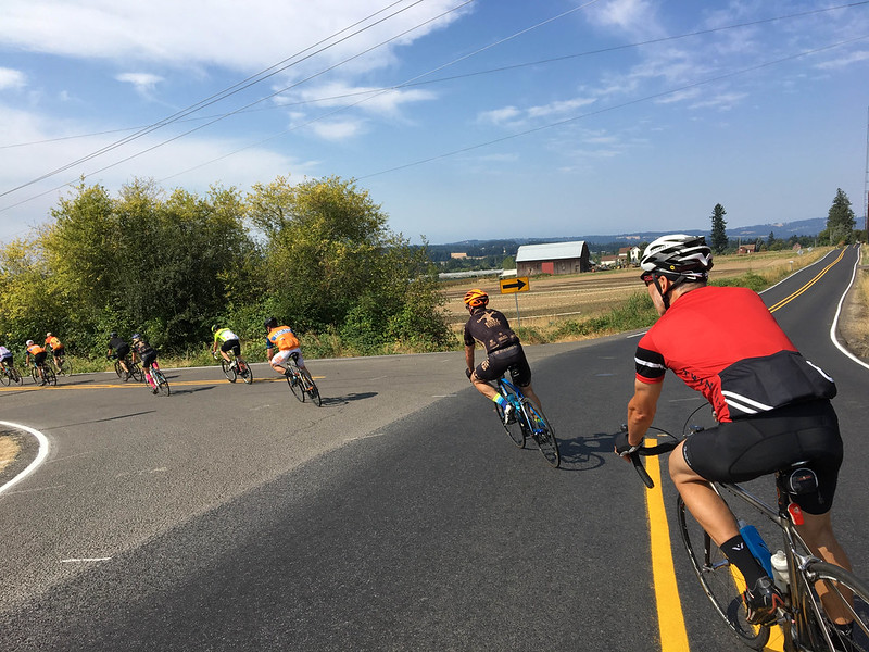
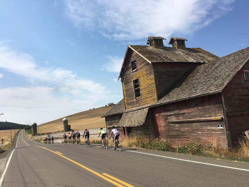
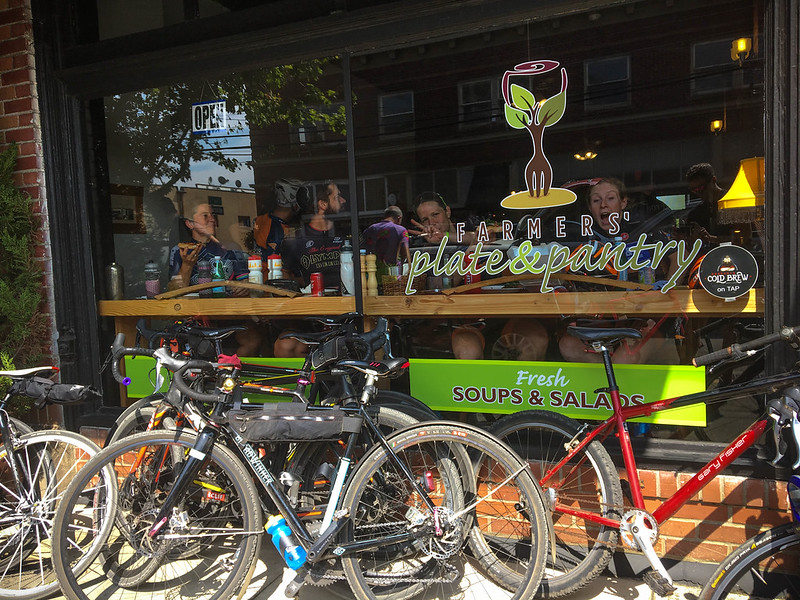
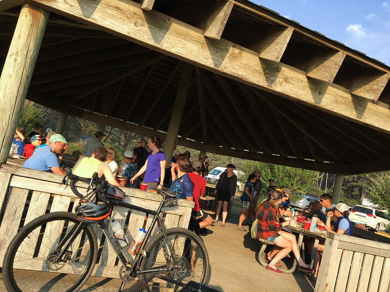
About 60 of us started from the shop in Sellwood and headed west via Lake Oswego en route to our designated lunch stop in the small town of Carlton. I can now highly recommend Farmers’ Plate and Pantry as an excellent stop between Portland the coast. At about the 40-mile mark we arrived just in time for lunch and the food was perfect. Big pizza slices, fresh salads, generous burgers and fries. And with plenty of hospitality to match (even for sweaty, lycra-clad hordes).
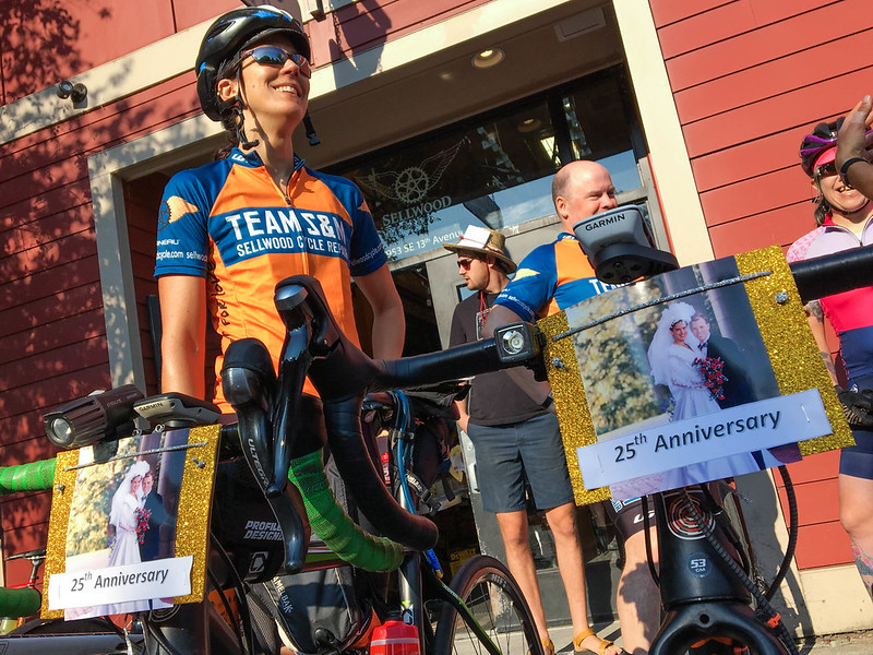
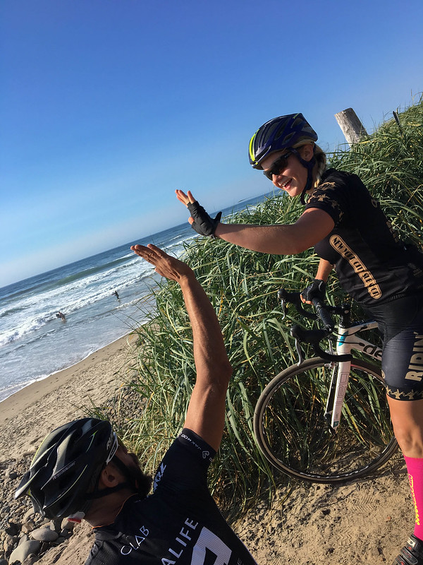
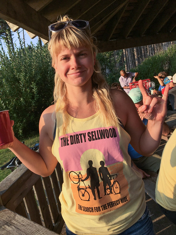
Mielle Blomberg and her husband had something special to ride for.
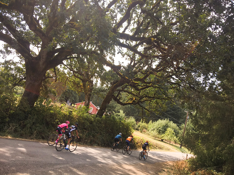
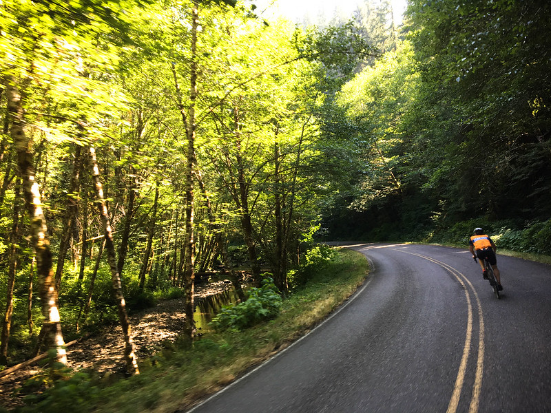
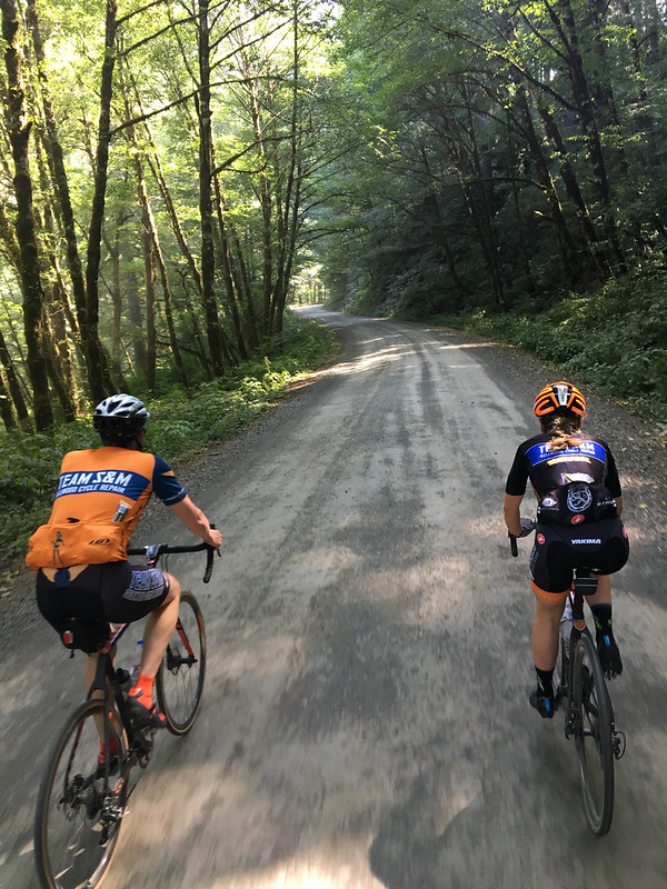
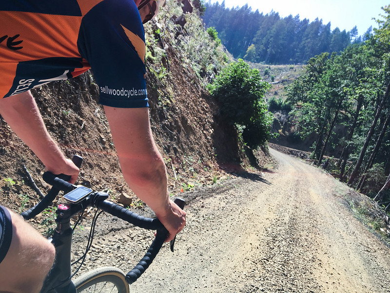
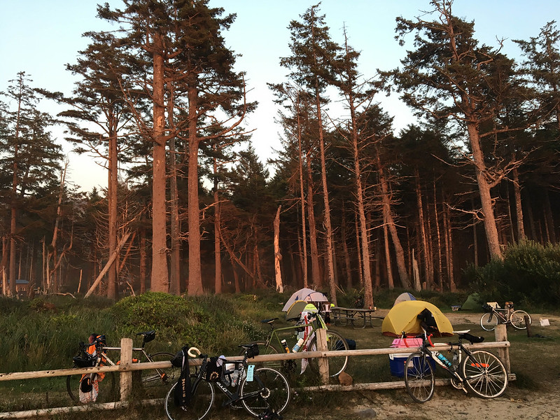
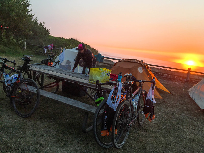
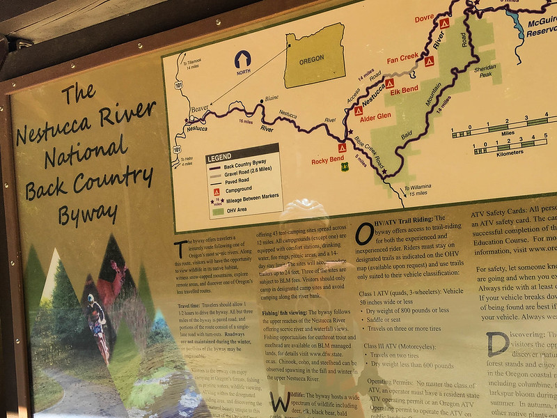
After Carlton the real fun began as we made our way into the hills and onto the Nestucca River National Backcountry Byway. This 48-mile road connects Carlton and Beaver and has very little auto traffic. It hugs the river most of the way and has a few gravel/dirt sections just to make things interesting. Another thing that makes Nestucca Road special for bicycle lovers are the several campsites along the way. They’d be perfect for overnight adventures and they have fresh water to refill your bottles. (One route option would be to take MAX to Hillsboro then bike about 50 miles to a campsite right on the river.)
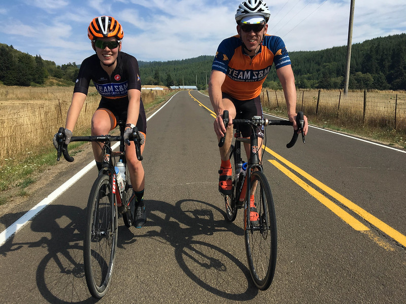
These two speed demons — Clara Honsinger and Peter Koonce — offered me much-needed aerodynamic assistance (a.k.a. pulled me through some tough miles).
Advertisement
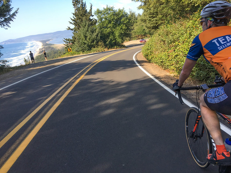
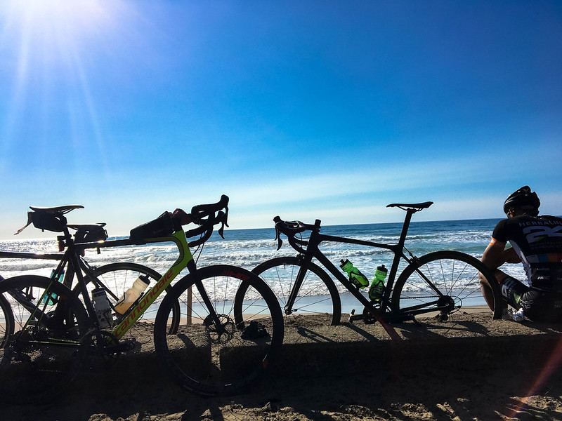
At Beaver we swung north to the sandy dunes of the coast and into Cape Lookout State Park.
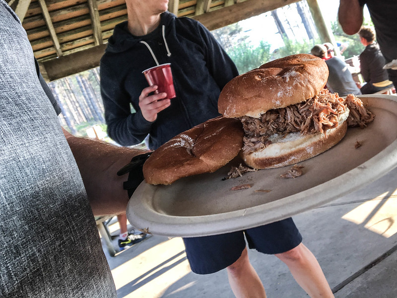
The shops had reserved a group tent site right on the waterfront. After setting up camp we were treated to a hefty plate of pulled pork, rice, and coleslaw from Samurai Lunchbox, a local cart in Sellwood that made the trip just to feed us. We all marveled at the sunset and enjoyed each other’s company before settling in for the night.
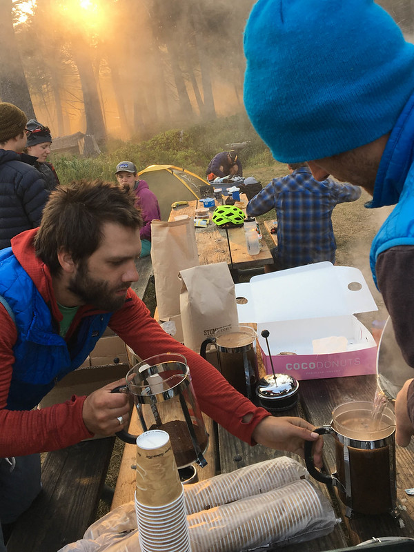
After fresh coffee and oatmeal Monday morning we did the route in reverse back to Portland.

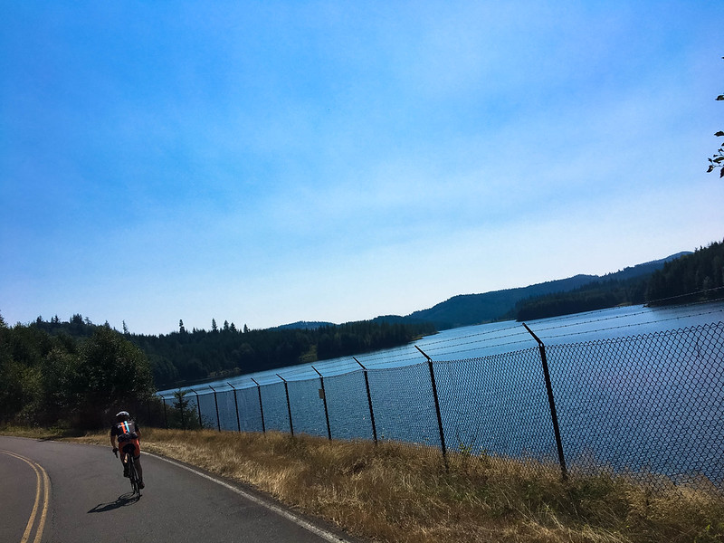
McGuire Reservoir.
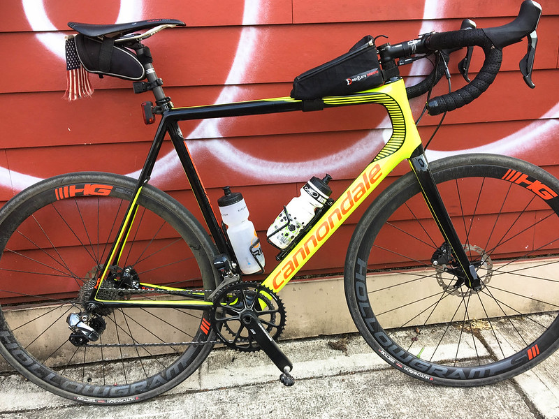
My tool for this job: A very racey Cannondale SuperSix Evo Hi Mod with Ultegra DI2, disc brakes, and 32c tubeless tires. (And notice the USA flag I always ride with in rural areas these days.) It’s been a long time since I had a go-fast road bike and it’s pure joy. Thank you Western Bikeworks for getting me set up on it.
I loved exploring these new places — especially without having to carry my own gear! Huge thanks to the crews at Sellwood and Dirty Fingers for making this happen. Already looking forward to next year. Check out the routes and plan your own adventures here. (This route would make a killer loop by adding the Trask River Road out of Forest Grove/Hagg Lake.)
— Jonathan Maus: (503) 706-8804, @jonathan_maus on Twitter and jonathan@bikeportland.org
Never miss a story. Sign-up for the daily BP Headlines email.
BikePortland needs your support.

 to the Oregon Coast carfree")
")

Thanks for reading.
BikePortland has served this community with independent community journalism since 2005. We rely on subscriptions from readers like you to survive. Your financial support is vital in keeping this valuable resource alive and well.
Please subscribe today to strengthen and expand our work.
Tried doing that last year. We dealt with a terrible rear tire slash (it ate many tubes, ended up getting a new tire) and a blown spoke on the other bike. Scariest drivers along the lonely Willamette Valley roads leading up to Carlton. Wow.
Still, we made it to the top of the pass, then went and played in the Willamette Valley instead.
Must be nice to have sag and advance notice to restaurants 🙂
oh dang. sorry to hear about your travails Ted. And yes, having some support for gear and a bit of organization on a ride like this sure does help… especially having the pizzas pre-made at Farmers’ Plate ;-). I could see more shops doing stuff like this in the future.
Agree with the sentiment regarding rural drivers and that this article is not representative of what it’s like to ride out on those roads.
Excuse me BB?
This article “is not representative” of what’s like to ride out there? Have you ever considered that your experience is just that — your experience. And that the experience of other people might differ from you own?
I’ve ridden 1000s of rural miles in Oregon and have had very very few bad interactions — certainly not enough to keep me from riding.
I agree with you and others that there are certainly juvenile, disrespectful, poorly trained drivers out there and I have been passed closely more times than I’d care to report. But I’m not sure it’s any different in rural areas than in urban ones.
“I ride it and it’s fine”
Okay, dude, thanks for your opinion. So sick of that attitude – it’s a tactic to shut down others’ experiences.
I for one am with BB. I will never ride in rural Oregon. It’s bad enough in inner Portland where there are plenty of other cyclists. No way in hell I’m risking my life out in the mountainous two-lane roads with no shoulders where there are hundreds of raised pickups for every cyclist.
I disagree Adam. I am sharing my personal experience with BB. That’s all. How can say I’m trying to “shut down others’ experiences” when I run a website with one of the main stated goals of sharing people’s experiences? And I moderate a comments section that gives broad leeway to people like you and BB to share your experiences?
Yes I might have been a little short with BB because I didn’t appreciate his tone. That was my mistake. But my comment is about my experience. I’m not trying to shut anyone down. Thanks.
It’s your appeal to authority here that I find off-putting. “I’ve ridden 1000s of rural miles in Oregon and have had very very few bad interactions”. It comes off as dismissive and defensive. Surely not indicative of someone who values “goals of sharing people’s experiences”. I hear this attitude all the time used to shut down differing opinions in Portland.
I hear you Adam. Sorry for that. I know exactly what you are referring to and that type of thing bothers me too when others do it!
In this case, my intent was to relay to BB that overall my experience on rural roads – over many miles — is not as harrowing as his.
Thanks for your comments.
Adam,
I visit this site almost everyday and really enjoy the wide range of topics discussed. I thought this was a very well done write up on what looked like a very fun ride with a lot of cool people. I would of loved to of done it myself if my schedule would of allowed.
Your tone on the other hand is really off putting. I don’t know what kind of riding you do but you sound scared of nearly every type of riding situation. What kind of riding do you do? And why are you putting down people for their opinions just because they like to ride differently then yourself?
How is the way you’re expressing your ideas not an attempt to shut down Jonathan’s opinions?
The reason he mentioned is mileage is to provide context for what informed his opinion which people thinking of starting this type of riding will want to know. He has much more experience than most cyclists with this type of riding. I’ve done quite a bit myself (pushing 100K rural miles in OR).
I personally appreciate his ride reports. There are some routes that look great on a map but which are especially bad with loony drivers or other threats, so knowing what works and what doesn’t is highly valuable.
The other thing I like about people sharing their positive experiences on a bike is it helps remind me why I ride and gives me more ideas to try.
Hearing that everyone sucks, the roads are terrible, and we’re all in perpetual danger is hardly a motivation to get out there.
And what’s your goal Adam when you constantly post nothing but how scared you’d be of almost every single bicycle ride Mr. Maus posts? Aren’t you trying to “shut down” those that would consider riding these rural roads through scaremongering?
Adam, I understand where you’re coming from. It took me over a year after arriving in Oregon before I dared trust riding on the road here (other than very, very rural roads where no one is, some lovely logging roads and inside of the cities), and I had nearly 400,000 miles of road riding experience in many cities/states under my belt at the time.
That said, when I did finally get back in the saddle, here’s what I learned:
1. Traffic inside the cities can be problematic, especially in Portland, largely because of the drivers who live outside the cities in the suburbs. (Note: I consider a place to be a suburb if the people living there commute by car to a nearby city, no matter how many trees are around their houses).
2. In the ring around any city, those suburbanites generally treat cyclists poorly and greatly expand the risk of riding.
3. But, get outside that ring and it’s a new world. Sure, there’s pick-ups and hunting rifles, but the people are almost always civil, polite, considerate and just plain nice to me when I’m riding.
I call it the donut effect. The hole in the middle (the city) is okay to ride. The area outside the donut (true rural) is great to ride. The donut itself (the suburbs) is awful. Unfortunately, in order for you to ride outside the donut, you’ll have to pass through it. I hope you find a way to do so, and when you do, share the route with the rest of us.
I would endorse this too. I live in Hillsboro near the UGB, so my ride choices are to head in to the suburban sprawl, or in less than 5 minutes be out in the western rural areas. 95% of the time I pick the latter, because the experience over the years has proven far superior. With beautiful scenery, quiet roads that can be discovered, and only occasional encounters with trucker idiots. The nearest miss I’ve had all year though was from a Honda Element with a Timbers sticker on it just as an anecdote not to judge too much by stereotypes.
You seem to be trying to shut down the opinion and experience of people who have spent time riding in rural areas.
How much riding have you spent riding outside of the city? If the answer is little or none, then I would suggest that you are not in possession of enough experience to develop an informed opinion.
Speaking as someone who has also ridden 1000’s of miles in rural parts of the greater Portland area, I have had some negative interactions riding in the sticks but certainly fewer than in the city- in total but also on a per-mile and per-interaction basis.
If you’re truly scared to ride out of the city then I feel sorry for you since you are severely limiting your potential for having fun on a bicycle.
I would encourage anyone considering expanding their range and going for a ride out in the country not to let wet-blanket attitudes deter you.
Between Portland and Newberg there are many routes that only have decent shoulders or roads small enough to not have any lane markings at all. Looking at the route they rode maybe 10-15 miles on roads that I note as caution spots when I ride.
If anything I think Jonathan’s perspective is a good balance to… oh, maybe someone who hasn’t ridden this area at all that may have preconceived fears about it.
Adam, you would get scared if a squirrel gave you a dirty look so I put much more weight in what Jonathan’s experience depicts. You seem to expect no real world problems when riding so give him a break. The ride looks awesome. Get a grip Adam and for crying out loud, toughen up
This is a great route and I’ve done it many times. I don’t have a memory of being sketched out by traffic on Nestucca River road. In fact you hardly see anyone until you hit 101 in Beaver, and if coming back to Portland, it’s quiet until you creep up to Hillsboro. Riding in rural Oregon and Washington is the best. I would not prefer to ride anywhere else.
I agree with Jonathan, 99% of the time, I have excellent interaction here in Portland with drivers, yet today a driver with Oregon plates on N Williams called me an Assh***. Oh well, I guess I didn’t please his road etiquette critique. This doesn’t make every city driver a crazed roadrager.
A ride in the country, with farms, forests, coastline, sunshine, and interesting interaction with people is worth the risk of possibly upsetting the rare disgruntled driver.
Lovely photographs, I’ve got to get out and ride that route again. I’ll have to sign up next year.
I wonder if it has changed in recent years? I did this ride about 6 years ago, via the MAX Hillsboro variation, and don’t recall any dangerous passes.
I ride the area between Beaverton and Newberg almost weekly year round and far prefer it to riding in town around traffic. I’ve had some bad experiences but far more bad experiences and my only wreck in urban settings.
I ride in Yamhill county about 4 times per week primarily on my lunch break. During low traffic times like lunch time during the work week almost any road is safe to ride. There are a lot more roads that I won’t ride during high traffic commute times. I have had very few bad or scary interaction with drivers in Yamhill county.
I concur w/ this. I live out in Yamhill CO wine country, non-peak commute hours are pretty car free, and even more so if you get off the pavement and on the gravel. I will say I limit my weekend afternoon rides simply because its wine country and people come here to winery hop.
Thanks for displaying the flag. Be aware that the rural citizens you encounter may recognize that you have it reversed. The US Flag Code says that when displayed vertically, the union should be in the upper left, from the perspective of the guy in the truck behind you. Also, it looks fairly tattered and should probably be retired and replaced.
I’ve always wanted to do something like this but am wary of the unpredictability of rural Oregon drivers. Safety in number seems to be the key.
Jonathan – I am “shocked, just shocked” that this was your first time up and over to Beaver…it is such a nice route where you can count the passing cars on all your digits about once vs the other routes with thousands of cars. Glad you tried it out. 🙂
The MAX and camping option definitely makes a nice failsafe for this coastal route, as I had to do it one summer when I left the office way too late / the rush hour and spent the dark night slowly climbing the mountain with camping gear and slept on a picnic table…I will have to try the sag wagon option some day. ;-)2
PS. I did not recognize the photo of the gravel downhill section without trees…did the route get clear cut this year…or did you take a side route?
ha! That’s actually a pretty steep uphill. And yes, it was a side route off of Meadowlark that then dropped us off onto Nestucca via an access road.
Thanks.
I took this route solo ~15 years ago and really enjoyed it. I felt like I’d discovered a secret back door to the coast.
Same here, but it was 29 years ago. Done it several times. It is absolutely gorgeous, and Jonathan’s photos do it justice.
very cool
Remember: Those who are interested in trying this route out and like to have a paper map…that PBoT (thanks Jeff!) has printable (sans phone) maps for these coast routes.
https://www.portlandoregon.gov/transportation/article/301633
Thanks for posting that link, Todd. I created that map , and others, in response to all the requests for info. I would get on how to bike between Portland and the coast at a time when the only source of info. was the ODoT state bike map – a great resource, but not exactly the desired level of detail.
The Nestucca Rd., which I first rode 23 years ago, seemed like a hidden gem of a route, especially compared to, say, Hwy. 30. I’ve ridden it a half-dozen times since in different seasons and it’s always been splendid – it was especially nice & quiet for a few years when the road was barricaded around Elk Creek…
Thanks for remembering that, Todd – sadly I think those maps were removed from the PBoT website (at least I can’t find them anymore) at some point after I retired. Oh well. Still a great ride, I’ve always gone from the Hillsboro MAX to skip the suburban riding.
PS> I would love for others to share their experiences about some of the even less travelled side routes to the Nestucca road…I have heard a rumour that there is a side route that avoids much of the grade on the east side by the reservoir…any truth to that?
It’s interesting you mention the flag and riding in rural areas..I’ve thought about that quite a bit, being a cyclist that does do rural routes, usually NOT with a large group, AND not being white. Just sayin’..these thoughts run through my head quite a bit these days. I also noticed that if I had participated in this ride, I would (again) be the only non-white rider. Not trying to demean anything, this is just my reality in the sport/activity I’ve chosen, I guess.
Hi again Sukho,
Want to go on a ride with me? I appreciate your comments lately and think it’d be cool to meet up off line. Get in touch if that sounds interesting to you maus.jonathan at Gmail.com.
Definitely. I’ll drop you an email. I’m doing the Bicycle Quarterly Un-Meeting this weekend outside of Carson, WA. https://janheine.wordpress.com/2017/08/29/last-details-bq-un-meeting-and-volcano-high-pass-challenge/
Jan and company are quietly making their mark in the bike world, even if most people don’t realize it. Yet.
“the USA flag I always ride with in rural areas these days.”
I need help with the flag thing. I think I’m missing something.
***phrase deleted by moderator***. It works — i have jerseys for some areas. BTW, they go way easier on ‘bents as they’re interested in them from a technical perspective
***Hi Kyle, I don’t appreciate that type of stereotype-based insult. People who live in rural areas are not “rednecks” any more than people who live in the city are “liberals” or “elites”. Let’s not go down that dark path of using labels to diminish and divide. Thanks. – Jonathan***
lycra provokes; flag cancels the damage?
I ride without either so I guess this line of thinking never occurred to me. But I do like to carry pepper spray for untethered dogs.
I simply speed up. It is never the dog’s fault. I would gladly confront the human that is responsible for the lack of tethering. Oh, the flag stuff works. Great ride, btw. I have always carried my gear, but eat out and get a room. Nothing like a clean chamois. At least most rural folk are not always on the phone.
yeah pretty much. that’s my thinking.
I just want people to remember that we’re all Americans and that I love my country too.
And FWIW I wouldn’t carry pepper spray. Too militant for me. I’ve found dogs are easily repelled by water from my bottle (if they can catch me- which is very rare).
A couple thoughts. First off, spray can be difficult to deploy when there are multiple dogs, unfavorable wind conditions, or you don’t get advance warning. Out speeding them doesn’t work so well uphill or against anything other than light headwinds. Even when it works, I believe it trains dogs to chase cyclists.
Not that outrunning isn’t fun. When I’m on the trike, the teeth come at eyeball level which can produce some truly inspired sprints 🙂
But I think it’s best to be as boring as possible, emotionally neutral, slow way down, even stopping if necessary with the bike between me and the dog if it comes to that.
I can’t speak for Jonathan as to why he does it, or for rural drivers as to how they react to it, but I like the idea just for the simple fact that it reminds anyone looking that “Here I am, an American, traveling on an American road, in America.” Subtext: “My rights are the same as yours, and if you don’t believe in that, you’re shitty at being American.”
In all honesty, I have very few problems of this sort. The tiny number that does this is typically just trying to get a rise out of you — i.e. they’re way less dangerous than someone who isn’t paying attention.
I came down from Seattle a couple years ago and did this camping loop using Nestucca River Road. You guys have some really great routes out to the coast & should appreciate them. The Olympic mountains & Puget Sound really put some constraints on our coastal route possibilities from Seattle.
https://ridewithgps.com/routes/10216707
Was that from Amtrak Cascades or the Coast Starlight?
Newberg / Yamhill County tends to be “shoulder free” / in the lane riding, but is largely car free during non-peak commute times. Also, if you stay off the main roads (say Hwy 219) traffic tends to drop off dramatically. Once you get off the pavement and on to the gravel, the cars all but disappear (tractors, less so…). Of Note – this is wine country and people / tourists come here on the weekends to drink wine / winery hop. I try to wrap my weekend rides PRIOR to noon. Just to be safe.
I rode this once to the coast to go camping, and it was amazing, with the exception of a man in a pickup truck outside of Carlton, who stopped next to me when there was no shoulder, and hurled for me to “gtf off the road, bc these are MY roads and I live here” and blew black smoke in my face, and of course flats from the gravel. A man who lives in the mountains there even offered me fresh water. Once I got to the coast, I cried. Took HWY 6 back.
Give the route another try…its way better grade wise going eastward from the coast back to Carlton vs the westward direction (unless you have a sag wagon or ebike).
Great piece, JM! Wish I were strong enough to try it.
Also, how many gears in that “go fast” roadie did you actually use?
Great thanks to Eric, et. al., for years of heroic service to the cause in PDX.
Hi Jim,
I used all the gears! 😉
This looks pretty fantastic. Definitely something worth putting some training miles in for next year. Thanks for the report Jonathan!
I’ve done this ride a few times including this Sunday and back Monday. Yes. All rides can generally be improved and this one could have used a few different roads in it’s approach to Carlton, but Nestucca River road has little to no traffic and there’s certainly no reason to fear it. I did encounter a few very respectful log trucks and a couple other vehicles on the return trip Monday. I’ve ridden hundred of thousands of miles on Oregon rural roads and have had so few negative interactions that I can’t remember one specifically. If you don’t have two days and support to do this specific ride, you can make this into a great one day loop. Start at one of the wineries in Dundee and cut out the urban sections. After passing McGuire reservoir,turn left off of Nestucca River road onto Bald Mountain Access Road and Climb another 1,000 feet to Sheridan Peak. You can then descend the south side into Willamina and make your way back to Dundee through the valley. Using Balliston Road usually results in a substantial tail wind on the return trip.
A closeup of the map on that display would’ve been nice. Maybe it’ll have a national bike route designation someday. Great photos.
Great photos, as usual – love your “off kilter” angled framing (really makes them “pop”).
Quick techie question: there were off-road/unpaved/gravel section, yet you rode what appears to be a skinny-tire road-racer bike. What happened to your green Salsa Vaya? I recently bought a new Vaya GX (with the carbon fork) and am loving it as a commuter (22 miles a day, mostly on pavement). Did you outgrow it?
Thanks
Hi caesar,
I still have the Salsa Vaya.. But it’s a beast and it wasn’t the right tool for this job since I wasn’t carrying any gear. I wanted something that would be super light and fast. As for the tires and terrain… I’m very comfortable riding in the dirt and when i have smaller tires I just adjust my speed and style accordingly. Slick 32s are fine for most gravel roads.
Coast Range=the Tuscany of North America.
Hillsboro to cape lookout is my way of getting to camp at the beach. Cape lookout hiker/biker camp is second to none! Having done this ride maybe 8 times; I never had any negative interaction with any motorist. I usually take the bus from tillamook (the Wave) back to Portland the next day.
Back in 1999, 5 years before moving to Oregon, I was planning my first ride down the coast out of Portland. I asked on a listserv (remember?) the best route from PDX to the coast. Susan Otcenas of Team Estrogen suggested the Nestucca River route. 18 years later, a move to Portland, opening a bike shop, it’s still the only way I’ve ridden to the beach, always taking MAX first to Hillsboro and camping past the summit because I ride slow, always self-supported. Never an adverse encounter on rural roads. Maybe 16″ wheels and street clothes inspire more amusement/pity than rage? Thanks Susan!
Such an awesome SQUAD to ride with! A few years ago we did this as a team weekend and it was fantastic.
I’ve ridden a lot in town and a lot out in the country. The bonehead driver rate seems very similar to me.
I just learned about this ride and have been itching to do it! I’ll probably break it into a 4-day trip and camp mid-way.
Two questions:
1. For those of y’all that have done this route by taking the MAX to Hillsboro, by what roads do you prefer connecting to the route as described in this article?
2. For those of y’all that ride with a visible USA flag, could you articulate the benefits? The thought of engaging in a patriotic display makes me uncomfortable, given the loathsome state of racism and inequality in this country. But I also understand that, as a vulnerable and exposed road user, it’s worth having as many tricks in the toolbox as you can.
I would recommend TV HWY to Forest Grove and then HWY 47 all the way to Carlton for most people experienced enough to do this ride to begin with. It is a rural HWY and at times has fast and heavy traffic however the majority of it has a shoulder wide enough to bike safely on and in my experience the majority of motorists will make an effort to hedge away from you or still cross the centerline when passing. This is gonna be the most direct route for someone just looking to get there.
For someone comfortable with less shoulder and ok with a bit longer route to avoid traffic I would recommend going south on 219 then using Tongue, Blooming Fern, Fern Hill to get to Springhill and then following that (which turns into North Valley Rd) to parallel HWY 47 and tie into the route Jonathan used East of Carlton. Springhill can be uncomfortable at times but I regularly see other cyclists on it and for the most part traffic is lighter and patient. Another fun road if you’re looking to get the gravel and hills started earlier to cut over South of the Blooming area on Dixon Mill Rd which drops into Springhill Rd just East of Gaston.
If your top priority is to be away from cars and explore then I would suggest looking west of HWY 47 for small parallel roads like Old HWY47, Patton Valley Rd, Mt Richmond Rd, Rockyford Rd and Puddy Gulch Rd which meet up with Meadowlark West of Carlton.
Better compromise between those if you prefer all pavement is turn off on Laughlin from Spring Hill and take it to Highway 240, then through Yamhill (refuel there since you will avoid Carlton) to Moores Valley Rd that turns to Westside, then right at Meadowlake.
Also I seriously don’t get the gravel section they did at the top other than for the hell of it, the all paved Nestucca Access Rd. is quiet and scenic as well with views of McGuire Reservoir.
“for the hell of it” is exactly why some chose the alternate routes. The past couple editions of The Dirty Sellwood included a fair amount of gravel, so there were several optional sections on the return route for those that have come to expect that from this ride. As much as I enjoy gravel, my main objective was simply to accomplish a second 100 mile day so I skipped them.
Yes Laughlin is probably even better, less traffic and cuts some distance off.
I can feel the giddiness right through the photos! Fun read and I love all the pictures. Thanks, Jonathan. 🙂
Er… I think I meant ‘gleefulness.’ Cough. 😉
I agree with other posters. You go out there outfitted with Lycra, a $5000 bike and attitude, you’re gonna get harassed. Wear street clothes, a hat rather than helmet, and panniers on your bike, you’re barely noticed.
Yep. That’s why I only throw bricks through the windshields of *trucks* and out-of-state cars who are in the city.
You go into Portland with your expensive giant diesel truck, a hat with a political statement and attitude, you’ve got it coming. Drive a smartcar, have a PBS totebag, you’re barely noticed.
(this is sarcasm.)
Love the ride reports Jonathan — very inspiring.
I do almost all of my riding on rural roads. Most drivers are very kind and courteous. Some are dicks, but some people are like that no matter where you are.
The Dirty Sellwood once again proved to be one of my top rides of the year. Always a spectacular new route with some of the greatest folks on two wheels. It was great to meet you on the return trip, Jonathan! Thanks for all the pictures…I was too busy trying to keep up to take any. Although I don’t live in Portland, I very much enjoy the posts, discussion, and advocacy on BikePortland. Keep up the good work!
Nice pictures and description of a route I’ve never heard of before.
Like others, I’m interested/curious about the thinking that goes into flying a small US flag in rural areas. “***phrase deleted***” as another commenter called it?
Placating ***word deleted*** seems like a slippery slope to me. But maybe there’s more to it?
Hi Dan,
I never think of my fellow Americans in those terms (I’ve deleted the insult you wrote. I hope you understand.).
I use the flag so that people who don’t know me and might have the wrong feelings about me and/or who might be angry with my presence… perhaps realize in that split second that we are both patriots who love our country. And with that, maybe they’ll be a bit nicer as they pass.
You’re obviously not one, or it wouldn’t be an insult to you. Most of the *******s I know are quite proud of the term.
The sad fact that the average MAGA will respect the flag more than your life and would be more afraid to desecrate it running over you, than well, running over you.
Hi Jason, Please don’t talk like that here. “the average MAGA” is a really mean way to refer to people. I think you can express the same feelings without resorting to labels like that. Thanks.
I didn’t think it worse than “redneck” Jonathan but I guess it’s political, so I’ll refrain from that specific a label in the future.
Thanks Jason. And I am deleted “redneck” too. Both are inappropriate in my opinion.
Actually, these would work even better than a small flag and be more visible from a distance and loath to admit it, but not that bad of designs too. https://www.primalwear.com/collections/patriotic-designs 25 years ago I had a ***Deleted*** cut me off and jump out of a truck threatening to kick my *ussy ass, I came up with the lie that I was training for Team USA and then I was suddenly ok and he left me alone.
Funny, I bet that guy has his own silly hobbies that could be belittled too. Why people choose to single out people riding bikes in the country is beyond me.
Since there seems to be so much antipathy here towards people who live outside the city, I just want to contribute a couple of anecdotes.
On a recent ride in the country (I think it was Clack county), my friends and I were pulled over resting, when a scary-looking lumberjack type in a giant truck pulled up to us.. ..and asked us if we were ok. He had passed us in the opposite direction, heard a loud sound, thought maybe one of us got run over, and pulled a U-turn to come back and check on us.
On a prior ride out in the country, kind strangers – also in large pickup – went 20 miles out of their way to drive my friend and his broken bike back to his car.
I’d also like to note that many members of the Cajun Navy, who have been volunteering their time and risking their lives to rescue stranded Houstonians, could also be considered “rednecks.”
Both assholes and good people transcend labels.
I’ll reply since the tone above got off-track from a civil discussion, which I regret – It is absolutely true that there are jerks and heroes everywhere no matter their creed.
I have ridden enough around the PNW to have noticed though that in places where dramatically different demographics border each other, there is more cultural friction and antagonism all around. At the rural coast, in Eastern Or and Wa, In Idaho, also in Texas etc. I have received less (basically none) “punishment passes” and other harassment frequency than I have in the outer edges of the metro area.
I think feeling culturally threatened drives antagonistic acting out. But that is a much wider symptom in our current society than just cycling. For my part I do try to stop at rural farm stands for mid-ride snacks and thank the locals, and also give a wave or thumbs up to anybody who gives me a respectful pass on rural roads. And as I said way up the thread I still VASTLY prefer rural riding over haired, distracted, entitled suburban mega roads that truly scare me. My life is much more at risk from someone too selfish to even notice me rather than being noticed but just not liked.
“punishment passes” is a great way to put it. Overall I have a safer experience (driver vs cyclist encounters, intentional or not) but the speed differential and intentionality make the occasional rural interaction stand out.
My experiences are usually pleasant when riding rural, the major roads (you know, the ONLY roads) east of Carlton were a notable exception.
Some people are completely ignorant of the law, or are unwilling to follow it. Here’s a recent comment from a story about Tamar Monhait:
“bicyclists…should also stay off of roads like Germantown Road as there is no shoulder and drivers like myself will not cross over the double yellow line into the oncoming lane, we won’t risk our lives to “share the road”. You choose to ride in a vehicle lane, you get to take the risk. I myself won’t ride a bicycle in a vehicle lane at all. If there is no shoulder, I ride on the sidewalk (illegal but safe) or go a different way because I don’t want to get hit by a vehicle. And for those who say “you have to wait until it’s safe to pass”, roads like Germantown don’t have those places and FYI it is illegal to impeed the flow of traffic. 2015 ORS 811.425¹ Failure of slower driver to yield to overtaking vehicle.”
I occasionally encounter attitudes like that, or they may suggest they have no option other than to hit a cyclist when passing on blind curves.
This is much more bark than bite — if people really were like this, cyclists would constantly get killed and there would be a lot more crashes in general. I ask them how they handle other slow moving things since middle aged posers are only one of many potential things they may encounter. I also remind them that regardless of how they feel, they would expose themselves to enormous legal liability if their actions contributed to the death or injury of others.
Many, many wonderful people and responsible drivers in Oregon’s rural, mountain, and farm areas. Far, far fewer cars on the roads, and usually much better sightlines. While I don’t have data, my sense from riding those roads is that you’re as safe, or safer, there as when riding in urban Portland. Looks like a really nice ride in the post.
People fear the unfamiliar — it seems like the people who have less experience with rural riding have more fears surrounding that.
I strongly prefer rural to urban riding. If there is any association between treatment of cyclists and vehicle type, the connection is more related to people who associate their identity with their vehicle than the actual vehicle. I personally see no reason to fear pickups more than any other vehicle type as the most dangerous drivers are the inattentive ones.
I don’t know if it’s safer or not than urban riding, but I’ve never had safety concerns. But then again, I don’t worry about that much in town either. Btw, I’m in Moscow Russia right now. One of the cool things you can do here is rent a bike with your transport pass (though I haven’t done it yet). Penetration of bike share is amazing, though riding conditions overall are challenging except in touristy areas. If you think PDX is tough, you’d go out of your mind here.
By far the best route to the coast. Not much auto traffic compared to the other routes. I felt safe.
Sorry for the necropost but this is a great writeup and I thought I’d offer a recommendation and update. I’ve ridden this route a few times each way over the past couple of years. 2018 and 2019 have seen major closures on this route while ODOT installs culverts and paves the gravel section on Nestucca River Road. There is a detour on Bald Mountain Road/Bible Creek Road. It adds about 1,000 feet of climbing and a few miles but has great pavement, is a single lane for the most part, and is absolutely beautiful. If riding east>west, this is the route I’ll continue to take once the roadwork is completed since I don’t mind the climbing (kinda have to like climbing if riding that direction in any event) and you’re missing less on the Nestucca River Road portion because you would otherwise be riding on the side of the road opposite the river. But heading west>east, I’ll definitely revert to the original route since you’re riding right alongside the river.
Is it possible to walk around the gates? The detour adds 1,000 feet.
Getting around the gates is easy. The problem is with the scope of construction, which can be massive. If they are replacing entire culverts, you’ll be turned back at the site of construction. At that point, your option will be to portage around what may be a three mile construction site (through wilderness) or turning back. Even worse, the section of Nestucca River Road that the detour circumvents is 14 long. But the construction impacts only 3 miles of Nestucca River Road. So you won’t know you’re in trouble until you’ve already ridden through 5+ miles of Nestucca River Road. If you find yourself in trouble, you’ll have to backtrack all of that.
Personally, if I were riding east>west, i’d take the detour without a second guess. Yes, there’s 1,ooo more feet of climbing. But you’ve already busted your ass to get to that point anyway (because the east>west ride climb is much more compressed) and the additional climbing isn’t that bad. If I were riding west>east on a weekend (when they construction crews might not be out there), I might chance riding up past the gates to see if you could portage past the construction. If you can, the ride will be much more enjoyable as the detour heading west>east radically changes the elevation profile you might have been expecting (i.e. instead of a gradual 14 mile climb you’ll get a massive 4 mile climb followed by a slightly less massive 11 mile climb)
Any updates on conditions this summer? I am hoping to take some friends on this ride in a few weeks and go around the gates. In July of 2018 I was able to around the gates and ride the gravel with no problem. It’d be great to hear updates from anyone who has been on the road in the past few months.
(While the detour is beautiful, the extra 1000 feet would be a stretch for some of my companions on an already long ride from Hillsboro to the Coast.)
Not the best insight into your question, but I rode it again this past Thursday and ended up taking the detour (again). The closure sign is still up and the telephone information line still indicates closed. We did ask a couple of people in Carlton if bikes might be able to get past and were told “definitely not”. However, it wasn’t clear if they had first hand experience (they definitely weren’t cyclists).
In our case, if there was any doubt, we had to take a detour. I was riding with an older rider who was on an e-bike and even using the lowest assist level, he had severe range anxiety as we were heading out from Battle Ground. He was pretty sure he could make it over the detour and into Pacific City on his remaining charge. But being turned back at the closure would have been a killer since it would have added 14 miles to the ride (half of it uphill) and riding that thing with zero assist would not be fun. As it was, he finished with 3% charge.
Interestingly, at the very end of the detour, we ran into a guy in a car who was scouting out the road for a ride. He asked us if we knew if the closure was passable on bike as he had made it around previously (maybe that was you?). We gave him the same information described above and he turned around. That was the first I had heard that anyone had actually been successful getting around the gates. However, we had such a blast on the downhill from Sheridan Peak that I still didn’t regret taking the chance.
Where is your finish on the coast? If it’s reasonably close (e.g. Pacific City or Neskowin), why not take a nice rest in Carlton? Grab something to eat at the little convenience store and take 30-45 minutes in the park (there are public restrooms alongside the swimming pool building). That might be enough to get your friends over the detour.
Thanks for the reply.
Last night I ended up stalking a few people on Strava that had done segments on Nestucca this summer and messaging them. Hearing replies from them, it looks like the “closed” portion of the road was still fully passable in June, barely passable in July (huge gaps in the road that needed to be forded), and, as of last weekend, it became totally impassable due to the construction. One person reported that Forest Service was parked at the gates of the closure and escorting cyclists out.
Rather than risking admonishment from the Forest Service – and the extra elevation from needing to backtrack – it looks like we’ll try to go on the detour on Bald Mountain Access Road. My friends that are nervous about the 85+ miles and 4000+ feet of elevation might end up driving part way with their bikes in tow and leaving the car overnight. Imperfect, but better than driving the whole way!
I just spoke with a riding buddy who did the route on the Friday before Labor Day. He was turned back at the construction gate. The construction crew there said he could wait for an hour or more (they were a bit vague on timing) and hike his bike through or turn around and do the detour. He did the detour.
We did the ride this past weekend. It was lovely. On Saturday (9/7) I biked from Hatfield Station (end of the MAX line) to Pacific City using the detour on Bald Mountain Road (92.5 miles, 5,634 feet). Friends joined halfway by parking at Dovre Campground (paying the additional vehicle fee) and meeting me at the intersection of Nestucca and Bald Mountain road for the detour. Their half route was 48 miles and 3300ft.
We ran into a guy who had ignored the road closure signs, but gotten through the construction Saturday going downhill with some admonishment from the construction workers.
On the way back, we decided to go the direct route. No work was being actively done on Sunday. The road was muddy, but passable. Following Nestucca was much prettier (that lovely river!) and a lot less elevation.
With the huge equipment there I can certainly understand why they wouldn’t want people riding through when construction is ongoing Hopefully when it reopens it won’t see significantly more car traffic, because the biking is truly wonderful.
I think one of the best routes to take is to go from Beaver, Oregon and then travel to the northwest on the logging roads. It allows you to avoid the blind corners and the lack of a decent shoulder on Highway 101. I took that route last year and I enjoyed it. It does add over what felt like well-over 1,000 feet of climbing but the views are great and there is a lot of shade.
Rick – Can you post a map of the route you took from Beaver (ridewithgps or strava if you use either of those)?
Trying to figure it out, do you think something like Bunn Creek Road? Are these paved?
https://www.google.com/maps/dir/Beaver,+OR/45.3021474,-123.852885/45.3219117,-123.8904413/@45.2993971,-123.8938295,13z/am=t/data=!3m1!4b1!4m10!4m9!1m5!1m1!1s0x54eace3f004ee991:0x612aff5c5c668e59!2m2!1d-123.8265054!2d45.2767726!1m0!1m0!3e1
I think more than one or two miles of Bunn Creek Road is paved with some potholes but it has lots of sand and a nice creek by it. Take it to Andy Creek Road.
Go north on Bunn Creek road from highway 101 directly by the Beaver Firearms and Grocery store. I don’t quite know all of the numbers/names of the rest of the forest service roads. A lot of 101 between Cloversale, Oregon and Sandlake Road at 101 has barely any shoulder. Take the route to go to Andy Creek Road because I doubt that it has a metal gate where it meets Sandlake Road (like Newberg Road at Sandlake Road).
Here’s the only Beaver>Sandlake route off 101 I could make on ridewithgps that might make any sense to ride:
https://ridewithgps.com/routes/31802958
I suspect the vast majority (90%) of this is gravel. I know that this route hits Sandlake Road on a gravel stretch that looks somewhat decent from Sandlake Road (there is one other option to hit Sandlake that looks like a dirt road that gets no use). And if you use google maps street view to go up Bunn Creek Road, the pictures end pretty soon (a few hundred meters from HWY 101) and even then the pavement looks pretty minimal (single lane with no paint). Also, some of the grades on this route get pretty steep. The average grade over the 3 mile climb is almost 6.5% and there are a number of places where it appears to exceed 10% (but with some false summits so you can catch your breath). I’m not sure I’d like to do that after riding 130 miles. So of course, when I ride out there after the weather gets better this year, that’s the route I’ll take.
I drove out to Pacific City from Carlton this weekend (late June 2020) and the Nestucca River road was STILL closed. I haven’t been able to find updated information as to when it will be open. While out at Pacific City, I did a little route finding and rode Bunn Creek Road from Beaver to Sandlake Road. This is the only route I could find that would allow you to get from Beaver to Pacific City without riding on 101. Due to significant logging operations, I would NOT recommend this route during weekdays. Even on weekends, there are significant caveats. Here is a write up I did on ridewithgps: https://ridewithgps.com/routes/33166477
I’ve heard from people online that construction workers have let people ride bikes through the construction site. What are the caveats of the Bunn Creek Road route ?
It’s hit or miss. I was turned back outright once. A friend was stopped and told he could pass through “in a couple of hours”. The problem is that the closure starts about 7 miles past the beginning of the detour (and substantially down the hill towards Beaver). So if you get turned back, you’re looking at an extra 14 miles of riding plus a decent amount of extra climbing (in addition to the extra mileage and climbing required by the detour). Depending on where you’re starting from, that might just push you over the edge (as it did for me). Calling the construction info number on the signs leading up to the closure offers no useful information at all.
Is the dirt/gravel smooth on the Andy Creek Road? It seemed smooth in July or so of 2019.
The last couple of miles toward Sandlake Road are pretty good smooth gravel. You can get a lot of speed without much risk of pinch flats (if you’re running tubes). The top part is nastier. Once I made it over the peak and started to descend, I had to really slow down. I was riding 32mm tires with tubes and it was pinch flat heaven. Had I been on my gravel bike (40mm tubeless), I would have gone down the top part much faster.
I’ve done some more research and have come up with a couple of additional options for getting from Beaver to Sandlake Road without using 101. Read the comments accompanying each ride for a key to the various color codes and actual experience people have with riding the routes (both have a very short section that I haven’t seen on any route that someone has actually ridden). This is one of the problems with ridewithgps – it is super easy for users to mess around in front of a PC and create what might seem to be a great route, only to find that it takes you over a road that hasn’t used in 50+ years and is totally destroyed and unrideable. All of the routes that avoid 101 have a ton of climbing over a short distance. I’ll be heading out that way in a couple of weeks and will try to do both of these routes (assuming the ride out there doesn’t kill me).
https://ridewithgps.com/routes/33822023
https://ridewithgps.com/routes/33822069
It looks like the Nestucca River closure is nearing its end (if it hasn’t effectively for bikes). I rode out to Pacific City on August 28th. While the warning sign just outside of Carlton is still there, as are all the detour signs, the actual “road closed” sign is no longer there (just before the beginning of the detour). We still did the detour over Bald Mountain Road/Bible Creek Road. But at the top of the detour climb at Sheridan Peak, we ran into a guy who had been camping at the campground just before the closure. He said the entire closure section was paved and should be perfectly passable on bikes (but there’s always the potential for a construction worker to send you back). He said the only thing that needs to be done is line painting and guard rails.
NOTE: I saw signs for an impending road closure on the detour from September 8-October 8th 2020. This is about halfway down the descent on Bible Creek Road. It would suck beyond belief to take the detour and get turned back at that point.
Finally, after a lengthy exploratory ride this morning, I think I have finally found the best route from Beaver to Sandlake without any riding on 101. Here’s a link. Read the description carefully (as well as the control point notes). While there is one mile that I haven’t ridden, I’m pretty certain it is just the last portion of Bunn Creek Road (paved). If you have the energy and right bike (and tires), this would be an excellent end to a ride into Pacific City.
https://ridewithgps.com/routes/33951818
curiosity finally got the better of me this morning and I simply drove to the end of Bunn Creek Road. It does indeed end where I suspected. I have modified the ridewithgps route linked to in my orginal reply above. If you have the energy and the proper tires, this is a wonderful way to get from Beaver to Sandlake. The Bunn Creek Road pavement is excellent and mostly shaded.
To try to revive this thread once again. I am getting ready for my regular ride from Portland to the coast in September. I see a new posting on BLM website saying “In the interest of public safety, the Nestucca River Road is CLOSED temporarily between Fan Creek Road (near milepost 12) and Cedar Creek Road (near milepost 7), starting on June 2, 2021.” Is this so? Any information from anyone on why? More construction or..?
To go from Highway 47 to the ocean, use the route in this thread by Mr. Maus and then take Bunn Creek Road. When you get to the top of that mountain where there are four gravel roads, take a left of road 1040 which keeps going uphill, before going downhill to Sandlake Road. That route is a tsunami evacuation route.
I don’t recommend this ride at all; log trucks fully loaded and barreling down hills with Jake-breaks, tight corners and no shoulder
– toys isn’t my cup of tea. Not to mention the loaded horse trailers or frustrated drivers pulling dirt bikes on their trailers or the RV’s. Being passed with oncoming traffic is nerve wracking.
This route is one that is best on the weekends. I have done this route in the summer on weekends and on a weekday on a giant cargo bike. It is a far better route than Highway 6 or 26 with the car and tire fumes and pollution and noise. How many RVs use this route on such tight roads?