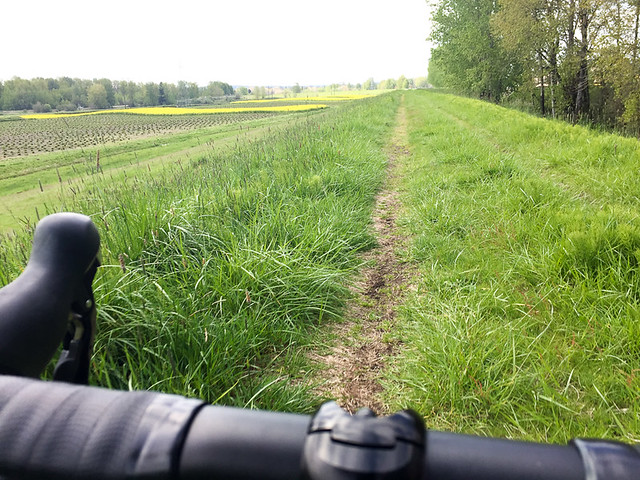
(Photos: J. Maus/BikePortland)
A Port of Portland project in Troutdale will include a significant extension to the 40-Mile Loop path along the Sandy and Columbia Rivers.
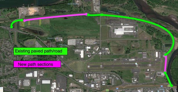
The extension totals 2.1 miles and will finally make it possible to walk and roll on a paved path between Marine Drive near Blue Lake Park (via NE 223rd Ave) and the new paths along the Sandy River constructed by the Oregon Department of Transportation in 2014.
Here’s a map showing how these new paths will make the connection between the 84/Sandy River and Marine Drive.
And here’s the Port’s project map:
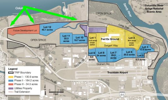
The new paths comes as part of the Troutdale Reynolds Industrial Park development, also known as TRIP. The site was recently featured in the Portland Tribune following a new report by the Environmental Protection Agency.
The 700-acre site used to be an aluminum plant and now the Port wants to create an industrial zone that the EPA says will support 3,500 jobs. The Port of Portland owns the property, which is adjacent to the Troutdale Airport.
Advertisement
While the Port says it’ll take 10 years for the site to be fully developed, Melanie Mesaros, a spokeswoman for the Port told us they’ll begin construction on the paths in 2018. The design phase will star this fiscal year and construction is only being held up because the paths are on a levee and Multnomah County is going through a levee recertification process.
Mesaros told us via email Friday that the path extension work will be broken up into two main sections: a 1.77 mile segment from Blue Lake Park to Sundial Road (see dotted line on map above), and a .33-mile segment near Harlow Road adjacent to the Sandy River. Once complete, it will be possible to easily avoid downtown Troutdale, Interstate 84 interchanges, and that high-stress frontage road near the truck stop that’s familiar to anyone who’s ridden in this area.
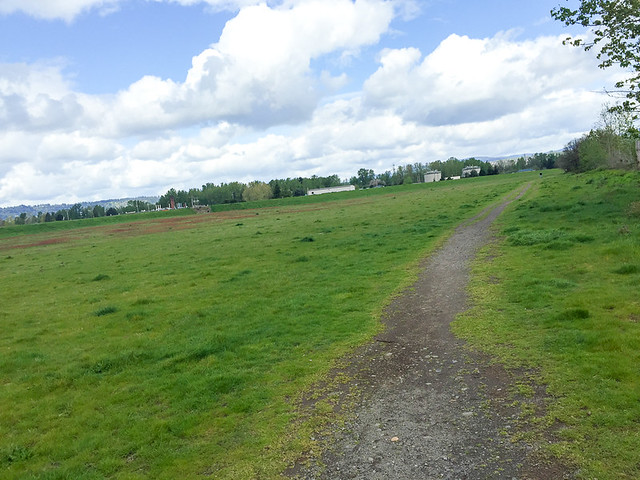
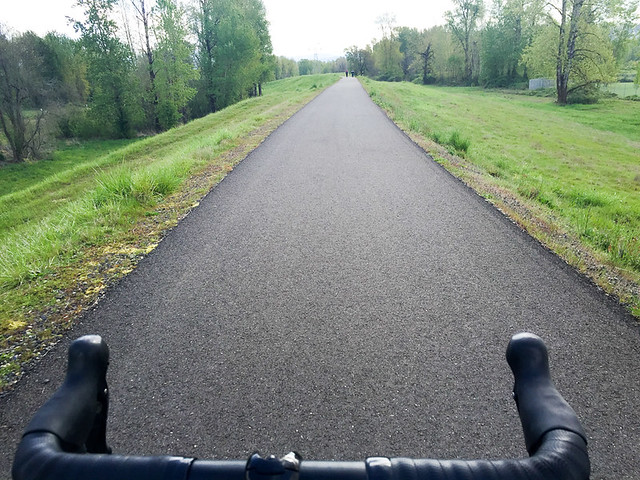
You might recall that back in May 2015 I shared a ride report and photos from this exact area. In that story I rode on unimproved dirt paths in both of the sections where the Port planned to make a paved connection.
— Jonathan Maus, (503) 706-8804 – jonathan@bikeportland.org
BikePortland is supported by the community (that means you!). Please become a subscriber today. You can also make a one-time donation here. (Note: Our support pages are down for maintenance at the moment and will be back up shortly.)




Thanks for reading.
BikePortland has served this community with independent community journalism since 2005. We rely on subscriptions from readers like you to survive. Your financial support is vital in keeping this valuable resource alive and well.
Please subscribe today to strengthen and expand our work.
We at the 40 Mile Loop Land Trust are super excited about closing in another gap on the 40 Mile Loop!
Please visit our website at http://www.40mileloop.org to download maps, learn more about the history of the path and how you can help us complete our mission!
I biked this for the first time a month or so ago! I used Google Maps to plan a route back from 1000 Acres Park in Troutdale, to Pdx via Marine Drive.
According to Google Maps, the section that is currently unpaved is listed as some kind of right of way. If you look at it, it clearly shows a road of some kind.
When I biked it though, I felt uneasy. I couldn’t tell whether biking it was legal or not. There were no signs saying “Private”, but it felt like private property.
It was just gravel, and there was a large amount of homeless camping debris everywhere. I was alone, and felt a little sketched out. The gravel path also got narrower and narrower, and the grass taller and taller, until by the time I was biking on the section closest to Marine Drive, it was completely off-road.
When it kicked me out at the other end of the trail next to Marine drive, I had to get around a gate, and the sign on the gate informed me it was private.
I am SO GLAD to see this is about to be paved!! It seemed like such an odd omission from the 40 mile loop.
There was a Policymaker’s ride through this area a few years back highlighting the exact route you rode, Adam. I can’t remember the exact year. Does anyone reading this have records of that?
Here is a map of the route. It was in 2012. I’ll see if I have any photos of it. https://ridewithgps.com/trips/666904
>>> When I biked it though, I felt uneasy. I couldn’t tell whether biking it was legal or not… there was a large amount of homeless camping debris everywhere. <<<
That's a sign you were on a genuine bike trail.
This is great. It will be excellent to see these beautiful areas connected!
Also in the area… I rode out to Blue Lake the other day and noticed, coming in from the West, they’ve created a nice smooth new path that gets you off Marine Drive and drops you directly into the park.
Is this a new thing or one of the many off-street stretches along Marine Drive that are battered by invasive tree roots?
Champs, this is a portion of the Loop that has been in the Master Plan for many years, and is just now being improved for use by the general public.
It is called the Chinook Landing Gap.
Some of it is much improved, but it eventually reverts to tree root moguls as my missing water bottle can attest.
Mixed feelings. The 40 Mile Loop is a good plan and adding a section is nice. OTOH, I’ve enjoyed that section in particular for its relative primitiveness and solitude. Guess I’ve got another year or two of walking its dirt and cobbles before I enjoy the paving.
If I don’t have to ride by the airport and see the fence lined with bottles full of trucker urine… I guess I might not.
http://40mileloop.org/wordpress/wp-content/uploads/2013/07/40mi-Loop_FINAL-for-Print_Page_2.jpg
http://40mileloop.org/wordpress/wp-content/uploads/2013/07/40mi-Loop_FINAL-for-Print_Page_2.jpg
Why not leave it gravel?
Because not all of us can ride gravel. Including most wheelchair users
Just because it’s gravel, doesn’t mean its easy. And it’s barely gravel. It’s mostly very, very long grass (thigh high in summer) covering the entire trail.
Porous pavement ?
That’s a great idea.
Scott, does the Master Plan call for more connectivity and signage along the stretch of the 40 Mile Loop that is actually along Marine Drive roughly between the airport and the part heading towards I-205 bridge?
When I biked it, I found it super-frustrating. The signage was poor. I got to one intersection (NE 138th I believe), didn’t see the trail continuing, and had to get onto the bike lane of Marine Drive.
Then, once I’m on the bikelane, I look to my left, and see the trail! It went around the other side of some industrial building or other. NO SIGNAGE telling anyone where it went. It just kicked you out onto 138th and ended.
It would be so nice if the bikepath along Marine Drive was continuous. There are chunks of it where you are forced onto the road for a good amount of time. Not good for biking families etc. Well, actually, impossible for families.
and we say goodbye to another fun little bit of dirt/gravel/trail to make way for sanitized biking – sad day. I’ve ridden that a few times and it has always been a fun stretch. Now if we could only get some trail in forest park…
There are many trails in forest park. Be polite.
I am excited to read about this extension of the route along the Columbia and Sandy Rivers but want to second the questions and feedback above about the existing route from 33rd to Blue Lake along Marine Drive.
I ride this route once or twice a week and have too often seen why it is commonly labeled as one of the most dangerous roads in Oregon. For my safety I avidly use the trails but there are two sections without trails and the road crossings from 122nd to 185th often make me question whether it would be safer to stay on Marine Drive. Rarely do cars stop at the designated bike crossing areas east of the I-205 crossing. Additionally transitioning from the bike path to the bike lane on Marine Dr westbound at 122nd is terrifying in rush hour traffic. I welcome any suggestions for the best way to get through that intersection safely.
A step in the right direction, but I agree, a continuous route along the river that doesn’t force you onto Marine Drive would help a lot. (18 wheelers sometimes use it as an I-5 to I-84 shortcut – that should be illegal. Direct that traffic onto Lombard.) Signage would help. Crosswalk signs and beacons would help, too. (Beacons should flash red, not yellow.)