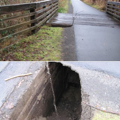
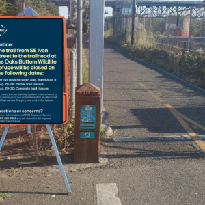
A section of the Springwater Corridor path about 20 miles east of downtown Portland has been closed due to a sinkhole.
According to Portland Parks and Recreation, the “potentially unsafe” sinkhole is just before a bridge on the section of the path between SE Callister and SE 262nd Avenue. They recommend a detour onto adjacent Telford Road (use caution if you do, because there’s no bike lane and not much of a shoulder).
Parks hasn’t said when the path will re-open. “Safety is the top priority… this section of the trail will be closed until engineering and other staff can adequately assess and repair the problem,” reads a statement they put out a few minutes ago.
This isn’t the only impact we’ve seen on the Springwater due to recent wind and rainstorms. Several trees fell across the path near Oaks Bottom yesterday. Here are a few shots of the trees shared on Twitter:
@PDXParksandRec @PDXBikeTraffic yes, here is a better photo from the south side, just before Oaks Bottom Trail pic.twitter.com/eUUZSGa3Kl
— Peter Koonce (@pkoonce) December 22, 2015
Advertisement
https://twitter.com/SplendidCycles/status/679086825684774913
Parks says they’re aware of the trees on the path and that Urban Forestry staff are out assessing the situation now. The path is still open.
If you know of any other path closures, flooding, or other impacts, please get in touch with us.
— Jonathan Maus, (503) 706-8804 – jonathan@bikeportland.org


Thanks for reading.
BikePortland has served this community with independent community journalism since 2005. We rely on subscriptions from readers like you to survive. Your financial support is vital in keeping this valuable resource alive and well.
Please subscribe today to strengthen and expand our work.
“this section of the trail will be closed until engineering and other staff can adequately assess and repair the problem.” Oh, no. That means this time next year, maybe. Thanks for the heads up, Jonathan.
Erosion on the Ross Island segment began in March 2012 and wasn’t fixed until November… 2013. If that’s any sort of benchmark, you’ve got the wrong year.
Exactly. And it’s not used anywhere near as much.
This is an outrage! Mother Nature would never dare do something like this to streets where cars drive! I’m going to write a letter, no, I’m going to post a comment on Bikeportland!
Heh! Mother Nature just snorted tea out through her nose.
I wish she’d let me in on the joke.
She did do it, in Oceanside, but the road wasn’t closed to pedestrians, only cars.
The tree on the Springwater near the Oaks Bottom spur was cleared early this afternoon.
So if the one arterial through the south end of town were compromised by a small sink hole, would the response be “we need to write some memos on this”, or would it be “we have contracted with private crews to get this road open as soon as possible so commuters can get to work on Monday morning?”
Just curious. It’s an honest question.
Kane Road, which is a major arterial through Gresham and access to MHCC was closed due to a sink hole and isn’t scheduled to reopen for at least 3 months. I know it’s not S. PDX, but it does impact quite a few, even some bikes.
http://www.oregonlive.com/gresham/index.ssf/2015/12/downpours_causes_deep_sinkhole.html#incart_big-photo
I was pretty specific in that if this was the one road. Kane has an alternate route that is pretty easy to navigate by car. I attended MHCC and delivered to it for a time. Also, that hole is massive. So, what if Burnside had a sinkhole..how long would it be closed?
Use caution on Telford because people drive close to 60MPH+.