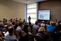
Bicycle Transportation Alliance
was one of the presenters.
(Photos and story by Will Vanlue)
The most interesting (in my opinion) and well-attended session I sat in on at the Oregon Active Transportation Summit focused on the work being done just over the hill from Portland in Washington County.
The session covered a few topics including an overview of two recent road projects and a change in the county’s policy on mid-block crossings (a key policy given the presence of many multi-use paths and suburban/rural arterials).
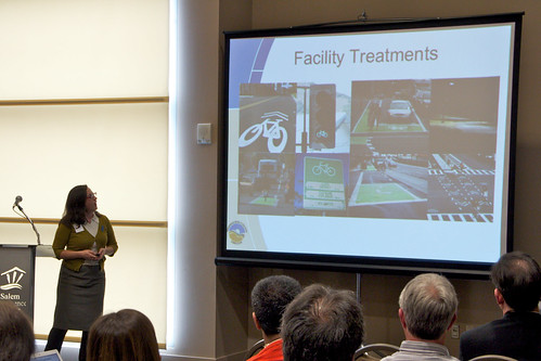
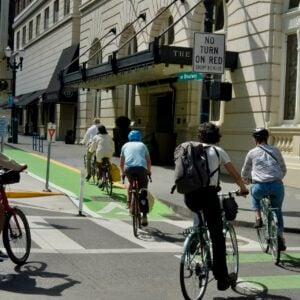
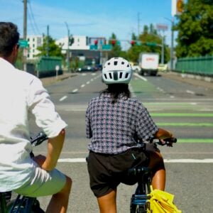
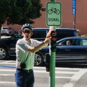
It also dove into Washington County’s highly anticipated Bicycle Facility Design Toolkit, an official document to help planners and engineers select the appropriate facility for bicycle traffic.
“the last thing people in Washington County need to hear more of is “Portland, Portland, Portland.”
Drusilla Van Hengel, Planning and Programs Manager for Alta Planning & Design, explained the simple three-step process laid out in the toolkit:
- Evaluate a road (the speed and volume of motor vehicles, the age and abilities of people expected to use the road, etc) and select the safest, most protected type of bicycle facility for that type of road.
- Evaluate the technical feasibility of the type of bicycle facility chosen and adjust the design if needed.
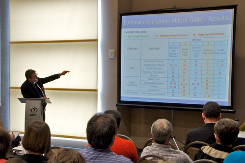
- Run through a final yes/no decision chart to confirm the final design is appropriate for the given situation.
So why does Washington County need its own toolkit when there are other design standards (like the NACTO Urban Bikeway Design Guide)?
It’s because most modern design standards focus on solutions for urban environments. While that’s all well and good, Washington County covers a wider range of land use, from urban downtowns to rural farmland and nearly everything in between. With a broad mix of land use in Washington County, engineers need support and guidance on a wider range of design options.
Having a Washington County-specific guide also gives engineers greater confidence when choosing “innovative” (which usually means “safer”) designs for bicycling infrastructure, knowing designs they’re choosing from were identified and approved by other officials in Washington County.
The toolkit isn’t just for engineers and planners, however.
Jessica Horning, Transportation Planner with Kittelson & Associates, explained how, along with planners and engineers, the toolkit is also geared towards developers and citizens.
There are plenty of photos and easy-to-understand charts in the toolkit to help developers better understand county standards and give residents an idea of what to expect when projects are underway in their neighborhood.
Horning also said the toolkit gets Washington County out from under the shadow of neighboring Portland. Transportation is a regional issue in the tri-county area but challenges faced in Washington County are far different from those in Portland’s core. As Horning put it, the last thing people in Washington County need to hear more of is “Portland, Portland, Portland.”
That’s why the toolkit contains lessons from a number of places outside of the Portland-Metro area. Designers of the toolkit drew on knowledge from Minneapolis, Victoria, Vermont, and even Wisconsin to find “best practices” that fit Washington County’s needs.
Since the toolkit contains solutions and decision guides for a wide variety of land use, it could be useful to many other jurisdictions across the United States that have a blend of urban, suburban, and rural neighborhoods.
Adam Argo, who presented the overview of two Washington County road projects and is on the board of the Westside Transportation Alliance, mentioned that this presentation has already been accepted into another transportation planning event in California.
Currently the Toolkit is in it’s final draft phase. You can review the full toolkit (PDF) on Washington County’s website and provide your thoughts and feedback for consideration until April 30th.
— This report from the Oregon Active Transportation Summit was contributed by Will Vanlue. Read more from him on The Prudent Cyclist and check our archives for more Washington County coverage.


Thanks for reading.
BikePortland has served this community with independent community journalism since 2005. We rely on subscriptions from readers like you to survive. Your financial support is vital in keeping this valuable resource alive and well.
Please subscribe today to strengthen and expand our work.
Washington County is the next Washington County! So excited for where they’re going out there.
I did click over to the offer comments page. I would like to see use of the R4-11 sign (Bicycles May Use Full Lane), rather than “Share the Road”. The “Share the Road” sign is often misread as bicycles share, rather than everyone share.
This is a really exciting project for us (Alta Planning + Design) to be leading with Kittelson. Washington County has a real cross-section of roadways from rural to suburban to very urban. To demonstrate the application of bikeway design techniques that can make cycling an everyday choice in this environment is challenging. The county has shown real, progressive transportation leadership.
Thanks, Steve! You’re right – the county has shown very strong leadership here and you (Alta) and Kittelson have done a great job moving this project forward. It’s not easy to draw up a document that’s both detailed and technical enough for engineers while also being easily understandable to non-wonky people. 🙂
An active transportation ‘toolkit’, assembled to fit Washington County’s specific needs that differ from those of the larger metro area city, Portland, is fine idea. Contents of such kits seem to boil down to pre-formulated road infrastructure treatments that planners, engineers and developers can plug into whatever projects are on the table, rather than devise something completely from scratch.
A ‘tried and true’ package of solutions has some advantages and some pitfalls. One of the potential pitfalls of such a resource, are mistakes that can be made in installation of a given solution from the toolkit to actual street situations. While a solution can look good in people’s minds and on paper, will it actually work as intended, in actual use on the street.
Here is what I just entered on the comment form for the toolkit:
I didn’t mention it in my comment to them, but I like how so many WA Co. residents seem to drive red Porsches…
Red flag! “Evaluate a road (the speed and volume of motor vehicles, the age and abilities of people expected to use the road, etc) and select the safest, most protected type of bicycle facility for that type of road.”
Why would you design facilities with just one age group in mind? The expected road users are people of all ages and all abilities, that way every street is safe to travel.
Maybe I should have said “…the age and abilities of all people expected to use the road…”
But in the presentation they were clear (and the language in the guide indicates) that you should be looking at the entire expected user group. For example, if a road runs past a retirement center and an elementary school in a suburban neighborhood it will likely have a different mix than on a road that connects two industrial districts in a rural setting. But in both cases the design would be aimed at more than one specific demographic.
If you click on “change” in the second paragraph of this article, it takes you to an article on changes that will include more mid-street crossings in Washington County. One crossing in the article (or comments) is for Fanno Creek Trail at Hall Blvd. If you look at the map of that section of trail you can see how ludicrous it would be to put a crossing at that location. The trail only goes about 3/4 mile north of the crossing and ends, AND there is a perfectly good intersection for peds/bikes/wheelchairs to cross on about 200 feet to the west on Hall! I’ve ridden and driven this route hundreds of times – there is NO REASON for a crossing there. Here’s the map:
http://www.mapmyride.com/s/routes/view/bike-ride-map/oregon/tigard/8180946
This is just another example of government employees wasting taxpayer money. If they install it, a criminal investigation should be done and those responsible should be put in jail for intentional waste of taxpayer dollars. This is a perfect example of why this nation is bankrupt and is going to fail HARD and soon.
If the trail only continued for another 3/4 of a mile I might agree but the trail actually continues much further; it just doesn’t look like it on the map. At Denny Road there’s a small break but it does continue all the way up to Portland. Also, if you take a left where the trail gets to Denny (when you’re traveling North) you can get to the Beaverton Transit Center.
The crosswalk at Hall is an option but it adds a considerable amount of time as people travel along the trail and it’s a fairly dangerous intersection if you’re not in a car.
If you’ve ridden the Fanno Creek trail (which it sounds like you have) you’ll know that people in cars frequently dart in and out of the parking lot of the grocery store and the road at the intersection west on Hall. They have a habit of paying more attention to the vehicles speeding down Hall than to the people walking or riding, even in the marked crosswalk at the intersection. (I’ve nearly been hit while crossing at that crosswalk three times in the last two years by people looking the other way while driving.)
Sure, these are all hazards I can deal with personally (and it sounds like you can too). I just shudder to think of my grandmother or friends’ kids trying to cross Hall at the trail considering the current conditions.
The intersection at Hall, just to the west of the trail/street intersection is no doubt plenty safe if you hit the “pedestrian crossing button”. That is a much cheaper and better option than spending a lot of money on a crossing that is not needed. If however the intersection at Hall (Greenway is the street I think) is unsafe, then make minor changes there to make peds/cyclists safer. THEN, if you have a place where ACTUAL safety improvements are needed, spend the money there IF the county isn’t bankrupt. FYI, if you take a right at Denny you can end up in Boston.
Yes, if you take a right at Denny you could get to Boston but first you’ll continue traveling on the rest of the Fanno Creek Trail which gets you much further than a quarter mile. Regardless of how you personally choose to get around Washington County, hundreds of people incorporate this intersection of the tail and Hall into their daily routines.
There have already been many public meetings on this crossing and the prevailing opinion of everyone in attendance (officials, engineers, citizens, etc) is that a safer option is needed at the trail itself. If you have other specific suggestions that those folks haven’t thought of yet — about how to make the crossing at the signal, and the driveways and sidewalks leading to and from it, safer and easier to use — I’m sure the city and county would love to hear them.
But regarding the signaled crossing, the times I’ve nearly been hit were in the marked crosswalk when I had the walk signal. People driving cars turning right (east) onto Hall don’t always look for other people walking across the street.