Click for PDF
After three and a half years of planning, Portland Parks and Recreation is ready to officially present their 47-page Red Electric Trail Planning Study to City Council. Next week they’ll present the recently completed plan that was undertaken to,
“…investigate potential routes for an east-west trail that would extend the Fanno Creek Greenway Trail, creating a continuous, 16 mile bike and pedestrian trail between the Tualatin and Willamette Rivers.”
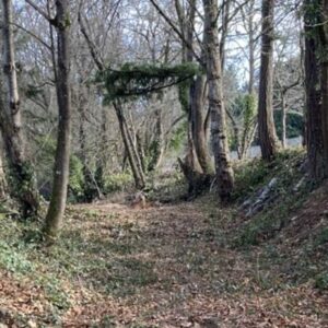
The Red Electric Trail gets its name from an old railroad line operated by Southern Pacific in the early 1900s.
Once completed, the trail would include several miles of off-highway, bike and pedestrian only trails and would provide much needed trail facilities and connectivity to residents of southwest Portland.
Study authors point out that while the primary goal of the trail emphasizes recreation over transportation, the trail would assist in encouraging kids to walk and bike to school (there are seven schools along the route), and in their conclusion they write,
“Having a through route for bicyclists will encourage cycling to work, school, visits, and errands…the proposed route would re-connect Hillsdale and Hayhurst to neighbors along the Willamette River, and the growing employment area of South Waterfront District.”
You can view a PDF of the study on the Portland Parks and Rec website.
This sounds like an amazing trail, and you can help remind City Council how important it is to Portland by showing up to testify on Wednesday, May 16th, at 10:30 am. If you live in an area that the trail would run through, you are especially encouraged to attend and share your thoughts.
- Red Electric Trail presented to City Council
10:30am, May 16th
City Council Chambers, City Hall (1221 SW 4th)


Thanks for reading.
BikePortland has served this community with independent community journalism since 2005. We rely on subscriptions from readers like you to survive. Your financial support is vital in keeping this valuable resource alive and well.
Please subscribe today to strengthen and expand our work.
Thanks for the update, Jonathan. It is always good to hear about more trails progressing toward construction!
Scott Mizée
npGREENWAY.org
The Red Electric was more properly titled “Portland, Eugene & Eastern”, though the name was seldomly used by the public. It passed through the ownership of a number of railroads before eing aquired by Southern Pacific in 1915.
The Red Electric was one of the Portland area’s interurban railroads – rail lines with trolley-like cars that transported people from their homes in the country to their jobs in Portland. They were the original form of mass transit, and served the same function MAX does today.
In addition to the trail right-of-way, the Red Electric also encompassed the current route of the Willamette Shore Trolley from south waterfront to Lake Oswego, as well as a number of lines in the Salem area.
Thanks, Jonathan, for repoting on this!
This is great. The trail will be within a block of my house. Since I commute between SW PDX and Beaverton for work, this will be a great trail way to get to work and back on.
Some segments of the trail already exist in rough form, specifically near Hayhurst Elementary. Several of the neighborhood kids walk to and from school on the trail sections but most would be difficult for kids to ride bike on. Very exciting news.
Fred,
any chance you could get yourself or those kids to city council chambers next Wednesday? it’d be great for the Mayor and council members to hear from you.
Jonathon,
I will put it on my calendar. The kids will be in class at that time, but I think I can squeak out of work for a short time to attend.
I live in Southwest Portland and attended a number of the planning meetings. This will be a great trail. In SW Portland the hills and narrow roads are a barrier to new bikers. The old railroad bed follows the grade much better and I think it will have a big impact in getting SW people on their bikes.
When I was on staff at the BTA I tracked this project and attended several public hearings about it.
At the time, there was very vocal opposition from some adjacent homeowners who felt it would decrease their property values and cause personal safety problems. I remember one man shouting several times in a row about how the path would “come within ten feet of his son’s bedroom window!!!”
My suspicion is that the opponents are active but not representative of the greater community. However, during the time when I was involved with the project, I had the impression that their opposition resulted in Portland Parks backing off on the pace of this project.
In any case, the local opposition gave the impression that this is a controversial project (and problematic projects have a way of not rising to the top of the list).
If you support this project, especially if you live nearby, please do track the project, speak up at public meetings, write letters and emails, etc. If you want this trail built, it’s important to show that the community at large supports it.
While it would probably be difficult to convince your neighbors to let you borrow their kids so you can take them to city council, I’m almost positive that the kids would learn a lot more by going to a city council meeting for an hour or two than they will in elementary school…
“I remember one man shouting several times in a row about how the path would ‘come within ten feet of his son’s bedroom window!!!'”
Never underestimate the power of one vocal opponent, no matter how crazy, to derail a land use hearing and or decision. Oregon land use review cases are replete with instances in which the local planning commission has approved a use only to have one loud opponent convince the city council, county commissioners, or whoever is the next level up, to deny the use.
I sometimes ride the Fanno Creek Trail, to which this would connect. I feel safer on riding on B-H highway. Fanno Creek Trail has blind corners and people walking across the trail. The last time I rode it, a kid learning to ride his bike stopped in the middle of the trail, almost in front of me. I didn’t come close to hitting him, but if he had swerved a bit more to his left he would have been right in front of me. Then, around another corner, there was the guy walking his dog. He was on one side of the trail. His dog was on the other. The leash stretched between the two. I stopped. Thank goodness for disk brakes.
I’d rather see the money that went into planning this, that may go into additional land acquisition, fighting the court case from the angry neighbor mentioned in #7, etc., instead go into fixing crash corner, also known as Beaverton-Hillsdale, Oleson, and Scholls. Making the left turn from the bike lane on W/B B-H to S/B Scholls is, to say the least, interesting. Or widen the bridges on Barbur, between Capitol and Terwilleger, to accommodate bike lanes. Or put a modern bike lane on Garden Home Road.
The Fanno Creek Trail by the Portland Golf Club could use a straight path between SW 86th Ave and the southeastern edge of the golf club by the fence.
I know that B-H/Scholls/Oleson intersection was up for possible MTIP funding recently, and I believe it was funded. Metro’s website is hard to use so I can’t confirm easily, but this report (PDF) seems to indicate the same (see pg. 4-17). The MTIP project is for planning and engineering work, so construction would still need to be funded.
Washington County has funding for that Raleigh Hills redo, but it is only 50 % funded as of 2014 for the design part of the project.