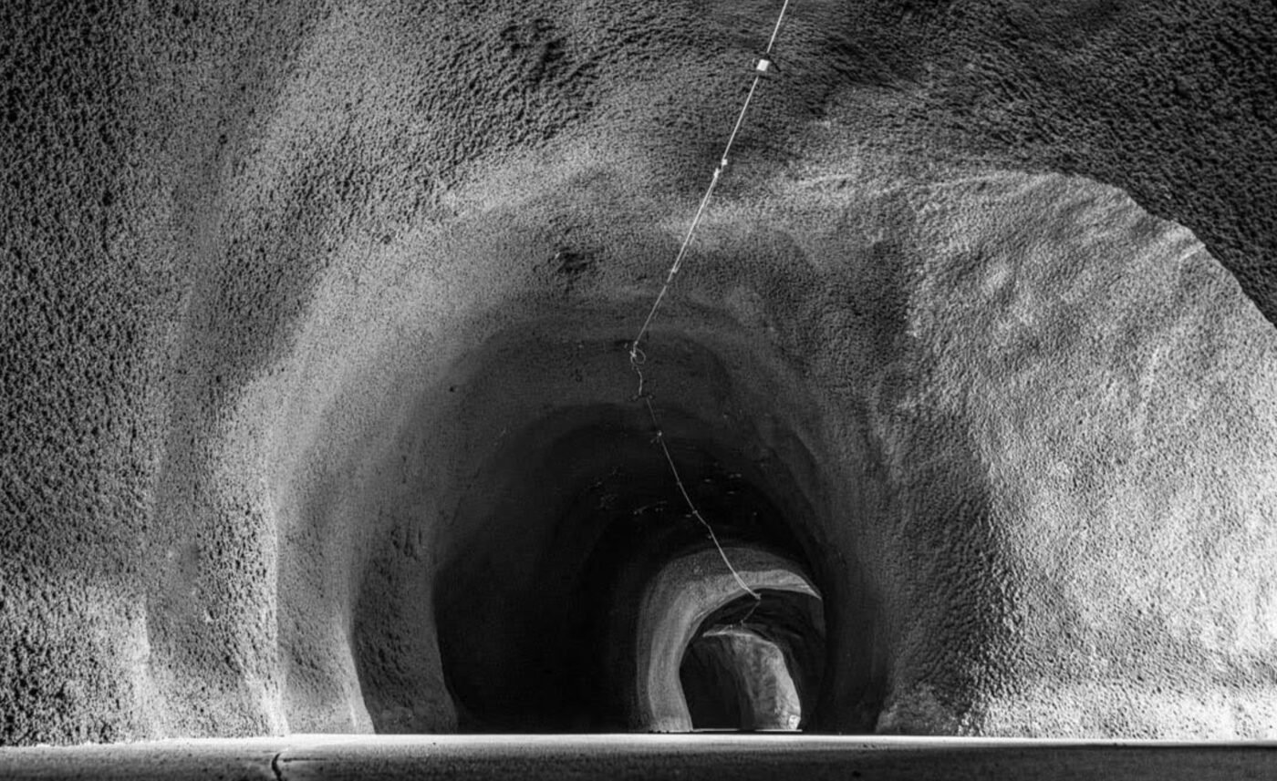
This coming Saturday, the Oregon Department of Transportation will cut a ribbon on one of the most extraordinary infrastructure projects in our state’s history for the second time. The reconstruction of the Mitchell Point Tunnel in the Columbia River Gorge.
After six years of design and three and-a-half years of construction, the $31 million project will finally be open to the public — but unfortunately just for the dedication ceremony. ODOT is billing Saturday’s event as a preview because a minor rockfall has caused a delay and there’s still a need for crews to make “finishing touches” that will likely be wrapped up before year’s end but could extend into 2025.
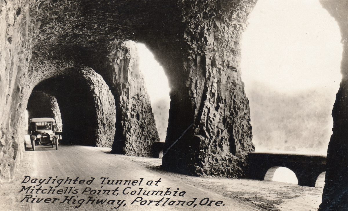
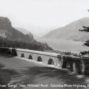
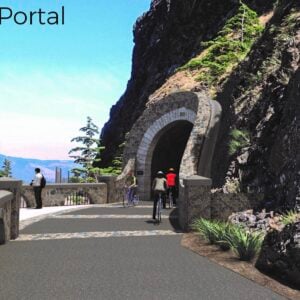
The original tunnel — carved out of basalt and featuring five arch windows where Model T drivers could gaze out onto the Columbia River — was a feat of engineering when it was first built in 1915. It was closed in 1953 when Interstate 84 was built and then destroyed and filled with rock in 1966. ODOT resurrected the tunnels in 2018 as part of their ambitious Historic Columbia River Highway State Trail project that looks to reconnect the famous old highway between Troutdale and The Dalles.


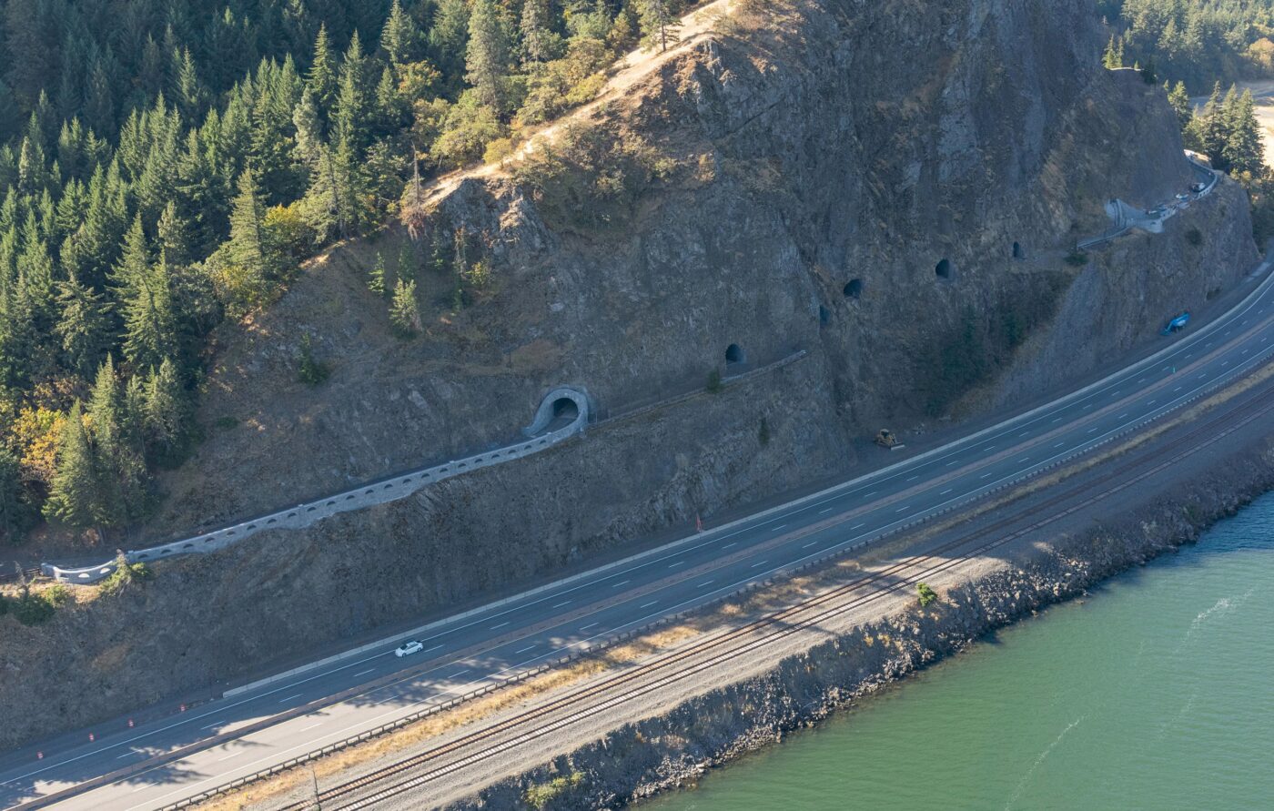
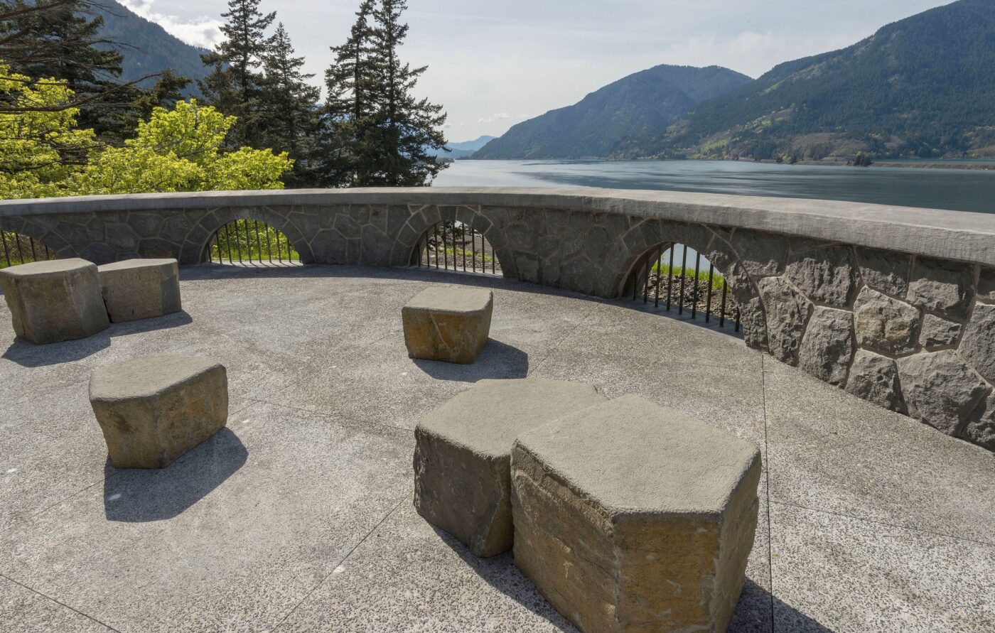
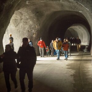
The segment that includes Mitchell Point Tunnel is one of the last pieces of the puzzle and has been a massive undertaking. The new tunnel is 1.5 miles long and is carved through 655 feet of a basalt mountain. The arched windows are back and folks who attend Saturday’s event will be able to peer out of them just like people did over 70 years ago.
ODOT has promised the tunnel would open in 2024 and with nasty winter weather approaching fast, officials say they wanted to give the public an opportunity to see it at least once before spring. The location of the tunnel is also inaccessible at the moment due to the construction closure of the I-84 off-ramp and gaps that exist in the historic state trail route to its east and west. There’s no parking for bikes or cars near the tunnel, so ODOT has organized a free transit shuttle and hike-and-bike routes for Saturday’s event.
To be clear: While this tunnel has been built as a bike path, cycling will not be permitted at Saturday’s event. (One advocate I spoke to who follows this project very closely said, “There’s a moat around the tunnel.”)
If you want to be among the first people to see his amazing new piece of trail, here are the instructions on how to get there whether you are driving, taking transit, or biking to the venue:
Take Transit:
- Take the Columbia Gorge Express operated by Columbia Area Transit from Gateway Transit Center, Cascade Locks or Hood River.
- All Eastbound Columbia Gorge Express buses from Gateway Transit Center, Troutdale and Cascade Locks (run by CAT) will drop off at Mitchell Point on Saturday, Nov. 16. See bus schedule information.
- From Portland, take the 8:50 a.m. bus from Gateway Transit Center to make it in time for remarks and ribbon cutting. Estimated arrival at Mitchell Point Tunnel is 9:50 a.m.
- Tickets one-way are $10, for a total of $20 for a round trip. Alternatively, Gorge Passes are $40 per year and valid for this trip.
- From Hood River or points east of Hood River, take the event shuttle. Details below.
- The last two westbound Columbia Gorge Express buses to Portland depart Hood River at 4 p.m. and 5:30 p.m, arriving back at Gateway at 5:10 and 6:40 p.m. respectively.
Free Event Shuttle:
- Starting from 9:30 a.m., free event shuttles will run from Viento State Park (I-84 east Exit 56) and CAT’s park and ride at 224 Wasco Loop, Hood River.
- The last shuttle from the event will run to Hood River at 3:30 p.m. and return to Viento State Park. The last two westbound Columbia Gorge Express buses to Portland depart Hood River at 4 p.m. and 5:30 p.m.
- Shuttles will circulate continuously and will arrive about every 15 minutes.
- Shuttles are free to ride and there is no parking fee.
Bike and Hike:
- Bike to the end of the Historic Highway State Trail from Viento State Park and walk the final 0.7 miles. Free and hosted bike racks will be set up at the end of the existing trail segment. Bikes are not allowed on the temporary unimproved trail that links the existing State Trail to Mitchell Point.
Drive and Shuttle or Hike:
- Limited parking is available at the Viento State Park day-use lot on the north side of I-84. From I-84, take Exit 56 to Viento State Park where signs will direct visitors to the parking area. From here, you can catch the shuttle or walk 2 miles on the State Trail and 0.7-miles on a temporary unimproved trail that links the existing State Trail to the Mitchell Point trail head.
- Free shuttles will drop off/pick up between Viento State Park and 224 Wasco Loop, Hood River between 9:30 a.m. and 3:30 p.m.
- Once parking is full onsite, the next closest location is about 6 miles west on I-84 to Wyeth Trailhead at Exit 51 where additional parking may be available to access the event via bicycle to transit.
While we wait for the permanent opening this spring, there will even more urgency to complete the remaining trail gaps on each side of the tunnel. According to ODOT officials, the 0.7-mile gap to the west of the tunnel between Viento State Park and Mitchell Point is expected to begin construction in 2026. On the east side of the tunnel, the trail segment from Ruthton Point to Hood River (which will cross under I-84) is currently in design phase and will also begin construction in early 2026.
Check out ODOT’s website for more information on Saturday’s dedication event and the Historic Columbia River Highway State Trail project.



Thanks for reading.
BikePortland has served this community with independent community journalism since 2005. We rely on subscriptions from readers like you to survive. Your financial support is vital in keeping this valuable resource alive and well.
Please subscribe today to strengthen and expand our work.
I’ve been as far as Cascade Locks, but ODOT’s website could be clearer about the route between there and Hood River. I84 isn’t an appetizing ride, but lunch and a pint at Pfriem might be enough to offset what’s left of the gaps.
Champs, it’s not to hard to follow – pick up Forest Lane coming out of Hood River, which crosses over the freeway, then bear Left on the frontage road. Pass the Herman Creek trailhead, then soon after Right on the Herman Creek/Wyeth Rd. It’s a pretty good climb but not onerous on a quiet road, drop on down to the Wyeth campground where you can pick up the trail, and follow it to Viento Creek. The trail extends beyond here but I’m not clear if it connects to anything yet..?
Good for ODoT for making amends for their dynamiting the original tunnel in the ’60’s.
This was/is mostly the Fed at the end of the day, they built I84 and with Federal lands money are mostly responsible here now.
ODOT is certainly the facilitator but they are beholden to the Fed for much of whats going on here.
All good as they are the only ones with the $$$$$$$ to make this happen and we’re not there yet.
The last pieces are shaping up to be very lackluster at best for the challenges being presented.
The trail from the bottom of Mitchell Pt. on the East side to Westcliff Drive and I84 will be very uninspiring with the county, city and businesses pushing back hard on making this anything resembling “World Class”.
Nevermind from there through town which can already be very challenging even if you are already a very confident and experienced rider.
But this key piece is another very big lynch pin out of the way and hopefully it will inspire the other stakeholders to get more onboard which they are so far loathe to do while fighting tooth and nail against it already.
For the Dedication Nov 16th: Here is a page of two rides and one hike. It has links to biking from Cascade Locks to Viento State Park and from Wyeth Campground to Viento. At Viento you can pick up the free shuttle to Mitchell. OR, if you wish, you can continue East on the last Viento-Perham Creek bike trail and then walk to Michell along the old Wygant trail (which is lovely). I have posted these two bike rides and walk maps on ps://gorgepedal.com/gpmitch/accessmitchindex.html. The access to transit is also on this web page. AJZ
Thank you for your dedication to Columbia River Gorge biking/walking infrastructure AJZ!
https://gorgepedal.com/gpmitch/accessmitchindex.html
A person who drives out to the Columbia Gorge gets a free shuttle for all their passengers, but each person who takes transit pays an additional $20.00. Oddly, they split that into two ten dollar fees, as if a person who goes out might not come back, or is not guaranteed a ride back.
Have they said what they are doing about camping on the path?
No because there isn’t any. At least not that I’m aware of. Are you aware of some or did you just come here to say the same thing people say every single time I post anything about a bike path?
There are at least 2 or more actual campgrounds along this segment of the trail, plenty of other area’s that can be utilized as well.
This isn’t just a bike path and the transient/homeless out there are actually far more self sufficient than the “campers” in town.
Anymore pedantic comments or would you like to actually get on topic here?
The tunnel itself is only 200 meters (655 feet) long*. The 1.5 miles figure appears to be the length of the entire new trail segment.
I’m still massively excited for this project, regardless!
* https://www.oregon.gov/odot/Regions/Documents/HCRH/Final-2024-ProgressReport-Web.pdf
yes thanks for that clarification