Land use can be a snoozer, I get that. But the decision made here is what will determine what type of bike facility we get, if any.
City of Portland staff recommended denial of the Land Use permit for the proposed 263-unit Raleigh Crest development on the Alpenrose site a week ago Friday, concluding that “all of the relevant standards and approval criteria have not been met.” Although the denial was based on several issues, the most complicated of them seemed to involve a wildlife corridor located on the southernmost edge of the property.
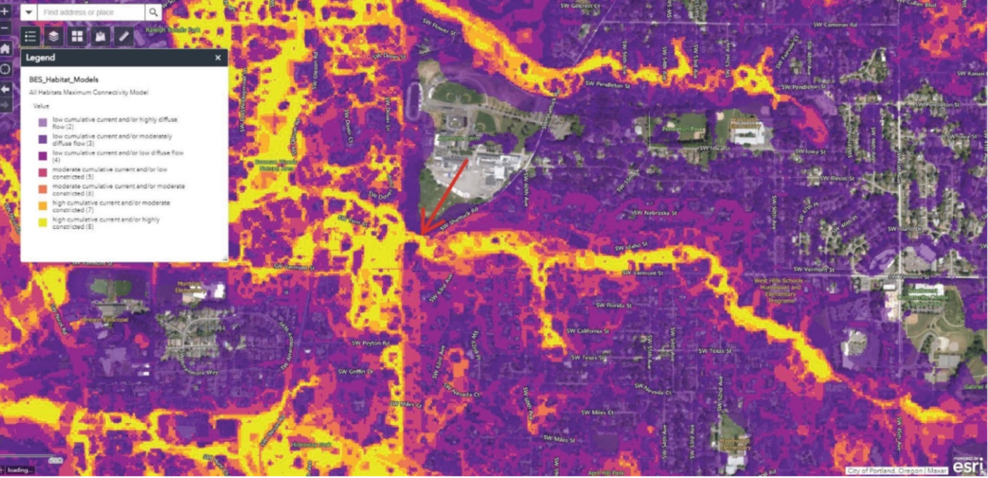
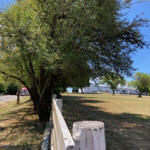
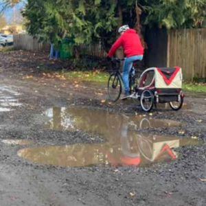
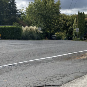
The pinch-point of the corridor is the area just north of the intersection of SW Shattuck Rd and Vermont St. Not only is this location tricky for wildlife, it’s also not a great place to be on a bicycle or walking—but wildlife has federal and state protection.
Here’s an excerpt from the decision that talks about the wildlife issue:
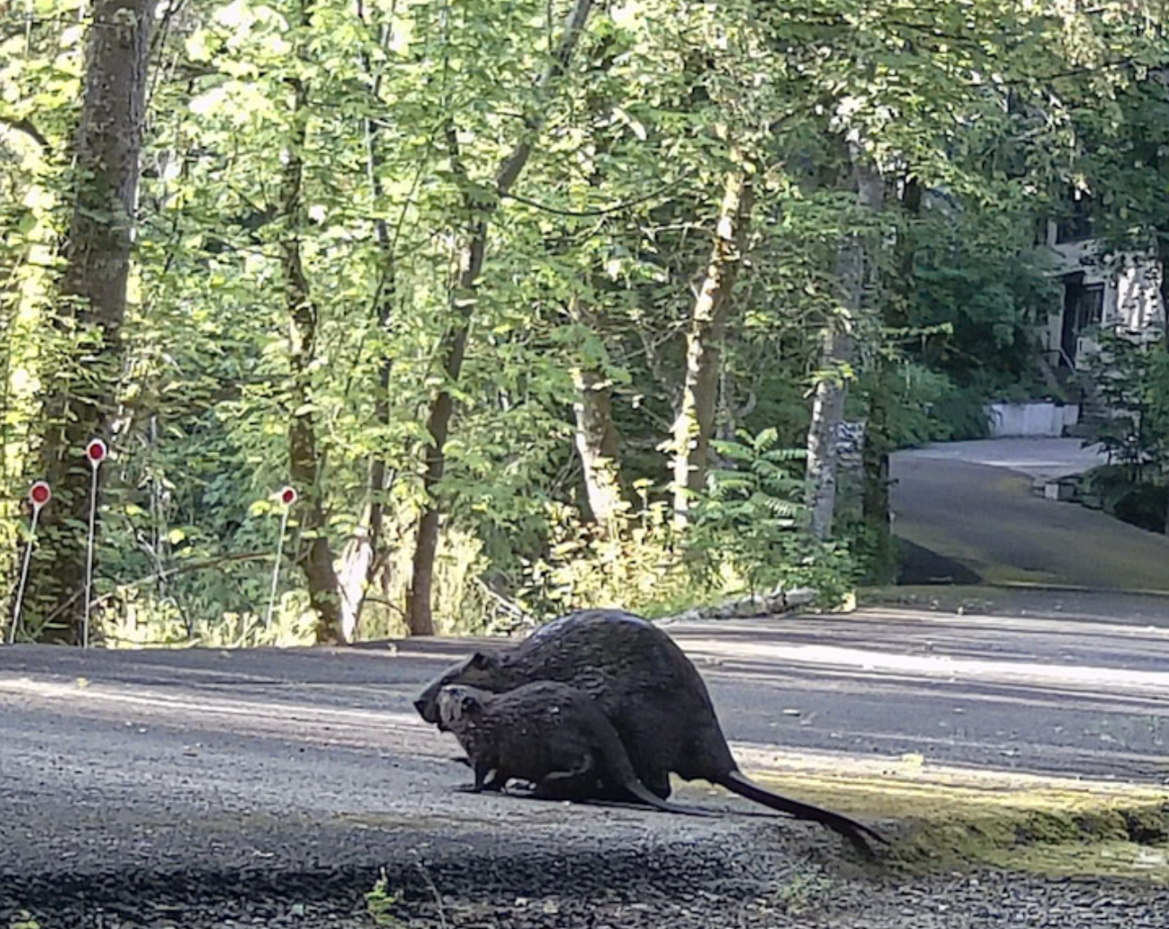
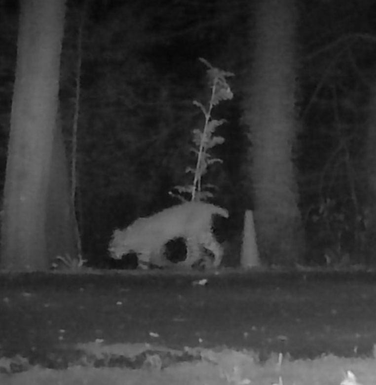
… the site is a critical connection point for the movement of wildlife between the upstream habitat areas along Vermont Creek up to Gabriel Park and the extensive downstream habitat areas starting at Bauman Woods and the confluence with Fanno Creek and beyond into the Fanno Creek habitat corridor. Thus, wildlife mobility is a key functional value of the site and the ability of wildlife to continue to move through this corridor should be preserved and carefully considered in any redesign of the SW Shattuck crossing. Any increased barriers to movement (e.g., proposed retaining wall, fall protection fencing, increased vehicular traffic, etc.) and reduction of wildlife mobility through this corridor must be mitigated, as they could have adverse long-term impacts on local wildlife species, particularly semi-aquatic mammals such as beaver, river otter, muskrat, and mink as well as the flightless ducklings of locally breeding waterfowl, such as mallard and wood duck. Beaver are of particular concern because of their status as a keystone species in wetland ecosystems and the important role they play in creating and maintaining the habitat used by a wide variety of other species in this wetland complex.

Recap
When BikePortland last checked in on the proposed development of the Alpenrose site, the city had just approved (in concept) the developer’s proposal to build a multi-use bicycle and pedestrian path (a multi-use path, or “MUP”) along the property’s SW Shattuck Road frontage. This was a big win for cyclists and pedestrians because it meant that the city was accepting the design’s bio-swales as adequate for treating stormwater run-off from the MUP.
Readers might have noticed that the MUP stopped short of Vermont Street. SW Shattuck Rd narrows as it passes through a wetland and over Vermont Creek, and loses the width needed for the MUP. In a configuration which is common in southwest Portland (which lacks stormwater pipes under the road), Shattuck runs through the wetland on a berm which has a pipe, or culvert, running perpendicular to the road to allow Vermont Creek to pass underneath it.
Maybe this is more than you want to know, but it is the size and shape of the culvert which is tripping up the Bureau of Environmental Services approval. The bureau wants Raleigh Crest to upgrade the culvert to allow safe passage for bigger animals, and BES is also concerned that a proposed retaining wall on the west side of Shattuck will block that passage.
What happens next
Denial of a permit is not the death knell for this project that one might think.
Permitting and Development staff prepare the report for, and make recommendations to, the Hearings Officer, and it is the Hearings Officer (HO) who makes the decision to approve the permit or not. The public hearing for the project will be this Wednesday, via zoom. The HO bases their decision on the staff report, the applicant response, and on comments from the public.
The public and the applicant are allowed to testify, and one thing I will be listening for is the developer’s stance toward the denial. The developer has a choice, they can comply with staff requests, or push back against them. The issue of proportionality might arise, in other words, “who should pay and how much?”
Proportionality
Proportionality falls under the Nollan-Dolan body of jurisprudence, a series of court cases which have limited the public works requirements jurisdictions can exact from developers. In this case, the city is arguing that, because of the harm to wildlife caused by the increased traffic Raleigh Crest will bring, the developer should bear responsibility for improving the Shattuck-Vermont intersection and the wetlands around it.
An obvious argument the developer can make is that the city has neglected this street for decades and that, therefore, the city should shoulder part of the cost of fixing it, that it shouldn’t be the developer’s responsibility to fix a subpar street.
What makes it a proportionality issue is the need to determine what portion of the cost each party should be responsible for. This can be settled through negotiation, or it can go to court. If any party disagrees with the HO’s decision, they can appeal it to the Portland City Council, to the state Land Use Board of Appeals, and to Oregon courts.
Why Land Use is important
Land use can be a snoozer, I get that. But the decision made here is what will determine what type of bike facility we get, if any.
Also, we are in the middle of a national housing crisis that is being partly attributed to permitting and zoning complexity (and to NIMBYism), so understanding the process a developer and city go through before a subdivision can be approved might shed light on the price of your rent.
Finally, land use and transportation, which should go hand and hand, have largely become decoupled in southwest Portland. This disconnect leads to gaps in the cycling network, and to the southwest having the least sidewalk coverage in the city. Development of the Alpenrose site will possibly let readers watch the birth of a gap in real time.


Thanks for reading.
BikePortland has served this community with independent community journalism since 2005. We rely on subscriptions from readers like you to survive. Your financial support is vital in keeping this valuable resource alive and well.
Please subscribe today to strengthen and expand our work.
I find it absolutely delicious that PBOT ignored most hazards to pedestrians trying to cross Shattuck or walk further than Alpenrose property lines, but were all “OOOOOHHHHHH SAVE BAMBI!”
Guess school kids aren’t as important as beavers.
I do give the city props that they listened to neighbors pointing out there was far more wildlife here than claimed by other parties. A properly-done development here is sorely needed; this setback hopefully gives time for someone to slap PBOT upside the head and start looking for solutions in SW besides ‘giving up’ on pedestrian safety.
Beavers are pretty important though, and the city should invest in SW sidewalks and such as a matter of principle. The cost of doing so is inflated only by their insistence on not removing any car infrastructure
Thus my comment that many neighbors sent in testimony about seeing beavers and other animals, even though city and developer initially appeared to downplay that. I’ve seen the beavers in there myself. Glad BES took that seriously.
The hilarity is that PBOT wasn’t worried about that pinch point for ped/bike safey at all. Maybe PBOT can save some face and put up “Share the road – with the beavers” signs and little beaver outlines with sharrows on the pavement.
There’s a line in the bureau’s response that made me laugh: “Staff notes the lack of existingsidewalks on nearby collector streets creates an environment that makes walking less attractivethan in neighborhoods where separated sidewalks increase safety and comfort for pedestrians.The lack of through connections on local streets, and lack of bike lanes on collector streets makecycling less attractive than areas where a complete network of low speed local streets exist.
This an existing condition and typical of conditions in similar parts of the City, not an impact ofthe proposed development.”
Gee, if only we had some sort of, I dunno, a city department or something, whose sole job it was to fix situations like that. Maybe they could come up with a plan that makes new development help fix the problems along the way. Just spitballin;.
Sarcasm aside, note the last sentence, which is explicitly letting developers off the hook for frontage requirements in “similar parts of the city” as policy. That should enrage you, and Nollan/Dolan notwithstanding, is a complete abdication of the city’s obligations to the safety of it’s citizens.
Sure seems like BES has their shit together a lot more than top brass at PBOT. Let’s make all ROW work the purview of BES and have ped/bike friendly stormwater improvements everywhere!
Yeah, PBOT really is not doing a good job of getting any infrastructure up to snuff for pedestrians or cyclists. The idea that developers should pay for sidewalk upgrades is fine, but then there’s situations where the developers somehow don’t have to (like on SW Gibbs) because of stormwater reasons. It’s just like… why not make the street narrower to add sidewalks? Does every road need to allow two lanes of car traffic at all times, no matter what? But I realize I’m repeating myself here.
I think the issue here is more of if the city can actually exact enough from a developer to meaningfully change pedestrian/cyclist conditions. I think the answer is no, not unless the entirety of SW Portland is redeveloped. Given that is not practical, the city needs to invest in real infrastructure for an affordable price. The only way I can see this as being possible is to reallocate existing rights of way to be something other than “car-only thoroughfares”. Developers should still be responsible for adding good infrastructure (sidewalks, etc.) within the bounds of their development and the directly adjacent right of way though, it just also should connect into some like 10 year plan of real projects with a budget paid for by the city at large.
I love this idea! I see no reason why Shattuck couldn’t become one-way between Illinois and Vermont, freeing much road space for cycling and peds. I hope someone can take this idea to the city, who has the cover of “wildlife protection” as the reason to make this change – not b/c undeserving cyclists or peds are getting space on the road.
Well, you may find many drivers suddenly do not care about ped/bikes if it inconveniences them. You never know; When at SWHRL, Lisa helped improve a Greenway design, which involved making a street one way at a certain point. With a few grumbles, that neighborhood admirably agreed to the change and it seems to be working for all involved.
Shattuck is a busy street, and there aren’t many side streets to get around something like Fred’s proposal – a problem throught the SW all along the Tualatins.
It’s a 1 minute detour from the corner of Shattuck and Vermont to the corner of Shattuck and Oleson if you take Oleson instead, I just don’t buy that 1 minute of a drivers time is worth ruling out a cheap and easy fix for bike/ped safety
What do you anticipate PBOT would respond to such a proposal, and how would you help address their concerns? How do you show them there is popular support for the idea?
PBOT staff should make the moral argument that pedestrian lives are more important than driver convenience, and they should show the anticipated actual travel impacts while explaining that they are of little concern relative to the benefits. I’m saying they should propose things like this themselves
OK, that made me laugh. Not at you; the sad fact that it seems an argument one would have to make.
Engineering handbooks have no morals, and the good folks at PBOT who feel that way seem overruled by car-centric management.
PBOT would probably make proposals like this if they received clear political direction to do so.
Responsibility for large shifts in policy lies with those we elect, who can be held accountable by the public. If voters see the benefits as clearly as you do, convincing politicians should be straightforward.
Sadly for those of us in District 4, much of the oxygen is going to vcandidates who promise to clean up downtown and ‘fix’ houselessness. Downtown business interests and suburban fears of the homeless are the only things I hear neighbors talking about. I hope some of the candidates who understand the world is more than downtown get elected, but getting lumped in with PBA-style interests and power/money means the rest of us are just along for the ride.
The way D4 was drawn make it all but certain that downtown interests will dominate there. This is especially unfortunate for the folks in the small portion east of the river.
PBOT claims these decisions don’t set precedent, but they very clearly do. Once you’ve let one person off the hook, it’s harder to hold the next guy accountable.
The city has yet to acknowledge that pedestrians and cyclists are also on the endangered species list in SW Portland.
“BikePortland–Come for the Bike Stuff, Stay for the Land Use”.
I really appreciate all your land use articles.
Thank you, qqq, I appreciate your saying that. It gets a little lonely out here
I hear lots about the shrinking local journalism in the US and I agree that we are lucky to have people covering crucial issues!
Yes, thanks Lisa – land use can indeed be a “snoozer”, as you put it, but it shapes the world we live in, for better or worse.
Going to second this. Portland really has no good news source of such info unlike many other cities, and BikePortland does a great job filling this massive gap with stories like these.
Is there a link to that habitat corridor GIS? I see that creek is the sole outlet for and connection to all of Gabriel Park’s riparian grandeur, so it seems quite important.
I couldn’t find a link, it was a graphic in the report, and even in the report, it wasn’t of good quality. I went to PortlandMaps, but couldn’t find anything in the BES gallery, so I gave up after a few minutes. I’d like to find the zoomable map too.
My internet connection has slowed to the point of being useless. But what you need to find is “LU 24-036049 LDS PD EN” A-G EXHIBITS.PDF
Exhibit E.1 is from BES and has the graphic and more detail about the corridors.
https://gis-pdx.opendata.arcgis.com/datasets/73391ec4c5f2423089c2786a85a23efa_111/explore?location=45.478377%2C-122.730845%2C15.03
What a champ, thank you!
if you add &style=RIP_VALUE to the end of that URL, the map will be a little easier to read (IMO)
Yeah, that does the trick, thank you. It doesn’t have the Metro Wildlife Corridor model that EEE mentions below, but it has a lot.
https://gis-pdx.opendata.arcgis.com/datasets/73391ec4c5f2423089c2786a85a23efa_111/explore?location=45.472216%2C-122.723635%2C14.00&style=RIP_VALUE
This is really neat and that portal is quite the rabbit hole, but it isn’t Metro’s wildlife corridor/connectivity model. I can’t seem to find it on any of Metro’s mapping sites.
This is the kind of thing that just…rankles, so badly. How much of Metro Portland’s wildlife has been completely paved over, without any consideration whatsoever, in the promotion of single-family suburban/exurban sprawl? There can be all kinds of justification for why this is different, but acres and acres of nature have been felled for the sake of the most destructive and consumptive land use possible, as the de facto standard style of development, and yet here we are–a dense development just a few miles from downtown Portland–and now we have to make it stop . It just all feels so insincere.
I thank you, Lisa, for the coverage of these sorts of issues. I only wish that there was a more consistent trickle of good news to share.
I agree that Portland should try out panelák development.
The Alpenrose site could look like this.
But that’s a big mountain to climb, since developers will argue that families want to live in suburban houses on their own lots, not in high-rise buildings. Culture usually wins, and it’s hard to change culture.
“developers will argue that families want to live in suburban houses on their own lots,”
They argue it because it’s true. Even if you like living in a big complex, most Americans strongly prefer living in a single family house.
Yep – I am one of them, Watts.
“Because it’s true” should become your motto.
“This is the kind of thing that just…rankles, so badly.”
I feel the same way about our urban tree canopy.
Such terrific reporting, Lisa – thank you!
I hope the city really steps up here, since I can totally see the developer making the point about neglect: “You’ve tolerated this crappy narrow road over a culvert for 50 years and now you want US to improve it?”
But that’s the same “original sin” logic that prevents any improvement in cycling/ped infra in SW: it’s fine to have cars using the existing streets and polluting the water, air etc. But build just ONE bit of new infra for bikes and peds? Well – then you’ll need to treat EVERY INCH of rainwater run-off from this new impervious surface.
Runoff from an existing surface is just fine; runoff from a new surface is a problem that requires mitigation.
Basically the city and the developer need to step up and re-build Shattuck together. I hope they do it.
Well, yes; exactly. That isn’t PBOT’s fault, as the fed standards got tighter. You must ‘treat’ all runoff from more than 500 sq ft of new impervious surface, especially if directed to a point source, like with a curb. That means to sewer, holding pond, swale etc – and in SW PBOT likes none of those options (again, not always it’s fault). So they won’t allow more than 500 sg ft if they can get away with it, but make note that the new house, the driveway, the new road, all get treatment baked in to a single solution, but that ROW sidewalk footage is always a bridge too far to deal with and PBOT rules out a sidewalk. Developer might claim “noone walks on those dangerous roads; why should I fix it?’ PBOT brass and the city attorneys are desperately afraid of Nollan/Dolan suits and have made it policy to not risk them in SW; this is their own fault for not having a consistent application of ROW improvements, as required by Supreme Court to win those cases. Their own staff pointed out other cities win these cases, and that advice was ignored in the recent Ped Design Review as far as I can tell. It’s a choice by PBOT to rule out sidewalks in SW, as well as meaningful lane reductions and adequate pedestrian protection. They simply hide behind a rule and refuse to consider any solution that incommotes a driver, or costs PBOT a dime.
BTW – Watts and I feel the same about the canopy, but I also find it insulting that PBOT and BES put the existence of a few trees (many nearing end of life) over ped/bike safety. Trees derailed or moved pedestrian paths on at least 2 projects I know of. Trees are great; I’ll be sure to admire one as I lie beside it dying in a ditch after ‘sharing the road’ with a car.
I don’t know what these projects are, of course, but it seems that tree preservation is often a case of money. Three large trees (two on the property line, one a street tree) were recently cut in my neighborhood to make it easier to develop a small lot for high-end condos. A different design could have preserved some or all of them.
If new buildings are more important than trees, and pedestrian paths in a specific location are more important than trees, and auto safety is more important than trees, we’re going to lose trees. No need to wring our hands, tree loss is a deliberate choice we’re making.
But not to worry — those new street trees we’re planting to replace the big ones that everyone loves will reach their full height and their tiny canopy in a few decades (if we remember to water them). I’ll (probably) still be here to see them!
SW Gibbs and a project by Gabriel Park. GP moved the walkway up a steep hill and on a major detour because of trees. So trees are sacrosanct when pedestrians are involved, but negotiable when costing a developer. Agreed: deliberate choices. I have also found that developers get to fetch the woodchipper, and homeowners are told tno and/or soaked for steep replanting fees if they have too small a yard for on-site mitigation.
Frankly, BDS should work harder to preserve trees from developrs like in your scenario. John Yeon and other architects managed to make beautiful development by respecting trees and trying to make them as much a part of the design as the structure. The PAM’s exhibit on his work was extra fun for me because 1) they printed one of his photos backwards (in catalog, too) and no-one noticed and 2) there’s a famous house where the garage is set away from the house, and the pathway to it winds through a grove of trees. A young architect with a client looked at it and declared “I would have put the garage closer.” We all tried to give the client ‘run now’ gestures.
That’s a wonderful assessment of PBOT’s posture in your previous comment (the one before this one).
I’ve always wondered why other cities are able to do what just seems impossible for PBOT.
A thought experiment:
After this setback, developers opt out of the Alpenrose development.
As a result:
– the wildlife corridor remains unaffected, and the resulting status quo for relevant urban wildlife in this corridor helps to maintain a status quo of ecological health in this urbanized area, which is generally highly affected by other urban influences
– regional housing prices remain unaffected by the development of many new units of housing inside the Urban Growth Boundary (prices remain higher)
– As a result of regional high prices, and the difficulty of developing housing in Portland, development is displaced into neighboring communities, and into other regions more tolerant of growth
– This development is more likely to occur on green fields, in timbered private lands, and in the Wildland Urban Interface, as compared to development in Portland
– Habitat is thus lost at a higher rate in such communities
– this habitat loss includes…
– … habitat that is in a higher state of ecological health than that of Vermont Creek (a polluted urban stream in second growth forest)
– habitat that has higher connectivity to reserves of biodiversity (it may not be surrounded by suburbs, like Vermont Creek)
– or rarer ecologies, compared to Vermont Creek (for example, Willamette Valley oak woodlands)
The basic question is what is the marginal value of wildlife habitat in Vermont Creek, compared to the marginal increase in likelihood of habitat loss and fragmentation which occur in less-environmentally-strict suburbs, exurbs, and regions, as a natural result of development being curtailed in places like Portland, which are urbanized already, but have stricter environmental regulations?
I’m not sure that, if the City were to quantify these impacts, they should decide any differently. It’s just that I think we should be aware of these trade offs.
On the one hand, if our governments had highly valued wildlife movement patterns in the 1950’s we likely would not have built the Interstate road system. That would have had huge negative effects on our economy!
On the other, the Interstate road system has upended centuries-old migration patterns of many species across the nation, and retrofitting for wildlife crossing is a partial solution, with large disruption and expense (https://conservationnw.org/our-work/habitat/i-90/).
Another way to think about it:
– I don’t personally want to live in a super-dense community like that of Singapore. However, if everyone did live like that, we could theoretically preserve and conserve a much higher percentage of the earth’s surface for purposes of wildlife habitat.
– If I own an old, small single family home in Portland on a double lot, with an Audubon Society-certified Wildlife Habitat, would it actually be “better for the environment” to just bulldoze the whole lot and put up four houses instead? What about an 8 unit apartment building?
This is probably too philosophical for a clear answer, but I do think it’s a serious question to ponder.
Comment of the Week.
This comment seemed to go under the radar, but it’s a great reminder about the importance of looking at the big picture in land use and more.
A non-land use, related example I think of is tightening fuel standards for cars, leading people to buy trucks that were exempt, and had even worse mileage than existing cars. It doesn’t mean raising the standards was wrong, but a better awareness of effects might have led to addressing that loophole before the stampede.
Unintended negative consequences that should have been obvious are created all the time with development regulations.
To save the beavers, we must destroy the beavers.
I;m sorry, unintended consequences are generally not knowable by definition, and since ANY action taken here COULD be the wrong one in long run – including flushing the animals down the sewer and building 5 100-unit tall towers here, say – all one can do is look for any obvious oopsie to avoid and deal with the hand given.
And it isn’t that people bought the trucks to avoid MPG rules – the car companies stopped making sedans, deliberatly increased weight of existing vehicles to get them into the truck category and bypass the rules… then heavily marketed them. The government could have addressed that, but didn’t. Oregon could insist on no growth of the UGBs and assign resources to fix issues like this as they arise, but hasn’t.
I appreciate the urge to think large picture, but too often it leads to inaction, or waiting for The Perfect Solution.
I disagree. Regulations, laws, and decisions of all sorts are made all the time that result in negative consequences that were obvious/easily knowable to many people, but weren’t what the people making them intended.
I agree. I said the rules led to people buying trucks that were exempt, not that they bought them to avoid the MPG rules. People bought trucks because that’s what was being built and marketed, like you said. And that was something that many people predicted before it happened. It was an unintended consequence that was easily knowable.
I agree. But it can also lead to better solutions. That’s why I liked Charley’s comment. It seems to acknowledge that both statements are true. Overthinking is bad, so is underthinking, and you often can’t know when you’re at the right balance point.
“Unintended negative consequences that should have been obvious”
Lots of things look like they should have been obvious in retrospect, but weren’t.
I was thinking of the dozens of times I’ve seen massive changes in land use and development regulations as a result of people testifying at hearings, or writing during comment periods, pointing out the obvious negative consequences that the proposed regulations would create.
Of course what you wrote is also true in other cases.
This seems like a classic Dolan case, and will likely be decided for the applicant if it makes it up the courts high enough. There has to be a proportional relationship between the impacts of the development itself and the thing the city is requiring them to fix. For the multi-use path, that test is met because the development will cause a large increase in the number of trips people take to and from the site, so it is justified to require building ped/bike infrastructure. But what impact is the site development having on this culvert or habitat connectivity? Is this denial based on the city wanting the developer to fix a pre-existing problem that the development is not making worse? In that case, there is no argument for the developer having to fix it. Or is the developer only having a small impact on a pre-existing problem? In that case, they can only be required to pay a percentage of the cost, not the full cost.
My Nollan/Dolan piece hopefully will be out Monday. Attorney for developer actually mentioned “nexus” and “proportional” in his testimony. But PBOT has been pretty passive about the transportation. I think you can make a case for there being nexus and proportionality for improving the Illinois/Shattuck intersection. But PBOT just wants a crosswalk.
Thus my outrage that BES is willing to risk a N/D suit over beavers, and PBOT will NOT risk one in SW as policy, even for schoolkids trying to reach bus stops. That intersection needs at least stop signs/4-way red flashers on Shattuck, or a full light with demand-button crosswalks, And I’m willing to bet that even a 100K stoplight passes N/D faster than a culvert repair.
If the intersection needs an upgrade now, why should the developer pay for it?
Because they are adding several hundred car trips to the intersection? And code requires them to ameliorate that? Or are you just trolling?
I totally agree developers should pay for the costs their projects impose on the rest of us (the primary reason I don’t like new apartment buildings without parking). My question is that if the deficiency exists today, shouldn’t the developer only be on the hook for the cost difference between bringing the intersection up to snuff for today’s conditions (city’s responsibility) and what would be required for post-development conditions (developer’s responsibility)?
Does that really sound trollish, or do you see a legitimate question there?
The answer is “yes,” Watts. And that is what proportionality is all about. I just added a satellite image of the Illinois/Shattuck/60th intersection in my newest post which focuses on Proprtionality and Nexus: https://bikeportland.org/2024/09/30/the-alpenrose-hearing-nollan-and-dolan-390145.
As you can see, the intersection is already weird, but it works OK because it doesn’t see much traffic. That will change when a road through the proposed development is added. Illinois is a greenway now, but would become an attractive cut-through for residents of the new development headed east toward 45th Ave.
Perhaps I misunderstood — I thought people who know the place were saying that the intersection needs a safety upgrade today.
If it’s OK now, and won’t be OK after the development is built, I’m totally on board with asking the developer to pay for the necessary upgrade.
It’s kind of a “why would the chicken cross the road” situation. There is no reason to cross the road (shattuck) right now. But when the MUP is in place, and the main road into the subdivision is in, the crossing becomes important.
Loki, thank you for providing a very clear description of the issues N/D raises for permitting and development.
I am curious if anyone knows whether PBOT – or ANY Portland bureau – looks at things and does ‘what ifs’ beyond the mandated 10 year cycles? Does BES look at a big stretch along a MAX line and say ‘we should game out how much capacity downstream trunks could take from future development here?’ Or the stupid baseball diamond, now slated to be put in the black hole of SW Waterffront – does PBOT have even a single staffer looking at how in the hell 20K people will get in/out of an area with about 2 roads?
Or does Portland simply sit hunched myopically at its desks, reacting to each proposal plunked in front of them as it comes?
Yes, yes; overworked and understaffed. But a functioning city would look at this site the day the owner listed it for sale (hell, the day relatives started fighting about it), and looked for issues likely to come up. A city truly motivated for more housing would find likely bottlenecks that would stop development – and not pass N/D challenges – and shake trees for cash to help fix them. Public monies to benefit private interest? Sure, that’s what governments do, Josephine Q. Public is supposed to get some benefits as well, per the rules…
My sadly cynical take is that this isn’t done simply because city management feels no need to plan; “We’ll just let the application waft in over the transom, point out some issues, someone will holler N/D!! and the application gets approved anyways. And we didn’t have to spend a dime!”
It was with great disappointment that I watched Wheeler bolt many of the useless apparatchiks who brought us to this solidly in place behind the scenes, before the new council system takes effect.