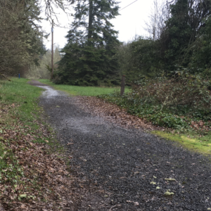
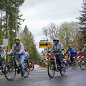
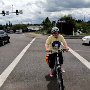
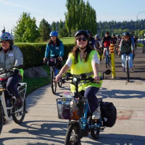
Riding a bike in Beaverton can be a treasure hunt. I typically use Google Maps, Strava, and local friends’ knowledge to sleuth out safe routes on park paths, cut-throughs, and neighborhood streets to avoid major roads like Tualatin-Valley Highway or Murray Road. Cut left behind the mailbox between two houses, cross a footbridge, and you’re there! Riding a bike in Beaverton can also be a terrifying game of Frogger, where I leap across five- and six-lane roads like Farmington or Canyon, and hope I’m not flattened.
But with a series of plans coming over the next few years, that might change. The City of Beaverton is updating their Transportation System Plan (TSP) for the first time since 2010. What is a Transportation System Plan? It’s a long-range plan required by the State of Oregon, which has told cities and counties they must reduce vehicle miles traveled. It lays out the city’s transportation priorities for all road users. In theory, it will cover planning and investments, as well as what to do and how to pay for it.
According to Beaverton Senior Transportation Planner Jessica Engelmann, the “Go Beaverton” project has been about two years in the making, and has two-and-a-half years to go. Engelmann said the city wants to hear from a wide swath of the city — from families, retirees, business owners, drivers, cyclists, and students. “Transportation decisions affect everyone in our community,” Englemann shared in an email to BikePortland last week. “From the little kid who would like to ride their bike to their friend’s house to the 50-year-old business owner who depends on customers visiting their business, to the 85-year-old elder who wants to continue to live independently.”
The City of Beaverton has secured funding, a consultant team, and community volunteers to serve as advisors (a Community Advisory Committee or CAC) and a new team of transportation ambassadors. The ambassadors were appointed by Beaverton’s City Manager in February. Although the ambassadors haven’t met yet, they have ambitious goals to connect with friends and neighbors and find out what they think about transportation issues in the city.
Beaverton adopted a complete streets policy in 2023 that defines rules and guidelines for making streets welcoming for all users. These efforts align with the State of Oregon’s Climate Friendly and Equitable Communities rules for transportation planning. Beaverton’s TSP update will include many other agencies and voices as part of a Technical Advisory Committee or TAC, such as ODOT (which owns major thoroughfares like TV Highway), Washington County, TriMet, Tualatin Hills Parks & Recreation District, Beaverton School District, and others.
It all sounds fabulous and hopeful on paper. It has all the right buzzwords, and I’ve heard the transportation ambassadors have been assigned the book, Walkable City Rules by Jeff Speck (a great book by the way). But what will it really mean, on the ground when/if the policies and projects are implemented? While I’d love to see Dutch-style protected and connected bike and pedestrian infrastructure spring up out of the bike lane paint stripes on Murray Road, I’m skeptical. In a car-centric suburban city like Beaverton, where will the money come from to make these changes? Will real change even happen?
Engelmann, who’s leading the TSP update project, thinks so. “The City’s Transportation System Plan, at its core, is a policy and investment plan for the next 20 years. It will consider transportation revenue sources the City expects to have, both over the short and long term. It will also consider what it would cost to program and build the transportation system the community desires.”
Imagine a future rebuild of a current major road like Cedar Hills Blvd between Walker Road and TV Highway. It’s currently five lanes general traffic lanes with lots of shopping and restaurants, and a patchwork of bike lanes—which are only paint and have fast-moving cars, trucks, and buses roaring by inches away. (I mostly ride the sidewalk there and yield to pedestrians.) When it comes time to decide between reducing traffic lanes, or removing space (sometimes landscaping) from business parking lots to create protected bike lanes, or staying with the status quo —what will we decide in the future?
Engelmann says, “That’s for the community to discuss and City Council to decide. [Future projects] could happen in a multitude of ways that we will explore as the plan progresses. Among several things, it could include exploring new sustainable revenue sources, restructuring city processes to better align with the plan’s vision and goals, or leveraging community resources to go after additional funds. Underpinning any of these actions requires a shared understanding of what the City is working toward and clearly articulating the City’s priorities.”
In other words, we’ll explore all kinds of options to come up with funding, and whoever’s on City Council at the time will need to be on board.
I hope we get this right. All of us who live, bike, or walk in Beaverton can see the result of decades of car-centric infrastructure — when we cross Cedar Hills Blvd or Jenkins Road on foot or bike and feel our blood pressure rise until we make it to the other side in one piece. I hope the city can produce ambitious projects that match their words and I’m eager to follow this project. For more information on the TSP update, check out the project website and stay tuned for more reporting from Washington County.
Tina Ricks writes for BikePortland about transportation policy across Washington County. She lives in Bethany and rides her bike around the county. Have a tip about Washington County transportation? Email tinaricksbikes@gmail.com.


Thanks for reading.
BikePortland has served this community with independent community journalism since 2005. We rely on subscriptions from readers like you to survive. Your financial support is vital in keeping this valuable resource alive and well.
Please subscribe today to strengthen and expand our work.
As a person who rides their bike in Beaverton all the time, I really like the wording used to describe the experience. I do not understand how anyone thought that 5 lanes with 45+ MPH was a good idea in an urban area – and this every single arterial in the city and around it. There is so much investment in the wrong direction out here.
When I ride my bike in Beaverton, I know many of my neighbors think I’ve lost my mind. I work hard with weird convoluted routes to stay off the 45mph roads wherever I can.
Thanks for covering this, the TSP feels like foundational policy that has a lot of potential to improve active transportation in Beaverton.
I’m cautiously optimistic that change is coming.
I’ve always wondered how on Earth a place like Cedar Hills came to be as it is. Having lived initially in central Beaverton, across from the high school, crossing Farmington to head north on SW Cedar Hills to Powell’s and the Winco, it’s mind-boggling that so very little has been done to deal with all the snarls in the area. The traffic on weekday AMs into the high school was hilarious (does no one let their kids walk to school anymore?); there’s a constant roar of cars along those ODOT roads (Canyon/Farmington) that trisect the city; Cedar Hills blvd (where I now live and walk south to that same Winco), as the only N-S thoroughfare, is likewise always packed despite the fact that there’s clearly more development to go (don’t even get me started on the six and eight lane intersection of Cedar Hills/Barnes just on the other side of 26; how much smaller could these roads be if they used traffic circles instead of queuing everyone up behind lights?).
I think I’ve said this before, here or elsewhere, but there’s just been too little planning for greater density in this area, so close to Metro Portland’s center. It’s taken me years to figure out why this area feels so much less pleasant to be around than I’d expected it to be (don’t get me wrong; I still like it here), but it’s because there’s such a density of people here–so close to Portland–who are all driving everywhere for everything.
I moved here from Greater Boston in 2020; my hometown was 46 miles from Boston’s center, and was still 75% as dense as Beaverton is at just 6 miles from Portland’s center. 6 miles from Boston’s center is Arlington, MA, which is twice as dense (3 times Cedar Hills), and has narrower streets and denser housing types (triple-deckers are nearly the basic housing types, not SFHs) that’ve enabled both (nearby) commuter rail and subway service to work for the community in ways that the low density here gives detractors of the MAX legitimacy.
The density here drops off too quickly, and it’s a chicken-or-egg scenario: the built environment works against transit’s success, and transit’s failure begets car-dependent built forms. The truth, though, is that both MAX and bus service frequency/coverage could work, and intensification easily be justified, IF we weren’t filling our westside suburban centers with parking garages, strip malls, and low-density housing, and stroads to service them all. Beaverton desperately needs to work on both these issues–density and transit/bike-friendliness–simultaneously if it wants to be the kind of westside hub it should be.
I hope that all this is changing. It’s going to take time and motivation, but changing the local “rule book” in the Transportation System Plan is a first step.
Tina, I’m so excited to see more regular coverage about the west side of town!
I’m cautiously optimistic about the TSP update. It really feels like there is a lot more momentum in trying to tackle the insane car-centric development style in Beaverton. It’s going to be hard to reign it in, but hopefully once this is complete, this will provide the needed guidance for the city to get working on things.
Thanks! I hope that the TSP update will be the beginnings of change, sadly at the glacial pace of local government. I’m cautiously optimistic.
I’m not sure how the city is going to keep taking lanes away from cars and also continue to charge drivers licensing fees. I appreciate people enjoying walking/biking however I have a big problem increasing traffic in the name of one or two bikes coming down an otherwise unused “bike” lane. Already this looks, sounds and feels like the dystopian 15min city and I will be voting against this at every opportunity. It’s ridiculous that the money I have to spend in order to drive is actively being used against me. Roads are for cars, stop forcing car drivers to pay to lose roads to bikes who do not pay for that infrastructure
In what way is a “15 minute city” dystopian? All that means is that your daily needs can be met close to home. Is that really so bad?
You need to get out of your echo chamber.
How many times do us 15-minute city advocates have to say it: the point is that you shouldn’t have to drive for daily life if you don’t want to. Not that you can’t drive if you really want to; not the obviously-insane idea–that no one is proposing–that you’re not allowed to walk more than 15 minutes from your home. Just that we’re not going constrain everyone else who doesn’t want to drive for every little thing so that it’s easier for those who do, which is more or less the current situation.
What you ought to be voting against is continuously building our towns and cities such that you are, practically speaking, forced to spend thousands of dollars a year–going to Big Oil, car manufacturers, tire makers, the highway construction lobby, insurance industry, doing almost anything but directly helping you and the people in your community–just to get around. That is the dystopia we’re currently living in, the one that you should find ridiculous.
Open your eyes.
What “drivers licensing fees” is the City charging?
Aren’t most or all licensing fees charged by the State and County? How much of those fees go to biking or walking projects–1%?
If “roads are for cars” how do people get around if they don’t drive there?
Do you prefer people riding bikes in vehicle traffic lanes instead of bike lanes? Do you prefer people to walk on the edge of the vehicle lane, or on sidewalks? Or do you want to change the law so it becomes illegal for people to bike or walk on roads?
Which roads have been lost to bikes?
As a regular beaverton cyclist, I don’t WANT to take away more lanes on busy roads. I just want more options to get through/ accross the stupid intersections. Every time maps wants to dump me onto Murray because it has a bike lane, I want to bang my (helmetted) head against the wall. There are decent bike routes here and there, but they tend to end suddenly and drop you into the WORST places.
Agreed! One of the most convoluted and confusing things to do in Beaverton/WashCo/Hillsboro is way finding across neighborhoods, looking for through-cut streets to stay off of big roads. But if I’m riding to a store or business, I sometimes need those big roads. And yes, the intersections are often terrible.
Hi there, author here. Keep in mind that gas taxes and licensing taxes haven’t fully funded roads for decades. In Washington County, roads are funded with local property taxes, which we all pay as homeowners or renters. I drive and bike in Washington County, and would like to not die on a bike.