
Today the city released the names of thirteen Portlanders who will be considered for appointment to the Independent District Commission (IDC), a body tasked with establishing the geographic boundaries for future City Council districts.
The IDC was part of the city charter reform overwhelmingly approved by voters last November. As stipulated by the reform, the candidates have been selected by the Mayor and will be formally appointed by the City Council on January 25th. Here’s the list:
- Amanda Manjarrez
- Arlene Kimura
- David Michael Siegel
- DaWayne Judd
- Edie Van Ness
- Joshua Laurente
- Kari Chisholm
- Lamar Wise
- Melody Valdini
- Neisha Saxena
- Paul Lumley
- Sharon VanSickle-Robbins
- Steve Fleischman
Of the nearly 300 applications for the positions, Mayor Wheeler stated that, “We received phenomenal applications from so many wanting to engage fellow Portlanders and create districts in which all residents feel represented in their city government. We see and are counting on the continued momentum to change our City’s future.”
The IDC faces a September 1, 2023 deadline for adoption of a districting plan.
The charter reform has strong guard rails to protect the IDC from the temptation to gerrymander:
The Independent Districting Commission would ensure that each district, as nearly as practicable, would be contiguous (one connected piece), utilize existing geographic or political boundaries, not divide communities of common interest, be connected by transportation links, and be of equal population.
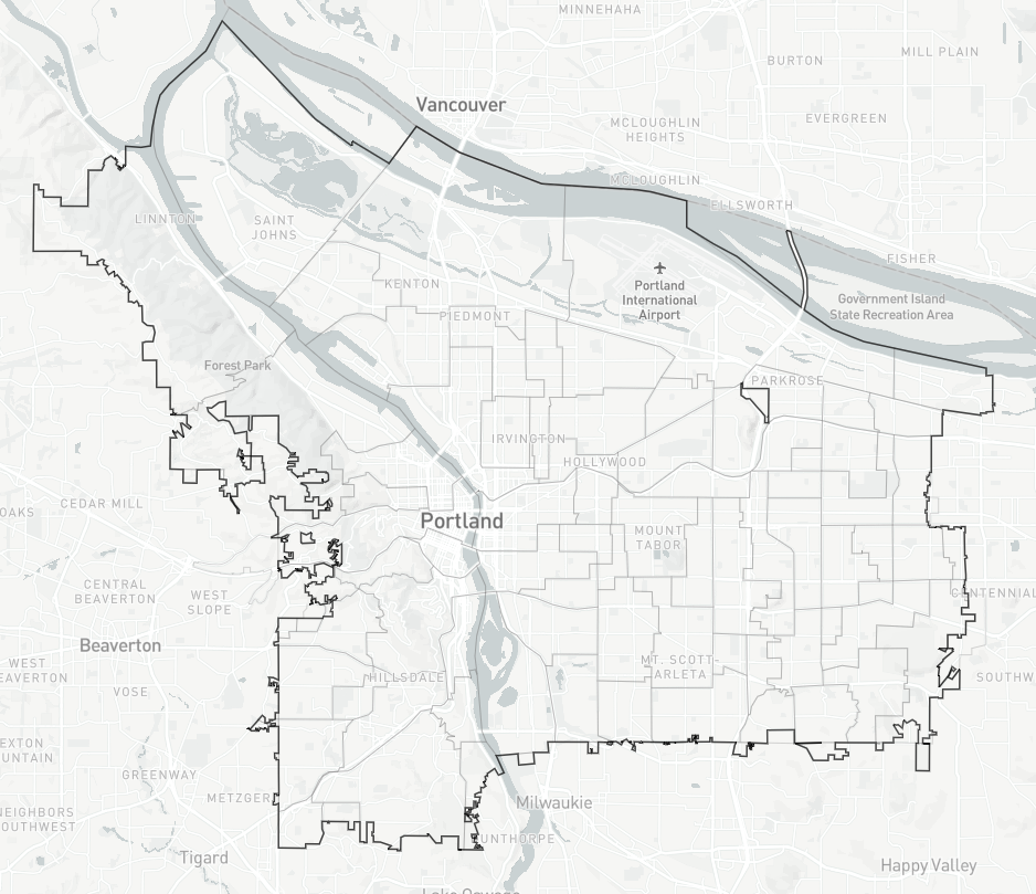
The equal population requirement presents an obvious challenge because of the Willamette River— a geographic barrier which throws a curve at contiguity. The problem is that less than a quarter of the city’s population lives west of the river. This means that a small portion of the east side must be included in a majority west side district to arrive at the required “equal population” of 25%.
This is not a surprise, and possible boundaries accommodating this were floated last year. They all involve taking a neighborhood along the east side of the river and connecting it to the western district.
If you think you can do better, consider playing along with the Districtr tool, from the Metric Geometry and Gerrymandering Group (MGGG). It lets you compose districts by selecting Portland neighborhoods from a map and helpfully keeps a running tally of the population count so you don’t go overboard.
As we move closer to implementing a four-district city council, I’m expecting to see more maps like the one Roger Geller presented to the Bicycle Advisory Committee, the Percentage of Planned Bikeways Built. City councilors will want to know what assets are coming to the district they have been elected to represent. That means more data presented geographically, by district.
")


")
Thanks for reading.
BikePortland has served this community with independent community journalism since 2005. We rely on subscriptions from readers like you to survive. Your financial support is vital in keeping this valuable resource alive and well.
Please subscribe today to strengthen and expand our work.
These maps and discussion are super useful! I am actually right in the midst of setting up some materials for a class exercise using the MGGG mapping tool.
A few quick comments from a field matter expert:
Generally, SCOTUS has been averse to population deviations over 1%. Precincts make this harder to achieve, but a proposed map with 5% deviation is unlikely to be viable.There is a claim below that it would be better to use neighborhood or neighborhood coalitions and not precinct lines. I’m not sure of the merits of the claim that neighborhoods — which are based on streetcar lines, older town, and developments — are a better reflection of communities of interest. Nonetheless, you could try to follow neighborhood boundaries if you want, but the final lines will inevitably rely fundamentally on Census blocks.Critical to keep the STV system in mind as you create your map. The 25% threshold means that maximizing the non-white percentage in one district may actually harm minority influence. By doing so, you may inadvertently be “packing”, a technique used to dilute minority voting power.Great stuff! So excited to see the interest and engagement.
Prediction: There’re going to make it harder than it needs to be.
https://districtr.org/plan/165535
Ah yes, just what the working class neighborhood of St. Johns wants, to be lumped into a district with the west hills, downtown, and affluent southwest Portland. Certainly wouldn’t want to be in a district with our neighbors on the peninsula. Representatives chosen by the majority of affluent west side Portlanders would definitely care about us, totally.
It’s harder to actually do stuff like this when you care about making sure people have representation.
St Johns and Linnton have a fair bit in common. But generally I agree, and I would prefer to put St John’s in with N Portland and have the populations unbalanced, but I know people would decry that.
4 is such an awkward number.
Keeping St Johns with the rest of N and NE makes more sense. My map gets better population parity than yours by adding Sellwood-Moreland, Eastmoreland, Reed, and Brooklyn to the west side.
https://districtr.org/plan/165852
Exciting to see this moving ahead. I don’t recognize many of the names, but I know Arlene Kimura and she is fantastic. My hope is that they get away from using the river as a boundary, this is my first pass:
https://districtr.org/plan/165543
I’m not getting your map when I click on your link, Watts’s map also. I’d love to seen them, maybe repost as screenshot?
Hopefully this works:
Both links work for me…
Changed devices, works nicely, thank you. I’m lovin all the maps!
This map splits up communities that have a long history of working together, such as Laurelhurst, HAND, Creston Kenilworth, and Richmond. I would want to see a map follow the neighborhood coalition boundaries to the extent possible.
I also suspect that there will be a push for E Portland to be its own thing, and their population is just about perfect for that. The river is a natural boundary, both geographically and politically.
I think the river boundary is a negative thing. IMO, the river is and should be the center of our city. I think part of the reason the river is so poorly treated is that it is always on the edge of the map. I also think think the continued segregation of East Portland as its own separate land is not necessarily the best for representation. I can see some value in the existing communities, but there are also drawbacks that include amassed power and wealth. This seems like an opportunity to reconceive how our City perceives itself, and I think districts could be more economically diverse than the way we have been perceiving/depicting the City. Obviously, the map is far from perfect and I think this will be pretty fraught challenge, but I personally hope they do not feel constrained by the river or by existing neighborhood coalitions.
“the river is so poorly treated”
The river is doing better than has been in many many decades. It’s one of Portland’s environmental success stories.
I guess it is matter of perspective. The big pipe has drastically reduced that amount of sewer in the river, that is success. There has been a little bit of brownfield cleanup at UP, that is a qualified success (they focused mostly on capping and there were no associated greenway additions included). On the other hand, the river is not actively being cared for or celebrated. Look at waterfront, just south of the Hawthorne Bridge. The river’s edge is a mass of rip rap, dumped concrete and weeds. The beach is littered with asphalt and concrete chunks and broken glass. There is not path or access to the beach besides a scramble over the riprap. This is one of the most prominent stretches of waterfront in the state and it is in shambles. In addition, the planning effort for the NP Greenway largely ignored the value of the river until the route got north of Swan Island. The noble, fledgling efforts at developing beaches and swimming docks are hugely popular but they are not taken care of. abandoned boats and non-functional camping boats dot the riverfront and contribute to water pollution and river hazards (I saw the river patrol towing a pirate sailboat out from the structure of the Morrison bridge where it had lodged itself this morning. The river could/should be focal point for the City, a place of beauty and nature with plenty of access and a variety of ways to enjoy (soft patch, riparian forests, beaches, docks, small watercraft launch points, etc. Instead, it is mostly neglected and not maintained. The City refuses to develop IGAs and hides behind the mix of ownership (DSL, Port, PP&R, BES, ODOT, Metro, etc) to avoid responsibility. I believe that representation matters- if the river has in the center of a district, it would be more likely to be understood as a central feature.
A lot of people are caring for and celebrating the river; the Human Access Project, the Audubon Society, and the various dragon boating clubs have all been very active on this front. The mayor hosts an annual swim across the river, and there’s The Big Float. Lots and lots of rocks and other debris has been cleared from swimming areas, and the swimming dock S of Hawthorne is set to return.
There were a lot of years where people saw the river as a toxic sewer, and treated it as such. Undoing that harm is a long and slow process. But it is happening.
The whole point (ok, maybe not the WHOLE point) of this redistricting is to give different geographic areas their own actual representation which they don’t have today. You don’t want to lump in east Portland with some other area because then their representation is actually split. Like, it doesn’t matter if the west hills have “amassed power and wealth” because they’re just one district.
East Portland has a large immigrant population, a lot diversity, and lower incomes when taken as a whole than other parts of Portland. Keeping them segregated as a voting block does give them distinct representation, but it also ossifies the exiting division in which they have to compete for resources. I see this an opportunity to break down the division of Eat Portland, and West Hills and have districts that are more economically diverse. The existing power structures are going to remain in place, why not spread the benefits of that around? If you have one district with the majority of amassed power and wealth, I think will change less than if the power and wealth is spread throughout multiple districts.
But that just doesn’t make any sense to me. “Break down the division of East Portland and West Hills” is what we have today. There is no division, we’re already “spreading the benefits around” since we have at large representation. The result of that is that all the representation comes from somewhere other than East Portland. The whole idea of districting is that it gives representation to places that otherwise would have none.
If you have one district with all the amassed power and wealth, they will only get at best a quarter of the seats. If money runs politics (and it does sadly), the most likely leaders will be people with more of it or better connections to it. Which means if you have districts that include diverse economics, guess which people in those districts are going to win and who’s going to be represented.
Not that these dynamics guarantee any specific outcome, but if the complaint is that East Portland doesn’t have good representation, then diluting their districts by mixing in various economic levels just keeps the status quo.
(I just noticed, as Adam said in another comment, this form of breaking up areas like you suggest is called cracking, and it’s a kind of gerrymandering.)
Representation doesn’t mean someone lives near you (or has the same ethnic background or the same gender or the same transportation preference, or even the same position on every issue); it means they listen to and consider what you have to say.
I agree that it is easier to win with money (especially if you have it early in the race), and this will probably be even more true moving forward.
Awesome, I love maps! My pass:
https://districtr.org/plan/165547Logic: A westside district makes geographic sense, and bunches a community of common interest (rich people) together, keeping them from dominating the other three districts. On the east side, I think it makes sense to have the remaining three districts extend from inner neighborhoods out to the peripheral neighborhoods. That will dilute the haves vs. have-nots dynamics that would result from having a purely outer eastside district pitted against a westside district.
Isn’t that the opposite of what we want? We have that right now, it’s all one district so the “haves vs. have-nots dynamic” is completely diluted. The result is that the “have nots” have no representation.
Your map could backfire on geographic and demographic representation, as you could get most candidates coming from west of I-205 or even west of 39th Ave. You have, perhaps unwittingly, gerrymandered the districts and “cracked” East Portland, thereby potentially diluting its representation overall.
In the case of a small geographic area like Portland, it is better to keep all districts as compact as possible and delineated along well recognized neighborhood and geographic boundaries.
By keeping East Portland, the most ethnically diverse and least socio-economically affluent part of the city whole, you can maximize the number of city councilors from that area. Likewise, if you pack all the west side along with the affluent neighborhoods in SE together, you allow the N/NE, and inner SE to get properly represented on their own.
The conservative voters in East Portland should not have their voice diluted!
Adam has made really good points on this thread, and a good map too. But I agree with you Watts, it doesn’t seem to have registered with many people that east Portland did not support Hardesty, they were Gonzalez voters.
And that shouldn’t come as a surprise. Nationally at least, Hispanic and Asian voters are more conservative than those on the leftmost of the Democratic party.
I say this as someone who sits pretty far left herself. But to me, this is one of the advantages of the charter reform. People will stop presuming to know what people in other other areas of town want.
Who are these 13 people and what are their qualifications/expertise?
It’s a political process, not a technical one.
Jay, The city did not release bios in their press release, but maybe I missed something. The top link in article is to the PR, that’s the official info.
All 13 are very public and have easy-to-find online bios:
https://www.betteroregon.org/news-story/meet-the-team-amanda-manjarrez
https://www.multco.us/2017-volunteer-awards/arlene-kimura
https://www.linkedin.com/in/david-m-siegel-faicp-1b288111?original_referer=https%3A%2F%2Fwww.google.com%2F
and so on.
Some are agency or nonprofit, some are community volunteers, some are corporate, some retired, a real mix.
If all Oregonians vote by mail, why use precinct boundaries at all? Why not use existing neighborhood association and district coalition boundaries instead?
The precinct boundaries along I-205 are clearly gerrymandered in a very obvious way. Nice start. Not.
https://districtr.org/plan/165556
No more than a 2.5% population difference between the largest and smallest district. Two districts that are at least 34% non-white in population, in East Portland and a very gerrymandered north central Portland. West Portland is even more gerrymandered.
Has anyone been able to create a contiguous set of 4 Portland districts whereby one of them is over 50% non-white?
I would challenge the assumption that non-white people have anything more in common with each other than they do with white people if that’s the assumption you’re making.
It’s not an assumption I’m making, it’s a federal requirement from the 60s that electoral districts or wards be constructed so that at least one and preferably several will make it easier for visible minorities to elect someone they prefer – a minority or otherwise. The Districtr website does a good job explaining this concept. My own community in NC recently went through the process of modifying existing city districts (we have 5) and we had to have at least 2 with majority-minority populations yet the largest and smallest districts had to be within 5% of each other’s populations to qualify (and avoid an ACLU/federal lawsuit.) Whites are only 40% of the population here, so it’s quite a bit easier to do that than in Portland where whites are over 70%. And the feds have a long history of scrutinizing city districts as much as they do state congressional redistricting – they’ve successfully sued many cities for not following the intent of the law enough.
I realize you were citing federal policy, but “they prefer” suggests a sort of common interest that I think does not exist in Portland. Heck, the last two election cycles have produced highly “visibly diverse” councils chosen by an overwhelmingly “invisibly diverse” electorate.
The racial dynamic in the south is completely different than it is here, and any sane policy should reflect that.
Most of the court challenges have actually been in Midwestern cities, Cincinnati for example, rather than in the South. Portland and Seattle are really odd cities in that they are so incredibly “non-black” but there other races to consider (Asians, Latinx, aborigines, etc), as well as East European immigrants – for example there are lots of Ukrainians and Russians in Portland even before this recent war, who came after the breakup of the USSR for religious reasons.
Here in the South it’s also not particularly unusual for blacks to get elected in mostly white districts, nor the reverse, but it is important for “minorities” however defined to have their voices heard at the ballot box – to encourage voting and for regular people to run for office, rather than just the rich and the well-connected.
Agreed, but I think I’d rephrase that as “it’s important for minority viewpoints to be heard at the ballot box”, a subtle but important distinction.
To the extent such viewpoints correlate with physical characteristics can be left as an exercise for the reader.
David, the Voting Rights Act did not mandate “that electoral districts or wards be constructed so that at least one and preferably several will make it easier for visible minorities to elect someone they prefer”.
This standard didn’t emerge until Thornburg v. Gingles (1986).
There are three criteria, aka “Gingles test”, and it may be in dispute whether these apply in Portland:
hope that helps!
Yes it does, thank you.
To answer your question David, no, it’s not mathematically possible in Portland to create majority minority districts. I’ve covered that in previous posts. That is the rational for multi-member districts. Mont Chris Hubbard’s video does a delightful job of explaining the problem, under title “proportional representation.”
https://www.youtube/user/montchrishubbard/videos
The best I could get from using precincts on the website was about 40%, but ultimately they’ll be using block group level data to refine the district boundaries. The result I got looked like those very weird snake-shaped gerrymanders you see in Texas or Maryland, particularly for the SE district.
This actually looks pretty good. Although I’d probably try to get the Irvington area in the same district as the west hills or maybe your south district. Basically, the areas that voted against charter reform 🙂
You’re overthinking the diversity angle. Portlanders have shown they have no problem electing minority candidates. Gerrymandering multi-member districts in a forced effort to maximize minority representation would very likely undermine the credibility of the endeavor from the get go.
If you want to maximize minority candidates, keep the N/NE neighborhoods together in one district and East Portland together in one district. Having one ugly-looking district with 40% minority representation will just make the other three districts more white and socio-economically similar.
This committee, if it is manned by reasonable people with a good local understanding of neighborhood geography and the general social dynamics between different parts of town, should only need one afternoon to hash out these districts. Anymore more time than that, they are overthinking things.
I would have them each use a simple tool the Districtr or Dave’s redistricting, and just make their own rough draft maps, and reference maps other people, like all of us have done. Credible and sensible patterns will emerge, and more advanced software can refine the boundaries to make them evenly split by population. By keeping it simple and keeping the districts as compact and defined, as much as possible, by neighborhood geography, the committee can get this reform off to a solid start. This really should be the easiest part of the process.
If this committee drags its work on for too long and the final map looks like coiled snakes, cynicism and polarization will create political headwinds that get in the way of progress on the other pieces to this reform.
Weirdly, I-84 is treated as a boundary, but the much more intrusive I-205 is not.
Anyway, I tried to keep neighborhood coalitions together as much as I could. I had to lump Overlook (Swan Island industrial area) and a chunk of NECN (including Lloyd District) in with the west side, and put part of SE Uplift in with East Portland, in order to balance population. But I kept the population variation under 2%, at least according on the 2010 census numbers Districtr uses.
https://districtr.org/plan/165561
I know one of these people and they were vehemently and publicly against city charter reform. Guess that doesn’t disqualify you from the charter reform committees…
Why should it? You can think something is a terrible idea, and still try to make the best of it once the decision has been made. I rather have some sceptics at the table than only true believers.
Skepticism and and vehement opposition aren’t the same thing. I do think there’s a legitimate concern that someone who was vehemently opposed to Charter Reform won’t act in good faith to carry out the work of the committee.
Presumably that concern was addressed before the person was appointed.
That’s putting a lot of faith in a Mayor and political establishment that didn’t want Charter Reform to pass.
yea while i agree it’s ok to be skeptical this person already thinks Portland is dying (bc homeless people aren’t all arrested), charter reform would be the nail in the coffin, and i worry more about them upending committees to watch them fail rather than engaging in good faith. It’s a classic approach to yell about govt not working, hamstring any progress, and then point and say i told you so.
It’s hard for me to see how a small number of individuals could prevent a committee of this size from reaching a decision on a map, and without anything to be gained by doing so, I am very skeptical that they’d even try. We all have to live with charter reform, after all, and even if this committee somehow fails, it’s going to happen.
Maybe I’m just less conspiracy oriented than some. Time will tell.
Seriously that’s my biggest concern about the process right now. The mayor and three of the council members were openly opposed to this change and now they’re in charge of implementing it. There’s a lot of potential for them to mess it up to maintain some semblance of the power they currently have.
So if charter reform does not live up to your full expectations, it’s automatically Tevis, mini-Tevis, and Mingus’ fault?
Nope that’s not what I said at all. They were opposed to it though and they do control the process of implementing it. Just like gerrymandered districts there’s potential for abuse here and selecting people that will carry out their vision of how they would like things implemented is the first step.
They literally tried sabotage the commission’s plan while suggesting a different system that would afford them much more influence over the city. Why would you trust people that were openly against this change to act in good faith?
“Proposed an alternative” literally does not equal “sabotaged”.
I cannot seem to be able to extend the district areas north of the Columbia River…into Portland’s largest unrepresented bedroom community 😉
Yes, I’ve always felt sorry for the 4 million or so Washingtonians who live south of the Columbia River who don’t get the full benefits of Olympia’s benign organic free-range enlightened despotism.
Lets make a deal!…redraw the east of Cascades boundary (new State of Jefferson) AND add Puerto Rico (or the new city state of NYC)…Congress will only add new states if there is a no new Senate offset of Dem vs Rep seats. 😉
I’m thinking we creat the state of East Virginia, the area east of Charlottesville in the beltline, or else Florida from Orlando on south (Burgundy?), since neither are part of the South anyway, as Republican matches for Puerto Rico, but I like your thinking.
Has anyone tried to swap out income class (proxy) for race given the boundary setting rules to see if representation boundaries are improved etc?
I don’t understand why anyone treats the river as anything more than any other block. It shouldn’t be special. It’s covered in bridges and you can move freely back and forth across it. It’s an arbitrary line. Therefore there should be no trouble expanding the west district a little bit across the river to balance population, economics, etc.
I know the quoted block says “utilize existing geographic or political boundaries”, but obviously there are competing interests that can’t all be satisfied and the geographic boundaries don’t actually correspond to anything real, when it comes to politics.
https://districtr.org/plan/165852
District 1: the west side and the SE neighborhoods immediately over the Sellwood Bridge, that share similar demographics.
District 2: North Portland and most of the central NE.
District 3: SE Portland not in District 1 and west of I-205
District 4: East Portland
I like this one. And you got the districts within 1.56% population deviation. Very well done.
Does this mean east Portland will stop getting crapped on?
Interesting topology.
Because of Maywood Park this two-dimensional manifold is not simply connected.
Neither is it compact.
Perhaps we should extend to dimension three and employ a Möbius strip.
I made this as a joke but the more I look at the details, the more I like it.
https://districtr.org/plan/166083
This is the sort of pattern incumbents who want to be re-elected prefer – it splits coalitions and voting blocs; it’s the worst outcome for minority populations wanting to be heard. And unfortunately it’s the most likely outcome.
I like that it reflects the fact that Portland’s polar regions are so culturally different than its deep south.
I tried to make one starting with central Portland, then did a northeast and southeast and was left with an outer crescent.
https://districtr.org/plan/166156
I also made one “just for fun”… https://districtr.org/plan/166158
One doubts that promoters of a hyper complex model of governance understood the deep topological truth embedded in their demand for four districts: every planar graph is 4-colorable.
Looking at the thirteen worthies charged with that coloring, one notes a paucity of white male geezers, even though we, over the four recent centuries are responsible for almost all “progress” currently enjoyed. (Exceptions: nuclear fission and DNA, both products of super intelligent ladies.)
Fortunately, there is BikePortland’s “Comments,” bailiwick of white male geezers extraordinary! Our 4-colorings necessarily are the sine qua non, the ne plus ultra, the summum bonum!
Ours will always be superior!