(*Note: This map is a work in progress and includes several sections that are incorrectly labeled.)
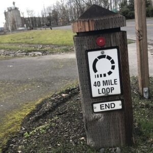
The 40-Mile Loop is a nonprofit that brings together government agencies to hasten the development of paths and trails that make a loop (hence the name) around the Portland metro area. It’s an idea that goes way back in regional lore and was originally envisioned by the famous Olmsted brothers in 1904.
As cool as the idea is, it’s not cool that this dreamy loop is still incomplete.
Thanks to devoted volunteer advocates we have a wonderful network of paths from Kelley Point Park in the northwest section of the loop to the Johnson Creek Trail near the rural outpost of Pleasant Home in the southeast section. But there are still about two dozen gaps left.
Before they can be filled, the first step is educating electeds, policymakers and advocates about where exactly these gaps are located. That’s where Glen Bolen and Jim Sjulin come in. Sjulin is a retired Portland Parks planner who’s work we’ve covered previously here on BikePortland. And Bolen is a planner with Oregon Department of Transportation Region 1.
Advertisement
After Glen saw our video on the Alderwood Trail (“Secret Slough Path”), he reached out to share a cool new resource. He and Jim put their heads and resources together to create a new GIS map that details each section of the 40-Mile Loop — and more importantly — where the current gaps exist.
We cannot close the gaps until we know where they are.
As you can see from the embedded map above, the purple sections are where we still need to either purchase land and/or build a trail or path. Have a click around, explore the sites on your bike, and let’s work to turn this entire map green as soon as possible!
Find a gap and make it your personal mission to help close it.
NOTE/UPDATE: Please be advised that this is not an official map. It is an advocacy effort and a work in progress. As such, there are some alignments and sections that might not be 100% accurate. We regret any confusion.
— Jonathan Maus: (503) 706-8804, @jonathan_maus on Twitter and jonathan@bikeportland.org
— Get our headlines delivered to your inbox.
— Support this independent community media outlet with a one-time contribution or monthly subscription.


Thanks for reading.
BikePortland has served this community with independent community journalism since 2005. We rely on subscriptions from readers like you to survive. Your financial support is vital in keeping this valuable resource alive and well.
Please subscribe today to strengthen and expand our work.
FYI re the purple segment that is missing in NW Portland: We’re trying to get PBOT to fix the four-block “Thurman Gap” between Naito aka Front and 19th Ave. Going west from there, the greenway is going to be relocated from NW Raleigh St to NW Savier St, per the Northwest in Motion plan. That will be slightly less out-of-direction for the 40-Mile loop than the choice of Raleigh shown on the map. So, the map should probably show the loop staying on Thurman up to 19th or 20thth then bumping over a block and staying on Savier from there up to 28th (or 27th as shown). Then, there is the problem of getting from 27th and Thurman to the Leif Erikson gate. The NWIM plan includes a possible climbing bike lane on Thurman, which would be very helpful. Even striping a climbing bike lane on the Thurman bridge over Balch Creek (which is 27′ curb to curb and therefore has adequate width) would be a start. The worst speeding in NW (per NWIM data) is on that 1300′ foot stretch over the bridge from 28th to 31st, which has nothing to slow drivers down. A crosswalk with a refuge island at the low end of the bridge, and a wine barrel full of flowers in the oversized intersection of 29th and Thurman would solve the speeding. Hopefully the loop can get connected up with a route lots of folks would feel comfortable using!
Scott, thanks for the details ideas. We definitely have some gaps that are pretty general.
Does the “North Portland Willamette Greenway Trail” actually exist as indicated on the map? As in, a continuous off-street trail that’s publicly accessible to bicyclists and pedestrians?
Not yet, but keep dreaming!
If “the purple sections are where we still need to either purchase land and/or build a trail or path” then the map is inaccurate. There are a number of proposed but unbuilt trail segments that show up as green on the map.
That’s my impression too. At the southeast part of the loop, I can find no evidence of the North Fork Johnson Creek Trail, connecting the Springwater Corridor to SE 282nd. I wish it were there!
Nothing even close to what the map shows. Even if you want to consider friendly roads as green, it’s still wildly inaccurate. Between Cathedral Park and the start of the Esplanade at the top of the Steel Bridge, only the short Waud Bluff trail and brief trail along MaCarthy Park on Swan Island actually exist as trails. The stretch on Greeley too, I suppose. Everything else is just road or straight up doesn’t exist. They have a green section below the University of Portland that is just train tracks, no path at all. I’m not sure where they got this information, it must have been on a report of potential trails, not what actually exists.
I am wondering about this too, as it appears that the trail goes right thru the Union Pacific Rail yard AFAIK you are trespassing if you take this path. You encounter a narrow fence tunnel at the end of the beach on the north end and then you see the signs. There is a large wide road that runs the entire length, which makes a great bike route, but the menacing fencing and signage seems to indicate you are not allowed to legally take this route. I would love to know otherwise.
Douglas and others:
I’ve just added a note to the post that clarifies how this map is a work in progress and has not been officially vetted by any government agency. It’s an advocacy effort that will improve over time. As such, there are likely some alignments/labels that are not 100% accurate. Sorry for any confusion.
One easy way for the map’s designers to check their work is to look at the PBOT Portland Bike Map. It covers all of the 40 mile loop that’s in Portland, and even a little of the part that’s in Gresham.
Ross Island’s closed east bank facility should now be in play.
Cool. Thanks for the post.
No offense, but “garbage in, garbage out!” The the exception of about one mile on Swan Island there is NO Willamette Greenway Trail available for use between the Eastbank Esplanade and Cathedral Park. This map shows the so-so bike facilities on N. Willamette and N. Greeley at the completed WGT!! Again in reality it just one big gap, except for part of Swan Island. Who did this map? They should consult with partners like npGreenway before publishing such a poor piece of work.
Similar problem on the west side. The map shows a segment of the South Waterfront Greenway from the Marquam Bridge to the Ross Island bridge that doesn’t exist.
I wonder how many other mistakes there are.
Thanks for the info Lenny. The creators of the map are in the post. I’m sure they appreciate your feedback and will continue to work to improve the map. And yes, I should have looked at it more carefully before publishing without more caveats as it’s obvious that there are significant caps that are not labeled. I’ll let Glen and Jim respond to why it was labeled as such.
I found it helpful to read the map legend before making any comments. The green portions seem to show where the loop is supposed to go, but it doesn’t necessarily show where it has been completed. The purple is known gaps, but the rest is known unknowns.