
(Photo: Lisa Caballero/BikePortland)
This article was written by our SW Correspondent Lisa Caballero.
The SW Trails community organization has an ambitious vision to build a family-friendly bicycle and pedestrian trail along the old Red Electric railroad route between Beaverton and the South Waterfront. I’m particularly interested in the east end of the route as a safe alternative to Barbur Blvd, so last month I met the organization’s founder, Don Baack, for a what turned out to be a very educational walk.
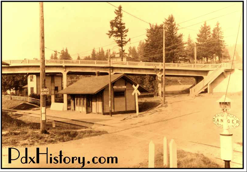
For fifteen years, between 1914-1929, the West Side Line of the Red Electric train ran from Portland’s Union Station south along Fourth Avenue and Barbur Boulevard. It turned off Barbur onto what is now SW Bertha Boulevard to arrive at this little station stop in Hillsdale. The bridge in the background was for Slavin Road, now SW Capitol Highway, and if you sit on the deck of Sasquatch Brewery you can almost touch the balustrade.
From Hillsdale, the train continued to Garden Home, Beaverton, Hillsboro, Forest Grove and then down to McMinnville and Corvallis.

Baack pointed out places along the western half of the proposed Red Electric Trail where one can still see the train’s berms and roadbeds. (SW Trails also has an annotated ArcGIS map to help you on your own self-guided tour.) But as you move east, there are big gaps in the trail because Barbur and Bertha Boulevards were built on top of the Red Electric right-of-way, and these are the type of busy roadways SW Trails avoids. The challenge for SW Trails was to find a less stressful route which followed the same alignment. Moreover, car traffic wasn’t their only problem, there is a 500-foot change in elevation between Hillsdale and the banks of the Willamette, and the train had already claimed the gentlest route.
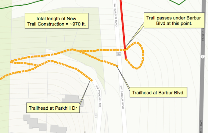
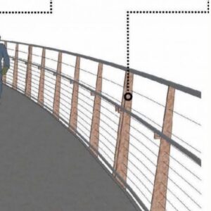
Their solution was to diverge from the train at Rieke Elementary School and cut across George Himes park. At the park, people on foot and bike would take different paths through the ravine to cross under Barbur Blvd. For bike riders, SW Trails wants to build a long 10% grade switchback, which would pass just under the south end of the Newbury bridge and then loop up to the northbound lane of Barbur to cross the ravine on the bridge with the cars.

At the Capitol Highway flyover, the Red Electric Trail would join the defunct Slavin Rd. Currently this is a 700-foot unimproved trail which needs work to connect to the existing northern end of Slavin Rd, and onto SW Corbett Ave. The riders would then head north on Corbett to the Hooley Pedestrian Bridge at Gibbs, cross I-5, and take an elevator down to the transportation hub of the South Waterfront, where you will find the Go By Bike repair shop and valet parking, the tram to OHSU, the Portland Streetcar, more trails, and buses.
I asked Baack what it would take to complete the eastern end of the Red Electric Trail. He said that part of the difficulty in moving the project forward is that it isn’t “owned” by any single bureau or department, that it crosses multiple silos: the switchback through George Himes Park runs through Portland Parks land; crossing under and joining the Newbury bridge touches the Trimet SW Corridor plans; ODOT owns the land east of Barbur where Slavin Road needs to be improved. The only group that keeps pushing the project forward is SW Trails. Baack pointed out to me that TriMet’s plans for the rebuilt Newbury bridge portion of SW Corridor light rail did not include a ramp to enter the roadway for cyclists using a future Red Electric trail.
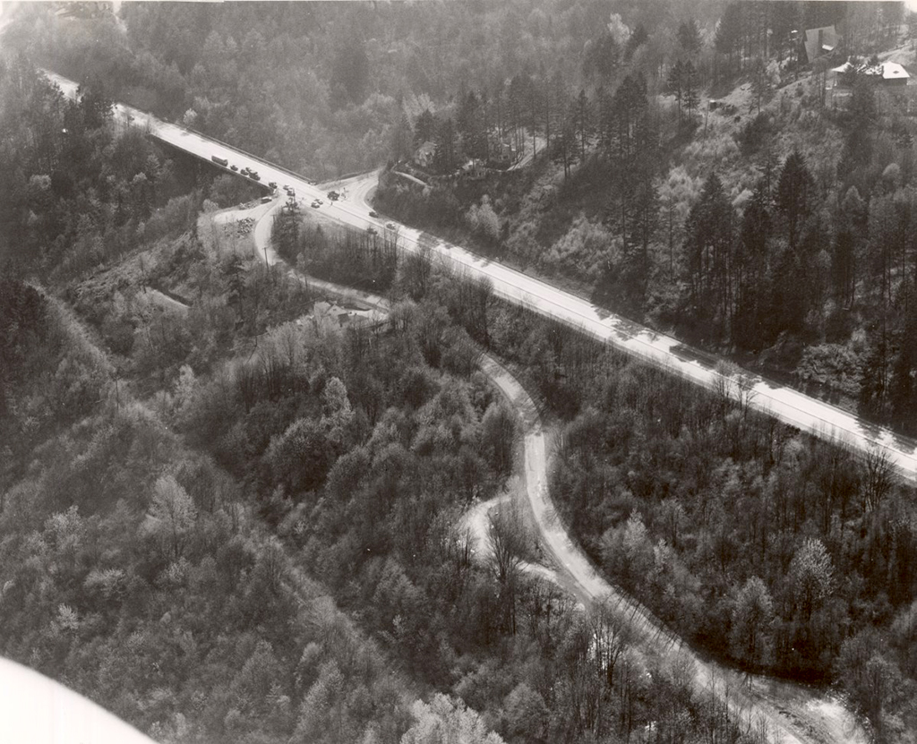
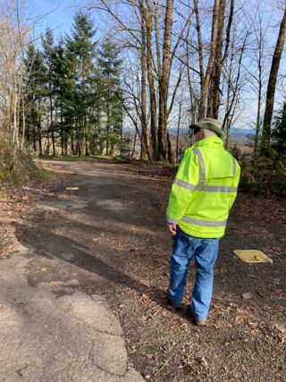
But Baack and SW Trails persist. This spring PBOT will build a bridge over the ravine just south of Beaverton-Hillsdale Highway, near the old Hillsdale station of the Red Electric. And they have City Council approval for their switchback in George Himes park. Baack has been working on the Red Electric Project for 20 years, and while we walked the remnants of the old Slavin Road, he told me that several of the original advocates he worked with have passed away. It would be so nice if someone in city government, or a bureau, or a wealthy person, could just give the Red Electric Trail the final push it needs to make the dream a reality.
I want to acknowledge a couple of websites powered by citizen-historians that made researching this article possible for me. Thank you to Mark Moore at PDXHistory and whoever “Timleyman” is at the Multnomah Historical Association. SW Trails is also a good source for historical information and guides.
— Lisa Caballero, lisacaballero853@gmail.com
— Get our headlines delivered to your inbox.
— Support this independent community media outlet with a one-time contribution or monthly subscription.


Thanks for reading.
BikePortland has served this community with independent community journalism since 2005. We rely on subscriptions from readers like you to survive. Your financial support is vital in keeping this valuable resource alive and well.
Please subscribe today to strengthen and expand our work.
He mentioned wanting to collect the funds to make it happen. How much money do they need? Is it possible to start a GoFundMe?
I like the idea of PBOT putting together a bike/ped wishlist project donation site in hopes of spurring action on these projects.
It just needs a priority on the general fund. Check “Why Portland’s roads are so bad: City Council ignores spending targets, funds other priorities” from Brad Schmidt
Like npGreenway,Sullivans Gulch,and other trail advocacy groups, they aren’t raising money for actual ROW acquisition or construction.Advocacy groups are there to ‘make us do it’, providing the chorus of citizens to make local government know where to place priorities. Face it, the more vocal and known a group is, the more support it gets. When they ask for money, its for mailings, for ‘bling’ to give out at community gatherings where support is sought, for supporting their advocacy and outreach. A group with 1000 citizens sharing a vision is much more likely to get support than a small, well intended group with little support.
I would support ALL trail advocacy groups, they don’t exist in a vacuum. Multiple trails, connected are much greater than the sum of its parts
Sadly, PBOT has temporarily stopped this project from advancing to what it could be. Portland’s “Portland Pathways” program can greatly help connect people to this trail and particular trails can be built with just one person, but Portland cancelled it the pathways program temporarily. Very lousy.
Why? Can you give a little more detail rick? This project is so important because it would finally connect almost the entire SW quadrant to downtown.
Portland’s website says it is “because of c0vid.” This project would be an incredible way to connect downtown Beaverton to downtown Portland if Beaverton would rebuild the trail on SW Vermont Street to fully connect SW Oleson Road to SW Nicol Road, but Beaverton has flat-out refused to do that even with meetings with the nearby neighbors.
That’s too bad. I’ve ridden past the end of Vermont through Montclair Elementary’s property (not during school hours, since that’s frowned upon) and past the edge of OES’ property, hundreds of times. It doesn’t seem like it would take much to finish that connection.
It simply needs either lots of rocks to make a berm or a boardwalk. It is platted, unbuilt public right-of-way but neither school has done much in the way of maintenance in the past nine years. Not even Beaverton wanted to acknowledge the need for the path in the outreach for bike/walk needs about four years ago. In the 1990s, OES pushed to get the road punched thru for the rat race crowd. All of the bridges over Fanno Creek by OES are maintained by Beaverton/WashCo. Pretty sweet deal for the most expensive private non-college school in Oregon.
Jonathan was there any consideration to building switchbacks for bike/ADA access along the SW Iowa stairs under I5?
SWTrails had advocated for a legit bike/ADA access so that people on bike and wheelchairs won’t have to slam on the brakes when going from Hillsdale to SW Slavin Road. Their common sense pleas have been ignored.
Great article!! I just wanted to give credit to Metro for purchasing the property for the switchback section next to George Himes Park. The land was in private hands but Metro got the deal done about 10 years ago.
Thank you for that contribution, Robert. I try hard to credit the various government entities for the progress they have made, but it takes digging and it’s hard to search for something you don’t know about! So I miss things, that’s just one of the reasons that reader comments are so important.
Some claim that the passengers would step off of the train with the rest of their apple they had ate. There are some apple trees and apple tree roots in the backyards of 1940s homes near Scholls Ferry Road where the train operated. McMillan Park in Beaverton has a berm, now a path, on the south side of the park where the train operated. The railroad pilings are partially still in Fanno Creek in Bauman Park by SW Oleson Road.
That’s Tim Lyman at Multnomah Historical. He’s put a lot of work into researching SW Portland history and getting photos scanned and loaded to their website. I’ll share this with him. Thanks.
Thank you!
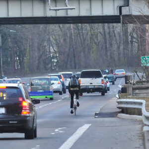
Glad to hear that the Slavin/Barbur connection is moving along. That would be a really fantastic diversion from how I used to have to do it. Never fell on that sweeping downhill around the ramp from SW Capitol onto Barbur, but I always worried about it in the wet, trying to stay above 35mph with car traffic right behind me.
My bigger concern has always been the long section (from SW 33rd to Shattuck, then across the Alpenrose property) shown on the map in dashed red. Despite the length, most of this stretch out to Shattuck already exists, as disconnected quiet dead-end streets without too much topography to them, and there are only a handful of properties preventing a trail from going all the way through. My understanding, as of a few years ago, is that at least a couple parties were absolutely unwilling to sell, although that is usually a problem that can be fixed with money.
As for Alpenrose, I would hope that whoever ends up owning that property can work with the city and/or county for an easement. That may be harder now that the velodrome is dead, and they’re less involved with cycling, but I don’t know. Just FWIW, there are informal trails through the woods on the north side of Alpenrose that will connect through, but they’re not easy going, generally unrideable in winter … and probably not legal, though at least as of a few years ago they weren’t posted. Only done it a handful of times myself, but pointing that out as a potential alternative (I think it may be owned by Schnitzer Manor) if Alpenrose is unwilling to play ball.
Bigger picture: I’ve always wanted a route that avoided Beaverton-Hillsdale highway, but stayed relatively flat and also avoided the big hills in between BHH and Vermont. You can get most of the way through today, mostly avoiding BHH, but the hilliness of the terrain in there (and the orientation of the roads) add quite a lot of climbing and ultimately a number of minutes to the trip. I have done it many times, but if I was in a hurry to get home to the kids I’d always ride BHH and roll the dice on safety. Such are the decisions you have to make.
It really is a shame that even after all these years, there still isn’t a very good bike route between America’s Greatest Biking City and its biggest suburban employment center. But many thanks to all who have worked diligently across numerous jurisdictions to inch things forward. Hopefully a full end-to-end Red Electric Trail will happen eventually.
Making a path from SW Jefferson to the Highway 26 overpass would be nice instead of having to ride on the bumpy pavement in Washington Park. Then, one could take the Highway 26 multiuse path. Or imagine Canyon Road with protected bike lanes.
If the Alpenrose property gets redeveloped, it would be required to have the path.
Thanks for this great report, and credit to Don Baack for spending 20+ years working on the trail. Amazing how he has managed to shoehorn a route through SW but also sad how there’s always room for cars – a real statement about our collective priorities. I live in SW and would use this trail 4-5 days a week.
I’ve always been impressed with Don Baack’s advocacy, hard work, and perseverance.
This a great idea. I will say that all public entities start listening more when you show up with checks. Create the non-profit and start raising funds.
That being said, in the long run the SW neighborhoods themselves will your biggest issue. As the whole Riverview fiasco shows, the locals will kill anything that might bring “those people” to their parks or streets.