
(Photo © J. Maus/BikePortland)

A plan the Portland Bureau of Transportation hopes will double bicycle use in northwest is out in draft form and you have from until December 20th to share feedback.
PBOT has released an online open house and draft of NW In Motion (NWIM), which includes a prioritized list of projects and programs aimed at boosting carfree travel in a 490 acre swath of inner northwest bordered by Burnside, I-405, Vaughn and the West Hills.
More than just a plan, PBOT says they’ve got funding identified for all but one of their 10, “Tier 1” projects and they plan to start building the first three early next year. The Tier 1 projects consist of five neighborhood greenways and five “corridor improvements”. PBOT estimates that nine of the projects would cost $5 million to build (a repave of NW 23rd would cost $8 -10 million).
Advertisement

Northwest’s relatively dense land-use and connected street grid should make it one of the best places for people who want to drive less. But northwest is far from reaching its biking, walking, and transit potential because of outdated infrastructure; it lacks major dedicated bikeways, its neighborhood greenways are virtually nonexistent (all of them fail to meet city guidelines for auto user speed and volumes), crossing its busy streets is risky, transit service is hard to access and buses are often delayed during peak hours.
Traffic data shows that 44% of northwest Portlanders drive alone to work. That’s higher than it should be given that 37% of all trips in the plan area are less than three miles long and PBOT’s drive alone mode split goal is just 30%.


To encourage less driving, PBOT and a volunteer advisory committee have met seven times since May 2018. Their resulting list of projects and policies focuses on changes that can be implemented within five years.
Here’s the list of Tier 1 projects:
Neighborhood Greenways
● NW Johnson St – 9th to 25th: Retrofit of existing greenway that includes alternating one-ways between 12th and 18th and median islands for safer crossings of 16th and 14th.
● NW Marshall St – 9th to 20th: Retrofit of existing greenway that includes full diverter at 15th.
● NW Pettygrove / NW Overton St – 9th to Cornell: New greenway that includes removal of rails on 15th and one-way only section (eastbound) between 9th and 10th.
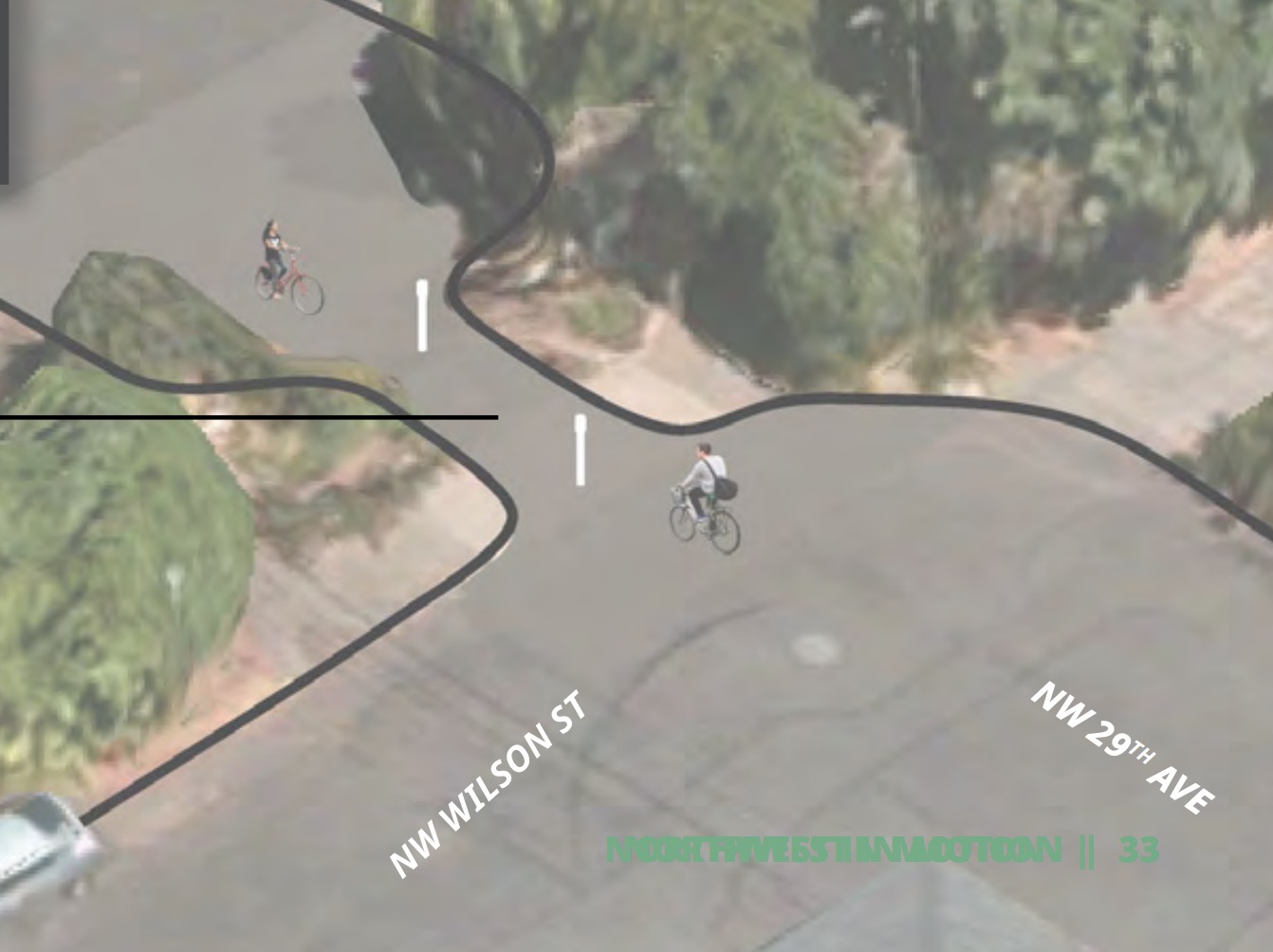
● NW Savier St – 14th to 29th: New greenway that includes interim, two-way carfree street between 19th and 20th and improved bike cut-through at 29th and Wilson.
● NW 24th Ave – Flanders to Vaughn: Retrofit of existing greenway that includes new carfree block between Westover and Flanders.
Corridor Improvements
● NW 25th Ave / Westover Rd: Calm traffic along NW 25th Ave and NW Westover Rd by adding traffic slowing devices and enhanced pedestrian/bicycle crossings.
● NW 23rd Ave: Improve the safety and asset condition of the northern section of NW 23rd Ave by reconstructing the roadway, rebuilding an aging signal, improving pedestrian crossings, and enhancing transit stops.
● NW 18th/19th Ave: Provide improved crossings, transit islands, and reduced bike/bus conflicts on NW 18th/19th to serve the Line 24 Extension.
● NW Everett / Glisan St: Improve safety along the NW Everett/Glisan couplet by adding crossing improvements and reducing traffic speeds. Improve bus stop accessibility and reduce transit delay on the Line 77 from NW District to the Pearl District and Old Town / Chinatown.
● NW Vaughn St: Improve safety along NW Vaughn St and NW Wardway by adding improved crossings, bikeway enhancements, and transit priority treatments. bike boxes at25th , safer crossings at 24th.
In addition to infrastructure, PBOT wants to implement a broad set of new policies and programs which could be have more impact than the projects.
The program recommendations include: improved street lighting, “daylighting” of intersections, a prohibition on right-turns-on-red, signals with leading pedestrian intervals, lower speed limits, and more.
As per their previously adopted vision clearance policy PBOT will recommend a 20-foot parking setback at intersections of all new greenways, busy commercial and transit streets, and streets near schools. Going further, PBOT says they’ll consider retroactive daylighting of problematic intersections and study the impacts of parking setbacks every intersection in the district.
Advertisement

One of the most exciting policy recommendations in the plan is a district-wide 20 mph speed limit. Since less than a dozen streets currently have speed limits above 20 mph, lobbying from advocates and committee members helped convince PBOT that a continuous 20 mph zone is feasible.
Interestingly, while the intent of the plan is to discourage driving, PBOT was careful to not create too much inconvenience for people who use cars — at least in the short-term.
The plan took steps to “preserve neighborhood circulation”, a PBOT euphemism for maintaining current levels of driving capacity. PBOT was also careful to “reduce the impacts to parking supply.” The plan would install auto traffic diverters only on the periphery of the quadrant (to reduce cut-through traffic from out of the area) and it proposes to remove 56 parking spaces while adding 16 new ones.
Looking to balance calls for more diversion with concerns about driving convenience, PBOT plans to take a phased approach. Phase one will “reinforce existing edges” of the plan area with diversion aimed at changing driving patterns of people who cut-through neighborhood when nearby freeways back up. If this initial effort fails to reduce the amount of drivers on neighborhood greenways, PBOT will consider additional diverters, but only after “a clear period of traffic monitoring and community engagement.”
In a section of the plan that describes benefits and impacts, PBOT said their approach to parking came from a desire to, “Balance the need for better walking, biking, and transit routes with the reality that some businesses and individuals will still rely on driving for at least some of their trips.”
Advertisement

Instead of striping dedicated bike lanes, PBOT says they took a shared-lane, neighborhood greenway approach because it would have less impact on parking supply. Given that nearly all of the streets in the plan area are relatively narrow (36-feet wide), PBOT would have to remove all parking to create a bike lane while maintaining two lanes for auto users. PBOT explained their approach in the plan:
An analysis of the impact to on-street parking was run, in which the proposed neighborhood greenways were replaced with bike lanes, to compare it with the parking impact of the recommended neighborhood greenway approach. The results were a reduction of 1,231 parking spaces in the plan area, which would have significant negative impact on residents and businesses by dramatically reducing the available parking supply.
While PBOT is planning for a future that is less reliant on on-street parking than today, this change must be gradual to allow residents and businesses to adapt to these changes. Based on this analysis, the Northwest in Motion Plan recommends the neighborhood greenway approach because the impact of proposed traffic diversion to be much less than the impact of removing 1,231 parking spaces.
Not only did PBOT try to maintain the existing number of parking spaces, they also looked for “opportunities to add parking where it is currently prohibited, as a way to mitigate for the parking that is proposed for removal.”
Even with this light-handed approach to auto use PBOT says once fully implemented the NW In Motion plan will have a “transformational effect,” on northwest Portland, “allowing people of all ages and abilities access to safe and comfortable routes to get around the neighborhood.” Once the recommended projects are built, PBOT expects northwest could bump up its current bike commute mode split from 7% to 14%. If that happens, their models say peak-hour driving trips could fall by 1,200 or about 12,000 fewer cars on the road every day.
When the final plan is adopted sometime in February or March, PBOT would begin construction of updates on Johnson, Marshall and NW 18/19th right away.
Check out the online open house or email NWinMotion@portlandoregon.gov to share feedback.
— Jonathan Maus: (503) 706-8804, @jonathan_maus on Twitter and jonathan@bikeportland.org
— Get our headlines delivered to your inbox.
— Support this independent community media outlet with a one-time contribution or monthly subscription.


Thanks for reading.
BikePortland has served this community with independent community journalism since 2005. We rely on subscriptions from readers like you to survive. Your financial support is vital in keeping this valuable resource alive and well.
Please subscribe today to strengthen and expand our work.
I hear you John. But I’d encourage you to read closely. This plan has funding already identified. And keep in mind it’s a different world these days where PBOT actually has cash to spend.
Oh good! More infrastructure for one of Portland’s wealthiest neighborhoods! Meanwhile here on the peninsula we don’t have a single safe crossing of the cut nor do we have a safe bike route that connects us to the rest of the city. Oh well, I guess its a tradition for the city.
Oh good! Another hot take about how “rich” Northwest is and doesn’t deserve any bike infrastructure improvements. You would think this old trope would die already but I guess not. Never mind that it’s one of the most stressful places to ride a bike in inner Portland due to the lack of safe cycling infrastructure.
This BikePortland piece from 3.5 (!) years ago is still relevant today.
https://bikeportland.org/2016/04/11/nw-portland-is-beautiful-but-that-doesnt-mean-its-just-for-rich-people-180423
I’m a huge proponent of using as up-to-date data as possible. The current census data is from ACS 2017.
The census tracts in the picture that are lighter colored are census tracts 49,48, and 52. They respective, inflation-adjusted, growth rates of 43.87%, 31.67%, and 2.93% between 2013 and 2017. The average of these three tracts is 26.16%
Census tracts 40.1, 41.1, and 42, which are all located northwest of the cut have had inflation-adjusted growth rates of 1.43%, 32.95%, and 22.42% respectively. The average of these three tracts is 18.93%.
The reality is that NW is rapidly becoming wealthier. I’m sure when the next ACS comes out we will see even more growth. The city is investing here because it’s where the wealthy either live, or are going to live.
Also of note, it’s pretty rare to see census tracts where the per capita income is higher than the household income. Maybe later I’ll go back and adjust it for per capita growth
Yes, it’s true that incomes are growing in Northwest, but that’s true for Portland as a whole and almost all the neighborhoods west of I-205. Using the census tracts you picked I don’t see the case Northwest is super rich compared to the peninsula.
In 2017 census tracts 49, 48, and 52 (Northwest / Goose Hollow) had household incomes of $44,800, $50,993 and $39,605; or, $45,132.66 on average.
40.1, 41.1, and 42 (on the peninsula) had household incomes of $39,861, $61,452, and $52,150; or, $51,154.33 on average.
It’s certainly true that there are a lot of rich people in Northwest as a quadrant, but this plan isn’t touching the truly affluent areas like Arlington, Hillside, Northwest Heights, etc.
And to put this all in perspective, the SE Clinton greenway passes through census tracts with incomes of $64,832, $80,203 and $63,387… and yet I never hear people making the case against providing building new diverters there on household income grounds.
Source: https://projects.oregonlive.com/census/american-community-survey/2013-2017/maps/#41051005000
I personally wouldn’t use household income, which is why I noted that the census tracts in NW Portland have the interesting and rare trend of having a higher per capita income than household income.
That’s because folks in the peninsula work more working class jobs than folks in NW. Take census tract 41.1 for example. It has the highest household income of any tracts listed. It’s per capita income ($25,959) is lower than any tact in NW. 41.1 also has 2.6 people per household, 1.2 more people per household than 49,48, or 52, all of which have 1.4 people per household. That means that if you live in 41.1, the median household has $23,635 per person, while in census tract 52, the “poorest” part of NW, you have $28,289 per person.
41.1 is actually a relatively affluent part of the peninsula though. The median household in 40.1 has 3 people and has $39,861 in income. That translates to a whopping $13,287 a year, per person. In Portland Oregon.
We also can’t ignore that all of the projects benefit the folks living in census tract 50, which at a median income $98,269 and 1.4 persons per household, translates to a nice $70,192 per person, per household.
And I do get mad about projects in other affluent parts of town. I think its beyond silly that PBOT is trying to get the 9th ave greenway build against opposition because apparently Vancouver/Williams is too far to go if you live in Woodlawn. Meanwhile I’m in deep St. Johns and I also have to travel to Vancouver/Williams to safely go south and can only safely get there by riding on sidewalks over the cut.
Census tract 50 is a little bit of an odd one, in that it straddles Northwest and the Pearl. The portion of Northwest that it includes has a lot of warehouses and commercial buildings with relatively low density compared to the rest of the neighborhood. The portion in the Pearl has a lot of people, but little (or none?) of the affordable housing, which is mostly on sites where the city had a development agreement with Hoyt Street Properties.
We could spend all day quibbling about the income stats for Northwest, but ultimately it would be missing the point. This is a relatively small amount of money (less than 1% of the cost of the I-5 Rose Quarter project) that is expected to have a large impact, in a neighborhood that is unquestionably seeing a lot of population growth.
It would really only miss the point if you completely change the subject. My point was that the city continues to design and fund infrastructure in the wealthiest parts of the city while neglecting the parts of the city that are lower-income. If the defense of that statement is “NW is actually not very wealthy”, that’s flat out wrong.
We can talk about density, but that’s a completely different topic. These projects are nothing but the rich get richer. Infrastructure improvements while adding parking? The city is giving a massive boost to the property value of the landowners in NW. Meanwhile hundreds of children in NoPo have to cross derelict sidewalks and Columbia/Lombard to access their schools or parks each day. Literally every single day I watch cars fail to yield to children IN the crosswalk at the Peninsula Crossing Trail & Lombard. Those same children have then cross the dangerous right turns on both N Gilbert & Lombard or N Heppner & Lombard. I’m not even asking for bike infrastructure. Just basic safety infrastructure for our community. We already don’t have police because PBOT has abandoned peninsula so speeding is an epidemic.
Portland continues to ignore the communities that least have the ability to deal with vehicular violence. NW has a 49% drive alone rate with most trips under three miles. PBOT is literally building infrastructure for people who have access to public transit, biking, and walking. The peninsula barely has bus service.
But hey, we have “plans” to get subpar, outdated infrastructure, if it gets funded, by maybe 2023 or 2024, so we got that going for us.
And of note, as I was poking around. To kind of hammer the point home, in 40.1, with a median household income of $39,861, 38.6% of people live below the poverty line including 48% of children.
Census tract 52, which has a median household income of $38,477 has only 27.8% of residents living below the poverty line and only 5% of children.
You really can’t compare parts of the city based on median household income alone
Median income doesn’t tell the whole story. Equity also means you must consider density. The residential density of the NW is double to triple that of most other parts of Portland which means there are more people in general- both rich and poor, per sq mi. I bet even if you subset the data for low-income only, the density of low-income households in the NW in Motion project area would far exceed the density of low-income households in many other parts of the city. It makes sense to put some effort into improving safety in places where many people would benefit.
And statistical income tells you nothing about who is more “deserving” of safety.
people have made this point on many occasions on bike portland. and i, personally, have come to regret my advocacy for diversion because active transportation advocacy in portland is a zero sum game.
it’s disgraceful that the city and pbot has funneled so much attention and money to twee inner portland while outer east portland, parts of N portland, and much of SW portland continues to be ignored. it’s also no coincidence that many of these neglected areas score highly on the city’s “equity metrics”.
If you go to the “online open house” there is a link to the actual plan. I looked at it and found this gem in the funding section:
“A portion of the parking and permit revenue from the NW District Parking Management Plan area must be spent on projects and programs within the area that reduce demand for parking. Some of that portion is expected to be dedicated to Northwest in Motion Plan implementation”
Sounds like if St Johns had paid parking and the same funding rules, there would be more money to spend up there.
If we’re ever going to achieve our citywide goals for carbon reduction and mode splits we probably need inner neighborhoods like Northwest to not just pull their pull their weight, but exceed the citywide goals. There’s a lot I like in this plan, but even if it succeeds at doubling Northwest’s cycling rates to 14%, that only gets us 56% of the way to the 25% that should be the [minimum] goal.
As for the funding, the bundle of near-term projects is only about $5 million; a reflection of how cheap bike/walk/transit projects area. (For comparison, the new bridge over the UPRR railroad tracks at N Rivergate, a project designed solely for freight, will cost almost $16 million). The majority of the $5 million will come from parking revenues raised in Northwest and from Systems Development Charges, which are levied against developers (who are building a *lot* in Northwest.
Giving you a big wave from under-lit, under-sidewalked, under-infrastructured outer SE! If you think I’m complaining, no, we’re fine. Don’t worry about us out here!
Hey, don’t blow a blood vessel yet, it’s probably just going to be more over-engineered crap, and the same bad pavement, something you probably won’t want to ride on.
Can’t be any worse than the cobblestone streets that make up n Bryant and N Central
What data was used for that mode split pie chart? PBOT has a habit of using dated or questionable statistics in its plans.
I hope there is a portion of the budget for a “common sense” quality assurance person to monitor actual construction. The “protected” crossing at 19th has been “live” this week, but it doesn’t appear to be any changes to signal timing (took 16th today so maybe those went up yesterday). If its currently used as laid out on the street, one is actually funneled perpendicularly into traffic simultaneously crossing 19th if you want to make the left to head eastbound. Its a protected intersection with signal timing that negates all the hardscape changes.
Also, they need to get more robust signage / parking enforcement for the changes at 19th and Glisan. Two full lanes into one full lane and a shared right turn only lane, but people are still parking on the curb in the right turn only lane. Similar issue for NW 23rd and Vaughn changes (traffic from 23rd to 405 ramp now has no signal, but the new pedestrian signals aren’t installed yet so there’s no light cycle where a pedestrian has priorty to cross over 23rd).
These are hopefully temporary issues, but they seem like both areas are now more dangerous for people on foot or pedal than before the projects began. PBOT needs to have some sort of point person for bike / ped improvements to make sure the project doesn’t appear “live” until its actually safe to use as the hardscape indicates.
This should be a great (more successful) strategy to shift the easiest trips out of cars into bikes. I look for ward to reading it. (I hope they have not forgotten about the lack of great & secure overnight bike parking.)
The way to message this plan: is getting “$200k lawyers” out of their cars for their >3 mile work trip make a lot more traffic lane and parking resources available for the “outer 82nd / Peninsula $40k commuter” who has less choice (time/ distance/ 2nd job) but to drive. [Assuming PBoT then works to start constraining and then cutting car parking capacity per best practices in other international cities.
Personally the biggest thing needed over there are a set of stoplights and diverters at 21st and 23rd. Johnson seems to be the best candidate.
I hope they really start following and enforcing state law and “clear the corners” (Oregon Walks’ goal). I hardly care how much other parking they retain or even add.
Still looks like PBOT’s priority is cars cars cars!
This is pretty stunning reporting. Thank you Jonathan. There really isn’t another source for people to learn the major points about a very detailed plan *and its implications* in one manageable read.
Disclaimer: I was on the NWIM advisory committee on behalf of Oregon Walks; these comments are my own:
Big picture, this plan is incrementalism. No car-free routes, no parking removal. Nothing that will do our part to stop climate change. But thanks to good PBOT staff and residents who geek out on volunteering their professional skills, it is well-curated incrementalism. The $5m will do a lot of good. 3 takeaways:
(1) a lot of what is billed as ped or bike infrastructure is really small add-ons to car infrastructure seeking to make it marginally less deadly and/or mitigate the destructive effects of regional cut thru traffic— so long as the changes won’t be perceived as significantly affecting driving or parking;
(2) even if you count all the NWIM projects as ped/bike infrastructure, the total spend is about half the cost of re-doing the pavement on 10 blocks of 23rd; and
(3) as Jonathan suggests, the biggest bang for our buck here may be if we can get district-wide traffic calming as a “programmatic” piece of the plan.
Please do the online open house! https://openhouse.jla.us.com/northwest-in-motion-3
Jog my memory. What awesome completed infrastructure project are we currently reaping the every day benefits of that was installed incrementally?
mmmm…Better Naito…N Williams…the Hawthorne Bridge path
All were improved incrementally.
Still working on getting the Tilikum Crossing to its full potential (but then, Moody and Bond are also improvements that are being added incrementally).
Two observations, one positive, one negative.
1. This is a great list of projects, and I can’t wait to see them implemented!
2. The silence about W. Burnside is deafening. It’s time for that street to get a road diet. Burnside carries about 10,000 cars per day in each direction, which is the exact same amount as Foster Rd. Even the FHWA recommends road diets for traffic volumes up to 10,000 each way (https://safety.fhwa.dot.gov/road_diets/guidance/info_guide/ch3.cfm#s335). Chloe, if you’re reading this, let’s do it! 🙂
Total daily traffic is not the metric used to determine road diet feasibility. It is peak hour volumes. 1,300 vehicles per lane per hour is what Division in the 50’s has been measured to move. 1,000 vplph is the rule of thumb.
the most recent counts are turn counts, not the best since they only measure what is getting through an intersection, not how many want to get through, but all are under 1,300 total vehicles per hour for peak directions.
Also, the plan seeks to increase the traffic classification for NW 18th, 19th, Glisan and Everett. That’s bad.
23rd will not be a repave. It will be reconstruction. Which triggers the Ped and Bike Bill, which requires ped facilities (they exist) and bike facilities (they don’t).
NW23rd and NW13th should be carfree. Maybe even NW21st. Then SE Division. The mall downtown. And on and on from there.
You guys have this so wrong you guys have already changed so many lanes to bicycle Lanes and there are no bikes using most them except for Vancouver. AveI must admit there are a lot of bicycles on that one and also by division on that path there are a lot of my bicycles on that’s two out of the many have already done it so why don’t you wait till people start using the other ones you’ve made before you want to spend a ton of money just waste money waste money waste money. Do you want to fix a major traffic problem that won’t cost you any money except for changing a couple signs you make the carpool lane only be for out-of-state plate Lane most people from out-of-state just want to travel through the state most likely and take it all the way over the bridge Whoever is the genius who decided to stop carpool lane before the bridge should be fired this would free up the other two lanes people from Oregon can merge get on and off the freeway it’s too simple of a solution I don’t understand what you guys do in these meetings
This should apply to every neighborhood within a 30-minute-ride radius of downtown. I’m shocked by how dangerous most of the bikeways still are since I started commuting 10 years ago. Green zebra crossings at busy streets are useless in the dark months without ligthing, and most busy streets don’t even have the crossings. It’s so depressing how little progress has been made.
“Green zebra crossings at busy streets are useless”
Your sentence could have ended there. Hate these useless markings that queue drivers to break the law.
I don’t see this having any effect. I know if won’t appeal to anyone in my family. Not me the strong fearless rider, not my wife the timid and scared wobbly rider, and not my kid the carefree rider.
This plan creates no new safe space to ride a bicycle.
It may not affect behavior, but it may increase safety.
Lower speeds and greater setbacks of parking from corners seem like meaningful safety improvements.
Incremental, but better than nothing.