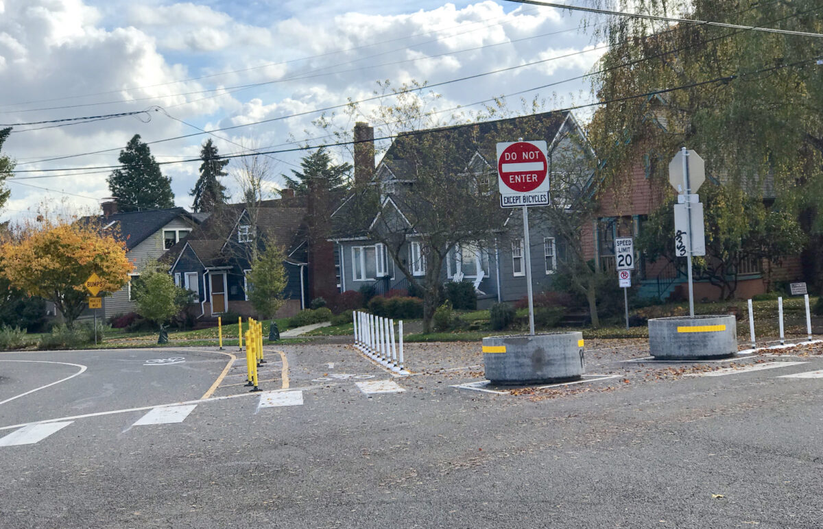
(Photo: J. Maus/BikePortland)
The City of Portland has released the first batch of traffic analysis data for one of their most contentious projects in years and the numbers look good if you’re a fan of safer streets.
Looking to slow down drivers and create low-stress bicycling conditions, the Portland Bureau of Transportation launched the Lincoln-Harrison Neighborhood Greenway Project two years ago. Elements of the project included the standard suite of PBOT tools including diverters, updated crossings, speed bumps, daylighting of intersections, and more.
While many applauded the project, opposition was fierce.
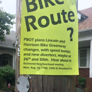
In November 2017 the Mt. Tabor Neighborhood Association voted against the most controversial part of the project — a diverter that would limit driving access to Lincoln from SE 50th. A subsequent public meeting to discuss the diverter turned into one of the ugliest displays of anger and neighborhood revolt PBOT has ever seen. Residents who supported the changes even had their property vandalized.
PBOT ultimately pushed through with the changes and now that they’ve been up and running we can see what impact they’ve had.

– Click here for PDF –
PBOT collected driving speed and volume data at over 50 locations along the greenway couplet and surrounding streets (since diverted auto traffic was a major point of contention). They released the first batch of data today (a final report once the project is 100% complete is forthcoming).
“The initial data demonstrates significant success,” reads the PBOT statement. Below are several “key locations” where the volume of auto traffic has gone way down.
SE Lincoln Street at SE 30th Avenue – 41% decrease in average daily traffic (ADT)
SE Lincoln Street just east of SE 50th Avenue – 51% decrease in ADT
SE Lincoln Street just west of SE 50th Avenue – 50% decrease in ADT
SE Lincoln Street at SE 57th Avenue – 16% decrease in ADT
Advertisement
Some people feared diverted drivers would simply use adjacent streets. PBOT has committed that if other streets see too much traffic (volume not exceeding 1,000 cars per day or 50 cars per hour during peak times), they’ll continue to “provide further mitigation to offset these effects.”
PBOT says their data shows most side streets are well below those thresholds, but there are a few locations they will continue to monitor:
SE 48th Avenue north of SE Division Street
SE Harrison Street west of SE 49th Avenue
SE 28th Place south of SE Harrison Street
SE Market Street east of SE 30th Avenue
SE 25th and 26th avenues north of SE Harrison Street
SE Stephens Street east of SE 25th Avenue.
View the map of data collection locations and see a spreadsheet of the data.
Learn more about this project by browsing our Lincoln-Harrison Neighborhood Greenway story archive.
— Jonathan Maus: (503) 706-8804, @jonathan_maus on Twitter and jonathan@bikeportland.org
Never miss a story. Sign-up for the daily BP Headlines email.
BikePortland needs your support.


Thanks for reading.
BikePortland has served this community with independent community journalism since 2005. We rely on subscriptions from readers like you to survive. Your financial support is vital in keeping this valuable resource alive and well.
Please subscribe today to strengthen and expand our work.
As a daily rider from southeast of there, I’ve started riding on Division in the morning instead of the (recently beautifully repaved) Woodward bikeway and then taking 52nd to Lincoln-Harrison. The morning student drop-off traffic in front of Franklin High School renders Woodward completely unusable. It’s got a beautiful new paving job and then is completely crammed with cars in both directions and no way for riders to get through to connect to Clinton. Would be interesting to see if there’s a shift of riders taking Lincoln-Harrison in the morning and Clinton-Woodward in the evening.
That said, the improvements to Lincoln-Harrison make for a great commute.
Of course traffic is going to go down if you put up diverters. But why not provide specific data on the increase in traffic on neighboring streets instead of just cherry picking data?
Maybe you could click on the spreadsheet linked at the end of the article?
My main takeaway is this: PBOT made the Harrison bike street calmer, and they absolutely deserve credit for making bikeways more hospitable to bikes and keeping the cars off of them. Bike diverters don’t get people out of their cars–that’s a behavioral change. PBOT can only make the street more hospitable to biking, and they seem to have achieved that.
I got the PBOT email, and I will agree that they did gloss over some increased traffic a little bit in their summary. But they did mention some areas of traffic, and provided the data for others to interpret–at least we have some transparency from PBOT.
One thing I find interesting in the data here (Full Disclosure, I live on the 20s bikelane around Harrison) is that traffic increased on 28th place South of Harrison, from 619->678 and 29th North of Harrison jumped up a whopping 533->714. Keep in mind, this is the 20s bikelane, the north south bike arterial. The road condition for the 20s bikelane is already terrible, but isn’t diverting this traffic adding insult to injury for those that use the 20s bikelane as their bike greenway?
Interesting to look at the volume data around the oh-so controversial Lincoln & 50th diverter. The north-south streets (ID#s 31-33) east of the diverter saw ~40% increases, while the east-west streets (ID#s 45-, 46, 52) saw a 50-90% increase. Looks like the diverter did it’s job of keeping people off Lincoln and instead filtered them through side streets. It would be good to have another data point a few more blocks west of the diverter. I get not liking the “cut-through” traffic on the streets that saw increases, but it’s likely that their volumes would have gotten to that level in a few more years of population/car growth anyways. Lincoln would’ve been a highway by then. Good work PBOT!
Looks like this project was definitely a step in the right direction! Bravo, local advocates and PBOT!
A point worth noting is that even *after* the diverters, the Lincoln-Harrison traffic is above 1,000 ADT (1,309 east of 30th; 1,179 E of 50th; 1,926 W of 57th). PBOT is still setting the bar for greenways (1,500-2,000 ADT) *well above* the bar for sidestreets that get car traffic diverted to them (1,000 ADT).
I would think that a policy that treated greenways as *true* priority streets for biking and walking would set the motor vehicle traffic bar for the greenways *at or below* the motor vehicle traffic bar for adjacent sidestreets. There’s a lot of work left to do!
I live in the area and the reduced traffic on Harrison and 30th is great. I didn’t make the connection until this article but the traffic on 30th is significantly reduced and drivers are driving at a safe speed. Before cars would be in excess of 30 mph. And Harrison is safer when my daughters and I ride across it to Sewallcrest Park. Bravo PBOT!
Overall it seems like traffic is reduced even with the increased traffic on side streets. Looking at west of 50th on Lincoln, Harrison and Sherman AM west traffic decreased by 38 drivers or to 76% and PM east 43 less drivers or to 73%. The other direction seems to have similar reductions 81% in the morning east and 73% in the evening west.
Anecdotally I’ve only been aggressively passed by a person while going up the hill east of 50th once since the diverters were put in when before it seemed to be a daily occurrence.
Maybe, as a conciliatory gesture, we could ask PBOT to implement speed humps on neighboring side streets around diverters?
I vote for more diverters on those side streets. It works great in Berkeley, where you can’t cut through ANY neighborhoods quickly.
traffic calming is one of the mitigation treatments for unexpected diversion.
Total side note: the article before this about painting traffic diverters showed a neighborhood association doing good and this article shows a neighborhood association behaving badly.
The other article says that’s a reason to “protect NAs.” And this article shows how it’s better to bring more voices at the table.
I live adjacent to the 30th diverters and while it has been nice to see the reduced traffic on Lincoln, the impact at the two data collection points on either side of my house show an increase of 164% and 180% (nearly triple the daily traffic compared to pre-diverters). Also the collection of speed data seems flawed since my perception is that speeds are up…but only if PBOT bothers to measure further than a block out from the corner (which requires a slow speed due to tight turn). I agree with the person above who suggests installing speed bumps as SOP on adjacent streets when diverters go in.
That would be a change from the standard for diversion evaluation. Diversion is number of cars. Speed is a different metric, it’s just that the speed count measures both, so it is the default count and reported. There is no metric for speed on side streets before and after a greenway project.
Thanks for that info, paikiala. I wasn’t aware that speed was not a metric for evaluation. I guess I feel like it should be. I’d love to see a study related to how increasing barriers does or does not have an effect on speeds on neighboring streets because in my experience (and mostly based on perception – which I realize may be faulty), drivers do speed up to compensate for their perceived loss of time in having to divert. Delivery drivers are the biggest offenders and my neighbors (and my household) have reported the UPS driver in our ‘hood several times.