(Photos: J. Maus/BikePortland)
Did you know there’s a ride that’s 80 percent carfree and will take you from inner Portland to beaches on the Willamette and Columbia rivers on a mix of quiet residential roads, sidewalks, and paths?
We all know how Portland’s 90-mile network of neighborhood greenways are great at getting us across town; but they can also help us get away from town.
A Portland Bureau of Transportation staffer once referred to our neighborhood greenway network as a “bus system for biking and walking.” And similar to how some of us use light rail to expand the scope of rides (like taking MAX to Hillsboro to reach Stub Stewart State Park), our neighborhood greenways enable smaller journeys more suitable for riders of all ages and abilities but no less fun and adventurous.
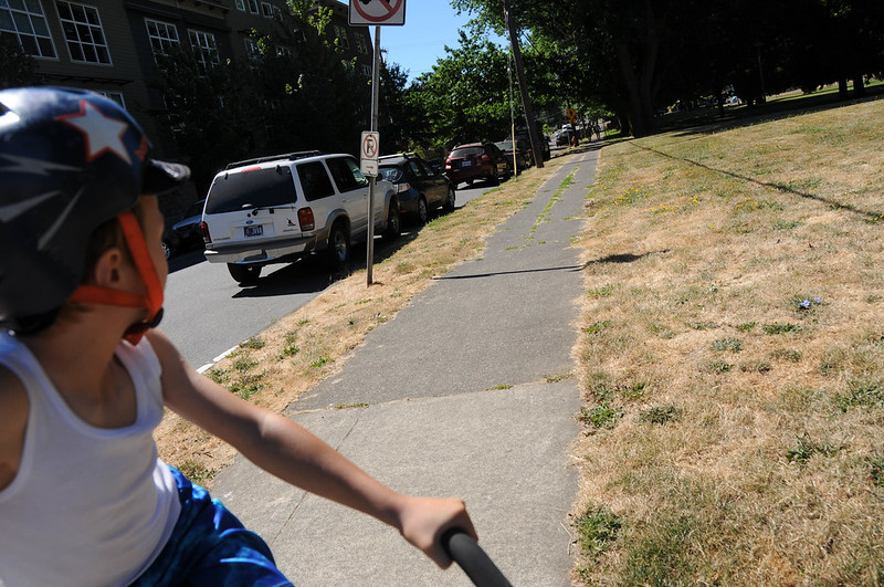
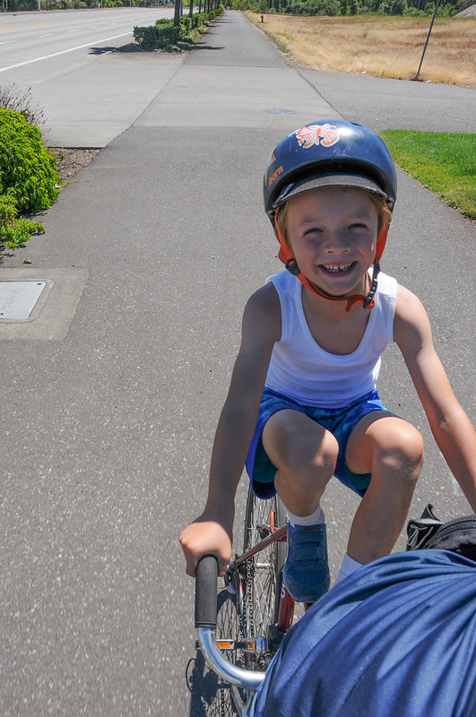
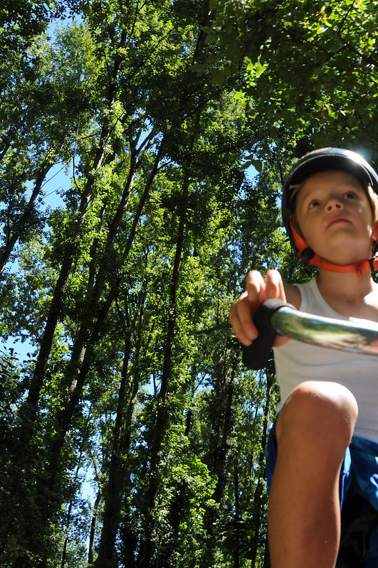
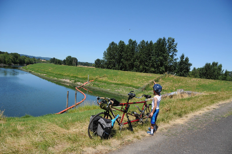
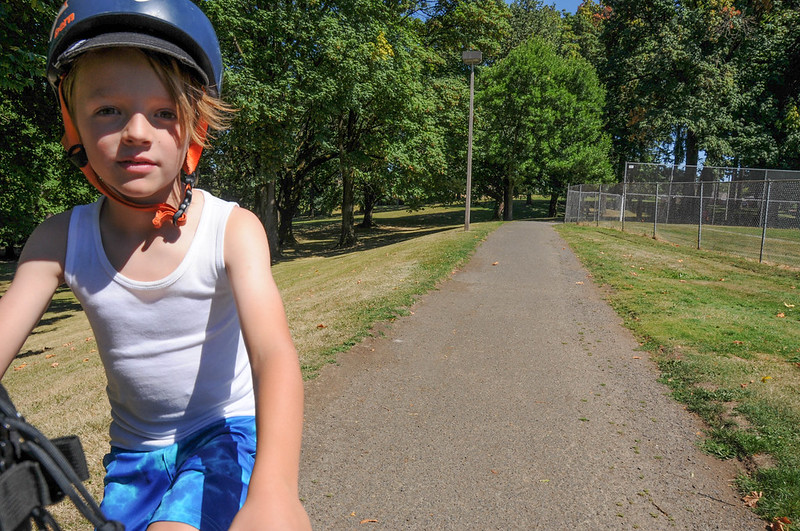
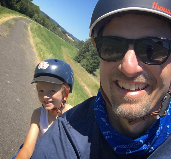
This past weekend my six-year-old son Everett and I hopped on a borrowed tandem (thanks Peter!) and headed out to Kelley Point Park — an isolated, 100-acre stand of cottonweed trees and grassy meadows at the confluence of the Willamette and Columbia rivers.
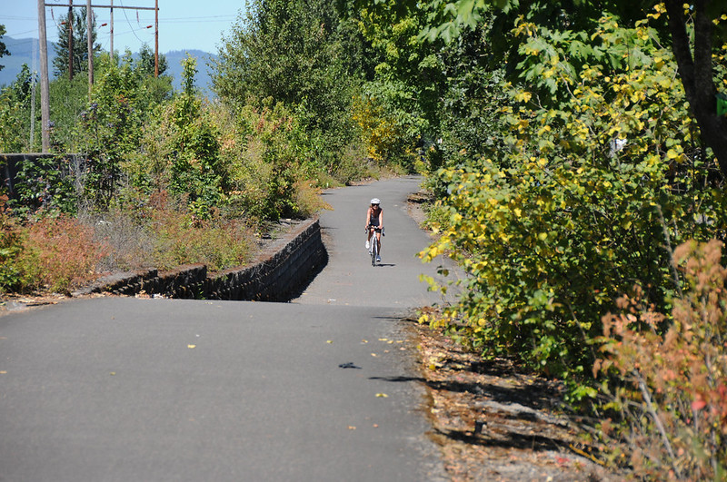
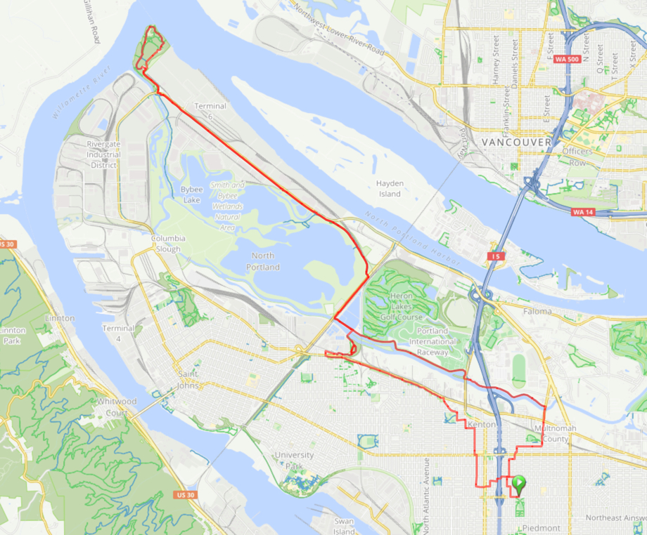
I’ve done this ride countless times. Each time I try to refine the route to make it as safe as possible. And by “safe” I mean a route that avoids proximity to motor vehicles and their drivers. The route we did on Sunday is about 80 percent off-street. The other 20 percent (give or take) is all on neighborhood greenways. This means you can ride this 20-mile loop relatively stress-free (especially on weekends).
Here’s how it looks…
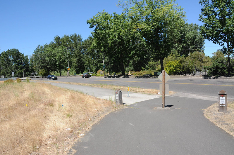
From the North Michigan Avenue neighborhood greenway we headed north to the carfree Bryant Bridge over I-5. Then using the bicycle signal sensor at N Dekum and Interstate we headed west to connect with the greenway on Concord. That took us north towards Kenton via a signalized and zebra-striped crossing of North Lombard.


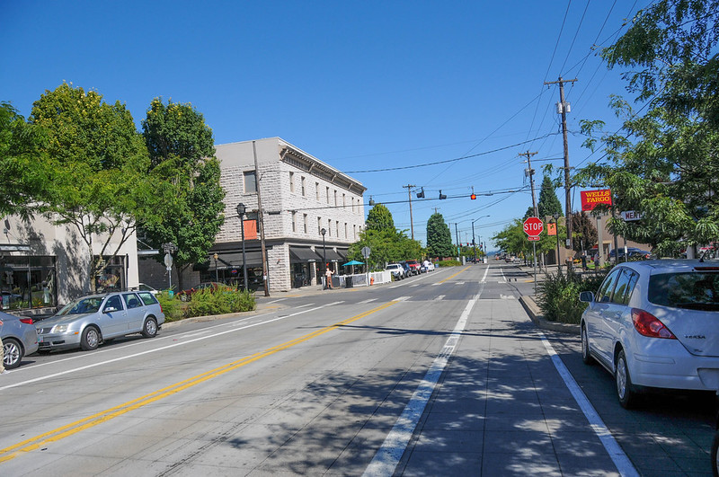
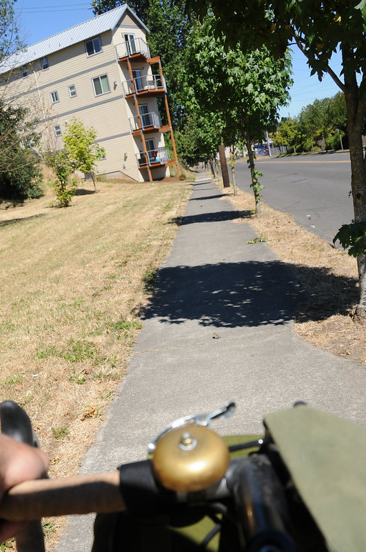
The bike lanes and bike-themed streetlight banners on Denver Avenue welcomed us to Kenton’s quaint commercial district. From there we skirted over to Kenton Park where we rolled up a curb-ramp to the sidewalk that would lead us out to Columbia Boulevard. The next 16 miles of this ride would be on paths separated from motor vehicle traffic (except for crossings and driveways of course).

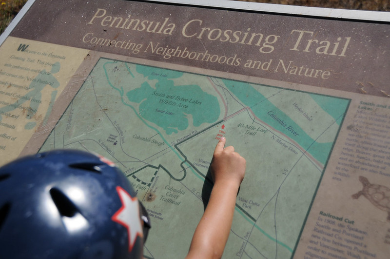
There’s a wide sidewalk that runs along Columbia for 1.5 miles and connects Kenton to the Portsmouth neighborhood. At Portsmouth we used a signal to cross Columbia and connect to the Peninsula Crossing Trail. The Portland Water Bureau has just finished making some changes to this path that winds through trees to a bridge over the Columbia Slough and connects to the Columbia Slough Trail. They closed the westernmost path that used to offer a nice hilltop view of the water treatment plant; but they added a gravel path to the northeast that offers river access and a bit of a challenge for skinny-tired road bikes (keep speeds very low on this gravel path due to short sightlines).


Advertisement


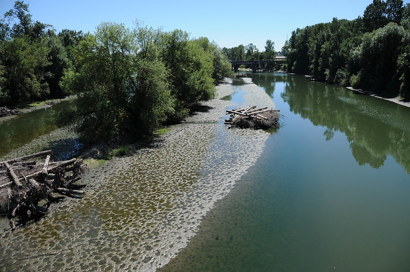
We took a left after the bridge and connected to the path adjacent to N Portland Road toward Smith and Bybee Lakes, a Metro-run natural area. The left turn from the path across Portland Rd is about 0.6 miles from the slough (from here it’s 4.7 miles of relaxing carfree riding to Kelley Point Park). The lakes are a perfect spot for a break. There’s a restroom and drinking fountain about 0.7 miles west of Portland Road. You can park the bike at Smith and Bybee and wander through the paths (riding is not allowed) which are known for being home to deer, owl, beaver, rabbits, and all manner of interesting things. There are plenty of secluded spots to discover where it’s easy to enjoy quiet picnic or nature-inspired sketchbook session.


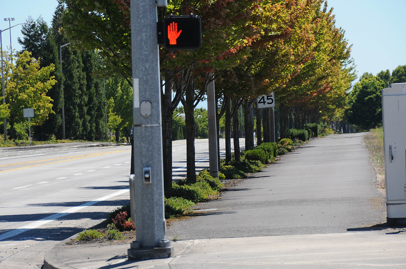
Rolling past Smith and Bybee you continue west for about four miles on a wide sidewalk adjacent to Marine Drive. On weekends this is a very chill section; but be advised this is a heavy industrial zone and there are many driveways where large trucks and factory employees roll out. The good news is the path is wide and sightlines are mostly good. It’s also popular enough that people are used to seeing bicycle riders on it.

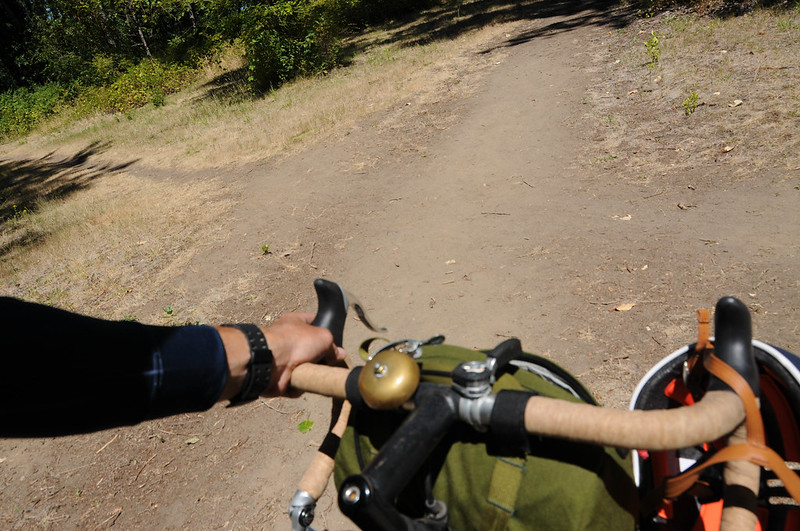
The only part of this entire trip that qualifies as an annoying gap is the short crossing of Marine Drive from the path to Kelley Point Park. There’s a sad sign on the path that reads “40-Mile Loop – END”. Motor vehicle speeds are high here and many of them are big trucks. We really need a safer crossing into the park that doesn’t require people to ride the shoulder of Marine Drive. With a signalized, user-activated crossing we could connect a path on the north side of the street near the park entrance (there’s pleny of right-of-way). Also note that if you aren’t afraid of a few roots and tiny bit of narrow dirt trail, you can avoid crossing Marine Drive via a path that goes under the bridge that’s near the park entrance.
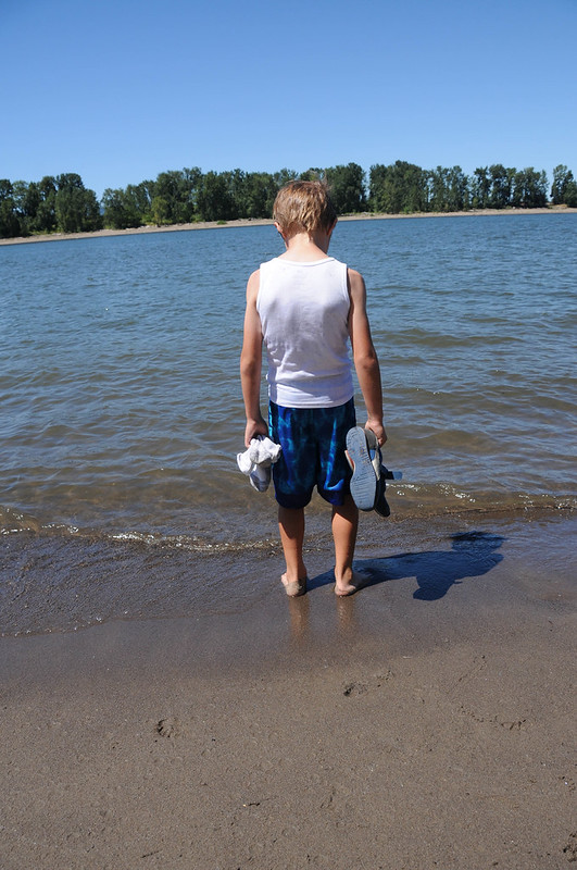
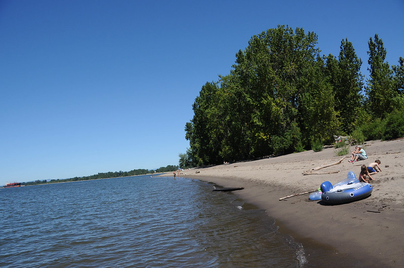
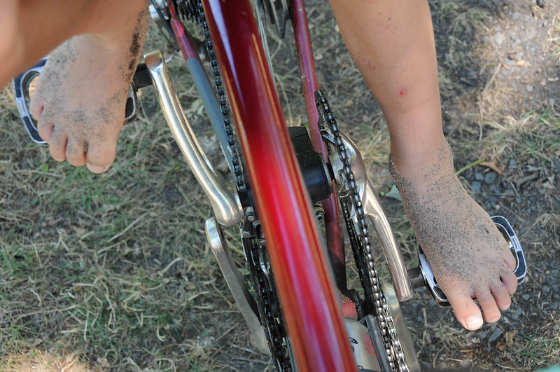
Once in the park we headed to a large central meadow to eat our lunch and play a few games. Then it was off to the Willamette River beach on the west side of the park to cool off and hang in the sand before the ride back home. Everett opted to leave his shoes off for our return journey.


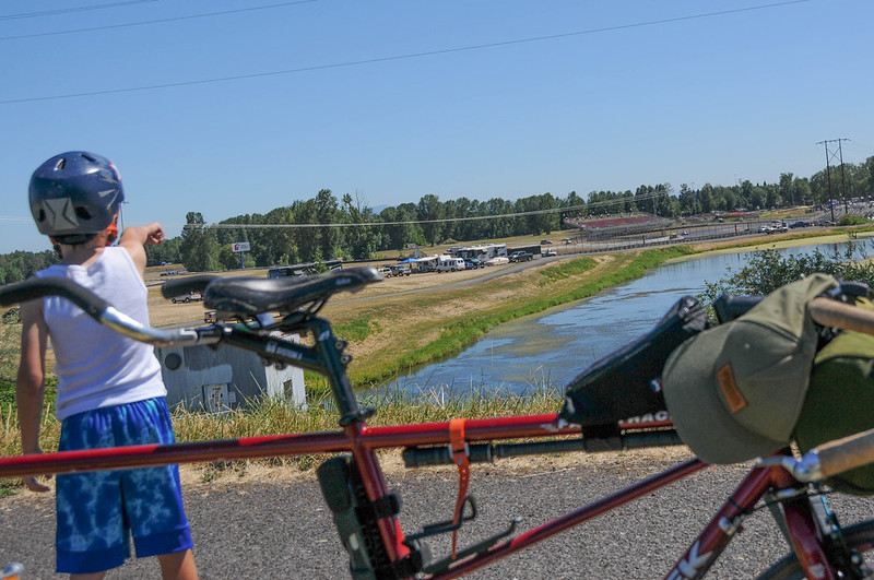
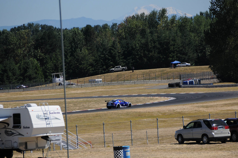
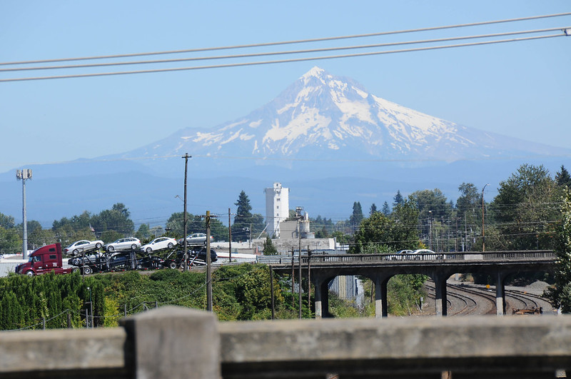
We rolled back the same way we came and were treated to several great peeks of the Mt. Hood peak. Instead of going back over the Columbia Slough Bridge near the water treatment plant we continued east. This took us on the path along the slough toward I-5 and Portland International Raceway. There was some serious auto racing on Sunday so we stopped in awe at the sound and speed of the sleek machines as they navigated the course’s hairpin turns at breakneck speeds.


We continued east on the Columbia Slough Trail on the new carfree connection ODOT made under Denver Avenue. People have been living and camping in this section for a long time. I’m used to riding carefully around people and their belongings and the garbage they produce; but Sunday was the first time I came upon cars illegally parked on the path. The slough trail goes all the way to Vancouer Avenue (and someday soon hopefully we’ll close the gap and connect it to Marine Drive via 33rd Ave). From Vancouver we headed south and crossed Columbia Blvd while staying on the sidewalk all the way to Farragut Park. I skirted through the park’s shaded paths and water fountain to cool off just before we returned home via N. Albina and back to the neighborhood greenway on Michigan Ave.


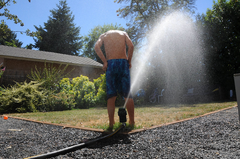
It was Everett’s longest ride ever! He earned every drop from our sprinkler…
I can’t recommend this route enough. It’s got so many great attributes and appeal for all types of riders. Download my route on Ride With GPS and feel free to ask questions in the comments. Have fun!
— Jonathan Maus: (503) 706-8804, @jonathan_maus on Twitter and jonathan@bikeportland.org
BikePortland is supported by the community (that means you!). Please become a subscriber or an advertiser today.


Thanks for reading.
BikePortland has served this community with independent community journalism since 2005. We rely on subscriptions from readers like you to survive. Your financial support is vital in keeping this valuable resource alive and well.
Please subscribe today to strengthen and expand our work.
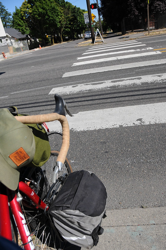
The way your bell is situated is making me a little crazy.
it isn’t ideal. I’m aware of that. But it works fine! I’d put it on the other side but there’s a lever on the right side for the drum brake.
But what about flipping it so the striker is ready to hit with your thumb. Know what I’m saying? I love a bell up there, it’s just it looks awkward to use.
I notice goatheads (a.k.a. puncturevine) starting to show up in Kelly Point Park. Watch when riding on unpaved surfaces. You don’t want to run over or step on them.
Neighborhood Greenways are “stress-free”? News to me.
so predictable adam!
not all of them are created equal of course. The ones on this route are very chill traffic-wise… Especially on a Sunday.
Those separated paths actually do look quite nice, though. I might have to do this ride someday.
“Predictable” is one word to describe his comments, I suppose.
Technically, I believe that’s the sewerage treatment plant, and not the water treatment plant.
as long as we’re being pedants, sewerage is the pipes. sewage is what gets treated.
Actually, when discussing sewage, I believe it’s “peedants”.
regarding the “gap” crossing of marine drive, there is a trail under the road that parallels the slough, unfortunately it dead ends into a dirt trail on the other side in Kelley Point park. Not sure why PDOT abandoned this project (and the trail that goes south/opposite direction towards wapato). I avoid Columbia due to traffic noise, opting instead to get directly on the Marine dr. MUP via Delta Park via the slough trail to Whitaker Rd, which is the only real sketchy section, but there is a side walk….
Yep that’s the trail I will usually ride. I didn’t mention it because it has some rocks and roots and it’s not something I felt would be good to send people on who were expecting a nice connection.
any idea when and if PDOT plans to fix this gap ? and many others that are so annoying like the disappearing bike lane, the one at SW Stark and 1st bugs me the most since there ‘s plenty of room for a bike lane, all it would take is paint.
This is my favorite ride in Portland! I’ve been doing this ride at least once a month for the past 3 years. I really like making this a loop by taking the path along Lombard on my way back and cutting through Chimney Park to Pier Park (there is a newish bridge over the train tracks connecting the parks), taking Fessenden, and then the Peninsula crossing trail back to the slough trail. Adds a bit of on street riding but it makes the ride more interesting.
I often do a very similar ride.
I ride a lot of these sections during lunchtime rides when I work from home. I hadn’t considered riding with my kid off to Kelley Point this way though. Now I know what I’m doing this weekend. Thanks much for posting, Jonathan.
I used to ride a lot of this when I lived closer to it. I liked it because it was never packed like the Esplanade or Springwater. It’s too bad the path into the woods to the south of Kelley Point is still messed up and not open.
I’ve recently introduced a friend to bike commuting, and I’ve been looking for routes to ride together that are both approachable and that end at a fun destination.
This route is going to the top of the list. Thanks!!
This ride is terrible and no one should ever do it. The path is subject to almost constant micro-meteor showers and Kelley Point Park is filled with toxic waste and ghosts that will curse you and your family for generations. You should avoid this area at all costs!
Except on Sundays. I won’t be riding it on Sundays.
lol
Last time I went to Kelly Point park I ended up having to take so many antihistamines that I fell asleep on the beach and got a sunburn. Two thumbs down. Very pretty tho. Also, very adorable pictures of your trip. Looks like you all had a great time.
Jonathan – man! Everett sure has grown up tall!!
I have often said…this route needs a ferry for bikes…imagine hoping over to Frenchmans Bar Park in Vancouver or Sauvie Island!… now that would be a great low stress loop!!!
Absolutely! Or I need a kayak with bike rack that I could pull behind my bike. I wish I kept track of how many times I have done this route.
Thanks for the report and suggestion.
A tip, when at Kelley Point, go to the Columbia side rather than the Willamette side. The beach is shadier, and the water is cooler and clearer. And, on the Willamette side you’re swimming pretty much in Columbia Slough water from storm drains and the sewage treatment plant — the confluence of the Slough and the Willamette is only about 100 yards upstream from the south end of the beach, and it takes much more than that for the two flows of water to mix thoroughly.
https://goo.gl/maps/ujP47zmrj3D2
FWIW,
Ted Buehler
the treatment plant discharges into the Columbia. there’s a pipe that crosses Hayden Island.
turnips, thanks for the correction.
Still, Columbia Slough isn’t a place that most folks would want to swim. And just because the slough water has entered the Willamette doesn’t mean its mixed yet. I assume it will be right up against the Kelley Point Park beach.
Like the Fraser and Thomson Rivers at Lytton, BC Canada
https://goo.gl/maps/VQdeuhk8w9F2
Or the Rio Negro and Amazon at Manaus, Brasil
https://goo.gl/maps/xMiwthVfcw32
On the other hand, with no rain in the last month there is probably very little flow in the slough. Next time I’m out there I’ll go take a look and see what the flow rate is on the slough.
Until then, I retract my comment about the Willamette side of the park having questionable water.
Ted in OR
The flow rate on the Slough is basically zero right now.
But the signs say to not enter the water…
I and a friend rode to PIR for the vintage races on Saturday. Cool old race cars and the bike was a great way to get there and park free.
The Human Powered Vehicle races are here in May as well. That is a really interesting event for cyclists to see. Recumbents, streamliners, speedy trikes. Some very fast indeed!
Not much recumbent chit-chat here. They are pretty cool bikes.
Jonathan,
Thanks for publishing “wormhole” routes like this that connect areas in less than obvious ways. As for the comment on the dream ferry, there was a ghost of a proposal about ten years ago for one connecting Ridgefield, WA, with Saint Helens–what a ride facilitator that would be!
You’re a really, really cool dad. Thanks for all that you do for your family and for the rest of us.
Thanks for a lovely ride report! I love this loop and used to take it all the way into downtown St. Johns (via the Industrial loop to N. Burgard, which becomes Lombard St.) when I wanted a longer ride.
Enjoy this and other in-the-city loops for now, and adapt when more and more people move to Portland and want to use them. Use a bell, stay cheerful and mind your manners, and enjoy the scenery (especially when riding along the edge of Smith and Bybee Lakes — look carefully in the fall and early winter and you might see a snowy egret there).
This is a favorite post-work ride for me, though I do your route in reverse and often pick up Marine Drive out to 205 before returning via 33rd and back through Dekum. That has some unfriendly links via Marine Drive gaps but generally it’s a really nice little loop to do to blow off some steam and get 20+ flat miles in.
I just did a simpler version of this ride a few weeks ago when I was cat sitting for some friends in Kenton. I wasn’t even aware of the path along Columbia, but I took Denver to the Columbia Slough trail to the Penninsula crossing trail to the Marine drive trail. I live in NW and haven’t really ridden around North Portland or taken this route in close to a decade. When I was planning my route and getting ready to head out I was thinking, awesome, a 17 mile ride almost entirely off the streets!
If I squinted and wished really hard parts of the Columbia slough trail almost looked a tiny bit like Denmark, although they would never have a bike path in such poor condition, and the noise from PIR was really annoying. There were about six cars parked on the sides of the trail near the sewage treatment center when I went through and a man vomiting in the middle of the path, but no one bothered me. The Penninsula crossing trail was nice enough. The marine drive trail was pleasant until I was past Smith and Bybee lakes. Riding between a high speed street with huge trucks roaring past constantly and all the bleak industrial buildings was…depressing, although the trail was wide and mostly pretty smooth. There was a truck behind me on the road into Kelley Point park and the driver honked and yelled at me to get off the fucking road and then aggressively passed me way too close then cut me off so close he almost hit me with the back of his truck. I had a nice time walking around Kelley Point park and resting on the beach for a little while. I wanted to dip my feet into the water but the signs about raw sewage changed my mind. I did the same route in reverse to get back to where I was staying.
To be honest this ride just made me realize how far we still have to go toward being a seriously decent cycling city.
Sorry to hear about your bad experience Anna. I agree with you that the conditions are nowhere near what they should be. Everything I say about Portland bike infra has to be understood in the context that this is, well, Portland Oregon USA and not a real cycling city like they have in the Netherlands.
As for the road into Kelley Point Park. I completely agree. This road needs to have striped bike lanes and/or some sort of signage and markings that make it clear that bicycle riders should be expected — and respected.
Another option, especially for those that live further east is the beach just east of the Gleason boat ramp on the Columbia River just west of the airport. I like to take NE 33rd early in the day (traffic is lower), and head east on the Marine Drive bike path. I come back via the I-205 path, so the route ends up being mostly off-street and fairly flat. Some of the connections on the I-205 kind of suck, though.
I hadn’t ridden the north section of the 205 path for maybe a month, and man that thing is trashed right now. Just so much junk, trash, and shopping carts everywhere (blocking the path in multiple spots). I would not recommend the 205 path right now to the people (but yes that beach there is nice).
Have illegal campers taken this over yet?
Those shopping carts blocking the I-205 Trail may have been placed there illegally in an attempt by the homeless to block off the path, which is, of course, illegal. I’ve always wondered why the spur to/from PDX Airport isn’t signposted from the I-205 Trail, nor is it signed from the Max station at the airport. The path along the south side of Airport Way does have a few Bike Route signs on it, but no guide signs.
Also, regarding that End 40-Mile Loop sign you saw. How old did it appear to be? Should’ve taken a pic of it. Given the decision in Gresham earlier this year to suspend the project thru the Mt. Hood Community College area – which brought the entire project to a standstill – one hopes that that sign doesn’t mark the end of efforts to get the project to reality for perhaps decades – or longer.
This is a North Portland Classic…. and also great birding route… specially in the Spring…. or in October when you might catch migrating pelicans at Smith & Bybee lakes.
The section of path along Columbia Slough between the water treatment plant to the undercrossing of Denver is abysmal…the paving has virtually disappeared for much of the trail and it’s only appropriate for mountain bikes. It shouldn’t even be described as a trail. Especially given the investment in the new Denver-to-Vancouver Ave. section, it’s a real embarrassment for the city that this major gap persists.
Last year I contacted Portland Parks (who are apparently responsible for this section) and was told that the repaving of this section had been funded… but still nothing.
I think many folks would be much more likely to take this trip once this portion is paved.
Jonathan, do you have any more current info about the status of this?