(Photos: J. Maus/BikePortland)
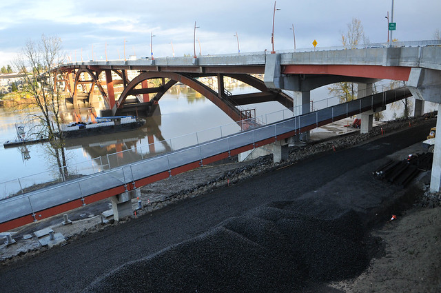
It’s been almost a decade since our very first post about replacing the old Sellwood Bridge. Now, after years of debates over funding sources and designs, the new bridge is almost 100 percent complete.
While it re-opened to traffic back in February, many of the bikeway elements were unfinished. In recent weeks Multnomah County has made significant progress on the bike lanes, sidepaths, crossings on the west side, and on the greenway path connections. I rolled over a few days ago for a closer look at how it was all shaping up.
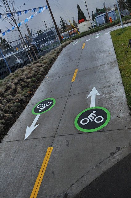
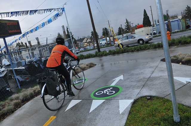
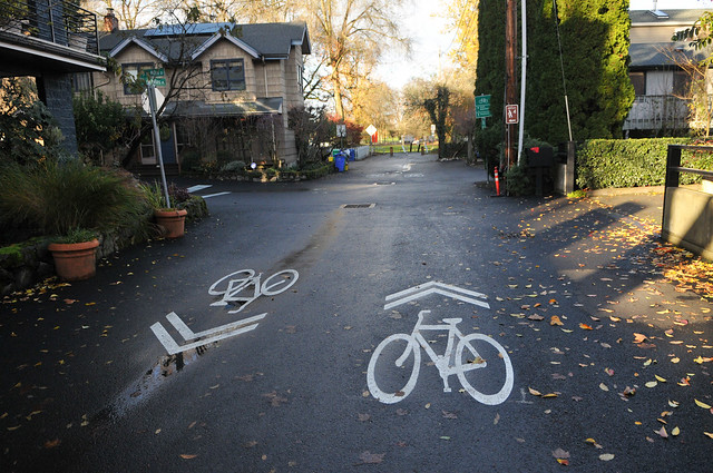
From the Springwater path, I made my usual connection up to the bridge via Spokane and SE Grand Avenue. The county has installed a new path with bikeway markings to direct traffic up onto the bridge.
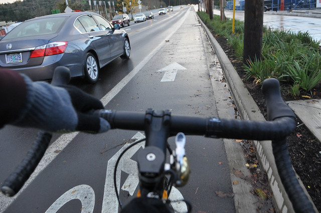
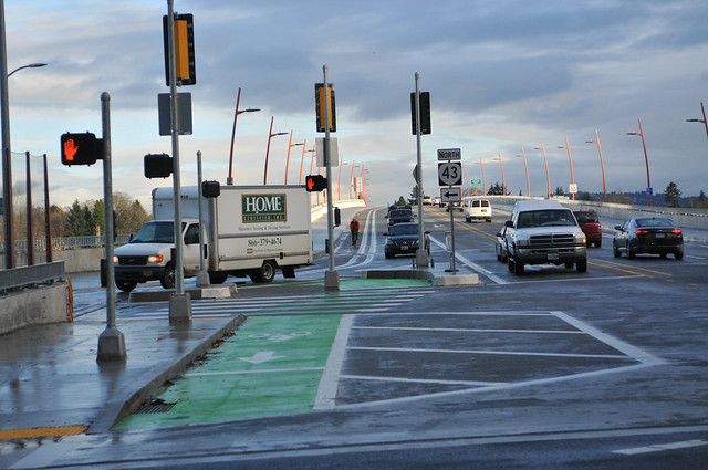
I then back-tracked over to the eastside entrance at SE 6th to get a better view of the new cross section (note the left turn box in the foreground).
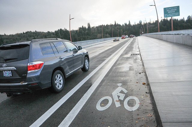
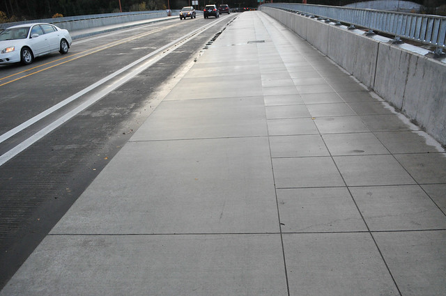
Instead of having all vulnerable users share an area separated from motorized users, the County and their advisory committee decided to stripe a traditional, on-street bike lane on the main roadway. For most of the way the bike lane is five-and-a-half feet wide with a two-foot buffer. It will be interesting to see what percentage of riders opt for the bike lane versus the sidepath. Unfortunately, if you start in the bike lane from SE 6th and then decide you’d rather be on the sidepath, there’s no smooth ramp to take you up there. The only break in the path is a ramp that’s only meant for people leaving the path and entering the bike lane. This seems like an oversight that should be corrected.
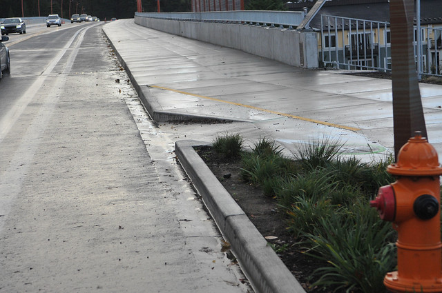
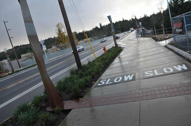
Back up on the sidepath, I noticed two large “SLOW” markings on the ground. I assume the County is worried about bicycle riders going too fast and colliding with other path users. If that’s the case, perhaps they should use the same treatment on the main roadway where motorized vehicle and bicycle users share space separated by nothing more than paint.
The County is relying on a subtle difference in the texture of the concrete in order to designate cycling space from walking space.
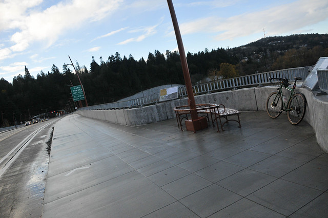
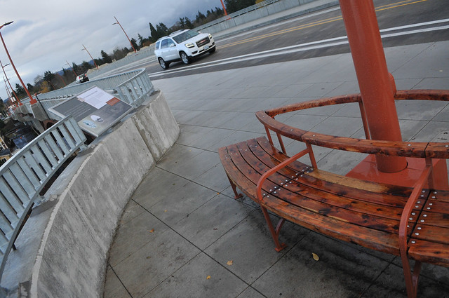
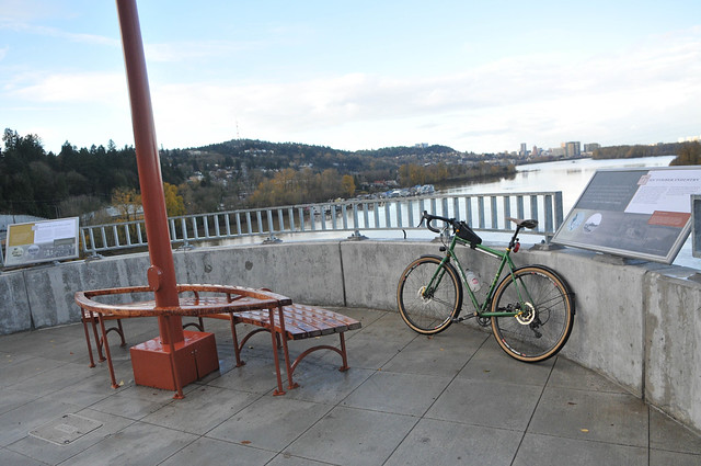
Mid-span there are two new belvederes on each side. These are wonderful! The space is nice and big and there’s a bench, signs about local history, and a great view of downtown and the river.
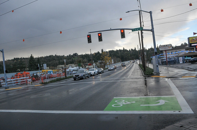
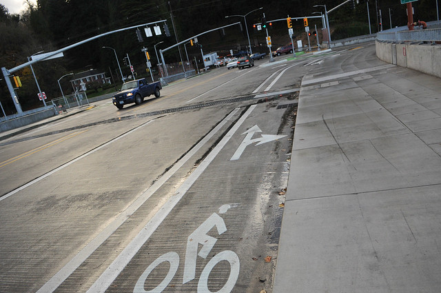
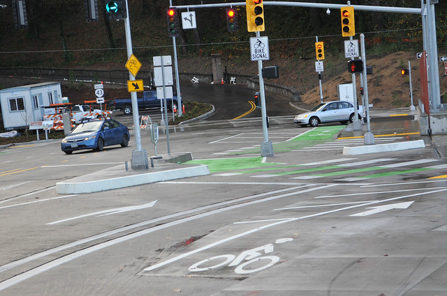
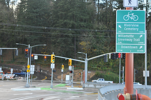
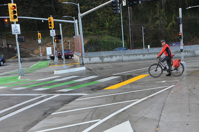
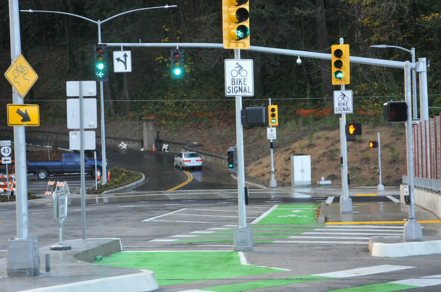
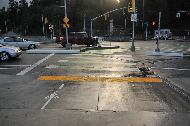
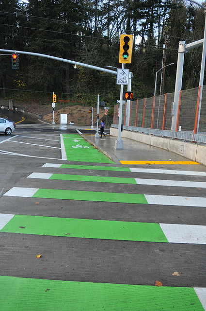
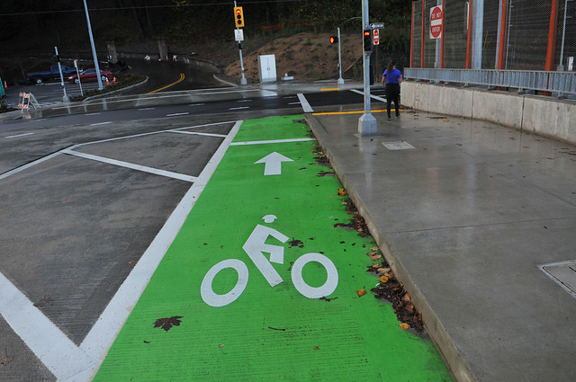
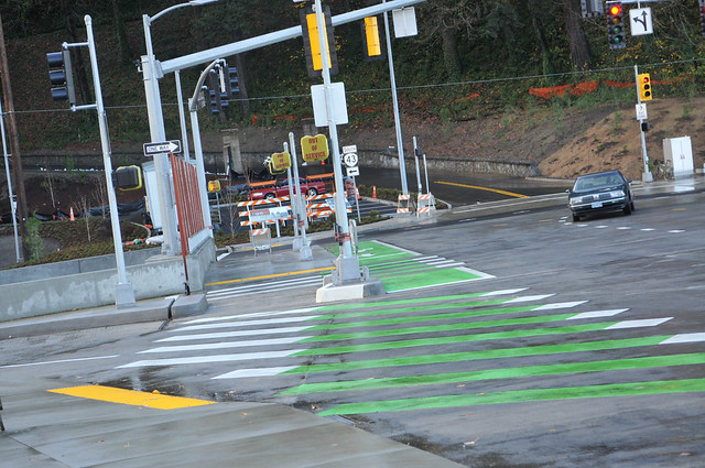
On the west side the bridge is unrecognizable from before. Bicycle users will see a lot of new signs, markings and even signals to help get across Highway 43 and into River View Cemetery. There are crossbikes, lots of green-colored bike lanes, and several bike-only signals. It feels a bit confusing at first, but I’m sure folks will get the hang of it. The direct connection into the cemetery is so nice and is now much less stressful than before. Same goes for the new treatments from the cemetery eastbound onto the south side of the bridge.
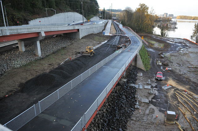
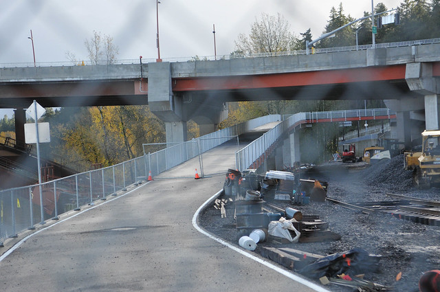
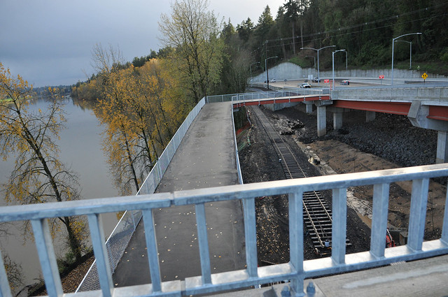
Another major bit of progress is a new section of the Willamette Greenway path that connects to the eastbound path and bike lanes via a new bridge. This new path goes under the Sellwood Bridge and then (like the ramp on the north side), loops back, climbing gradually up to the south side. It wasn’t open yet but Multnomah County says it should be open by December 10th.
As we reported back in July, the new section of path that goes north of the Sellwood Bridge through SW Miles place toward Willamette Park is open for business. I noticed a few new sharrows and bikeway signage.
It’s very exciting to have this important connection back in the network. Speaking of which, TriMet bus service will return to the bridge on Monday after a 12-year absence due to weight restrictions. A few other notes: A speed reader board is now in use for eastbound traffic to help discourage speeding in Sellwood neighborhoods and two bicycle counters will be activated in the coming weeks.
Have you ridden any of this yet? What do you think?
For more information, check out the County’s excellent project website at SellwoodBridge.org.
— Jonathan Maus, (503) 706-8804 – jonathan@bikeportland.org
BikePortland is supported by the community (that means you!). Please become a subscriber or make a donation today.




Thanks for reading.
BikePortland has served this community with independent community journalism since 2005. We rely on subscriptions from readers like you to survive. Your financial support is vital in keeping this valuable resource alive and well.
Please subscribe today to strengthen and expand our work.
Think I’ll give it a spin this weekend. Thanks for the write up.
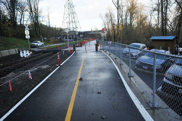
what are all the new train tracks for?
The Willamette Shore Trolley (http://wst.oregontrolley.com/). Once the north section is re-certified they’ll start operating again to Bancroft St, but with an added passing section at the Sellwood Bridge so both of the Portland Vintage Trolley vehicles they use can operate simultaneously.
Will they have a stop at the Sellwood Bridge? With the new siding, it seems like they could add one there.
The plan is to eventualy include a stop at Sellwood Bridge.
Are they going to electrify the line?
For the crime train, duh.
always surprised to see so much standing water after new construction projects in the NW… don’t contractors realize that it rains here?
Apparently not. Like how the wood beams of the pavilion at Director Park needed to be replaced because they were not water-treated. I mean, I’m not an engineer or anything, but I would think that waterproofing things that sit outdoors would be important in the Pacific Northwest.
I ride it pretty much every morning and am generally happy with it. With regard to the sidepath v. bikelane: unless there are a lot of people walking on the sidepath, there’s no reason to ride in the bike lane. I’m also looking forward to the new ramp to the south side. Given that I rode the previous incarnation of this bridge exactly once (despite living less than a mile from it) and said, “never again”, it’s a really big upgrade.
My only complaint is the intersection at SE 6th at Tacoma. As part of the project, a light was installed on SE 6th. To keep drivers from cutting through on SE Umatilla (a greenway and the main way around the gravelly part of the Springwater), a bike box was installed on 6th on the south side of the intersection and the intersection is signed as right turn only for drivers. Cyclists are allowed to cross Tacoma or make a left onto the bridge.
Effectively every morning I’ve gone through this intersection (more than 30 trips by now) I see at least one driver making the illegal left onto the bridge – including one driver who took a left from the right lane last Tuesday! On bad traffic days, they’ll line up 12 deep to make the illegal left and one day they backed up two blocks all the way to Umatilla.
I’ve been in email contact with the head of the project and he said that he’s gotten approval to fix things. Until then, I cut to the front of the line and ride as slowly as possible while taking my left onto the bridge.
Jeff, do you know what he meant by “fix things”? Are they considering making the left turn legal? I’m not on that side of the bridge much, but it seems like the left turn prohibition has a lot of drawbacks, well-intentioned as it may have been.
I was told that there was ‘traffic engineer approval’ to provide a solution to help prevent drivers from making the left. I did not get the impression that making the left turn legal is not the way they’re going.
Making the left turn legal turns 6th into a very attractive place for westbound cut-through drivers to make a left onto Tacoma and in turn making the Umatilla greenway (as well as Tenino) into an autobahn.
I did not get the impression that making the left turn legal was the way they were going.
Sorry about the ridiculous double negative. Need more caffeine.
This week’s field work notice says:
“Changes for 6th/Tacoma Signal: The traffic signal phases for north and south-bound movements on SE 6th Ave. will be combined in December to improve east-west traffic flow on Tacoma St. Signs will be installed to prevent right turns on red for westbound traffic on Tacoma and northbound traffic on 6th.”
I’m not sure if that’s what he was referring to? I take it to mean it’s currently signaled north and southbound on different phases, which would sure make illegal lefts easy. On same phase, it’d be a whole lot harder.
That’s the other (north) side of the intersection. What that means is that they’re planning to make right turns onto the bridge illegal for all the westbound drivers approaching the bridge from the Spokane greenway.
While in a perfect world, this would make taking the left onto the bridge from the south side of the intersection safer for cyclists, I expect similar levels of non-compliance by the cut-through driving public.
The cut-through traffic sounds like a mess. On the other hand, what about people driving from homes and businesses located south of Tacoma from 6th eastward who want to head west to cross the bridge? What route do they take? For instance, heading out of Tom Dwyer Automotive on SE 6th and Tenino, with no left at 6th and Tacoma, you’d turn right to head east on Tacoma, then left on 7th up to Spokane, then left again, then right onto Tacoma westbound.
If that last right turn is restricted, then you’d go a block further east to go around the next block. It seems like this all adds a bunch of left turns from eastbound Tacoma, with people using the blocks north of Tacoma as turnaround routes.
What a mess. The legitimate vehicle traffic from south of Tacoma needs a way to get onto Tacoma westbound, without having to drive around the blocks north of Tacoma (and creating negative impacts) but allowing the left at 6th seems to mean encouraging cut-through westbound traffic south of Tacoma.
I misread. It’s a no right *on red* southbound. Which would make the (clearly) legitimate use you describe doable.
Ahhh, but did you also observe all the new cut-through high speed traffic through the neighborhood. As well as the illegal left turns from 6th onto Tacoma west bound :(.
I hear you Carrie. And I got your email about this. Just haven’t had time to deal with it. I will be in touch. Thanks and keep me posted.
The city says they are working on it. The signals will get tweaked timing-wise at SE 6 and new signs discouraging cut thrus should be installed shortly. The “Your Speed is..” sign east bound is on, bike counters should be up and counting in the next few days. Cheers for the new ped/bike guide signage!
The city says they are working on it, but the city has also reported back to the Neighborhood Board that part of working on it includes ZERO enforcement of the turn restrictions from 6th.
Yeah, the cut-through traffic at rush hour on SE Umatilla (n’hood greenway and part of the Springwater Trail route because there is no trail in this section) going towards SE 6th to get on Tacoma is a huge bummer. I travel 7 miles longer round trip to take the Springwater Trail rather than deal with cars all the way on surface streets on my commute… and I still have to deal with ******* cut-through traffic on SE Umatilla.
The sidewalk needs bike/walk markings, like the Tilikum Bridge. Otherwise, people cycling will assume they need to be in the dangerous painted bike lanes on the roadway. Or the county could have poured some concrete or used Jersey barriers in the buffer area, rather than relying on paint alone. This is the approach used on the Granville Viaduct in Vancouver BC, and I did not notice any flooding or debris in the bikeway.
Additionally, the hash marks in this photo should have been concrete medians, to offer cyclists more protection. The west side area looks confusing as all hell (I blame ODOT, who mandated what amounts to a highway interchange with OR Route 43) but I’ll reserve full judgement until after I ride though there.
Overall a huge improvement over previous conditions (no one who has ridden the old bridge would dare dispute this), however, I expected a bit better accommodations considering this was 100% new construction. It’s not too late though. With a few minor tweaks, this could be perfect.
Why do you need a protected bike lane when you have a 12′ sidewalk (a foot wider than the Hawthorne bridge, and considerably less bike and pedestrian traffic)?
Why have the painted bike lane then? Because it’s really an “emergency pull-off lane” per the specs. Plus, since the sidewalk does not have any bike markings and the bike lanes leading up to the bridge direct you onto the painted lanes, for all people know, you’re not even allowed to bike on the sidewalk.
What about a compromise? Add plastic bollards. In an emergency a person in a car can drive into them.
My idea for a compromise was to eliminate the bike lane and make it just an emergency lane by adding slash marks to it, then modifying the “shared sidewalk” by making the bike area slightly lower than the walking area, so it is clear where cyclists should go. This also has the added benefit of allowing vision-impaired people to “feel” where the bike area of the shared sidewalk starts.
I just don’t see the point of putting in a known-to-be unsafe painted bike lane on a bridge that will undoubtedly have 40 MPH motor traffic (even though the speed limit is much lower).
If you don’t want to use the on-street lane, just don’t use it. Why do you continue to insist that it should be removed? When I’m riding fast and there are lots of pedestrians and traffic volumes are low, I’d prefer to use the on-street lane. Stop trying to dictate where I ride by eliminating a useful feature of the bridge.
You have repeatedly explained in this forum that you ride slowly and prefer protected bike lanes and greenways where volumes and speeds are low; I don’t demand that you ride faster. Please stop trying to limit my options for where I ride by designating the on street-lane to a break-down lane. JUST DON’T USE IT!
Painted bike lanes on a bridge are unsafe. Why are we installing unsafe facilities on brand new construction projects? Why not instead make the protected path wide enough for both slow and fast cycling traffic? Just because some people want to ride fast, does not make it okay to install dangerous facilities.
It’s better if faster riders can be on the street.
Except when I have specific reasons to believe it’s not necessary, I observe the same practices when passing cyclists as when passing joggers, dogs on leashes, kids, and the like — I assume they’ll be unpredictable and jump in front of me at the worst possible time.
I know the vast majority of cyclists are afraid of cars, but in all honesty, I find cars more predictable and feel safer riding close to them than I do with cyclists unless they clearly have solid group riding skills.
The raised bike lane should be pigmented asphalt, in my opinion. And yes, maybe an inch lower than the pedestrian walkway.
Yes, I don’t understand how the county/TriMet get away with these shared facilities like on the Hawthorne, Tilikum, and Sellwood Bridges given the ADA. There is no way for a blind person to tell where the bike area is. A short curb solves this problem and makes it clear for sighted people where not to walk.
I had a blind GF for 6 1/2 years. This kind of thing is very straightforward — she would be walking along the side away from the traffic.
Things like curbs are likely to trip or crash people who aren’t paying enough attention (particularly in the dark and inclement conditions) as these aren’t nearly as obvious as people doing whatever on the path.
In Holland, they use brick-red colored asphalt for bike lanes. The US standard is green. The latter, I think, stands out better.
Do we know that the sidepath isn’t getting markings? I have to assume that’s part of the remaining work.
Also, yes, the street-level bike lanes also serve as vehicle emergency lanes. Is that such a terrible idea? I think it’s a pretty reasonable solution, although your plastic bollards idea is smart.
I thought I remembered reading that the sidepath will not be getting markings, but I can’t seem to find the article that stated that. Perhaps someone can confirm this?
It’s pretty terrific–in fact, the cycling elements of the new bridge are overkill considering the comparatively limited cycling traffic it gets. I ride the bridge twice a day 3-4 days a weeks on my commute from NE to PCC; I’ve yet to see more than three other cyclists on the bridge, and usually have it to myself. It gets only modest ridership because it is faster and more pleasant to go downtown by bike on the East side of the river, and because the only other connection on the West side is the rather steep–though beautiful–ride through Riverview Cemetery that connects to Lewis and Clark and not much else. The bridge simply doesn’t need the bike lane in addition to the very wide MUP.
IIRC, the grandiose Macadam interchange was required in order to gain Federal dollars for the project, and that the interchange accounted for half the cost of the project.
These aren’t bike lanes. These are breakdown lanes with bike lane markings. Without them, a stalled vehicle would completely block the bridge in one direction, and emergency vehicles would have no way to cross the bridge.
That is not a bad thing.
Rather than push for bike lanes, I’d much rather advocate for breakdown lanes. Support is easier to get — even from the anticycling crowd — because everyone benefits from the real emergency and breakdown benefits.
Breakdown lanes are huge, there’s rarely anyone in them, and when there is, it’s no big deal. They also block emergency traffic, but when there’s only one vehicle to get around, people can shift easily enough to let them through.
The new bridge is a massive improvement, though the old one didn’t bother me nearly as much as Ross Island Bridge. If you want a sucky crossing, that would definitely be the one. Tilikum helps, but adds several minutes unless your natural path would have gone through South Waterfront anyway.
I don’t have a problem with the breakdown lanes. I have a problem with breakdown lanes disguised as bike lanes. It sends a bad message that cyclists get their own space, when in reality, the primary usage is something else entirely. A bike lane has a very specific definition and this dual-usage deviates from that. Now, if the county just striped the lanes as breakdown lanes, I would not have a problem with someone cycling in it anyway. Just don’t call it a bike lane.
Come on. 99%+ of the time these lanes are going to be used as bike lanes (thus striping them so). We get it. You don’t like them. So as suggested above: don’t use them. Some of us will.
I agree. I will use them – have already used them – and I prefer the bike lane/breakdown lane to dodging pedestrians, families with small children, dogs on leashes, etc.
I’d second the need for bike/ped markings. And further, I’d like to see the same for the waterfront on both sides of the river.
I can’t even understand why they put that bike lane at all. Biking on that giant sidewalk was great during construction.
I’ve ridden it several times. With the kids on their bikes, we ride the MUP. When I’m alone on my single bike or captain of the tandem and we’re moving fast, we ride on the marked, on-street lane so there’s no danger of pedestrians wandering into our path.
The connections are great to the path on the west side, to the cemetery, and to 6th and to Spokane.
My only complaint is that the minimum green time for bicyclists to cross Tacoma at 6th should be lengthened so bicyclists have enough time to clear the intersection.
The project is every bit as good as what was presented at the public meetings held eight or ten years ago. Thanks, Multnomah County!
Learned a new word! “Belvedere”
That’ll give great access to the mountain bike trails at Riverview Natural Area. Oh. . .
Some of the public r-o-w trails in the adjacent Collins View neighborhood are badly maintained and can vie for narrow mountain bike trails.
By the pics, accommodation for walking and biking on the new bridge looks much better than it was on the old bridge. I rode the old bridge a few times…a horrible experience biking on the main lane, and not much better for walking on the sidewalk.
Part of the reason the experience was bad was due to the wind and tire noise coming from motor vehicles at mph speeds that seemed high for the bridge. Can’t remember what the posted mph speed across this bridge is, and don’t see the speed limit signs in any of the pics. I suppose the posted speed limit is 35 or 40. If so, posting it for 25 might improve the functionality of the bridge for walking and biking, without unduly compromising travel and transport by motor vehicle.
Having MUP pavement markings advising people biking to ride slow out of consideration for people using the path, doesn’t seem unreasonable in the absence of similar markings on the main lane for people driving. If slower motor vehicle speeds in the main lanes are an objective when people are biking in n the adjoining bike lane, some kind of sign to that effect at closer to the eye level of people driving likely would be more effective.
The long MUP approach ramp on the west looks very nice. Ideal for fast descents. Hoping people will handle that opportunity responsibly.
Bridge is 30 mph, as of this week (the final speed, now that construction is essentially complete).
The bridge itself is a huge improvement for walking and biking. What I don’t like is the west side (Highway 43) from the bridge north for a few hundred yards. It’s become a total concrete, freeway environment for drivers, really out of place with the rest of 43 north and south of the bridge. It feels designed by engineers whose only concern was vehicle movement at substantial speeds.
The pedestrian experience in that same area is also bad. Heading south to the bridge, the long switchback ramp may be fine for bikes (except the squared-off 180-degree turn) but it’s a long haul for pedestrians, and it puts them walking along the new concrete wasteland of Highway 43 for the last 100 yards or so to the bridge. It used to be you could walk down on the tracks from the Miles neighborhood all the way to the bridge, then up a short stairway to the bridge. The bridge was horrible, but the pedestrian experience getting there was pleasant.
It could be once the mini-bridge under the Sellwood Bridge opens, the nicest route for pedestrians will be to use that to get under the bridge and up to its south side, so you don’t have to walk along 43 (if I’m understanding things correctly).
Since everything’s not done yet, I don’t know what the pedestrian experience will be getting from north of the bridge southwards to Powers Marine Park. It used to be a pleasant walk close to the water along the tracks. I hope pedestrians won’t be forced up onto Highway 43 to get there.
I agree. The new bridge has zero stairs and that is lame.
agreed. I walked dozens of times from Sellwood to Fulton Park this summer, and after they opened the new path and (hopefully only temporarily) closed the sidewalk on Macadam, it added an annoying extra distance. I do think the bridge to the south sidewalk will cut some of that off.
What about cut-thru traffic on the side streets of Sellwood?
Cut-through traffic was present before the reconstruction of the bridge. It has existed for about 100 years since the original was built.
Rode the bike lane East-Bound (on the south side of the bridge today). It’s beyond an improvement. It’s a totally different bike-able bridge now!
That being said, hitting the East end was pretty confusing. The bike lane appeared to go straight into the back of a parked car on Tacoma.
There’s a bike box to cross 6th and wait, but will you get the signal if you stand there? Or do you have to push a button? Ok. I’ll push the button. And then I stood there for a really long time looking at the big empty left turn lane for “vehicles” leaving the bridge. Why didn’t I just merge left and use the turn lane like the awesome vehicle I am? Would I even trip the light with my bike?
Why didn’t they provide a green bike lane merges left into the left turn lane? Oh yeah. Our policy is now separation of modes at all times. And I get it. Separation means “safety”.
Always waiting because planners treat bikes like a clunky pedestrian … gets frustrating when every “left turn” requires waiting through two full really long light cycles.
We’ll get this figured out. It’ll get tweaked. It’ll get popular. Because it’s awesome. (And because Sellwood is the best and fastest growing neighborhood). It’s popularity will cause problems that will require adjustments.
I agree that it’s awesome, but I also doubt that it will get traffic on the level that you imagine. The Springwater is a vastly better facility for getting downtown than is the Westside MUP, and the only other options on the west side of the bride are Macadam and the steep route through Riverview Cemetery–routes that only a small number of people will ride.
Sewer and stormwater projects that will close both Terwilliger and Boones Ferry at times thru the fall of 2018 could lead to people seeking to ride bicycles for transportation in and around SW Portland. Many people ride thru River View cemetery and along Terwilliger.
I’ve been riding through Riverview Cemetery 3-4 days a week for six years, and I’ve yet to see more than five other people on bikes there. On most days, particularly in winter, I either see one other person or have the place to myself. I love the bridge and it has dramatically improved my commute, but I also think it would have been more than fine with half the cycling infrastructure.
There is an on-street route through Johns Landing from Nevada to Boundary that avoids Macadam on (mostly) SW Virginia and a little bit of Corbett. Boundary has a light that allows you to cross Macadam. Then you take a left on Landing and get to the South Waterfront via the route outlined in the post a couple of days ago.
I will add that although Virginia is a 25 and a neighborhood street, when Macadam gets backed up, the most aggressive and/or clueless cut-through drivers I’ve ever dealt with in 5+ years of daily bike transportation in this town re-enact their favorite “professional driver, closed course” car ads on it.
But how is that route better than the Springwater? I used to take the Westside path to the cemetery on my commute (I switched to SW Corbett during the construction of the Macadam/Sellwood Bridge interchange), but switched to the Springwater/Sellwood Bridge route when the new bridge opened. That route adds 1.5 miles to my commute, but it also saves me 5 minutes because it is much faster. I think people heading downtown and even most people going to the South Waterfront are going to stick to the east side of the river.
The bridge is overbuilt when it comes to cycling infrastructure. Not very many people are going to go north after crossing to the westside, no more than a comparatively trivial number of people go west through the cemetery, and only the most hardcore of hardcore will go south on 43. I’m not sure that there will ever be demand for the MUP on the bridge’s south side, and it is unfortunate that the county spent what must have been a significant chunk of money on that element of the project and on the substantial viaduct leading to it and did not use that money on other projects. Lord knows that SW Portland has almost limitless cycling infrastructure needs.
It’s nowhere near as good as the Springwater. I was suggesting it as an alternative west side route to the west side MUP and Macadam. Maybe if someone needs to make a stop in Johns Landing on their way home to Milwaukie…
It’s overbuilt for now. If W side facilities improve (all the way to Beaverton), who knows what might happen? Or, somebody has their fingers crossed behind their back and the future may hold a 4-lane MV bridge.
It’s funny, the project’s projections about number of riders on the bridge and westside trail varied immensely, depending what point it was trying to make. I recall a projection of something like 14,000 bikes per day in several years, with 7 or 8,000 continuing north on the westside Willamette Trail.
I agree not a lot of people are going to cross the bridge westbound to ride north on the Willamette Trail to downtown when they can just stay on the faster eastside trail. And not many people are coming from the westside down by the Sellwood Bridge to ride or walk the trail (unless a trail opened to LO).
It isn’t as though Portland city council has had a giant celebration party for the new trail by SW Miles. The old connection on the west side from the Sellwood bridge to ride or walk north was horrible. Like playing chicken when another person was using that path by the wall beside Highway 43. So many cracked segments of sidewalk on Highway 43. Nearby Burlingame Bikes is still a relatively new bike shop and they don’t regularly stock CX or mountain bikes.
The Miles Place section of the trail is 100% different than what the project designers originally proposed. They wanted to run all the houseboat traffic down the street, adding about 200 cars per day (vs. only a few dozen per day from Miles residents), tear out trees and greenery along the street, build conventional sidewalks, and have bikes and cars share a 1-lane wide space down the middle. Fortunately the residents (with lots of outside support from bikers and walkers who used the trail) prevailed, and the final design remains much as it was before, with few cars, and cyclists and pedestrians having priority. I don’t know of another street like in it Portland, although there could be if PBOT has softened from its original “You’re never going to get what you want/We can’t allow pedestrians in the street” message to the neighborhood, and if other streets’ residents would see the advantages of placing their own vehicle travel third in priority.
Miles Place is the closest we have to a Dutch-style woonerf. It’s what Clinton street should be like, instead of its current cars-first design.
When the neighborhood was trying to prevent the County and PBOT from destroying the character of Miles, people tried to explain how the woonerf concept would work better than the full separation the project was saying was mandatory and better. A woman from the Netherlands surfaced in the process, who was also a pedestrian advocate, who had extensive knowledge about woonerfs and really helped the neighborhood’s position. It was a turning point, because pedestrian groups who the project was listening to were adamant that anything that didn’t involve separate sidewalks was dangerous.
So there’s a lot of education about woonerfs that needs to happen, and having Miles as an example should help move people away from the separation-is-the-only-safe-way camp.
SW Fairvale Court has the potential to be like SW Miles as it will have the route of the Red Electric Trail. It will serve like a shaded greenway instead of riding along soon-to-be-repaved BH Highway. Miles Place and the new trail is very nice and peaceful.
I agree that it’s awesome, but I also doubt that it will get traffic on the level that you imagine. The Springwater is a vastly better facility for getting downtown than is the Westside MUP, and the only other options on the west side of the bride are Macadam and the steep route through Riverview Cemetery–routes that only a small number of people will ride.
Totally agree. I live 2 blocks away on 8th/Tacoma and ride into downtown daily for my commute. The Springwater is easy breezy. I’ll never use the bridge to get downtown. I will ride it to get up the cemetery for weekend rides, but I will never use the bike lane, always the sidewalk. Especially now with buses running. And what happened to the cyclist on the St Johns. I just don’t think the sidewalk will ever get that packed (even in summer) that I would want to ride the bike lane with buses and Clackamas County drivers buzzing me, especially when I don’t have to.
I ride this every day twice a day and also rode the old bridge for many years. I love the new sidewalk, it is a 1000% improvement over the old one. I always take the sidewalk and not the bike lane, and so far so good. I will admit the interchange for getting to the cemetery at the west end is a bit confusing at first but you get used to it. The light changes quickly and I have never had to wait very long. Overall, I love it and it is a big improvement over the old bridge. Thanks to all who helped make this happen!
I look at the photos and see viable solutions for NPGreenway where folks have cited solutions do not exist. Expensive yes, but relatively low-hanging fruit to boost livability, recreation, nature immersion, and affording more folks, who would otherwise be anxious on current options, commuting resources via bikes from the peninsular to central city employers.
The make-it-happen comes down to power agencies advocating at the state and federal level. NPGreenway is stuck because the city, Metro, PBOT, and ODOT do not recognize the values across the board. A lot of hurdles, but evidence above it is doable. Will and way stuff.
Why is there both a bikelane and a raised sidewalk for bikes? Little confused.
I think engineers wanted a suburban bike lane to double as an emergency pullover for cars when police and emergency vehicles need to travel.
Bikelane for transportation cyclists, car breakdown, and stormwater spread at inlets. The sidewalk is for peds and recreational/novice cyclists.
I am an experienced transportation cyclist and I will not be using the bike lane.
Yeah, the cut-through traffic at rush hour on SE Umatilla (n’hood greenway and part of the Springwater Trail route because there is no trail in this section) going towards SE 6th to get on Tacoma is a huge bummer. I travel 7 miles longer round trip to take the Springwater Trail rather than deal with cars all the way on surface streets on my commute… and I still have to deal with ******* cut-through traffic on SE Umatilla.
I sympathize with anyone living on or using streets like Umatilla that have become cut-through routes.
Unfortunately, it seems like people planning projects like the bridge often don’t think through the impacts their projects have on surrounding traffic, or maybe they feel they’ve solved their own immediate problem, and now it’s someone else’s.
On the west side, the project didn’t realize the bridge design would require moving the Macadam Bay houseboat driveway. Then they tried to ram that houseboat traffic down Miles. In fact, they already made the decision to do it before telling the neighborhood. Then when they couldn’t get away with doing that, they created a new driveway that seemed to solve things. Then sometime in between when they showed everyone the design and when it opened, they eliminated left turns from the houseboats. So now anyone going south from the houseboats has to first turn north and use neighborhood streets (ironically Miles St. mostly) to turn around.
Earlier in the project, ODOT wanted to close a bunch of commercial driveways on Macadam and run the traffic through neighborhood streets. The argument was it would make Macadam (ODOT jurisdiction) safer. The fact that it would make neighborhood streets (PBOT) far less safe seemed irrelevant to ODOT.
Don’t blame the engineers, blame Google Maps and Waze. Sellwood has always had horrible traffic, and cut-through traffic as well. The difference now is that every nitwit with a smartphone now has an App telling them they can save 30 seconds by taking an “alternate route”.
https://bicycledutch.wordpress.com/2015/12/15/how-to-prevent-rat-running/
Engineers need to manage the traffic instead of acting like people are not a part of the design.
Thank you for that link.
Yes, if people are using apps to help them cut through, then that’s part of the design context that engineers must understand and take into account.
I want to complement Multnomah County for an absolutely amazing job managing a major project. They met all major deadlines. They kept traffic moving under very difficult circumstances. The very few closures were reopened early. They kept the public informed. They respected cyclists and neighbors. There needs to be another bridge further south to carry Clackamas County traffic headed to Washington County. It’s way too much to expect that the Sellwood Bridge should carry it all. I do hope PBOT can come up with some better solutions for cut through traffic.
I live 2 blocks from the bridge. I rode the old one 2-3 times per week; the new one 3-4 times per week. The new one is magical. I love it. Way to go Multco!
????
This project is being completed a year behind schedule. It was originally reported to be completed by Fall of 2015. They claimed they ran into delays in putting pilings in around the river.
http://portlandtribune.com/pt/9-news/241646-108474-sellwood-bridge-opening-delayed
It’s a bit of an exaggeration to claim the project was delayed by a year, isn’t it?
The link you provided in The Tribune explains that the County changed the tentative opening from fall 2015 to January 2016. I figure that’s no more than four months; not one year. The Tribune article goes on to explain issues such as encountering harder rock; having to rebuild the retaining wall; and delays in fabrication of the steel. While the last one isn’t a good excuse, the first two are the result of some things that appear to be really unpredictable.
I guess you’ve never had something unexpected delay a project, right? My kitchen remodeling, for example, took longer when lead pipes were discovered in the wall after the cabinets were removed and the walls were stripped back to the studs. Based on the copper pipes in the basement, we’d guessed all the pipes had been replaced. What’s a few extra days delay, right? Cost extra, too.
Maybe you better become a contractor who can deliver on time, every time. No excuses.
The rock and retaining wall surprises were not necessarily “really unpredictable”. Both could have been due to shortcomings in consultants’ work, or shortcomings in the contractor’s and/or County’s understanding or interpretation of that work.
Yes, let’s not get carried away with praise. This project had some tremendous screwups, and plenty of lack of respect for neighbors and communication shortcomings.
However, in the examples I’m familiar with, it wasn’t the County people themselves who were the problem (quite the opposite generally) but the consultants and general contractor.
I bike commute home across the Sellwood bridge west to east and then north on the Springwater trail a couple times a week and it’s wonderful!
The Ross Island bridge carries a lot more traffic than originally designed for and is overdue for an overhaul. The fact that it’s part of US-26 makes it worse. During the old Sellwood Bridge farewell night, I examined the pavement and the walkway. Pavement was worn out, and that walkway was too narrow (remember, the old Sellwood opened in 1925; Ross Island in 1926). Talk should start soon on a new R.I. Bridge. But how do you deal with the traffic? Remember, the interchange at the R.I.’s west end was built in the 1940s. If you thought the traffic problems during the new Sellwood’s construction was bad, just wait until the new R.I. Bridge project starts. And that’ll take years.
Didn’t ODOT remove the sidewalk on the Ross Island bridge on the south sidewalk ?
The Ross Island Bridge did originally have sidewalks on both sides. I’ve seen photos with pre-WWII autos that showed sidewalks on both sides.
I suspect the south sidewalk was removed in the 1950’s. If it was done any time prior to 1976, it would have been under the jurisdiction of Multnomah County, the original owner of the bridge.
In 2000-2001 ODOT did a major reconstruction that resulted in narrowing the wide curb on the south side from less than two feet to essentially nothing. That’s also when the steel guardrail barriers were installed on the cast concrete railings.
You think the Ross Island Bridge sucks now? Try riding it in 1997. Sometime in the late 90s (I can’t remember exactly when) they closed it for quite a few months for rehab, and they widened the (north side) sidewalk. Yes really, it used to be quite a bit narrower than it is now. About the same as the old Sellwood Bridge sidewalk – a really bad thing, with the speed and volume of traffic on the Ross.
So while the RIB may be pretty unpleasant now (and I know, because I rode it often when I lived in Brooklyn), at least it isn’t seriously dangerous anymore.
Oooooh, a sign is getting installed.
THAT’LL SHOW THEM!!
Why do planners think we want to be in the street with nothing but a line of paint between us and cars? I don’t feel safe there on fast moving streets and bridges. One texting driver…
The planners asked us what we wanted with several public open houses and surveys in 2006 and 2007. Sorry if you didn’t show up to express your opinion or provide any written comments.
If you don’t feel safe with nothing but a line of paint, just use the shared use path!
All these changes are great. Soooo much better than before. And the “Men Below Please Don’t Throw” signs (not to mention the “Cyclists please walk bikes” ones) are gone too?
Besides the new crossing, one of the things I’m really looking forward to with the completion of this park is finally getting Powers Marine Park back. It’s actually one of my favorite secret spots in Portland, and we’ve been without it for many years now.
I am grateful that I was able to work on this project off and on for several years on the consultant side. I cannot claim credit for this but the amount of effort it took to work with all the stakeholders and get consensus/approval was impressive, and we all learned a lot. Thanks for documenting the progress along the way.
Now it’s all done, but no way to get from the north ramp to the bike route that goes through the cemetery without riskily crossing four lanes of cars.