The Oregon Department of Transportation (ODOT) has revealed their list of projects that could get funding through their Mt. Hood Multimodal Transportation Plan (MHMTP). Along with the list is an online survey where you can tell them which of the 40 projects you think are most important.
As we first covered back in March ODOT is putting a renewed focus on the highways that lead up to Mt. Hood (US 26/OR 35 between Sandy and Hood River) in an effort to improve safety and give people more options for traveling to and around the popular recreation area. This Multimodal Plan is a $650,000 effort to plan and then implement a number of small-scale projects that will make transit, walking, biking, and driving easier and safer.
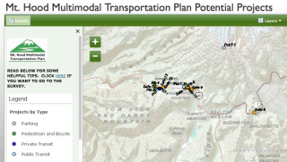
The list of 40 projects unveiled this week has been whittled down from hundreds of ideas they’ve received in the past several months. They’ve split the projects into seven categories ranging from public (and private) transportation to parking management, the creation of new transportation organizations, basic road safety improvements, bike-related projects, and more. You can check out an interactive map of all 40 projects here, or see the four projects that specifically mention bicycling below…
- Mt Hood Highway shoulder widening for bicyclist use — There are many stretches of US 26 and OR 35 where shoulders are very narrow or nonexistent. Bicyclists rely on shoulders for travel through this area. This project would widen shoulders in areas on US 26 and OR 35 where there are no or substandard shoulders. Shoulder widening would be targeted to areas based on need.
- Bike/ped info along Mt Hood Highway with maps to mountain biking, alternate routes to US 26/OR 35, hiking trails etc. Wayfinding would be a key element.
- Bike intersection improvements at OR 35 and Historic Columbia River Highway (E. State St.) in Hood River — This intersection lacks striping for bicyclists headed east on HCRH to OR 35 north (or across the highway to the HCRH multi-use path). The project would stripe a bike lane through the intersection to improve safety for bicyclists using this intersection.
- Bike intersection improvements at OR-35 & OR 282 intersection — The bike shoulders on southbound OR 35 end through this intersection so bicyclists have to merge into high-speed traffic at this location. In addition, there are not bike lanes striped on OR 282 as it nears OR 35 so bicyclists have to enter the lane at the intersection. This project would stripe a bike lane on OR 282 and would widen OR 35 to allow for space to build a bike lane through the intersection.
In the online survey, the public is being asked to choose five projects from the list of 40 that they feel a stakeholder group should recommend to ODOT. “The MHMTP Project Leadership Group, made up of representatives from the Oregon Department of Transportation, Clackamas and Hood River counties, and the US Forest Service, will ultimately decide which projects on the draft list are included in the plan,” an ODOT statement.
ODOT expects to have the plan completed by the end of the year. Projects selected will be implemented “within the next few years,” says ODOT.


Thanks for reading.
BikePortland has served this community with independent community journalism since 2005. We rely on subscriptions from readers like you to survive. Your financial support is vital in keeping this valuable resource alive and well.
Please subscribe today to strengthen and expand our work.
“You can check out an interactive map of all 40 projects here”
missing link
Hi Stevie:
Here’s the link to the online map: https://deagis.maps.arcgis.com/apps/OnePane/basicviewer/index.html?appid=3a76232e4cd74c99b073a521e6e34533
Look forward to reviewing your survey results,
Mike
My recommendation is to ignore the map, and skip directly to the checkboxes labeled “PB-*” and select five of them.
It’s pretty difficult to follow.
I am a resident of Government Camp so my vote goes to Aerial Tram from Govy to Timberline, and foot bridge to ski bowl. This will help bring in Bicycle tourism as it will complete a way to get your bike up to Timberline, ride the trails down and get to the bike trails at Ski Bowl.
Finish with a beer at Charlies and your day will be complete.
How much of the tram project would be funded by Timberline? They seem to have the most to gain from the project…
It’s a project with Timberline and Ski bowl. It’s one of the main reasons why the Mt. Hood Fusion pass was started, it got the two ski areas to work together on future projects.
Here are a couple older articles:
http://www.bendbulletin.com/apps/pbcs.dll/article?AID=/20070121/NEWS0107/70121001/1025&template=print
http://www.mthoodadventure.com/about-us/collins-lake-resort-history/
http://www.timberlinelodge.com/wp-content/uploads/Tline-Next-50Yrs.pdf
I’d like wider (and cleaner!) shoulders on Oregon highways, period. They’re not that expensive. Temporary expansions could even cut down on the need for single-lane shutdowns and flagging.
Sure having better shoulders , etc. would be better for biking around Government Camp but I can think of many other commute biking areas that are more active biking areas that need improvements over a recreational biking area.