(Photos © J. Maus/BikePortland)
The Oregon Department of Transportation (ODOT) knows that if Mt. Hood is to remain a popular recreation destination there’s got to be a better way to get up there than driving in a car. Highways that connect to Mt. Hood are becoming magnets for congestion and crashes, so the agency has launched the Mt. Hood Mutlimodal Transportation Plan, a project they’re working on in partnership with the US Forest Service, the Federal Highway Administration, and Hood River and Clackamas Counties.
The impetus for this project (which includes Mt. Hood, Sandy, and Hood River) is the federal Omnibus Public Land Management Act of 2009. Section 1207 of that law, under the heading “Tribal provisions, planning and studies” says that ODOT must develop, “an integrated, multimodal transportation plan for the Mount Hood region to achieve comprehensive solutions to transportation challenges.” Among those challenges, says ODOT Region 1 Project Planner Mike Mason is ever-increasing traffic and a history of crashes.
“There’s a lot of demand and interest in biking both on Highway 35 and 26.”
— Mike Mason, ODOT Region 1
Traffic to Mt. Hood is only expected to increase from the 2-5 million annual visitors it already gets and one huge growth area is bicycling. Mt. Hood is home to a hut-to-hut mountain biking system, popular singletrack trails, a growing number of mountain bike races and events, the Sandy Ridge trail system, the mountain bike park at Skibowl, and the Timberline MTB Bike Park which is expected to be open for business in summer 2014. Other bicycling trends around Mt. Hood are unsanctioned road races and fatbiking on snowmobile and cross-country ski trials.
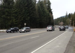
“In the winter and summer months, there is a tremendous number of people who go up to the mountain for recreations,” said Mason during a phone call earlier this week, “During peak periods it’s really congested and dangerous. There are a lot of crashes.” Separate from this planning project, ODOT is already pumping $27 million dollars into “safety and preservation” projects like their U.S. 26 Mt. Hood Highway Safety Project.
While the Highway 26 project is aimed at making driving safer, Mason says the goal of their Multimodal Transportation Plan is to encourage fewer people to hop in a car to begin with. “What we’re hoping to find are good ideas to reduce the number of people who feel they need to drive cars up there.” He’s also aware that much of the Mt. Hood traffic comes from young people who may not even drive yet. “How are they going to up there?” he wonders.
Due primarily to environmental constraints, Mason made it clear that expanding highway capacity for auto traffic is not on the table. “Widening the corridor is not going to happen,” he said. “This isn’t a typical ODOT highway planning project.”
“Are people interested in increased transit between Gresham and Sandy?” Mason asked rhetorically,”Does it make sense to have a park-and-ride and jump on a bus? What types of ways can we get fewer people driving up but still get them to the ski hills?” (It’s worth noting that The Mt. Hood Forest and Clackamas County were just awarded a transit grant for the “Mountain Express” bus service a few weeks ago.)
Mason spoke a lot about bicycling and access to existing bike trails. “We hear a lot from Hood River about people biking. There’s a lot of demand and interest in biking both on Highway 35 and 26.”
The budget for this plan is $300,000 for outreach and planning and $350,000 for implementation (paid with funds from all project partners). With the implementations funds, ODOT says they could end up doing things like lane striping changes, improving the condition of roadway shoulders, improving access to trailheads, changing curb alignments, and so on. “This plan isn’t meant to include everything,” is how Mason put it, “What we’re aiming to do is come up with some affordable projects that can be implemented in the near term.”
This will be a very interesting plan to follow and involvement from people who bike on, to, or around Mt. Hood will be crucial. ODOT needs and wants to hear from you and they plan to have a “manageable list” or actions by this summer and implement them by the end of the year. Stay tuned for a survey and other options to share your input in the next few months.
Learn more at the official ODOT project page.


Thanks for reading.
BikePortland has served this community with independent community journalism since 2005. We rely on subscriptions from readers like you to survive. Your financial support is vital in keeping this valuable resource alive and well.
Please subscribe today to strengthen and expand our work.
awesome hope this happens 🙂 but a lane buffer would make me feel warm and fuzzy.
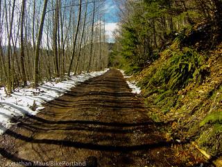
doh just noticed that sweet dirt road. woot!
I was hoping Jonathan might share the privy information of where that road might be. I’d love to bike up Hood, but 26 does not sound appealing.
Based on the file name of the image I think it’s the Sandy Ridge mountain bike trail.
I don’t recognize that road as being anywhere at Sandy Ridge.
If you’re looking for an alternate route for Hwy 26, Still Creek Road is nice.
There is also an old abandoned road up to Timberline.
Yeah I couldn’t say if it’s right or wrong as I don’t mountain bike and have never been over there.
Is Still Creek Road paved? I can’t tell on Google Maps. I’ve used Wildcat Mountain road to go up a little but further up the mountain than Sandy before, but haven’t ventured further than that yet.
Still Creek is not paved except for maybe a short stretch here and there. Hard pack dirt. Cross tires or durable touring tires would probably be fine.
This could be great. But I’m a little perplexed at the rhetorical questions:
“What types of ways can we get fewer people driving up but still get them to the ski hills?”
Um. Buses? Shuttles? Vans? Bikes? Charging (a lot more) for parking at the destination. Coordinating among existing transit agencies so that schedules make sense, transfers are logical, and folks can find out about the details.
An interesting parallel (?) effort for the coast appears to just be getting underway. http://www.nworegontransit.org
The website seems to be very much a work in progress, but the goals are promising:
The North by Northwest CONNECTOR is a coordinated regional transit system managed by the CONNECTOR Alliance. The Alliance is working to enhance the livability and economic vitality of northwestern Oregon through the implementation of regional transit strategies.
The CONNECTOR Alliance is a partnership of: Columbia County Rider, Sunset Empire Transportation District, Tillamook County Transportation District, Benton County Transit, and Lincoln County Transit.
These five partners are taking action to:
Improve transit connections between northwestern Oregon communities.
Brand and market transit service in all five counties as a single seamless service.
Build community partnerships to increase transit ridership while promoting regional business and economic development opportunities.
Implement sustainable funding strategies for continued transit system development.
I’ve looked into riding a shuttle up to Mt. Hood, but the schedules are extremely lacking, and they only seem to accommodate early birds. There’s no way I’m getting my family across town to a pick-up point by 7am. If there were, say, hourly buses to/from downtown that ran in the afternoons and evenings, that would be very useful.
Agreed! I’m happy to be up there around 9, but usually don’t want to stay until 4, and the shuttle schedules don’t allow that. I would love to see hourly shuttles, maybe leaving from Sandy or even Government Camp.
I don’t understand why they can’t run an almost regular bus, that could also pick up/drop off hikers. Many trail heads are right off 26, so this seems like it would be a slam dunk. If you run them consistently enough (and people don’t have to wait too long (10-15 mins.)) I think this could work due to the main-road nature of 26 for getting to/from Hood.
Yeah, right? Eugene’s LTD runs hourly buses as far as 60 miles from Eugene so that you can access hiking and mountain trails in the Cascades, on the weekends.
Three cheers for improved biking facilities on 26 and 35! Would be such a plus for my beer century over Mt. Hood.
This seems so necessary (and simple). A shuttle system from a park and ride lot (that exists or could be easily created) with a few options–one bus goes Skibowl–>Timberline, the other stops at Gov’t camp and then off to Meadows. Turn around and repeat. When I lived in the Roaring Fork Valley (Aspen, CO) I took the “city” bus the entire 45 miles from door to door. All the busses were outfitted with outside ski/board racks, and they made a circuit to all four ski areas in the area.
I am astounded at how expensive the “ski” bus is to meadows–$20 a person…two of us and it becomes cheaper/easier to drive ourselves. These options will only work when the parking situation at the mountain changes. Parking at the aspen areas is both hard to find and expensive. Although it won’t surprise anyone to hear that the majority of people riding the RFVT system were employees who couldn’t afford to live in Aspen/Snowmass, so we had to be “downvalley trash” and ride the bus.
The cost and hassle of getting to Mt Hood in the winter has prevented us from going as often as I would like. With a family of 4, a car rental is by far the cheapest option, but it’s still $60 for a day with a zip car or an SUV from the airport. Even a cheaper compact car would be $45 with insurance, and then there is the cost of gas. I would love to take the bus, but paying $20 a person, and only having one pick-up time doesn’t work. Having real transit service, with buses every hour from Gresham to Timberline (with stops at Sandy, the villages and Government camp) would make it possible for us to go sledding or snowboarding, or even mt biking in the summer.
Driving is bothersome enough when you *don’t* have to put on chains. I’d love to have a viable alternative to driving to get the the mountain.
Pie-in-the sky 23rd century solution could be an underground maglev subway that doesn’t require cutting a single tree, but for now I’d be pretty happy with a bus system similar to what some national parks have.
Plus, if they made it work for enough people, it could pay for itself by reducing the number of cars destroying roads with studded tires.
I’ve already filed a lawsuit to stop it. Hwy 26 is a pristine piece of asphalt and it needs to be preserved(!) 🙂
It is totally possible to tour by bike on pavement from Portland to Mt Hood on secondary roads – I did this once years ago with friends. Take the Springwater to the end of the pavement and parallel it on pavement when it turns to dirt.
My memory of the exact route is dim because it has been nearly ten years, but you find your way up to cross Hwy 26 to SE Orient Drive which leads you to Bluff Road, Hudson, and Lusted. Cross the Sandy River at Dodge Park (rather a steep climb back out of there with a touring load). I think it is Ten Eyck, Marmot, and Barlow Trail from there to Lolo Pass Road. We went up Lolo Pass Road, turned right about half way up, and camped a ways over. The place names in that area elude me right now, but it was a great trip.
I was RATHER green at that point — probably my first bike tour — so family ferried my camping gear up for me. Too bad they got lost and only found me well after dark…..
Just a thought:
Utilizing all of the same standards and equipment types construct an on-demand light rail extension from the Gresham terminus up to the popular destinations on Mt Hood. As few stops as possible, basically an express shot up to the top.
We definitely should charge more for it.
It should parallel Hwy 26 as much as possible if only so that it is functioning as its own advertising: “here we are stuck hours behind the wheel while they zip up the mountain for the price of gas.”
Obviously such a light rail line would need some winter modifications and probably stronger motors for the continuous steep inclines but these problems have been easily surmounted in northern Europe, no need to reinvent the wheel.
And I’d personally remove some of the seats to make room for recreational gear.
As for funding: 40%-50% of total costs should come from a coalition of those interests that would benefit from this on Mt Hood. ODOT should cover most of the rest of it but there are definite health and environmental benefits to getting as much of this privately owned motor vehicle traffic off the road as possible.
Going up they burn much more fuel than normal, going down they hopefully DON’T burn through their brakes.
Removing the excess vehicle exhaust along with water table pollution (some of Portland’s drinking water comes from this area, right?) could only benefit the health of all of Portland’s citizens.
Let’s repurpose the WES equipment! This wouldn’t lose any more money than that fiasco. Or, use the WES trains to do this on the weekends.
NO
This NEEDS NEEDS NEEDS to be electric.
Y`all can squelch your “dirty electricity” rants; for each ton-mile the dirtiest coal generated electricity is cleaner than diesel.
This isn’t about clean, it’s about cost: electric drive is simply more reliable and less sensitive to changes in energy source.
Diesel is going up and its price is unstable to boot. So much so that the trucking and the freight rail industries are moving as fast as they can to abandon diesel for anything else, usually CNG. Even while CNG operating costs are higher because they don’t want to be locked in to the most expensive energy source on the block.
We can argue ’til we’re blue in the face about whether WES was a good idea, may yet be a good idea, if it will ever break even or if all public projects are a bad idea because public welfare is a loss leader. Just don’t pretend that anything petroleum powered is a wise long term investment.
Wow, there’s a $10 Billion idea!
Hourly bus service would be sufficient, and affordable. I’m sure lots of people would take it.
Anyways, building a railroad up the mountain would have an enormous environmental footprint, not to mention a multi-billion dollar pricetag.
Wait a sec. The law is from 2009 and we’re just now hearing about this? What is wrong with ODOT?
My guess would be a lot.
I last drove up to Mt Hood snow about 3 years ago… the drivers are just as horrible as everywhere else but add in snow and people rushing to get their tired family home and the conditions for driving are deplorable… I’ve avoided the area ever since… I’d only feel safe going back up there (via any mode) if I didn’t have to go on any shared roads… in other words I’ll try to never drive/ride in a car… and if I bike it will have to be on back-roads… the attitudes of drivers after they come off the slope is worst than when they get off work…
I’ll second this,and say that the conditions the roads are kept in are horrible as well. The snow removal is pretty poor (and I would love some salt, but I know everyone in PDX/OR hates salt). After moving here from CO and skiing about 15-20 days a year I have skiied at Hood exactly once in my 3 winters here. Part of it is higher prices in OR, but the driving conditions are significantly poorer than in CO, despite Hood being closer than any mountain I would ski there.
Ski train! Ski train! Ski train! Like this: http://is.gd/mN8mk9
In the summer you can fill it with hikers and load bikes in the equipment car. A Swiss-style train to the mountain and continuing back and forth to Bend would be epic. Expensive? Yes. A dream? Absolutely.
The new schedule of the Mountain Express (funded in part by the grant referenced above, funded in part by Timberline and Skibowl and other partners, including Tourism) is scheduled to begin in October. The bus is currently scheduled to operate 5 times a day, 7 days a week in winter. In summer, the equipment will include a towing package and trailer for mountain bikes. Stay tuned!
Be sure to check out the new article in this months Mountain Times:
http://www.mountaintimesoregon.com/modules.php?name=Lead&acton=showad&aid=341