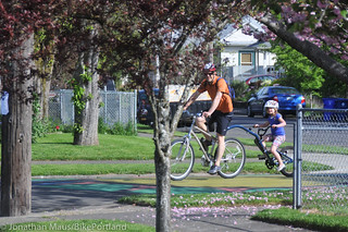
seen their neighborhood transform in part because
of the tree-lined, traffic-calmed street that runs through it.
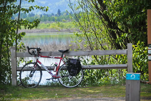
(Photos © J. Maus/BikePortland)
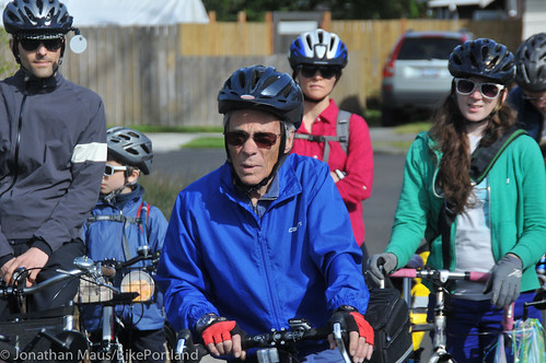
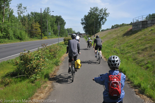
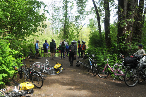
What the Bureau of Transportation has done in the past few years to develop a low-stress residential street network has revolutionized Portland neighborhoods. The changes aren’t always noticed, but their impact is beginning to emerge. For relative pennies, PBOT has created a (mostly) connected, family-friendly network of streets that are comfortable to bike on and easy to navigate. It’s still not perfect (never will be), but the maturity of this network is worth noticing. And at the ‘Sharrows to Sparrows’ ride held on April 27th, it was hard to miss.
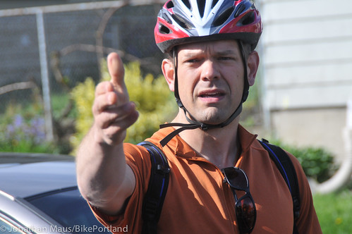
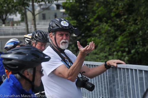
The ride was led by PBOT’s Greg Raisman (a dedicated advocate as well as a mastermind behind the city’s greenway program) and Mike Houck, a veteran local natural areas advocate who wrote “Wild in the City” and now executive director of the Urban Greenspaces Institute. The basic premise of the ride was to demonstrate how these neighborhood streets have opened up access, not just to destinations like work, school, and the grocery store — but to Portland’s great parks and natural areas as well.

Mike Houck.
|
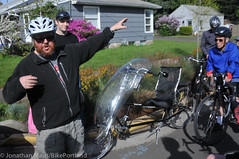
Greg Raisman (white helmet).
|
The way PBOT looks at these streets is not just as transportation corridors, but as a means to improve quality of life. Or in the words of Raisman, “We need to get a lot more out of our streets than just moving people around.” Indeed, as a PBOT press release announced yesterday, our streets are “the city’s largest public space.”
St. Johns resident Walker Leiser is a living testament to this approach. He lives on N Central Avenue, one of PBOT’s best examples of neighborhood greenways. With his two young daughters in tow, he spoke to the group of riders at one of their first stops. With the street trees, bioswales, curb extensions, speed humps, 20 mph speed limit, crossing improvements, traffic diverters, and other features, Leiser said his street has once again become a neighborhood meeting place. Children wander from porch to porch, people talk to each other. “It’s got a real 1950s feel to it,” he said.
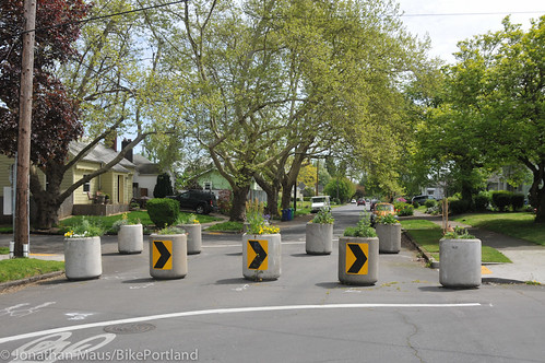
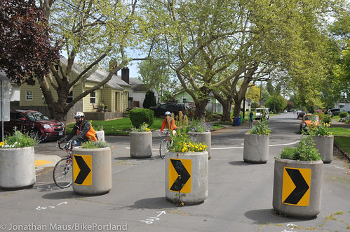
Just down the street from Leiser’s house is the most significant piece of neighborhood traffic diversion I’ve seen in Portland for years. A full prohibition of through motor vehicle traffic at Central and N Tyler avenues. At this off-set intersection, PBOT has placed 10 large concrete planters that prohibit people from driving north-south on Central or east-west on Tyler. I was amazed I hadn’t seen or heard about this before; and I was amazed that PBOT was able to get this design through the public process (they often propose great designs like this, only to compromise when neighbors push back)…
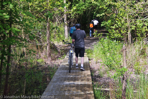
We then made our way through St. Johns and connected to the Peninsula Crossing Trail (via an awkward, sidewalk-riding-against-traffic maneuver on Lombard)…
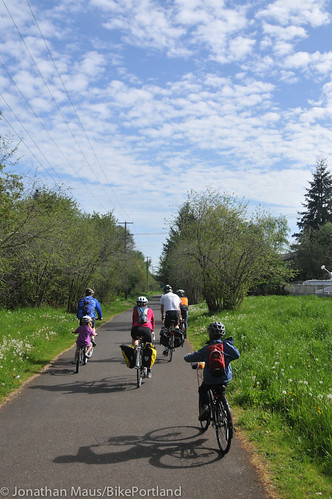
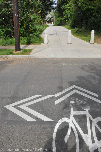
Just north of Lombard, we connected to a newly completed piece of bike path that makes an important connection between neighborhoods. The path between N Westanna Ave and Newell Avenue seems like a small thing, but it has a major impact. It allows the neighborhood greenway to continue along N Houghton Street and connects thousands of people to the Peninsula Crossing Trail and points beyond…
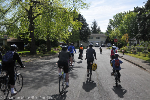
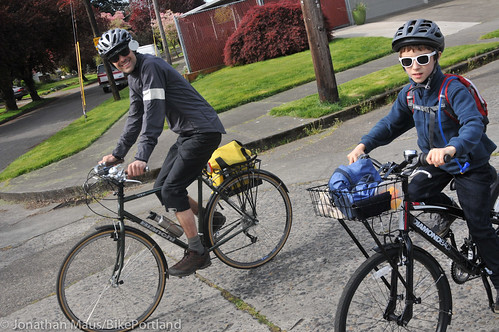
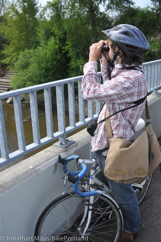
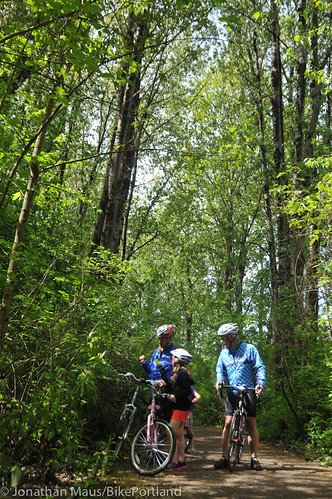
As we continued at a pleasant pace, I noticed the participants on the ride had an extraordinary age range. A few looked to be retired, and we had kids as young as nine riding their own bikes. The riding was so relaxed, The Oregonian columnist Steve Duin rode with a notebook and pen in one hand while he interviewed subjects for a story…

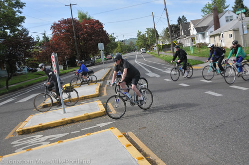
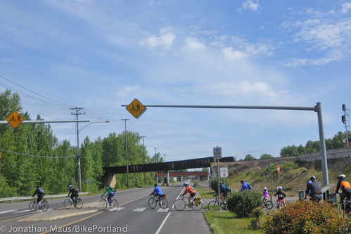
At N Portsmouth and Houghton we sampled the civility of a new, and safer, crossing design…
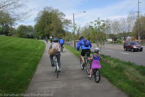
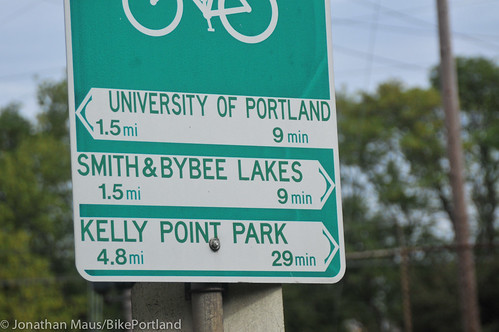
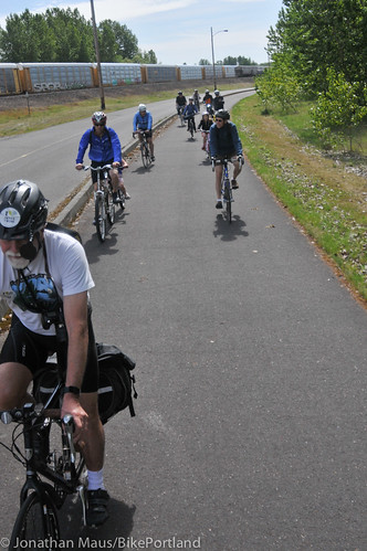
The ride included a stop at the Village Market in New Columbia where residents now have access to healthy and affordable fruits and vegetables — some of which are grown in the adjacent neighborhoods. We then made our way north along the under-appreciated paved bike path that runs parallel to Columbia Blvd en route to Smith and Bybee Lakes and then back on the bike path toward Columbia Slough…
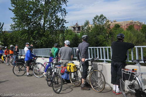
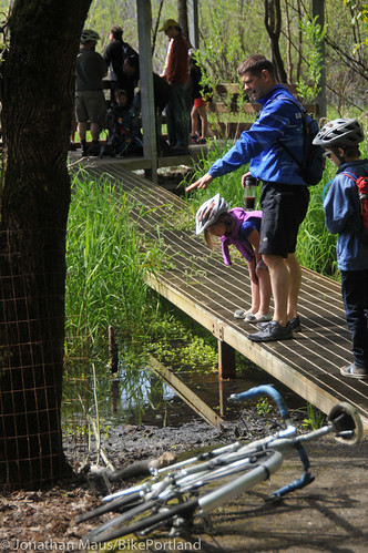
We stopped on a bridge over the slough. This is where Houck, an experienced bird-watcher, was in his element. He shared a story about the old days, when log workers would refuse to work in the slough because tanneries had dumped so much pollution in the water. Today it’s home to double-crested cormorants, cliff swallows that had make mud nests under the bridge, white crown sparrows, and even the occasional bald eagle.
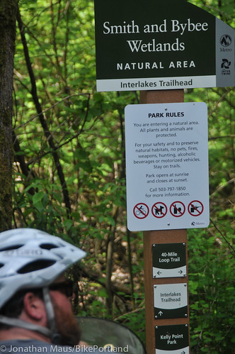
We continued pedaling north on the path to the crossing of Portland Road and the (carfree) entrance to Smith and Bybee Lakes…
When we arrived at the lakes trail, we walked our bikes (it’s the law) and relished the cool shade of the towering trees. At lookout points, we peered into the water at western pond turtles and had a close encounter with a red-winged blackbird. One day last fall, Houck shared, he counted 450 great egrets in one of the lakes.
There are two more ‘Sharrows to Sparrows’ rides (details below). I highly recommend them. They’re an excellent way to discover the natural urban wonders of Portland and they’re a reminder of the revolutionary roadways right outside our front doors.
——
Saturday, May 11th, Esplanade to Johnson Creek and Oaks Bottom, 9 am to Noon.
The 12-mile ride from the Vera Katz Eastbank Esplanade to Johnson Creek and return through Oaks Bottom Wildlife Refuge. We’ll be looking for Peregrine Falcons that nest on the Marquam Bridge at OSMI and wildlife along the way. Meet Greg and Mike promptly at 9 am on the Eastbank Esplanade at the west end of SE Madison Street (east side of the Willamette River), at the river overlook adjacent to the Portland Fire Station, right under the Hawthorne Bridge.
Saturday, June 1st, Southwest Portland, 9 am to Noon.
An event of the United Nation’s World Environment Week, for which Portland is the North American host city, this 10-mile ride will explore SW Portland’s Gabriel Park, Fanno Creek Greenway, and Nicol Road Marsh. Meet Mike and Greg promptly at 9 am at Gabriel Park Community Center in the SW Corner of the park, 6820 SW 45th Avenue.
For more information contact Greg Raisman at (503) 823-1052 or greg [dot] raisman [at] portlandoregon [dot] gov.


Thanks for reading.
BikePortland has served this community with independent community journalism since 2005. We rely on subscriptions from readers like you to survive. Your financial support is vital in keeping this valuable resource alive and well.
Please subscribe today to strengthen and expand our work.
Thanks a million, Jonathan!
Tomorrow’s Southeast version will start at the Vera Katz statue on the Esplanade. Right next to the fire station under the Hawthorne Bridge.
It’s gonna be a beautiful day and we’re going to learn how salmon are currently present in the Sellwood neighborhood. Doing these rides has been an amazing experience and learning that we have salmon spawning grounds in the heart of our urban neighborhoods has been one of the best surprises yet!
Greg, thanks for a very informative and fun ride. The Johnson Creek area is beautiful and it really opened my eyes to the accessibility of Portland for biking. Now I know the story of the “ghost ramp!”
A few weeks ago, I was riding home from a night meeting at Sitton Elementary School. As I passed through Central and St John, this was the scene.
http://www.flickr.com/photos/gregraisman/8618776252/in/set-72157629169820462
Beautiful.
Thanks for highlighting this route.
I use the “greenway” portion on Central and Houghton at least 3 times per week. When the diverters were placed unceremoniously last fall, it was a nice surprise. It’s treatments like this, and the lowering of the speed limit, that draw me to these bikeways. For years I kind of could wayfind on my own through neighborhoods if I didn’t want to use a faster thoroughfare, but have come to notice and enjoy the small things going in on these official neighborhood greenways that keep me coming back to them(I’ve also used this to connect to Wabash and then Bryant all the way to N.Vancouver as an alternative to Willamette-takes a bit longer, but is more relaxed).
There are truly some annoying things, for sure- that sidewalk jaunt onto Lombard and the back-and-forth nature of the new connection between the Penninsula Crossing trail and the beginning of Houghton, but overall it’s pretty good. Oh, the pavement is pretty teribble as well, but hopefully that will be smoothed out soon.
I love this route because sometimes I leave early and take some time to go to the Slough or Smith and Bybee or maybe even Kelly Point Park. Actually, come to think of it, my appointment is at 4…so…okay gotta go!
Jonathan-nice piece. Thanks for covering the trips. Hope you can join us tomorrow. One small change……it’s double-crested cormorant, not double-breasted!
Mike Houck
I am dying to know how those concrete planter things were allowed to be installed. There are so many ways that quality of life would be improved by doing that all over. Please please please let me help do that in Northwest.
PBOT proposed a median on St Louis, where Central crosses (similar to HoughtonXPortsmouth), but at the public outreach meetings the residents thought it too much of an invonvenience. An alternative location internal to the greenway was suggested and Tyler’s central location and geometry worked well for this experiment. PBOT installed the repurposed trash bins and the neighborhood is maintaining the plantings.
So, the key information you need to request such a thing is;
1. On a greenway
2. with public outreach and support
3. approved by PBOT
We live right next to the planters on Central and Tyler, and we love them! Not all car-driving neighbors are happy, but the traffic has slowed and we feel safer biking with our 3 year old. Wish there were more!
When I hear about how neighborhood greenways revolutionized Portland I always think that it might have revolutionized Portland EAST of the Willamette. West of the Willamette it’s still a biking and walking desert. Granted, the topography is much more difficult. But we need a lot more investment over here. I’m glad to see that there is a ride over here in SW Portland, too.
Northwest Portland also lacks a single greenway.
“At this off-set intersection, PBOT has placed 10 large concrete planters that prohibit people from driving north-south on Central or east-west on Tyler. I was amazed I hadn’t seen or heard about this before”
I told you about it! Right when it happened, last October. With pics, even.
https://twitter.com/bunengine/status/254353496957153280
https://twitter.com/bunengine/status/254355124451954689
https://twitter.com/bunengine/status/255502061100220416
Thanks to JM, GR and many others. This is our rubber stamp as is the ‘clover leaf’ design of the 1950s highways. This is such a great article of what we could export into so many communities, suburban, rural, inner city…so exciting…z
It looks like these concrete barriers are getting great reviews, but dead ends and concrete barriers should only be used sparingly. In too many cases I see traffic calming essentially creating cul-de-sacs, rather than actually slowing traffic.
What’s great about Portland’s street grid is the easily navigable network of streets, with few dead ends, allowing for a diffused flow of traffic. I don’t have a car, but I live in Portland and work in Vancouver and I see the difference in street planning on a daily basis – choked arterials, impossible-to-navigate neighborhoods. I would hate to see the same kind of planning echoed here.
Unfortunately diverters are needed because if you convert a street to a full blown greenway (turning the stop signs), that just encourages drivers to cut through neighborhoods on these quiet low-traffic streets to avoid a traffic-choked artery nearby. I agree that they shouldn’t create cul-de-sacs but that use isn’t particularly widespread.
More diverters everywhere!
I have an opposite view. My theory is that the motorized traffic should be funneled as much as possible onto the arterials, leaving the side streets quiet and safe. Even if just the existing bike boulevards were protected from motorized through-traffic, I think many more people would feel safe and rider counts would multiply. Creating safe routes from everywhere to everywhere is what I’d like to see. And by safe routes I mean those where bikes and pedestrians are not being passed by motorized vehicles, at all. Seems like we could just put in those concrete planter-diverters and the job is done. Cheap and effective. And easily adjustable.
A major obstacle to these diverters is that emergency vehicle response can be slightly slowed. I’d make that trade-off in a second, but the ‘safety’ card is played when diverters are proposed.
At the recent Active Transportation Summit, the term to define what you’ve described is a ‘traffic cell’. I looked into it and it essentially is the concept that motorist do have to go out of their way to get from point a to point b, but the internal network is still passable for non-auto use.