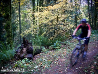
(Photos by Hudson Henry)
After I shared a story about a recent ride in Forest Park, I heard from many readers with fun routes of their own. The story and photos come to us from southwest Portland resident Hudson Henry.
Do you desperately need a mountain bike ride, but don’t have the time to get to the coast range or Gorge? Do you close your eyes and picture that knobby tire leading you carefree through the woods? When I feel the stress build up and really need a quick dirt ride, I head out Highway 30 to the northern reaches of Forrest Park. While the legal riding there is technically on firelanes, the northern lanes are often very rugged and trail like.
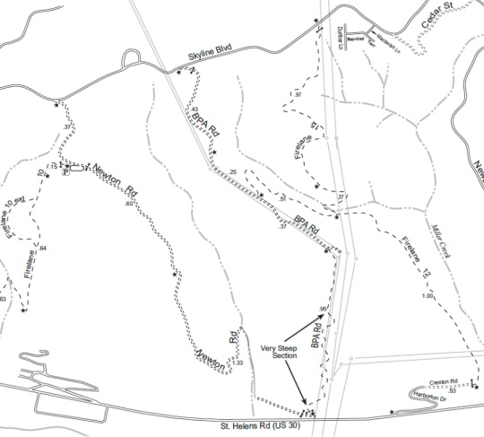
My favorite little six-mile loop starts by climbing up Firelane 12 from Harborton Drive. Quickly you leave the hustle and bustle of Highway 30 behind in exchange for a narrow, overgrown double-track climbing through deep woods. The only sound aside from your tires and labored breathing are the wind in the leaves and birdcalls. After clearing a few trail obstructions and steep short uphill grinds, stay left at the fork by Miller Creek. Now pace yourself for the steep climb up to the junction with BPA road.
The junction with BPA’s power line road is just above its notoriously steep and muddy section. Turning right, follow this well-graded gravel road up the final bit of your 1,000 foot climb to Skyline Boulevard. Popping back into civilization for a moment you take a left on Skyline and follow it to Newton Road. Watch for cars coming the other way as you descend this steep narrow, twisting gravel road to the Newton Parking lot and head straight through the gate and back onto a rough dirt road through deep woods.
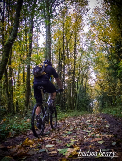
Now you are one very short but steep climb from the best part. Drop your saddle and prepare to descend. Newton’s decent starts as a fast narrow dirt road down a steep ridge with sweeping turns and trail features to play on. As it descends to the creek below it becomes narrower, rougher, and more overgrown until you find yourself on a technical, twisty trail demanding every bit of your attention and skill. The creek crossing resembles a technical trials course. This may have once been a road, but no car has gotten through this maze of dirt, roots, and stone in a very long time.
All good things must come to an end. As the trail widens and drops back down to Highway 30 less than half a mile from your starting point, you can’t help but wonder to yourself… “Do I have time for another loop before dark?”
My friend Jeremy and I have ridden this loop or variations including it too many times to count. It never fails to put a smile on our faces. Isn’t that what it’s all about? Hopefully soon Portlanders will have good singletrack to ride close to home, but for now the northern park is my favorite quick fix.
(Hudson also shared this handy map for reference)
See more Reader Stories here. If you’d like to see your stories on the Front Page, use our submission form.


Thanks for reading.
BikePortland has served this community with independent community journalism since 2005. We rely on subscriptions from readers like you to survive. Your financial support is vital in keeping this valuable resource alive and well.
Please subscribe today to strengthen and expand our work.
Sounds like a nice route, maybe I’ll try it some time. Once you go to the trouble of putting the bike in the car though some of the convenience is gone. I generally ride from the Pearl up to Lief Ericksen and follow that out to Germantown and back, 27 miles round trip. It makes a nice workout from town, no car involved!
The ride out Hwy 30 isn’t that far. Just go by bike. It takes about the same amount of time.
Nice writing!
Thanks Jonathan. Keep doing all that you do for the Portland bike community! We love it. See you on the trails. -Hudson (for more of my photos and stories see http://www.hudsonhenry.com)
Fascinating — two-track roads so poorly maintained and seldom traveled that they become singletrack… One of the benefits of tight budgets, I guess…
Ted Buehler
Nice article. I’d like to see more Reader Stories.
Good write up. It just so sad that this is what we have to mountain bike on near town. Seems like we have to settle for scraps.
30 miles of trails you can ride on in Forest Park. That’s “scraps?”
Yes, where mountain biking is concerned, fire roads are “scraps.” Singletrack is the only real/true type of mountain bike trail, of which we have less than 1/2 mile to ride in Forest Park.
Fire roads are not trails. there is .25 miles of trail open to bikes in Forest Park.
I really enjoy people who don’t mountain bike telling us about what great riding we have available in Forest Park. That’s the best!
Speaking of heading up 30, is Scappoose open again?
I love Newton!
The 1995 Forest Park Plan says bicycles are only allowed on pathways at least 8 feet wide and provide a long sight line. Think Saltzman Rd. as an example.
Also, Firelane 15 is open to bikes, go up that instead and take a left on Skyline. Also, Firelane 10 is awesome. Start at Skyline Tavern, ride to Newton St, take a right thru the parking lot, ride FL 10 (veer off to the right to add that loop!) all the way down and up to Germantown. Jump on Leif Erickson to Springville. Grind up that to Skyline and take a right to Skyline Tavern. On a good day, you can do that in 1/2 hour. Go both directions for more riding, and hangout at Skyline Tavern after to refuel with a pint! PUMP used to do this ride once a month, Ride the Wild Side!
Long Live PUMP!
Love those variations too!
Beautiful ride, and a real workout. LOT’S of up. Definitely a technical trail near the bottom by the creek. The last downhill is cool, but be aware of at least 3 trees that have fallen across the trail as of 1/12/13. They are all near the beginning of the downhill so it’s not all bad. The trail crossing is tricky with the slick rocks and moss. This seem to be a great training area, and plenty of areas to challenge yourself to keep pedaling.