(Photos © J. Maus)
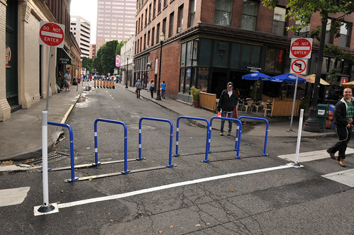
On Saturday, the Bureau of Transportation installed new signage and infrastructure on SW Ankeny and officially made it carfree from SW 2nd to SW 3rd Avenues.
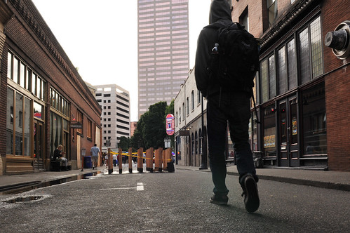
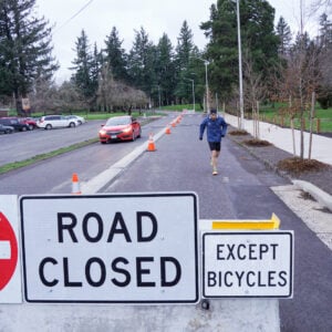
“Do Not Enter” signs are posted at each corner and a bike corral has been installed on the east end of the closure (at SW 2nd). The grand opening is scheduled for July 21st and preparations from businesses are already evident.
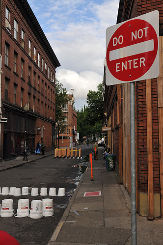
I stopped by on Sunday evening for a closer look.
The bike corral does great double-duty as both bike parking and a barricade to prevent any through motor vehicle access (it will work even better as it gets filled up with bikes). There’s nothing on the street itself yet, but tables and chairs for adjacent businesses are set to come by this Thursday.
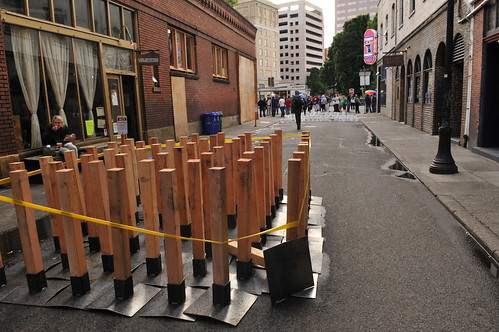
There were a bundle of posts in the street that one shop employee told me were going to be used to divide up the seating areas.
Another employee of a business on the street told me she has mixed feelings about the change. She’s taking a “wait and see” attitude.
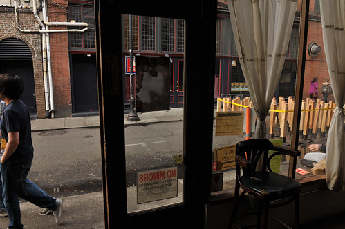
I spoke with an employee of Voodoo Doughnuts, who was enjoying the quiet street on her lunch break. Voodoo just finished an expansion onto the corner of SW 3rd and Ankeny and a huge line doubled over itself at the west end of the street. The employee said Voodoo doesn’t have plans for putting tables and chairs on the street, but the lack of cars will make the ever-present line much easier to manage.
The Voodoo employee sat and enjoyed her lunch on a bench while looking out onto the empty street. “It’s actually pretty nice,” she said, “I won’t have to breath any exhaust during my breaks anymore.”
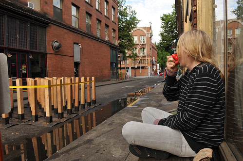
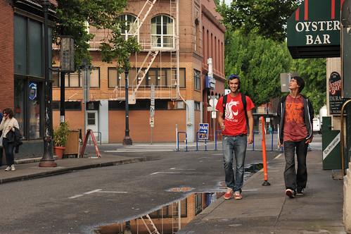
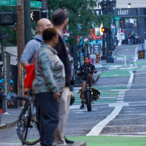
Even though the street is off-limits to cars, strangely, most people still walked on the narrow sidewalks. I guess old habits die hard. I think once word spreads that the street is carfree — and especially once it’s filled with walkers and diners — folks will begin to spread out and treat the street like the plaza it now is.
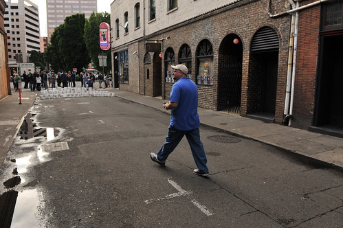
PBOT and the businesses have set this Thursday, July 21st, as the official grand opening. Adding to the festivities on Thursday, Portland Afoot, the awesome news zine and wiki about low-car life, is celebrating its first birthday. Stop by Valentine’s (232 SW Ankeny) from 6:00 to 8:00 pm for food, drinks, and “great conversation with fellow transportation aficionados.” (See Facebook page for more details.)
If you stop by to enjoy the carfree ambiance, remember that this is still considered just a “pilot project” by PBOT. They plan to re-open the street to cars on October 21st. Of course, if the public and business owners deem it a success, I imagine they’d go ahead and make it permanent. One other thing, bikes now have limited access as well and people are expected to dismount and walk their bikes on sidewalks.
— For more, browse our Carfree SW Ankeny story tag.


Thanks for reading.
BikePortland has served this community with independent community journalism since 2005. We rely on subscriptions from readers like you to survive. Your financial support is vital in keeping this valuable resource alive and well.
Please subscribe today to strengthen and expand our work.
They should definitely pull the ‘Do Not Enter’ signs. They’re so unwelcoming and the whole idea of the car-free street is to be more welcoming.
I would hope that physical obstructions at either end of the street would be deterring enough for people driving in the area.
What a brilliant idea, block off the street with bike staples. What will be at the west end?
Another sheet of pavement!
this would be the sign in Germany when entering such a street:
http://de.wikipedia.org/w/index.php?title=Datei:Zeichen_242.svg&filetimestamp=20060729130144
i certainly agree the signage is unwelcoming. unfortunately, mutcd has nothing equivalent to the german treatment
http://mutcd.fhwa.dot.gov/pdfs/2009/part2b.pdf
on the other hand, since we are not really trying to regulate the flow of motor traffic through here, but simply to indicate that this is not a motorized space, maybe we do not need to be mutcd compliant.
But Jim-Bob from Gresham with his F-250 might think it’s open season on pedestrians with that sign.
The do not enter will help prevent someone from running into the staple rack at night, which will probably happen anyway.
i am not inclined to offer my bike as a buffer
string some lights over the street between the buildings
Bikeportland story headline:
“First look: SW Ankeny is now carfree”
And…Bike free.
People will no longer be able to ride their bikes on this street. They’ll be obliged to walk their bikes along pedestrian crowded six foot sidewalks…instead of down a wider 10′-12′ swath in the middle of the street…that would still have left the lion’s share of room for cafe tables, in an area located on the sidewalks and extending some distance into the street.
“…One other thing, bikes now have limited access as well and people are expected to dismount and walk their bikes on sidewalks.” maus/bikeportland
I don’t understand why the loss of a single small block’s worth of street in the grid system of Portland is significant to anyone in cars or on bikes. I admit, it’s not a corner of town I bike through very often, but how hard is it to find an alternative to that one little street?
It’s significant, because if the street continued to be open to the vastly reduced amount of space that a bike and rider occupies (compared to that of, say…a car.) people with bikes would probably appreciate the opportunity to slowly cruise the street as part of considering whether to stop and patronize one of the businesses.
Being a part of the city’s through street grid system is not the only consideration for allowing a continuation of vehicles being allowed to travel the street, where a significant part of the street’s function has been assigned a recreational function, as this one now has.
Making the street ‘car-free’ was a great idea. Putting the tables smack dab in the middle of the street isn’t such a great idea. I suppose people will manage, but people in wheelchairs…and everyone else…might have appreciated the extra room that a wider swath down the center of the street would have allowed, rather than the modest 6′ wide sidewalks, jammed up against the buildings along with news boxes and garbage dumpsters.
Not too many people have them it seems, but last night, a guy with a disability brought his Segway right into the Starbucks out in Beaverton. A Segway rolling down an Ankeny sidewalk would take up a lot of its width in passing.
Taking a look at maus’s pic above, of the two guys walking side by side, it’s fairly easy to understand that a person walking their bike along side themselves, approaching a couple from the other direction will oblige single file, still making a tight fit with just two people side by side with the bike.
A swath for public through access down the center of the street would be a better, more effective utilization of the public space.
It is very significant, as Ankeny there is the turn around choice before having to deal with Burnside.
It is illegal to ride on the sidewalk, so if you pass ash street by bike you must cross Burnside, go around the block and back across Burnside.
Not to mention the rudeness of this scenario to people on the street.
Close a street so businesses can use it to make money?
But now others can hardly use it?
Oh you can walk down the sidewalk..
The one not plugged by the great Voodoo doughnuts……
Which we could do just fine before.
I am sorry.
I have to add that this street closure is just dumb…
Cars are not allowed in the space. Bikes are. Bikes are still allowed to travel through the street, they just cannot be pedaled by their operators.
If you’re walking a bike, you’re a pedestrian not a bicyclist. Com’on J. Maus!, you write a bicycling blog. You know this. Stop trying to sell it as a “car free” win because it’s not…
I agree w. ‘wsbob’. Why deem it “car free”, when clearly it’s “bike free” as well. And we might as well say it’s “non-patron free” as well. This is about private businesses gaining control of public space for their own benefit at the detriment of all other users.
Pedestrian-only zones in cities w/out commercial or retail space typically become dead zones filled with homeless who camp out. See Ankeny Square and the historic (and defunct) Eugene pedestrian mall.
I think we’d all do well to read Jane Jacobs a little more often. The Death and Life of Great American Cities makes for some good reading.
Ankeny has restaurants and bars, so the street’s not likely to have vacant street ‘close the shutters-everybody goes home’ syndrome. Except maybe after the bars close and all the patrons go home, but then…not too many people would be taking a vehicle on the street between 2am and 6am.
The bigger issue is that putting the tables in the middle of the street effectively decommissions the street for practical through travel purpose.
I appreciated Rick Risemberg speaking up here…. http://bikeportland.org/2011/07/18/first-look-sw-ankeny-is-now-carfree-55879#comment-1891296 … but ‘pedestrian street’, isn’t what’s shaping up here. Clear out the cars, so people can relax and walk in the street; that’s what a pedestrian street is.
People aren’t going to be doing much walking in the street, if there’s a lot of tables in the way. Pedestrian through travel will be confined to the street’s rather narrow 6′ sidewalks. There, the so called ‘bike access’ will reduce bikes to the status of rather unwelcome luggage.
The simple fact, is that Ankeny businesses would not lose any square feet of table space, if the combined width of the six foot sidewalks to either side of the street were put together to make a 12′ swath down the center of the street. In the realization of a true pedestrian street, people could freely walk down the middle of the street. People could pedal a bike there, at a slow speed…or if safety and practicality required it, be obliged to walk their bikes down the street.
About those signs, it is strange how in this country we seem always to be short a few. Has anyone else noticed that when you leave a grocery store that has separate entry and exit doors side-by-side, the sign you see on the inside of the door that is for people entering the store *always* reads ‘Do Not Enter’ when it should read ‘Do Not Exit’?
Do we really not have in our arsenal of signs one that captures the allowed/disallowed movements on this block?
San Francisco has several of these, whose business thrive!
Japan has had numerous pedestrian streets–and even pedestrian street networks–that are the busiest spots in town. And Buenos Aires’s Calle Florida, a 100-year-old pedestrian street, was the only part of town where merchants were thriving when we visited a few years ago.
Santa Monica’s Third Street Promenade–yes, you have to walk your bike through, but it is not a traffic sluiceway any more!–is the major destination in that city’s downtown.
All these pedestrian streets are popular places where people not only buy things but meet and hang out–narrow town squares as it were.
Here’s a link to a little photo essay I did up on them:
http://www.newcolonist.com/pedstreets.html
Hells to the yeah! Now. Can we get bike corrals to act as diverters every ten blocks, on every single one of our bike boulevards!!!!!!!!!! 😉
I think this is a win.
1. Ankeny between 2nd and 4th is not an essential cycling street because it switches to 1 way opposite at 3rd, and dead ends at the transit mall on 5th. 2nd Avenue southbound makes a lousy commute street because the Morrison bridge dumps 4 lanes of traffic onto/over 2nd, and Morrison bridge path Westbound runs on the left side. The better route is either waterfront or Hawthorne bridge to 4th avenue southbound. It makes little sense to leave the waterfront MUP to go Ankeny to 3rd Avenue southbound due to the unsignalled crossing @ 2nd and the car-free nature of waterfront.
2. As far as only benefitting the businesses on Ankeny, 1. there are only a couple of long-term operations on that block and as turnover is high, there is opportunity for some other enterprising folks to get in there and do something. 2. It benefits anyone who would like to go down there and experience a car-free type experience. If you need to go someplace that doesn’t serve alcohol, there are countless (booze) free options within walking distance (Something I’ve always considered missed opportunity in pioneer square).
3. If it’s successful, it creates a model for recreating this in other locations in the city.
4. Even Elvis approves. (at least, he appears to
which is good enough for me) http://bikeportland.org/photos/photo/250992835/portland-car-free-days-day-2.html
Win.
Oliver,
YOu are wrong about Ankeny being essential.
Very wrong.
Look at it’s placement alone…
Once all the cars are removed, the one glaring thing that stands out to me – and I hope I don’t sound like a crank for thinking this – is how ***UGLY*** SW Ankeny Street is.
I don’t mean the buildings themselves, but rather, the fabric of the streetscape. It’s dull, it’s grey, it’s cement, it’s dirty, it has puddles the size of Lake Eerie (very ped friendly in particular, that last one!)
The point I’m making is, all the above works fine for cars. But as soon as you turn it into a ped environment, it’s just awful. I think if you want to encourage pedestrians to frequent your area, aesthetics are everything, unequivocally. Take a look at this photo of a very similar alleyway, this time in Amsterdam, and spot the differences –
http://www.flickr.com/photos/the_whatsit/4011404350/
They have plants, and cobblestones, and street furniture. It’s absolutely beautiful!! If the Ankeny trial goes well, and the change becomes permanent, I would love to see these kinds of aesthetic improvements considered.
PS – The most interesting thing to me about this photo is that, rather than “do not enter”signs, in Amsterdam instead, they have a clear sign with a picture of a pedestrian on. Much less “cars are evil, no no no”, but the message is still crystal clear who the roadway is for.
I was thinking the same thing, especially the huge puddles. At least nobody will be splashed by cars going by.
We should celebrate this event. I hope its a smashing success so we can start talking about which streets to close to cars next.
You mean which streets we close to cars and to bikes.
NO thanks…
First off, Hoorah!!!!
One point of clarification in response to “the road is now meant for walking”: while the road is now free of cars, the designs as presented at City Council did not feature any “walking areas” actually inside of the street, and actually the plan is to continue to keep through walkers to the sidewalks, as the roadway will be filled with tables and chairs (and hopefully a public bench). This is sort of the opposite approach from NYC’s parklets, which are generally considered public parks and anyone can walk through, around or even use the tables.
It will be interesting to watch this project go in and I’m hoping folks will sound in with feedback to PBOT and City Council. If we want a truly pedestrianized street, we may want some of that road space for those strolling through, in addition to the businesses’ tables.
I don’t frequent this area, so I didn’t realize this change was new when I happened to walk down the street this weekend. I did walk in the street since it was obvious cars couldn’t drive down it, but there were huge puddles to cross to get from the sidewalk to the street. And as commenters above have mentioned, this street is butt-ugly. I hope the trial works out and a more permanent solution like “K” mentioned is put in place. I also agree that it would be nice if a clear “sidewalk” walking/biking path was established in the middle so that it is still easy to navigate the street with the addition of diners, etc.
Hey, thanks for the shout on our event, Jonathan!
Personally I’m excited to see this in action. If it doesn’t turn out to be everything Portlanders could desire, then hey, our plan can change next year. It’s a pilot. Let’s try it.
I hope they can refine the concept similar to inner Amsterdam where the streets are large enough for pedestrians, bikes and scooters for the disabled.
Nice work PBOT.
I hope this pilot project will be a success.
And be replicated in many ways, including
* streets closed to cars but open to bicycles
* streets closed to cars (and preferably open to bikes) with no fees paid by the private sector.
* parking spaces closed to cars and turned into private “parklets” paid for used by adjacent businesses.
* parking spaces closed to pars and turned into public “parklets” with no fees paid by the private sector.
* heck, just close more streets to cars any which way.
Ted Buehler
my thoughts exactly
Well, Bo & Luke Duke were beginnin’ to feel like a fish outa water up in P-town. Them Duke boys didn’t realize it but they were in a heap of trouble when they rounded the corner on Ankeny, tryin’ to outrun Roscoe & Boss Hogg. I believe we are about to see if the General Lee can fly over bike staples and donut tourists, somethin not seen often down in Hazzard County. Yeee Haaa.
Nice goin’ Cap’n. Daisy Mae might need to whomp up some tasty home recipes for etouffe la scrap, jus’ in case some wannabe Genera Lee don’ manage to clear the bikes.
It does seem a bit odd that the city decided to mount the bike racks on 2nd, rather than out of the intersection, on Ankeny itself.
RE: Do not enter signs.
Yes, theyre necessary. Think of people using GPS.
“Turn right” ….well, you need the do not enter signs to make it clear that the GPS is wrong (outdated).
Ditto for people who are used to driving on that street and dont expect it to be blocked one day.
Just putting a bike rack in front, especially at night, would lead to problems.
The do not enter signs are standard, meet visibility guidelines etc.
In a few years, if the street gets remade (ie, all level, no curbs) then perhaps the signs would no longer be needed.
Along those lines, for folks who use the OpenStreetMap snapshots for Garmin that Lambertus makes or MapQuest Open for bike or car directions the next one will show this new pedestrian plaza so your Garmin will avoid it. If you’re interested in giving it a shot, let me know and I’ll help you get started.
The Lambertus snapshots do include bicycle specific data as well, so if your Garmin Dakota, Oregon or Nuvi can do bicycle routing, you’re in luck.
It replied to the wrong post, this should have been under the post about GPS directions taking you through the pedestrian block with a vehicle.
The do not enter signs could take an “EXCEPT PEDESTRIANS” plaque. I’m not 100% on this, but I believe the manual on Standard Highway Signs allows any symbol that can take the red circle and crossbar on it to take a green circle with no crossbar instead to explicitly sign something as permitted.
That “DO NOT ENTER” sign never applies to pedestrians. Maybe you meant “EXCEPT BICYCLES”? I’ve seen some of those around town.
And you’re right, but most folks walking around aren’t roadgeeks, and it’s not like this country’s averse to “Captain Obvious” signage.
I’ll call the Waaaaahbulance for everyone that can’t walk a short block in a pinch.
I used to bike this block every morning on my way to work until it was closed off. Voodoo is the only business open at the time and I feel it’s unnecessary to prevent bike usage in the morning but they now have roped off the tables in the middle of the street so now it’s impossible to pass through. I agree with a previous posting that suggested a throughway in the middle for both walkers and riders and move some of the tables to the sidewalk to make space. Simple enough. I ride on the next block over now though.
I should hope if that happens, the cycleway is well marked and pedestrians are made aware of crosswalks on the block since cyclists escaping West Burnside tend to have some momentum coming down the hill.
The Do Not Enter signs would actually prohibit bicycles on that block, too, so that signage is appropriate for a pedestrian plaza. More hint cyclists shouldn’t go through is the bicycle parking blocking the intersection. Obviously I’m slightly disappointed there’s not a cycleway through for cyclists to escape West Burnside, but that seemed an odd block for cars to want off at due to bad sightlines at the first few intersections, even if it were only open to cyclists at night through morning rush hour…
das fresh holmes