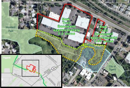
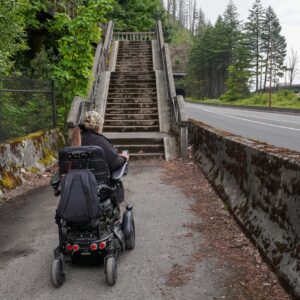
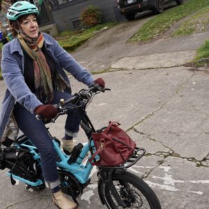
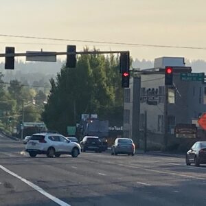
Metro has acquired rights for a trail easement across two properties in central Tigard that will allow them to add length to the popular Fanno Creek Greenway Trail. It’s not a huge piece of the trail, but it helps close a glaring gap that currently exists just northwest of Main Street in Tigard.
With the legal rights secured to build the trail behind the two properties at the corner of SW Tigard and Grant Avenues, Metro will be able to build an additional 865 feet of trail. Metro paid $52,000 for the three acre easement, using money from its $227 million natural areas bond measure that voters approved in 2006 (this is the first trail deal made with that money).
The trail that will eventually be built here (Metro says construction will begin within three to six years) will help close the gap that currently exists between Woodard City Park and just behind Max’s Brew Pub on Main Street (SW Johnson Street provides the connection).

The Fanno Creek Greenway is a gem of a trail that weaves through Beaverton, Tigard and Tualatin. When complete, Metro envisions a 15 mile route that will take people from the Willamette River in Southwest Portland to the Tualatin River.
Learn more about the Fanno Creek Greenway Trail on Metro’s website.


Thanks for reading.
BikePortland has served this community with independent community journalism since 2005. We rely on subscriptions from readers like you to survive. Your financial support is vital in keeping this valuable resource alive and well.
Please subscribe today to strengthen and expand our work.
YAY!!!!!!!!!!!!
WHAT?!! Why the huge delay?
“Metro says construction will begin within three to six years”
I’m not sure, but that SW Johnson Street boardwalk project also included sewer work along with a huge wetlands project. It was a total of over $1,000,000.
This is rad! Now onto the connection at Allen and Scholls.
It’s only when someone gets hurt that the city will hurry up and build. Who wants to volunteer?
Government construction projects are exercises in patience. This seems about right for such a project. How long has the CRC been planning? This project is actually going a lot quicker than the CRC considering the project scale, they have already acquired right of way for the project, now the EIR, and letting bids if the EIR doesn’t show any problems that need taking care of, will take at least a year after the EIR is completed. So 3 years at the absolute quickest sounds right.
You can find out more on this and other trail projects by going to the THPRD Trails Advisory Committee meetings. They are held on the 3rd Tuesday of the month at the Elsie Stuhr building at 6:30pm (usually in the Poplar room, and bikes are not allowed in the building).
There will be a ride May 15, for the 2nd Annual Tualatin Hills Ride Into Spring. First we’ll get together at 8:30 a.m. at the Tualatin Hills Nature Park for some brief discussion about THPRD’s expanding trails network. Then, at 9 a.m., we’ll head out on a relaxed bicycle ride (three distances to choose from, so bring the kids).
The delay is because of how little funding there is for trails. Even something this small needs to get in line.
We need either a regional trail bonding measure to pass or a state funding mechanism to make these happen. The prior regional bonding measure was just to acquire property, not to build.
Awesome news! The FCT has a long way to go, but has also come a long way.