There’s a new cycling route to the Portland International Airport (PDX).
Last Friday, TriMet quietly removed barricades from a 1.1-mile stretch of a protected bike path that takes riders directly to the end of the MAX light rail line and PDX terminal. The path was partially funded by the Port of Portland as part of TriMet’s “A Better Red” project, a $215 million investment into the MAX Red Line.
In addition to an extension of the Red Line in Washington County, A Better Red added a second track to sections of the line between Gateway Transit Center and the airport. The project also comes with two new sections of bike path: One from Gateway Transit Center to Gateway Green Bike Park adjacent to I-205, and the other on NE Cargo Road from just west of NE 82nd to the PDX terminal. The new Gateway Green path and all other elements of A Better Red are expected to be complete later this summer, but TriMet has opened the new path to the airport.
The path was built by TriMet and Port of Portland, who provided $2.3 million in funding. The Port seized the opportunity of TriMet’s project to realize their vision of a new path on the south side of Airport Way along the MAX line that was a key part of the Port’s 2014 Portland International Airport Bicycle & Pedestrian Master Plan.
I took a closer look at the new path on Saturday. I found it to be a welcome addition to the bike network, but it needs better connections to existing facilities. (Watch the video above for more.)
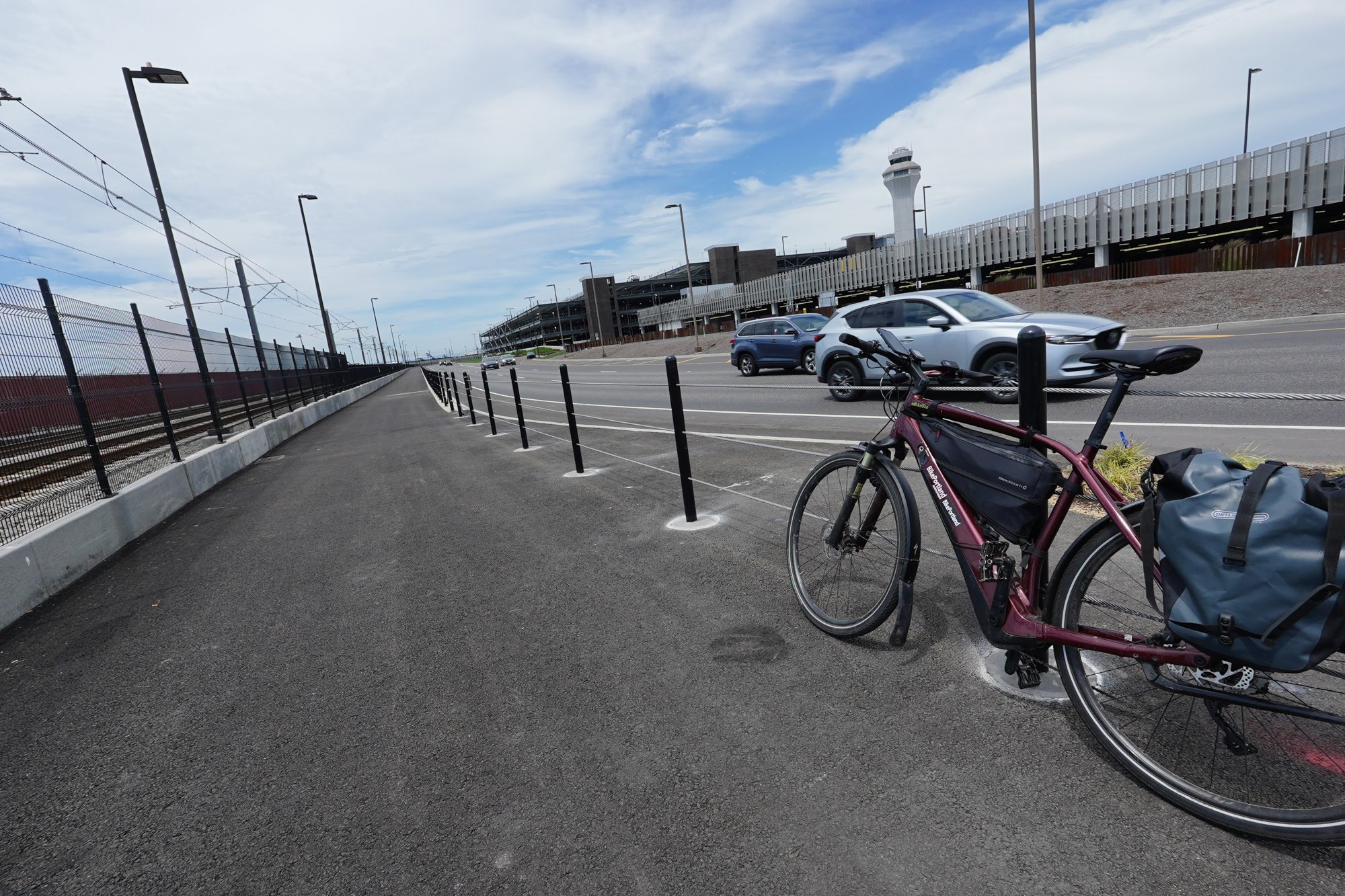
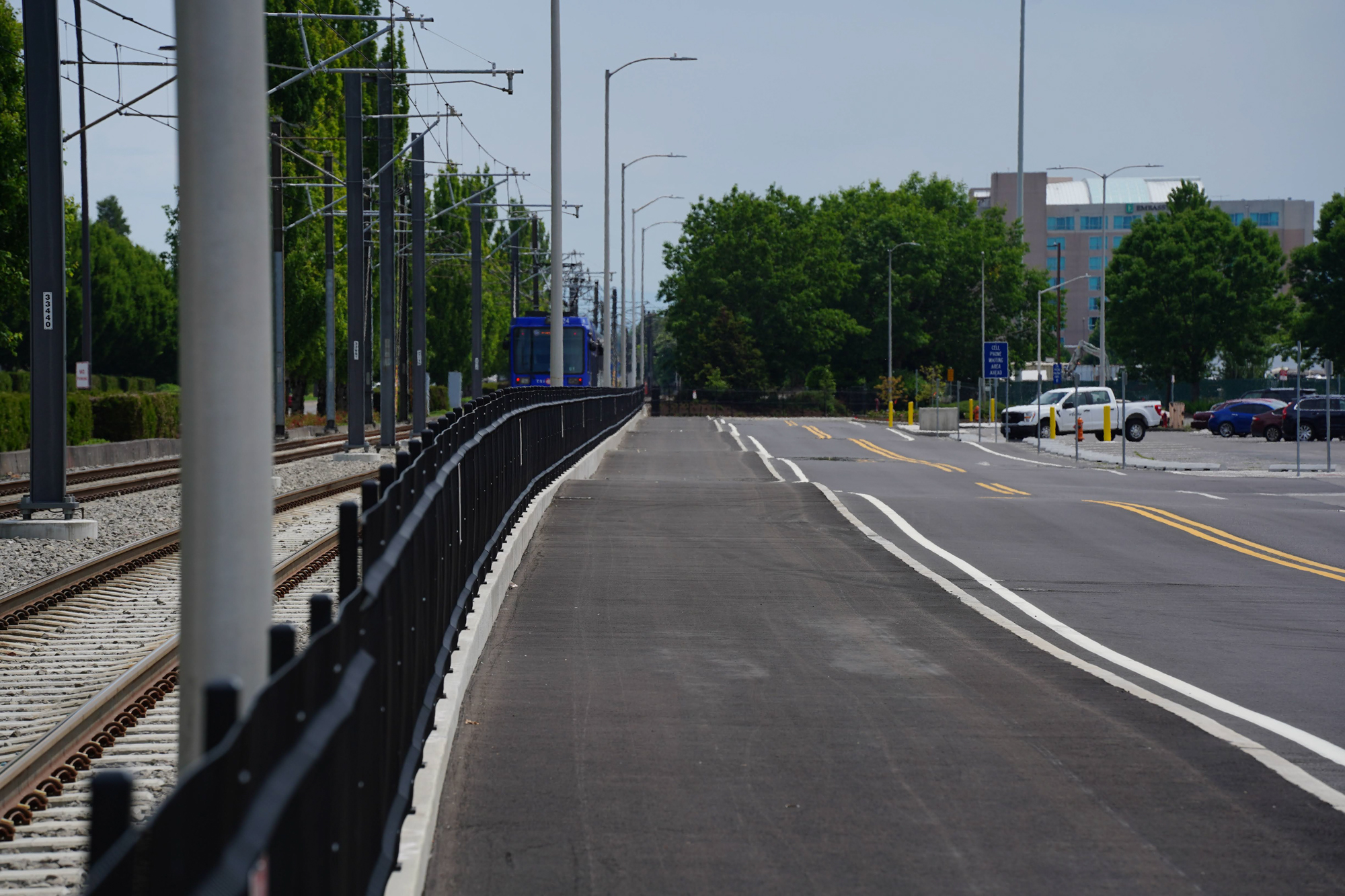
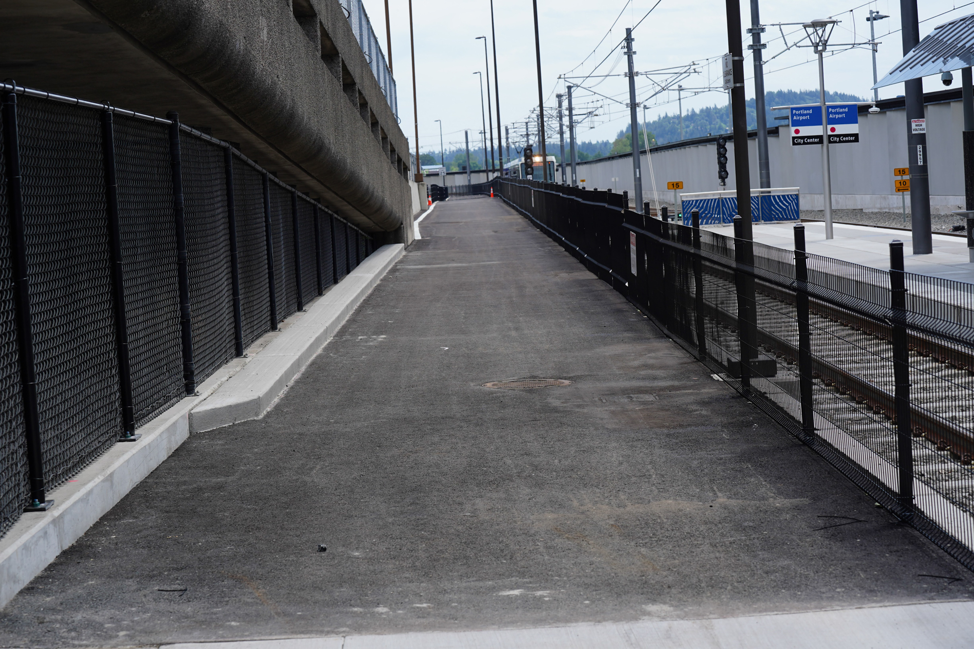
The old bike route to PDX required bicycle users to cross the wide and busy intersection of NE Airport Way and 82nd, then share lanes with car users on a frontage road before connecting to a half-mile path that ended on the north side of the terminal. The new route connects to an existing sidewalk/path near the airport’s designated cell phone waiting area and shopping center on NE Air Cargo Rd. The new path is bi-directional, wider, longer, and provides more protection from other road users. It also connects to a bike parking area near an entrance to the terminal.


Unfortunately the new path isn’t well-connected to existing infrastructure and we’re still a few major pieces away from having a bike route to the airport that’s safe, easy-to-use, and convenient for a broad slice of existing and potential riders.
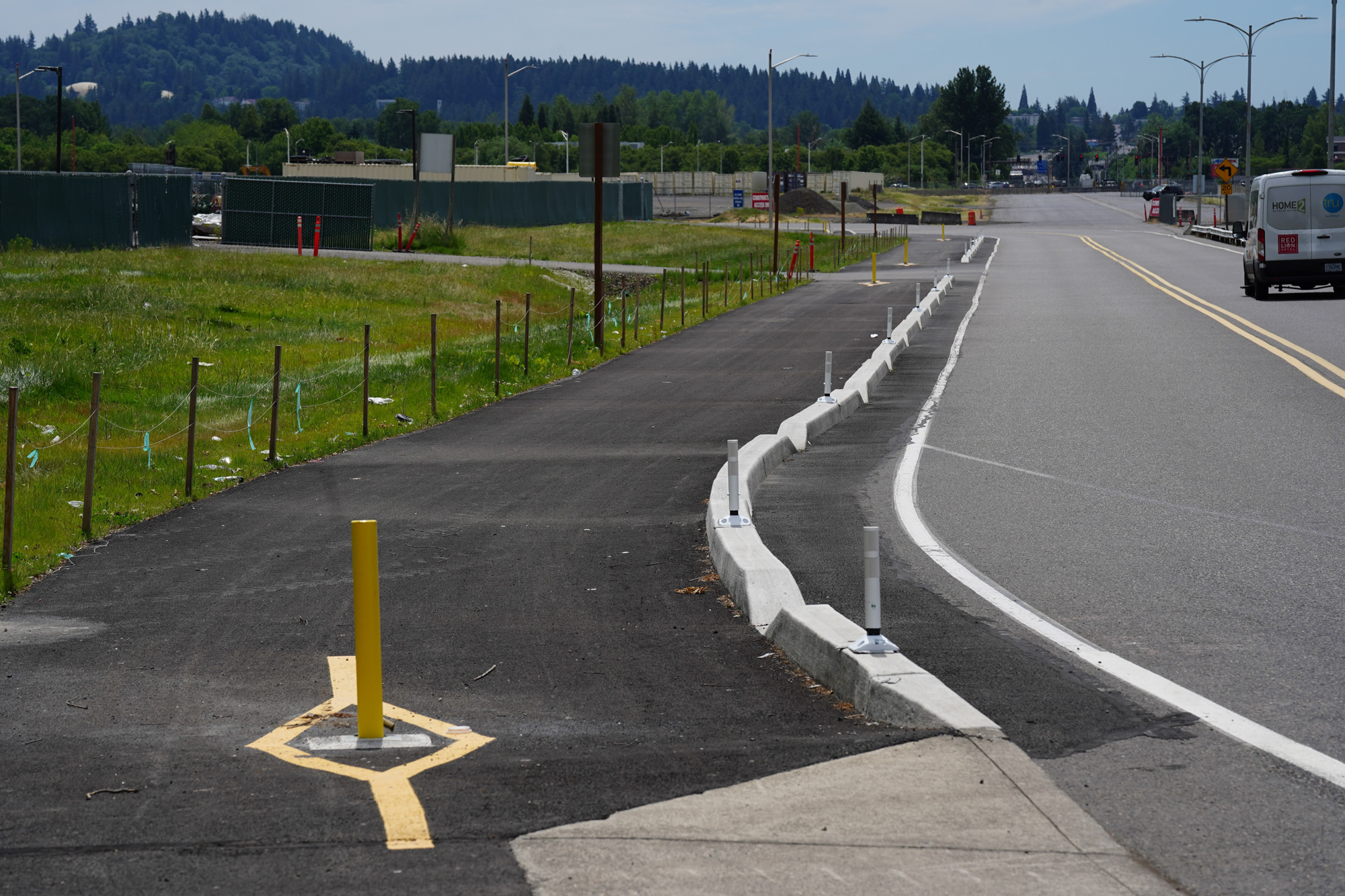
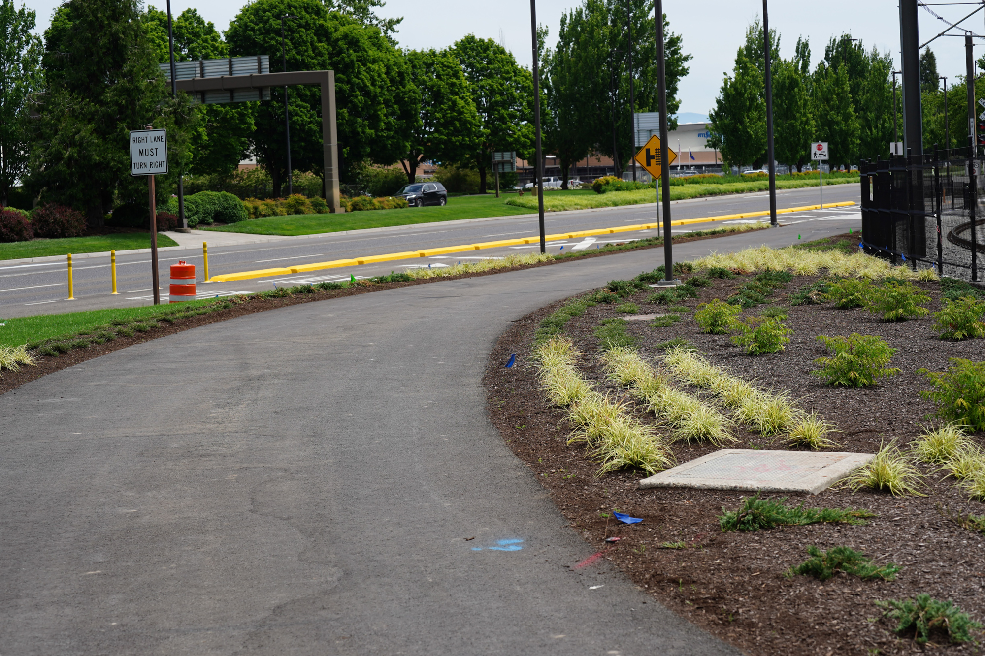
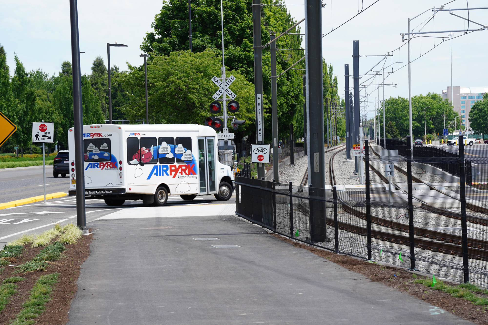
As I rode on NE Alderwood toward 82nd Ave, I wasn’t sure where the new path began. I relied on signage or other design cues that I hoped would make it obvious, but I was disappointed. After a few wrong turns near the intersection of 82nd and Air Cargo Rd, I got up onto the sidewalk to check a map and emails on my phone. Once I found it where the new path began, I crossed 82nd in a painted crosswalk, navigated a slip lane (there are two at this intersection), and made my way onto the sidewalk on the northeast corner of NE 82nd Ave and Air Cargo Rd. I headed northwest past wide, busy driveways of a gas station, mini-mart, and fast food outlets and eventually found the start of the path.
Directing bicycle riders onto a sidewalk (even if it’s wide) with busy driveways is no way to introduce them to a protected path. Hopefully TriMet/the Portland will add more signage (including pavement markings) to let riders know they are in the right place and let drivers know they are crossing an important regional bikeway.
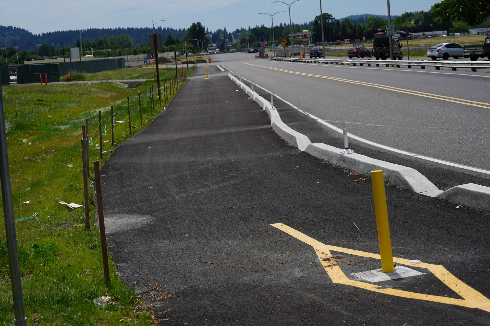
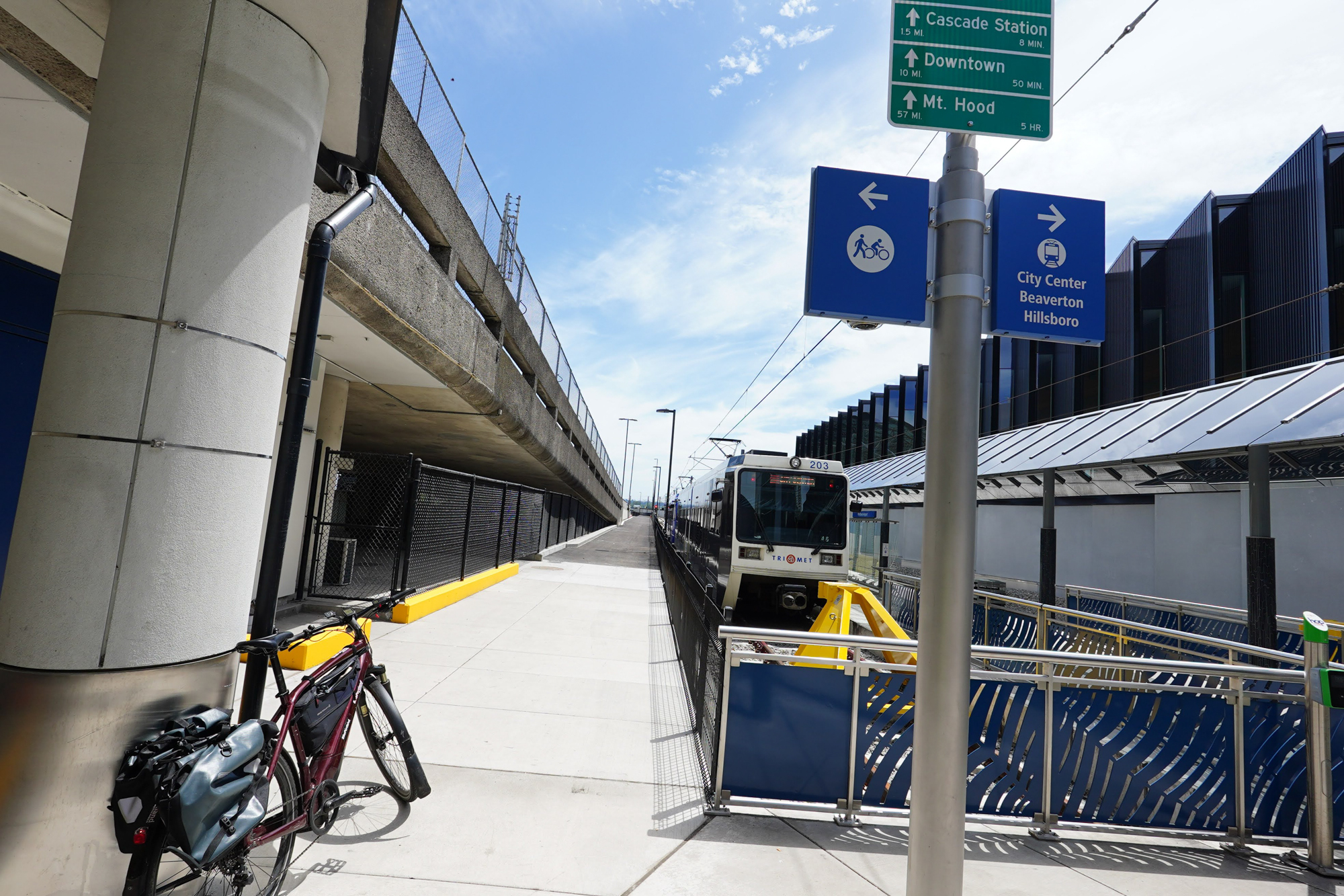
The path begins at NE Air Cargo Ct., a small but busy road that provides access to the PDX cell phone waiting area and rideshare driver parking lot. Again, more signage and perhaps an enhanced crossing is needed here to let drivers know this is more than just another crosswalk. Once I was finally on the new path, my blood pressure dropped and I could relax a bit. I looked up and saw a “PDX Terminal” bikeway network sign and knew I was in the right place.

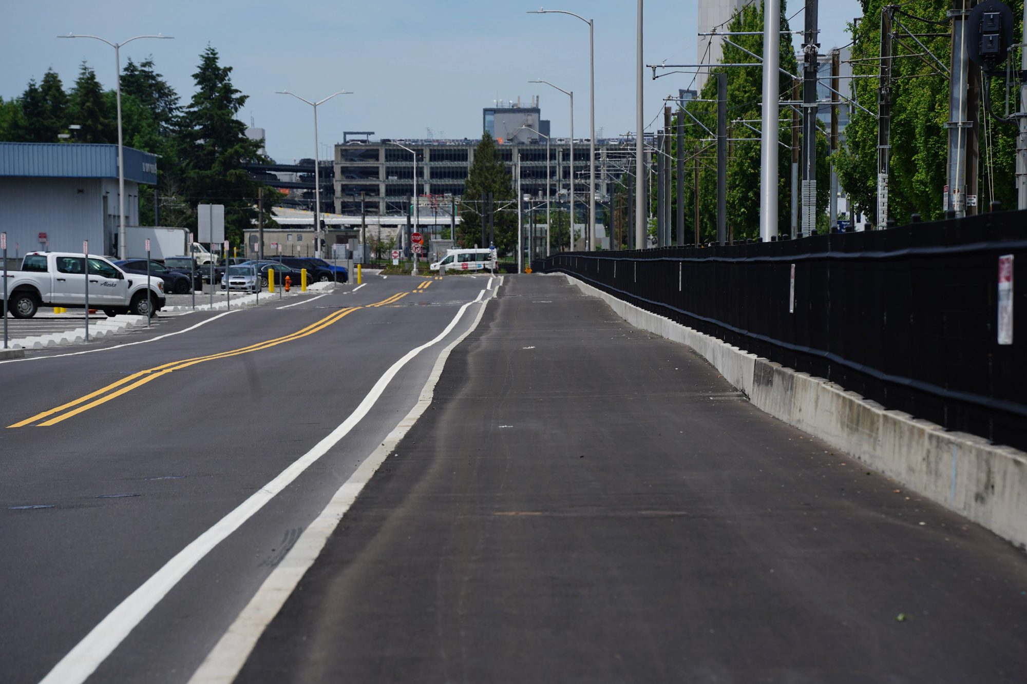
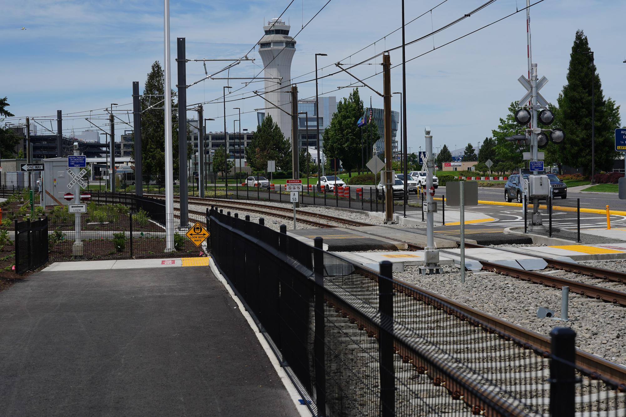
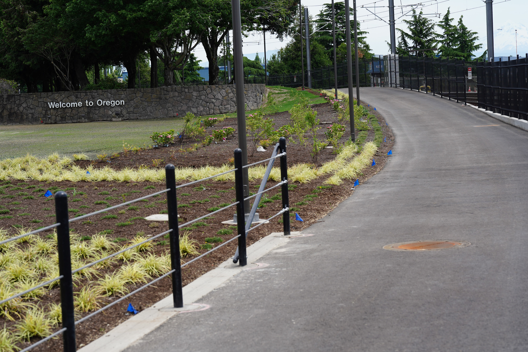
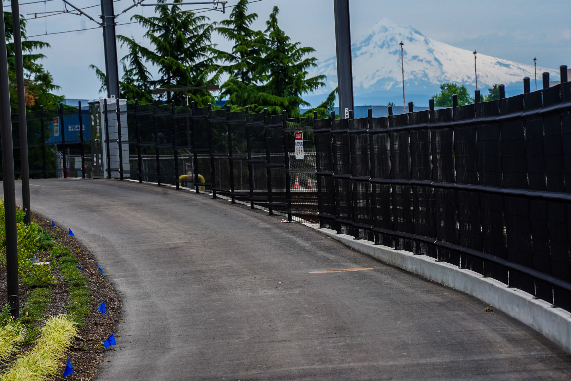
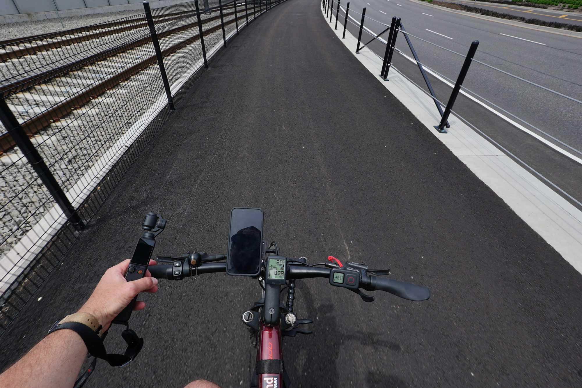
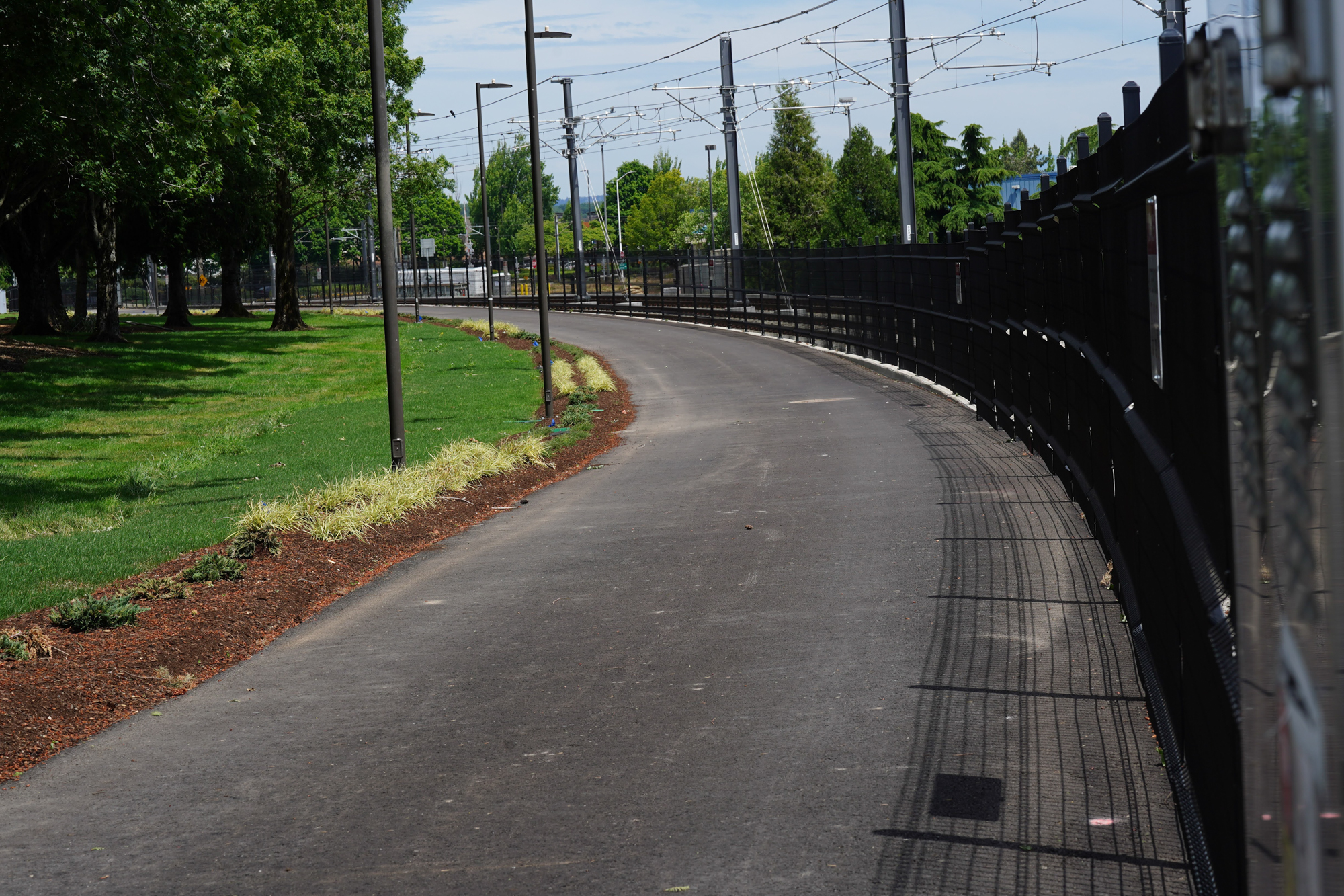
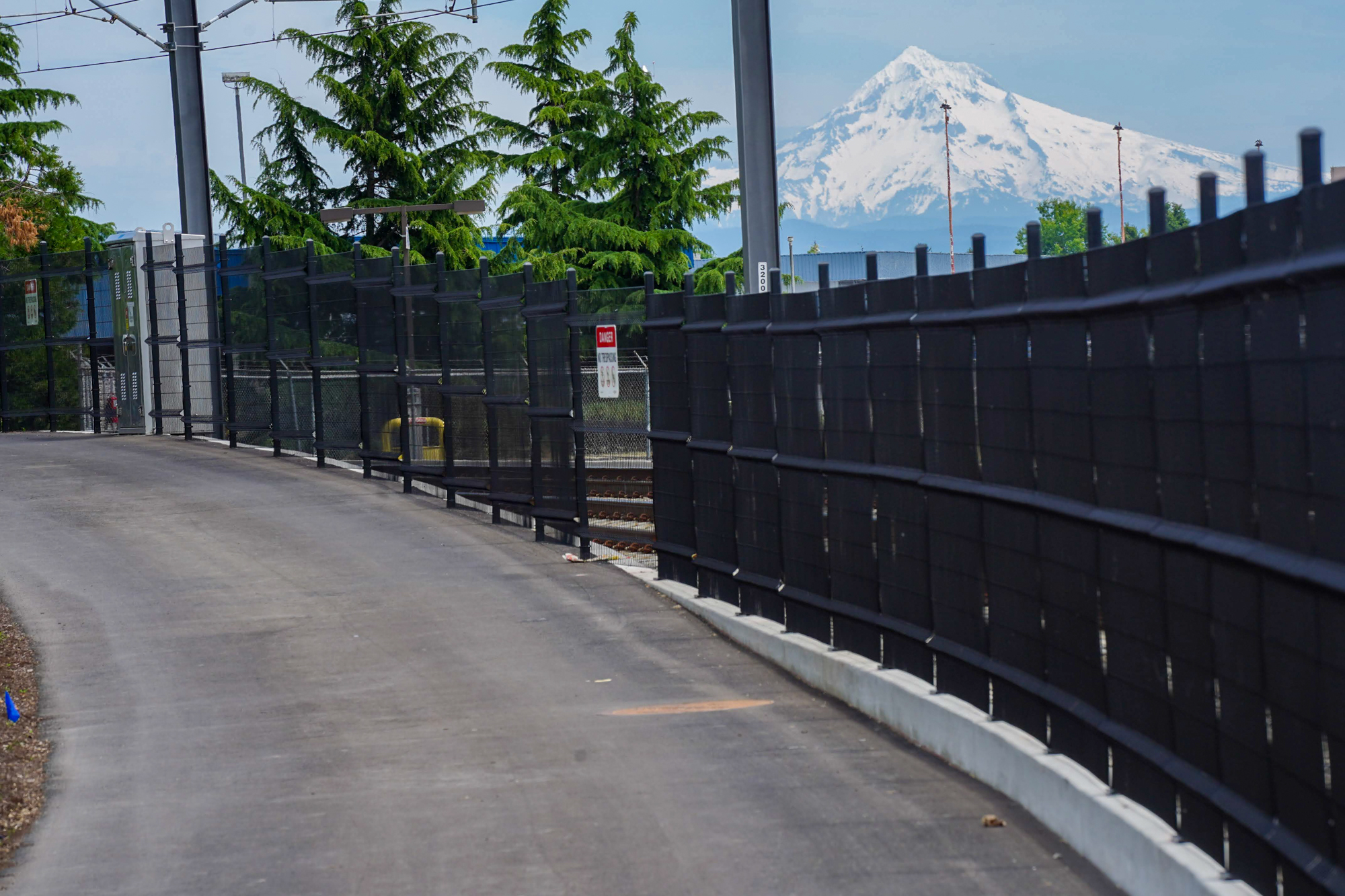
The new path is separated from other lanes via a standard curb. The width felt adequate at about 10-12 feet wide, although I was the only person out there so I couldn’t judge what it would be like with opposing bike traffic. A bit further north the path is directly adjacent to the MAX line and becomes an above-grade facility on its own raised track. About half-way on the path it crosses the MAX rails (“We really want to stress the importance of safety,” a TriMet official emailed me about the crossing). After the crossing is where the new path gets really nice. There’s a grove of trees (beyond the “Welcome to Oregon” sign and those wooden horses you’ve seen when you drive home from the airport) and grass. On one side you’ve got runways and airplanes next to light rail tracks, and on the other you’ve got the busy traffic lanes and the airport.
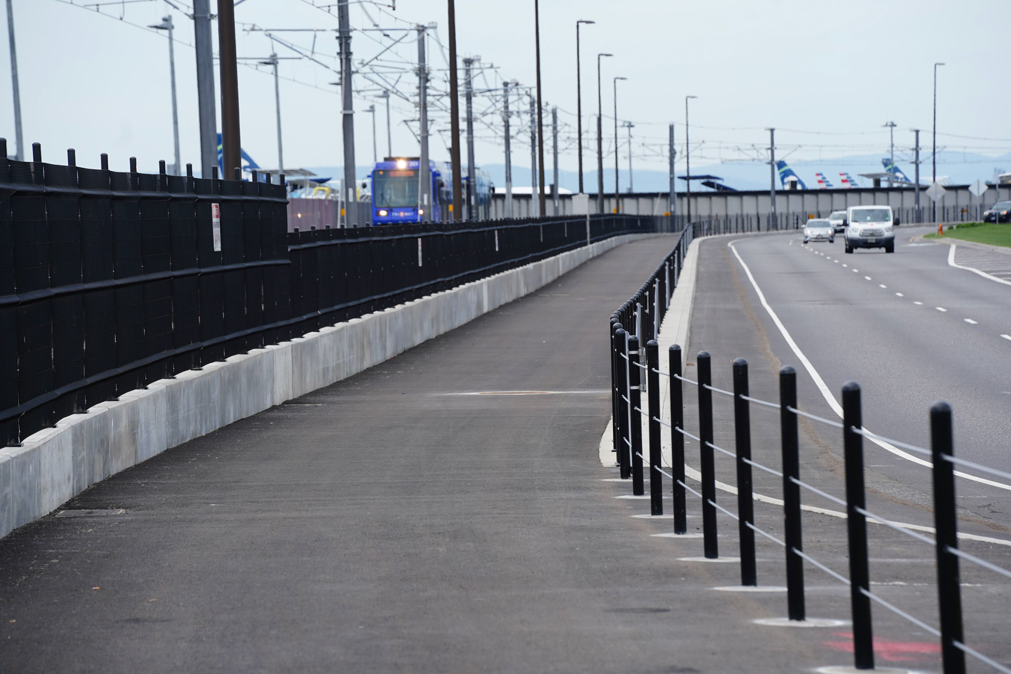
This final section of the path feels safe and separated and there’s a lot of interesting stuff to look at. The path is separated from multiple lanes of car users by heavy-duty steel posts and cables. Eventually the path ends into the airport MAX station. Just a few hundred yards away from the end of the path are a few bike corrals at a designated bike parking area. Keep in mind there are hundreds of employees at the Airport, so many of the users of this path will be shift workers. For travelers who need secure, long-term bike parking, the airport needs better options. There’s a gated bike parking area on the opposite side of the terminal, but I haven’t seen it for many years and I’m unsure of its status.
It’s also notable that the southern part of the new path veers away from the MAX tracks and Airport Way and instead goes along Air Cargo Rd and the new Travel Center development. That wasn’t the original plan. As you can see in the graphic above, the 2014 plan included a more direct route that would connect this new path to an existing path along Airport Way with a better connection to Cascade Station shopping center and other paths.
According to the Port, the 2014 recommendation is no longer in the plans. Port Media Relations Manager Allison Ferre told BikePortland they built the sidewalk on NE Air Cargo Rd with the intention that the new path would connect to it. As for why they chose to route the new path away from the MAX line along Airport Way, Ferre said, “The existing bike/pedestrian network converges at 82nd Ave and Air Cargo Rd, so the plan is to keep that as the focal point for practical and safety reasons (separate from vehicle traffic on Airport Way).”


If that’s the case, we must improve the 82nd Ave/Air Cargo Rd intersection. Currently it’s a mess (see above) and shows zero regard for bicycle travel. There are two slip lanes which add to the stress. It’s not enough to make islands of good bikeways when 95% of riders can’t swim.
Overall, this is a nice addition to the airport biking network and TriMet, Metro, and the Port should be applauded for making it happen! I can’t wait for the new path coming to NE Cornfoot Rd in 2026 and other improvements planned in the coming years. There’s no reason we can’t have safe and convenient bike connections to the airport from existing neighborhood bikeways in the Parkrose, Cully, and Woodlawn neighborhoods.


Awesome, now I can use a zero carbon and urbanist method of travel to get to the airport where I can blow my yearly carbon budget away with a single flight!
Kidding, just being too cynical. Once more path is built, this will be a nice additional way for employees to get there. Like you said, I couldn’t imagine leaving my bike there without secure storage, or possibly my least valued bike on a bike lock. Maybe a Biketown but it looks like you can’t leave a bike there.
The path looks nice, as far as it goes. I like the metal posts and cables, those should be used all over the place! I hope this continues to improve.
Recognizing that a single flight can emit more CO2e than a year of driving is absolutely not something to dismiss as cynicism. Climate shame is something that we should be feeling so that we can be motivated to make less destructive choices (e.g. commit to stop traveling by air or at least decrease our air travel).
Thanks for running this story, Jonathan.
I’ve biked this path a few times already, before it was officially open. I like it a lot. Definitely two thumbs up. As I’ve told Jonathan, this is the only really nice path that has been built in the City of Portland in the last couple years.
I typically bike to the airport with a suitcase or backpack, fly away, come back in 1 to 3 weeks. I do this about 6 times a year. This path saves about 5 minutes and a lot of hassle riding into the airport. It’s also pretty along the stretch where it’s separated from the roadway by a grove of trees.
I like the actual routing, along Air Cargo Road, better than the 2014 plan routing along Airport Way.
I think the connections at the east end are fine. You have a couple good choices —
go south on “Old 82nd Ave” to Alderwood (The road is marked at both ends “construction access only” but there hasn’t been anything but empty pavement for at least a yeargo south on the 82nd Ave of Roses to Alberta St. Nice shoulders the whole way (sidewalks the last block where the shoulders disappear) A 4 lane divided highway with almost zero traffic and nice shoulders. Totally underrated. go east across the 8nd Avenue of Roses to the existing bike path system that links up with Cascade Parkway, and from there north to Marine Dr on the “Wheels to Wings Trail” or east on Alderwood to the I-205 multiuse path.
The completion of this trail only leaves the connections between Columbia Blvd and Air Cargo Way as lacking bike friendly routing. But, a lot of people in this town can handle Cornfoot or the divided section of 82nd Ave without hesitation. It will be great when bike paths connect Columbia to Air Cargo Way, but that shouldn’t stop those of us who are comfortable on reasonable Portland streets from riding to the airport anytime.
Ted Buehler
Jonathan,
Who is responsible for Maintenance/Cleaning of these new paths? TriMet? Port of Portland? Other?
good question! I’m asking now and will let you know.
It has to be the Port. I highly doubt TriMet maintains anything outside of their property.
A few minutes ago, I added this route to Google Maps. Does anyone know anyone in Portland who edits Open Street Maps or Cycle OSM ?
Open street maps are Open in name and spirit. Sign up for an account and submit your edit immediately!
Well I guess this could be good but it seems like another big project that could work for many so long as they are like us, reasonably adept, stubborn and determined.
Even though many cyclists here are plenty savvy we seem to often have a low threshold for something like this.
As you pointed out it is hoped that signage, markings and ques will guide you but your instinct is often sidetracked by seemingly counterintuitive design that makes no sense from the saddle.
I often look at these projects and wonder if they are worth scouting just for fun and reference, they often are not even if I temper my expectations.
Bottom line is, what if an average or less cyclist decides to embark on this to get to PDX for a flight?
Without direct knowledge, extra time, the Force and some luck, they’ll likely miss it.
This is another example of getting it done without truly making it worthwhile for all.
They really need to cross over to the south side of Air Cargo Rd before the cell phone lot, so the path could continue south to Alderwood without having to cross 82nd at all. And anyone going to Cascade Station would have a slightly less busy crossing of 82nd on the south side. Eliminate the slip lane from Air Cargo Rd to 82nd and it would be decently safe and comfortable.
The connection in the 82nd/Air Cargo vicinity is pure junk.
It’s terrible and highlights the all-too-often Portland predicament of nice infrastructure with poor connectivity. If you’re leaving the airport by this path, and it ends as it does, abruptly and unceremoniously, where exactly have you been dropped into that would be considered a decently secure and safe bike route?
I’d imagine that most of those bikes at the airport arrived by Max.
Matt — The trick is to ignore the last 1/4 mile of this path. Just get on/off Air Cargo Road a few blocks west of the path terminus. From Air Cargo Road there is a nice sidewalk on the 82nd Ave of Roses on the west side. Once you get 1/2 mile south to Alderwood (no cross traffic, since it’s the airport runway) you’re back on a reasonably friendly street system into the Portland grid. Three options
1. Alderwood/Cornfoot/47th/42nd to the Holman Neighborhood Greenway
2. 82nd Ave of Roses southbound to Alberta St
3. Alderwood westbound to the I-205 path system.
Ted Buehler
Ted, thanks for the info and the video below.
For option 2, is that riding 82nd Ave south, past Columbia, until it curves to meet up with the short segment of 82nd from Killingsworth, and then riding on 82nd Ave for the few blocks to Alberta St.?
Currently, you can take a shortcut on Old 82d Ave from Air Cargo Road to Alderwood. It’s 80′ wide and doesn’t have any traffic on it.
It’s easy to spot on your bike, it’s called “Construction Access Only”.
I’ve ridden it plenty of times. If anyone does ask you to leave, just turn around and use the sidewalk instead.
South entrance to ‘Construction Access Only” Road
https://maps.app.goo.gl/dW4ZWNRg3VgegDf76
North entrance to “Construction Access Only” Road.
https://maps.app.goo.gl/8CYWsNnejWa58vD9A
Ted Buehler
This is way better than the old option using the north side of airport way. I walked to the airport this summer from my house in NE and had a very difficult time figuring out how to get across the intersection of 82nd and NE Airport Way. This is super cool.
I flew into Portland in 2021 and assembled my bike in the airport to begin a tour to Tillamook and down into California. I was so impressed that there was a bicycle assembly station in the terminal, but riding out of the airport was definitely sketchy, as we’re the first few miles of narrow road heading downtown. This sounds like a great start!
I didn’t find the old path and frontage road that bad, and it was always better than airports that bikes/peds couldn’t access at all.
Just goes to show if you remove a lane of traffic, throw up some post and cable you can have a lane for people and bikes in like 5 minutes. You don’t need a sidewalk. Just think 11-14 feet for people. Could do that across the saint John’s like tomorrow. Downtown Portland on the race track one ways?
Thanks for the report. Some secure bike parking would be great at the airport end. And a Biketown rack. It is funny that you mention the view of Mt. Hood, as the airport was originally designed so that when you would walk out of it, you would have a gigantic view of the mountain welcoming you here, but then….the parking garage was built blocking the view.
Nice piece of infrastructure. I was hoping it would run the entire length of the red line back to gateway. But that’s asking way too much, I suppose.
The path from pdx to gateway has been in place for a very long time. Take Cascades pkwy (busy but bike lane) down to ikea, take a right and then a left, and you’ll go under the freeway right to the 205 path. You can even detour through gateway green along the way.
Us bus riders at Parkrose TC are still waiting for those promised “Better Red” improvements we were supposed to get (better bus shelters and a reader board of arrival times).
Tick tock, tick tock
Looks intriguing but I’m not white ready to use the I-205 path again after some less than fun “experiences” there.
Cully to Alderwood is a better way to access this trail.
Yes, but Cully is tricky north of Killingsworth and Alderwood has no shoulder until Cornfoot. I recommend 42nd to Cornfoot as a nicer route.
Agreed, but Cornfoot has a rough surface and is fairly scary when there is significant traffic. I would nominate Cornfoot between 47th and Alderwood as a place that a bike lane would make a huge difference.
Message received: https://www.portland.gov/transportation/pbot-projects/construction/ne-cornfoot-road-corridor-improvements-47th-avenue
Wow, they actually built out the desire path I’ve been using for years. Love it. No more sketchy no-shoulder riding to leave the terminal with the flow of traffic.
Funny, after viewing the images my first thought was: Can we have curbs and metal posts on… any of our in-town bikeways? Please??
Also, it’s fun and easy to bike to the airport.
If you’ve never done it when flying, consider doing it for recreation sometime to learn how to get there. Then if you do want to do it when leaving town, you’ll know the route.
Amit and I led a ride to do this last summer. Amit made a very nice video documentary of the ride and route. We’ll probably do it again this summer with the new route.
https://www.youtube.com/watch?v=tH7SB1KWMDk
Ted Buehler