(Photos © J. Maus)
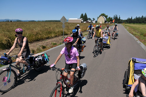
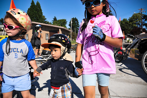
What would happen if eight adults and 12 kids (ranging in ages from just under four months to 14 years old) pedaled their bikes 41 miles from Portland — with bikes loaded full of food and camping-gear — to enjoy some summer camping?
This weekend my family and three others found out. And it was good.
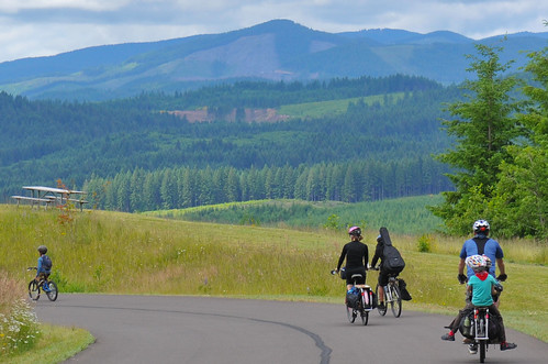
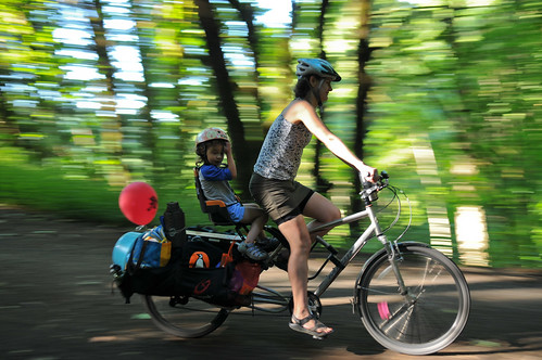
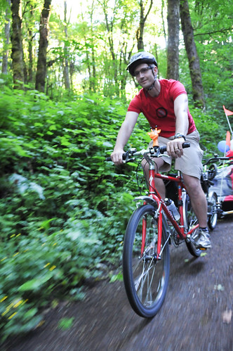
In something of a sequel to a trip we did back in 2009, our flotilla of 11 bikes (four Xtracycles, two tandems, three trailers, two tag-alongs and three single bikes) went up against narrow and high speed roads, steep hills, rude people in cars, and crying babies.
Not only did we live to tell about it, we had the time of our lives!
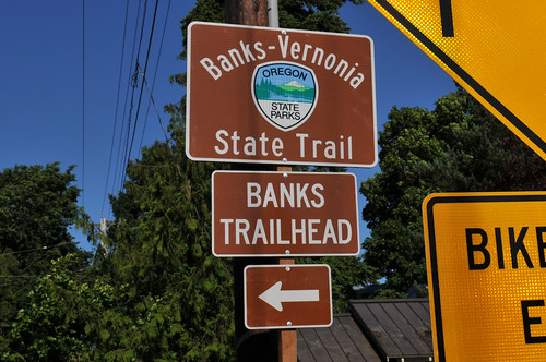
Our destination was Stub Stewart State Park, located about 18 miles northwest of Hillsboro. We chose that destination in large part because the park is located along the Banks-Vernonia State Trail, a 21-mile, award-winning paved trail that was just completed last fall.
But before we could experience the bliss of a carfree trail we had 30 miles of roads — and a major climb — to deal with.
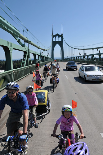
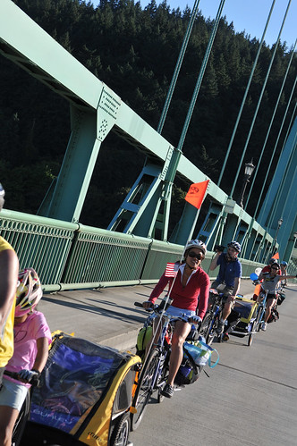
Taking a full lane on the St. Johns Bridge was a real treat. Despite a TriMet bus driver blaring on his loudspeaker, “The law says you must ride single file!” — we got over without incident.
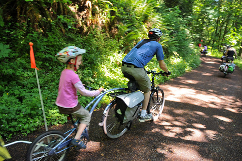
Next up was the Big Climb up and over the West Hills. Thanks to some route planning help from PBOT’s Jeff Smith and route guru Michael Wolfe, we decided to take NW Saltzman Road through Forest Park. Some members of the group were worried about riding a dirt and gravel road, but Saltzman turned out to be quite nice. It was shaded, had just a gradual incline, and most importantly, it was completely carfree.
Getting through the rural roads of Washington County was much less enjoyable.
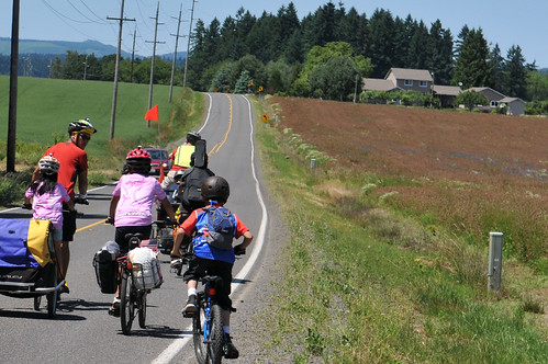
With a constant refrain of “car back, car back,” our group hugged the edge of the road on NW Springville and NW West Union Roads. We had one guy yell “Idiots!” and “This road isn’t made for family riding!” Unfortunately, I agree with his second point. It sure would be great if Washington County could either widen the roads to include a shoulder for bicycling, and/or enforce safe passing and slower motor vehicle speeds.
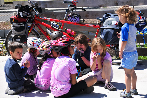
Eventually we made our way to the B-V trail head in Banks (after some painful rolling hills on Banks Road and a nerve-wracking crossing of Highway 26). After the stress of narrow roads, everyone was relieved to be on the trail. We took a well-deserved break for treats (with this many kids, treats are a must) and then rolled out.
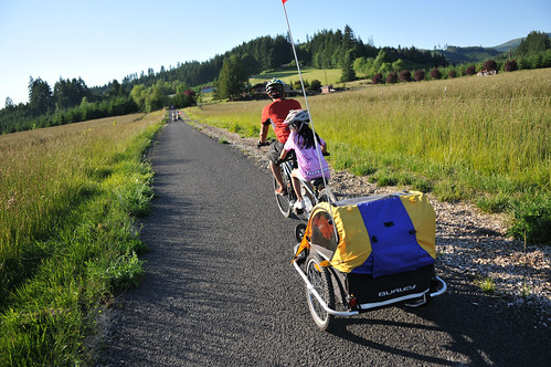
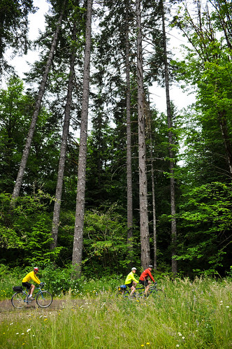
The trail heads due north from Banks, through farms and fields, then points upward. You can feel the air cool and see the trees thicken as farmlands are replaced by forest. Like a guest in a foreign land, the paved trail pierces swaths of deep green ferns and dense groves of timber. Tall trees stand like a fortress against the bright sun, letting only a fraction of its light through.
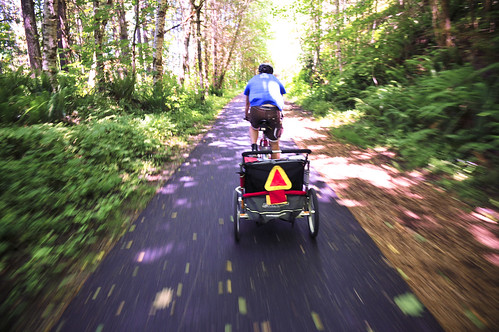
When we finally reached the state park, we were greeted with one last grueling climb up to our cabins (no tents for us this trip!), which just so happened to sit atop the park. It was a harsh way to end the day (perhaps they can build a more gradual bike path?), but the views, the setting sun, and a road lined with wildflowers helped brighten our moods.
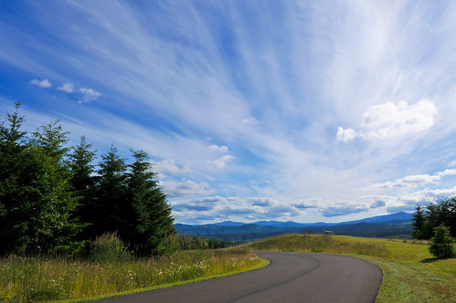
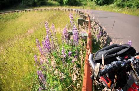
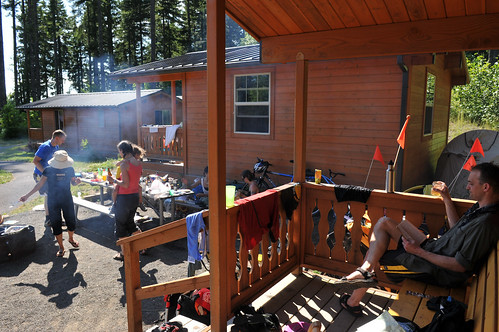
On Sunday, we saddled up and ventured north about 12 miles to the town of Vernonia. With completion of the B-V Trail and the presence of a state park, Vernonia seems on the cusp of something big. The newly completed B-V Trail and the growing mountain bike trail network at Stub Stewart could combine to give that town an economic boost it hasn’t seen since the timber boom.
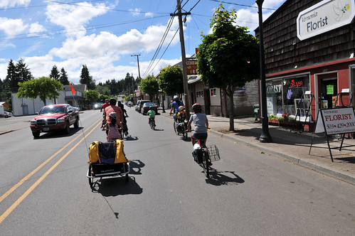
I was impressed with the crowds on the trail. Parking lots at the main trail heads were jam-packed — and so were parts of the trail. (On our way home, I counted 174 people on the trail from Stub Stewart to Banks.)
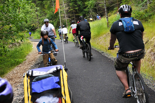
Many people who do this trip take the MAX train to downtown Hillsboro. From Hillsboro, it’s an easy pedal to the start of the B-V Trail in Banks. On our way home, we had someone who wanted to take the MAX back to Portland. The ride from Banks to Hillsboro — on scenic and nearly empty farm roads — turned out to be one of the highlights of the trip.
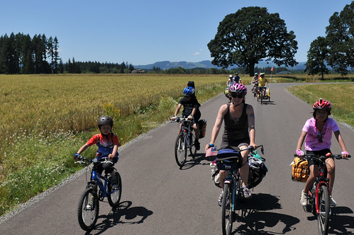
After Hillsboro, we weaved our way east on a combination of bike lanes and multi-use paths. The climb up and over NW Springville to Skyline was tough; but it was a bit easier given that we were lighter without several kids (five of them took MAX) and with less food in our bags.
The descent down Saltzman Road in Forest Park brought our only mechanical of the trip. A buckled front fender sheared three spokes off one rider’s front wheel (luckily, a few zip-ties sufficed as a quick fix). After Saltzman, we were treated to an inspiring ride across the St. Johns Bridge. Being the 4th of July holiday, traffic was minimal and we all soaked in the view and the feelings of accomplishment for an epic weekend of family riding.
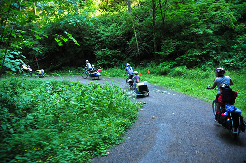
If you have questions about any aspect of the trip, I’m happy to answer them in the comments. Check out more photos in the gallery. You can see detailed maps of our routes both there and back via Ride With GPS.


Thanks for reading.
BikePortland has served this community with independent community journalism since 2005. We rely on subscriptions from readers like you to survive. Your financial support is vital in keeping this valuable resource alive and well.
Please subscribe today to strengthen and expand our work.
So was the big TriMet bus planning on sharing the lane with you? Hardly appropriate considering there was a whole other lane for him to use.
Also, he was wrong, you ARE allowed to ride two abreast, particularly in the interest of safety in this case (unless I have a gross misunderstanding of the law).
The Trimet incident is both amusing and typical. And regardless of the rules about riding two abreast (or not), it would be reasonable and legal on that four-laned bridge for even a single rider to take the middle of the outer lane, simply for safety, to avoid reckless people in cars squeezing by without moving over.
Professional driver, my – well, you know…
ODOT saw fit to deny the effort to include bike lanes on the bridge, although the lanes are extremely narrow ( 4x10feet) and congestion occurs at the end, not mid span. ODOT claimed and got exemption from Oregon Bike Bill requirements stating it was a repair job,not a new facility, and historical considerations.
The sidewalks on the bridge are narrow and with only slightly larger decks around the piers, are essentially unsafe facilities.
Taking the lane, especially with a larger group, longer bikes seems not only prudent, but the only safe option.
Those lanes on the St. Johns Bridge aren’t wide enough for a regular car to share with a cyclist, let alone a Tri-Met bus. Doubling up and taking the lane is the safest way to go, and it’s legal; the bus driver was a doosh.
I’m sure it is frustrating for the operator (they may be able to pass safely), but law enforcement is a Police responsibility
next time avoid west union and springville. G town west of the hills is pleasant and leads to lesser traffic’d roads out by C pass. then head through Helvetia and the foot hills to N Plains.
Great inspiration, Jonathan and company! I’d love to try that sometime with my own floatilla of families.
Happy Summer!
that last hill to the stub stewart cabins is part of what keeps me from going. if YOU think it’s “grueling,” i might just die!
Well, there are other camp sites lower down on the mountain… but if you get a cabin be prepared to climb. It’d be great if they made a paved bike trail separate from the road that had less of an incline.
The hike in sites are our favorites. Densely wooded, cool and with good separation. Also,usually plenty to choose from! And only a 1/4 mile from the entrance. Going with the neighbors this weekend in fact.
That might be difficult – the paved road is one of the easiest routes up that grade. Still, Stub Stewart isn’t entirely completed, and I’m sure something like that might be possible in a future phase of the park. Jonathan, you should talk to Alex Phillips and ask her to get you in touch with the park ranger for that park – perhaps you can get involved with the Master Plan for that park on the public input process. I’ll likely be involved representing Cycle Wild, but it’d be great to have input from family riders, since that park is ideal for them.
Hi Im Vic and I really enjoyed your big family bike trip blog!Im visiting Portland with my teen girls in late June, and we were thinking about skateboarding on part of the verona trail. Could you suggest some sections with easy downhills that are smooth enough for longboards that the girls and I might enjoy. That farm road to hillsboro with no traffic also looked fun. Directions would be great too. It looks so fabulouus! thanks, Vic Vaughan
Beautiful pictures and account of the getaway. Glad mother nature cooperated too.
MAX seems like a good option to avoid some of the terrible Washington County roads. Seems like Riding from the east side to Sunset TC via the Washington Park would be safer. It’s too bad they can’t use some of the ROW adjacent to the west side MAX line and put in a sweet MUP.
technically, extracycles, tandems, trailers and other long rigs aren’t allowed on the MAX
Been taking about taking my kid bike-camping at Stub this summer, though I’d take a much different (and more pleasant) route between Portland and the Banks-Vernonia Trail.
For those comfortable riding on dirt, Boomscooter or Hares Canyon Trails might provide a slightly less grueling (though longer) final climb than the brutal park road.
Glad it was fun, and I suppose the upside of being highly visible on busy roads is that maybe you opened a few eyes to what’s possible.
Awesome trip. I was bike touring out that way as well, from Hillsboro MAX way up the Tualatin River, and then all around the vineyard area and Newberg, and back to PDX via Champoeg, Canby, and Oregon City. Beautiful weekend for those open roads!
I just took the opportunity to write an email to Washington County Transportation to encourage them to focus improvements on West Union and other important ‘escape routes’ for cyclists. It is so frustrating to carefully pick your routes to avoid traffic just to be yelled at by drivers. I ride this route all the time and it’s hard to believe the county hasn’t recognized how urgent the need is to improve safety for riders on these handful of roads.
I think one reason the county isn’t aware is that they have no bike/ped advisory committee like greater Portland’s other 2 counties. Hal Ballard, Jim Parsons and others have been working to change that, but if you’re a Washington County resident, they need your help! If a number of citizens keep asking for it at county commissioner meetings, perhaps they’ll make one. County budgets are pretty strapped, though – and that’s a major reason why WashCo doesn’t have a bike/ped committee – it costs staff time to have a transportation member on the committee to receive input, answer the advisory committee’s questions, and prepare materials for their review and input.
These challenges are going to continue to get more difficult until and unless the economy improves. (or at least the budgetary situation) Continued input given to the county commissioners is likely the best way to get something done. (but be polite) The squeaky wheel in local politics usually gets the grease – if that wheel is polite, professional, and reasonably articulate. Bonus points if you can make *your* point without bashing any other group, the commissioners, or county staff.
Can’t wait until next summer when our little one is old enough to put on a bike. Beautiful photos Jonathan.
Washington County: 10 years ago I attended a design review meeting for the rural road improvement near my home. I commented in regards to lowering the speed limit to 35 from 45 and was rebuked by the County representative. He said lowering the speed limit would not slow down drivers if the road was built to go faster. As it turns out, he was right. The posted speed is 45 and too many drivers go 55+. In fact, a lot of them are going as fast as they can get there vehicle to go. I’m positive that some of them are going 80 or 90mph (no exaggeration).
Glad you had a good time! Very nice pictures.
The law might tell you to ride single file on the St Johns bridge but it also lets you take the lane. I wonder if your friendly TriMet
… Driver would prefer that? (grrr hit submit by accident)
It’s gray area (when the lane is too narrow to safely share – especially with a bus) as to whether it is legal or not to ride two abreast with the extra lane of travel in the same direction. I contend that it is safer and therefore defensible in court (not that I’m a lawyer!).
http://bikeportland.org/2011/06/07/bike-law-101-riding-two-abreast-54334
Awesome! Thanks for sharing Jonathan!
Was the TriMet driver correct, or is it ok to ride two abreast? I admire your chutzpah!
It is okay, provided you are not impeding traffic. Since there is an available lane (and I’m assuming traffic was light), the vehicles could easily pass the group using the left lane.
I missed all the comments prior – sorry to ask a redundant question! But yes, that bridge is quite tight. Keep up the good work!
looks like an excellent little get away.
i too have flipped a burley with my child inside. she was fine (strapped in, helmet but no head impact), but i felt completely horrible about it. i didn’t think i was riding haphazardly at all, but it happened. the Solo is a lot more inclined to flip than the ‘double wides’ – especially if you are used to the wider ones..
as for the St John’s.. given the speed that drivers take on that bridge, i have never felt comfortable taking the lane, as i am usually solo. in a group it would be a different story. the sidewalk isn’t much safer – watch out for those bus rear view mirrors as they definitely drift into sidewalk airspace.
i took my daughter out to Stubb last fall on the cargo bike. just the two of us and it was great. took the max to hilly-b first, and she still got way bored on the ride. i am thinking a Bike Friday tandem would be great to give her something to do!
yeah Jonathan, how’d he end up doing a flip?
We were riding on NW Springville in a section near PCC Rock Creek. I noticed some white plastic bollards a little too late (there was a train of people ahead of me). I tried to avoid the bollard, but one of them snagged on the trailer and over it went.
It bugged me because the bollards are white, the same color as the lane striping! and they are placed a few inches inside the shoulder… as opposed to outside the shoulder. Seems to me you’d rather have people hit them with their cars than with their bikes right?
A certain politician is going to jump on this, you know. 🙂 Glad he’s ok (as I would have expected). Looks like it was a lot of fun. Reminds me of some short tours that Mrs Dibbly & I did in North Florida with some close friends some years back.
Jonathone Maus wrote: Seems to me you’d rather have people hit them with their cars than with their bikes right?
How about a stripe on each side of the bollards, like a double line for “Do Not Cross!”
Sounds good, but it would have to be approved for inclusion into the next revision of the MUTCD. While Portland is pretty cavalier about experimental changes to drive change at the federal level, the counties are not – unapproved treatments can possibly open up the county to legal action in the event of injury.
The lwa alos says the speed limit is 35 mph on the St Johns Bridge but only 1 in 10 (at most) motorists obey that.
Cool story Jonathan!
Is Satlzman rideable with a roadbike using 25mm tires? I like its proximity to the St. Johns bridge and would love to add it to my list of routes. I’ve never thought of riding up it before.
yes. 25mm tires would be fine on Saltzman. Just tread lightly.
Saltzman is fine on 23’s too. one of the best climbs in town, 7-10% for 1000 ft. its better when its dry as it gets muddy in the winter.
Scroom!
Sorry. That was supposed to be a reply to BURR who pointed out that long bikes, etc, aren’t technically allowed on MAX
next time, to avoid having to cross Hwy 26, rather than taking the right on Mountaindale Rd, take the left (Dersham Rd), right on Harrington, (flush toilets at St Francis Church in Roy), X Roy Rd, bc Wilkesboro, at the end turn R onto Hwy 47 into Banks.
Cornelius-Schefflin has nice wide shoulders, but it is probably south of where you want to ride.
That was the route that I described to Jonathan. Much better not to cross US 26 at grade.
this routing also avoids those soul-sucking rollers on Banks Rd.
Great report Jonathan. But it sounds too daunting especially with older children (8-12) riding their own bicycles.
The tri-counties could really double down on their infrastructure and tourism investments if they created safe/connected routes for casual cyclists.
We’ll be trying out Barton Park later this summer and will let you know how it goes.
Hey Dan.
I’m going to post a follow-up story with more thoughts and details. It was too long to share the photos and the basic narrative all in one post.
I regret that it makes it sound too daunting. It’s really easy to change the route to less stressful roads… and even the route we took, while stressed at times, was overall very cool. None of the young ones on bikes (ages 9, 12 and 14 I think) ever even had a close call or a stressful moment. Your boys would have been fine.
Your older boys would do great, Dan. Carter is 8; and rode a 20in 6 gear bike. I had lots of apprehension, but I knew he was fine once I saw him riding confidently up Saltzman. My biggest concern was not going up but down and making sure that he wasn’t going too fast or out of control. The two older boys led the way up Saltzman as well as on the trail to Stub Stewart. In total, the children riding their own bikes rode about 85 miles even with taking the Max back to Portland. Not a single complaint of being being tired.
We did benefit from being in a group of experienced riders that took any challenges in stride (e.g., Banks Rd). I also appreciated the fact that Jonathan briefed us on any potential difficulties so we could mentally prepare. With such a large group, I was amazed at how quickly everyone fell into single file formation at a drop of “car back”.
Glad the trip went well, Jonnathan. That’s exactly what I wanted to try to do this year with Cycle Wild – have a family-friendly trip, but it’s far more effective when organized with someone who has a family. Glad the trip went well overall and thanks for sharing your experience!
and I apparently can’t spell anyone’s name correctly today – %^&%# typos.
Hi There,
I might be going camping there next weekend. Do you have a map of the route you took by any chance? I would like to do the same!.Thanks!
I’m thinking about a bike-camping trip with my child this summer to one of the closer campgrounds (Stub, Champoeg, Milo McIver, Metzler or Barton). But of course this time of year most of the reservable tent sites (let alone cabins!) are already taken.
Does anyone know if any of these parks has the ability (i.e., overflow or walk-in/bike-in sites that rarely fill up) to accommodate folks on bikes who’ve arrived without a reservation during the peak summer period?
I can’t make the trek out to one of these campgrounds (especially with a kiddo) if there’s a significant risk of being turned away. In a car you can always try the next campground or hit a dispersed area of the national forest, but often not a reasonable+safe option if you’ve arrived by bike.
Nice! Looks like a great trip. A bit longer than what we did a couple weekends ago here in Eugene but we had a bigger group and wanted our first ride to be ‘close to home’.
here’s the ride report from that trip:
http://eugenesrts.org/news/kidical-mass-camping-a-great-time
All the families had such a great time we’re already talking about our next family bike camping trip!
@GlowBoy – we have had great luck using the hiker-biker sites in state campgrounds. In Washington state, we have several times been put into regular sites they have held back for just that purpose, where they did not have a formal hiker-biker area.
I think they are well aware of the travel limitations we have and try very hard to take care of bike touring riders.
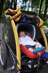
I am interested in your car seat trailer set up for your 4 month old. Can you elaborate on how you secured it in there?
Thanks Bikesalot … after more research it looks like the SP campgrounds I’m looking at (Stub, Champoeg and McIver) all have separate hiker-biker sections with plenty of spaces that rarely fill up. So it sounds like I could head out to any of those places on a busy summer weekend without worry. Cool.
Wow. I’m impressed. The kids were real troopers, as were the adults.
I am interested in traveling to Stub. We are tent camping and intend to take the Max to the end of the line. What is the calmest route to tent camping, mostly no traffic means of getting to the camp site? Is there showers available for tent campers if you are in the basic tent camping area? Is there a more full facility with showers and other comforts if you want that? I would just walk over as needed and stay in a basic $10 site if we could
Hike-in tent sites start at $10, and there is access to showers. The park also offers other tent sites and cabins. Pricing varies by time of year. More information can be found here: http://www.oregonstateparks.org/park_255.php.
One thing about the Primitive/Overflow Hike-in sites: they are located WAY down the hill well below the ranger station. It is a pretty good climb up to the regular camping areas where the showers would be located. I have not been in there since the year Stub opened, but at that point they were IMO the most attractive spot for camping. Most everything else was pretty much out in the open without any shade trees around.
I ride through the Park every month year-around, but the hill is steep enough everywhere that I tend to stay on the trail and do my camping out around Vernonia.
Your comment about the “nerve-wracking crossing of Highway 26” has made my wife too nervous to complete this trip via max to the trailhead with our two kids. Any chance someone might elaborate on how to cross this deathly dangerous highway with a family in tow? oh my!
No need to cross Hwy 26 near Mountaindale. Ride up from Hillsboro to Banks through Roy, go to the trailhead of the State Trail on the north edge of Banks, and take the Trail UNDER Hwy 26. Problem solved!
Using Hillsboro assumes you took Max out to the end of the line. If you are coming from the north, cross Hwy 26 anywhere east of Mountaindale, get to Roy and proceed as above.
What a great story. Taking those kids on a long trip like that bike must have been very fun for them (and everyone else).
What did you use in your trailer for the 4 month old? I never saw anything like that but it seems more sturdy than the snuggler they sell. And how did you safely get it to stay in there?