🚨 Please note: BikePortland is currently on hiatus and only publishing guest articles. Learn more here. Thank you. - Jonathan 🙏

Advocates line up to support singletrack in Metro parcels north of Forest Park

tualatinlead

Detail of Metro trail proposal shown back in May.

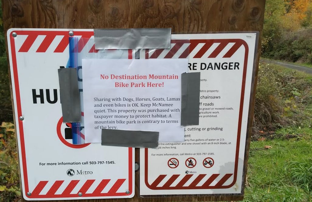
If all goes according to their plans, Metro could build about a dozen miles of new biking trails in the North Tualatin Mountains Natural Area, a 1,300 acre section of hills just north of Forest Park. The agency will unveil their recommendation for where trails should be built and who should be allowed to use them at a meeting tomorrow night (11/17).

If the trails in this plan get built, they will represent the most comprehensive network of singletrack (made for cycling) in the history of Portland.

Metro used a voter-approved levy to purchase four parcels off NW McNamee and Skyline Roads and has spent the last year in a planning process to decide how to manage public access. The stakes are high because the new trails will be built a mere 12 miles from north Portland — far closer than any other similar riding opportunities in the region. The land is currently undeveloped with only rudimentary dirt roads running through it.

Read more

First look at ODOT’s draft of a new biking and walking plan

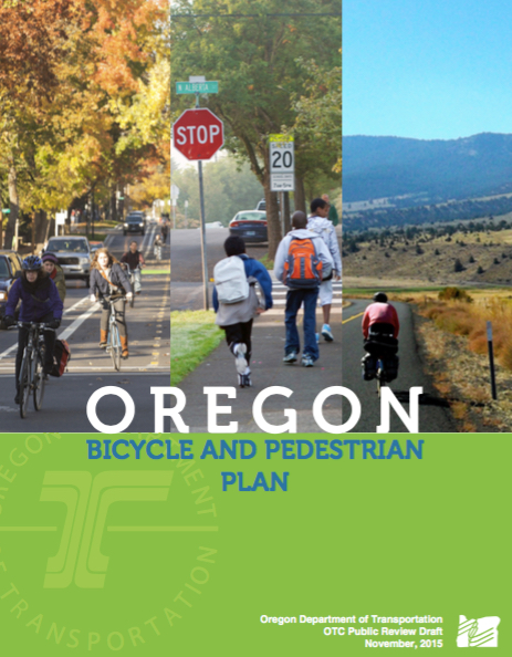
plancover

Plan cover.

The Oregon Department of Transportation has released a draft of their new Bicycle and Pedestrian Plan.

This plan is the result of two and-a-half years of meetings and outreach and it’s the first time ODOT has updated its biking and walking plan since 1995 (an update to their design guide in 2011 notwithstanding). It’s a crucial document because the policies and strategies in this plan will set the framework for what ODOT decides to build going forward.

A coalition of transportation advocates that includes the Bicycle Transportation Alliance, Oregon Walks, the Sustainable Transportation Council, the Oregon chapter of the Safe Routes to School National Partnership, and two members of the plan’s own advisory committee have already penned a letter to ODOT with their concerns about the plan.

We’ll be taking a closer look at the plan in the coming weeks. At first glance it appears to be a solid start, but could use some strenthening in order to make a real impact.

Read more

bikeportland search function

Buffered Bike Lane with a bike symbol and arrow pointing forward

I use (used) this a lot. Like the ability to explore archived conversations. The old version was not great; the new version is so terrible it is almost worse than no search function (sorry to be so blunt). Folks have made some suggestions for how to piggy back onto google to search this site:

Suggestions for bikeportland

Suggestions for bikeportland

But I would like to think that there would be a (fairly straightforward/free?) way to upgrade the internal search function here so that we could get back at least to the level of service (LOS) we had before the recent switch.

Thanks very much!

Grant Petersen at Rivelo

Rivendell Bicycle Works founder, Grant Petersen, will be the special guest at our holiday open house on Saturday, December 5, from 1PM until 5PM.

Come by for some egg nog, cheese, and cookies.

Our logical, but not legal, address is 401 SE Caruthers St, Suite 103. We’re at the corner of SE Water Ave and Tilikum Crossing in the reddish building with the glass roll-up doors.

The Monday Roundup: German scofflaws, winter tips, John Wayne threat, and more

download this area

Click to download.
(Image: Google Maps)

This week’s Monday Roundup is brought to you by Cascadia Ciderworks United, makers of fine cider made right here in Portland.

Here are the bike-related links from around the world that caught our eyes this week:

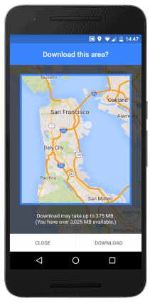
Offline maps: Google Maps can now pre-download maps of areas you plan to journey.

John Wayne Trail threat: A major biking path in eastern Washington is under threat because two state reps are taking “concerns of adjacent landowners” way too seriously. (More details.)

Tips and tricks: To stay safe at night this winter, convince your city to stripe narrower traffic lanes and install speed cameras. Wouldn’t it be nice if more news outlets at least mentioned this alongside lights and reflectors?

Beyoncé on a bike: GearJunkie aims for a balanced exploration of whether and when an image of a woman on a bicycle goes from sexy to sexist.

Read more

City applies for funding of Flanders bikeway bridge, 70s Bikeway, and more

redelectric

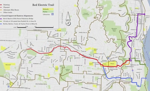
The Red Electric Trail, a dream for southwest neighborhood activists, could get over $600,000 in funding if a city grant request comes through.

City Council voted 5-0 yesterday to authorize grant applications for five major bikeway projects. The $9 million in grant requests would help the Bureau of Transportation fund a host of key projects, some of which have languished on lists and in the hearts of advocates for many years.

Read more

City ponders new bike lane striping design for N Interstate Ave

Buffered Bike Lane with a bike symbol and arrow pointing forward
interstatetillamooklead

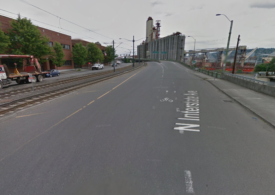
Looking southbound on Interstate at Tillamook, about to enter 315 feet of traffic “free for all.”
(Photo © J. Maus/BikePortland)

Anyone who rides south on North Interstate Avenue between Tillamook and the Broadway Bridge/Larrabee split can understand why the Bureau of Transportation wants to re-stripe it.

Read more

‘Families for Safe Streets’ to launch Sunday on national day of remembrance

Powell protest ride-55.jpg

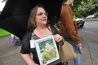
Kristi Finney at a protest on Powell Blvd in May.
(Photo © J. Maus/BikePortland)

A new organization for people whose lives have been changed by traffic violence will hold its first public event this weekend.

As part of the World Day of Rememberance for Road Traffic Victims, members and supporters of Oregon and Southwest Washington Families for Safe Streets will meet noon Sunday at 1805 NE 2nd Ave. in Portland, the headquarters of Oregon Walks and the Community Cycling Center. Anyone is welcome.

From there, they’ll meet for fellowship and then break into carpools and bike trains “to place memorials at crash sites along high crash corridors to build awareness and honor those who’ve died.” The group hosted an event this week where volunteers cut out cardboard in the shape of humans.

Read more

Taking the pulse: Aggressive driving in Portland

Riding Portland's urban highways-37

What’s going on out there?
(Photo © J. Maus/BikePortland)

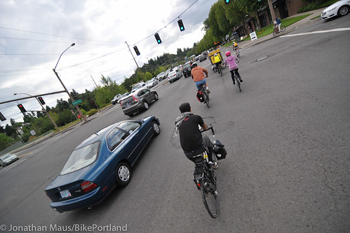
Part of my job is to monitor various sources of information. As I do that, trends often start to emerge. Recently I’ve sensed an uptick in chatter about how “aggressive driving is getting worse in Portland.” I’ve also heard of a few specific incidents just in the last day or so.

I’m putting this on the Front Page to hear more from you and gain more understanding about whether or not aggressive driving is indeed on the rise or if these are isolated incidents that don’t point to a larger trend.

Read more

John Wayne Pioneer Trail needs your written support!

Buffered Bike Lane with a bike symbol and arrow pointing forward

The John Wayne Pioneer Trail (JWPT), of which Iron Horse State Park is one part, needs the support of anyone who might enjoy riding it on a bike, or other non-motorized use. In case you haven’t heard, it’s a rails-to-trails project that runs more than 200 miles from North Bend to Tekoa, Washington, a mile from the Idaho border. Seattle to North Bend isn’t formally part of the JWPT but there are good bike routes (plural) to the trailhead, with bike connections from the King Street Amtrak station. The JWPT itself includes crossing the Cascades, the 2.3 mile Snoqualmie Tunnel, upper Yakima River, arid shrub-steppe hills, Columbia River, Channeled Scablands, and the Palouse Hills. The western part of the JWPT is already in use but parts of it are still in primitive condition. There has been an attempt to give part of the eastern right-of-way over to local land owners, which would stop public access. Positive, friendly words explaining how bike tourists bring money to rural communities, and how we are respectful users and neighbors, will go a long way to bolstering support to retain the trail. Out-of-state writers are great; they show the scope of interest and potential tourism customers.

Tom Fucoloro has more information, including public meeting dates and locations as well as some of the back-story, in this post:

http://www.seattlebikeblog.com/2015/11/09/road-trip-to-save-our-states-longest-trail-three-meetings-this-month/#comments
Ellensburg is the closest hearing location to Portland. Those of us who can’t make a meeting, please consider sending your words of support to jwtcomments@gmail.com.

History and photos by a horse-drawn wagon association here:

http://www.jwpwr.org/
General info:

https://en.wikipedia.org/wiki/John_Wayne_Pioneer_Trail