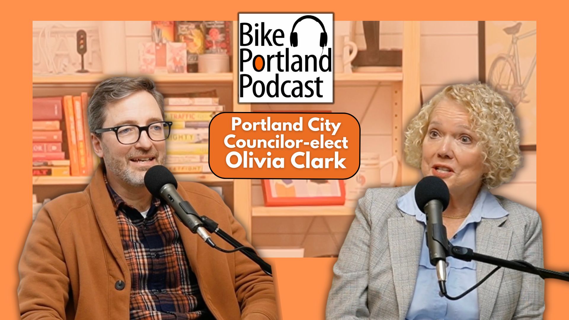
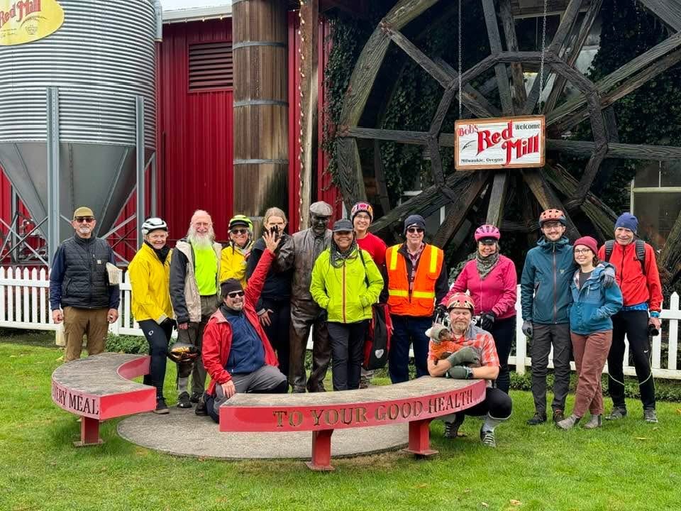
Allow me to break into the holiday week with the latest interview from The Shed.
On Friday, Portland City Councilor-Elect Olivia Clark came by and we had a wide-ranging conversation. Clark was the top vote-getter in District 4 (everything west of the Willamette River and a small piece of southeast including Sellwood) and has a good shot at becoming City Council president. Why? Her background is very impressive. It includes: founding of an affordable housing nonprofit in the 1980s that focused on farmworker housing; leading legislative affairs for former Oregon Governor John Kitzhaber; being board chair of Providence Health Systems, then working as TriMet’s executive director of government and public affairs for over two decades. During her time at TriMet her job was to secure funding for the Orange Line MAX project and she’s credited for helping fund the Tilikum Bridge.
(Photo: Jonathan Maus/BikePortland)
During our conversation we talked about how to revitalize downtown Portland, how to approach transportation funding, why Clark thinks Seattle is going to outperform Portland in transit unless we find another stable revenue source, and more.
Find the interview in the players above, on YouTube, or wherever you get your podcasts.
NOTE: Today is my daughter’s birthday (she’s 22 years old) and then we’ve got that Christmas thing on Wednesday. So I’m taking a break this week and likely won’t be posting anything further until Monday, December 30th. Have a great week and I’ll see you on the other side.
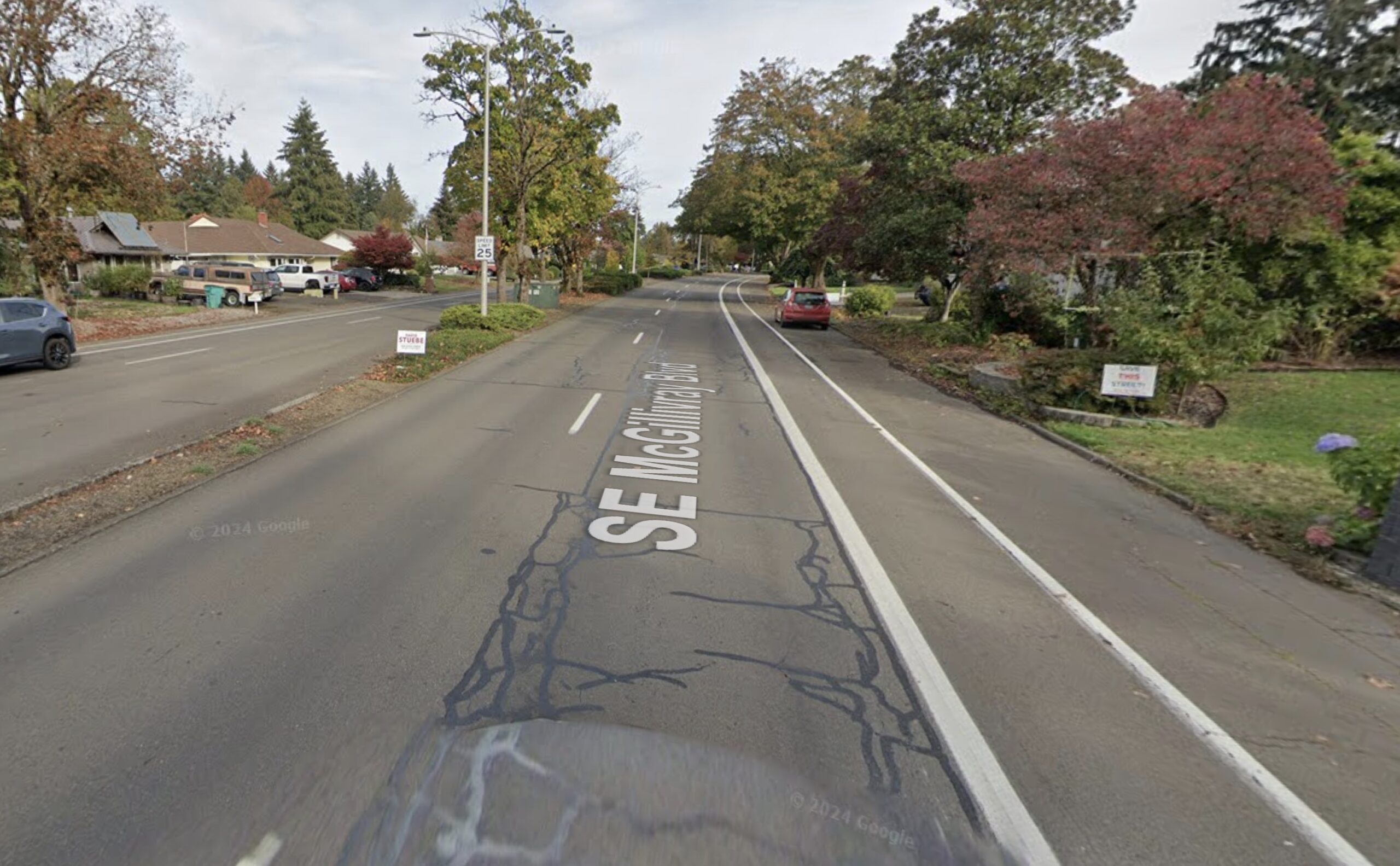
SE McGillivray Boulevard in Vancouver. Note the “Save This Street!” sign on the right.
Transportation politics in Vancouver, Washington got a little more interesting earlier this month when a group of grassroots activists turned in enough signatures to move their “Save our Streets” petition forward. Volunteers gathered 6,572 signatures (2,300 more than they needed) to support their goal to amend Vancouver Municipal Code to state that an election of the people must take place before the city can move forward on any project that reduces driving lanes and converts them to other uses.
“If passed, any changes to traffic lanes that result in the loss of a lane for vehicle travel will have to be approved by a majority of voters in Vancouver,” reports The Columbian.
The signatures are a huge victory for “Save Our Streets,” the group behind the petition, but they haven’t accomplished their goal just yet. In an interview with BikePortland today, Vancouver City Council Member Ty Stober explained how the initiative must still be validated by the city clerk. Whether it ultimately passes or not, Stober said the entire episode illustrates how difficult it can be to accept change.
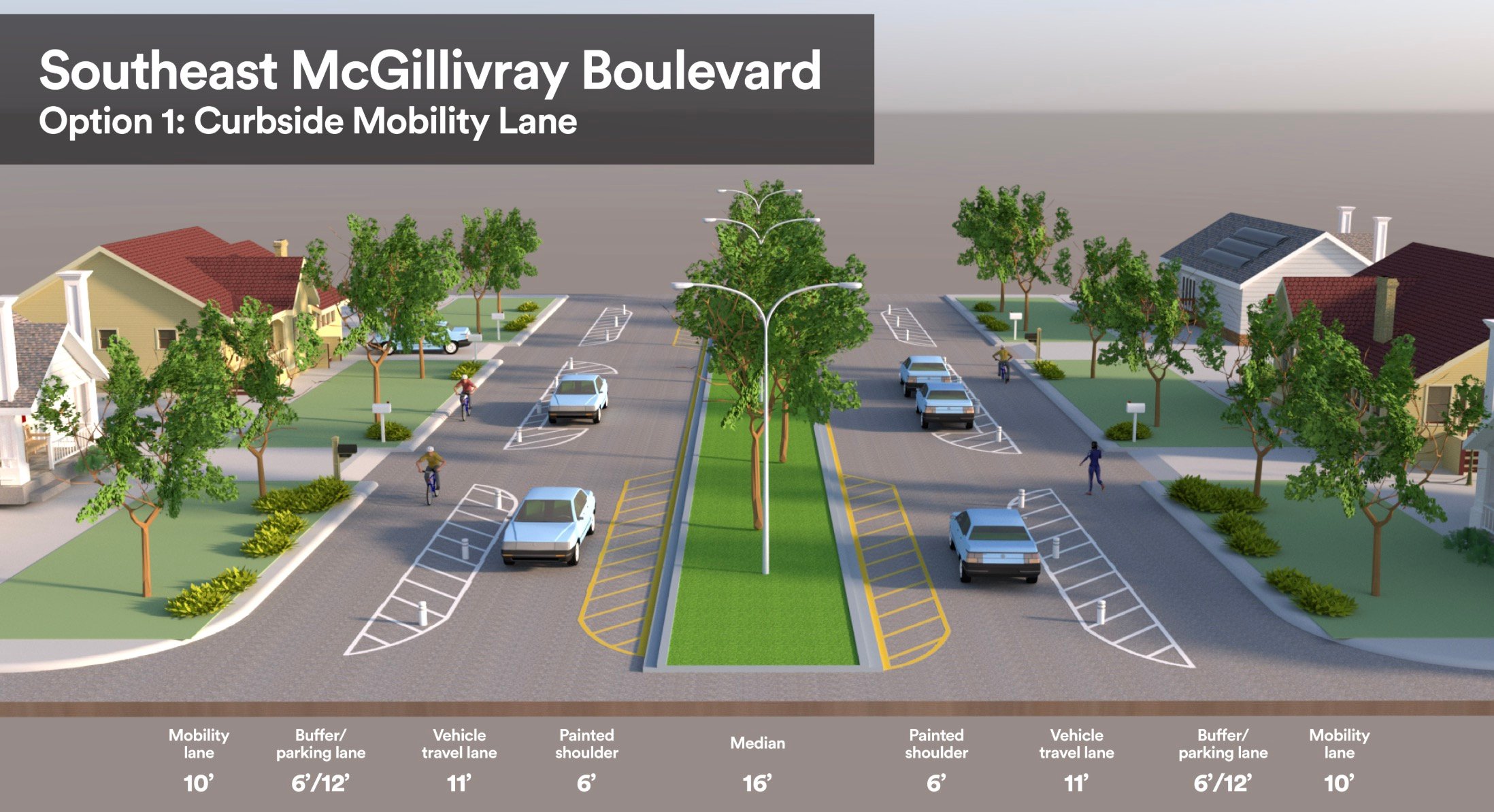
City of Vancouver Design Option #1.
Save our Streets has pushed back on the City of Vancouver’s Complete Streets Program, which includes major road redesign projects that look to improve safety and add protected “mobility lanes” (how Vancouver smartly refers to bike lanes), reduce speeds, and improve safety. One subject of the group’s ire is a project on SE McGillivray Boulevard set to begin next year. The preferred design (above) would change the street from its current profile of six lanes for car users (four for driving, two for parking) and one narrow, unprotected bike lane; to two lanes for drivers, fewer parking spaces, and a 10-foot wide mobility lane buffered from traffic by a parking lane buffer.
That more modern, safer design is what “Save Our Streets” and their supporters want to save Vancouverites from.
One of the chief petitioners, Laurie Arndt, who’s lived a few blocks off McGillivray for 46 years, told me today she’s worried that the city’s design will lead to more dangerous driving. Not less. She says having only one lane for drivers isn’t enough. “People are very frustrated when they can’t go fast and it’s just going to cause a lot of congestion and frustration, and people will veer out of the areas that they are supposed to drive in, and they will create hazards.” Arndt also worries that when school buses let students out in the travel lane, frustrated drivers will veer into the bike lane and hit them.
The way Arndt puts it, filing the petition was a last ditch effort to get the City of Vancouver to listen to them. And she said her and her husband (who helped gather signatures with her) don’t want to take the bus and are too old to ride bikes.
Here’s the language Arndt and Save Our Streets want added to city code (and that was attached to the signature-gathering initiative form):
The City of Vancouver shall not construct or contract for the construction of any project which results in the conversion of a lane or lanes of vehicle travel on any existing principal arterial, minor arterial, collector, industrial or access street to pedestrian, bicycling, mobility, or transit use without approval by a majority of voters in the City of Vancouver in an election for the project.
This provision will apply to any applicable project approved after its enactment or to any applicable project previously approved for construction by the City in which:
1. the contract has not been awarded pursuant to a competitive bidding process or
2. funding has not been appropriated.
Vancouver City Council member Ty Stober.
The Save Our Streets website offers a litany of concerns and questions about the project and states, “This is not anti bike, pedestrian or mobility lanes.” Instead of eliminating two driving lanes, they say the city should find space by narrowing the center median, and put the mobility lane on just one side of the street. Stober said he’s also aware that many Save Our Streets supporters believe increased police enforcement would accomplish the city’s goals.
The group’s main charge is a claim that changes planned for McGillivray and other streets, “are being done without community involvement.” That claim doesn’t stand up to scrutiny however, because the project spent two years in development and went through a wide range of community outreach. The City of Vancouver received 1,300 survey responses, held walk and bike audits, hosted an open house attended by 120 people (including some folks from Save Our Streets), and mailed three project flyers to over 8,000 households.
Those facts aside, Arndt says the outreach process was a sham, with city officials sharing surveys with predetermined outcomes. Ultimately, Arndt feels like the city’s plan just won’t work in her neighborhood. “Vancouver was designed as a suburb,” she said. “We understand and support busses in the city, downtown, and those kind of things. But it’s different out here in the suburbs. It just wasn’t built like that.”
Stober, a veteran of transportation project controversies now in his third term on council, is sanguine.
He chalks up the controversy to tension in the community that has built up over time. “We all want great things for our city and change is stressful,” he shared with me today. Stober also says now that the City of Vancouver’s major transportation projects are moving out of the older, more progressive-leaning, closer-in neighborhoods and into the suburbs, they are being met with stiffer opposition. He says many people who live in the Cascade Park and neighborhoods surrounding McGillivray are former Portlanders who moved to the area specifically for its suburban appeal when Interstate 205 was built in the 1980s.
“One of the messages we hear is, ‘I don’t want to live in Portland. I don’t want this to feel like Portland.'”
Vancouver City Council doesn’t want their city to feel like Portland either. Stober said they’re just trying to achieve the vision laid out in their adopted plans. “We want to create a transportation infrastructure that promotes community. We want transportation infrastructure that supports some of our more vulnerable people,” he continued. “Our elderly seniors who no longer have the ability to drive or to go outside and feel shut-in, giving our kids the opportunity to be able to play outside. We’re making decisions not just for today. We’re making decisions for generations to come.”
The next big decision the city will make will come on January 6th. That’s when the Vancouver city auditor will issue a final report on the validity of the signatures and the initiative language. If the auditor finds both are valid, the vote to enact the code changes would be in November 2025. If the initiative language is ruled to be illegal or otherwise invalid, the petitioners could sue the city. Another avenue might be a court stepping in and letting the vote happen. Then if it passes, Vancouver City Council could file suit against the petitioners to block it.
Either way, the legal process will take a while to work itself out. Meanwhile, the City of Vancouver is moving forward with the SE McGillivray project and plans to break ground this coming spring.
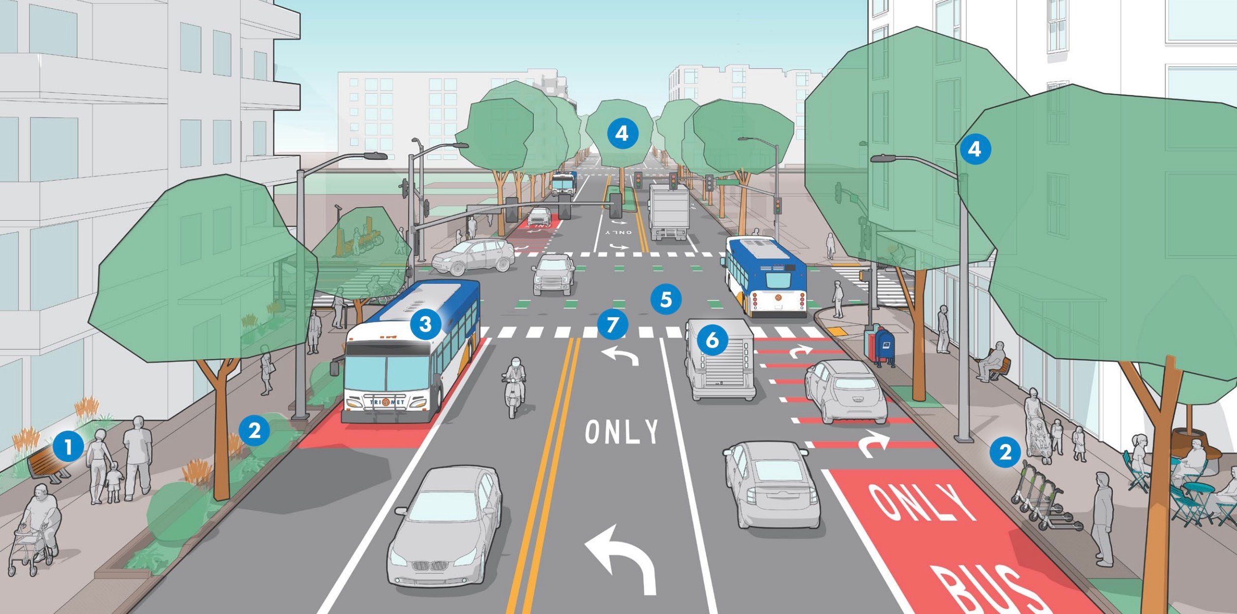
Can you find the bikes in this image? (Source: City of Portland)
Let’s play a game: Look at the City of Portland’s concept for the future of 82nd Avenue in the image above and try to find a bicycle. I’ll wait.
Every mode besides the bicycle is clearly represented in the drawing, but you need to look very closely and use x-ray vision to see a few bikes hidden behind a tree in the center left. Meanwhile, the Portland Bureau of Transportation is so eager to show that car users will still have access to all five lanes they placed three drivers in “Bus Only” lanes. Sigh.
This drawing is from PBOT’s Building a Better 82nd Avenue Plan that was unanimously adopted by Portland City Council on December 4th. We knew PBOT wasn’t going to include dedicated bike facilities on 82nd Avenue. We first reported that fact almost two years ago and followed-up back in August with a story that made it official. The council hearing two weeks ago was another opportunity for PBOT to explain their rationale, and for Portlanders and city council members to weigh in.
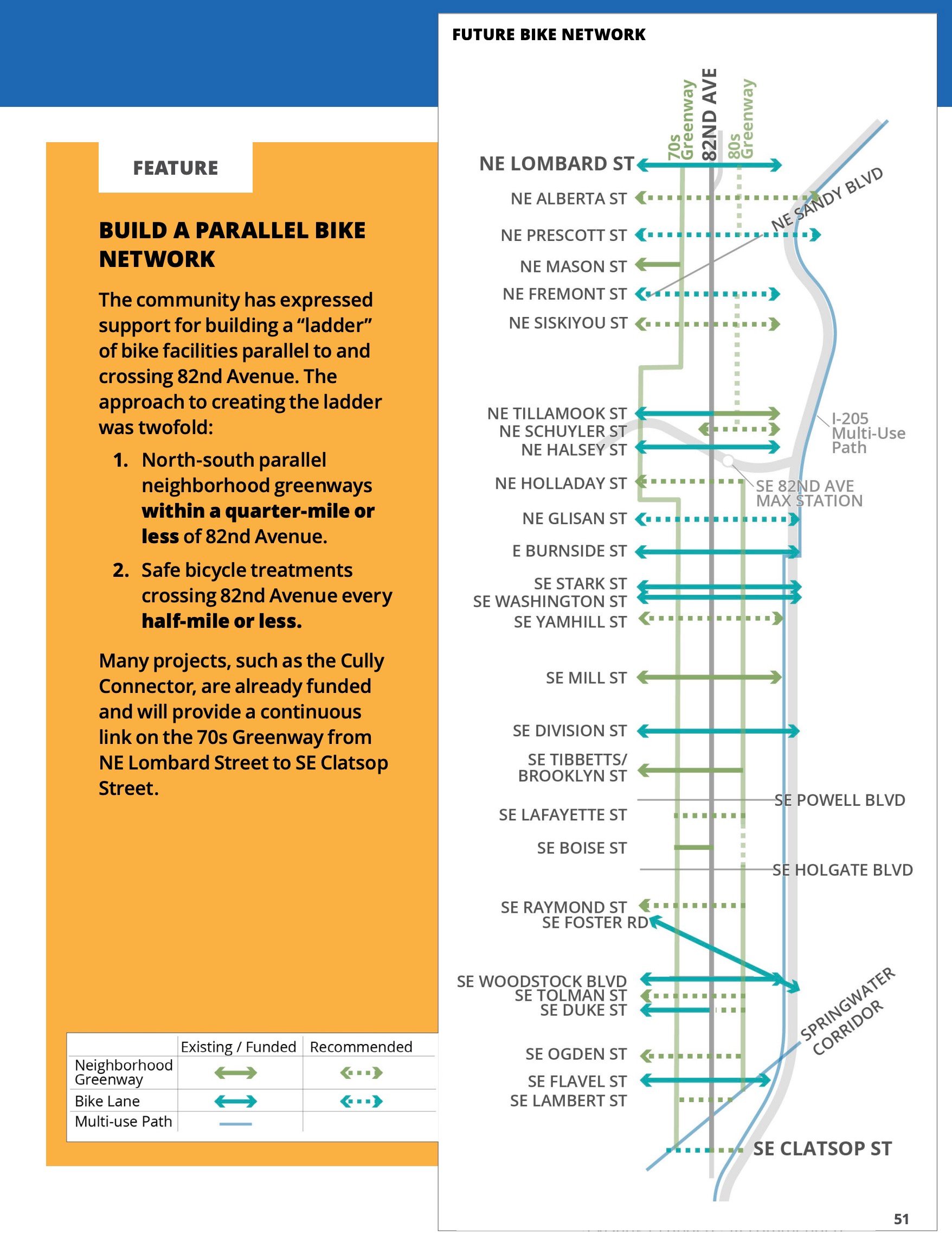
PBOT’s bicycle strategy.From PBOT’s Building a Better 82nd Avenue plan.
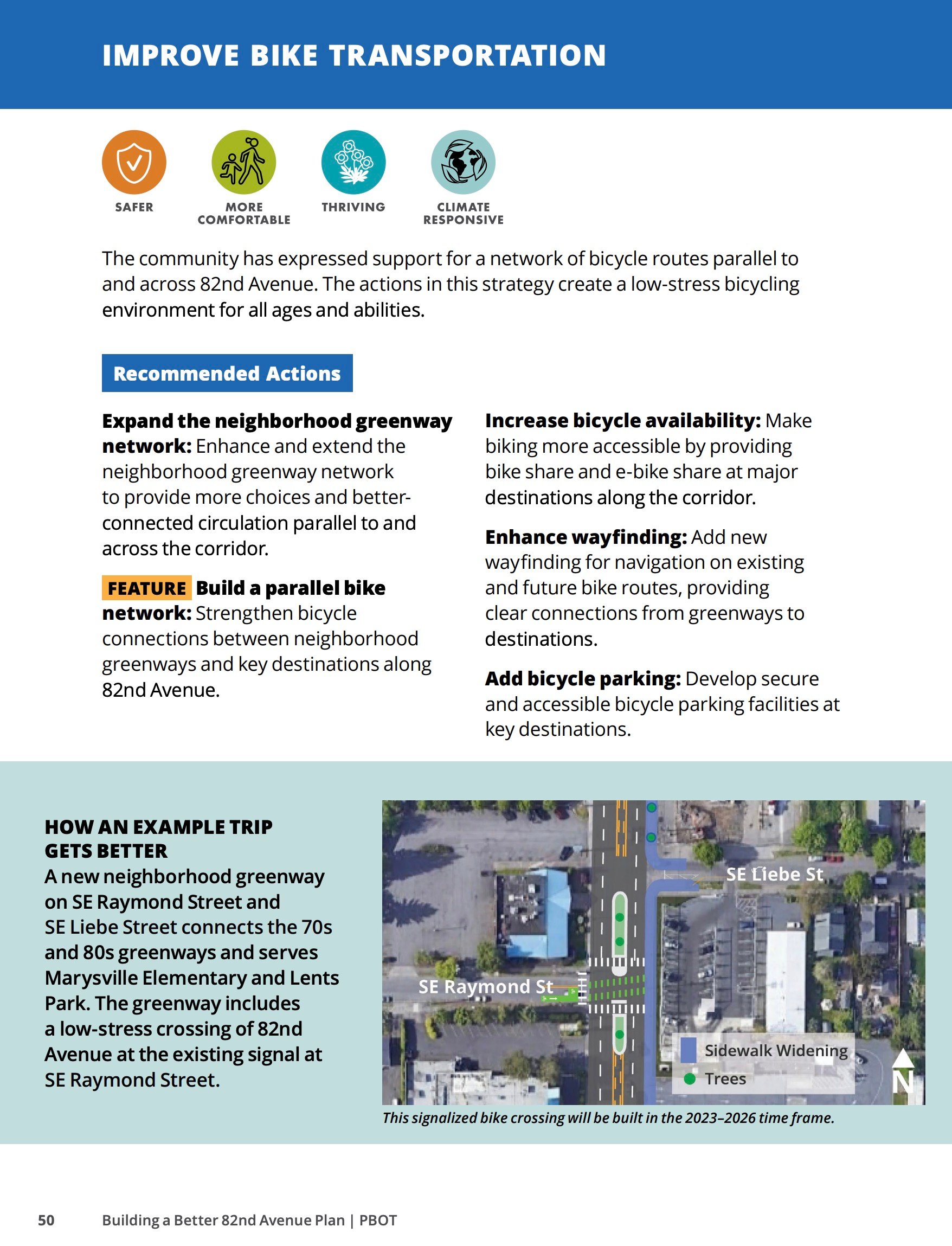
In a presentation on the plan, PBOT Planner Julia Reed told Mayor Ted Wheeler and the rest of council that bicycle use on 82nd is a lower priority than other uses due to its lower classification compared to other modes in our Transportation System Plan. Even so, PBOT considered it. They ran the traffic numbers on converting the outermost lane to a protected bike lane and found it wasn’t workable, due to transit delays and automobile diversion. So the PBOT plan will focus instead on cycling improvements on nearby neighborhood greenways, then make sure there are safe crossings and access points across and onto 82nd.
PBOT calls their cycling approach a “bicycle ladder” strategy. Imagine the sides of the ladder being bike-friendly streets on either side of 82nd, with the rungs of the ladder being the crossings.
“We explored the possibility of incorporating dedicated protected bike lanes,” Reed explained at council. “But modeling showed that would result in the Line 72 bus [the busiest line in Oregon] facing major congestion — a more than 50% travel time delay.” In the plan itself, PBOT says their modeling showed the installation of a protected bike lane would also “lead to significant automobile diversion.”
Hearing PBOT so clearly pit transit against bicycling (an unforced error in my opinion) was music to the ears of Commissioner (and council member-elect) Dan Ryan. “I’m enjoying this!” he exclaimed at one point while clarifying with Reed that there would be no dedicated bike access on 82nd Ave. Ryan has long advocated for getting bike users off major roads. He sees streets less as community-builders and more as corridors for commerce and believes it was a mistake for PBOT to install protected bike lanes on SE Division and often cites business owners who agree with him.
“I think sometimes in Portland we try to put too many modes of transportation in a small space,” he said before voting “aye” on the plan. “And we’re not connected to the reality of the importance of arterials to move goods and services around which everyone wants. So I think you’re striking a really great balance.”
Thomas Ngo, board chair of The Street Trust, also expressed support for the plan during his invited testimony. He spoke about how he lives nearby and how dangerous it is to cross 82nd or access its transit stops. He made no mention of the bicycling issue.
Two leaders from Bike Loud testified at the council meeting and expressed strong disappointment in the plan. Bike Loud Vice Chair Kiel Johnson said, “We are concerned that this plan fails to meet our most basic transportation priorities,” he said. “What you’re being asked to approve today does not include a plans to have a continuous ADA compliant sidewalk, or any bicycle facilities, or a street layout that will create the safe, vibrant Main Street the east Portland community has been asking for.” Johnson said if PBOT really wants to save lives and reach its transportation goals, they should “repurpose car lanes”. He likened this opportunity to the choice former Oregon Governor Tom McCall faced in the 1960s when he decided to remove Harbor Drive and create Waterfront Park. “All the transportation planners told him removing the freeway would lead to ‘carmageddon’… but they decided to buck their own transportation planners and remove the freeway, because it was the right thing to do.”
Kiel and Bike Loud Chair Aaron Kuehn both testified that the lane cross-section outlined in the 82nd Avenue Plan does not comply with Oregon’s Bike Bill, which requires transportation agencies to provide adequate cycling facilities whenever a major road reconstruction or repaving project takes place (and which they know something about as representatives of plaintiffs in a pending lawsuit against the city for not following it).
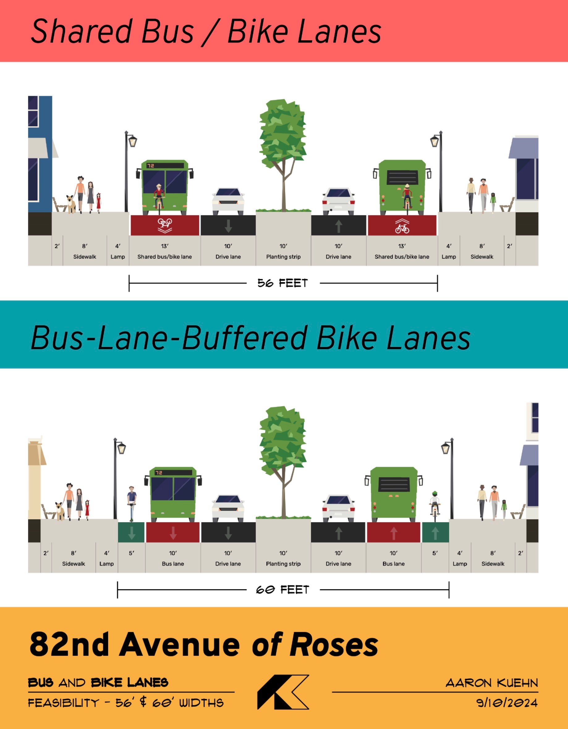
(Source: Aaron Kuehn)
Kuehn says the plan replaces 82nd Avenue with essentially the same cross-section it has today. At the least, he believes 82nd should have a shared bike/bus lane. Kuehn wants a dedicated bus lane on the entire seven-mile corridor and an explicit acknowledgement that bicycle riders are permitted to ride in it if they choose (much like riders do on current Rose Lanes on Martin Luther King Jr. Blvd and elsewhere)
Kuehn points to current Biketown data that shows a significant amount of people using bikes and electric scooters on 82nd (and its sidewalks). He wants to see the street re-classified as a Major City Bikeway in the TSP to bring it up to par with other modes. Kuehn has sketched out two cross-sections showing how bike riders can be accommodated on 82nd: One shows the shared bus lane, the other shows a bike lane that’s protected from car drivers by a bus lane buffer.
The future of the bus lane is still up in the air. There’s a separate process currently underway to determine exactly what type of transit facility 82nd gets.
Oregon Walks Executive Director Zachary Lauritzen is closely tied to this project, having received sizable city grants to organize support for new sidewalks. He didn’t take a position on whether or not 82nd should have bike access, but he made it clear he’s disappointed PBOT isn’t opening up the conversation about the lane configuration. “The community really wants to have that conversation [about lane dedication],” Lauritzen said. “They want to know what the future of 82nd Avenue looks like. They want it to be slower. They want there to be fewer cars, and they want it to be safer.”
Reed emphasized that there’s nothing in the adopted plan that dictates the type of bus lane that’s ultimately built on 82nd Avenue, or whether or not we allow bike riders on it. I’m reminded of a conversation I had with TriMet Planner Michael Kiser about this subject back in June 2023: “I’d like to say, ‘We did Division, now let’s go bigger’ But we don’t control the right-of-way and want to work with our partners.” Those partners on Portland City Council will be much different starting January 1st. Whether or not they’ll be willing to have this conversation remains to be seen.
Outside an event at the Immigrant & Refugee Community Organization hosted by Free Bikes 4 Kidz, one of the nonprofits who won a state grant. (Photo: Free Bikes 4 Kidz Portland)
Bike repair clinics for homeless Portlanders, free bikes for refugees and immigrants, an electric cargo-bike library for underserved youth — those are just some of the 26 projects that have been awarded grants by the Oregon Department of Transportation’s Innovative Mobility Program.
This program was the idea of former Oregon Transportation Commission member Alando Simpson. It was launched in 2022 and is funded through $10 million set aside (out of a total of $412 million) from Oregon’s share of the federal Infrastructure Investment and Jobs Act passed in 2021 and $10 million from the state’s general fund.
ODOT has awarded over $330,000 in microgrants this go-round. Unlike the first round of grants in 2022, which were limited in size to just $5,000, these latest awards went up to $15,000. Preference for the grants are given to communities that are historically underserved and the idea is to make an immediate impact by funding projects that can reduce car use.
The grants were passed out statewide. Below are a few notable ones from Multnomah County:
Blanchet House of Hospitality ($13,000): Host reoccurring bike repair clinic for people with low incomes and people experiencing homelessness.
Free Bikes 4 Kidz Portland ($14,895): Expand bicycle safety programming and bicycle distribution to reach Veterans, immigrants, refugees, and students and families of Title 1 schools.
ROSE Community Development Corporation ($15,000): Host bike camps and learn-to-ride events and purchase a bicycle fleet for youth at Rose CDC’s affordable housing complexes.
Bike Works by p:ear ($15,000): Host various active transportation outreach events and provide bike safety gear to young, low income and homeless individuals.
Community Cycling Center ($15,000): Support youth bicycle mechanic programming that occurs in alternative high schools.
Play Grow Learn ($15,000): Host community bike rides and provide bicycle safety education. Create an e-cargo bike lending library in partnership with River City Bicycles.
WashCo Bikes ($14,990): Expand bicycle safety programming and bicycle distribution to reach the Hispanic community and youth and families of Title 1 schools.
Next up for the program are more grant funding cycles and an expansion into study and assessment grants. To learn more, check out the Innovative Mobility Program page on ODOT’s website.
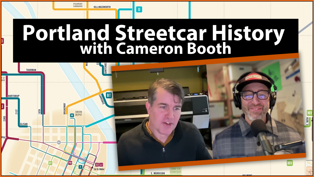
Many of us can summon a general outline of Portland’s streetcar legacy. We know the city was once filled with tracks and lines that criss-crossed both sides of the Willamette and we have experience seeing old tracks on or under a street we ride on. But for transit buff Cameron Booth, it is a history that deserves to be understood in greater detail. Booth, whose fascination with public transit maps began after a boyhood ride on the London’s “Tube”, is a graphic artist by day who’s working on a project to digitize Portland’s streetcar history.
Some of you might know Booth as the guy behind Transit Maps, the very popular blog and online store that features nearly 200 vintage and artistic transit maps from all over the world — including the BikePortland collab, “1896 Cyclists Road Map of Portland.” Booth enjoys restoring old transit maps and creating his own. A few months ago, he mentioned to me in passing that he was researching streetcar information via historical articles in The Oregonian and then sharing what he learned on a website. I’ve always been fascinated by how streetcars have shaped our city, so I was instantly intrigued by the project. This morning I finally got to learn more about it.
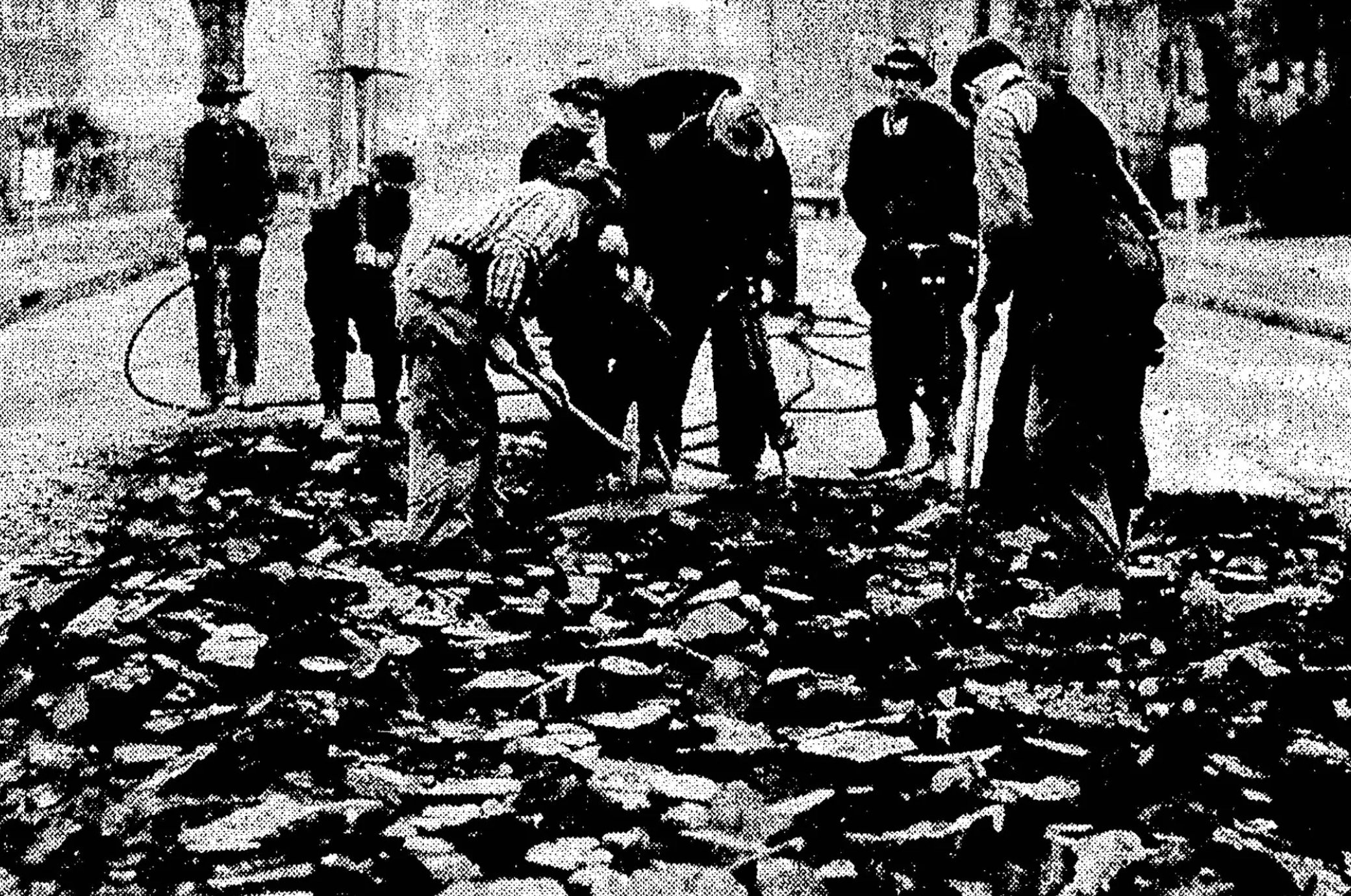
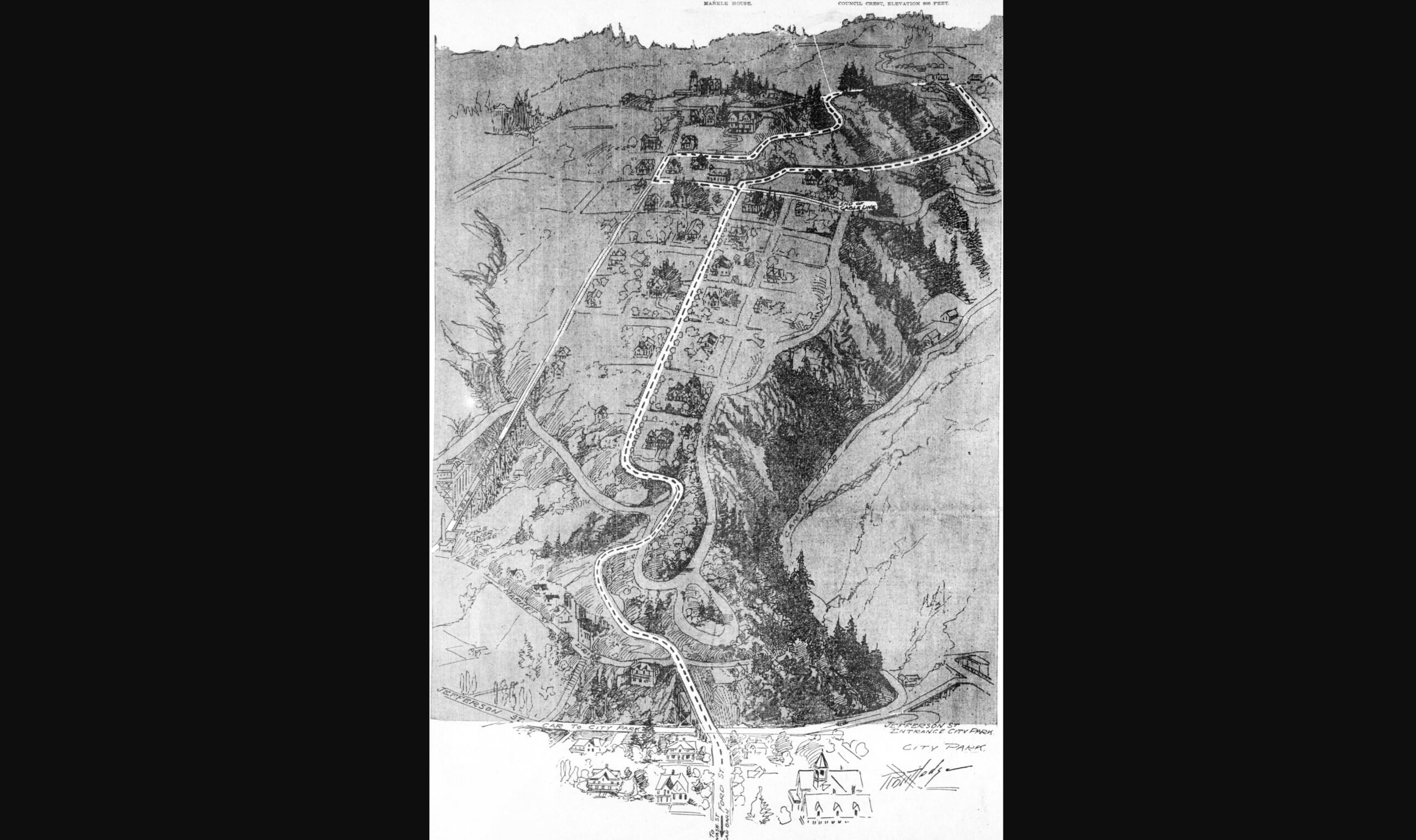
Crews digging up a portion of the Bridge Transfer line during WWII.Map – Around New Portland Heights Loop, 1904.
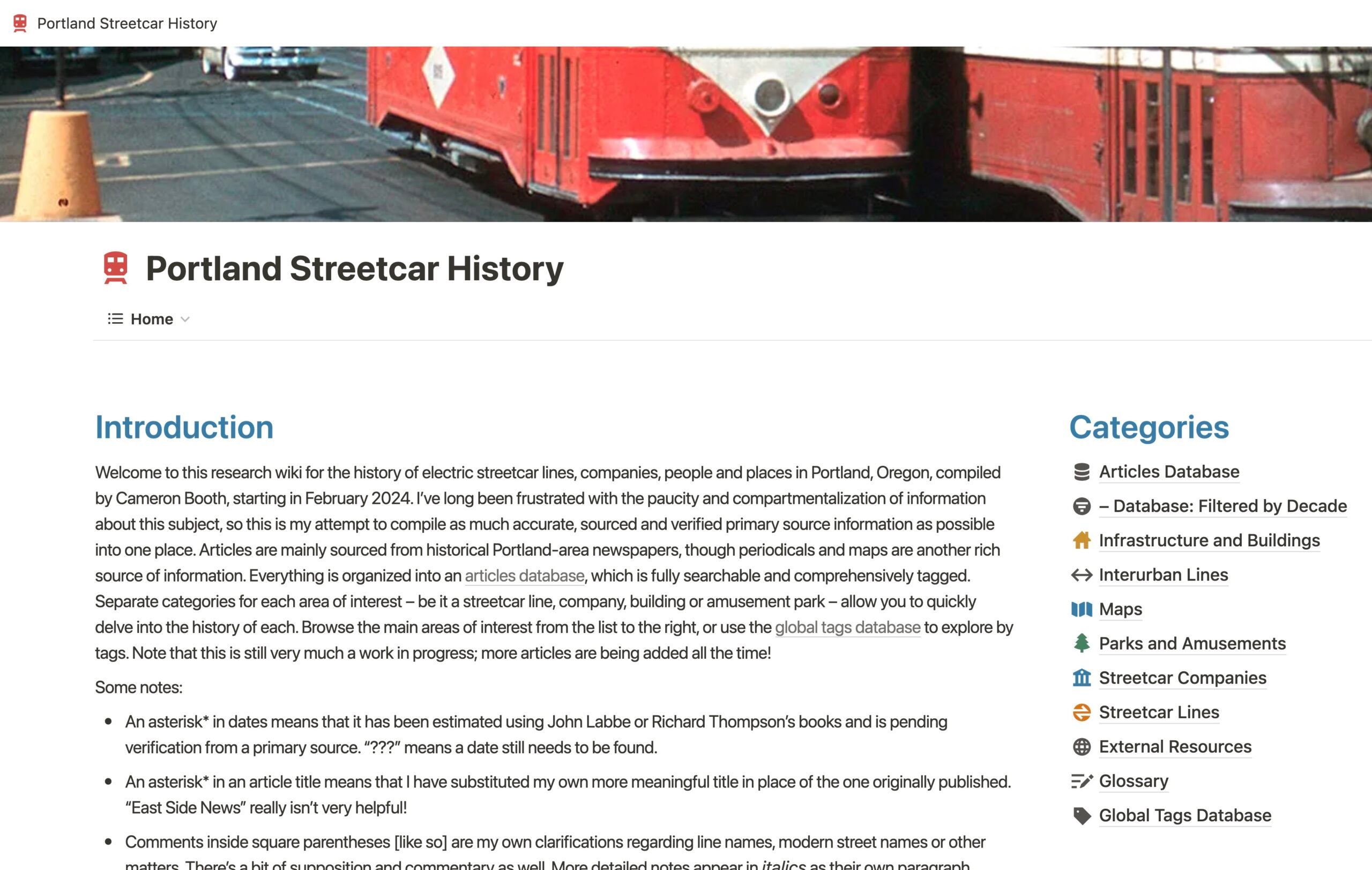
Portland Streetcar History is a website where Booth is sharing the over 1,000 articles he’s transcribed so far. He’s sharing illustrations of old maps and has compiled information on 35 different streetcar companies and 68 distinct streetcar lines. He began the project in February 2024, armed with nothing more than a Multnomah County Library Card and an insatiable curiosity. The project started because he was already doing the research for this map projects, “And every time I went to work on them,” he told me in an interview this morning, “I have to go the library and borrow like eight different books, or I have to look on the Internet and find four or five different websites to get that information that I’m after. So in the end, I guess I was just like, well, what if I just started compiling all this stuff myself?”
Judging from the changelog on the wiki-style website he’s using to share everything he finds, Booth edits a few articles a day. Browse the list, choose something to click on, and you might find an article from June 19, 1904 that details a new “through line to St. Johns” that would have created a new route, “from the heart of Portland” all the way up the peninsula to St. Johns. Or you might click on a detailed, high-resolution image of a 1932 map of transit lines in the central city. Each item is notated by Booth with updates and insights, creating an intriguing trove of transit information.
What started as a way for Booth to fact-check specific route locations and line information, has grown into a project that tells a wider story. Through all the articles he’s transcribed, Booth says, “You can see the social impact and the way that the streetcar basically, in a lot a lot of ways, defined the way Portland looks now. You know, all the cool neighborhoods are all along the old streetcar lines.” It makes you wonder what those neighborhoods were like in the peak of Portland’s streetcar era, which Booth pins to 1915-1920.
Beyond that, Booth said he’s learned of a brief revival during World War II. “There was shortages of gas and tires and stuff like that, so they actually dug out one of the streetcar lines. They’d buried it in 1940 and then there was a rubber shortage for tires so they basically dug up this old line and started running streetcars on it again.” It was the Bridge Transfer line that ran from the Broadway Bridge to the Hawthorne Bridge on Grand and Union (not Martin Luther King Jr Blvd) on the eastside. “There’s photos in the newspapers of them jack-hammering out the tracks,” Booth said.
The tracks would all be buried eventually as rising maintenance costs and stagnant rider fares buried streetcar companies in debt. Booth says from what he’s gathered in contemporary news articles, it was not the onslaught of cars or any conspiracy by Big Auto to buy up companies and bankrupt them. They just weren’t cool anymore. “By the 1930s, they were seen as old-fashioned and out-of-date,” he said. Unloved and unmaintained, the streetcars were replaced by buses which were considered to be much more modern and comfortable.
“And you can literally see the attitude change to streetcars through the newspaper articles,” Booth shared. “At the beginning it’s all, ‘Oh my goodness, another streetcar line! How exciting!’ And by the end, it’s like, ‘Thank goodness that’s gone.’ The public attitude towards them was changing drastically.”
Has Booth come across any mentions of bicycle riders in his research? Yep. He recalled two stories.
In 1890 or so he came across an article about a man who was biking on SW Jefferson near the old Portland Heights cable car line. The man fell into the hole where the cable returned and was seriously injured. “He wanted to sue the cable car company, but they said, ‘Well, you were riding a dangerous and defective bicycle.'” Booth also said around the turn of the 19th century, when American was solidly in its bicycle craze era, streetcar companies lamented that they were losing ridership to bike riders.
Booth’s research is full of fun little nuggets like that. And it’s all available online. Check out his Portland Streetcar History website to learn more. And if you’re looking for an excellent holiday gift, check out his store on Transit Maps.
Please nominate comments by replying with “comment of the week” or “COTW” so I can more easily find them via search. Thank you.
We had another great week of comments. It makes me so extremely happy that after all these years we still have a solid comment section that is often just as illuminating — if not more so! — than the stories we share above them. When most media outlets gave up on comments, I doubled-down. And it has paid off. Nearly 600,000 comments later we have a platform where (almost) all perspectives can be shared, where we can learn from each other, and where respect is earned by the value of your ideas and how you choose to express them. Thank you.
With that, let’s get to the Comment of the Week.
We are making progress in bringing downtown Portland back, but we need to do more. And no matter what city leaders do, people won’t hang out downtown if there’s nowhere to relieve themselves. Yes I’m talking about public restroom! I hoped at least one candidate would run on a “more bathrooms downtown!” pledge, but it didn’t happen. This is a huge issue that we must address.
I was on the citizens advisory committee many years ago that helped to advocate for the Portland Loos. Far fewer than the suggested number (originally 25 to 30) were installed, due to the cost of construction and maintenance. Of the original units installed downtown, a couple were completely destroyed by vandalism (which in one case included toilets plugged with quick-dry cement) within the first two years of operation. Maintenance on the remaining units has been inconsistent, probably owning to a combination of budget cuts and the pandemic.
Before the pandemic, when my trips downtown were far more frequent, I tried to use the Portland Loos and about half the time they were inaccessible because someone was sleeping or doing drugs in them. I was warned more than once by whomever was inside “just go somewhere else, you’re not gonna get in here anytime soon.”
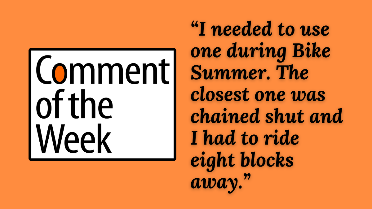
The last time I needed to use one downtown was in June during the Bike Summer kickoff party. The closest one was chained shut due to extensive vandalism damage, and I had to ride until I found a temporary porta-potty eight blocks away.
I volunteered to be on that advisory committee because, as someone with Crohn’s disease, I can’t always predict when I’ll need to find a restroom. I figured there might be others with similar needs. In the end, it hasn’t really mattered.
Today, I only go downtown if I absolutely must, and I take public transit. I’m older and slower now, and there’s no point in putting myself in harm’s way if I don’t have to. When a place — a street, a bike lane, or a public restroom — isn’t safe enough for the most vulnerable, then it’s not really safe.
I feel your pain Beth H.! This is a major issue that isn’t getting enough attention. Hopefully we can make progress soon, so that more folks can feel relaxed and relieved while spending time downtown. Thanks for all the great comments last week. And remember to please nominate good ones by replying to them with “comment of the week” or “COTW.”
Here are the most notable stories and other items our community flagged from the past seven days.
This week’s sponsor is Bike Tires Direct, who just announced a big Warehouse Sale January 18th. Check their website to RSVP and get an invite to this huge savings opportunity.
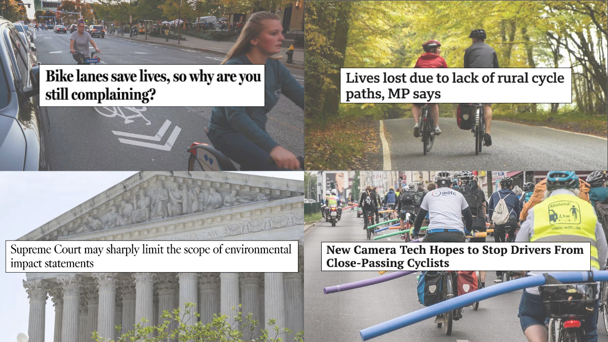
NEPA nope? There’s an effort to weaken the scope of the National Environmental Policy Act (NEPA) so big projects are responsible for a much more limited set of impacts and the Supreme Court is about to weigh in. (LA Times)
Merckx takes a tumble: 79-year old cycling legend Eddy “The Cannibal” Merckx crashed his bike and broke his hip. Get well soon Eddy! (Associated Press)
Local non-profits in trouble: Several major local nonprofit orgs have hit major financial headwinds that have resulted in layoffs and soul searching. (OPB)
Inflation and affordability: One reason some small community bike shops are going belly-up is that their costs are rising, but their customers can’t pay higher prices. (Cycling Weekly)
Dash cam for cyclists: Is the hope of a small, affordable and reliable dash cam for cyclists finally about to come true? Learn about the Cycle Safe project if you want to find out. (Streetsblog USA)
Bike culture: What happens when a famous cyclist gets seriously injured in a dooring incident involving a post office van? Well, when it happens in Belgium, the postal service launches a national campaign to increase awareness of the dangers of opening car doors. (ABC News)
Cost of light rail: Notable that some elected officials in Vancouver, Washington are balking at the price tag to maintain and operate a new light rail line that would be build as part of the Interstate Bridge Replacement project. (The Columbian)
Rural realities: At least in the U.K. they’re actually talking about the dangers faced by people who ride bicycle on rural roads. This is a vastly under-appreciated issue here in the states and something that deserves a lot more advocacy and conversation. (BBC)
Just share the damn roads: A good way to refresh your arguments when someone complains about bike lanes, with a good reminder at the end about what cities are all about. (🔐💰Boston Globe)
NYC is doing something right: I realize New York City is an outlier for American cities, but it’s still nice to know what cycling is booming there. A recent count of four major East River bridges shows a 15% increase over last year. (BK Reader)
Daylighting law: California will put a new law into effect in 2025 that will prohibit people from parking cars within 20-feet of an intersection. Known as “daylighting” this is a move that should be watched closely by Oregon safe streets advocates. (ABC)
Less care parking, more homes: It really is that simple, and folks who’ve been yelling this from rooftops for many years have an excellent new bit of research to back them up: Data from Colorado shows that giving developers more flexible can result in 40 to 70% more homes being built. (Sightline)
Video of the Week: Bogota, Colombia’s “Ciclovia” is what inspired Portland’s Sunday Parkways. Now the city is celebrating 50 years of open streets (Al Jazeera English)
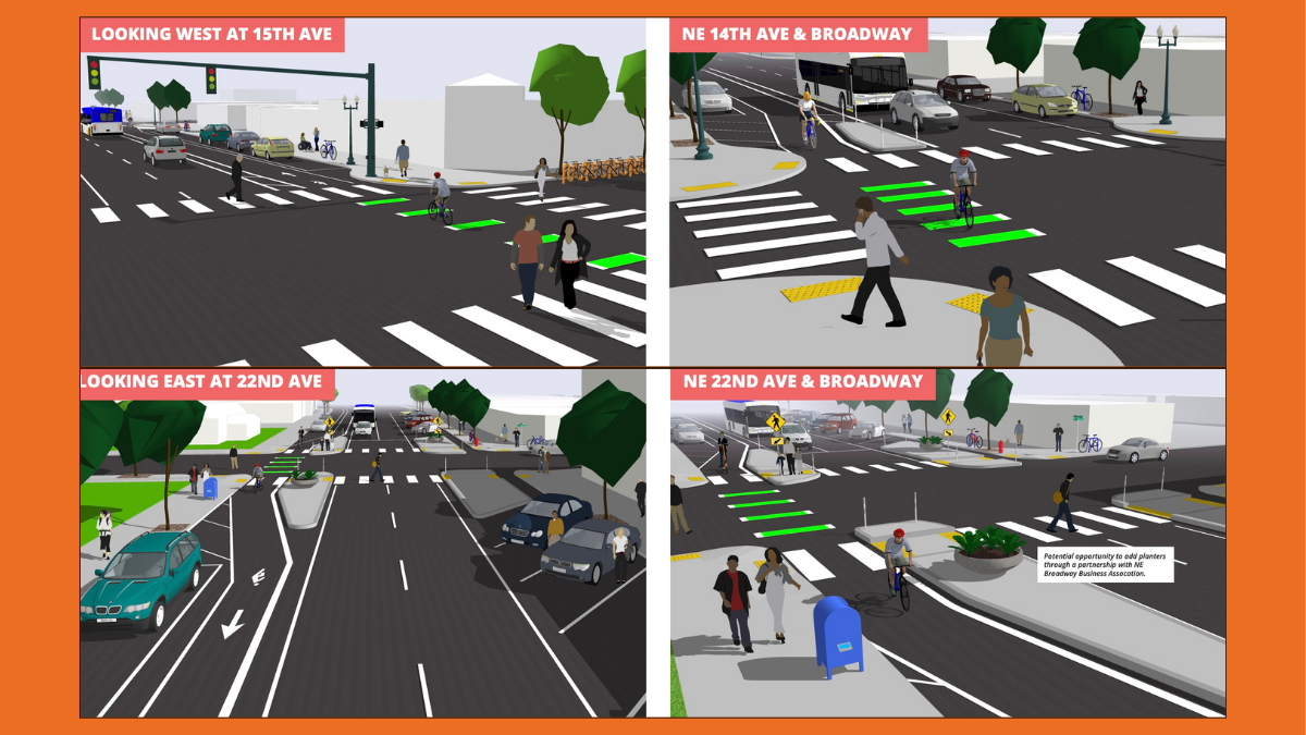
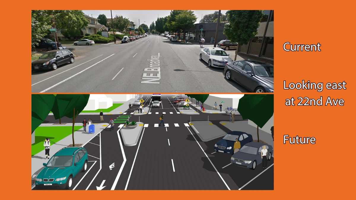
The Portland Bureau of Transportation has revealed a new proposal for a major redesign of Northeast Broadway. And while the city will remove one general lane for driving and vastly improve several crossings, the unprotected bike lane isn’t as impressive as some folks hoped for.
To refresh your memory, this is happening because of the Broadway Pave & Paint project. Since PBOT plans to repave the street between NE 7th and NE 26th, they are seizing an opportunity to reconfigure the lanes and make other changes. These changes will ultimately connect to a major, federally-funded project from NE 7th to the river that is part of the state’s I-5 Rose Quarter Improvement Project.
But unlike the $38 million PBOT received to transform lower NE Broadway, they have only a meager $500,000 (in addition to the paving funds) to spend on the Pave & Paint section from NE 7th to 26th. That budgetary limit helps explain not just the design choices, but also the reactions to it.
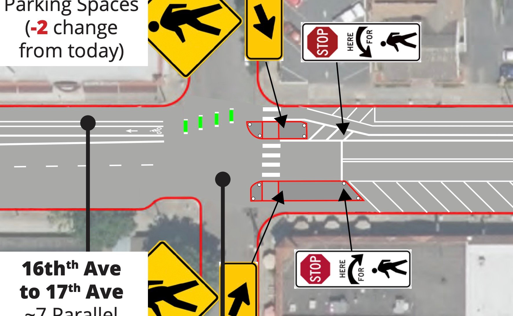
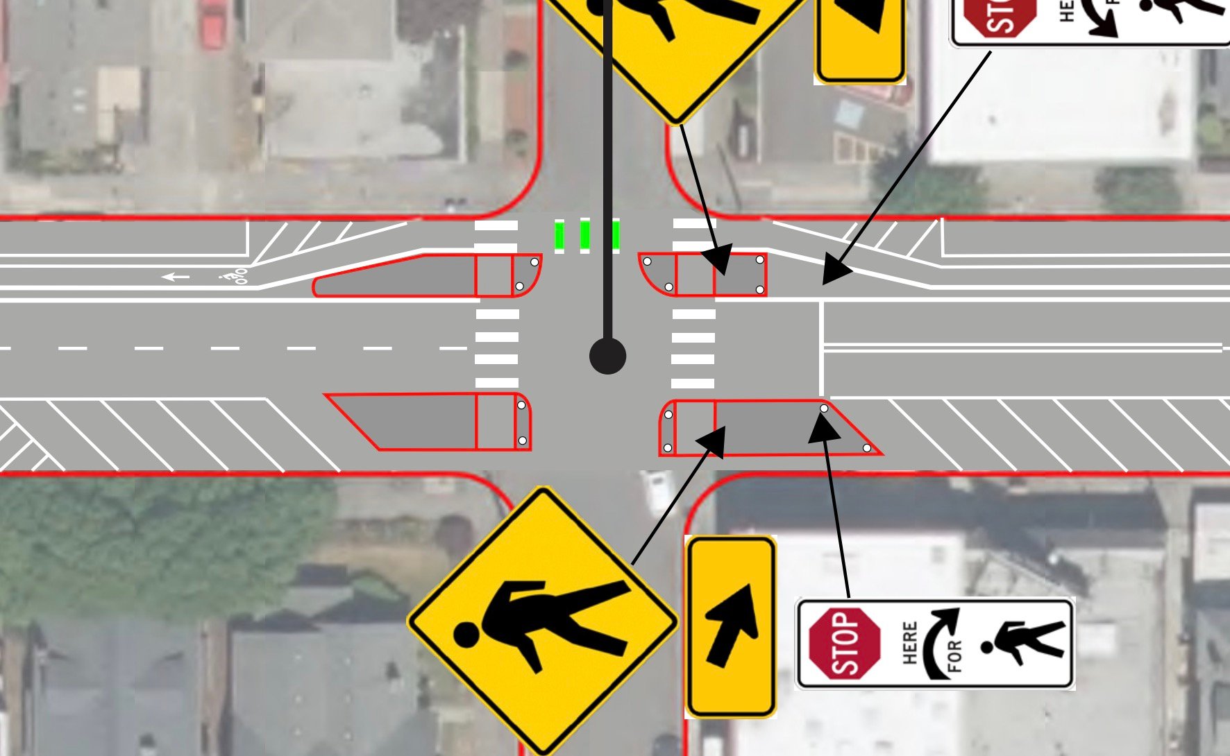
Detail of roll plots of NE 17th and NE 19th intersections.
The design concepts PBOT shared back in 2022 showed a parking protected bike lane. But the design proposal revealed yesterday as part of an online open house and survey is an unprotected bike lane sandwiched between two lanes used by drivers. That fact peeved some folks when I shared the drawings yesterday. “This is awful,” one person wrote on Bluesky. “When will PBOT build a real goddamn protected bike lane, and not magical wands and paint?”
BikeLoud PDX Vice-chair Kiel Johnson spoke with PBOT Project Manager Mike Serritella about the project this morning. After their phone call, Johnson told me in an interview that, “The project isn’t living up to the Transportation System Plan.” “We don’t think it will be comfortable for a wide range of riders,” he added. “And the budget illustrates that we continue to underfund these opportunities.”
The bike lane PBOT wants to build is about 11-feet wide (same as the adjacent lane for drivers) once you add buffer zones on each side. But it lacks physical separation — which has been the consensus best practice standard for years now. And in some sections, PBOT has maintained parallel parking spaces that will require drivers to maneuver over the bike lane to reach a spot.
Despite one less lane for drivers, the streetscape in PBOT’s new drawings is still dominated by cars. And as we struggle to regain cycling momentum and prevent deaths and serious injuries on our roads, any space dominated by such a deadly vehicle will fail to result in the outcomes we all say we want.
From PBOT’s point of view, this is a major step forward and all they can do with limited funds. “The team believes this recommended design optimizes resources available at this moment in time and sets up the corridor for future upgrades and investments,” their website reads. In contrast to this $500,000 to spend over 20 blocks on NE Broadway, PBOT will spend $16 million to build fully-separated and protected bike lanes on 27 blocks of SW Fourth. The agency also says their proposed design for Broadway does not preclude upgrading the bike facility with more protection in the future.
PBOT can also point to a load of other changes Broadway will receive — like protected intersections where new median islands will greatly reduce crossing distances.
Another thing that gives PBOT confidence is the fact they’ve got political support for a road diet through a major commercial district. Yes the local business association is fully on board with the changes despite losing driving capacity outside their doors — and despite a 4% decrease in total car parking spots along the corridor (11 spaces less than they have today).
It likely didn’t take too much cajoling by PBOT for the business association to agree to these changes however, because current conditions are absurdly car-centric. Between NE 17th and 26th, NE Broadway is as wide as 82nd Avenue (a former state highway). Even PBOT says the street is currently “overbuilt for automobiles” and their analysis found that — even at peak travel hours — drivers use only 50-60% of the total car capacity on the road.
Given this wasted space PBOT has 14-18 feet of roadway space, “to be reallocated along the corridor for community priorities.”
PBOT wants to use that space for a wide, buffered bike lane as well as five new pedestrian crossings (at 11th, 13th, 17th, 19th, and 22nd), two bus stop bulb-outs, and the new median islands at intersections. The maximum speed limit on the street will also be lowered from 30 to 25 mph.
Matt Zajack from the Sullivan’s Gulch Neighborhood Association likes what he sees. He’s met regularly with PBOT, reps from the Irvington Community Association and the Northeast Broadway Business Association since planning began this past summer. “Although it doesn’t hit every item on a long wish list,” Zajack said. “we are excited about the long overdue updates and changes that will bring this road in alignment with current codes and safety standards and better align the vibrant, human-centric business and neighborhood corridor we have here.”
Given the changes on the table and the new parking arrangements (neighbors worry a vast reduction in parking in the corridor means more people parking on side streets), Zajack says the neighborhood is downright “excited” about the project.
PBOT wants to hear community feedback before they finalize their design in February. If all goes according to plan, they’ll repave and repaint Broadway in summer 2025.
— Browse the open house and take the survey to make sure they hear your voice.
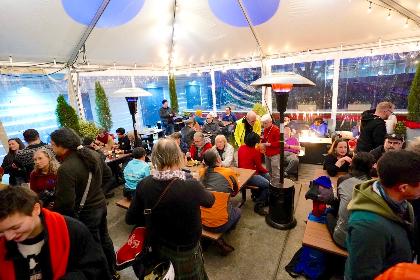
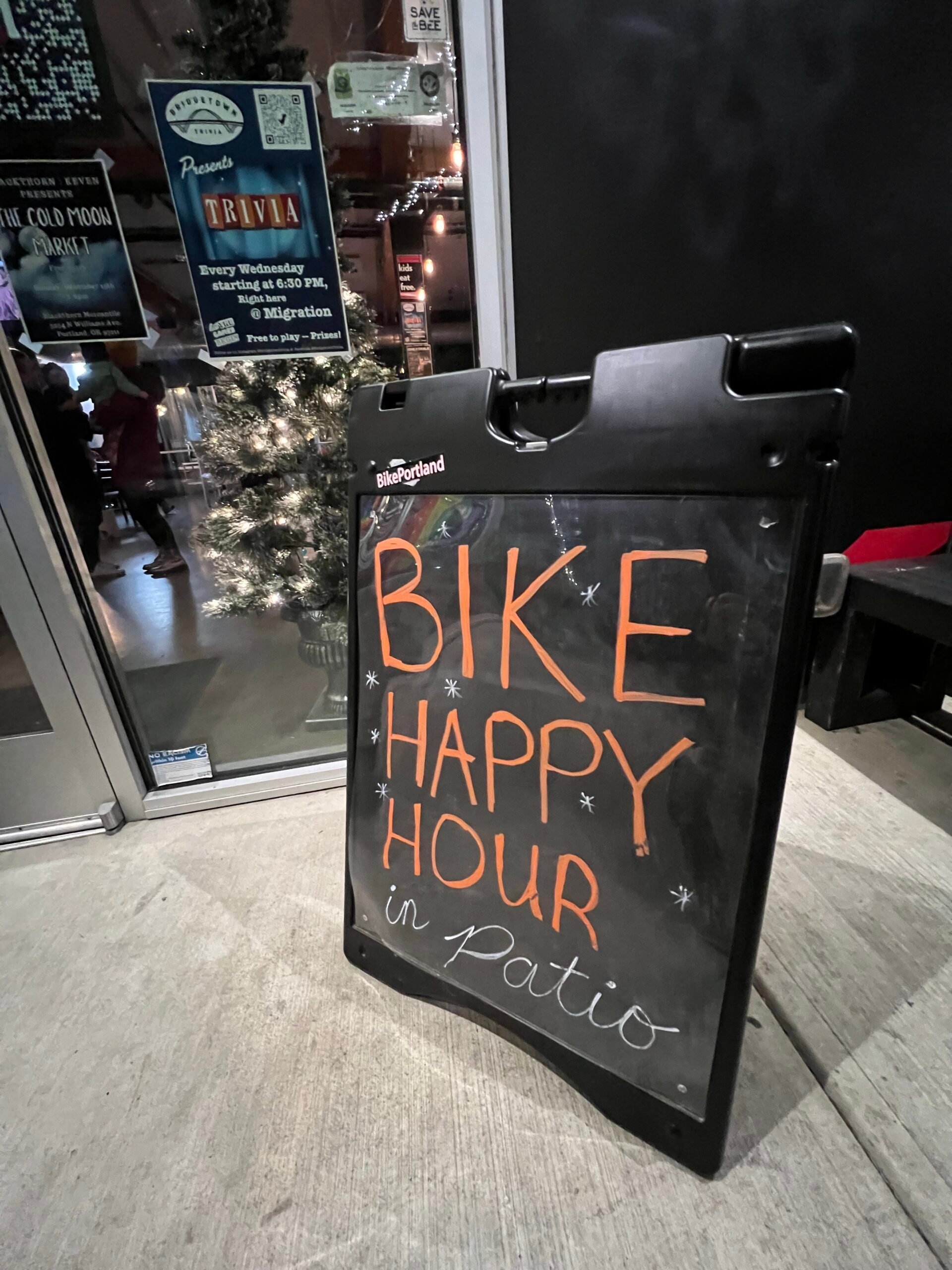
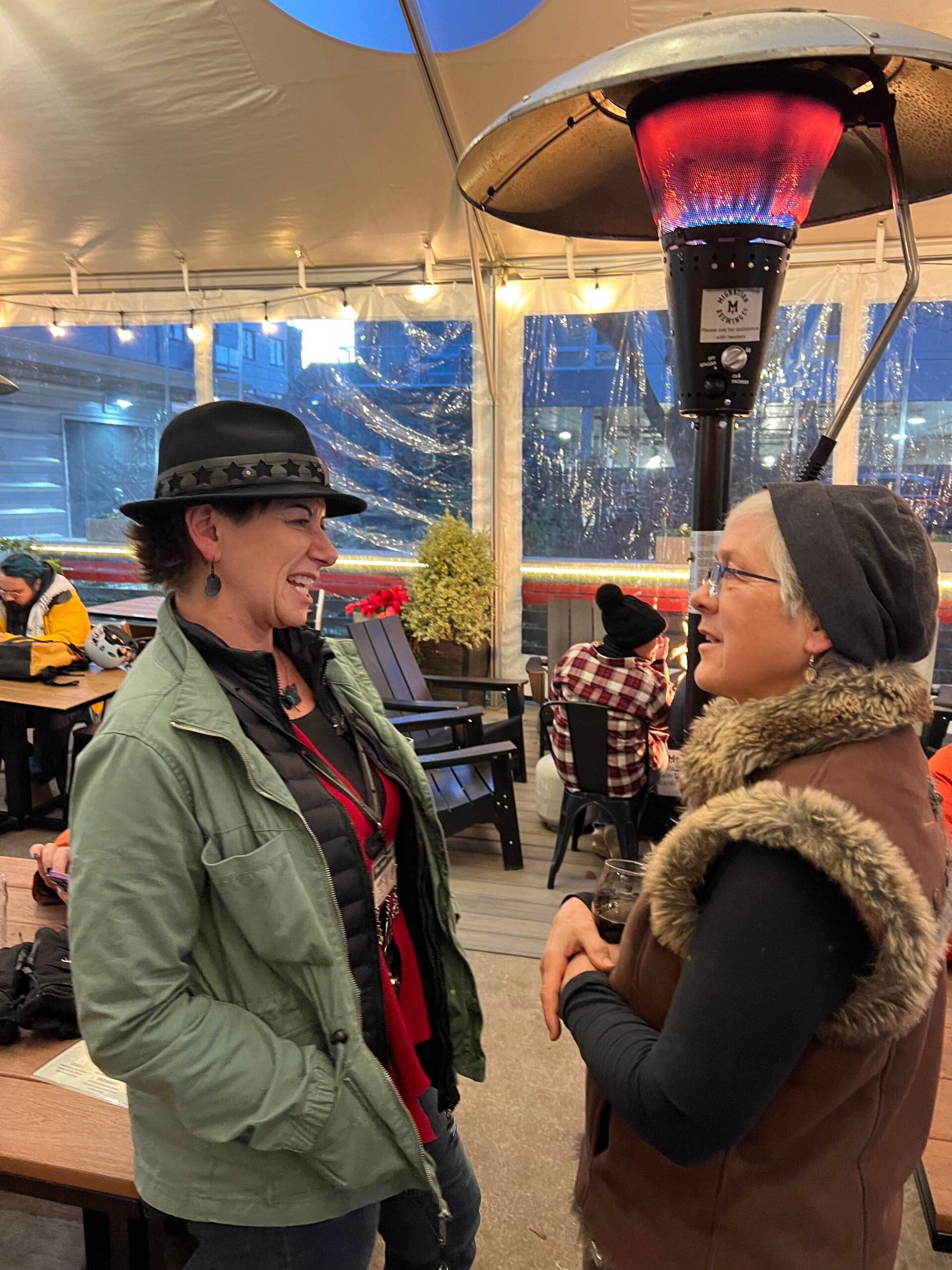
Come and join us for a special BHH on Wednesday 12/18 from 3-6 pm at Migration Brewing on N Williams Ave. (Photo: Jonathan Maus/BikePortland)
Thanks for the idea Joe!
Hi everyone. Just wanted to let you know we are having a white elephant gift exchange at Bike Happy Hour next week — an idea that came from local bike advocate extraordinaire Joe Perez during open mic this past Wednesday. And our gracious hosts at Migration Brewing have donated a grand prize: Everyone who participates will be entered into a drawing for a $50 Migration Brewing gift card!
Here’s how it will work:
Please bring a wrapped, bike-themed gift that is worth $15 or less. The funnier, the better — and it can be only tangentially related to biking and/or Bike Happy Hour.
All gifts will be placed in a pile on one of the tables.
Everyone participating will get a number.
Player #1 can select any gift from the pile. The first player opens the gift and shows it off to everyone.
The following players can choose to either steal Player #1’s gift or grab a gift from the pile.
A gift can only be swapped once per turn and a gift can only be swapped a total of three times.
***All players will be entered into a drawing for a $50 Migration Brewing Gift Card Grand Prize. (Thanks Migration!)
We are just trying to have fun so rules might change without notice. If anyone has other suggestions, let me know. And of course you are welcome to join us even if you choose not to play.
Can’t wait for this special BHH Holiday Party – a new tradition! Remember to wear your ugly sweaters and other Christmas garb if you’ve got it. See you next week!
P.s: If you haven’t joined us at the new location yet, it’s nice and cozy and I think you’ll like it. Conveniently located on N Williams Avenue between N Failing and N Shaver. Check out there website for more info and see photos below for a vibe check.
Tis the season. (Photo: Jonathan Maus/BikePortland)
Weather be damned. Life is too short to stay inside and too dull to not include bike rides.
Here are a few suggestions for life in the saddle this weekend…
Saturday, December 14th
Sorella Forte Group Ride – 9:00 am at River City Bicycles (SE) Classic shop ride vibes but led by a cool and welcoming, all-women club based out of Portland’s coolest bike shop. More info here.
Saturday Social – 10:00 am at Woodstock Park (SE) A certified Portland Bicycling Club ride leader will take you on a 15-25 mile exploration of the metro area at an intermediate pace (13-15 mph). More info here.
Inn Between Holidays Ride – 1:00 pm at Reel M Inn (SE) Partake in this joyous tradition of an “Inn” themed bar tour led by a guy named Josh who has a gift for bike-cultural geography. More info here.
Ride to It’s Giving Market – 1:15 pm at Ladd Circle (SE) There’s a cool holiday market with lots of bike merch that would make great gifts and there will be no billionaires involved. Why not bike there in a group? More info here.
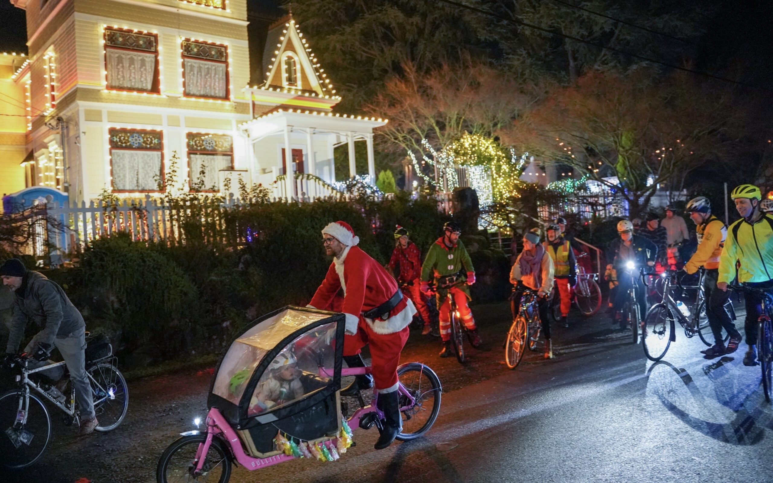
Holidays on Franklin Street – 5:30 pm at Expo Center MAX Station (N) Tom Howe will lead this ride over the river and through the woods to a neighborhood in Vancouver that goes all out with Christmas decorations. More info here.
Sunday, December 15th
Mini Velo & Folding Bike Ride – 10:00 am at Something Cycles (E Burnside) Like Zoobomb but in reverse and on a different mountain. Join this fun local bike shop for a group ride on little bikes and see if you can make it to the top of Mt. Tabor. Don’t worry, there’s a cafe stop for fueling up beforehand! More info here.
Techno Christmas Peacock Lane Takeover – 6:00 pm at Irving Park (NE) Nakedhearts:PDX wants to get you dancing in the streets and what better place to do it than carfree Peacock Lane. More info here.
— Did I miss your event? Please let me know by filling out our contact form, or just email me at maus.jonathan@gmail.com.
Maitri Dirmeyer (center in blue) at a Bike Milwaukie ride in June. (Photos: Bike Milwaukie)
There’s a resurgence of cycling in the city of Milwaukie just south of Portland. After being quiet for a few years, Bike Milwaukie has been reinvigorated thanks to a dedicated group of volunteer advocates who are building on a strong foundation. I caught up with one of them, Maitri Dirmeyer, earlier this week for a conversation to hear more about what they’ve been up to.
For the uninitiated, Milwaukie sits along a bend in the Willamette River about two miles south of Sellwood Park. It’s separated from Portland by the posh Waverly Heights golf course and an industrial area anchored by the Goodwill bins. The population is just over 21,000 people spread out across about five square miles of land.
The relationship between Milwaukie and Portland was forever changed in 2015 when TriMet expanded MAX light rail to Milwaukie. And then in 2017 the City of Milwaukie spent $3.3 million on a bike path to connect the two cities along SE 17th Avenue. That path takes you right to Milwaukie Bay Park and connects to the Trolley Trail which you can take for a few more blocks south to an Orange Line MAX light rail stop. On the city’s northern border is the Springwater Corridor path.
Dirmeyer and her winning entry in the bike decorating contest at last week’s Umbrella Parade.
These biking and transit connections create a solid active transportation foundation. But as many of you know, no American city realizes its biking potential without a persistent push from dedicated advocates. That’s where Dirmeyer and the core volunteer group behind Bike Milwaukie comes in.
Bike Milwaukie started in 2007 (as Milwaukie Bikes) and by 2009 there was enough juice in the local bike scene that BikePortland hosted a Get Together event at a cafe on SE Main Street. Bike Milwaukie founders Matt Menely and Greg Baartz-Bowman led monthly rides and formed partnerships with city government to do things like raise money to install a bike rack outside City Hall in 2015.
Dirmeyer says the group went dormant for a few years but came back to life this past spring when advocates had to answer the call and make sure City Council adopted the 29th Avenue Greenway project. “After the council meeting, a group of us decided we should start back up our monthly rides,” Dirmeyer shared with me earlier this week. “And we’ve been hosting at least one ride every month since May.”
Dirmeyer credits a “core group” of advocates for the recent renaissance including: Jay Panagos, Pam Denham, and William Anderson.
Bike Milwaukie rides.
Hosting rides is a great way to establish (or in this case, re-establish) the presence of a bike advocacy group. But Dirmeyer rattled off an impressive list of other things she and her fellow volunteers are working on. They’ve successfully attached a biking component to several major Milwaukie community events like Porch Fest and the recent Umbrella Parade, where they held a bike decorating contest. “We’re also collaborating with the city’s Arts Committee to cross-pollinate and get more people comfortable with cycling. It’s all about introducing routes and just creating community and having a good time on bikes,” Dirmeyer said.
At the Umbrella Parade, Bike Milwaukie worked with city officials to set up temporary bike parking. The partnership went so well, the City of Milwaukie plans to set up another bike parking area at the upcoming annual Winter Solstice event on December 21st.
Milwaukie also has its own Bike Happy Hour. Dirmeyer loved the vibe at our weekly events (“I just think they’re awesome!”, she said), so she brought the love to her city and they’ve met every month at Beer Store Milwaukie since September. In January, a Milwaukie city councilor will attend and speak about upcoming transportation projects.
Milwaukie is already relatively bikeable given its small size (“You can bike anywhere in Milwaukie because it’s all within three miles,” says Dirmeyer), but the City of Milwaukie is poised to push even further. In part due to the strong climate and cycling legacy of former Milwaukie mayor and current Oregon House Represenative Mark Gamba (who I interviewed in 2019), the city already has a slate of good bike projects on the books.
The impressive raised and separated bike paths on SE Linwood Avenue installed in 2022 set a new standard for what’s possible. Now Dirmeyer and her crew are watch-dogging a number of projects and plans, including an important upcoming update of the city’s Transportation System Plan. The next big project will be a multi-use path on SE King Road that connects to Linwood. “That’s going to be a big deal,” Dirmeyer said.
Milwaukie’s cycling future looks really bright because of Bike Milwaukie and the folks behind it.
If you want a perfect excuse to roll down and find out what all the excitement is about, check out their Winter Solstice and Christmas Ships Viewing event on December 21st. Dirmeyer says they love having Portlanders visit by bike and they’ll be leading a ride to the event. If you’re worried about being cold, the event is famous for its hot chocolate, chili, cookies, and bonfires!
To plug into all this Bike Milwaukie fun, watch for their events on the Shift calendar, and/or follow them on Instagram and Facebook.
(By the way, a technical glitch prevented me from sharing audio and video of my chat with Maitri. Sorry!)
Excellent (but smelly) bike parking on NW Marshall and 13th. (Photos: Jonathan Maus/BikePortland)
Since we’re sort of on the topic of bike parking, I thought I’d share an experience I had this morning in the Pearl District.
I had at meeting at Sisters Coffee on the corner of NW Marshall and 13th. It was raining and in the high-30s (pretty tough riding weather) so I dressed up for the ride. I had my parka, a cozy and waterproof hat, and a cool new pair of rain paints from Rains. I do not like to make a “Look at me! The wet and weird cyclist!” type of scene when I enter a business or a meeting, so I left my house early and looked for a place to park where I could get dry, do a costume change, and get composed before I got down to business.
As I rode up the smooth bike lane on NW Marshall (that PBOT flattened just for bikes on a cobble-stoned street!), I remembered the story I did five years ago about a covered bike parking spot. To my pleasant surprise, this parking area was located just across the street from the coffee place. This gave me a perfect place to re-organize myself and get ready for the meeting. (I also loved having a lockable front bin* to stash my wet rain paints, gloves, and hat instead of bringing it into the meeting.)
Well, I should say, it was almost perfect. Unfortunately it reeked terribly from human pee. The smell reminded me of the controversy around this bike parking area: the building owner initially tried to put it behind a locked gate to protect it from vandals and people trying to sleep there, and to make it for building residents only. Thankfully someone complained about how the gate was a city code violation and it’s now been completely removed so folks like me can find a dry place to park my bike while doing business nearby.
The takeaway: Open and accessible bike parking is always better than putting it behind a gate; and a covered bike parking spot that reeks of piss is still 100 times better than a nice-smelling spot that’s exposed to the rain. Oh, and downtown Portland needs more public restrooms.
Hope you’re doing OK in this cold and wet weather. Hang in there. It will get better!