Joe Cortright is an urban economist, an author at City Observatory, and co-founder of No More Freeways.
If you followed Tuesday’s Portland City Council work session or have been reading press reports about the Interstate Bridge Replacement project, you’ve probably noticed claims that the size of the project has somehow been reduced to adding “just one auxiliary lane” in each direction to I-5. The implication is that they’re only building enough capacity to expand the existing I-5 bridge from its current six lanes (three in each direction) to eight lanes (three plus a so-called “auxiliary” lane in each direction).
This claim is false.
A close look at the materials prepared by the Oregon and Washington departments of transportation shows they plan to build a new I-5 bridge at least 164 feet wide — easily enough for ten or even twelve traffic lanes.
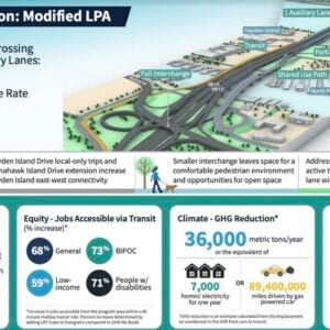
A close look at the materials prepared by the Oregon and Washington departments of transportation shows they plan to build a new I-5 bridge at least 164 feet wide — easily enough for ten or even twelve traffic lanes. While the glossy materials describing the project prominently talk about “one auxiliary lane” (in each direction), they almost completely omit a description of the actual width of the bridge. The IBR documents show only crude and misleading cartoon-like drawings of the bridge, without any actual measurements. That’s intentional: because they don’t really want you to know how wide a structure they’re planning.
But in a cryptic note in their presentation, they do refer to the width: The so-called ten lane bridge (two auxiliary lanes each direction) is said to have the same “footprint” as the 2013 Locally Preferred Alternative (LPA, a step in the federal NEPA review process). For the record, that footprint is 180 feet. For the so-called eight lane bridge (one auxiliary lane in each direction), the footprint is described as “2013 LPA Minus 16 Feet” which works out to 164 feet wide.
The broader context is this: the so-called “bridge replacement” is really a five-mile long, ten or twelve lane wide highway widening project that will cost $5 billion, and potentially a lot more.
Advertisement

This is a repetition of the false claim made for the preceding project — the failed Columbia River Crossing (CRC). In 2010, in response to objections from the City of Portland and Metro, ODOT and WSDOT announced they were reducing the size of the CRC bridge from 12 lanes to 10 lanes. But in reality, all they did was change the references in the project documents to that number of lanes, while literally erasing from the Final Environmental Impact Statement every single reference to the actual widths of the bridges and other structures they intended to build. A public records request showed the actual plans for the bridges — which were not published — were exactly the same size (180 feet in width) as they were for the 12-lane version of the bridge.

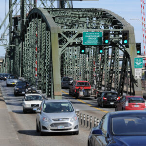
(Photo: Jonathan Maus/BikePortland)
The limited materials released by the IBR project to date make it clear that they are engaged in exactly the same deception.
With standard-width 12 foot wide freeway lanes, this 164 foot wide bridge would accommodate ten traffic lanes (120 feet), with 11 foot shoulders on either side of the travel lanes, or as many as twelve travel lanes (144 feet) with five foot shoulders on either side of the twelve travel lanes). (Alternatively, the 164 foot width would allow construction of 12 travel lanes with 2 foot wide left shoulders and 8 foot wide right shoulders, which would be common, if not generous for an urban bridge.)
While they’re calling it an eight-lane bridge, it’s really a 10 or 12 lane bridge.
ODOT and WSDOT will no doubt say they’re “only” adding two lanes, and point to the supposed safety benefits of wider shoulders; but nothing prevents them, after building a 164-foot wide bridge, from coming back with a paint truck and re-striping it for ten or twelve lanes. In fact, they’ll claim that they can do that without any further environmental analysis under a “categorical exclusion” the US DOT claims to the National Environmental Policy Act.
This isn’t an aberration or an accident, it’s an intentional strategy to evade environmental review: ODOT and WSDOT did this a decade ago on the failed Columbia River Crossing. It did the same thing with the I-5 Rose Quarter project, again claiming it was merely adding one auxiliary lane in each direction. Meanwhile its actual plans (which it kept secret and didn’t include in the Environmental Assessment) showed it planned to build the I-5 Rose Quarter project to be 160 feet wide, easily enough to accomodate 10 lanes of traffic.
The highway builders know — though they refuse to admit — that more lanes induce more traffic and more pollution. That’s why they’re engaging in this highly deceptive process of claiming they’re just adding a single “auxiliary” lane, when in fact, they’re engineering structures that can be repainted in a day to be vastly wider. This subterfuge enables them to claim minimal environmental impacts now, and then with no further review, create exactly the wider roadway they wanted all along.
Read more of Cortright’s writing on the IBR project at CityObservatory.org.


Thanks for reading.
BikePortland has served this community with independent community journalism since 2005. We rely on subscriptions from readers like you to survive. Your financial support is vital in keeping this valuable resource alive and well.
Please subscribe today to strengthen and expand our work.
They did the same thing with I-5 in Eugene. Take a look at the width of the “4 lane” replacement bridge:
https://goo.gl/maps/9fpSENfmpregeEef8
One of the reasons those bridges are so wide is because of the construction process. One old bridge was removed and replaced with a new one; traffic in both directions was diverted to the new bridge; the second bridge was removed and replaced. There were narrow lanes and pretty severe lane shifts during the detour, but they were able to keep two lanes flowing in each direction fairly successfully. There’s no realistic detour in the Eugene area and too many environmental conflicts to simply move I-5 to a different corridor.
Why would the second of the two new bridges need to be so wide?
Obviously future proofing.
“ODOT does not analyze the impact of the projected increase in [Eugene] I-5 bridge traffic on the environment, urban sprawl or global warming. ODOT can legally get away with this because, the agency claims, it’s an issue of paint.” https://eugeneweekly.com/2012/02/24/eugene-weekly-news-1-22-08/
65′ clear bridge width for 2 lanes. That means 32.5′ wide lanes. Or 5x 12′ travel lanes plus a 5′ shoulder. Or 4x 12′ travel lanes plus two very generous shoulders (7/7 or 11/8).
Thanks Joe for your truth telling in this long, seemingly endless, story of deception. I experienced a version of this double talk while serving on the Governors’ I-5 Tast Force 20 years ago! Keep up this important work!
Ten lanes at Rose Quarter and ten across the bridge creates another bottleneck between them that will be the next project they propose fixing. ODOT has made it pretty clear that they don’t care what people in the City want and will just lie, repeatedly, to get the design they want.
What bottleneck? ODOT just expects people to follow Waze and divert onto local streets. Avoid the NoPo trench on MLK, Williams, Rodney, Interstate, etc. Convenient ramps back onto I-5 at Marine Drive (see diagram above).
About one-third of the southbound traffic coming across the bridge in the morning exits at the first three exits (Hayden Island, Marine Drive and Interstate). This includes lots of people who work in the Columbia industrial district. Then, particularly in the morning, traffic from north Portland residential areas joins I-5 southbound, making the traffic volumes higher through the Rose Quarter and continuing on I-5 or going to I-405 or I-84.
About 25 years ago, three bottlenecks were identified: I-5 bridge; Rose Quarter: and the two-lane section of I-5 southbound adjacent to Delta Park. The third was completed about ten years ago. I don’t think its a conspiracy to pick one section at a time to widen.
So you’re saying 2/3rds continue southbound going from what is currently designed to be a 10-12 lane bridge down to 6 lanes and then back up to 10 lanes. How is that not a manufactured bottleneck?
The conspiracy is laid out in this guest post. They’re hiding the true width of these projects. They also lied about the environmental impact, congestion reduction, and benefits of their original proposed caps that could only support a park.
We cannot have true climate justice long as the oligarchs are buying our government.
Don’t get distracted. The problem is the culture of the Highway Builders at ODOT and their fan boys. That IS something that our Democratically controlled State house, senate, and Governor’s office could address. In fact, all it takes is a stroke of a pen: institute tolling on I-5 immediately and watch this issue disappear.
The more things change, etc.
The problem with this is that it says the bridge will be too wide but never really says why anyone should care. The problem is that it will drown Portland and its local streets in more traffic. Those vehicles coming across the bridge have to go somewhere, they have to have a parking space wherever they go and they aren’t likely to stay in just one place all day.
I understand and share the frustration with the misleading public information campaign. I still remember how ODOT’s projections showed that widening I5 at Lombard was going to reduce traffic at the Rose Quarter and on the Fremont Bridge. That’s just the way a lot of traffic engineers think. They as professionals have the “right” solution but they need to get people’s “buy in” even if that means twisting the information.
Here I think what is needed is a clear focus on alternative numbers that really matter. There needs to be a clear commitment to no increase in the number of vehicles coming across the bridge regardless of its capacity. If tolls are the mechanism for controlling that then bypassing that commitment needs to be politically cumbersome to the point of being all but impossible. If WashDOT or ODOT (alone or together) control the tolling they will eventually cave to political pressure from Washington real estate developers and commuters to allow more vehicles at the expense of Portland’s local streets and residents.
Exactly. This wider CRC, with convenient, free-flowing off-ramps (2 lanes wide) to Marine Drive are going to be pumping through traffic onto North Portland neighborhood streets every morning.
Not to discount Mr. Cortright’s on-going interesting discussion about ‘how wide is wide’ in the eye of the beholder…
…but per more about the numerous continuous fallacy of other comments that ALL the traffic growth is generated by the north side of the Columbia. For better or worse the days of an easy “reverse commute” [or “reverse social/ hiking trip”] across the bridge are gone…its messed up in both directions for many hours of the day (and even worse northbound on many a weekend).
And many of the new homes up in the greater Clark County are being filled by displaced Portlanders / Oregonians…but who have also kept their jobs and friends on the southside of the river. Thus the issue.
The lanes are given away for free, to people driving 5,000 pound vehicles to move a 170 pound person. Thus congestion is the price to manage demand.
Any sane frat party host would stop giving away unlimited free beer instead of listening to the drunk folks who say “dang it, there’s a line, just buy more kegs and put it on the tab of the other frat.”
Any sane person would say, “$2 a cup” and then some folks would choose to not drink so goddamn much and the line would shrink.
This is how the earth burns – irresponsible frat party hosts giving away free highways.
Best frat party comment of the week. 🙂
I’m stealing this the possibility of future debates with road warriors.
I do that ‘reverse commute” and drive across the bridge from Sellwood in SE Portland to Vancouver, WA every morning and every afternoon. My usual travel time is 18 min in the morning and about 25 min to home. It’s a piece of cake. When are you driving it because I aint seeing what you are seeing (“messed up in both directions”)?
Thanks for the facts. The ODOT director and staff should be held accountable for lying to the public. This is not how democracy works.
Sadly, “Bridgegate” is already taken.
Let’s just make it a stop sign and ferry pulled by donkeys. A city of 2 1/2 million can accommodate the traffic very easily that way.
Replace the bridge and get light rail on it, along with bike lanes and pedestrian walkways.
This thing is happening because the feds are tossing money everywhere so its a rare chance to replace a thing that is old and not up to seismic standards.
Eventually toll it after the dust has settled.
The population of the NW is going to continue to grow due to climate change and social change and will see greater than expected migration. The region has not decided to build dense affordable towers so population is dispersed.
Climate change: Arizona/California/Nevada/Utah have to choose between water or electricity at the moment. If water runs out they turn to the NW.
Social change: don’t say gay, transgender hate bills, and overturn of roe vs wade. Same as above, but many from low income states will choose Oregon due to lower costs than Washington or California.