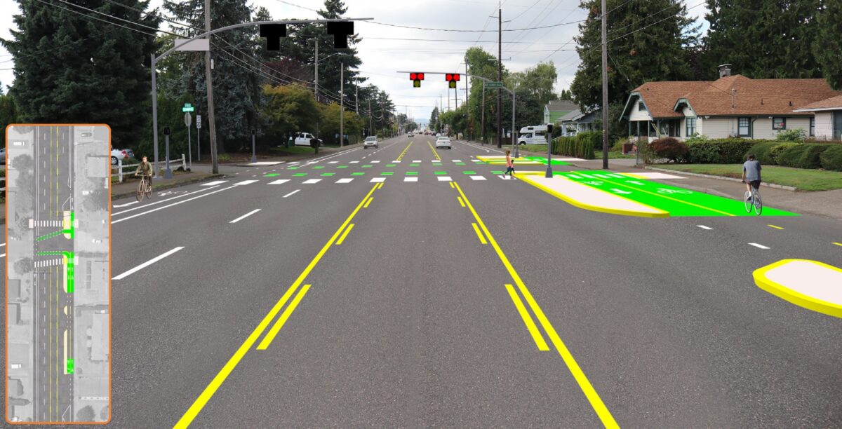
(Graphic: City of Portland)
Starting this spring the Portland Bureau of Transportation will create new bike lanes on outer Northeast Glisan in a bid to tame dangerous driving and improve safety for all users. It’s Phase 2 of the East Glisan Street Update project that began in 2019 and has already led to significant safety impacts.
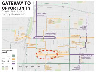
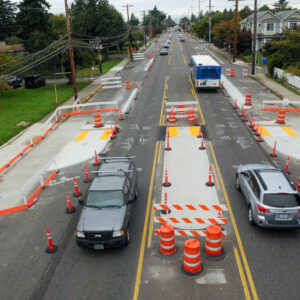
You might recall our coverage of Phase 1 that restriped Glisan between 122nd and 162nd (city limits). That project changed the configuration of this dangerous arterial from five general lanes (including a center turn lane) and no bike lanes to three general lanes (including a center turn lane) and parking-protected bike lanes.
At intersections, the cross-section transitions to two general lanes in each direction and buffered bike lanes. This is part of what PBOT refers to as a “narrow road, wide node” design that looks to create safer conditions while not having a major impact on travel times for car users. In a October 2019 video, PBOT explained how this “smarter street” reduces speeds between signals but, “You’ll still [drive] efficiently through the major intersections, keeping your overall travel time close to what it is now.”
Advertisement
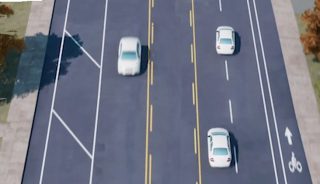
(Mockup by BikePortland using PBOT graphics)
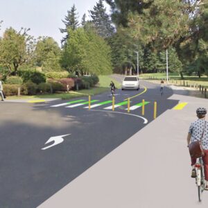
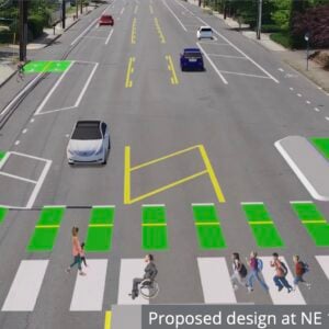
Phase 2 will focus on the section from 102nd to 122nd. PBOT will install new crossings with flashing beacons at 108th, 113th and 155th. The lane configuration will be different depending on which direction you’re going (see images above and right). Eastbound will have two general lanes and buffered bike lanes; westbound will have a center turn lane, one general lane, and a parking-protected bike lane.
This “offset cross-section” isn’t standard for PBOT. They say it was done in response to community feedback and traffic volume analysis that suggests one general lane eastbound would create too much delay for drivers. “Adjusting the street to have one driving lane in the westbound direction still offers many of the safety benefits and provides space for bike lanes,” PBOT says.
Data collected by PBOT after the completion of Phase 1 showed, “an overall improvement in safety measures,” and no significant travel time delays or diversion into neighborhoods.
Advertisement
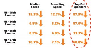
Drivers slowed down across the board, with particularly steep decreases in top-end speeding. An evaluation of Phase 1 changes (PDF) also shows the lane configuration changes didn’t have a significant impact on transit times (outside of relatively small increases in peak times) or car user travel times. The worst part for drivers is a 30-second travel time increase during the evening peak period (note the data was collected in February 2020, prior to major shifts due to Covid).
PBOT also measured how bicycle users were impacted by the Phase 1 changes. PBOT uses a “Level of Traffic Stress” metric which rates biking conditions on a scale from 1 to 4 with four being the highest stress. With no bike lane prior to this project, Glisan was an LTS 4. The sections with parking-protected bike lanes are now considered LTS 1. Where there are only buffered bike lanes (approach/at intersections), the stress level rises to LTS 3. PBOT says recent speed limit reductions on Glisan (from 40 to 30 mph) bring it down to LTS 2.
This is just one project in PBOT’s “Gateway to Opportunity” effort to improve road safety in outer northeast Portland. Learn more at Portland.gov.
— Jonathan Maus: (503) 706-8804, @jonathan_maus on Twitter and jonathan@bikeportland.org
— Get our headlines delivered to your inbox.
— Support this independent community media outlet with a one-time contribution or monthly subscription.



Thanks for reading.
BikePortland has served this community with independent community journalism since 2005. We rely on subscriptions from readers like you to survive. Your financial support is vital in keeping this valuable resource alive and well.
Please subscribe today to strengthen and expand our work.
Interesting. I wonder why eastbound would have more delays than westbound if a car lane were removed. It’s not like only one direction has access to the freeways, nor are there nearby one-way streets that would take some of the pressure off the westbound lanes. If the issue is the intersection at 122nd, then why not just have two eastbound lanes for one block or so, instead of over the whole length? Because in the rendering provided, that westbound bike lane looks nice, but the eastbound one leaves something to be desired. I’ve got to say that I’m disappointed with that decision.
Rush hour traffic is always worse in the evening. I’ve always attributed it to people having something of an ability to start at different times, but I just looked it up and it looks like it’s largely because in the evening people are leaving a more concentrated area all at the same time.
I don’t get it either. I’m half expecting Stark to have the east-bound two lanes merged into one on its redesign.
Given the planning commission’s response to Hawthorne, will they respond to PBOT about how dangerous this section of Glisan is for pedestrians with the two open car lanes? Or will they say nothing?
Haha there is not a single road or path in this city that is an LTS 1.
I might say that some of the paths out in WashCo like the Westside Trail are LTS 1, but that’s about it in the metro area.
PBOT should extend the bike lanes to NE 47th because Glisan is more direct and flat than the Everett greenway
Plus Everett needs some serious road work done. I’ve approached PBOT project managers before and inquired about greenways getting preference in paving since a good many of them are virtually not rideable. I received zero feedback.
There’s a project in the Transportation System Plan to create a bikeway on Glisan between 47th and I-205. That stretch of Glisan is 80′, so hopefully it will be somewhat easier for PBOT to implement that idea that in it was on the 70′ wide Hawthorne. As long as a comfortable way to cycle through Coe Circle could be designed, Glisan could become a really great route between the Central City and East Portland.
The I-205 Halsey overpass and under crossing are going to be important for this. Crossing Glisan on 205 sucks, despite the recent “improvements” that didn’t amount to much. I explored under 205 the other day and they’ve done a bunch of work to create a better access road for gateway green. Originally the road was muddy and at the track grade, now it’s elevated. I’m not sure if it’s also the beginning of this undercrossing project, or just temporary terracing with concrete blocks, fill and gravel.
Or maybe someday we’ll get a bike/ped bridge over 205 somewhere in NE?