The Portland Bureau of Transportation will begin work next week on what they’re (smartly) calling an “update” to Northeast Glisan Street east of I-205 to the city limits.
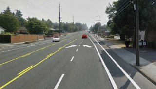
The project will take a variety of steps to improve safety. PBOT will reconfigure lanes to encourage safer speeds, add medians and flashing beacons to make it easier to cross on foot, add bike lanes, and more.
PBOT crash data puts NE Glisan in the top ten of the most dangerous streets in the city. “Highway-style streets like NE Glisan Street divide neighborhoods and make it nerve-wracking for kids to walk or bike to school or families to walk to parks or the store,” states the project website. “Long stretches of road between signals mean people drive too fast, making it unsafe, and sometimes deadly, to cross the street.”
Advertisement
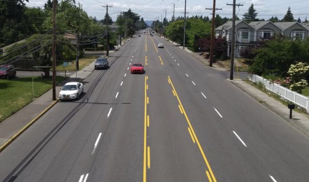
This section of Glisan currently allows drivers to use all seven lanes of the roadway — including five for driving and two for parking. The project will reduce that number and create several zones where drivers will go from having two lanes (in each direction) to one. Instead of reducing lanes for drivers along the entire corridor, PBOT has come up with a less controversial idea: “narrow road, wide nodes”. There will be one lane for through driving (in addition to a center turn lane) in three sections, but it will go back to two lanes at major intersections of NE 102nd and 122nd.
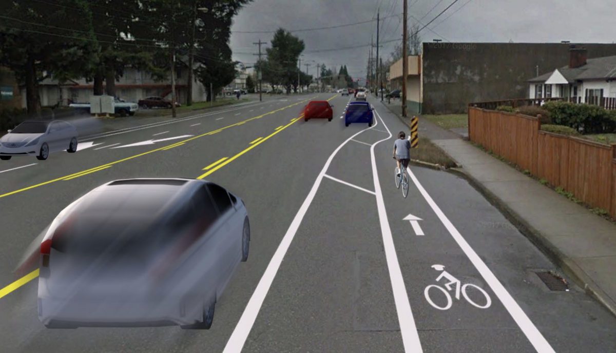
Here’s how PBOT explains this new approach:
“Major intersections will continue to have multiple driving lanes in each direction. For example, this image (above) shows what NE Glisan Street will look like going west at NE 125th Avenue approaching the major intersection at NE 122nd Avenue. This “narrow road, “wide node” design minimizes delay for people driving while still improving safety between intersections. Bike lanes will continue through the intersections. This increases the overall people-moving capacity of the street.”
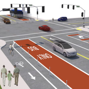
Bicycling-related updates will include a new signalized crossing at NE 128th (part of the 130s neighborhood greenway), a buffered (paint-only) bike lane eastbound and a parking-protected bike lane westbound between NE 102nd and 122nd, and parking protected bike lanes in both directions from 122nd to 162nd (city limits).
The project budget is $400,000 and funding came from a mix of federal highway funds (granted to the city by ODOT and Metro), and PBOT System Development Charges and Portland’s cannabis tax.
— Jonathan Maus: (503) 706-8804, @jonathan_maus on Twitter and jonathan@bikeportland.org
Never miss a story. Sign-up for the daily BP Headlines email.
BikePortland needs your support.



Thanks for reading.
BikePortland has served this community with independent community journalism since 2005. We rely on subscriptions from readers like you to survive. Your financial support is vital in keeping this valuable resource alive and well.
Please subscribe today to strengthen and expand our work.
This will be a viable option now for people who don’t want to head out on Springwater. I’ll continue on the car-free trail, I feel unsafe around texting and/or drunk car drivers.
I’m so glad to see so many improvements out in East Portland! Glisan is always a huge pain to negotiate and virtually forces anyone wanting to travel north/south east of 102 to use the unpleasant, debris filled bike lanes on 102, 122, 148, etc.
Unsurprisingly, the folks on my (East Portland) Nextdoor are losing their minds about this work (and the 102 ave work).
Get off Nextdoor and save yourself. We are east of 205 also. We signed up, about lost our shit with some of the wild and horrifying takes of busybodies that post there regularly and promptly deleted our accounts. The same people show up to the PH-G n’hood meetings. It’s all very terrible.
So it’s a safe assumption that they won’t be at the Parkways event this weekend?
Geez…. I got banned from Nextdoor about 2 weeks ago. Posted 2 videos showing bike lane violations that put my life in danger. I was swarmed by bike haters and castigated as an “entitled cyclist”. Was asked by a ‘leader’ to take down the videos, said, “No”. Now I’m banned. That’s site is seriously the worst!
You should report that moderator to Next Door. I don’t believe you violated their terms of service.
It is theee worst. Move on and view this as a blessing. Like when you lose a job you hate and you can’t bring yourself to leave. You need this. It happened. You’re gonna be better off!
The bike and ped hate was what floored us too. It’s strange how people think. Fortunately I *think* most of those folks are older. Boomers. Just the worst folks around. Their ideas and views can’t fade away fast enough.
Yeah, not too worried about it. A bit of a blessing in disguise. I encourage all cyclists to raise hell on Nextdoor in support of cyclists until you’re banned.
This looks like a huge improvement. Glisan east of I-205 is a non-option for cyclists, and is scary to drive on right now.
Nice! – good to see PBoT working on reforming its mid-century safety deficient “highway capacity centric” arterials. Looking forward to riding it [and driving it] once completed.
Did you notice the header image in the announcement email featured an unnecessarily blocked bike lane? I’ve seen an uptick in full bike lane blockages by construction signs and equipment this year.
Is the bike lane disappearing at Intersections where it goes back to 2 travel lanes through, and turn lanes? Does it completely lose the buffer? For example in the image captioned “Glisan westbound at NE 125th Avenue approaching NE 122nd Avenue.” I cant tell if they gave up rendering the bike lane or it actually disappears.
Should be noted if they kept it only one through lane instead of two at intersections, they’d have the room to upgrade these in the future to protected intersections without buying any additional ROW.
I went to the website, and based on their text they explicitly state that the bike lanes do continue through intersections. However, they don’t say whether they remain buttered or not
Nothing beats a piping hot buttered bike lane first thing in the morning.
😉
My guess is that they are maintaining 2 lanes in each direction west of 125th to reduce the traffic delays that this will create. Glisan between I-205 and 122nd is quite crowded, and a reduction to one lane in each direction would create fairly epic backups. This would create a huge backlash in east Portland. East of 122nd, however, the traffic counts drop off significantly.
It kills me to see PBOT continually do sub-standard work. This might be an improvement but it’s still lame as hell. We deserve better.
But but but…if these “improvements” are made where will the planes land in emergency situations or when the Russians [Chinese] bomb the airport? Vancouver?!
[Did not President Eisenhower’s Defence Highway Act 1956 have some sorta clause that the minimum width of any state or federal highway arterial be sized to accommodate the landing requirements of a typical fighter bomber of the period?]
Case in point: there’s a DC-8 crash site just a half-block south of Glisan at 157th from 1978. Perhaps one day they’ll put up one of those cheesy historic markers? Or a white-painted ghost plane? 9 people died, mostly people in houses; the plane itself crashed because it had run out of fuel, lots of injuries but surprisingly few deaths.
Crashes due to fuel exhaustion are more survivable, because you don’t have thousands of gallons of jet fuel to ignite when the tanks rupture.
I think a white DC-8 chained to a phone pole would be pretty awesome, myself.
What about a safer crossing between 102nd and 122nd? Maybe around 108th bikeway?
I lived in the area for 8 years, biked all the time to the EPNO offices crossing Glisan. There’s a good route at 106th that has a 4-way crossing without a jog, as well as at 113th, both of which connect to the HOP. The north side of 113th is a good cut-through for bikes that cars can’t go through, a short bit of unused right-of-way that a local builder has encroached upon. 114th has a short jog. There’s a crosswalk at 117th that was put in after several walkers got hit and killed by car drivers.
This looks awful. I could pick it apart but where do I even start with it?
Maybe just don’t.
I have no gripes with the traffic calming going on out here, but I’m worried the neighborhood streets will suffer with cut through traffic from angry drivers looking for short cuts.
Yes, this looks like a mess. The green Cross Bike crossing currently have no legal standing and confuse everyone.
It’s brilliant. I would only add some of those ODOT ‘safety bolders’ to the striped off areas, for additional traffic calming and crosswalk protection. Maybe some of the new bolders that keep popping up near the freeways could be relocated .
The boulders are heavy enough that it’s hard to carry more than two at a time. That means a lot of trips.
Keep those boulders coming!
As someone who bike commutes on the outer east side, the improvements that have been coming down the pipe have been more than appreciated! I was caught off guard yesterday when I saw 102nd had been re-striped from Fremont to Sandy. I didnt know that was in the works, but 102nd is now actually rideable for that short stretch where I ride daily! I guess I’ll have to save the Frogger jokes
That crash marked a turning point in how cockpit crew were trained to interact with one another iirc. CRM came about from it.
what is the “raceway” part of the headline referencing/describing?
Are people racing of Glisan? That would be pretty wild.
PBOT referred to the street as a “raceway” in their project materials.
(more of a general comment) as a cyclist, i do not like the (legal) ambiguity of “cross bikes.” instead a green dashed lane line would be a more precise indicator that a bike lane continues through and intersection.