
(Photos by Jonathan Maus/BikePortland)
If you haven’t been out to the Crown Zellerbach Trail in a while, it’s time to go back. If you have no idea what I’m talking about, it’s time to listen up.

The Crown Z (what Columbia County would prefer you to call it) underwent a major facelift late last year and with summer finally here, this rail-trail is ready for its close-up.
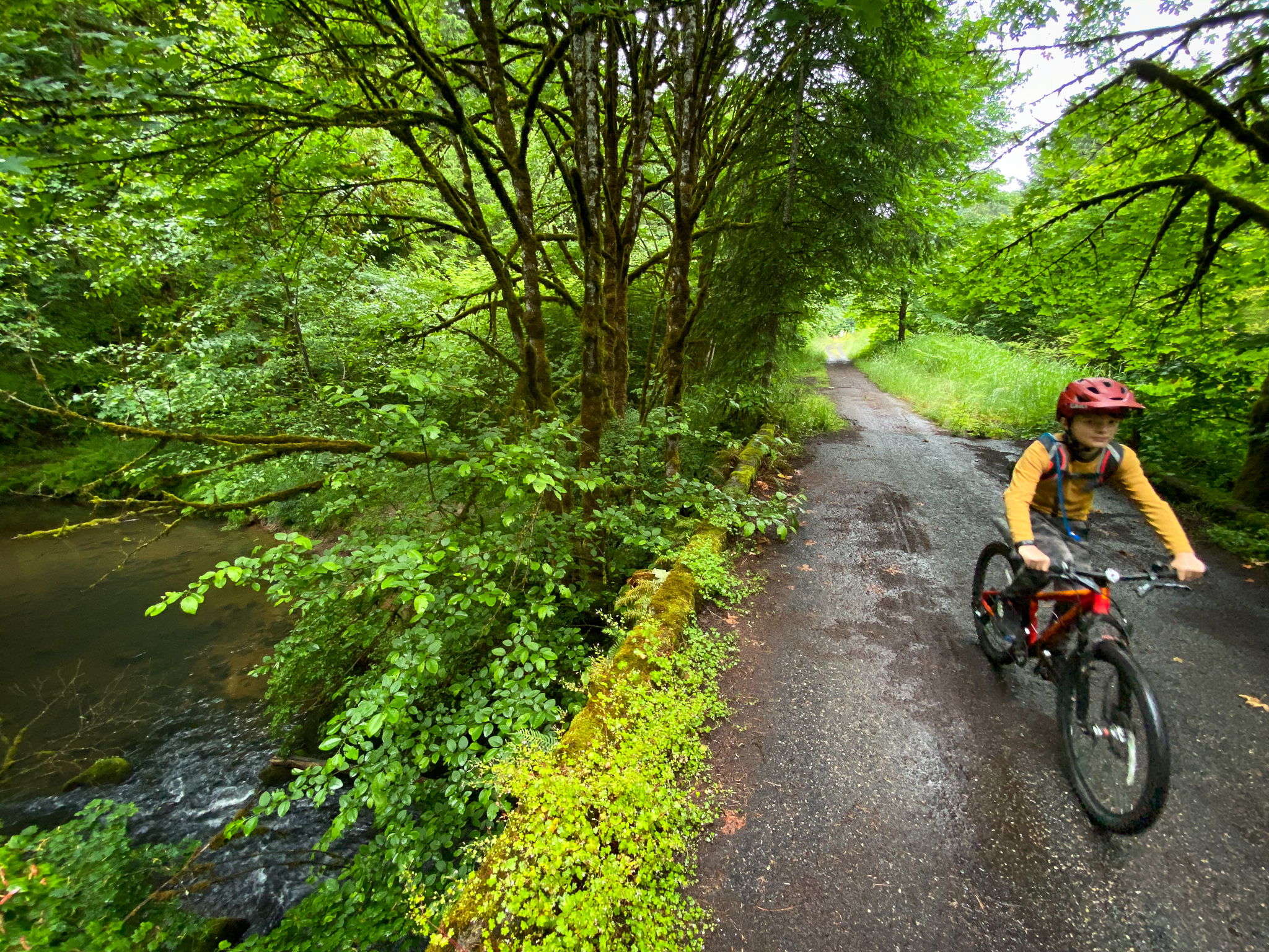
The Crown Z used to be a major railroad line that ran timber and supplied work camps between the Multnomah Channel in Scappoose and the Nehalem River in Vernonia. Today it’s a 22-mile long linear trail that offers easily accessible and safe riding great for all ages and abilities.
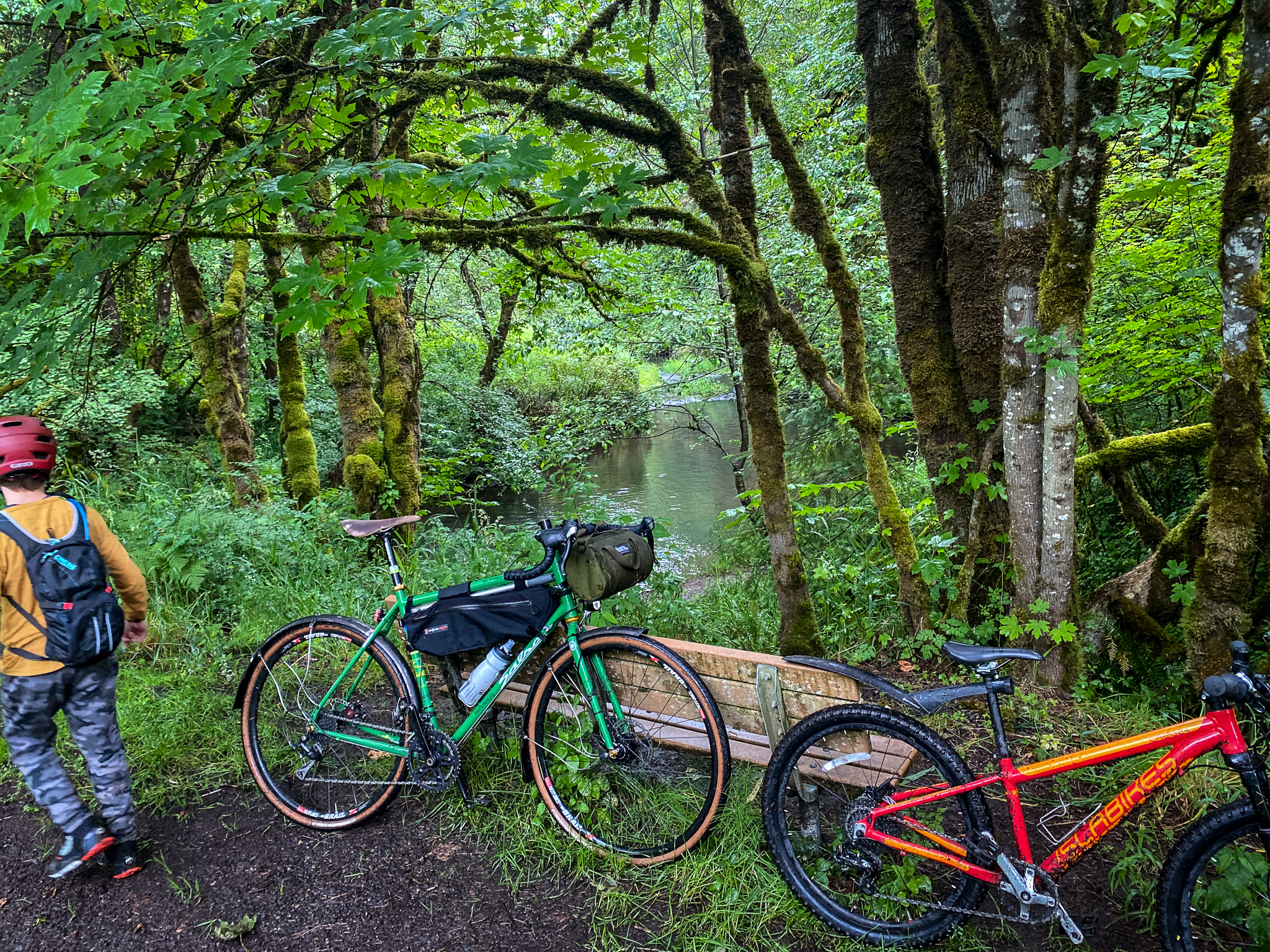
The trail is in great shape right now, even with a lot of recent rain. As things dry out in the summer heat, the beautiful trees that border the path will keep you cool in their shade. And with numerous creeks nearby, you can always hop off and splash around. When you do, don’t miss the impressive foliage that’s like a Pacific Northwest plant guidebook come-to-life.
Advertisement
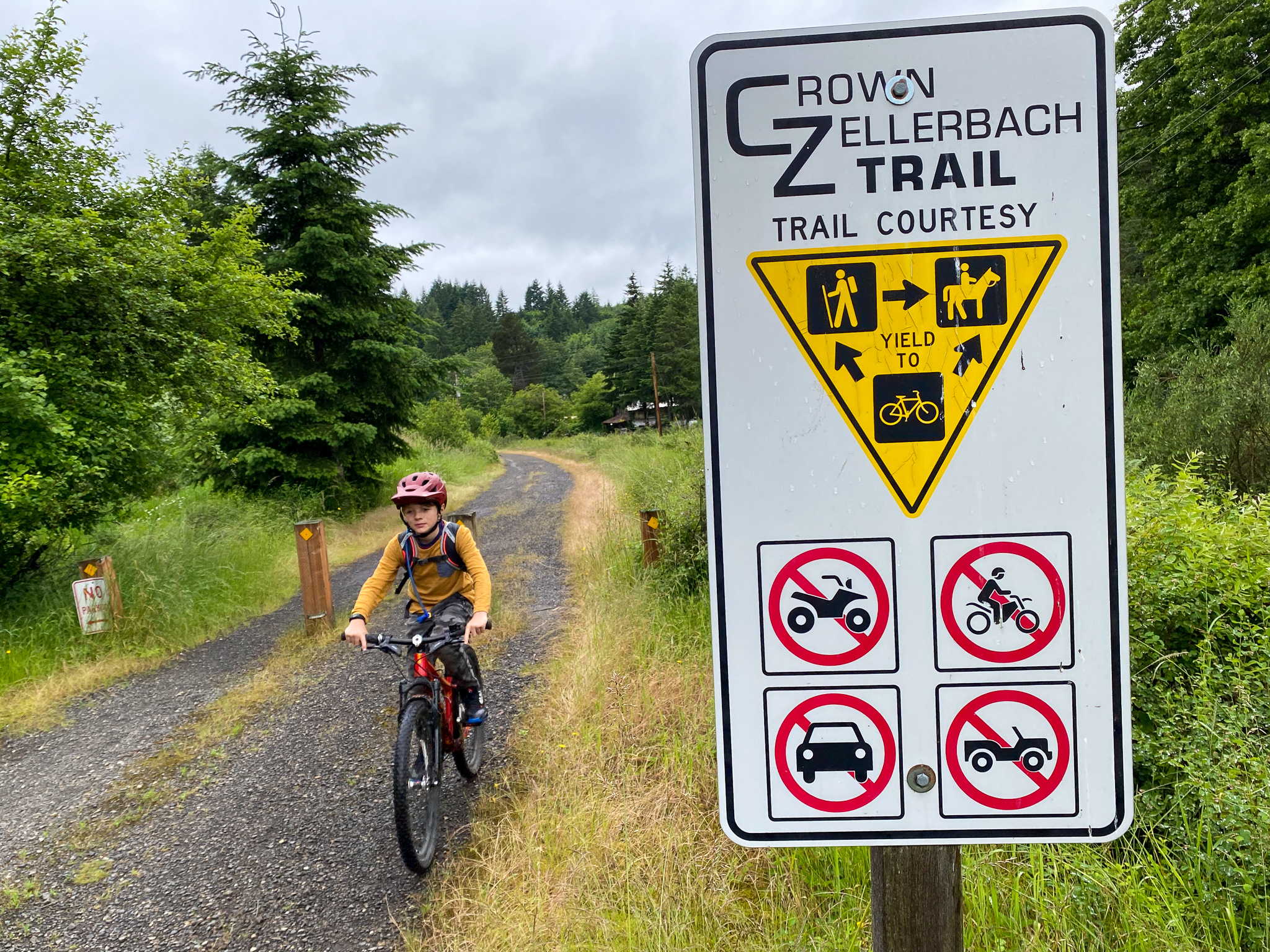
For many years the CZ was neglected and used mostly by adventurous riders. It provided a fun and safe alternate to the windy and narrow Scappoose-Vernonia Highway (which I do not recommend riding on) which it parallels. In recent years the community and County have teamed up to invest in the trail. Thanks to generous donations by local businesses, the hard work of volunteers, and political support, the CZ now boasts amenities that make the relatively short drive (or ride) from Portland well worth it.
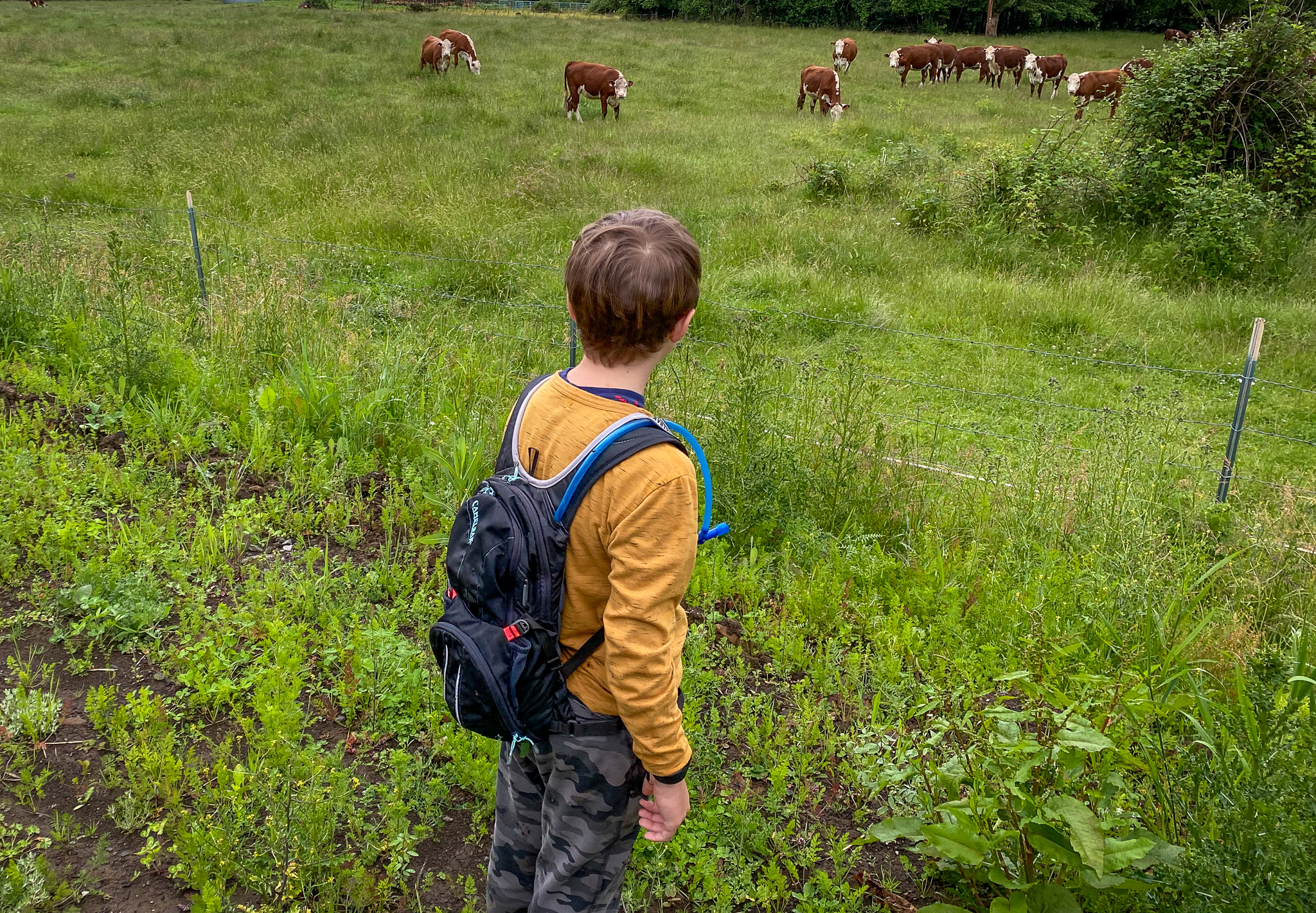
I’ve ridden it many times myself as part of long loops from Portland. After noticing some of the upgrades on a recent ride, I went back on Saturday with my nine-year-old son. It took us about 35 minutes to drive there from north Portland. We parked at the Pisgah Trailhead, which is about two miles west of Highway 30 in Scappoose.
We rode five miles up the trail from Pisgah to the new trailhead at Ruley. Along the way we stopped several times to hike around creeks and to get acquainted with the forest.


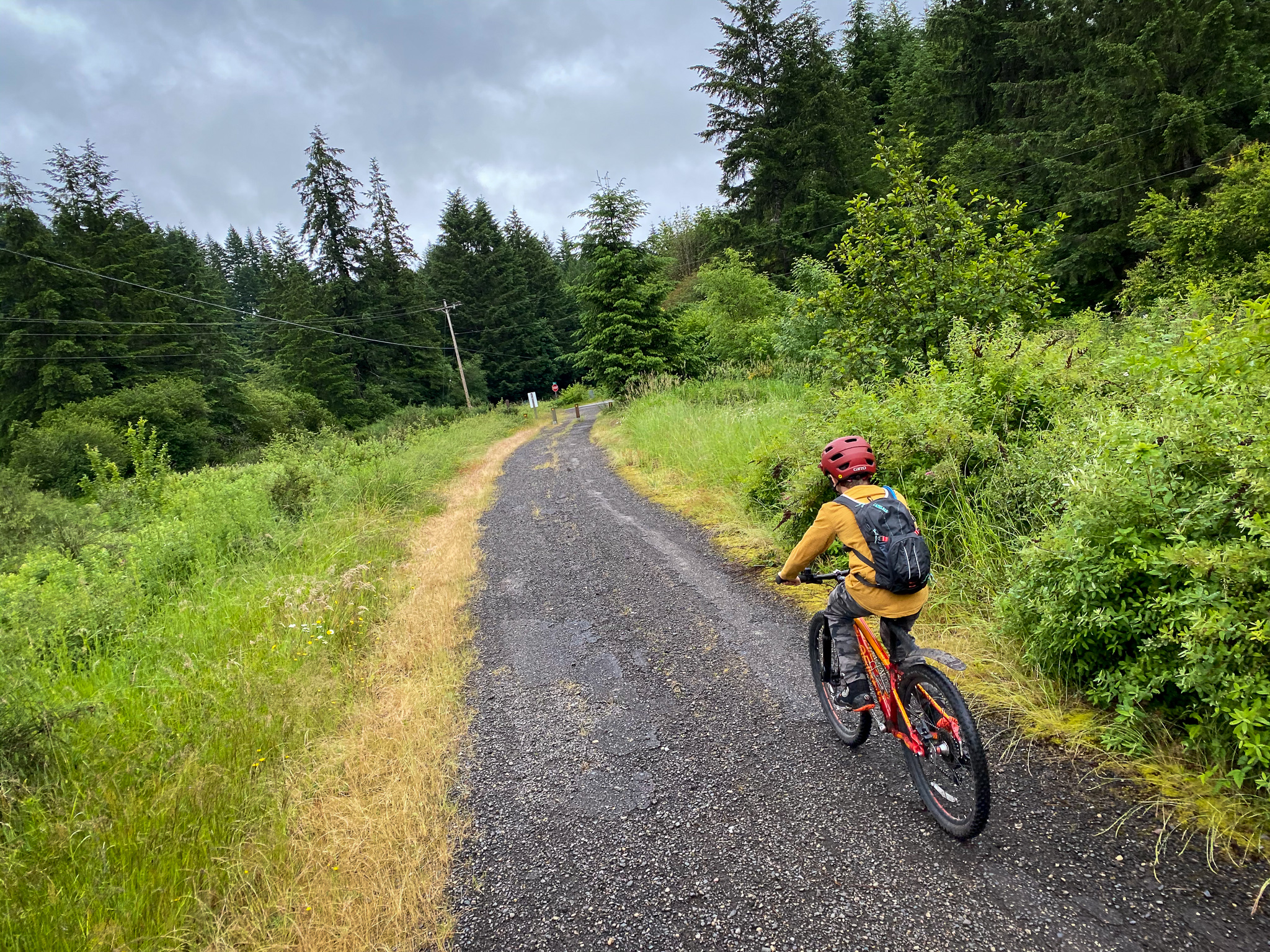
It was so much fun. I highly recommend it to anyone with young kids or family members who want to ease into unpaved/gravel riding. One of the great things about the CZ is its topography. It rises gently in elevation from its start east of Highway 30 and goes 14 miles west to its peak at the Nehalem Divide trailhead. That means you can head west until you’ve had your fill, and the reverse route back to the car will be all downhill. (I don’t have to explain to parents what a big deal this is.) It will also be fun to track our progress as my son gets stronger and more adventurous — pedaling further west each time out until we make the connection to Vernonia Lake.
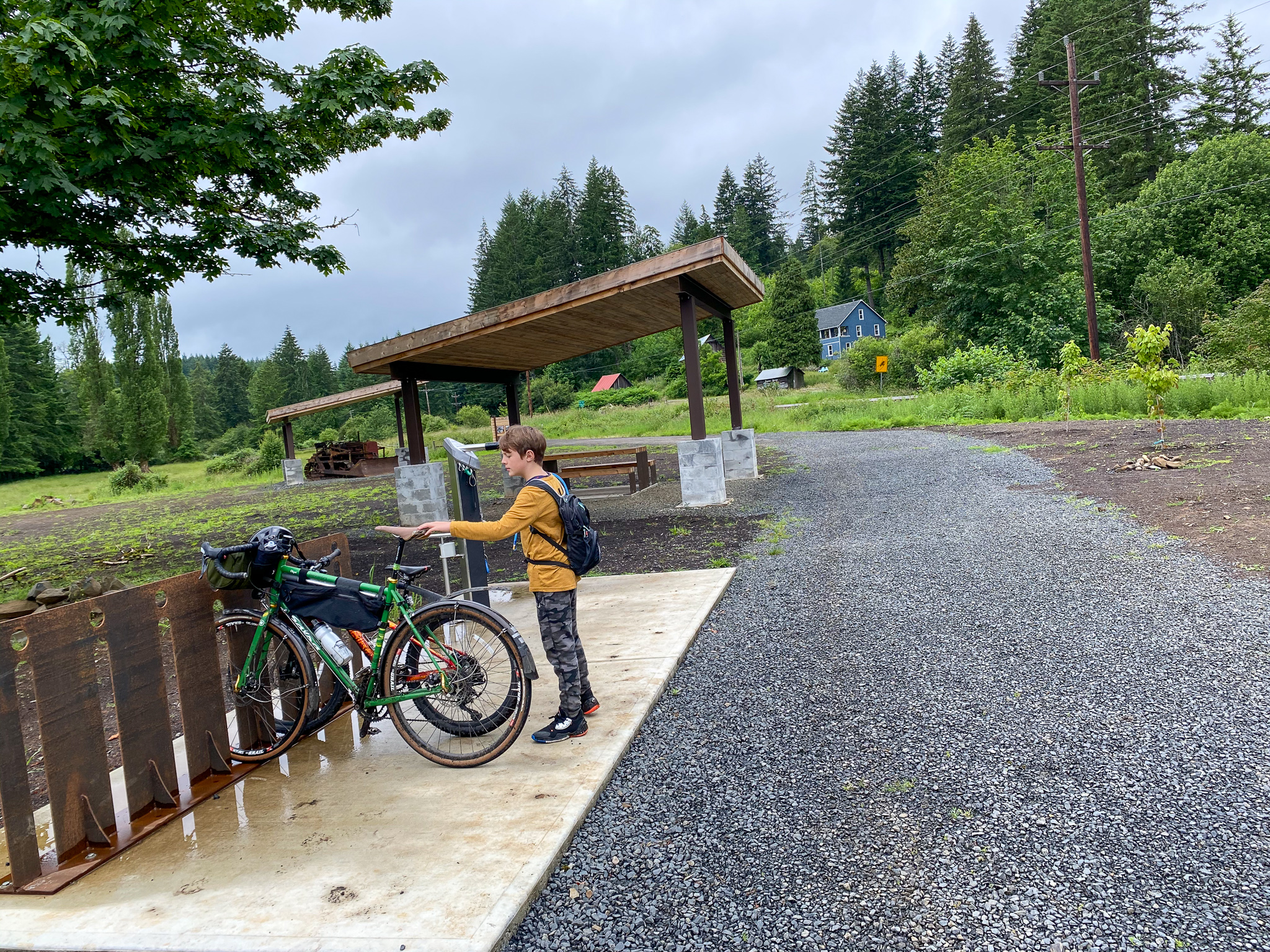
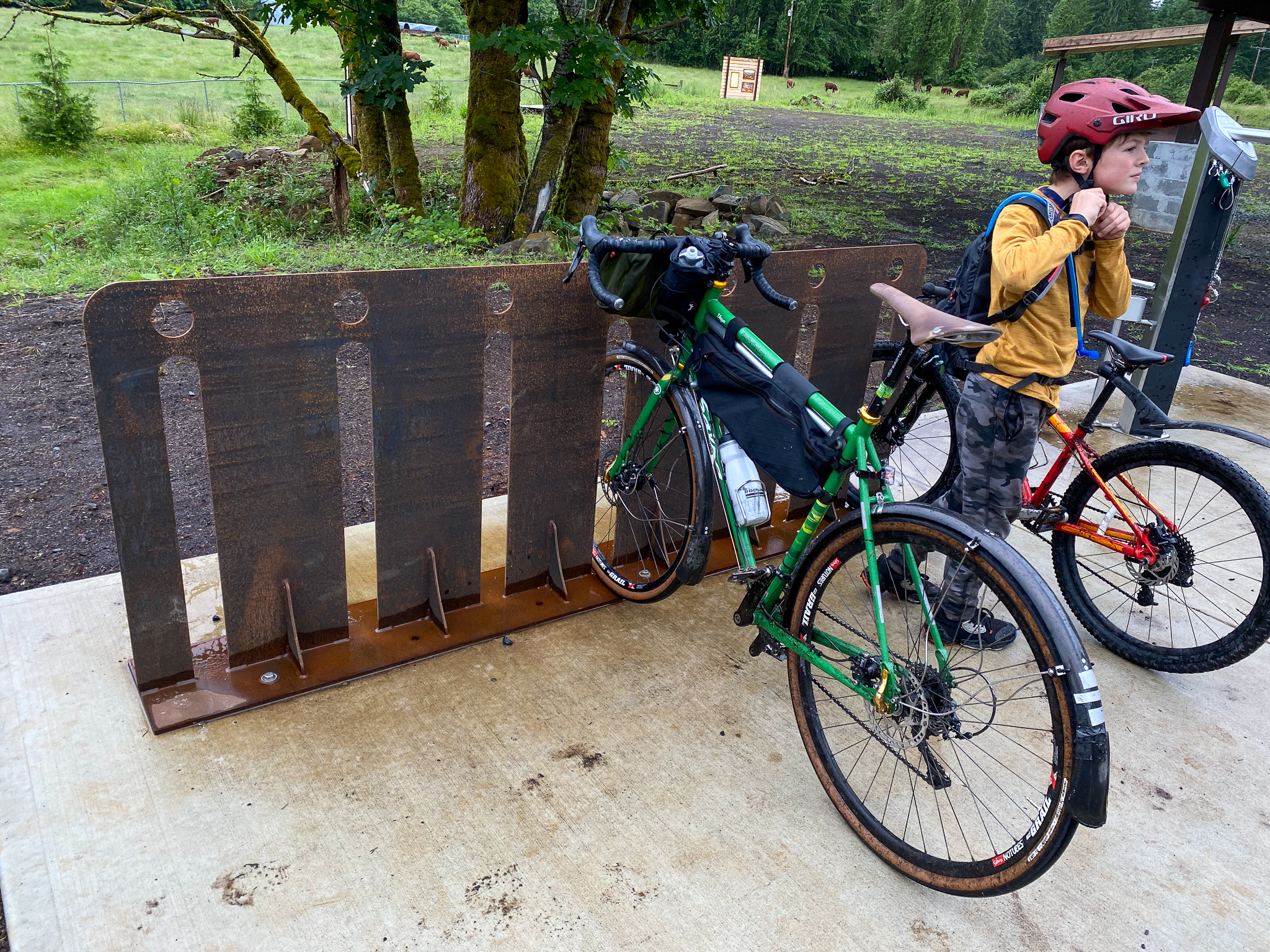
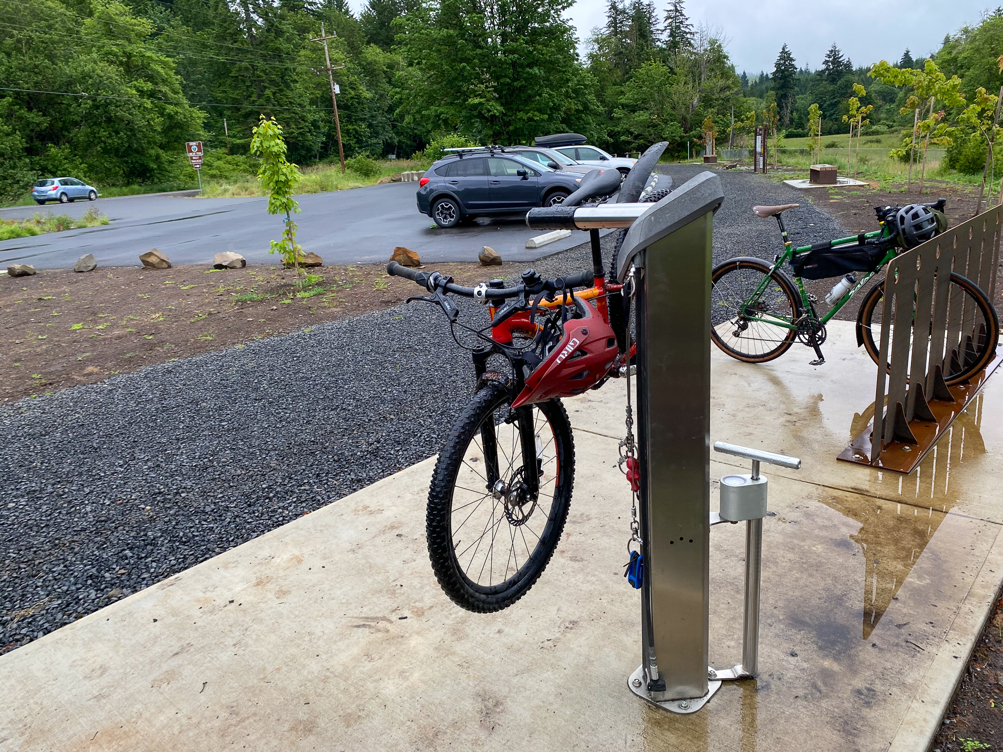
Our destination on Saturday was Ruley trailhead. Columbia County and their partners have done amazing work at this location. There’s a covered picnic bench, a nice bathroom and hand-washing station, bike parking, and a deluxe bike repair stand and pump in case you need to fix your rig or make adjustments. Everett loved getting to know the herd of cows in the nearby meadow.
My favorite part was the outdoor museum.
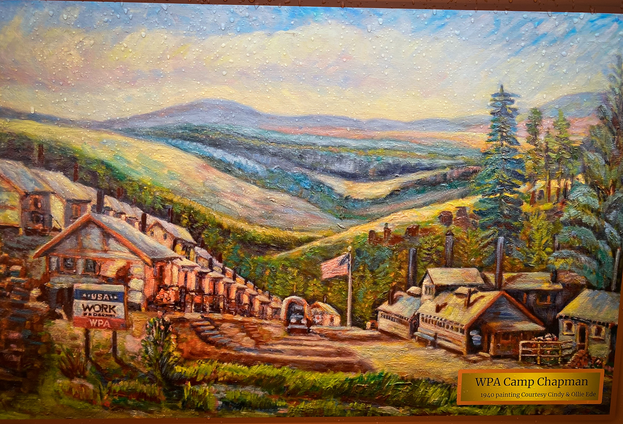
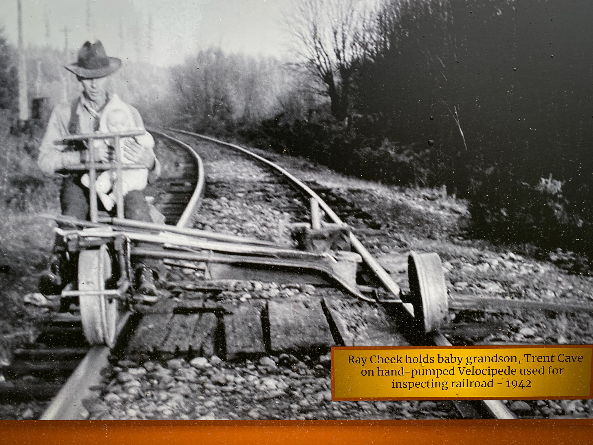
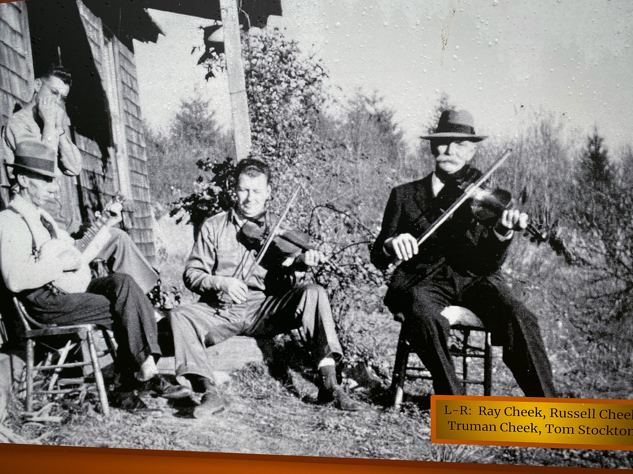
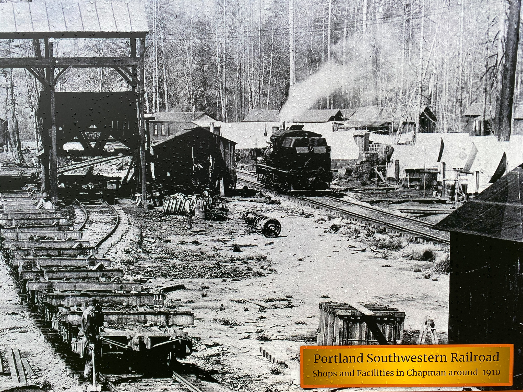
I’m a huge fan of making historical connections to the places I ride though. Thanks to the Columbia County Historical Society and Museum Association (Facebook), there are several kiosks with old photographs and information that tell the story of the surrounding area. Camp Chapman was a major settlement created by the Works Progress Administraion (WPA) in 1935. 1,400 workers were stationed in the surrounding hills and labored to build the roads and other infrastructure. The photos show family life in the 1940s and there’s even a neat old painting of the camp itself. (Several decades before Camp Chapman the area was home to major logging camps, which I highlighted after riding here in March 2019.)
After lunch at Ruley, Everett and I coasted back to the car. “That was so cool!” I heard him say at one point. “I was gliding through the forest, just like sort of zenning out for a minute.”
If you need a moment of zen, head out to the Crown Z*.
More information
– Friends of CZ Linear Park Trail on Facebook
– Official Columbia County website
– Background on recent improvements from Columbia County Spotlight
(*Note: Riding in places like this is a no-brainer for me because I’m white. It’s not like this for Black, Indigenous and people of color. As reported by OPB last week, there’s racism in the outdoors too. And this past weekend someone found a noose hanging from a truck while in a rural area outside of Cottage Grove. That is unacceptable and we want you to know these realities are on our mind as we share these places with you.)
UPDATE: Portland resident Dale Latham serves on the Crown Z Trail Citizens Advisory Committee. He points out that the trailhead near Vernonia isn’t ready for the public yet and is still an active logging area, so please avoid riding through the western end of the trail. He also says if you do come out, bring a face mask and be sure to try the restaurants in Scappoose or Vernonia. “We Portlanders should help our rural neighbors by leaving something in return. Both communities have some great local restaurants less than quarter-mile from the trail.”
— Jonathan Maus: (503) 706-8804, @jonathan_maus on Twitter and jonathan@bikeportland.org
— Get our headlines delivered to your inbox.
— Support this independent community media outlet with a one-time contribution or monthly subscription.


Thanks for reading.
BikePortland has served this community with independent community journalism since 2005. We rely on subscriptions from readers like you to survive. Your financial support is vital in keeping this valuable resource alive and well.
Please subscribe today to strengthen and expand our work.
I love the CZ. It’s such a nice float down once you get past Gunners Lake.
I was out running on the CZ this weekend too. Starting at Chapman Landing doesn’t add anything but miles and the connection to Vernonia is still a work in progress. The wide trail abruptly changed to single track and dumped me off in an active logging zone. I chatted with the guys working. They told me to follow the power line down to town and that they were clearing trees to finish up the trail on that end. The sign at Nehalem Divide points up a logging road instead of the trail, but other than that the signage is great and easy to follow.
That’s great intel. Thanks Tim. When they punch it through to the B-V near Vernonia Lake it will be cause for major celebration!
We haven’t been able to install the kiosk at the Divide Trailhead yet, but we are working on it. In the meantime there is a trail courtesy sign leading to the trail just as you turn off the paved highway. Park on the shoulder of the gravel logging road. The Divide Trailhead leads to beautiful forest in either direction and on a clear day there is a nice view of Mt Hood at one spot.
Thanks for the write-up. I plan to take my 10 year old ASAP.
This is great! I am doing this with my daughters this week!
The outdoors for people of color (raises hand) is one thing, but I think the greater privilege is male.
Women can’t always camp together in the same peace that men get. It only gets uglier when you mentally unpack the rationale of that selective suspicion and harassment.
Camping is not allowed along the Trail, but Columbia County has some campgrounds that are hosted, reducing the “a-hole male” factor somewhat. Check out the Columbia County parks link at the end of the article.
Thanks for that perspective, Champs. I have long thought that white privilege is still pretty big in the outdoors: years ago I took a Black friend of mine camping and hiking in some of the places I love in southeast Oregon, including Steens and the Alvord desert. He is reasonably outdoorsy and will go hiking alone on occasion – I have backpacked with him in Yosemite too, where the bigger crowds may make it safer. But even as a big, tough guy who grew up poor in Spanish Harlem, he told me he NEVER would have dared go to a remote part of the Oregon Desert alone.
I was glad to help provide that experience for him, but profoundly saddened that he needed me as a guide – not to find his way around, but simply to safely exist in those places.
But you are right that it’s pretty bad for women too. I don’t know a lot of women that go camping or hiking alone, at least not without a dog, and while being in a group can seem safer it sometimes invites even more harassment.
Wow way to beat us up for this too. Thanks! Happy riding!
You could read about the experiences of others with empathy and understanding, or you can just walk around the world with a persecution complex.
Aww, if THAT makes you feel persecuted as a white guy, try to imagine how much worse it would be if you suffered harassment that was actually threatening.
As Courtney Barnett sings, “I wanna walk in the park after dark. Men are afraid that women will laugh at them. Women are afraid that men will kill them.”
I serve on the Crown Z Trail Citizens Advisory Committee and your article is the greatest compliment we could receive. We created 9 trailheads along 21 miles because we want this to be a family friendly trail that could be done in segments of 2-4 miles (one way). However, the trailhead near Vernonia is not yet open and the easement to allow public use on that last segment has not been finalized. Please wait to ride that segment until we finalize the easement and the landowner finishes logging operations. We will let you know!
Also, we are still working on additional signage, so please let me know of any other way finding problems.
Finally, please take your face mask and stop in Scappoose or Vernonia for a bite to eat. We Portlanders should help our rural neighbors by leaving something in return. Both communities have some great local restaurants less than 1/4 mile from the Trail.
Thank you to the Crown Z CAC for all of your work! It is much appreciated.
I had hoped to hike from Vernonia Lake to Scaponia Park with some scouts. I didn’t realize that the trails are not yet connected. I’m glad I found this info. I’ll have to make another plan.
Dale, What do you suggest for those of us who ride this to link to the Banks Vernonia trail? Where do you suggest we get off the Crown Z in order to avoid the trespass on the logging land? In other words, what is the best way to exit CZ on the west end?
Thanks for putting this trail on my radar and it looks like a lot of fun. My son is not yet 4 and we’re just thinking about making the jump from a balance bike to a pedal bike really soon. So we’re still probably a few years away from family riding on this trail, but it’s something to keep in mind.
By the way, I think I mentioned this before, but you really take great pictures.
Anyone with kids not ready to confidently ride on the gravel portion of the trail should explore the two mile segment between Chapman Landing and Trtek Trailhead in Scappoose. There is a lot of wildlife and the path is paved so toddlers can wander, strollers are easy to manage, and beginner bikers have lots of room. And there is good local coffee, baked goods, and pizza near the trail and away from Hwy 30.
Thanks MTW! Definitely keep this trail in mind. And as Dale says in another comment here, the eastern-most section at Chapman Landing is paved and nice. Even the unpaved spots are super easy in terms of gravel roads. One reason I’m so eager to recommend this for kids is that the trail allows you to ease into off-roading because it gets more difficult the deeper into the hills you go. In other words, it’s like a graduated system of difficulty and you can just turn around and coast back to your car when you’ve reached your limit.
I’ve been wanting to try out this trail for a while now. Maybe I’ll get out there this summer. Thanks for the reminder.
I hope there will someday be a Portland-Scappoose bike trail between Highway 30 and the Willamette, extending this ride all the way into Portland.
There is space next to the railroad ROW, but funding would still be a big problem. There are so many great riding opportunities along the route, and HWY 30 is a huge barrier.
Thanks for the write up. As a long time Columbia County resident I have ridden the CZ Trail several times but it has been a while (Sticking to the road bike after hip replacement. A little more history, after they stopped using the rails it was converted to a private road just for log trucks. There was no speed limit on it so they could make more trips from the cutting area to the log mills.
Apparently, there is an abandoned tunnel under the summit. I guess it was one of the few logging railroads that built a lot of tunnels.
https://en.m.wikipedia.org/wiki/Portland_and_Southwestern_Railroad_Tunnel
There is a tunnel, and I’ve accessed the East portal. I would not recommend it, as the terrain is challenging, the tunnel is in near-complete collapse, and the Bureau of Land Management obscures the exact location to discourage finding the tunnel (technically trespassing). That said, it’s easily found by the adventurous, but going alone is risky, at the least.
Whew! Glad I read this and the updates. I’m hoping to take a couple newbie bike packers out Crown Z to Banks-Vernonia to Stub for an overnight at the end of July. Is Columbia Forest Rd the logging road to avoid? Plan was to take that to Pebble Creek to Knott to town.
Are they going to stay off the roadway now?
I’ve never been to this trail & I’d love to check it out.. How exactly would you get there from downtown Portland? Would this be safe option to get to the Banks-Vernonia Trail if you are barred from using public transit because you don’t have a”regular two wheeled bike, and don’t consistently have any other options?
Sort of: ride Hwy 30 to Scappoose… I have done the CZ and then BV and then rode back via Hillsboro and Beaverton in a big loop from downtown. Besides the trails it is either very empty roads or bike lanes the entire trip, but that doesn’t mean it is great: it is called the “Dirty 30” for a reason and it is about 100 miles and the western end of the CZ is steep (both up and down,) loose gravel so depending on your bike you’ll probably end up walking for a couple miles just before Vernonia… You can break it up into two days: there are campgrounds and a hotel near Vernonia, but of course that means you need to bring a little bit more than just a water bottle and a spare tube.
Does the CZ trail allow electric bikes?