
(Photos: J. Maus/BikePortland)

There’s a huge benefit to Portland’s urban growth boundary that never makes its way into planning debates: It allows people to bike from city streets to rural backroads in relatively short order.
I live in north Portland (about three miles from City Hall downtown) and I can pedal south, north, east or west and be among 100-year-old “Century Farms” or wild places and natural areas in about an hour or so. Sometimes I’m surrounded by so much beauty so soon after leaving the smelly and busy streets near home that I do a double-take at my watch: Have I really only been gone that long?
On Saturday this cherished phenomenon was in full effect as I set off on an evening jaunt into Washington County. I didn’t expect to be gone that long, but everything (the roads, my body, my bike) felt so good I didn’t get home for another five hours. I missed dinner with the family, but I had a feast of my own with friends I’ve come to know well over the years. Their names are: Newberry, Phillips, Helvetia, Jackson Quarry, Dorland, Moreland, Skyline, Rocky Point, Dutch Canyon, and my old friend Otto Miller.
Advertisement


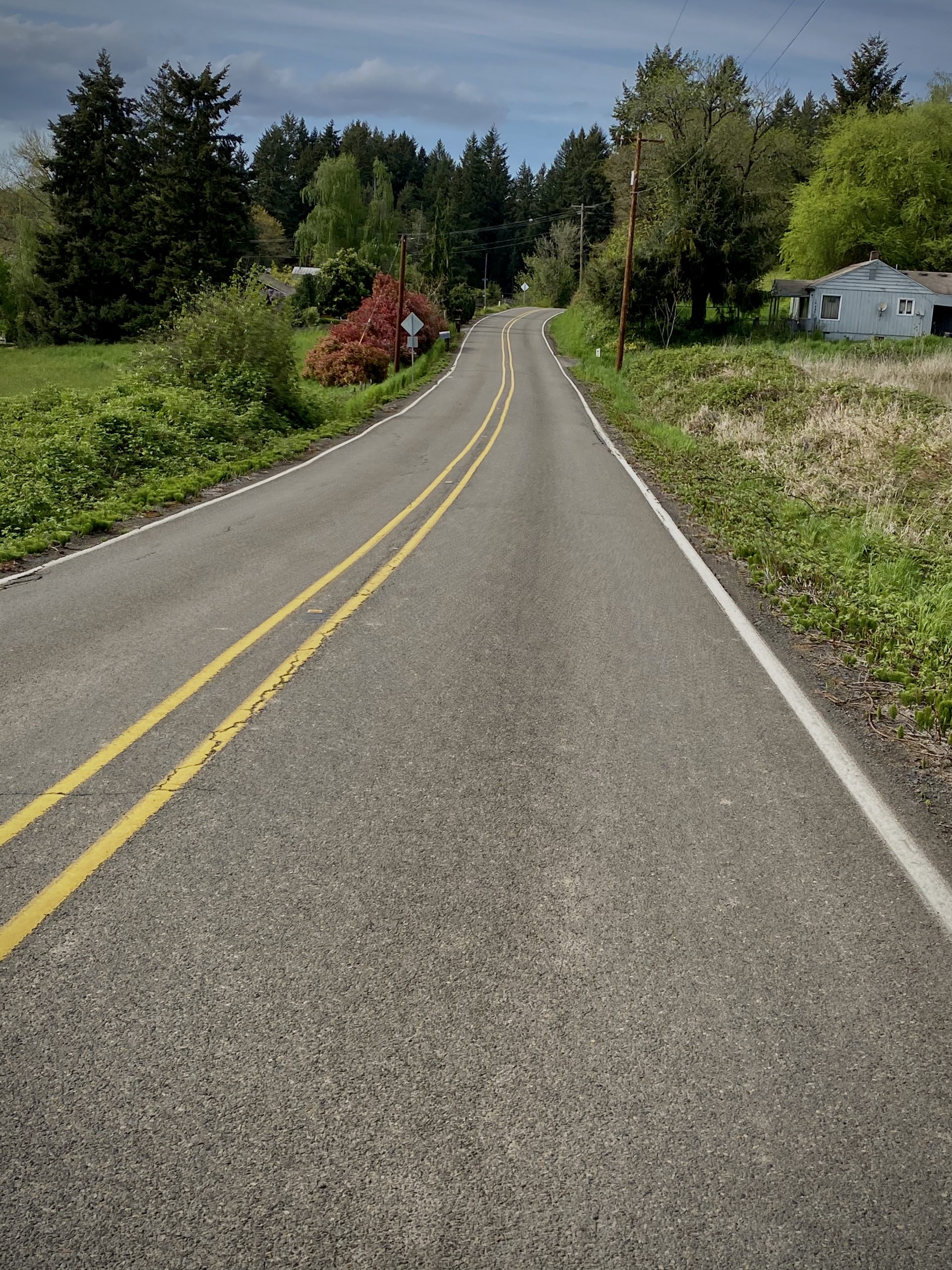
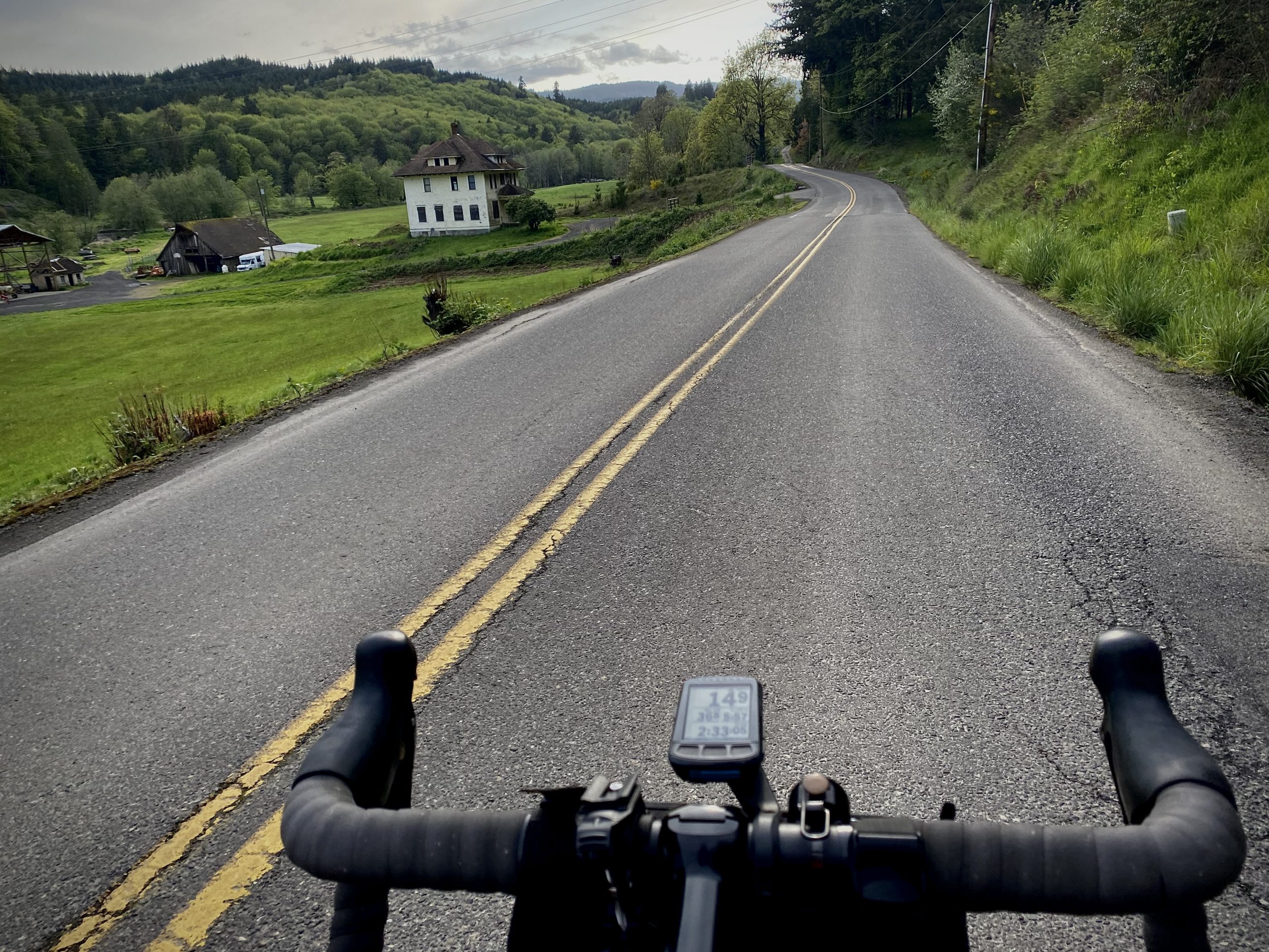
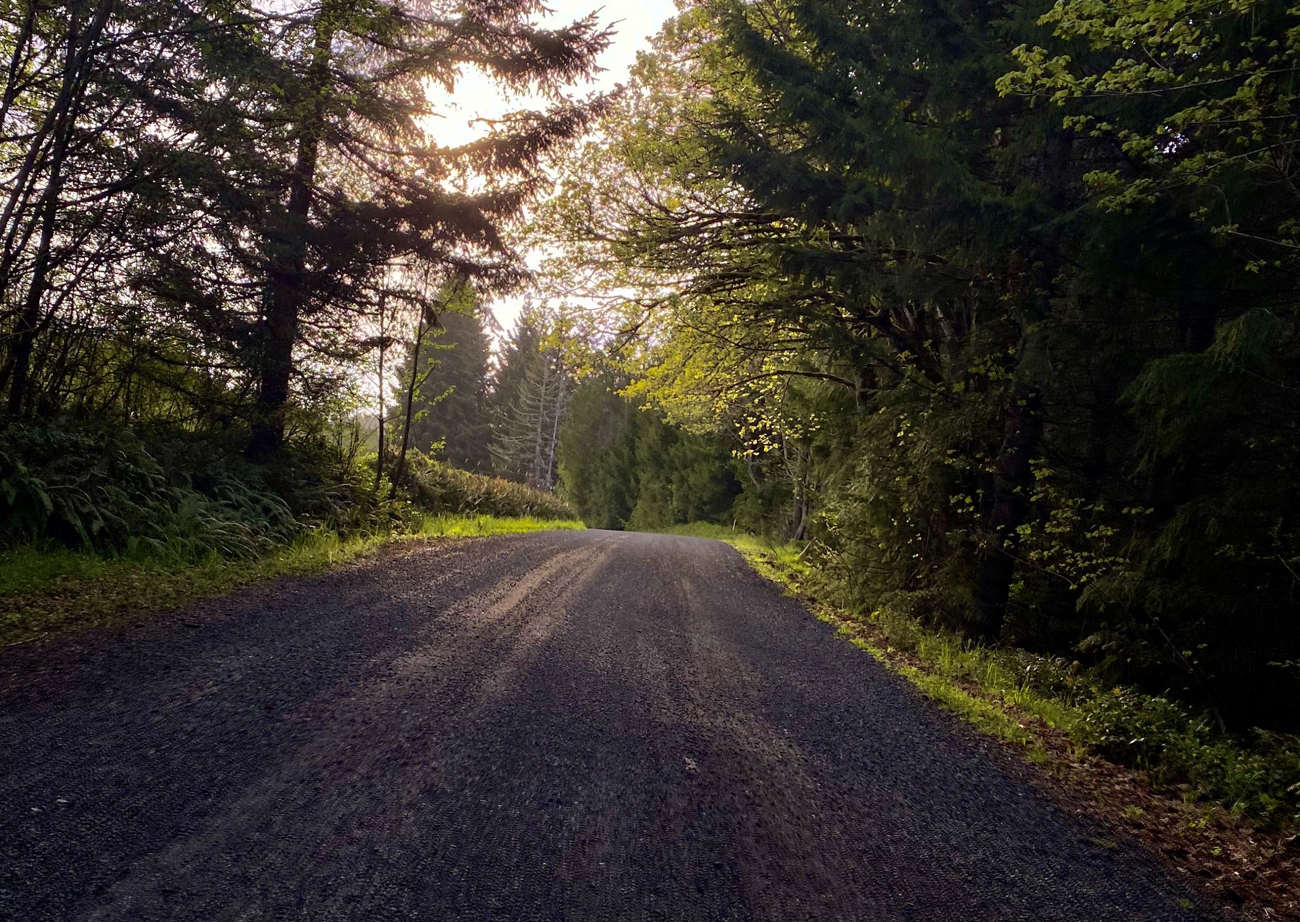
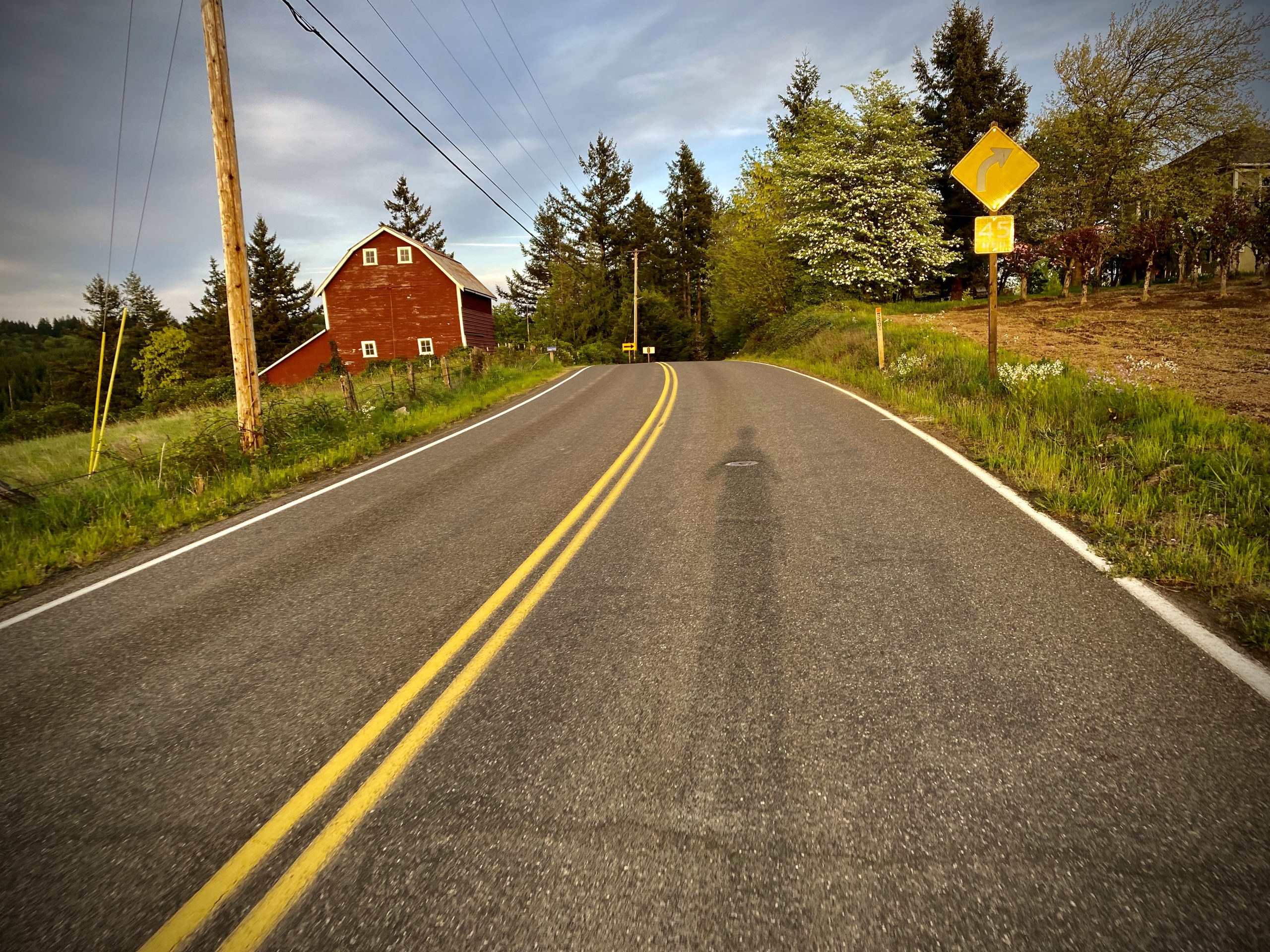
These roads have always been a source of solace and challenge for me. Now with fewer drivers on them and spring in full bloom, they’re quieter and more picturesque than ever. For many minutes during this full 67-mile ride I felt like I was the only person on the planet. Just me, my thoughts and my bike. A true escape.
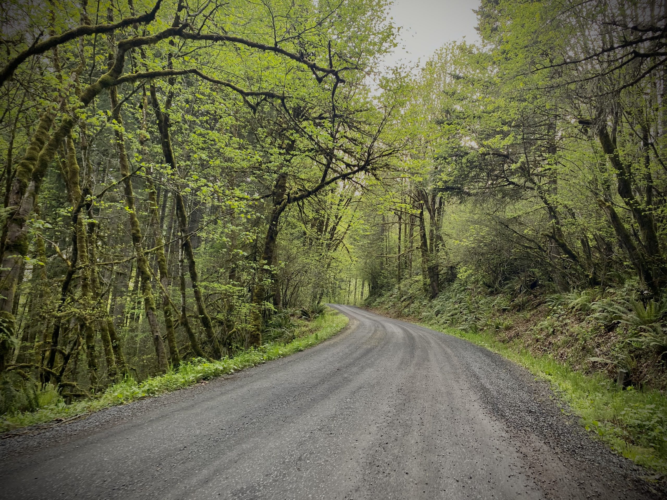
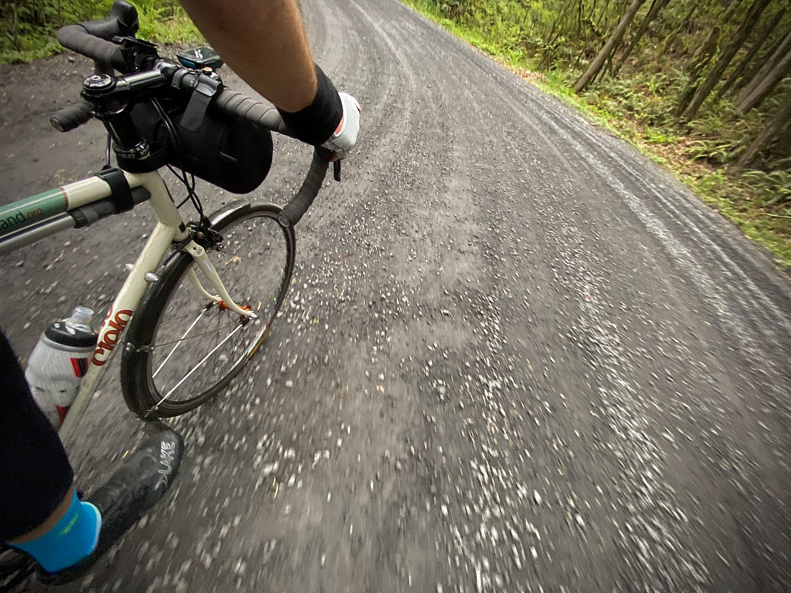
It wasn’t until I got home and saw the route on Ride With GPS (an amazing and local route creation and planning app that I strongly recommend) that I realized it explored three counties: Multnomah, Washington and Columbia. It also creates three distinct loops. You can start with the Portland-Newberry-Skyline loop, then add the Dorland-Moreland extension next time, and then put it all together with the Dutch Canyon-Otto Miller section. (Note that Otto Miller is an unpaved gravel road.)
Here’s the full route:
Please note that I took precautions to preserve my health and that of others: I rode alone, I rode at an off-peak time (even sacrificed dinner!), I wore a face covering while in the city and when other people were present, I stayed away from crowded areas, I packed all the water and food I needed so I wouldn’t have to stop at a store, and I didn’t ride beyond my fitness or abilities.
Stay safe and healthy out there, no matter where your bike is taking you these days.
— Jonathan Maus: (503) 706-8804, @jonathan_maus on Twitter and jonathan@bikeportland.org
— Get our headlines delivered to your inbox.
— Support this independent community media outlet with a one-time contribution or monthly subscription.


Thanks for reading.
BikePortland has served this community with independent community journalism since 2005. We rely on subscriptions from readers like you to survive. Your financial support is vital in keeping this valuable resource alive and well.
Please subscribe today to strengthen and expand our work.
Cool mixed surface ride! This is a great time to get outdoors on the bike. All research so far indicates that the virus is extremely unlikely to spread between people outdoors if your avoid crowds and keep your distance. The car traffic is as low as I’ve seen it and the weather is improving. I don’t think it can get any better.
Smoke Ranch Road is just gorgeous.
Wondering if you have a fav (or a couple favs) or it just depends on the day?
Absolutely great riding in that entire area though I normally try to plan routes to minimize time on HWY 30. Not for safety concerns, but rather because it’s just noisy junk.
Do you know if riding along the Gorge is OK if you don’t get off the bike? I know the lands are off limits, but if the roads aren’t, this might be a good time to enjoy them.
I rode the Portland Rivers century route this past weekend, but was unable to continue on HWY 30 past the Y with Larch Mountain to climb Alex Barr Rd, as local rangers are barricading the road and only allowing local traffic to pass through. I think this could also present problems if you were attempting to ride anything that passes through the Cascade Locks area.
Hi Kyle,
The Gorge is pretty much off-limits. As I reported on 4/10, ODOT has closed the Historic Hwy starting at the Larch Mtn Road turnoff. So yeah, this means no Alex Barr Road looping. Bummer. Hope it re-opens soon.
Are those Clemente tires, you rocking the tubeless? Those are some sweet roads to be riding.
I think I speak for many when I say, the urge to be out on those long rides is very strong. Especially with the assumption that traffic is light. Although, it seems like there’s more speed-balls out there now. What was it like for traffic?
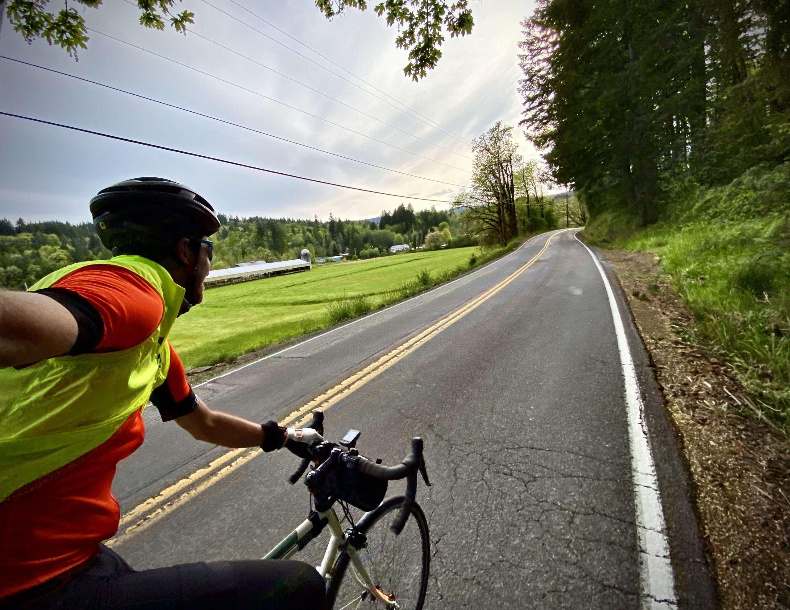
Tires are Continental up front and a Vredestein in back I think. Not tubeless. 28mm width. And drivers were very tame and well-behaved… But I think this varies for each rider. I have some tricks I use that I think encourage safer passing. I want to write them up on the front page to share.
I think a writeup of those tricks would help a lot of people and lower the barriers to cycling.
I often see people unintentionally doing things that encourage motorists to do dangerous/scary things. Riding’s safer and more fun if you these tricks — some of which are nonintuitive.
Yes, I’d be interested to read your tips. I have a route planned for tomorrow that looks very similar, though just a touch different – but same highlight roads. Excited to take my time on some lovely backroads.
One of the main things I do is the “look back”. I try to physically acknowledge every single car that passes me on rural roads. I am always listening and looking. Then, as a driver approaches I make sure to look back as demonstratively as possible (so they see me seeing them). Then I will move over to the right as much as I can. These two actions (looking back and then moving over) tell the driver that I see them, that I respect their presence, that I am a live human being that deserves respect, and so on.
I recently started using one of those Garmin radar lights and it has taken my “look back” to another level because it adds a super bright flashing light as drivers approach and it gives me an audio and visual warning via my GPS unit.
I think doing what you can to make sure drivers know you are aware of them and will adjust for them as they pass is a huge gesture of goodwill that results is safer passing and mutual respect. I think people who ride like robots and never look back and are stubborn about never moving over to the right when possible tend to get passed more closely and with more anger in general. YMMV. .02
I am so jealous! Beautiful barn photo.
Also wanting to do some longer rides! I’m a little hamstrung because I can only carry 2 bottles, which limits me to about 30 miles before refilling, and I’d really rather not buy drinks at a convenience store mid-ride these days.
I hear you about bottles dan. I recently got a handlebar bag for this reason (and it carries other stuff too). Western Bikeworks sells super nice bags made in LA by RoadRunner. Here’s the one I got. It’s big enough for an extra bottle and a jacket and snacks!
Thanks! I’ll check that out. BTW, thanks for the great ride pics!
Also there are seat rail/ post mount options to carry 1-2 spare bottles. Check out ‘triathlon seat bottle cage’ systems. Personally I’ve also carried a Sawyer Squeeze Mini in a jersey or pack if I know there’ll be an accessible water source and have time to stop for 5-10 min to refill bottles. They are only 2 oz. and pack up small with a rubber band around it.
Regarding tri behind the seat bottle systems — a lot of road cyclists won’t use them because they are prone to ejecting the bottles when you’re on rough surfaces such as the ones you might encounter on a descent.
Aside from the suggestions others have made, hydration packs are an option. Water is heavy/bulky and you eventually reach the limit of what you can carry. If you’re in populated areas, I’ve never had a business (it doesn’t need to be a restaurant or store) refuse a request to fill a bottle, and some buildings (such as churches) often have spigots you can fill from. If in lightly populated areas, you can also politely ask homeowners if you can fill from the spigot — many will fill from the sink.
Plainview Grocery and Auto Parts is a general convenience store at the intersection of NW Skyline Blvd at NW Cornelius Pass Road.
I must be a camel. In this weather I’d go for a 60 mile ride with one bottle and not even be done with it.
Planning rides around county and city parks is an option – they often have water spigots but they might be shut off now. Ride with GPS is great for that.
Oddly enough, cemeteries frequently have a hose bib also for water flowers.
*watering
While I haven’t checked every spigot/fountain at every park I’ve passed in an effort to not even touch anything while on out of town rides, the few I’ve checked at parks throughout the Portland Metro and in Southwest Washington have all been shutoff. That said, I’d advise riding with all the fluids/snacks/accoutrement you’ll need to complete the ride without stopping at a store.
Dan-I had the same predicament and started using a Dakine fanny pack for an extra bottle or two and all my food/tools. Works great. Others I ride with use bar bags for the extra cargo.
CamelBak-type pack/vest seems like a decent option.
Have you considered a rack and pannier bag, a la a “light touring” type setup? I’m not a total retrogrouch, but I’ve been using one on my do-everything bike for 10 years now. The rack is maybe 2lbs, and the bag is another 2 or 3. You can carry more water in the bag, along with snacks, tubes, tools, etc. I like to be self-supporting for my longer rides. You can always take the rack off for races.
44.5 MPH!!
teeheeheeheee… If anyone’s curious I hit that speed on the steep and very straight section of NW Rocky Point just before you get to the bottom at Highway 30.
impressively fast ride time on some classic deep cuts, Jonathan. Thanks for the write-up.