We’re now three months since the official launch of Metro’s effort to raise funds for transportation infrastructure via a bond measure that could go to voters in 2020.
This is likely to be the most consequential transportation funding decision in our region’s history. With activism heating up and outlines of the measure being drawn, it’s time to put T2020 on your radar.
The Basics
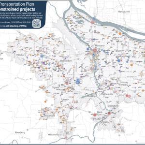
As the elected government that oversees federal transportation spending for the entire region, Metro is a natural leader of this effort. The agency likes their chances to pass a transportation bond given that voters approved a $653 million bond for affordable housing back in November. According to The Oregonian, the total ask could be as much as $20 billion when all is said and done.
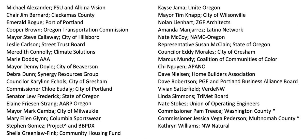
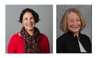
Back in February, Metro kicked off the planning process to decide where and how to spend that money when the 35-member Transportation Funding Task Force met for the first time. They’ve met five times since then. Multnomah County Commissioner Jessica Vega Pederson and Washington County Commissioner Pam Treece are co-chairs.
Advocacy
f
Will this thing be full of freeway expansions and leave crumbs left for everything else (like the State of Oregon’s 2017 transportation package)? Or will it be bold enough to smash the driving-centric status quo that’s destroying the earth and our lives more each passing day?
With so much at stake, transportation advocates from all backgrounds hope to influence the process. As expected, a key tension in this bond debate is how much of the measure’s revenue will go toward projects that increase access to driving, versus projects that encourage walking, biking, and transit.
The Getting There Together Coalition formed in 2017 and includes 25 organizations who want to make sure the bond makes the region more “livable for all”. Members include The Street Trust, WashCo Bikes, Oregon Walks, AARP Oregon, Disability Rights Oregon, APANO, and so on. Specifically, their priorities include: safety, public transit, a transparent process, prevention of displacement, and increasing access to transportation.
During public comment sessions at previous Task Force meetings, people have spoken most loudly about how the bond measure must aggressively tackle the issue of climate change. No More Freeways, a group that has come to prominence by organizing strong opposition to ODOT’s I-5 Rose Quarter Project, is also engaged around T2020. The group live-tweeted the April Task Force meeting and they have organized climate and Green New Deal advocates to show up to the May meeting which takes place this evening (5/15).
Advertisement
The Work So Far
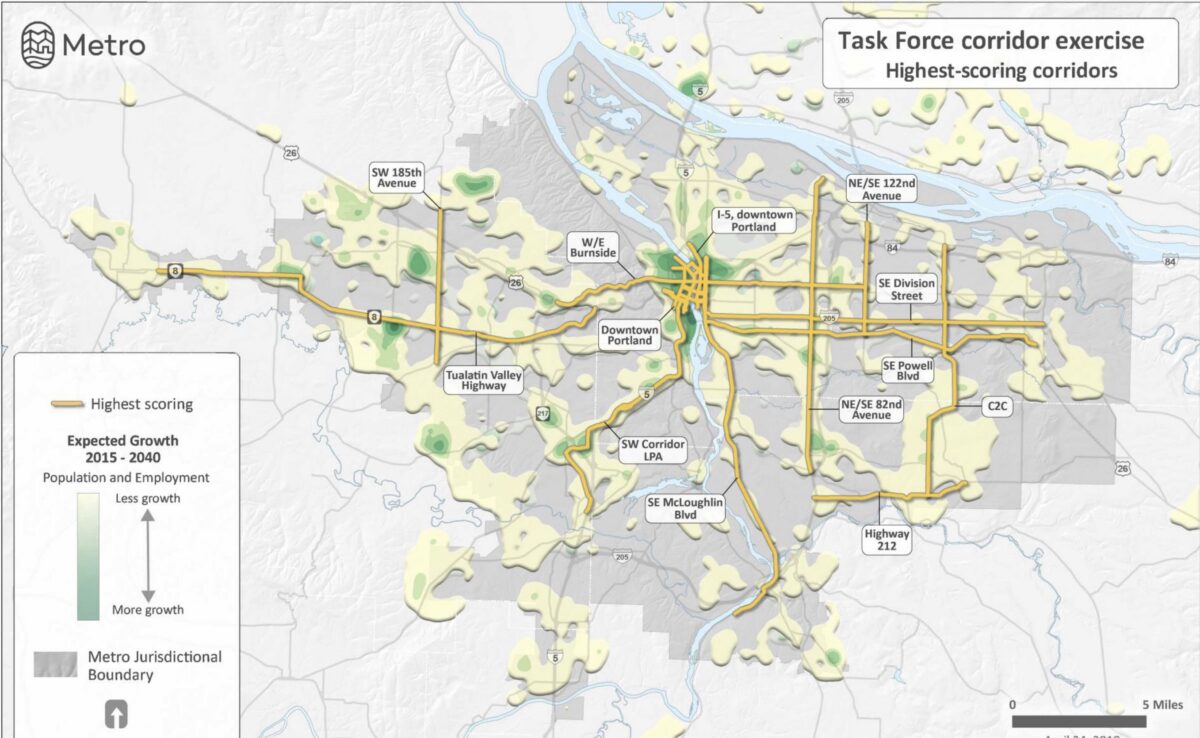
It’s still early days, but the Task Force has already begun to sketch out “corridors” where funds would be targeted. This shouldn’t be a surprise, given that Metro is a regional entity and wants to invest in infrastructure that crosses jurisdictional lines. And the “corridor” lens is already familiar to the agency. Metro’s 2014 Regional Active Transportation Plan identified 24 “mobility corridors” region-wide.
Based on input from the Task Force, Metro staff identified 75 potential investment corridors. After a scoring exercise, 26 corridors were placed in three different tiers: equity, potential for high transit ridership, and “high safety need.” (You can read a description of each corridor here.)
Here’s the breakdown of each category:
• NE/SE MLK/Grand Ave
• Tualatin-Valley Highway
• I-5, downtown Portland
• SW 185th Ave
• Downtown Portland
• SE Foster Blvd
• SE Powell Blvd
• NE/SE 122nd Ave
• NE/SE 162nd Ave
• N/NE Columbia Blvd
• 82nd Ave
• Tualatin Valley Highway
• SE McLoughlin Blvd
• SE Powell Blvd
• Burnside Street
• Downtown Portland
• NE/SE Martin Luther King Jr. Blvd./Grand Ave
• NE/SE 122nd
• Sandy Blvd
• SW 185th Ave
• SE Division St
• 82nd Ave
• 122nd Ave
• Powell Blvd
• NE/SE MLK/Grand
• SW 185th Ave
• NE/SE 181st/C2C (Clackamas to Columbia)
• Sandy Blvd
• Burnside Ave
What’s next?
The Task Force is expected to discuss the corridors gain at their meeting this evening and make a recommendation to Metro Council at their next meeting May 29th. Council plans to vote in spring 2020 on whether or not to refer the measure to voters.
As the Task Force continues to meet and activists begin to circle their wagons, Metro has just released the Getting Around Greater Portland survey.
With so much at stake, how many political compromises will leaders make? How far will advocates be able to shift the Overton window around what’s acceptable in terms of investment priorities? Suffice it to say, many questions remain.
Stay tuned to @BikePortland on Twitter for live updates from tonight’s Task Force meeting. Also check out Metro’s website for more information.
— Jonathan Maus: (503) 706-8804, @jonathan_maus on Twitter and jonathan@bikeportland.org
Never miss a story. Sign-up for the daily BP Headlines email.
BikePortland needs your support.




Thanks for reading.
BikePortland has served this community with independent community journalism since 2005. We rely on subscriptions from readers like you to survive. Your financial support is vital in keeping this valuable resource alive and well.
Please subscribe today to strengthen and expand our work.
Interesting open-ended survey.
Question: which one of the listed “corridors” is not like the others?
it’s kind of baffling that TV Highway isn’t on the safety list.
TV Hwy is one of the safest places to bike because of the huge shoulder – you can be several feet away from vehicles. However you do have to be careful where driveways cross the shoulder.
This entire effort is a waste of money. We have light rail now, and few use it. People prefer to use their cars even if they have to put up with stop/go traffic and 45+ minute commutes. I guess it could be useful when oil/gas supplies are restricted for some reason, but what will the trains look like with all those people on them? Probably like the Obamacare Website Technical Support Team trains:
https://illinoisreview.typepad.com/.a/6a00d834515c5469e2019b017a9f85970c-pi
Ah yes, Bonds. Buy now and pay later. Borrowing against your children. Sorta like climate change, isn’t it?
Do you have an alternative way of financing enormous capital expenditures, David? I’m sure you’re the guy that saved up to buy a house cash, but unfortunately we don’t really have the few decades to wait to build these projects.
Sorry, not me, I’ve been unemployed for the last 11 years, on the pay-as-I-go plan, uninsured and all.
The problem with bonds is not only you build now with your present technology and preferences, but your parents and grandparents did the same when they approved the bonds for the infrastructure you are now complaining bitterly about – streets for cars, parking for cars, freeways for cars, cars, cars, and more cars. Your children/nephews/nieces are going to ask, what were you thinking, building more concrete crap for your bikes, when you should have done this or that (new technology for 2045)?
I’d instead advocate that you pay-as-you-go, with the money you have. Isn’t enough? Then either raise taxes or do without, let your roads go to pot, build traffic-calming using broken pavement and traffic cones, ration your roads.
But then I’m poor, living in cheap bucolic pleasantly mediocre Greensboro NC, so I’d say stuff like that, wouldn’t i?
That’s a fair point, but also very selective. I mean you could say buying a power plant with cash would yield a better technology because you waited 50 years to build it, but then people have no power for 50 years and you probably never have the cash to build it. From a political perspective, raising taxes to pay for something indeterminate in the future (“this money is going to pay for whatever we deem important in 15 years”) is probably not realistic.
That saidm you’re probably onto something. Perhaps there’s a place for different standards for different purposes. Projects that save lives probably shouldn’t wait, people die in the meantime. Transit improvements are needed now to cut emissions. Congestion relief? Maybe there’s insufficient justification (aside from political) for bond-financing those.
In the governmental context, all justifications are political. What (non-political) justification is there for allowing people to skip their MMR vaccine (for example)? In your framework, highway capacity would 100% be considered “justified”. That doesn’t mean the framework is wrong, it’s just not an effective way to discriminate between highway and non-highway projects.
Obviously not a lot of informaiton to go by, but the draft corridor descriptions don’t excite me. Plenty of the projects include pedestrian, transit, or bike improvements, and some of the projects are only those. But it certainly appears that the motor vehicle funding would dwarf those projects in dollars.
Perhaps more significantly, I don’t see a lane here andn a crosswalk there marshalling thebroad public support for a multi-billion dollar bond. It lacks a cohert,, boldvisionathat would excite people. (see Sound Transit 3) This looks like a typical pork-barrel crap,, trying to give everyone something. Blah.
Sorry, wasn’t meant to be a reply.
We’ll also enjoy the benefit later, so paying later kind of makes sense.
As with VZ it would be useful to know how/why these folks got appointed.
The Golden Rule – Those with the gold, rule.
Two no-brainers (to my mind) that never seem to get considered:
1. Extend the Red line to Intel (instead of the fairgrounds). It would head north along Cornelius Pass Rd, requiring about 1.5 miles of new track. The ROW would mostly cross parking lots, though we might lose one or two KFCs/Starbucks. This would give a 15-minute one seat ride from Beaverton, or a 40 minute ride from downtown. Even more impressively, WES could be extended to Intel, providing 30 minute rides from Tualatin.
2. Extend the Blue line to Mt. Hood community college. Again, about 1.5 miles, mostly through a golf course. This would provide 30 minute rides from Gateway.
These improvements would allow the lines to function as commuter rail in both directions, and would maximize the use of investments we’ve already made.
A subway under the river connecting downtown to the Eastside would also be SWEET. 😉
I totally agree on the extensions of Max lines to their logical conclusions… it’s a no brainer. Blue to MHCC, Yellow to Expo Center, the new SW line to Wilsonville or at least Tualatin. And yes to moving toward a tunnel under downtown.
I suggest extending the Orange Line to Oregon City, as well. And on the west side, the old Oregon Electric line continues from Hillsboro to Forest Grove … strikes me as a natural Blue Line extension.
Commuter-heavy destinations aren’t really the best use of high-capacity, fixed transit like MAX. Intel’s commuting patterns are shift-based, with huge peaks of traffic during those changes, and basically nothing in between. Any major capital extensions of the red line should take it to mixed-use developments, similar to Orenco. These developments build all-hours demand for this expensive capital investment. The proposed extension will double service frequency to Orenco, for a very small amount of capital (just need a driver layover facility at HIO, since a pocket track already exists just west of the platform). Does Intel provide employee shuttle feeder lines to MAX stations currently? How much are those used?
After the SW Corridor, my vote would be for a line connecting SE Clinton and Powell/I-205, alonge Powell Blvd. The green line would run from Clackamas up to Powell, and then directly west into downtown via the Tillicum. A new Purple line would then run from Clackamas to PDX Airport, taking advantage of the Red Line capacity improvements at Gateway TC. The Powell line would be expensive, since the bulk of it would need to be elevated, but it has massive ridership potential, and would greatly improve travel times on the green line to downtown. This would also relieve MAX congestion between Gateway and downtown (especially the Steel Bridge area). A future Division St. MAX line could also use this Powell corridor. It would run east from downtown via Powell, turn north on I-205, and then east again on Division.
The fact that nearly every single one of these “corridors” is just the name of the car dominated road tells you what funds will be dedicated towards.
Why are there NINE people representing corporate interests on this task force?
And while it’s great to see a board member from the Street Trust involved, the absence of someone representing a grass roots transportation-focused group, such as, Bus Riders Unite/OPAL, Oregon Walks, or even BikeLoudPDX is glaring.
This kind of representation is why we typically see “business as usual” when it comes to transportation planning.
I agree–the document is utterly unimpressive, lacking any transformative vision. Here’s my vision for some of what a regional *transit/bike/ped- focused* measure needs to accomplish:
— multiple new genuine BRT lines (see Seattle Rapid Ride)
— many new bus- only lanes running for miles along major corridors
— major expansion of buffered bike lane network
— closing a large number of gaps on MUPs across the region
— major closing of no- sidewalk gaps
— major expansion of neighborhood greenways across region
— building the East side MAX connector
We need to look to the Seattle and Sound Transit ballot measures for the vision and scale to aim for. 2020 will be a once in a generation chance for transformative change. I firmly believe this bond measure should not be used to fund ANY road expansion, but in acknowledgement of political reality I’d settle for a 75% transit/bike/ped share of the money. No less. Why isn’t Metro chair Lynn Peterson, a very smart person whose heart is in the right place, calling for this kind of game- changing vision?
Re: east side MAX connector, I heard a rumor that the Steel Bridge is closing in 2021 for *2 years* for a major repair project. Anyone else hear that?
Quick question, what is the “Eastside MAX connector” ?
A connection, from the Rose Quarter TC to the OMSI area. The yellow line could be routed this way, and could even turn west at OMSI to cross the Tillikum into downtown. It would relieve the Steel Bridge and add stops in one of the fastest growing areas in the city.
Not Metro specific, but speaking of updates, can anyone provide an update on the plan to make the Historic Highway a one way with contraflow bike/ped path for a stretch? It was supposed to happen this past fall as I recall. What happened??
Bikeways? Metro could use some tiny portion of those billions to create a more complete, connected regional bikeway system. There are still a lot of gaps to be filled.
I disagree. IMO, the bulk of this money should go to improving mass transit and associated-pedestrian infrastructure. Cycling for transportation is far lower bang for our buck.
I agree, but I think you ought to consider adding freeway/arterial diverters, congestion pricing, and tollways. Make transit, walking, micro-mobility, and bicycling easier and cheaper than driving on a regional basis, not just at a neighborhood level. Imagine a series of diverters along 122nd & Division that allow buses, delivery vehicles, and bikes to pass through, but not cars.
That’s a nice looking map
At risk of sounding like a broken record here. Seattle’s Department of Neighborhoods’ 3 year old “Your Voice, Your Choice – Parks & Streets” participatory budgeting (PB) process allocates $2-3 million for parks and streets projects. The program is open to all but is centered on under-represented communities with the specific goal of advancing racial equity and giving vote and voice to the least represented. Not surprisingly the community has selected to allocate funds to small diffuse, human scale projects that improve safety and access…. not mega-projects that merely shift the unaccounted burdens and costs in time and space.
Seattle’s participatory budgeting has been successful enough that apparently Seattle’s Department of Transportation plans to replicate the program with another $8 million for street improvements in coming years.
Meanwhile Caltrans (California’s transportation department) now strongly encourages local and regional municipalities to use participatory budgeting in allocating $25 million in planning grants with communities like Oakland and Vallejo leading the way:
https://nextcity.org/daily/entry/california-transportation-participatory-budgeting-process
And in Vancouver B.C. is allocating new parking fees to a pilot participatory budgeting project this year, allocating funds from new parking fees to diffuse neighborhood projects that improve safety while creating a new constituency for helping ending the high costs of free parking:
https://www.thewestendjournal.ca/blog/2019/3/1/the-talk-of-the-town
Metro staff have incorporated a small portion of funding to pilot participatory budgeting in the 2019 Regional Greenspaces Bond Measure renewal. Why not do the same with a small portion of the 2020 Transportation Bond?