
(Click for larger view)
Naomi Fast is our Washington County correspondent. She previously wrote about plans to widen the Walker and Murray intersection in Beaverton.
Ever been on a MAX Blue Line train to Hillsboro with your bike comfortably resting on the hook and caught a glimpse of a person pedaling behind a sound wall over on the south side of Highway 26? This sight can give way to imagining there’s a well-marked bike route connecting Portland to Washington County. How long is that bike path behind the freeway wall? Does it go the whole way between Beaverton and Portland? Where’s the entrance?
The goal of this short, ride-along-style post is to locate the westside entrance to the bike path that runs alongside Highway 26, for which there are — unfortunately and inexplicably — zero wayfinding signs. It may seem like a short stretch, but one missed turn and it’s possible to get lost. Then a short stretch becomes a lot longer, which is no fun when late to work.
Here we go:

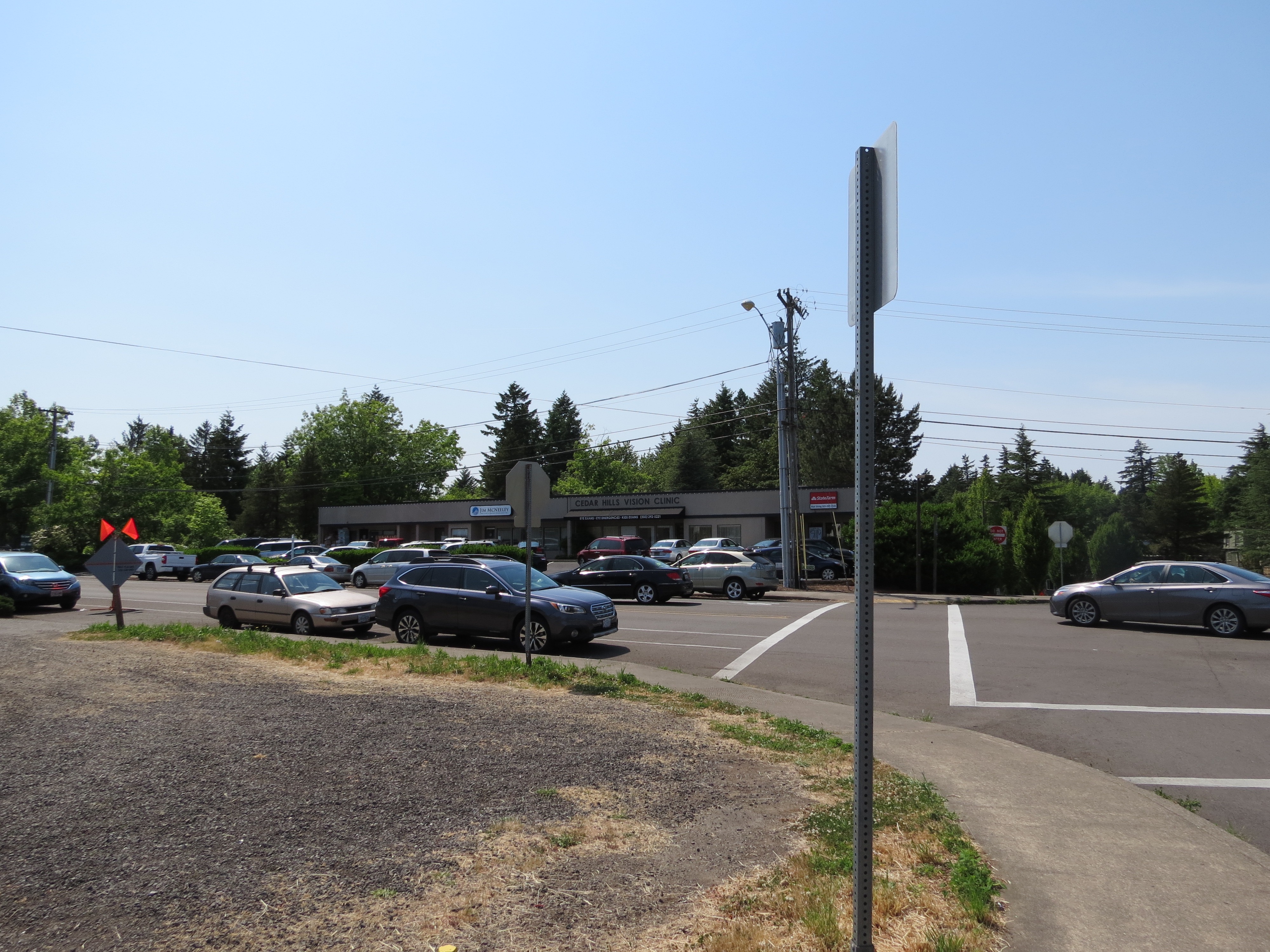


The starting point SW Butner and SW Park Way, an intersection people biking to or from the Sunset Transit Center frequently travel through.
Advertisement
By the way, if coming up SW Park Way from Walker Rd, it’s possible to follow the route of TriMet bus line 59 route a bit further east, and then turn right before the bridge on the unnamed 217 auxiliary road. But today’s ride-along will use SW Marlow, which is a right turn at the top of SW Park Way — the “knoll” of Park Way. (Note that Butner becomes SW Marlow south of Park Way.)
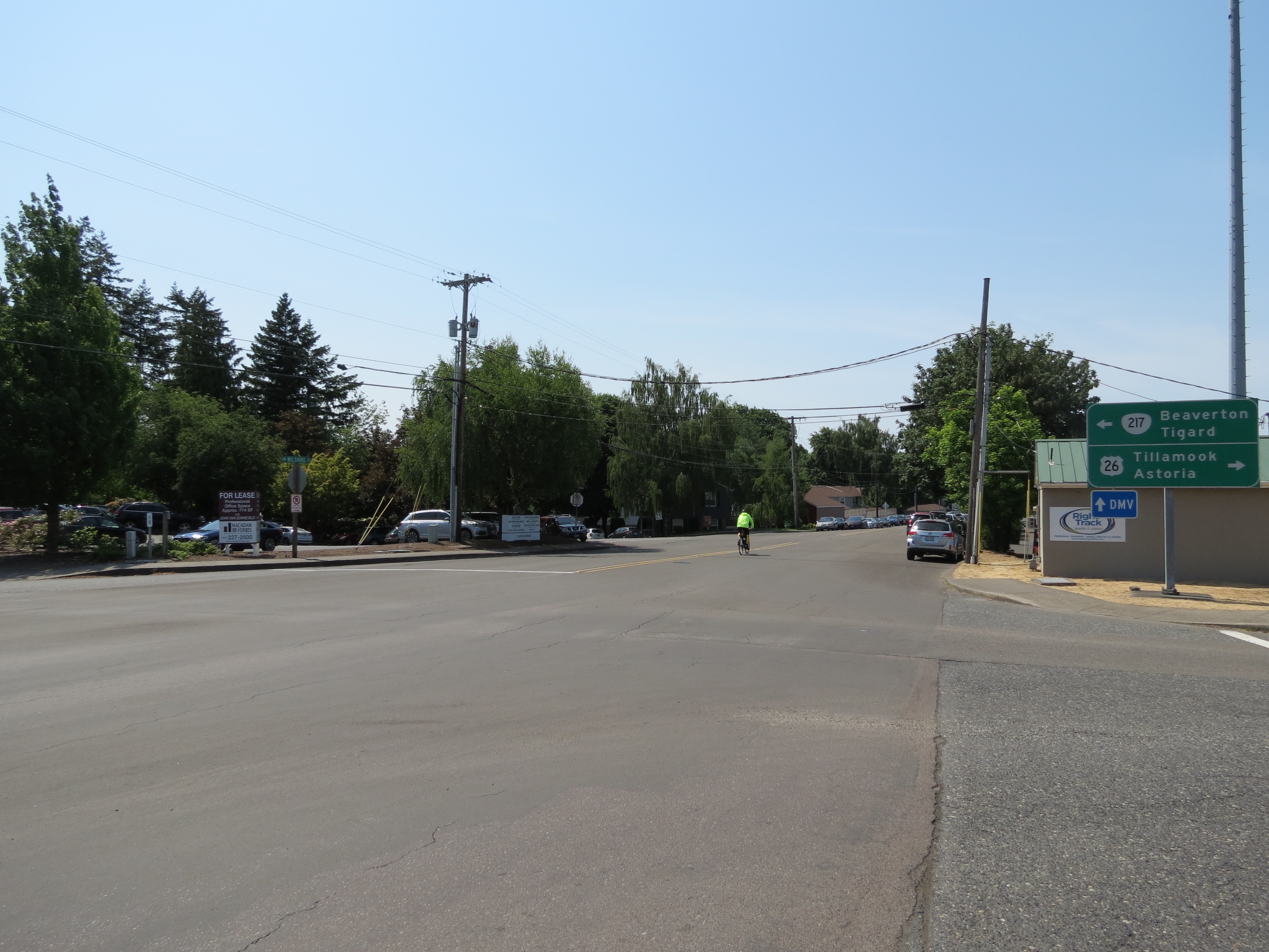
Is everyone in the southbound Marlow bike lane with me? Let’s go! This will be sooo easy.
From Marlow, take the next left on SW Wilshire St, to head east. This Wilshire is not as glamorous as the one in Beverly Hills, but it’s pretty fancy for us in Oregon in that it takes us to the bike path.


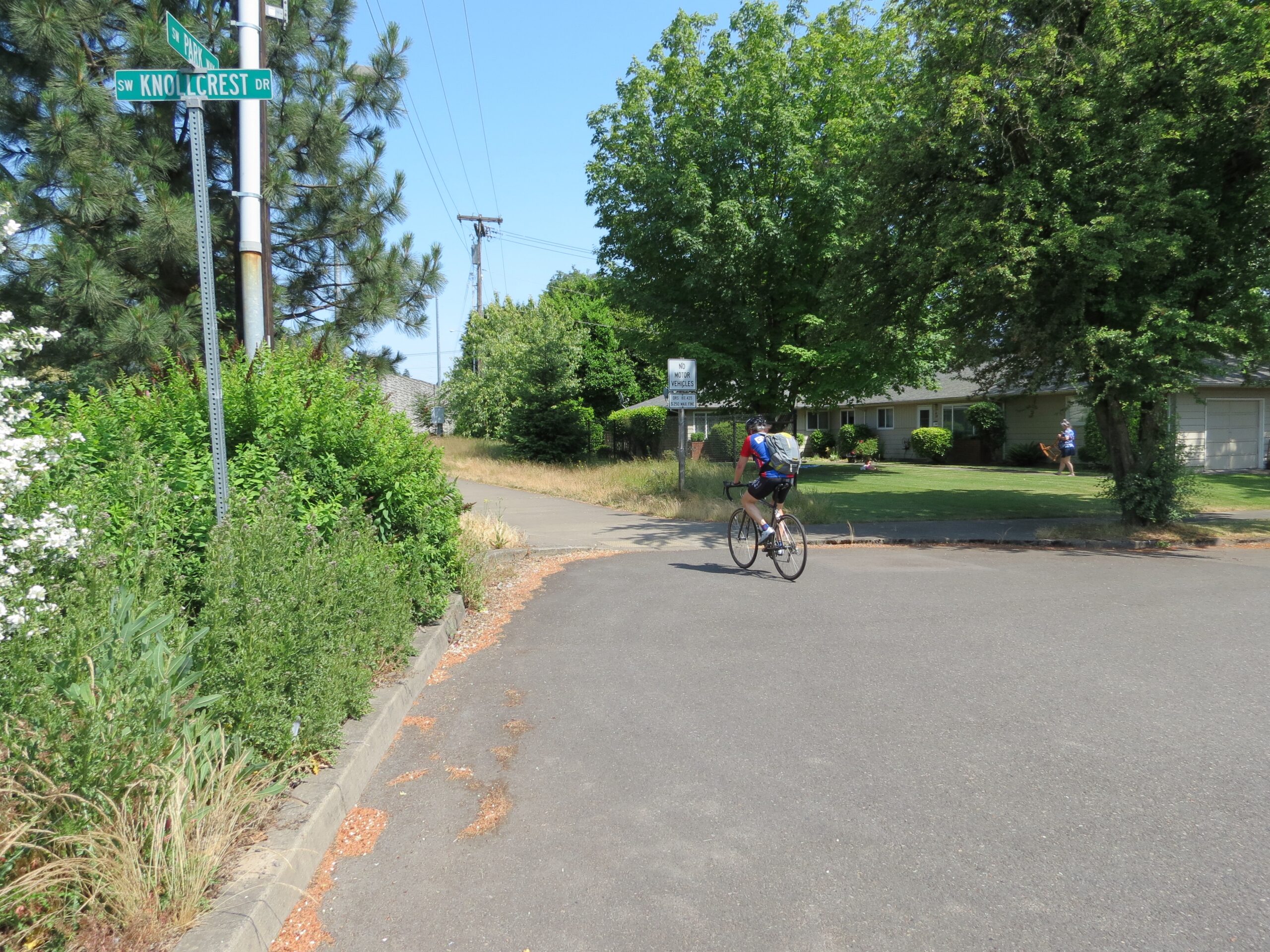
Follow SW Wilshire to SW Knollcrest, and turn left. Head toward the wall… look right, and there it is!
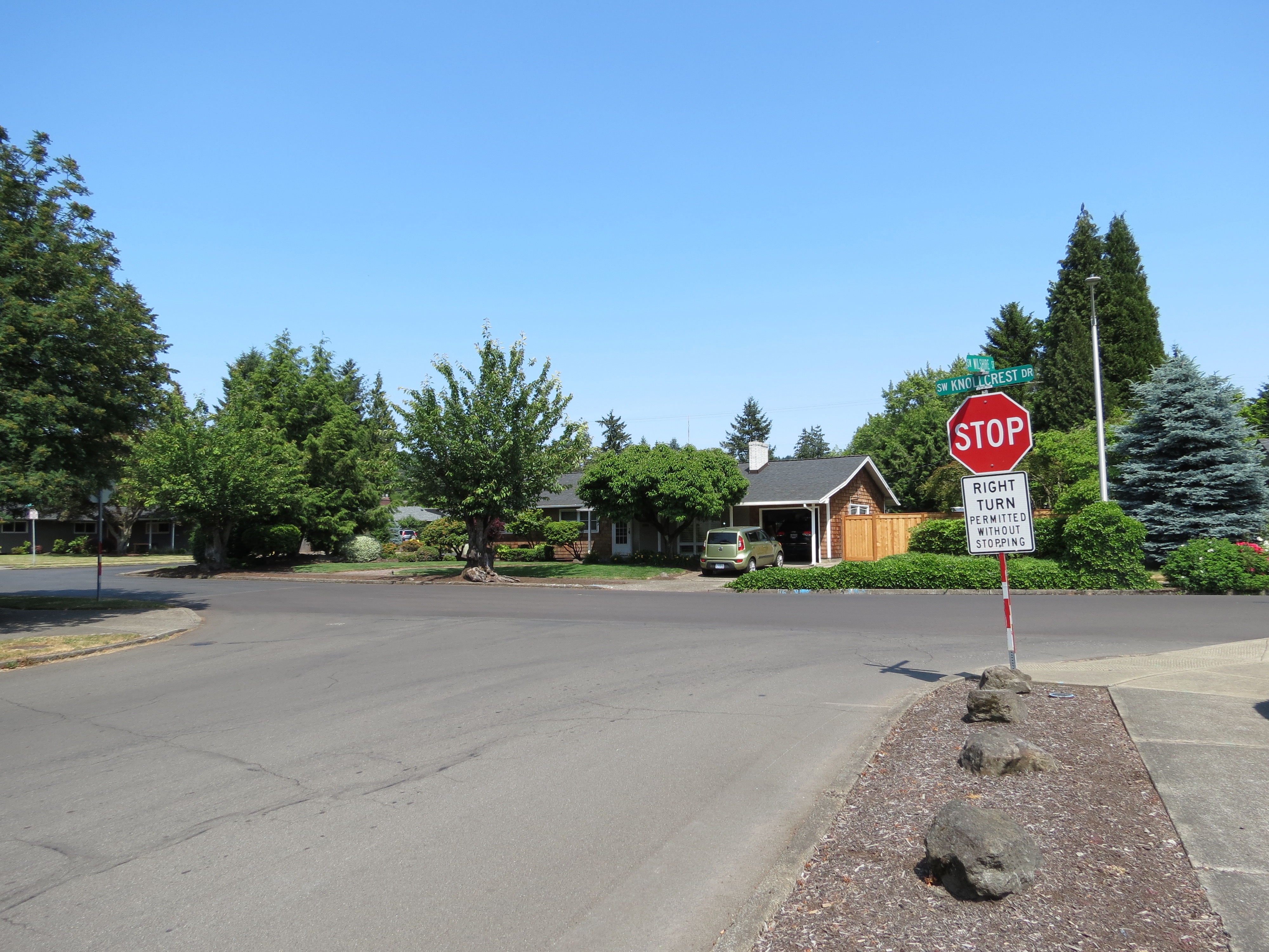
Seems easy enough, but out in the vastness of the suburbs on unfamiliar streets, and with no wayfinding signs, becoming lost in residential areas isn’t unheard of. If you do lose your way, there are a couple of “lighthouses,” or sign beacons to circle back to: the towering DMV sign and the soaring Cedar Hills tower. And remember: Bus line 59 continues on Park Way to Sunset Transit Center and the bike route on Wilshire is one street south of the bus line.
I hope this was helpful. Here’s the route on Google Maps. Let me know if you have other tips and tricks for finding your way on the west side and I’ll consider them for a future post.
— Naomi Fast, @_the_clearing on Twitter
Never miss a story. Sign-up for the daily BP Headlines email.
BikePortland needs your support.


Thanks for reading.
BikePortland has served this community with independent community journalism since 2005. We rely on subscriptions from readers like you to survive. Your financial support is vital in keeping this valuable resource alive and well.
Please subscribe today to strengthen and expand our work.
Thanks for the article. I have always wondered about that path. Does it connect all the way to downtown? Where does it connect to downtown? how is the ride?
Who maintains it? How can we advocate for some signs or bike indicators on the pavement?
Do you mean the Highway 26 multi-use path? ODOT maintains it. The Incense Cedar trees smell nice along the path and THPRD is planning to make a new 2.5 acre park along SW Pointer Road (part of the route). It can be nausiating breathing the car and motorcycle fumes when the path is on the south side of the freeway because there are few trees. The path stops at SW Canyon Court by the office buildings to the east of the Verde Cocina restaurant. You can ride there to the Oregon Zoo and then back up the hills to Kingston Drive to Jefferson Street or Vista Ave. However, I sometimes prefer use the Zoo overpass (Knights Blvd) to Highway 26 to ride on the relatively clean shoulder of the freeway because it provides a direct route to SW Jefferson Street. In fact, ODOT says it is legal to ride a bike east-bound on the Highway 26 east-bound shoulder from SW Scholls Ferry Road to the Jefferson Street exit. I’ve used it and it can be nicer than using Barbur Blvd in rush-hour traffic. From Sylvan, you can also try SW Hewett Blvd (near the Schollls Ferry east-bound on-ramp) to get to SW Patton and then to SW Montgomery, turn on Clifton, to ride on Cardinell to 12th Ave by PSU.
If you want a vastly-nice SW Scholls Ferry Road, please check next month’s online open house for Multnomah County’s Roads Capital Improvement Plan and contact county commisioner Sharon Meieran.
For signs to indicate the route from the Cedar Hills Shopping Center, I think the people to contact would be county commissioner Greg Malinowski and his successor of Pam Treece and the main leader of the Washington County Land Use & Transportation, Andrew Singelakis.
To get to SW Beaverton-Hillsdale Highway from Sylvan, try SW Raab Road to SW Canyon Drive and the side streets of SW Laurel by the TriMet Park & Ride.
Biking is allowed on US 26 more than just the segment you mentioned. In fact, the entire highway west of the Jefferson St exit/entrance is legally rideable, both eastbound and westbound. Only biking through the tunnel is prohibited. (Someone correct me if I’m wrong, but I don’t believe the Sunset Highway Trail makes biking prohibited on US 26 because of the mandatory sidepath law.)
Biking is also allowed on all of OR 217, I-5 south of the OR 217/Kruse Way exit, I-205 south of the OR 43/Oregon City exit, and I-84/US 30 east of the NE 238th Dr exit, I believe. I’ve ridden on the shoulders of freeways around here, and the only dicey areas in my opinion are on OR 217 near Hall Blvd and Scholls Ferry Rd. The shoulder disappears, and there’s about a foot of pavement next to active traffic lanes. Everywhere else the shoulders are at least six feet wide, and the only hazards to watch out for are debris in the shoulder and exiting/entering traffic, though the latter can be handled by exiting and re-entering the freeway at exits.
I always rode the path to the zoo and then the shoulder on 26 from the zoo exit down into Goose Hollow. When traffic is moving it feels super safe and easy. In stopped traffic I would slow down as I approached the exit to avoid awkward interactions with cars moving into the shoulder to get to the exit (to be fair a bike moving at 30+mph in the shoulder is not expected…) on the Goose Hollow exit, after you pop out from under 26 I always take the lane as I approach the corner into Goose Hollow. There are some shrubs that block the shoulder and there are a couple rough patches and dips + cars are usually going really fast and tend to fade towards you if you don’t take the lane, take it early and stay centered in the lane all the way to the traffic circle! Doing this cut a minimum of 15 minutes off my commute home from Beaverton.
They’ve re-paved Jefferson from about the bridge down to the circle, and re-allocated the right lane so it is now right-only onto 20th for cars, and beyond that it’s bus/bike only. They striped the bike lane all the way to 20th, and trimmed the brush that used to encroach on the shoulder of the curve. It’s still a little sketchy in that curve (although it feels much wider than it used to), and the drain grates and other access holes in the street make the newly-striped bike lane a bit of an obstacle course, but other than that it’s a fairly nice re-pave.
The Jefferson repave is fine as long as you just commit to taking the lane before the curve — they did a huge disservice by actually marking the shoulder as bike lane, where before it was ambiguous. It’s not even close to safe with those drainage dips, the first one comes before the curve is complete and a first time rider could easily find themselves making an emergency swerve or losing control into the car lane. Heed Jered’s advice — if you come into Goose Hollow on Jefferson from 26, take the lane!
This is what I always used to do, since it was obviously the only way to go. I would move over right about as the bumps on the white stripe ended, and then keep it cranked to 30 – 35 until the light at 20th. Since there was no bike lane, I never felt “bad” taking the lane. I’ve only ridden it a few times since the repave and now it feels more like I “should” stay on the shoulder, then in the bike lane (I haven’t paid attention to whether the stripe in the curve is an 8″ bike lane stripe or still just a 4″ shoulder stripe), but you are right that it is most likely less safe than taking the lane. It seems like a classic case of somebody thinking they’re doing me a favor, but then doing the wrong thing or doing it poorly and wondering why I’m not more excited about it.
So I guess my refined evaluation would be that the pavement itself is nice, having a whole bus/bike lane for one block in front of the MAX stop is nice, although once you’re around the corner into the circle, if there is a bus stopped in that lane you still have to just about change lanes to get around it if you’re going up Columbia, and your visibility to drivers coming down 18th is no better. The curve coming out of the tunnel is only slightly improved with the brush removal (and it almost looks like they moved the jersey barriers out a bit), but taking the lane is still the best way to avoid close-passing at the apex of a curve. The new bike lane from the bridge to 20th is, like most bike lanes, interrupted with grates and other under-street access points that make the 35-mph speed limit a little rough on a bike.
So, now that I can honestly say I’ve given the “new infrastructure” a solid try, I’ll likely revert to my previous strategy for navigating this section. Of course, now I’ll be slightly more worried that drivers behind me will be angrier, since there’s a “perfectly good” bike lane right there. Plus, now I’ll be breaking the law.
While the path itself doesn’t lead downtown, there are some nice low-traffic streets you can follow after the path ends at the sylvan exit. This includes Kingston which is one my favorite roads (up or down). Continuing the article’s idea of riding from the transit center, here is one of several routes over the hill: https://tinyurl.com/y9u7v3t6
This is my hesitation to take Kingston into town. From the zoo overpass to Goose Hollow is 4 minutes for me down 26 to Jefferson. How long does it take to get from the zoo overpass to Vista via Kingston?
It’s about 10 minutes. And it’s beautiful. The gem of my ride.
Take the path all the way to Sylvan. Then, take Canyon Street (it parallels 26 on the north side) to the Zoo. Follow the road out of the Zoo and turn right on Kingston for a ride through the Rose Garden, etc. Lots of places to get off and go into the city.
I’d like this to be the next wayfinding post: I haven’t been brave enough to even try to find my way through the maze of streets above the zoo in either direction. I’d love to be able to do a side-by side comparison of getting from, say, Jefferson and Broadway up to Sylvan via either my current route, which is through PSU to Montgomery and up to Patton/Hewett, or up through Washington Park.
It’s fairly straight forward through the zoo. Either Kingston or fairview for me. I prefer Kingston. However summer tourist season makes me prefer Montgomery. I really like the ride on Hewitt.
Hewitt. I didn’t like the cut through traffic on Kingston with the blind corners. Climbing Broadway is a pain but I found it more direct. I didn’t like descending Broadway though, too much of a view off a cliff, so I’d do Kingston in the morning, and stay off it on the evenings.
Although I eventually ended up doing Barbur to Capitol to avoid some climbing.
You mean Broadway Drive? Yikes. I’ve never climbed up that one. I used to descend it all the time, until I tried 26 to Jefferson. I’d tell anyone who thought the freeway was dangerous to try descending Broadway Drive in the rain…
I went down it once, in the rain. Climbed it many times, but I had mountain bike gearing. I don’t remember why I didn’t like Montgomery though.
In the flat lands now… thinking about this makes me nostalgic, and want to puke, at the same time. A ride from lake Michigan, all the way up to the old continental divide (before they put a canal through it) gets me 75 feet of climbing. Broadway to Patton is 500 feet!
I’ve ridden *up* SW Broadway Drive a few hundred times and I strongly suggest staying off of it, for those considering it. The speed differential plus 4 or 5 really bad blind right hand corners means you’ll experience close calls and honks. It is tempting because it is the most direct route for thousands of commuters.
When advocating for bike facilities the wayfinding is the piece that is most easily dropped. This path is pretty good and a nice amount of money was spent establishing it but the complete lack of signage on both sides decreases its utility dramatically. It would be like building a highway and not including any signage on it – completely useless except for people who already know where things are or are willing to depend entirely on GPS.
One aside on this path is that the seemingly endless construction that significantly narrowed the path over the past year or so to install more signs on 26 seems to be complete for now.
The construction on the path was really annoying. The path was narrowed for months with no work actually being done, and then when they finally wrapped it up they just patched the sidewalk with gaps that run the wrong direction. I’m curious whether ODOT has ever done anything that ridiculous to a road used by cars. I’ve been meaning to get a picture of it to share.
That asphalt gap patch was lame.
I love this path. There is also a STEEP hill about 100 yds long in the middle of the path that I love to hate. 🙂
This path is a great connection between Portland and Beaverton / Cedar Mill. I have been using it for over a decade.
This morning on my way in I passed a news SUV (pretty sure it was KOIN 6) parked in the westward bike lane on Canyon Ct overlooking Hwy 26, about 100 feet from a parking lot. They were probably there to do a morning traffic report. As I approached from behind, two men got out and were surprised to see me — the driver would have easily doored a cyclist with less experience.
That bike lane blockage would mean that they would also be blocking part of the car lane. Were they blocking the path that simply goes from SW Skyline Blvd to Canyon Court?
Can I ride an e-bike on this path if I’m going the legal speed limits?