

(Photos: J. Maus/BikePortland)
This post is sponsored by River City Bicycles.
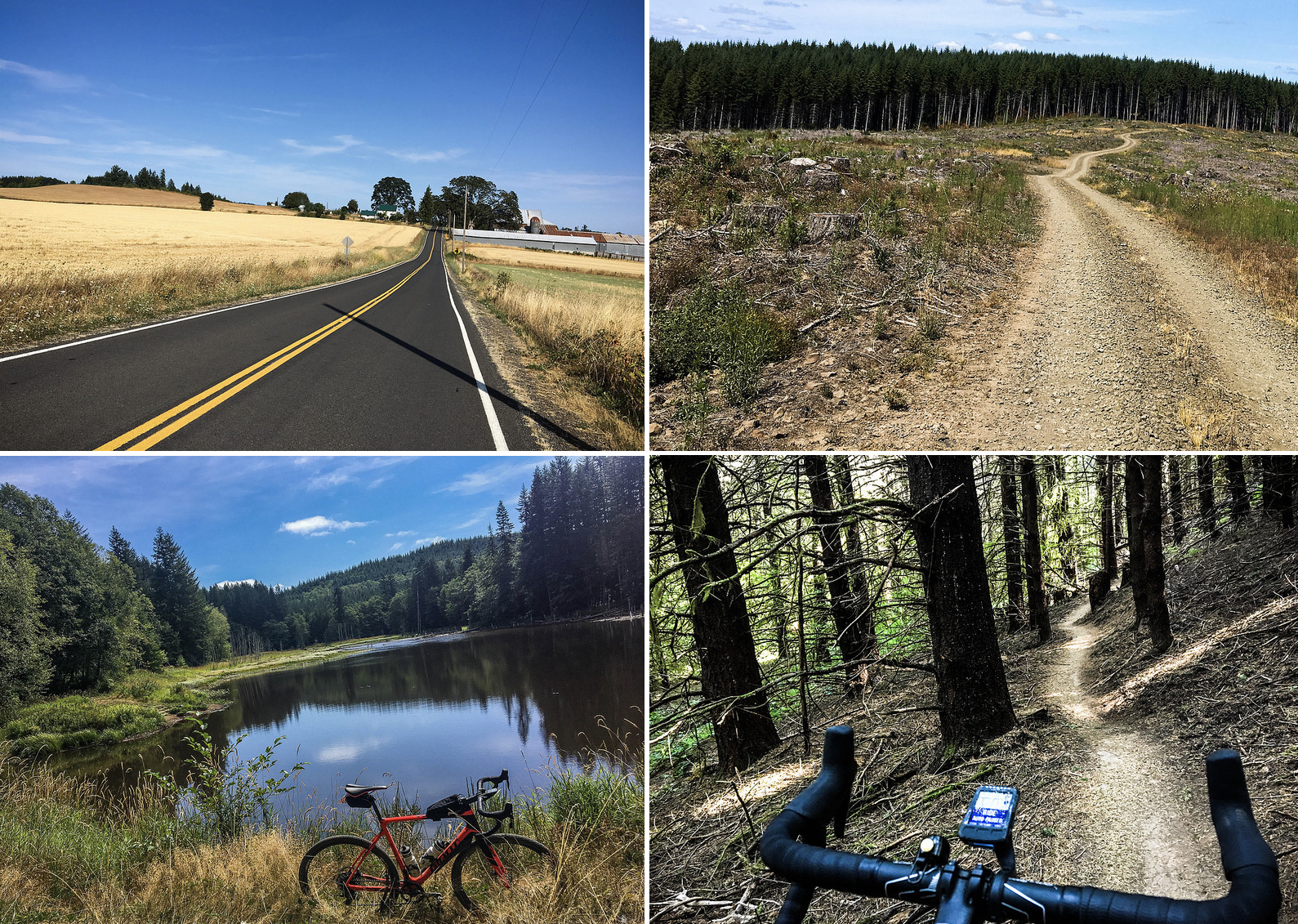
You know I have a soft-spot for Columbia County. A ride I did this weekend made it even softer: A 100-mile loop that pulls together adventurous riding that’s relatively close to Portland and offers everything from expertly crafted singletrack and primitive logging roads to carfree paths and smooth country roads.
I call it the Scappoose Vernonia Singletrack Century.

It started innocently enough. I need to get some miles in my legs before next weekend’s Dirty Sellwood ride. As usual, my thoughts turn north and west from my house near Peninsula Park when I dream about nearby adventures.
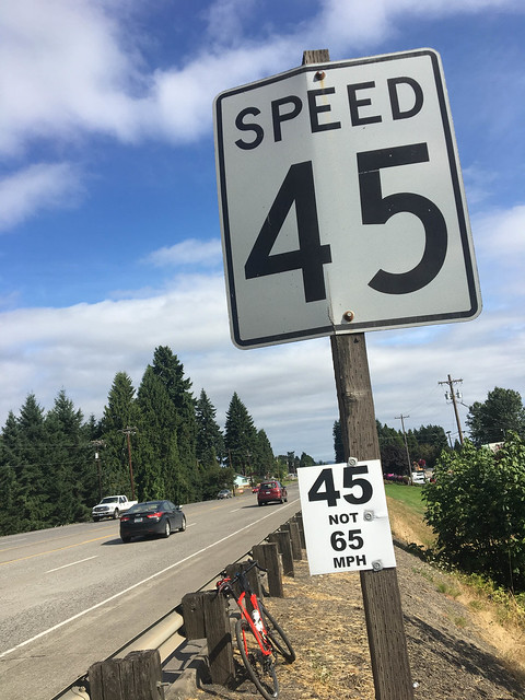
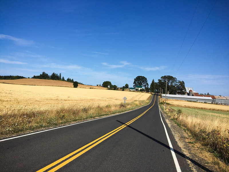
I started with about 20 miles of relatively chill and flat riding on Willamette Blvd and Highway 30. The highway could and should be a lot better for biking between downtown Portland and Sauvie Island, but I won’t get into that now. On weekends it’s not that bad, especially north of Sauvie Island when the traffic mellows and the shoulder widens. The fun started about an hour into the ride when I got to turn off the highway onto Dutch Canyon Road — one of my favorites. Many people take this route to do the popular Otto Miller Road loop; but few stay on Dutch Canyon to explore the dirt logging roads just beyond.
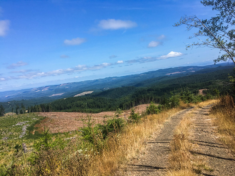
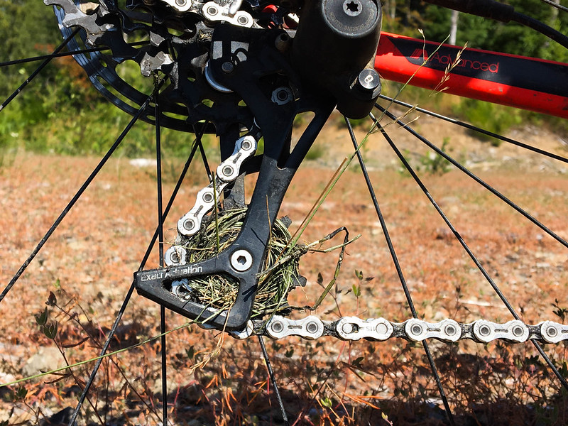
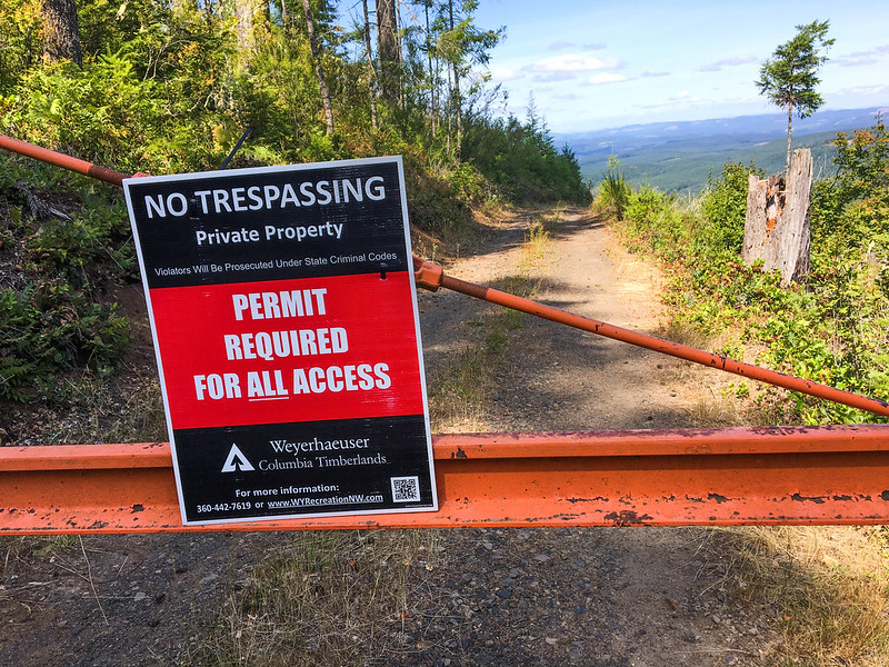
As I shared back in 2015, there’s a ton of great logging roads to explore between Dutch Canyon Road and the Scappoose-Vernonia Highway. (If you want to ride in this area, check the Weyerhaeuser permit maps first. I bought one for Columbia and Washington counties this year just to be safe. And I wouldn’t advise riding there on weekdays due to a high volume of logging activities.) Once I got onto the dirt, I spent the next 25 miles on logging roads — some of them in pretty rough shape.
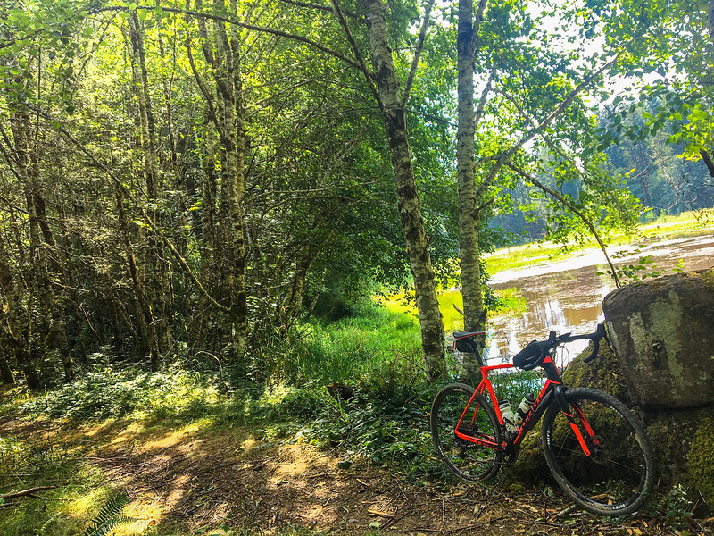
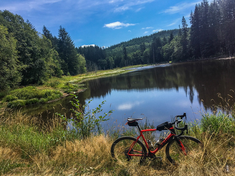
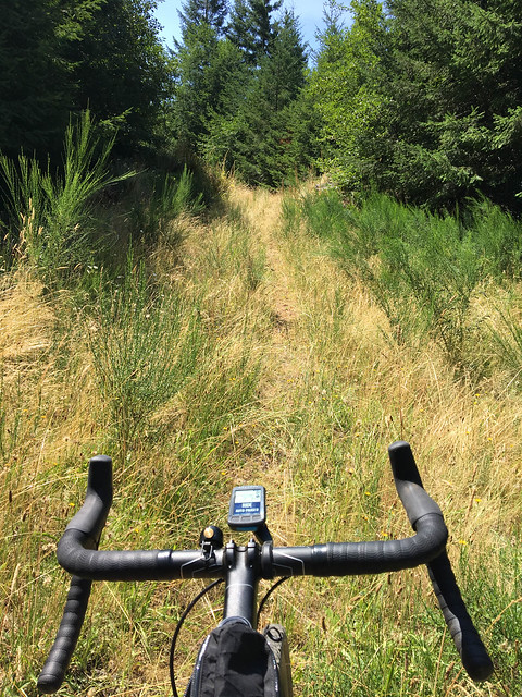
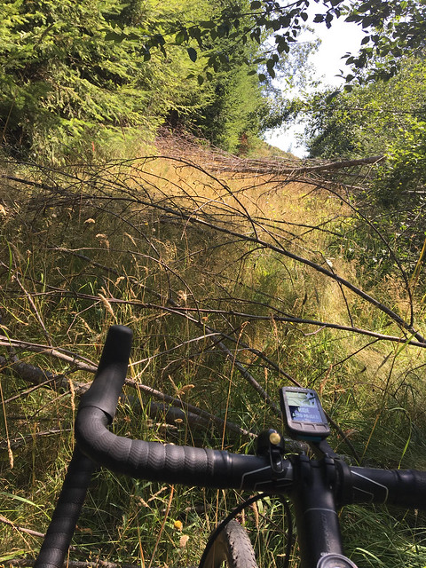
After connecting to Pisgah Home Road, I opted to check out Gunners Lakes. This is a sweet spot made up of three lakes that hardly anyone visits due to their location and lack of services. From Gunners Lakes Mainline, I worked my way back up to Bacona-Pisgah. Before I got there I made a wrong turn and climbed to the top of Long Mountain, a 2,200 foot peak with views so good I didn’t mind the detour. I also had to walk and carry my bike over a lot of down trees and branches on the last part of the Corral Creek Mainline Road just before where it meets up with Bacona.
Advertisement
I could have taken Bacona all the way to Buxton where it crosses the Banks-Vernonia State Trail. But I’ve done that many times and I wanted a bit more adventure today so I headed north on Pillins Hill Road which dropped back down into the valley along Pebble Creek just south of Vernonia Lake. From there I connected with the State Trail and rode it south for about 10 miles. At the trails half-way point, I jumped onto Highway 47 in order to connect to Hoffman Road. This was something new. My goal was to connect to the Stub Stewart State Park singletrack trails off of Genzer Road and I knew from previous rides that Hoffman would get me there.
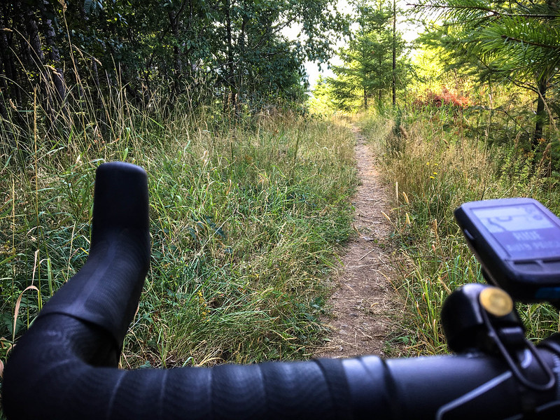
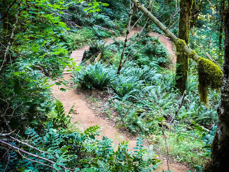
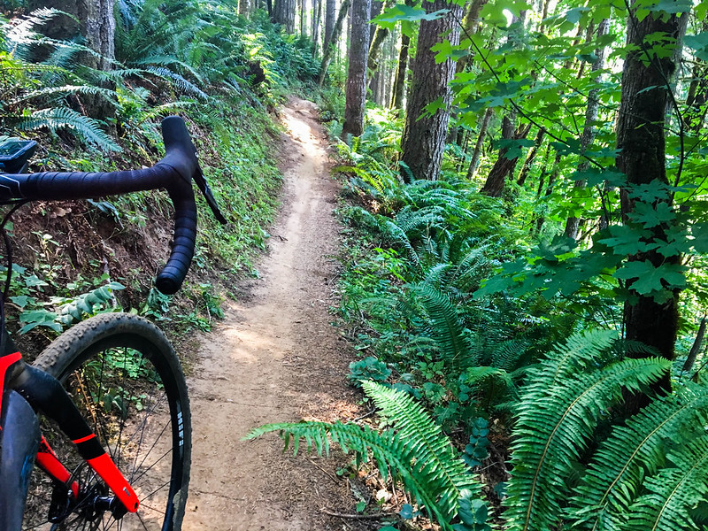
At mile 60 of this ride, the 1.5-mile climb up Hoffman Road was annoying. It’s just straight up and rocky. But at the top is where the major fun begins. Thanks to our friends at NW Trail Alliance, Stub Stewart has loads of really fun trails to ride. You can access the very top of them off of Genzer and enjoy about four miles of groomed and curated singletrack. There are berms that swoop you through the trees, challenging switchbacks, high-speed flow sections, bridges over creeks, and more. It was 45 minutes or so of trail-riding bliss.
Shoo-Fly trail dropped me off onto the Banks-Vernonia path and the rest of the ride was relatively uneventful. Just smooth sailing on pavement — which was nice after 30 miles of rocks and trails and dirt.

This is such a fun loop! I love the diversity of conditions and challenges it offers. Depending on your interest, you could use this route to explore the roads around Gunners Lakes (even via driving to Scappoose), find new ways to reach Vernonia, create a loop that includes the Stub singletrack, and so on.
Here’s my route on RideWithGPS.com.
— Jonathan Maus: (503) 706-8804, @jonathan_maus on Twitter and jonathan@bikeportland.org
Never miss a story. Sign-up for the daily BP Headlines email.
BikePortland needs your support.


Thanks for reading.
BikePortland has served this community with independent community journalism since 2005. We rely on subscriptions from readers like you to survive. Your financial support is vital in keeping this valuable resource alive and well.
Please subscribe today to strengthen and expand our work.
That’s a lot like the many loops I ride in the O&C lands west of Eugene. It’s a shame that so many cities, yours and mine included, have what I call the donut effect. Riding in town is fine; riding out away from town is fine. However, there is a zone at the edge of town that is unpleasant as all get-up (what I call suburban riding, but the folks who live there, all commuters, call it “country”). Some collaboration between cities and counties would be helpful to solve this and might even help us get some actual bike commuters (commuting used to mean crossing city limits).
Roseburg and the other logging companies that own land down here are a lot more generous with allowing cyclists to use their roads than Weyerhauser is. They close the gates most of the year (open during hunting season, but those folks are careful road users ime), but the signs all indicate that only motor vehicles are excluded. On those rare occasions when the fire danger is extremely high, they will ban everyone (kind of, sort of, depending on location).
Fun riding, especially on old touring bikes that were made to roll with reasonably wide tires. It’s nice to see the bike industry rediscover what some of us never left.
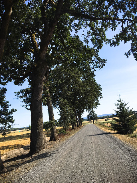
Looks awesome, one minor correction, that final bit of gravel caption is actually Harrison Rd. that connects to Mountaindale after that road crosses Highway 26. I’d actually take Wilkesboro Rd. from Banks to Mountaindale for a pavement option, or cut off Harrison to Hahn for even more extra gravel and a nice view of a little farm pond and woods.
thanks Jason. Made the edit.
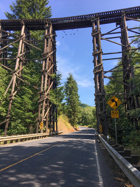
Judging by the quality of the railroad trestle picture, I’m guessing it’s cropped from a quick smartphone snap so you could enjoy the descent?
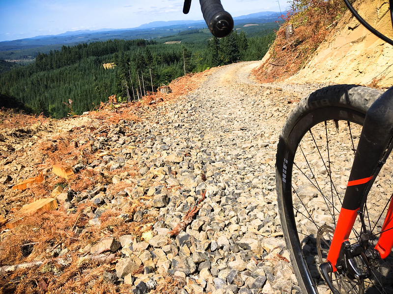
Also, how long is that stretch of gravel bigger than railroad ballast? I’m not very surface-allergic, but the sight alone is giving me a rash.
Hi Champs,
Thanks for the questions. I was actually climbing as I passed under the trestle, so I had plenty of time to get a good shot. And that large rocky gravel isn’t super long. There’s enough of it and it’s spread over a long enough distance — maybe a few miles — that I advise larger tires if you have them. Otherwise you’re forced to slow way own and flatting is easy to do.
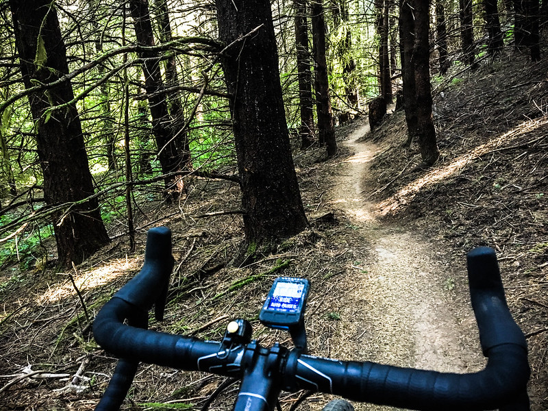
Hi Jonathan, awesome loop. Sorry if you’ve mentioned this before, but what do you use to navigate? Is that a Garmin on your bars? Thank you
Looks like a Wahoo Elemnt BOLT.
yep. Wahoo Elemnt Bolt. I didn’t really use it for navigation though since I knew where I was going (except for that one wrong turn). The maps on the Bolt are not great and couldn’t help me when I lost the route. So I used my iphone and the excellent Gaia GPS app which came through big time because I had downloaded all these maps in the past so I could find my way around.
Jonathan, depending on the day we might have just missed each other out there. I was out there on Sunday for a 50+ from Scappoose to Vernonia and back – all but a few miles gravel. https://www.strava.com/activities/1143983084
If you ever want to hook up for some riding in Columbia County let us know https://www.facebook.com/ColumbiaCenturyChallenge/
Very nice post! I love the riding past Dutch. Smoke Ranch Road is another fantastic one up that ways.
And some parts of Bacona are pretty tough!
Thanks for the mental vacation….
Beautiful oak trees
Talking about these isolated coast range rides, anybody come across an abandoned Willamette geared locomotive? I remember it back in the 60’s covered with brambles and rust on a siding from which most of the tracks had been removed. Haven’t been back since and wouldn’t know where to go anyway as I was with a logger who did the driving. It was west of Vernonia on an old an overgrown logging railroad.
No, but I have passed a house with a number of KFC signs and Colonel Sanders statues in the lot next to it as well as a collection of decommissioned TriMet buses.
Adjoining Clatsop county is great riding too. Trivia: If you ride Route 202 from Vernon to the coast (comes into the back of Astoria) you will lose track of the number of times you cross the Nehalem river. You will pass through the elk refuge, too.