Roads in Washington County are notorious for being wide and fast — which is why a new policy to physically separate motor vehicle users from bicycle users is such good news.
Last week the Washington County Board of Commissioners voted unanimously to codify their preference for protected bicycle facilities on major County roads.
In a statement about the policy, District 1 Commissioner (and Vice-Chair) Dick Schouten* said, “The board has long recognized the need to not only provide access to bicyclists, but to make sure that access is safe and equitable. Bicycling and other forms of active transportation promotes healthy lifestyles, reduces traffic congestion and improves our quality of life. As a Board, we are committed to doing everything we can to support this by making sure our roadways are safe for all modes of transportation.”
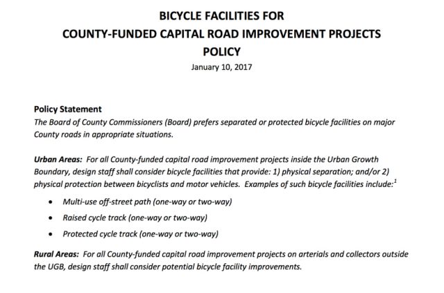
The policy (begins on page 45 of this PDF) that passed at the January 10th meeting not only states the Board’s preference, it also requires County staff to evaluate the feasibility of separated bicycle facilities on all County-funded capital road projects and then present those options to the Board before projects move beyond the 30 percent design stage. Also, when designing new road projects, County staff will be required to evaluate at least two bicycle facility types — including at least one that provides physical separation and/or protection of bicycle users from motor vehicle users.
Here’s an overview of the new policy:
Advertisement

According to the County, the new policy reflects their, “commitment to the benefits of active transportation.” A statement specifically mentioned using the new policy for projects that improve biking and walking access to schools. The County has committed $2 million per year for the next ten years to projects identified in their School Access Improvement Study.

Specific facility-types mentioned in the adopted policy include: multi-use, off-street paths; raised cycle tracks, and protected cycle tracks. It would also apply to both urban and rural projects — that’s an important piece of the story because Washington County is about evenly split between urban and rural roads and is home to some of the most popular recreational riding in the region.
Keep in mind that this is far from a mandatory requirement for protected bikeways. “The Board also understands, however,” reads the adopted policy statement, “that separated or protected bicycle facilities may not be the most appropriate option for a specific capital project for a variety of reasons – including safety, funding limitations, right-of-way limitations, maintenance concerns, etc.” This means the usual pressures of politics and public will are not going away and it will be up to County leaders, concerned residents and advocates to make the case for each project.
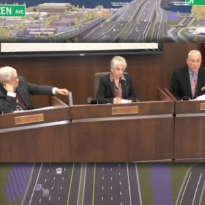
Even so, the endorsement of separated facilities from the Board is a very important step forward. Commissioner Schouten told us he anticipates it will lead to more of them being built. And Washington County Land Use & Transportation Director Andrew Singelakis said the Board was already headed in that direction. Last fall they chose a separated bikeway design for a project in Sherwood where a rural road t-bones into Highway 99W. In that project (see image above), the County opted for a 12-foot multi-use path to help people navigate between a new roundabout and the highway.
Portland has tried to establish a formal policy on protected bike lanes; but thus far no such policy exists. In 2015 PBOT Director Leah Treat issued an internal directive stating the bureau’s preference for protected bike lanes to be installed adjacent to new development. While hailed by advocacy groups and the media as a move that would make protected bike lanes the default treatment, it actually has no legal authority.
*Contact Commissioner Dick Schouten here.
— Jonathan Maus: (503) 706-8804, @jonathan_maus on Twitter and jonathan@bikeportland.org
BikePortland is supported by the community (that means you!). Please become a subscriber or make a donation today.



Thanks for reading.
BikePortland has served this community with independent community journalism since 2005. We rely on subscriptions from readers like you to survive. Your financial support is vital in keeping this valuable resource alive and well.
Please subscribe today to strengthen and expand our work.
Well, cool! We’ll see how it translates into action.
Yeah, I wonder if this policy would have helped Bethany BLVD at all, which currently has bike lanes that are narrower than the minimum standard, and sidewalks that are completely ridiculous.
What are the dimensions in feet and inches, of the Bethany Blvd bike lanes? I’ve ridden that road, and discussed it with a few people. It offers ‘determined and desperate’ riding conditions, which to me was somewhat reasonable before the improvements, when it was just a two-lane country road. Except when people were at home or in church on Saturdays and Sundays, Bethany was never a very good road for riding.
If it’s desired that people more easy going than the ‘determined and desperate’, will ride the lane or path, when a road with amenities for biking is designed, it should be designed to be appealing and comfortable for people whom have a need to feel they’re not inescapably subject to harshness of motor vehicle use on the road.
With its 5′ tree planted separation from the 14′ main lanes of the road, I like the 12′ MUP depicted in the proposed cross-section for Sherwood. If it was just for bike use, that would be ample travel room.
With people on foot too, I would expect that width to possibly be tight…though the Hwy 26 bike lanes, actually MUP’s are no wider…don’t think so, but not absolutely sure. And they work well. Depends on how many people at any given time, it might be anticipated will use what’s provided, and by what travel mode.
The bike lanes were presented to us as 5′ wide in the final design. The sidewalks were presented with 4′ of separation + 5′ sidewalk + 2.5′ before the wall on one side, and 2.5′ of separation + 5′ sidewalk + 2.5′ before the wall on the other side.
http://www.co.washington.or.us/LUT/TransportationProjects/upload/Bethany-Blvd-strip-map_road.pdf
I haven’t been out there with a tape measure, but visually you can tell that the bike lanes are probably 3.5′ to 4′ wide (engineering guidelines say they are measured from the curb to the middle of the stripe).
And take a look take a look at this:
https://goo.gl/maps/hV57Ld2dasC2
There is NO WAY that there is 11.5′ feet from the curb to the wall on either side of the road. And it’s hard to tell from the pictures, but the sidewalk has multiple obstacles in the middle of it, like lamp posts and bus benches, that result in a zig-zagging path that is hard for kids to bike on.
https://goo.gl/maps/UvjAmB1arGz
https://goo.gl/maps/hKJ4pxn3Gt32
https://goo.gl/maps/DFTznjyZnrQ2
https://goo.gl/maps/tJaxhSKHRKN2
Disgusting. Does anyone actually walk There? The walls and narrow sidewalk + wide roadway creates the feeling of a giant concrete ditch.
It’s part of our ‘safe route to school’, ha ha.
Yes, people do actually walk there…how many, I couldn’t say. The few times I ride the road…because when there’s more than just a small amount of motor vehicle traffic, it’s not an enjoyable riding experience… I generally see somebody walking on the sidewalk, but maybe just one or two over a great expanse of sidewalk. Like in summer for example. On a low traffic time, like before noon on Sunday, not much traffic, Bethany can be a nice, swift road to ride, quiet, smooth.
Just as a long term area resident…a ways away actually, close to the Nike campus…I feel the Bethany road expansion design was disappointing for its effect on area livability. My impression of about how it came to be, is that area leaders are dead set on prioritizing the maximization of a number of roads in the counties and cities for moving the greatest number of motor vehicles possible. Area livability takes a big hit, being subjected to the downsides of a road that isn’t quite a freeway, but sounds and performs in some ways close to how a freeway performs…running right through the middle of the neighborhood.
14 feet is too wide for any car lane.
Actually, Oregon has bike lanes, and main lanes of the road that people can use with motor vehicles and bikes. There are no “…car-lanes…”.
Fourteen foot wide main lanes are great if the right of way for that width is available. That width allows more area for people to ride bikes to the far right of the lane where the bike lane, if the road has one, may be junked up with lots of gravel, glass and whatever, such as this time of the year.
Good on Washington County for acknowledging the need for protected cycling infrastructure. Though they still seem to be on an unstoppable road-widening frenzy. It’s crazy to me how wide some of the major streets in Beaverton and Hillsboro are– especially surrounding the Nike campus which many people walk to from the MAX. Hopefully this policy manifests itself into retrofitting protected bike lanes onto the county’s over-built streets.
Yes. The road-widening is getting out of hand. Note the fierce fight back for the highway that is currently on NW Bethany Blvd.
‘Wider = safer’
–Washington County
I’ll be the first fly in the ointment. I thought it had been well-established that sidewalk riding is more dangerous than riding on the street, and much more dangerous than riding in a proper bike lane. Yet, here’s Wash. County saying they want to create mandatory sidewalk riding in the name of encouraging active transportation and safety. Through the looking glass we are.
I also thought that two-way cycletracks were so dangerous that even the Dutch have given up on them, yet here they are being proposed in the name of safety.
Look, there are appropriate places for side-paths, like along major roads that don’t have intersections for extended distances. I’m also fine and dandy with bike paths that are not on the side of a roadway; these often provide safety, speed and enhanced pleasure for people on bikes. However, what I see in this policy isn’t a step forward but just virtue signaling.
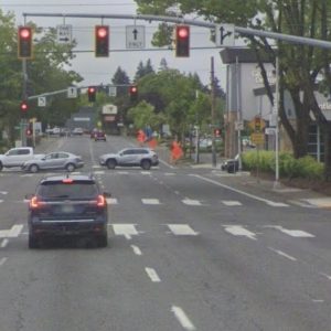
The bike lanes in Washington County are terrifying – most are just three foot gutters. I agree that two-wayin-roadway cycleways have limited applications, but a one-way protected bike lane on either side of the roadway with protection at intersections is far safer and more comfortable than a three foot gutter.
I’m not defending the status quo. I said “proper bike lane”. Those three foot gutter things are so bad they don’t even meet Oregon’s standard, which I consider to be abominable.
However, why replace one poorly done implementation, one which I’m sure they congratulated themselves on doing (very bikey, no?) with another type of even more dangerous implementation, which is what Wash. Co. is proposing to do? Why in the world does anyone think they can create a safe and functional segregated facility when they can’t even do a simple bike lane properly?
And, as always, I cannot help but enjoy the quixotic notion that a mis-named protected intersection can function adequately in an American context. We’re missing a few things that are essential for these to not be enhancers of risk.
“The bike lanes in Washington County are terrifying – most are just three foot gutters. …” adam h
Better than nothing. And that’s been the reality of bike infrastructure addition for a long time, not necessarily for lack of desire all around for something better. Great bike infrastructure can take a lot of time and a lot of money to provide.
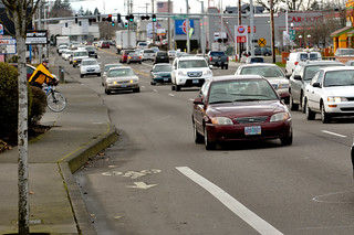
This is what I had to deal with when I worked at Nike and was cycling from the MAX. No way that’s safer than a proper protected bike lane. I would actually just ride on the west sidewalk and this excellent multi-use path rather than use that gutter lane inches away from 45 mph motor traffic. Once they built the path though Nike woods, I used that. Not everyone feels comfortable using a 3-foot gutter lane on a five-lane arterial with heavy car and truck traffic.
The cars beside you are only going 45-60mph. What’s the problem? 🙂
Not sure which campus entrance your destination was, but since you were using the sidewalk anyway, you might just as easily have used the north Jenkins sidewalk eastbound to Jay St…nice short side-street primarily serving Nike and some other small businesses.
The irony that is inescapable to me every time I pass by or see a photo, is that completely surrounding the Nike Campus, is that huge, and I mean…huge…earthen barrier…it can be seen in the pic you provided the link to.
Of course, it would be a substantial engineering project and expense, but Nike could have used maybe half of the footprint of that berm for a wide MUP, parallel for example, to 158th. Or sold the right of way to the county to build it, so it wouldn’t be Nike’s problem after it was built. On the inside of berm, Nike has acres and acres of land, currently just parking lot, until quite recently, beautiful grassland. The company could there, re-establish the full footprint width of its berm with room to spare.
This is good in theory, but obviously non-binding. I’m concerned about the increase from 10′ to 14′ travel lanes in the standard. Besides encouraging faster driving in general, when in many cases the obvious cost-reduction step of cutting out the bike lanes/multi-use paths occurs, we’ll then be left with even more dangerous travel lanes that bikes have to share with cars.
14 feet is like a race track! Bad idea !
Let us get the porous concrete, underground utilities, and giant street trees ! SW Scholls Ferry Road up next !
I hope it’s not too late to see protected bike lanes on upcoming projects like 198th in Aloha. We don’t have many trails like other areas of the County and I long for the day that I can take my kids biking without being stressed out.
Have you contacted Dick Schouten ?
Better get protected intersections as well or it’s just as bad as riding on the sidewalk like Portland’s idiot protected bike lanes.
Hillsboro and Washington county is building some general round-a-bouts. The county is working with Portland to build a round-a-bout at the dangerous intersection of SW Multnomah Blvd at SW Garden Home Road in Portland’s Ashcreek neighborhood.
That is a dangerous spot. Any word on what the bike lane will look like through the roundabout? I’m thinking it may still be dangerous unless there’s some very careful design, since so much of the (eastbound) car traffic continues straight ahead on Garden Home and almost none of the bike traffic curves left along Multnomah.
I’m not sure what it will look like, but I hope PBOT and Wash Co. make it a lower speed limit on Multnomah Blvd like 30 mph. One lane for car travel is likely proposed for both travel, not a four lane roundabout due to more crashes at four lane roundabouts. Funding is fully secured for that intersection as there are two adjacent side streets. There is a proposal for a traffic light but studies have shown less crashes take place at roundabouts. This was discussed at a CPO3 meeting last year.
ODOT sets the speed limits, not the county or city.
Only on ODOT roads.
No. All publicly owned roads statewide, right down to the street in front of your house and the alleyway behind it. If it’s not in the Speed Zone Program’s database, odds are the street in front is 25 and the alleyway is 15 by state law. Local jurisdictions do not have the authority to set speed limits in Oregon.
The roundabouts on Verboort are a little bizarre. You can click your way through one here:
https://goo.gl/maps/8LotBL1vjP32
I think if you want to go left here on your bike you’re expected to go from the disappearing shoulder onto the sidewalk, then cross Cornelius Schefflin to get to the other sidewalk, and then ride north until the sidewalk turns into a shoulder again. But if you’ve never been here before, you may find yourself accidentally taking the lane in front of highway traffic and then having to merge with them through the roundabout.
How is the new roundabout by Highway 47 near Forest Grove?
I don’t know. I stopped riding in that whole area after being nearly killed by a driver passing another car on Zion Church road and the county not taking my concerns seriously afterwards. Too bad, I used to like riding over there….
“…the dangerous intersection of SW Multnomah Blvd at SW Garden Home…” rick
For riding a bike, this is an intersection that requires greater care than others. Many eastbound riders seeking a route involving less exertion, are going to prefer Multnomah Blvd with its comparatively gradual climb and bike lanes…I think, 5′. This means that at the intersection at Garden Home Rd, they have to negotiate the sweeping curve of the road that is there, past waiting westbound Garden Home road users at the stop sign, instead of there being an intersection in which the two roads are at right angles to each other.
It’s imperative that people biking eastbound, signal well in advance of the intersection, to waiting road users on GH Rd, and if possible, as they pass through across the intesection.
A traffic light to regulate westbound GH road users could help to make the intersection safer for bike use on Multnomah Blvd.
I’m trying to visualize what type roundabout road engineers might apply to this intersection. Maybe they’ve already prepared a drawing for release to the public. Personally, I’m not so enthusiastic about roundabouts, though that depends on a range of considerations.
14′ lanes for the Sherwood project is ridiculous. Even in Minnesota where you have snow removal to deal with, no agency that’s working on protected bike lanes is proposing 14′ travel lanes.
very true
You say “14′ lanes for the Sherwood project is ridiculous.” ? Why do you say that?
Could try for 12′, but I doubt 10′ would be decided upon. 12′ would allow an extra 2′ for each of the MUP’s, making them 14′ over the graphic’s indicating them to be currently proposed for 12′.
What if someone riding a bike, doesn’t feel the MUP is safe for the type of riding they need to do? 12′ main lanes wouldn’t be as beneficial to them as would be 14′ lanes.
The 14 feet we’re talking about is for the travel lanes. No sensible road designer is spec’ing 14 foot lanes anymore. In Richfield, the small suburb a mile from me, multiple redesigns of busy streets are going on, using 11′ travel lanes. Some troglodytes are still designing 12′ lanes, but 14′ should be on the scrap heap by now.
As I earlier said…people biking, also use main lanes of the road, or travel lanes, as you refer to them. Extra lane width can be of benefit to them, depending on the particular road situation.
I don’t have a really strong sense of what 14′ main lanes are, for comparison, though there may be some here in Beaverton and Washington County that I’ve ridden on. Something I remember from a city meeting here in the beav some years back, related to the width of Broadway in Beaverton. The street has curb parking, but narrow sidewalks. People raised the question about narrowing the main lanes to create width for the sidewalks.
I don’t remember what the lane widths were, but the traffic engineers’ answer was that he didn’t think less than 10′ would be approved. From this, again, not sure, but I think the lane widths were 11′ or 12′. Whatever the width there is, in actual use, it’s not luxuriously wide for travel, parking, etc.
Spacious lane width can benefit road users other than people that drive. As a means of restricting the flow of and mph speed of motor vehicle traffic, I think that unless the lanes are very narrow…for example, such as to only allow passage of one car at a time on two way streets with curb parking on both sides, narrow lane width can’t be very effective.
The new Walker Road “freeway” near Nike needs this. I think a new 5 lane freeway for Walker Road near 173rd. Protected bike lanes.
Right, we need to stop pretending that there’s enough ROW for new 4 and 5 lane stroads but not enough room for safe bike lanes & sidewalks.
Every street around the Nike campus needs this. Especially 158th, as it’s a popular route from the MAX station to Nike’s West Campus.
Washington County has a long way to go before I’ll trust them to care about pedestrians. Kwang Park was killed on Baseline just after this blind corner near clusters of apartments. The speed limit on this road is, unbelievably, 40mph.
https://goo.gl/maps/8vtPAZWQQp32
I drove it yesterday when using the nearby MAX station, and was appalled at the speed limit here. It should be 25 at most. I haven’t heard anything to suggest that the county is reconsidering the speed limit. The police let the driver off and basically said, “oh well”.