
(All photos by Todd Boulanger/Urbane Streets)
The Oregon Department of Transportation has begun a project that will have a big impact on bicycling in north Portland. As we’ve been promoting for months now, ODOT’s North Denver Avenue project is focused primarily on rehabbing the road between Victory Blvd (near Delta Park) and Argyle St (in Kenton); but it also comes with several enhancements for bicycling.
Unfortunately the project also comes with some road and path closures that will last up to 90 days and make bicycling in the area a bit more stressful.
This is an important link in the bikeway network because Denver provides access to Portland International Raceway (PIR), the bike paths along the Columbia Slough, Delta Park, Vancouver, Marine Drive, and so on.
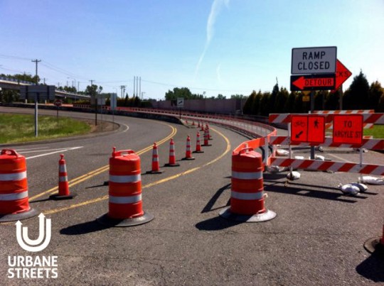
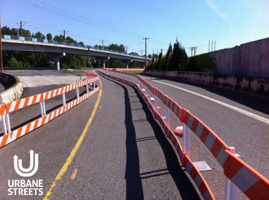
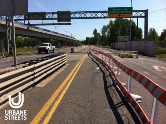
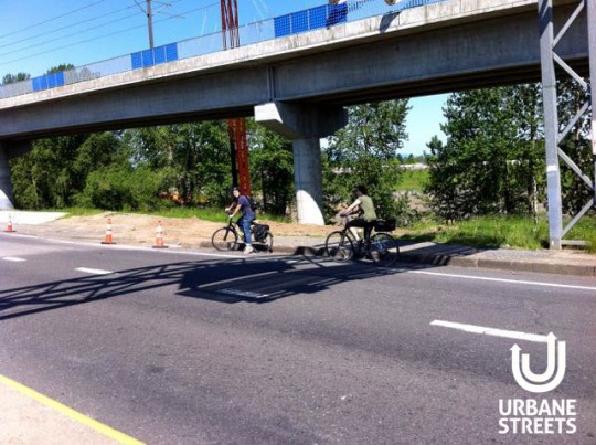
ODOT has a temporary protected bike lane set up around their work zone and BikePortland reader Todd Boulanger (a former transportation planner for the City of Vancouver who’s now a consultant) got a closer look over the weekend.
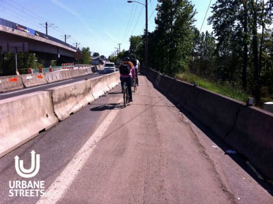
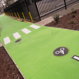
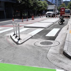
ODOT has prohibited driving completely in the southbound direction on Denver. In its place they’ve installed a fully-protected biking and walking lane between Victory and Kenton. Boulanger said he was impressed how well the street functioned with just one direction of auto traffic.
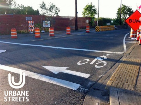
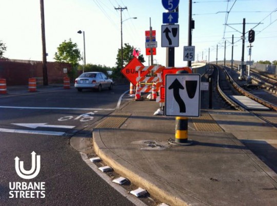
Overall, Boulanger gives ODOT a “B+ for bikes” so far. His only quibble is their decision to close the Columbia Slough path (he thinks they should have reopened it on weekends) and a poor transition northbound that confuses bicycle riders.
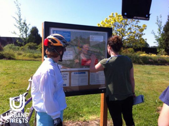
Here are more photos from Boulanger…
Advertisement
If you ride (or have ridden) in this work zone, please let us know about your experiences.
And note that the Columbia Slough path will be closed between Whitaker Road and Denver Ave until July 16th.
If you have questions about this project, learn more at ODOT’s website or contact Susan Hanson with ODOT community affairs at (503) 731-3490 or Susan.C.HANSON@odot.state.or.us.
This project is expected to be complete in the fall of 2015.



Thanks for reading.
BikePortland has served this community with independent community journalism since 2005. We rely on subscriptions from readers like you to survive. Your financial support is vital in keeping this valuable resource alive and well.
Please subscribe today to strengthen and expand our work.
I rode this last week and was also confused as to the entrance at the northbound end. A simple stencil on the ground saying “yes, you are in the right place” would be helpful for cyclists travelling south on Denver. That said, I was impressed with the detour for bikes and glad I didn’t have to backtrack towards Delta Park –> Portland Meadows –> Schmeer –> Vancouver to get where I was going.
Any word on if they plan on repaving the path from Denver Ave to N Portland Rd? I used to ride it frequently these past 15 yrs to get to Kelly Point Park and have seen it slowly deteriorate. Last I was on it (last summer) I swore that it would be the last time until it got fixed. You need a full suspension mtn bike to ride that path.
I like the deterioration. I ride it on bikes with 28mm tires and enjoy the path.
Paving is bad for the environment.
Oh Please, it’s RE-paving and a drop in the bucket as far as total area covered within the Portland area.
Took the new bike route to get to the Kentucky Derby at Portland Meadows last weekend. Finding the entrance near Kenton was pretty confusing, some more indicators would be helpful for 1st timers. Going Northbound, I also ended up leaving the protected path, crossed Denver, and took the Delta Park exit (no shoulder) intended for motor vehicles… There is a big gap in the concrete barrier at that point, so thought that’s what people on bikes were suppose to do. Wrong, I should have continued on the protected path North to Victory, then turn right (east) to continue to Delta Park. Keeping Schmeer open would have been nice but can understand that might have caused more safety concerns. Anyway, ride safe everyone!
Direct link to ODOT’s bike & ped detour map:
http://www.oregon.gov/ODOT/HWY/REGION1/99W_NDenverAve/Maps_StagingJune%202014.pdf
I rode it south-to-north from Interstate. I was warned well back on Interstate that there was a bike lane closure, so I kept my eyes peeled. I rode across Argyle and crossed Denver at 5mph-ish.
I think I prefer the Whitaker crossing under the freeway with this temporary config. Starting from way over on the N. Expo Rd. alignment, I feel more established in the lane and don’t have to monitor as many directions of traffic as the usual Whitaker “exit” from Denver.
Part of why I did not “award” a A+ for this effort…(though this is one of the best work zones of 2015 I have seen.)
As for the confusion for NB bike traffic for first time users, much of it is due to:
1) a lot of signs (a “fail” at clear communication);
2) many of the bike detour signs are placed poorly from the bike lane location a bicyclist would take if they were riding legally and without foreknowledge of the detour;
3) once a bicyclist gets close enough to the detour signs to act, it is often too late to find a gap so they are forced to park until the cross street signal is green; and
4) this intersection with the LRT facility does not provide a north south sidewalk ramp to easily ride up onto to wait out the traffic flow nor a Copenhagen left turn box.
Just on my short time in the work zone, I saw a NB couple (the only NB traffic) lost halfway through the work zone waiting on the side of the road to sneak back to the path at the break in the jersey barriers. (See photo)
Perhaps orange detour sharrows should be added to bring cyclists over to the route they should take before they enter the intersection so they can preposition themselves early to slide on over to the two way path.
——
Dear ODoT Region 1,
I will let you retake this test for your likely A+ grade…if you successfully address items 1 through 3 for sure. Extra credit will be given for the path reopening on weekends when there is no construction activity. (We so did not want to have to climb the 8 foot high fence to reach St Johns last week.)
Oh…and PS.
On my way home NB through the work zone last weekend, the type 2 barricades blew down blocking parts of the route. I assume the contractor has added more sand bags since then. (or they must have blown down this weekend too?)
Perhaps a better tool would have been the plastic jersey barriers…assuming there is enough width to allow them.
Was biking northbound through here a couple weeks ago and completely missed this. Was wondering why I found myself in a concrete tunnel with cars all of a sudden.