I get the feeling that there’s a lot of momentum around planning for the future of active transportation in Washington County. The Bicycle Transportation Alliance, the Washington County Bicycle Transportation Coalition, 1000 Friends of Oregon, the Willamette Pedestrian Coalition, and other advocacy groups have been turning their attention westward in recent months, not to mention the $2 million federal grant recently given to the community of Aloha-Reedville (between Hillsboro and Beaverton) to develop a livable community plan.
“Land use and transportation planning decisions are often emotional, and it is very important that the rules of the game are clear, consistent and spelled out for all to see.”
— Andrew Singelakis
The BTA’s statewide advocate, Susan Peithman, says Washington County is full of “new opportunities,” and that the effort to get active transportation on their radar has been going on for years; but it won’t happen overnight. “Like all big changes,” she says, “it’s like moving a ship and can take long time to change an auto-oriented culture of transportation governance.”
The BTA and their partners are hoping to coalesce the public’s pent-up demand for a functioning active transportation system in Washington County. Peithman says the goal is to, “Demonstrate support to our policy makers so they can feel supported when working on transportation that focuses on moving people not just cars.”
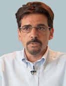
Tomorrow night, the BTA, WPC, and 1000 Friends are hosting an active transportation forum featuring Washington County’s Director of Land Use and Transportation, Andrew Singelakis.
Singelakis was hired this past February and was formerly the deputy director of the City of Tucson (Arizona) Department of Transportation. To help further your understanding of what’s going on Washington County, and to introduce you to Singelakis, I emailed him a few questions…
BikePortland: What are your top 1-2 priorities as Land Use and Transportation Director?
“Closing gaps within the bicycle and pedestrian system in the County will go a long way toward providing access from our high tech sectors and transit stops, or the so called ‘final mile’.”
Andrew Sigelakis: LUT [Land Use/Transportation] is a big department and there is a lot going on among its five divisions. The department has a talented and dedicated staff. A major issue is a decline in revenues, particularly in the development services area. We will need to figure out how to streamline our development review functions while revenues decline in an enterprise fund, while maintaining a high level of customer service. Another priority is to reevaluate our transportation planning processes to ensure that they are as transparent as possible. Land use and transportation planning decisions are often emotional, and it is very important that the rules of the game are clear, consistent and spelled out for all to see.
BP: What is the main challenge(s) Washington County faces in terms of land use and transportation in the next few years?
AS: A key challenge relates to the large urban unincorporated area in Washington County. Washington County has about 200,000 people who are not in a city, but who reside in an urban area. If this area were in a city, it would be the second largest in Oregon. These areas demand a higher level of service than rural areas. However, at the same time, the County has fewer resources available to serve those areas. The TIGER grant for Aloha/Reedville will attempt to understand and address this challenge, particularly ways to improve access to the region’s transit system. Infrastructure funding is another challenge. A good example of the needs out there include places like 119th street, where there are transit routes yet no sidewalks. Resolving issues like these are high priorities for the Board.
BP: Do you think bicycling can play a major role in addressing the challenges?
AS: Yes. Closing gaps within the bicycle and pedestrian system in the County will go a long way toward providing access from our high tech sectors and transit stops, or the so called “final mile.” In addition, bicycle and pedestrian amenities are seen as being essential elements of highway projects. Our MSTIP program [Major Streets Transportation Improvement Program], for example, while being viewed as a road building program, has actually resulted in miles of new sidewalks and bike lanes. In fact, about 30% of MSTIP projects include bicycle and pedestrian amenities.
BP: Any other thoughts?
AS: I am very happy to be here and to help Washington County make progress in solving some of its issues. Oregon is a great state. In fact this is my sixth state in which I have worked as a planner. In terms of planning law Oregon is the most comprehensive that I have worked in, with Vermont being a close second. Arizona, where I was most recently the Deputy Director of Transportation was at the other end of the spectrum. Other states I’ve worked in include New Hampshire (my home state), Maine and New York. In any event, it is always fun to learn about new places and to make new friends.
If you live, work, or ride in Washington County, consider getting involved and educated about what’s on the horizon. Learn more about tomorrow night’s event on the BTA’s website.


Thanks for reading.
BikePortland has served this community with independent community journalism since 2005. We rely on subscriptions from readers like you to survive. Your financial support is vital in keeping this valuable resource alive and well.
Please subscribe today to strengthen and expand our work.
Thanks for this article, Jonathan. We’re looking forward to a good conversation
Pretty soon Beaverton/Aloha will be to Portland what Ballard is to Seattle. I have mixed emotions about that. I guess I’ll just move to right outside the urban growth boundary.
“… AS: Yes. Closing gaps within the bicycle and pedestrian system in the County will go a long way toward providing access from our high tech sectors and transit stops, or the so called “final mile.” …” Andrew Singelakis/interview, bikeportland
I wonder what he might think about breaking up some of the cul-de-sac barriers to create through routes for pedestrian, bike use.
“In fact, about 30% of MSTIP projects include bicycle and pedestrian amenities.”
That’s because most of the MSTIP projects are widening roads, like widening a 2 lane road to a 5 lane road, and state law and good sense requires bike lanes and sidewalks be added. The real question to ask is: how many MSTIP projects are specifically for bike/ped enhancements?
I wish I could attend. I’ll look forward to seeing a summary of the Oct. 27 event. My specific interest is making Walker Road safely “walkable” from NW 185th Avenue to NW Von Neumann Drive.
It would be nice to see Walker “bikeable” along that stretch as well – specifically between 191st Place and Von Neumann. (also between 173rd and 178th)
I did not go last night because I was not able to get away from work.
Also, I did not perceive this meeting to be worth my time. I did not want to hear yet another discussion about how additional expensive rail-based transit is somehow good for bicycle transportation.
Meanwhile, the biggest headache on my bicycle commute, the Beaverton-Hillsdale/Oleson/Scholls intersection, has another round of planning devoted to fixing it. But there is no funding to actually do the fixing. See http://www.fixbhos.org/Background.aspx, where it says, “While Washington County is still working to identify construction funding, we have secured about $6 million in federal, state and local funds to support the design of phase 1 and possibly begin to acquire the right-of-way needed for the project.”
Did anyone go and can you offer a summary?
Seth…thanks for posting the link to the beav-hillsdale/olson/scholls fix plan. Doesn’t seem like much of an improvement. Biggest problem with that intersection, is that there’s too many motor vehicles attempting to pass through it.
Unless the planners decide to mow down a lot of buildings adjacent to the street and double the number of traffic lanes all the way from Hillsdale to Beaverton, that situation probably isn’t going to improve. If more of the commuters rode bikes though… Even a small car occupies the space that four bikes can travel in. Bigger cars, about six bikes.
The Smart Car is getting down there in terms of road space required…maybe the equivalent of two bikes. If all single occupancy motor vehicle operators were driving Smart Cars… What percentage of vehicles on the road do single occupancy motor vehicle operators represent? Forty to fifty percent? Get them all into Smart Cars and vehicle flow through the intersection could be increased significantly.
Crash corner is in the top 10 of intersections that need to be overhauled per TriMet. Fanno Creek would be greatly cleaned up by fixing crash corner which has independent, non-big box Parr Lumber and several grocery stores. March, 2015 will see the scheduled competition of the Fanno Creek bridge.