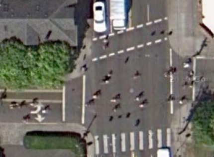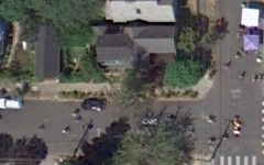
It seems like pure serendipity that Google decided to refresh the aerial imagery used in both Google Earth and Google Maps on August 15th, 2010 — the same day of Portland’s Sunday Parkways event in Southeast.

The mapping gurus over at Metro pointed out to me this morning that Google Earth’s 2010 aerial imagery for the entire Portland metro region was done on August 15th. The new images are already live.
Check out the route of Sunday Parkways Southeast or just start here and let us know if you find any other fun scenes caught by Google (images of Sunday Parkways are only in “overhead” view, not 45-degree view).


Thanks for reading.
BikePortland has served this community with independent community journalism since 2005. We rely on subscriptions from readers like you to survive. Your financial support is vital in keeping this valuable resource alive and well.
Please subscribe today to strengthen and expand our work.
I don’t know if these images are available to everyone? It’s weird, I click on your “start here” link, and I see an image w/ cyclists for just a second and then it changes. And if I search on Google Maps myself I get only non-Sunday Parkways images.
kathleen. yes they are the standard google maps images for at least the next year or so. make sure you are looking at the “Overhead” view and not the “45 degree” view under the “Satellite” menu option.
Oh, I think I figured it out — it was automatically changing to 45 degree view. If you’re clueless like me — mouse over the word “Satellite” and then click on Overhead.
I am the eye in the sky, looking at you
I can read your mind
I am the maker of rules, dealing with fools
I can cheat you blind
And I don’t need to see any more
to know that
I can read your mind
(Looking at you)
I can read your mind
(Looking at you)
Glow boy, you’re old (and I am too for getting the reference…)
You can now see the completed i205 path path now, updated from its construction.
You can also see the outline of the Gresham-Fairview trail including where they’re building the bridge over Powell for the Springwater connection.
Was not sunny when I was manning a corner.
Thanks for the tip — the Bike Temple looks like a going concern.
http://maps.google.com/maps?f=q&source=s_q&hl=en&geocode=&q=1621+SE+ankeny+St+portland+or&sll=45.522171,-122.649502&sspn=0.000448,0.001032&ie=UTF8&hq=&hnear=1621+SE+Ankeny+St,+Portland,+Multnomah,+Oregon+97214&ll=45.522197,-122.649548&spn=0.000448,0.001032&t=k&z=21
Pasture Ted
I’m famous!
I volunteered as an intersection superhero in the middle of the street at 35 Pl where it meets Lincoln. I drew the snowman which I never got a chance to see from space…thanks Metro and Google!
http://goo.gl/maps/cqXq
🙂