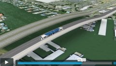
presentation on alternatives to
the 12-lane CRC.
– Watch below-
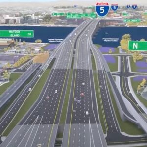
With the BTA flexing some muscle on the Columbia River Crossing project and a grassroots effort in opposition to a 12-lane bridge by Rising Tide Cascadia well under way, some of you might be curious about what other alternatives exist.
Nick Falbo is a Portland-based video game designer who is currently pursuing a degree in urban planning from Portland State University. Falbo is also a friend of Spencer Boomhower, whom you might recall as the artist/activist behind an excellent animated explanation of the Idaho Stop Law we first shared back in April.
When Nick noticed a guest article by Spencer about the CRC that was published on BikePortland in February, he started thinking about ways he could help raise awareness about the project.
The result was three short animated and fully-narrated video presentations. One is an introduction to the CRC project, the other is an explanation of the concept of “induced demand” and the other is an exploration of some of the alternatives to a 12-lane bridge that could be pursued.
You can view all three videos on Nick’s blog, or sit back and watch the one titled, “Alternatives” below:
Columbia River Crossing : Alternatives from Nick Falbo on Vimeo.


Thanks for reading.
BikePortland has served this community with independent community journalism since 2005. We rely on subscriptions from readers like you to survive. Your financial support is vital in keeping this valuable resource alive and well.
Please subscribe today to strengthen and expand our work.
The BTA should really hire Nick and Spencer as consultants any time they need an infographic (in video form) for PR and lobbying efforts. Excellent job, Nick, in getting the point across in the most compelling, succinct and clear ways possible.
Funny thing is I was just replying in another thread to someone who was wondering why these videos weren’t getting the attention they were due :). Awesome to see them posted here!
If you want to get all interactive with the presentation, you can download the original Google Earth tour here on Nick’s blog:
http://vzzy.wordpress.com/2009/05/12/crc-google-earth-tour/
or follow the links to the in-browser tour that makes use of Google Earth’s plugin. The videos show the presentation just fine, but if you enjoy exploring around Google Earth, you’ll enjoy the interactive tour.
Excellent videos, all three of them. A must-see for anyone following the CRC debate. I’d love to see the BTA embedding one of these videos on their home page.
Also worth pointing out that Nick and I have been working with our mutual friend Will Heiberg, who is another game artist, and a trails advocate, and the mad genius designer of the portable skills park everyone has been going nuts over at Sunday Parkways:
http://bikeportland.org/photos/photo/3650209227/sunday-parkways-09-118.html
Together we should be able to come up with something interesting… But we’re still figuring out what that’ll be exactly.
John #1, excellent suggestion 🙂
Nick – Good work making initially complex planning issues more accessible to a lay audience.
I would suggest you consider adding an alternative step to address the bridge congestion and traffic safety issues on Hayden Island:
– close and relocate Hayden Island ramps south to Marine Drive (this reportedly makes Marine Drive function worse…but I-5 has a higher function);
– close Vancouver’s Sixth Street on and off ramp (except perhaps for transit)
– move SR-14 on ramp to the old Sixth Street ramp location
– add a narrow arterial bridge between Bridgeton and Hayden Island
…these are not new ideas…but may have been discarded too early given the larger regional focus of the original project’s objective
Why not attached the bike path on that separate lightrail bridge as shown in the video?
Excellent! May I suggest that when speak of alternatives, we make them as physically attractive as possible. Make the MAX/Ped bridge lively, with people, plants, give it simple elegant footings, and empaphasize the impact it will have at touchdown. We have to make people IMAGINE what it would be like to walk and ride over the river. Imagine the experience of taking the MAX from downtown to downtown. Really introducing people to the concept, making them believe in it, put them there. Right now, the only thing most people know is being trapped in a car for hours a day during rush hour.
oh, and how about a nice visual of what a traffic jam on a 12-lane bridge will be like.
How about this visual of what a traffic jam on the CRC would look like 🙂
Traffic jam
Oustanding work!
I’d like to see the current decision-makers offer a point-by-point refutation of the alternatives. They are much more appealing not only because they would cost less, but because their simplicity would lead to a much quicker improvement of the congestion problem than the time needed to build $4B worth of bridge.
I’m impressed by the clarity and compelling logic of these videos. I encourage everyone to view them- it takes only minutes.
There are some really good ideas like congestion tolling, that are totally blown away by the sophomoric assumption that the existing bridges can be brought up to code.
kww,
Care to elaborate? I’m curious what you think is sophomoric about that assumption. My understanding is that the existing bridges are at the very least in better shape than certain other bridges in the region. What makes the current CRC bridges not savable in your opinion?