With the environmental review process and cross-section finalized, Multnomah County has moved into the design phase of their project to replace the Burnside Bridge.
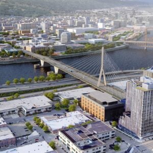
On Monday, the county released a survey to garner public feedback on which type of bridge they should construct. There are two choices for the eastern end of the span: cable stay and tied arch. (For reference, the cable stay is very similar to the Tilikum Crossing and the tied arch design looks like the Wapato Bridge that connects Highway 30 to Sauvie Island). In addition to bridge types, there are several other design elements that need your input.
Here are the two design options:


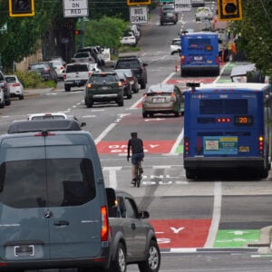
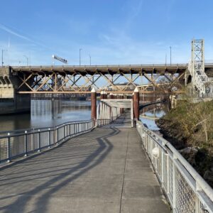
And detailed view from the saddle of a bicycle on the new protected lanes:


A new county website goes through all the options and has new visuals that give us a sense of what the new bridge might look like from a cycling and walking perspective. To refresh your memory the 78-foot wide bridge will have 34-feet dedicated to non-drivers. Car users will have two lanes westbound and one lane eastbound. Bus riders will have their own lane in the eastbound direction (and hopefully in the westbound direction someday soon). And bike riders and walkers will share a 17-foot wide space on each side, separated from other traffic by a concrete wall.
In some of the new visuals, they forgot to to include green paint or other delineator markings between the biking and walking areas. But rest assured, it will have bike lane green to help communicate where folks should ride.
The county wants the new bridge to, “provide a welcoming pedestrian space and viewpoint of the Willamette River, encouraging Portlanders and tourists to walk the bridge.”
Check out the new visuals and see what you think. Then be sure to take the survey and share your feedback. If you’re more of a hands-on learner and want to talk to project staff in-person, there will be a special “Breakfast on the Bridge” event July 12th from 7:00 to 9:00 am on the east end of the bridge near 334 NE Couch.


Thanks for reading.
BikePortland has served this community with independent community journalism since 2005. We rely on subscriptions from readers like you to survive. Your financial support is vital in keeping this valuable resource alive and well.
Please subscribe today to strengthen and expand our work.
I appreciate how much focus is on the design for this bridge! As compared to the monstrous behemoth being forced down our throats for the I-5 bridge to Vancouver!
Any updates on connections to the Eastbank Esplanade? IIRC the plans so far indicate that there won’t be one.
I think they’re still working on that. Some sort of ramp but I need to do a bit of work before I share a story on it. I missed a recent meeting it was presented at unfortunately. If I recall, they don’t have money for the ramp at this time, but they’re still designing one. I’ll get an update soon.
Really hoping for an update – would be awful to lose the possibility of access for 100 years !
Take a look at theses videos !!!
https://burnsidebridge.participate.online/tied-arch.html https://burnsidebridge.participate.online/cable-stay.html
the separation in the cabled section is awesome.
I wonder what the separation looks like in the bascule section …
Both of those videos show some sort of light rail vehicle on the east-side UPRR tracks.
Why no mention of costs of the competing designs? Do we have an unlimited budget for this project? Seems like this should be discussed upfront given the heavy burden for local taxpayers here.
Good point, Angus!
The budgetary costs of the negative externalities of automobile are truly enormous and only increasing parabolically.
Our transportation system is BROKE!
It’s time for well-off automobile users to stop sucking at the silicone nipple of big government subsidy and choose less expensive transportation modes!!!
From the website:
https://burnsidebridge.participate.online/additional-information.html