At long last, two of Oregon’s best cycling trails have been connected. Earlier this month, crews and volunteers from the City of Vernonia and Columbia County quietly filled the final gap that remained between the end of the Crown Z Trail (a.k.a. Crown Zellerbach Trail or just “the CZ”) and the start of the Banks-Vernonia Trail.
It’s not the 100% carfree alignment we still pine for, but it’s the next best thing…

Thanks to new investments and installations of signs and trailhead facilities, it is now easy to ride a bike on a mixed-terrain route through lush farms and forests for 45.2 miles between the banks of Multnomah Channel east of Scappoose, to the farming community of Banks in Washington County.
Along the entire route, only 0.7 miles are shared with drivers on Highway 47 — and it’s a stretch in a residential area that has very wide shoulders and a relatively low speed limit.
When you combine this progress with recent momentum on the Salmonberry Trail the picture of a Columbia River-to-Oregon Coast Range bike route comes into focus.
Crown Z Trail volunteer and advocacy leader Dale Latham was at the ribbon-cutting one year ago that marked the completion of the Crown Z. Since then he says volunteers and city staff from Vernonia and Columbia County have taken several key steps:
Advertisement


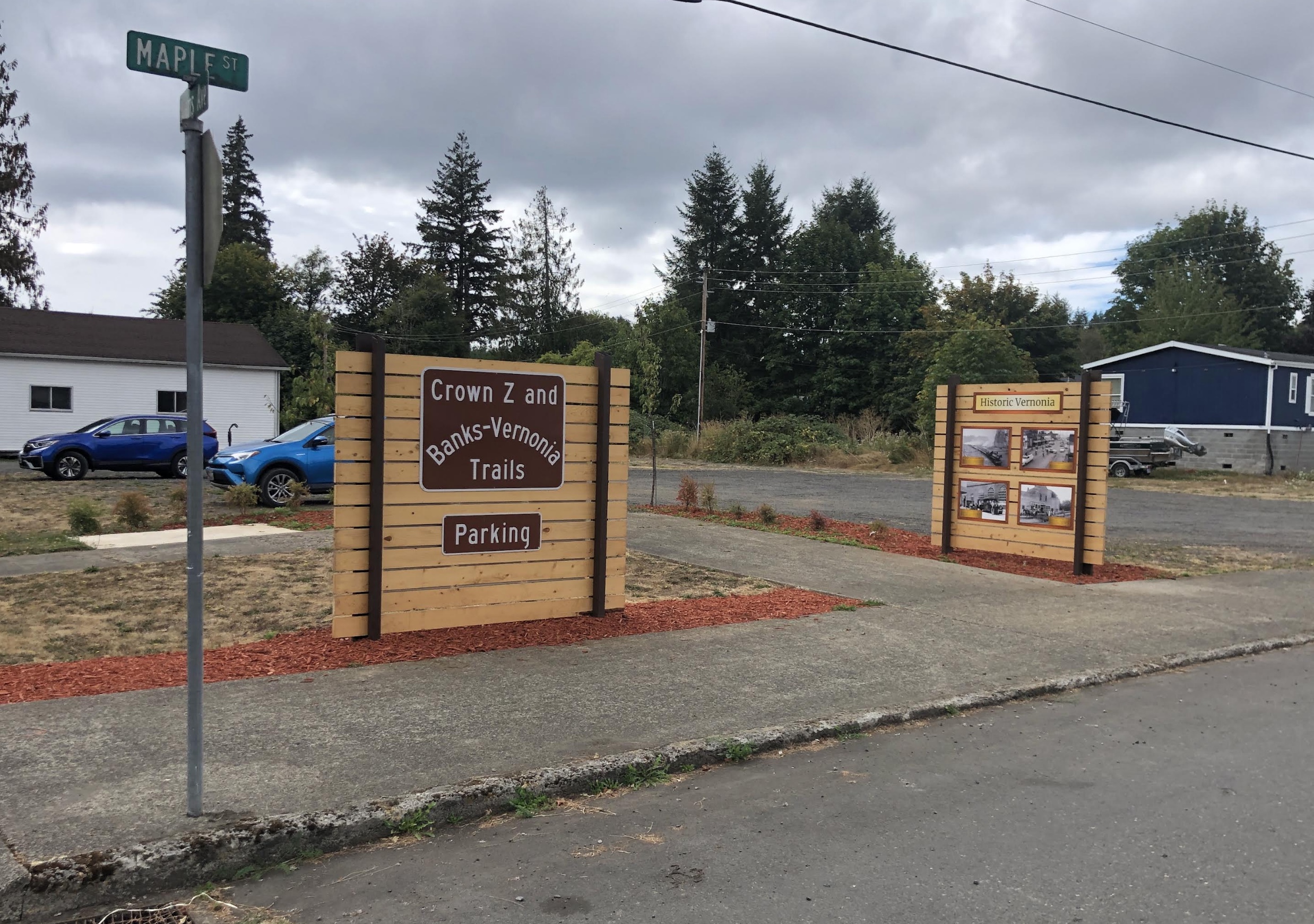
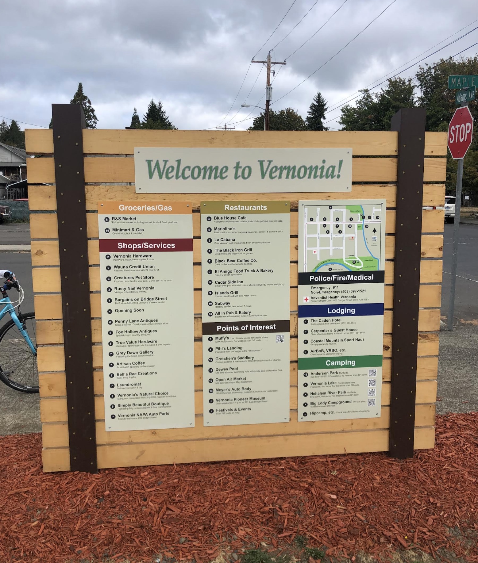
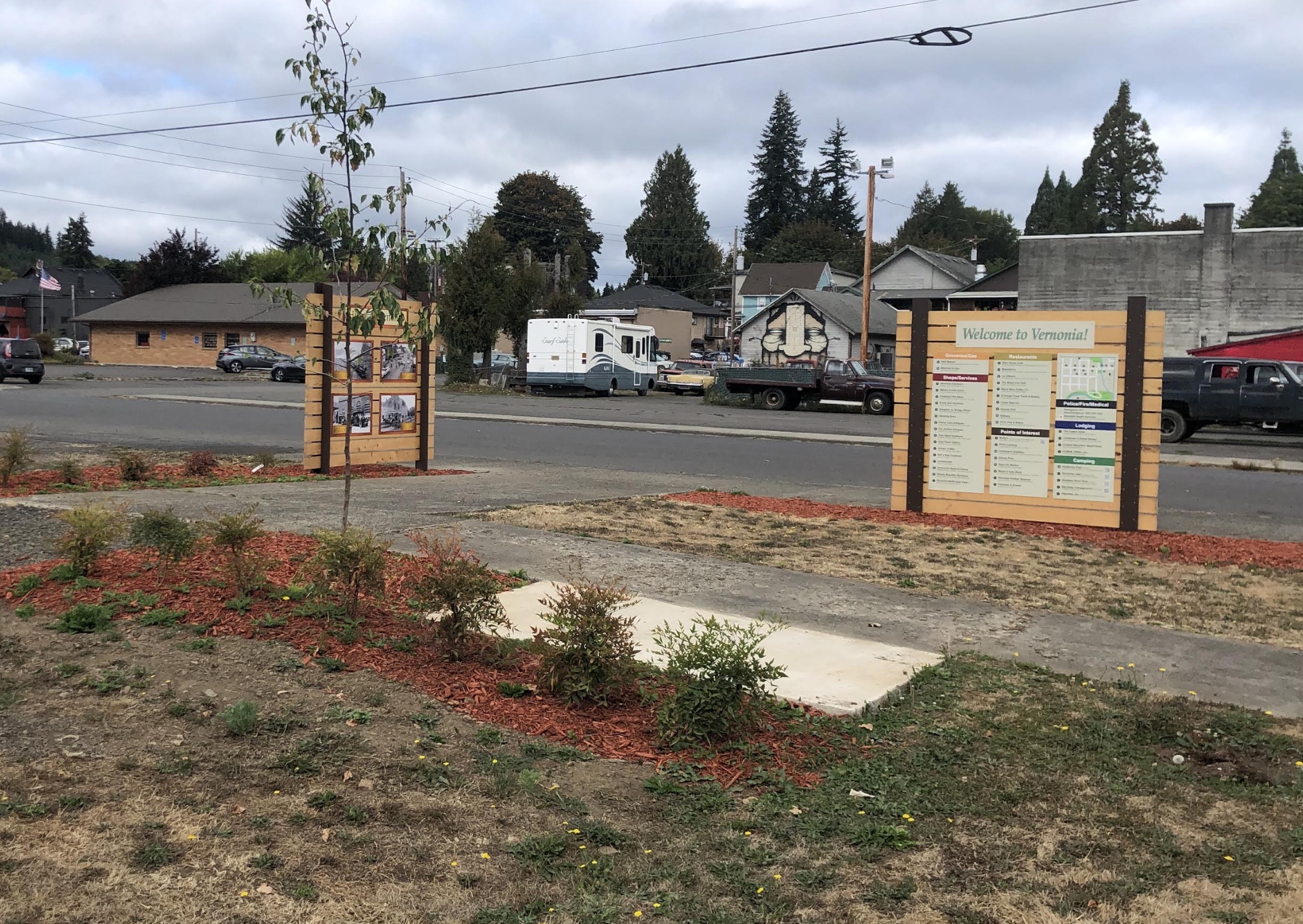
A new parking area and trailhead has been established in downtown Vernonia just a block from where the trail goes through Anderson Park (a great place to camp by the way) at the corner of Adams and Maple. The trailhead includes maps, an interpretive exhibit, and street signs to help orient trail users. There are also signs to direct drivers from Highway 47.
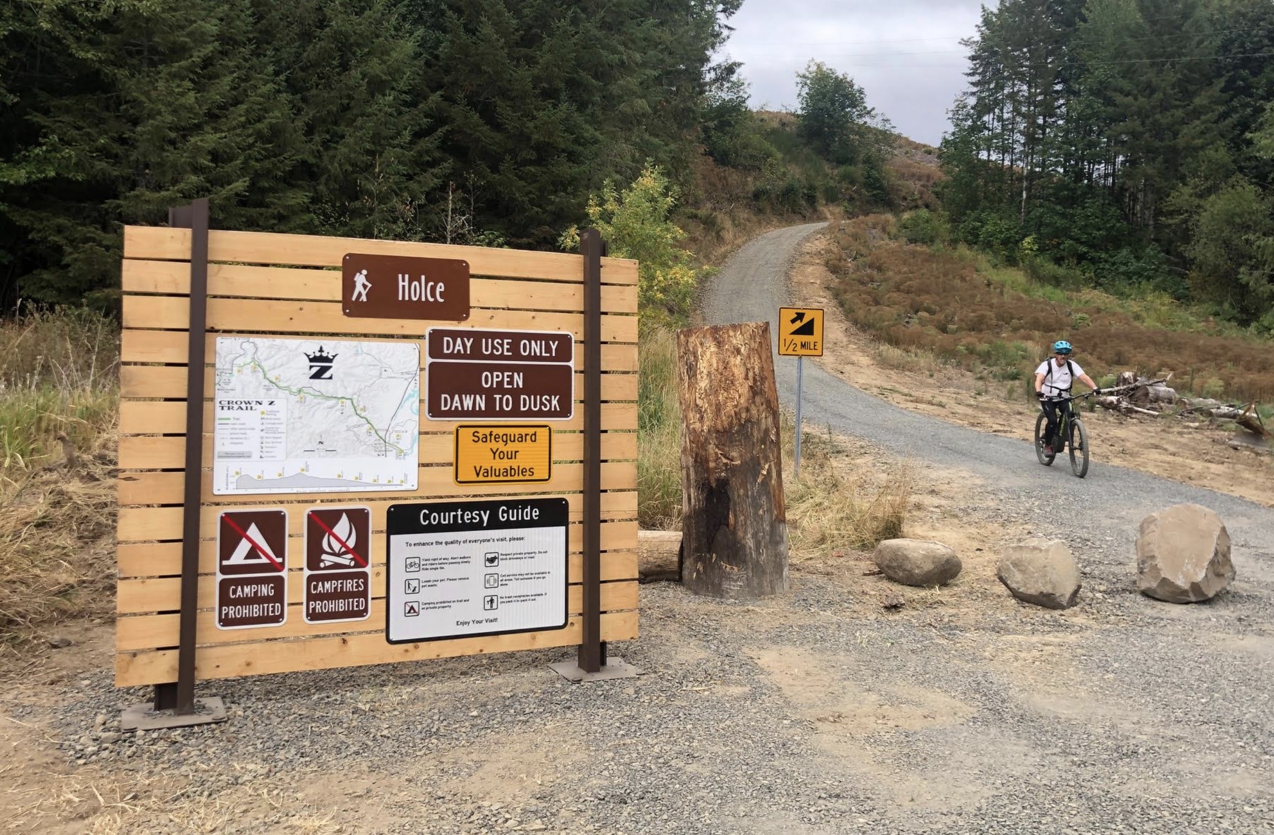
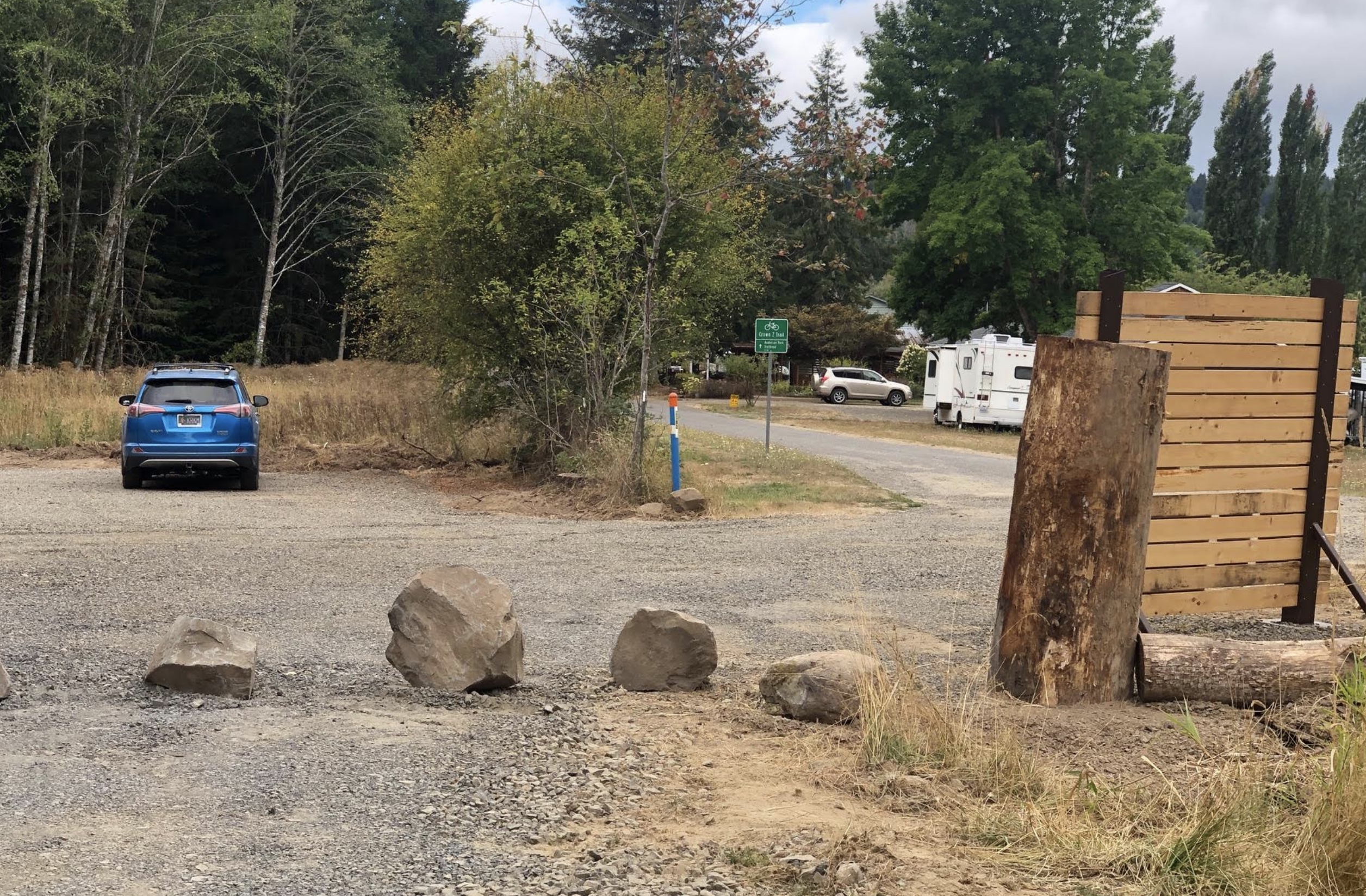
— A new parking area and new signage has also been installed at the Holce Trailhead, which is the western end of the Crown Z at the end of E. Knott Street.
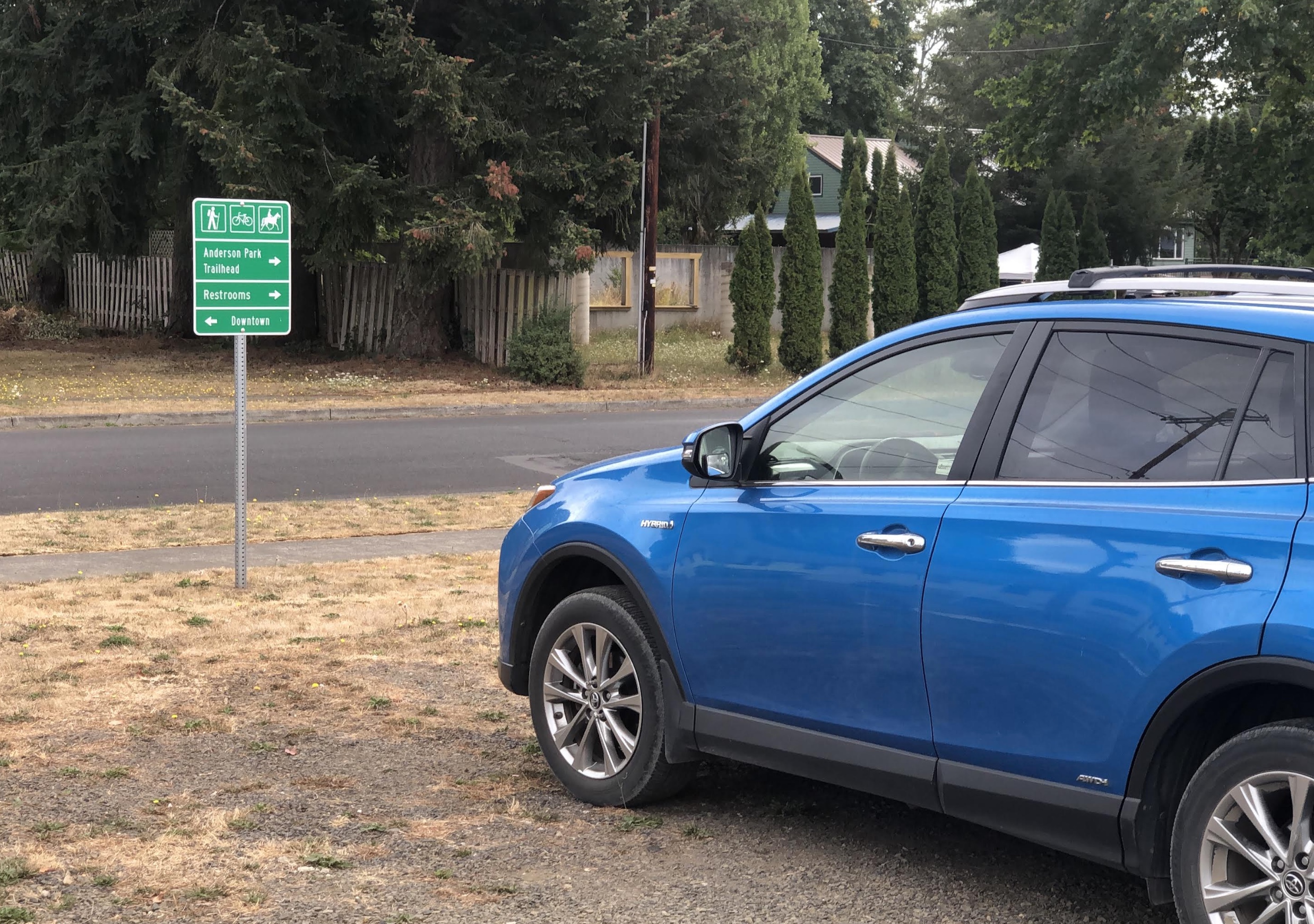
— To help people find their way on the 1.5 or so miles from the Holce Trailhead to the start of the Banks-Vernonia (at Vernonia Lake), and to make drivers aware of the presence of trail users, the City of Vernonia has installed about a dozen road signs.
— A revamped website at CrownZTrail.com includes a new trail map, trail guide, tons of photos, and an extensive history of the trail.
The investments of time and money it took to connect these two trails was made possible with funding from the Columbia Economic Team, Columbia County, the City of Vernonia and Travel Oregon. Installation was done by Columbia County Parks staff. The Crown Z Trail Citizens Advisory Committee and many volunteers provided countless hours of work to create the signs. The Columbia County Museum Association, the Vernonia Pioneer Museum, and several volunteers also contributed significant time to design signs for the project.
A few notes of caution before you head out: Cell coverage is spotty to non-existent on most of the Crown Z, so make sure to download a PDF of the official Crown Z Trail brochure or download the GPS to your device; and note that the new section between Wilark and Holce trailheads (2.5 miles or so) has some sections of gravel that hasn’t been packed-down much yet so expect loose conditions and a few very steep sections where walking might be a good idea.
Fall is an amazing time to ride this route, so fire up your map, pump up your tires, pack a few snacks and have at it!

— Jonathan Maus: (503) 706-8804, @jonathan_maus on Twitter and jonathan@bikeportland.org
— Get our headlines delivered to your inbox.
— Support this independent community media outlet with a one-time contribution or monthly subscription.


Thanks for reading.
BikePortland has served this community with independent community journalism since 2005. We rely on subscriptions from readers like you to survive. Your financial support is vital in keeping this valuable resource alive and well.
Please subscribe today to strengthen and expand our work.
Hoping we’ll someday get a Scappoose-Portland trail along Highway 30 and/or the Willamette, connecting the Crown Z to the 40-Mile Loop.
Agreed. In the meantime, my favored option is the NW Connector. Leaves from
Union Station and goes right to the CZ trailhead. $3 and has a bike rack.
https://www.nworegontransit.org/routes/downtown-portland/
Only Monday through Friday, unfortunately.
Do you know if the bike racks support semi-fat tire bikes, say 3″ tire width?
WOW! I wish I’d known this a couple weekends ago, when we rode this pretty tough connection between CZ & BV: https://ridewithgps.com/routes/37082078
I couldn’t find the route pictured above, would you mind sharing that?
Thanks!
@maria, that descent looks so much easier from these photos!
Maria, if you came down and ended at Knott then you took the official route.
Ok, good to know. Just a heads up to everyone: this lovely connection is a massive hill with lots of loose gravel.
I’m imagining you got to the bottom and perfectly re-applied lip stick and ripped away. Maria, I know how you roll!
This is fantastic news! I know what I’m doing Fri!
I did the Banks Vernonia trail back in May. It is a great trail and design. Starting at Banks trailhead you are at 500 feet and in Vernonia you are 600 to 620 elevation. A ride from Banks to Scapoose is one I definitely want to try. My journey in May continued on 47 to hwy 202 near Mist and into the south end of Astoria at the 72 mile mark. That is a trip I would recommend and do again.
Rode the Crown Z for the first time yesterday after cutting away from work a little bit early. Started at Pisgah and rode to the Nehalem divide (and back). I wanted to go all the way out but was running out of daylight. Hardly anyone out there on this weekday afternoon! Saw some broken (presumably window) glass at the trailhead which made me a little sad. Otherwise a great experience — scenic especially west of Ruley.
If anyone intends on connecting the routes together, it’s worth mentioning the trail conditions are dramatically different between the BV and the CZ. I usually take my road bike for the BV, but that wouldn’t be pleasant on the CZ. If anyone plans on doing both in one ride, consider a higher volume tire. I took my new hardtail out and was very comfortable on 2.35″ tires.
Used the new Wilark-to-Knott connector back in mid-May, and it was an absolute beast at that time — very deep & loose gravel on the hill up from Wilark and then very chunky rocks on the steep downhill to Knott through the logging area. On 650×40 tires, it required a fair bit of hike-a-bike. While it was definitely worth exploring, I still think of it as an adventure. Hopefully, it will become worn in over time. This RWGPS ride has some different photos of Scappoose and the CrownZ trail, and the last three photos are of this section. Have fun out there – the CrownZ is fabulous in early fall!
Apologies, still learning how to add links here: https://ridewithgps.com/trips/67328511
Just FYI. I live in Vernonia, .5 mi. from the start of the BV at the Mill Pond/Lake. There is now a wonderful food stand at the Pond/Lake called Calypso’s. They have soft serve ice cream, shakes, hot cocoa with soft serve and whipped cream, burgers, hot dogs, etc. Amazing food! Not open all the time, but usually afternoons till 8 or so now. Also, PLEASE walk your wheels from the Pioneer Museum down the walkway by 47 into town! It is the law, and it is important for the safety of pedestrians, for whom the walkway was built. I have nearly been wiped out on the WALKWAY by bike riders who ignore the sign at the start of the walkway. I also nearly accidentally wiped out a rider who flew up beside me with no warning and almost hit my grocery cart! It would have been bad for him at that speed! We welcome you to Vernonia. Please enjoy our town, but walk your wheels or stay on 47 into town. Thanks and happy riding!
This article is a bit misleading, that bit of “trail” from Knott street up the hill is super-chunk railroad bed sized rock in places and pretty steep. While not anything that can’t be navigated on 45c+ tires and a wide range cassette, I would imagine that many in this readership would be a bit disappointed by that chunk and the ensuing few miles of deeper chunk gravel and rock beyond that. That area and the next few miles from Knott are definitely not representative of the rest of the CZ and I am not sure what that bikes were in mind of whomever laid that road bed down. The signs are nice, I guess but a ton of cash could have been saved by leaving the trail alone and keeping it singletrack or lower impact road bed.
The old trail was obliterated when they logged that parcel in 2020. There were bulldozers and excavators all over that hillside for a few months and the end result was a big sandy mess.