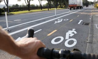
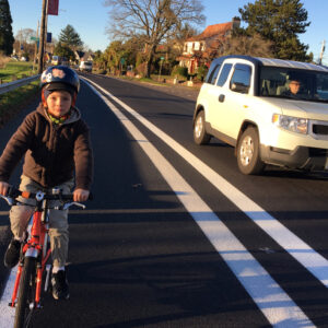
(Photo: J. Maus/BikePortland)
A new survey and call for applications to an advisory committee mark the official launch of the North Portland in Motion planning process.
Similar to other “In Motion” plans that have been conducted in other parts of the city, the two-year effort will identify needs and priorities of people who bike, walk and take transit in an area that includes seven neighborhoods and is bound by I-5 to the east, the Overlook Neighborhood to the south, and the St. Johns peninsula and Columbia Blvd to the north (see map below).
PBOT’s new survey asks people to share their top issues and barriers faced in the study area. Other input sought includes ideas on how PBOT could break down those barriers, where popular riding destinations are, and more. The survey will be open through the end of July.
Advertisement
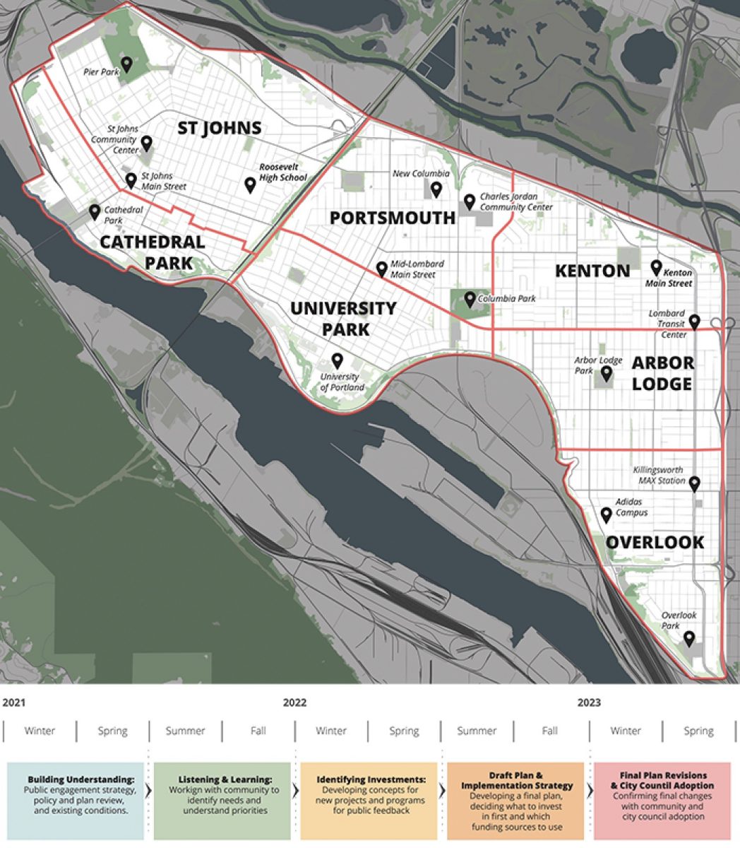
PBOT also seeks 20 members of the public to serve on the NPIM Advisory Group that will guide the process and offer key input as it goes along. If you have a strong connection to the study area, please consider signing up via the online application.
PBOT expects the final plan to be presented to city council in early 2023. Learn more about the process here.
— Jonathan Maus: (503) 706-8804, @jonathan_maus on Twitter and jonathan@bikeportland.org
— Get our headlines delivered to your inbox.
— Support this independent community media outlet with a one-time contribution or monthly subscription.


Thanks for reading.
BikePortland has served this community with independent community journalism since 2005. We rely on subscriptions from readers like you to survive. Your financial support is vital in keeping this valuable resource alive and well.
Please subscribe today to strengthen and expand our work.
Well, PBOT found a new way to make a survey terrible. Individual responses/ideas have to be 100 characters max, with no additional spaces for general comments. I’m sympathetic to staffers having to read through long submissions (really!), but 100 characters is barely a sentence.
Does PBOT want our ideas or not? This is supposed to be an early, exploratory, neighborhood-listen-y phase but I can’t even express a complete thought.
Imagine if public comments at city hearings were capped at 100 characters!
Hi Ivan, we hear your concerns and take them to heart. We’ve increased the character limit to 300 characters, which should allow for a fuller response.
Zef, like all the In Motion plans, the lack of protected bike paths render them too little, too late. I get that the expense appears to be an issue, at $250-500k/mile. But Portland is in the top 10-20 richest cities per capita in the WORLD. This isn’t a funding issue, it’s a priority issue. And alternative/cheaper and much faster option exist. The trade-offs such entail need to be weighed against the costs of ineffective and delayed ones. This matters because we do not have the time these plans will take to build. Why? First principles: the reasons we must have this infrastructure is to improve the health of those being harmed by emissions from vehicles and tires. If the cities choices for transportation cause this harm, there is a responsibility here. One that is BEYOND the opinions of fiefdoms and villages too. And in an era of rapidly destabilizing climate, where we know we must decarbonize as fast as possible, any plans that do not move us quickly towards reductions of emissions >50% by 2030 should be scrapped. I know this comes after decades of work by advocates and the city, and may sound unfair. But it is a reality we are all facing. Consider your role here, sit down with the Commissioners and think about how all this time/money/effort fails the first principle. We can do much, much better and have the data to show what would work. It’s time to stop combing for opinions about options from an artificially limited budget.
That’s a lot to expect from the bureau that thinks its bike plan isn’t even worth mentioning to its leadership. I know there are plenty of committed and good people in PBOT, but as an agency, it is falling far far short of the mark.
Thanks Zef — I appreciate you listening!
Thanks for being responsive.
This is all performative. Do the folks really not know that people want sidewalks, crosswalks, and protected bike lanes?
“How do we reduce barriers to walking, cycling, and transit use”
Uh gee, I don’t know. Build better infrastructure for walking, cycling, and public transit? I just saved the city a couple million.
If you live in North Portland, please overcome your cynicism and complete the survey—many in the cars-only crowd will surely do so.
The survey results give PBOT evidence that what they’re doing is wanted. So when people question or criticize PBOT for going forward with sidewalks, crosswalks and protected bike lanes, PBOT can respond (assuming those things are popular with survey takers) that those are what the majority of people in the area want PBOT to build.
Right, so its performative. Portlands weird “community engagement” model of government is so broken. We pay planners and engineers to know what makes neighborhoods walkable and bikeable. They have the resources to study traffic and understand flow. What could they possibly gain from this? They know it. There is a reason the 100 character limit was only raised to 300. They aren’t looking for any information (and what could they possibly get?).
PBOT frequently uses planning and engagement to give the illusion that they are working to make our streets safe and navigable, when their actual focus is on making them fast for private vehicles. Just take a look at the 2030 bike plan, so full of great ideas, the large majority will never be built. But wasn’t it funny making the plan!? This is just more of the same. PBOT uses NIMBY feedback to make infrastructure less safe far more often than they use it to justify making a project safer.
I’m sure that the end result of this will be that the affluent gentrified neighborhoods will get some decent infrastructure, St. Johns will get some unprotected gutter lanes, and Portsmouth will get nothing.
Yes, engineers and planners do know GENERALLY what makes neighborhoods walkable and bikeable. But being one doesn’t make them experts at the neighborhood level. They can’t possibly know everything people who live and work there know, and ones who think they can are poor ones. When they don’t communicate with people, projects don’t turn out well. There are all kinds of examples of projects that have changed substantially due to public input. I agree it can be harder for poorer neighborhoods to do that, but it does happen regularly.
If you can’t write your opinion in 300 words, write an email or call. Sometimes that doesn’t work, sometimes it works very well.
I’m curious what kind of of knowledge you are talking about here. The things that make it hard to get around Portsmouth and St. Johns are the same exact problems that exist in east Portland, Aloha, Boston, and Frankfurt. What “unique” problems could we possibly have that couldn’t be solved by basic principles of traffic calming, improved pedestrian infrastructure, and improved better cycling infrastructure.
Can you give some examples? The only ones I can think of that changed for the better are situations like the gutter lanes on Rosa Parks that were turned into semi-protected bike lanes. After the disaster rollout PBOT got enough complaints that they had to improve it. But that’s just a case of the city cheaping out and building sub-standard infrastructure and then improving it when they got too many complaints. That’s not an example of them actually learning something through community engagement. They know the gutter lanes are less preferable than the semi-protected lanes.
Do you have examples of PBOT learning something of actual substance rather than “learning” the community doesn’t want sub-standard infrastructure?
I don’t have nearly enough cash or home value for the city to care about an email or return a call.
“What kind of knowledge?”
Some examples, all real ones based on direct personal experience: Which streets or crossings are priorities for making improvements, unusual types of traffic (lots of skateboards, trucks where you wouldn’t expect, etc.), streets that are used for cut-through traffic, crossings that have bad visibility at night, places where people park in dangerous locations, routes that don’t work in snow or heavy rain, new buildings not yet built that will change traffic conditions, accessibility issues…anything that isn’t evident to someone who isn’t using the area’s streets or sidewalks regularly.
Also, my experience is that the public often has technical knowledge and even credentials that outmatch project staff’s. I’ve seen several times where projects that didn’t listen when the public told them they were using the wrong codes, calculating turning radii wrong, etc. ended up tearing out hundreds of thousands of dollars of work they’d just built. On projects where the staff DOES listen, that’s avoided.
They should be learning about this through traffic monitoring, not anecdotal stories. We literally pay experts to anticipate these things. I don’t actually believe its happening as you say, but if it is, that’s just examples of PBOTs total lack of understanding of of how people get around.
If a PBOT employee can’t tell an intersection has bad visibility at night, they need to get a new profession.
Folks correcting PBOT on codes isn’t a a good thing, it’s a bad thing that shows how weak and incompetent the agency is.
For you other posts, you are just giving examples of public input stopping PBOT from doing something they knew was wrong, not them learning something that changed their mind.
Traffic monitoring only gives designers information about a small range of the issues they need to understand. Asking for public input is a much more efficient way of getting information than trying to do it all with monitoring or other types of studies.
I agree that PBOT staff and their consultants shouldn’t be making mistakes on technical issues, but since they sometimes do, it’s better that the public has a chance to catch them before they’re built.
My comment after this gives several specific cases of PBOT learning something from public involvement that changed their minds.
I appreciate PBOT’s asking for public input, and have had lots of good experiences with staff listening.
“Can you give some examples (of projects that have changed substantially due to public input)?
Just four I’ve been involved in personally, recently:
1. PBOT dropped a “done deal” plan to add 200 cars/day on my neighbors’ dead end by connecting it to another street.
2. PBOT dropped a “done deal” plan to add sidewalks to my neighborhood when my neighbors and bike/walking advocates opposed it
3. PBOT and Parks dropped a plan to move the Willamette Greenway Trail away from the river
3. PBOT dropped a “done deal” plan to remove business parking on another street in my neighborhood
4. ODOT and PBOT dropped a plan to close highway driveways and reroute the traffic onto a PBOT street in my neighborhood
Why does this plan exclude Swan Island, the northern most sections of North Portland including Kelly Point, St Johns Prairie, Smith and Bybee Lakes, Rivergate industrial area, plus all of Hayden Island? The recreational and industrial uses are fundamental to a lot of North Portland traffic issues!
If everything is a priority, nothing is. “The basic idea [for the In Motion plans] is to take a deep dive into one section of the city,” Jonathan recently wrote.
North Portland has been waiting in line for a decade. For the good of our current and future residents, we should stay focused.
If we aren’t including Swan Island and Rivergate, then we are ignoring the impacts of Freight on our transportation network. If we exclude Swan Island, St Johns Prairie, Willamette Cove, and Kelly Point we exclude the biggest recreation trail opportunity in North Portland. Riverfront access should be a city-wide priority- it is an incredible missed opportunity. If we leave these things out of a conversation about how transportation in North Portland works, I fear that conversation is nearly meaningless. This is the time to some some holistic planning for North Portland, if we don’t discuss these areas and get them into a plan, they will never be discussed or planned and will never get built. We need to prioritize important things like a better integration of freight and access to the river.
Biggest bang for the buck projects:
Bike lanes on the entire length of Lombard.
Bring back the bike lanes on Greeley and do away with whatever the freight lobby and Adidas did there.
Put bike lanes on the St Johns bridge.
Clear camps from the Peninsula Crossing Trail and make that area usable again.
why do away with what’s been done on Greeley? Safe and useable, IMO (less so by the encampment down by the intersection with Interstate and current construction at Going not withstanding). FWIW, I’d like better connections over I-5, but I’m concerned that since thats the Eastern boundary it won’t be considered.
The switch from one side of the road to the other adds an extra phase to the traffic light at the intersection of Greeley and going, causing delays for all where there were already huge backups during evening rush hour.
The camp is the other issue. How many vehicles are being driven on the path and parked in the area near the camp now? A dozen?
Before that facility was converted into its current alignment, I used Greeley when traveling southbound from North Portland, but I used interstate or another parallel route when going northbound. Now I wouldn’t even consider using Greeley.
I just don’t understand some folks who always make this sound much worse than it is. I ride here every now and again and, yes there are sometimes a car or two parked next to the Hazelwood Grove tiny home village, but I’ve never felt it was that big of a deal. I’ve even had people pull across the path to load something up… but big deal! They live there. I just slow down a bit and smile and then get on with my day. It’s not dangerous in my experience and the people have always been accommodating and cool. This is just my experience. YMMV of course.
I have very different experiences: pickup trucks heading toward interstate while I head toward Greeley- with the fence on onside and cars parked o the other, there is nowhere to go. Plus, on a dark, rainy evening, you cannot see much with headlights in your face. It is scary and there is no good option except backtracking. This has happened twice in the 10 or so times I have tried to use Greeley heading north. I have also had people accessing the camps on Going trail me in their car ON THE MUP and verbally threaten me. I will no longer use those paths and I would not recommend them to anyone. Protected bike lanes are only useful if they are protected. Since the City allows them to be de facto driveways, they are traps and far more dangerous than bike lanes which are at least easier to leave if you need to avoid a threat.
Jonathan,
Not my experience there. Cars need to be kept OFF bike paths. Simple as that.
My expectation for a car exclusionary multi-use path is zero cars. I’m not blaming the folks at HG, but it’s pretty absurd to expect people to not feel annoyed/endangered by a car driving towards them down the MUP. I experienced this just last week. This is just another example of the city have years to find a good solution and failing to do so at the expense of everyone who lives in the city.
I do blame the car owners at HG. They are the ones after all who are driving on a bike path. Why do they get a pass on breaking the law? I can’t ride my bike on I-5 right?
I consider it a “crime of survival” and I’m not someone who considers everything a crime of survival. Those cars are probably lifelines for some of those folks and the only way for them to get to work. At the end of the day, homelessness is a failure of city, county, and state. When I was riding down the MUP and had a car coming toward me, my anger was at Multnomah County and the CoP for it’s complete failure to handle the increasing homelessness and squandering the hundreds of millions we’ve given them to work on the problem.
I take the same view of the cut in St. Johns. I’m disgusted by the trash, environmental degradation, and open hard drug use and would love if they could live in a manner that caused less problems for their neighbors, but at the end of the day they are living on the cut because Multnomah County decided that was better than re-purposing the Wapato facility.This is really the result of our tendency to vote in incompetent leadership that says nice things over competent leaders who are less good at being politicians.
The Wapato facility has been repurposed: https://www.bybeelakeshopecenter.com/
Yes, thankfully someone who far more sight than Deb Kafoury took a chance on it. Still wasted our money and isn’t operating at the capacity it could have.
Speaking of “crimes of survival,” I often wonder how many people experiencing homelessness choose to keep their vehicle insured. I’m guessing (pure speculation) that the number is zero, or very close. It’s not legal to drive without insurance because of the economic hardship it imposes on anyone, regardless of their living situation, who is unfortunate enough to be involved in a crash with an uninsured driver.
While I agree JM wholeheartedly with your sentiment (or at least how I am reading your comments), the situation on Going is not good for everyone involved. I too have encountered cars driving on the path, and feel they should never be there. Our car was stolen last month. A very old Subaru that likely could have lasted another five years, were it not for the thieves who trashed it. We found the vehicle at the Hydro Park at Going and Concord. Talking to neighbors there, the park is a dumping ground for stolen vehicles, those doing the stealing are staying in the camps on Going, and many are mentally unstable, making loud noises sometimes late into night, and in one case I heard entering someone’s house uninvited. While I do not support brute force policing, its a little too easy to suggest the neighborhood response is simple NIMBY-ism. There is certainly a lot of mutual aid occurring in these encampments. However, there is also a fair amount of appropriation going on.
Great idea! Get rid of the jersey barriers. If you can’t do it with paint its not worth doing! Crossing the on ramp while triple trailers barrel at you at freeway speeds was much safer than passing close to homeless people!
What if they spent the money they had for signal and put a signal at the intersection of the ramp and Greeley. An instead of this being a slip lane, it could be a right turn. And the ramp from Going to Greeley south could have a stop sign for people driving. And the speed limit could be 30 mph.Now Greeley is functioning like a street and it is not so hard to imagine bikes sharing that space.
I share some of the frustration expressed here, particularly the sentiment that we have traffic engineers for their expertise – they know what needs to be done to achieve X, so once X has been defined (e.g., “update traffic infrastructure to cater to higher density transportation to accommodate urban growth and mitigate pollution and emissions”), they should just do it.
Keep in mind though that it’ll take fighting even for paltry improvements – and I don’t mean fighting PBOT, I mean fighting your own neighbors. My NA is so adamantly against some diverters in our “in Motion” plan they pretty much broke the NA over it. Long live automobile convenience.
Everyone is in favor of “forget all this public process, just let the experts do what they know is right” when they agree with what the experts think is right. But of course the entire transportation system we have today was built by experts who actively ignored the impacts to the public. And everyone seems to suddenly be in favor of more public process when they don’t agree with what the experts say. So maybe some amount of deliberation and public process is a good thing.
Uh, our current transportation system is the result of listening to the public too much. The “public” generally wants wider and faster roads and couldn’t care less about pedestrians, transit, and cyclist.
This isn’t an accurate representation of my point.
Public process and deliberation absolutely should be involved – in defining X, the goal. Once that’s defined, let the engineers engineer (I’d argue this in any engineering domain – software, electrical, mechanical, etc).
Of course, I say this knowing full well the X your average public is going want isn’t geometrically possible beyond a certain urban density: “I want to drive my personal automobile everywhere all the time with 1.8x average occupancy with little impediments or congestion”. Or as I like to say, ponies and helicopter rides everywhere. People also generally want safer and more livable streets – from my own experience, a lot of people don’t see the inherent contradiction in those two goals.
“update traffic infrastructure to cater to higher density transportation to accommodate urban growth and mitigate pollution and emissions” = more freeways here in North Carolina and much of the rest of the country. When I was involved with EPIM in 2010-12, we had a lot of East Portland residents asking for more on-street parking and more freeways and expressways, I kid you not. Many folks are still convinced that an idling car causes more pollution than a moving car.
Of course idling vehicles emit more than moving ones; it takes an unmoving car an infinite amount of time to travel just one mile, and it can pollute quite a bit in that time.
This is a problem of definition: is the idling car polluting more particles-per-mile or particles-per-minute? To me, the particles-per-minute is pretty meaningless, because the point of a car is to move from A to B, and if it’s not moving, the energy, carbon, and other pollution is just a complete waste. If the car is moving, at least there’s some benefit to the cost!
I wonder what’s going to slow down progress, PBOT & its routinely bureaucratic processes or the NIMBYs that’ll use that process to their advantage.
Not mentioned is the North Portland Willamette Greenway, aka NP Greenway. Connecting the Esplanade/Rose Quarter to the jobs at Swan Island, along the river to Cathedral Park and the adjoining neighborhoods, again to the jobs and recreational near Kelley Point park. When the Bike Master Plan for 2040 was adopted, it called for one signature trail, and npGreenway was the furthest along and the defacto choice. There have been some success, connecting Pier and Chimney Parks with a bridge,and a bridge over Columbia Blvd freight route linking the SJ Prairie ( the former landfill) to Pier Park.Incrementally pieces are falling into place, but at a very slow pace. Investment in vision would benefit the entire city, providing safe access off street for much of the alignment.
Joe, I agree 100% that NP Greenway should be one of the top priorities for the North Portland in Motion Plan, but if you look at the map of the area that is being reviewed, they greyed-out/excluded the entire route of the NP Greenway!
Isn’t most of the remaining Greenway alignment on railroad right of way?
Until the railroad wants the trail to happen, it’s not going to happen. And they don’t seem interested. The sections both west and east of Swan Island are in railroad right-of-way. So what you’re talking about is long-term at best, and may not happen in our lifetimes.
alternate alignment for Willamette Bluffs would be to put the trail on the side of the bluff connecting to Waud Bluff. Cement Road might be more frictious.
Actually, there is a lot of progress on the N. Portland Willamette Greenway Trail.
On Swan Island, npGreenway and PBOT’s Zef Wagner are working on a concept for a 12-14′ foot wide cycle track along N. Basin Avenue from the head of the Lagoon to the Waud Bluff Trail.
We are seeking buy in from important SI businesses such as adidas, Daimler and UPS.
University of Portland will construct a section of the Trail on their new River Campus with public access to the River via N. Van Houten, once Covid delays are overcome.
The Portland Harbor Community Coalition, a broad community based group that includes npGreenway, has successfully pressured Metro to accelerate a thorough clean up of Willamette Cove and construct of first class park, including the Trail.
Friends of Baltimore Woods and the 40 Mile Loop are working with npGreenway to get PBOT and Portland Parks to pursue Metro funding for the Trail segment between Cathedral Park and Pier Park. Baltimore Woods is an unknown treasure of old grow, mixed forest overlooking the River. Check it out via N. Decatur at Baltimore.
Last, Metro and Portland Parks are at 30% design for a key Trail bridge over N. Columbia Blvd to connect Chimney Park (already linked to Pier Park by the bridge that Joe Adamski noted) with the St Johns Prairie (former landfill). More funds are needed, so public advocacy for this segment is still critical, but the project is moving forward.
Still lots to do…the Ash Grove Cement Road is there for those willing to brave the occasional UPRR cop as it remains closed to public use, except during extreme weather events. Getting around Wauld Bluff will take a combined effort of the City, U of P, the UPRR, and that is probably off in the future somewhere as the “last link” in a continuous bike/ped multiuse Trail from the Esplanade to the Confluence at Kelley Point.
Lenny Anderson, npGreenway board
Is Zef and NP Greenway looking into retrofitting the stairs into a ramp on the Waud Bluff Bridge? Those stairs are an unfortunate and unnecessary barrier
Note that the all important, but unfunded segment of the Willamette Greenway Trail between Cathedral Park and Pier Park via the Baltimore Woods IS included in the project area. A chance for N. Portlanders to line up in favor of this key link between the two Rivers!
By the time the Waud Bluff Trail was constructed, its cost was about 10 times the original estimate, largely due to the fact that its not just a steep paved path down an old service road, but a complex, steel reinforced structure from top to bottom on an active piece of geology, designed to be there for a long time. Add to that the fact that between the US Coast Guard base (Homeland Security) and the Union Pacific Railroad, there was not physical space for ramps instead of stairs. Note that the WBT is not ADA compatible due to the old road grade; so it was acceptable to have stairs instead of a ramp.
That said, if the Greenway Trail around the Bluff is sited above the UPRR ROW on U of P owned slope…as suggested by a U of P engineering class a few years ago, then a ramp would be required up to the bridge and a way to build it would be found. Get involved!
Lenny, I realize it is expensive, but it is “acceptable” to have stairs instead of a ramp. The design team found a loophole that allowed them to build a path that excludes people who use mobility devices. The majority of mobility device users use motorized trails and the grades would not exclude them. The stairs do exclude them, as well as people pushing strollers, riding e-bikes, tandems, pulling trailers, etc, etc. Also, from the base of the bridge to the end of the road, there is a path that is approximately 590 feet long. That is plenty of length for a ramp and landings that is less than 5%. I am sure cost was an issue, this could have been a universally accessible path if access was prioritized.