(Photos: Jonathan Maus/BikePortland/BikePortland)

By next spring or summer you’ll be able to bike across Interstate 84 on 7th Avenue between the central eastside and the Lloyd: No more snaking onto sidewalks or risking life and limb on Martin Luther King Jr. Boulevard or SE Grand Avenue; no more riding all the way up to NE 12th to get across the freeway.
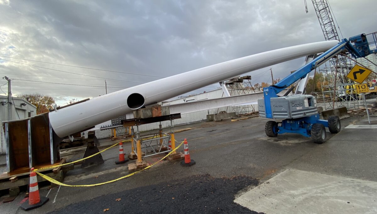
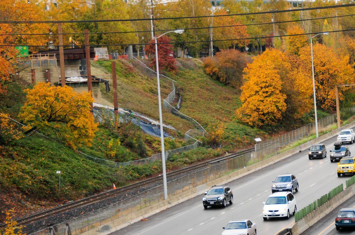
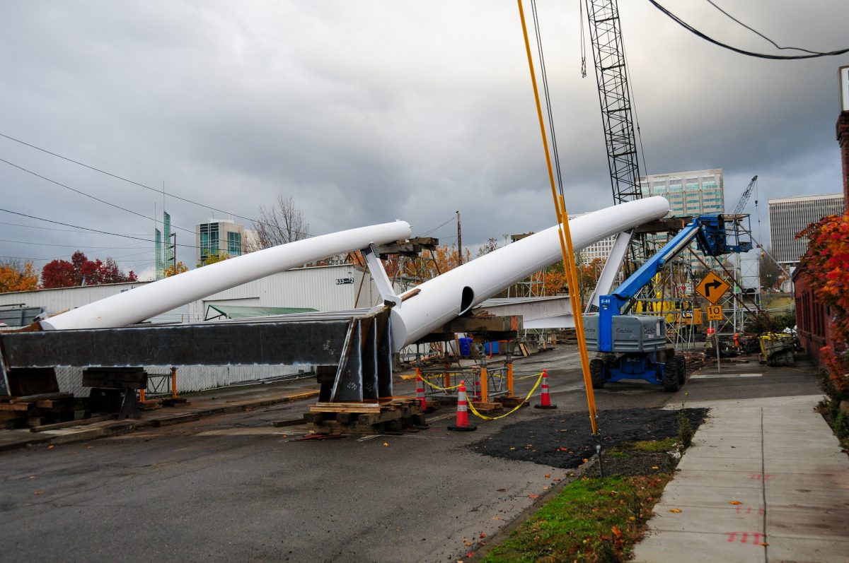
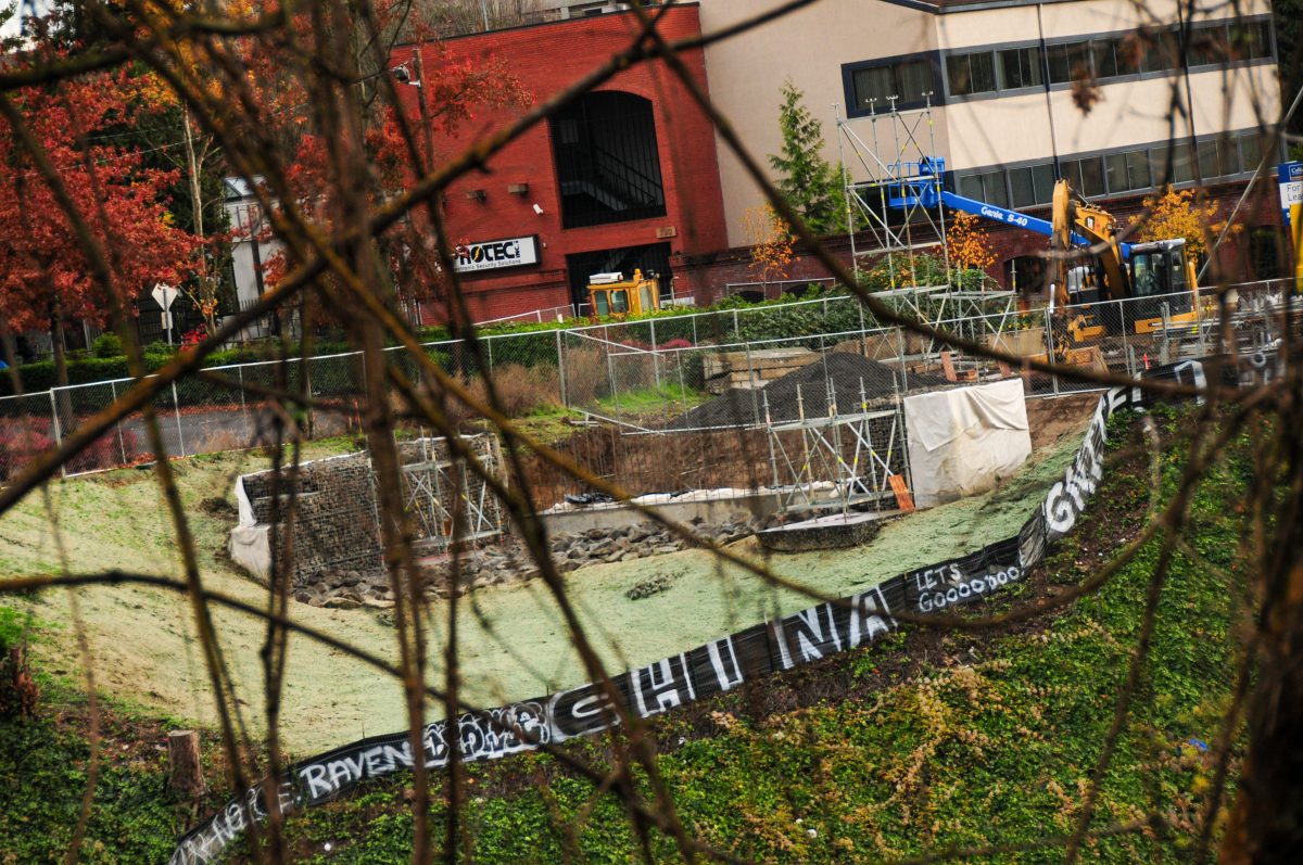
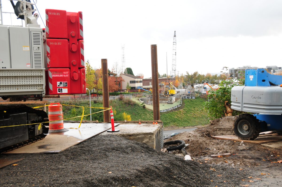
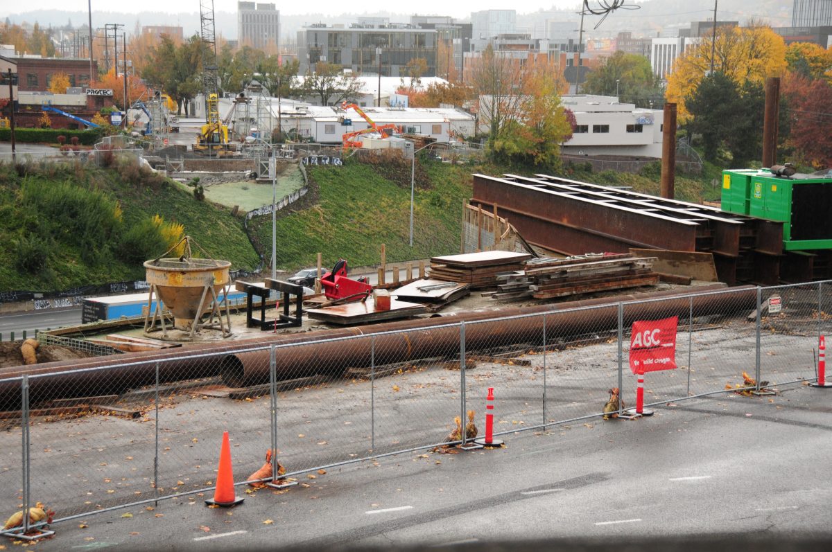
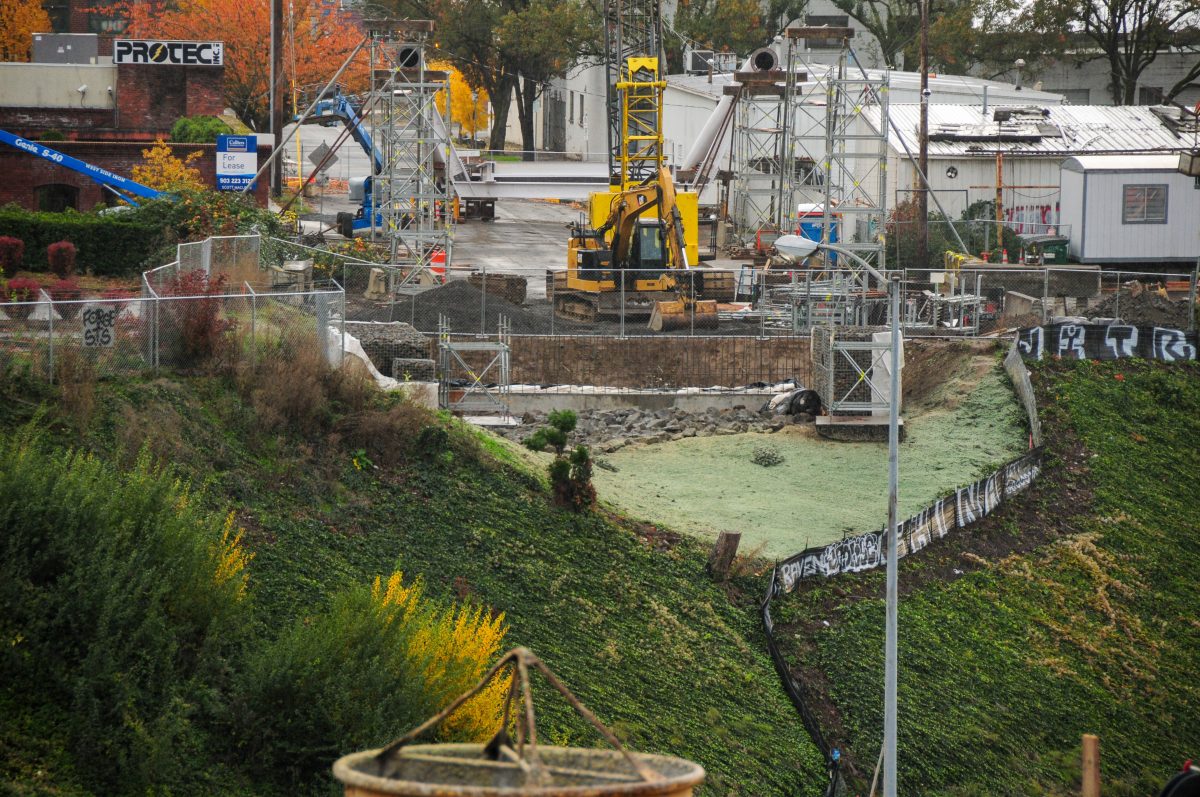
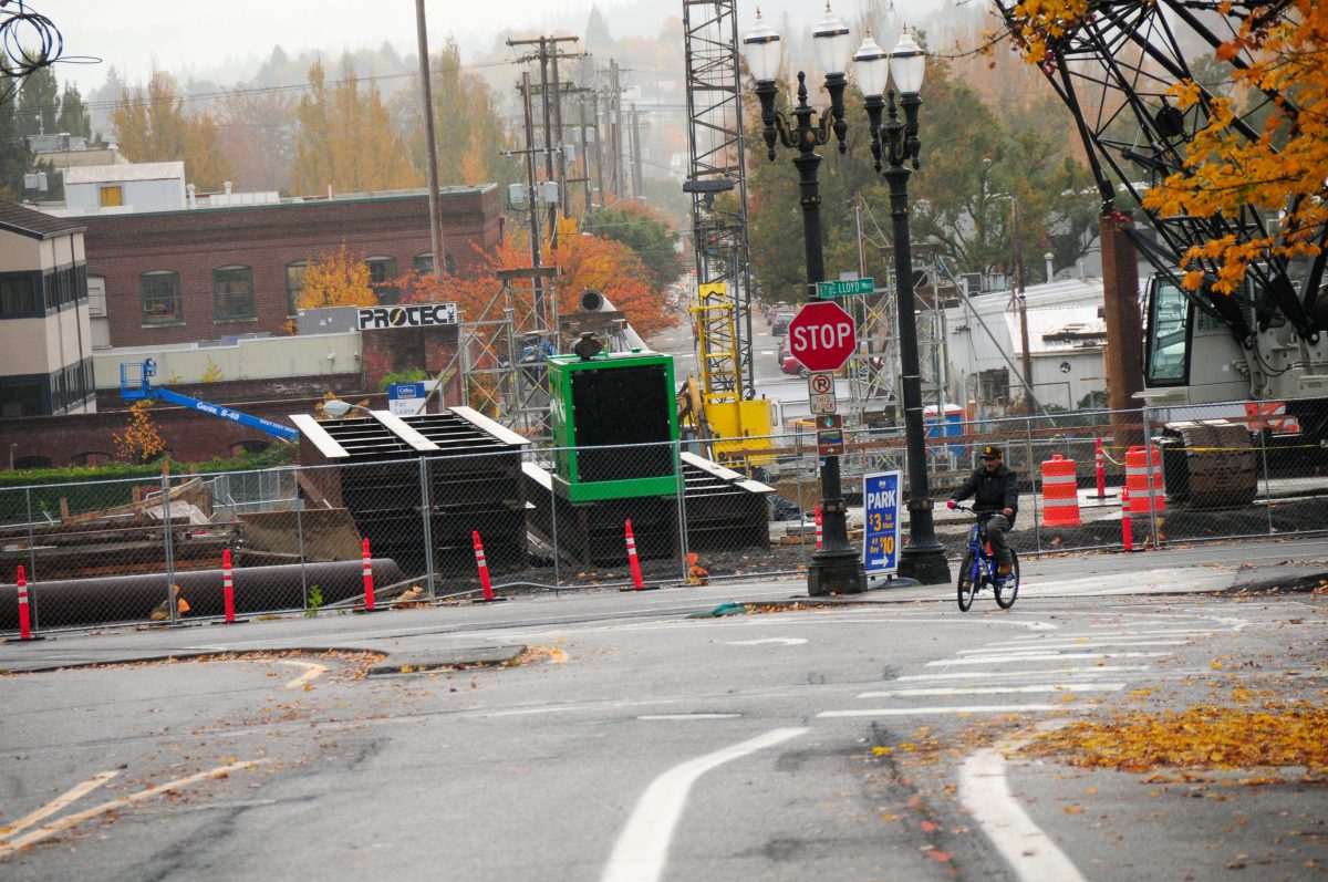
The Portland Bureau of Transportation has been working on the $14 million Congressman Earl Blumenauer Bicycle and Pedestrian Bridge for nearly a year now and — judging by a recent visit to the construction site — things are about to get very interesting. As you can see in my photos, the 300-foot arch pipes and steel girders are in place and landings on both sides of the span have been prepped.
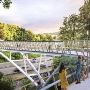
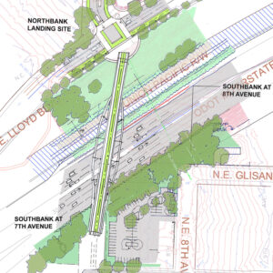
The new bridge will stretch 475 feet over Sullivan’s Gulch and will be 24-feet wide. There will be a 10-foot wide sidewalk and 14-foot wide lane in the middle for two-way bicycle, scooter, and other micromobility vehicle users. Each side of the bridge will become plazas that integrate with the street grid.
Here’s what I saw at the site a few days ago:
Advertisement
The completion of this bridge will be a game-changer for cycling connectivity between the central eastside and the Lloyd. It will also be an important marquee to signal Portland’s commitment to carfree travel.
And in other exciting bridge news, PBOT just announced that the Gideon Overcrossing is now open! Stay tuned for a full report on that bridge soon.
— Jonathan Maus: (503) 706-8804, @jonathan_maus on Twitter and jonathan@bikeportland.org
— Get our headlines delivered to your inbox.
— Support this independent community media outlet with a one-time contribution or monthly subscription.


Thanks for reading.
BikePortland has served this community with independent community journalism since 2005. We rely on subscriptions from readers like you to survive. Your financial support is vital in keeping this valuable resource alive and well.
Please subscribe today to strengthen and expand our work.
I hadn’t realized the Congressman Earl Blumenauer had passed away. When was this? I could have sworn he was in the news recently related to Biden. Portland is a reasonable community, so they would never be Republican and be so crass as to name a piece of public infrastructure after a live person, would they?
Didn’t Earl vote to reduce the funding of repaving streets when he was in Portland city council? I thought it is an Oregonlive article.
Darlene Hooley and Roy Rogers aren’t dead, either.
What in Portland were named after them?
The carfree bridge under the Aerial Tram is known as the Gibbs Street Bridge, but it is technically the Darlene Hooley Pedestrian Bridge. I wonder if we’ll end up calling the Blumenauer Bridge the “7th Ave Bridge”.
I’m guessing most people will end up calling it that, just because it’s easier to say and more intuitive.
I’m guessing that over time it will be called either the Lloyd Bike Bridge (for the area) or (much more likely) the I-84 Bike Bridge.
nice bridge. horrible name.
It’s not unheard of to name public things after living politicians. In fact Portland already has a street named after President Trump: Second Avenue.
I thought it was the Failing Bridge…?
You’re saying that we need a 3rd one after Failing Street and Going Street?
Don’t forget Skidmore Street.
The Donald Trump Memorial Sewage Treatment Plant
No need to insult sewage like that…
According to City of Portland code, there is a rule that a city street can only be named after someone after they have been deceased for at least five years. There is no such rule for bridges or other infrastructure, only street names. As others have noted, we have other bridges named after living people.
I don’t really have a problem with it, especially because it’s not like Blumenauer got an earmark for it or anything. The bridge was built entirely with City of Portland funding, and the name is just a way to honor a long-standing local leader who has championed bicycle transportation.
There’s a group in East Portland trying to get 122nd renamed after David Douglas, but the same city ordinance doesn’t allow any more streets to be named after foreigners (Douglas was Scottish.)
Maybe we can name a tree after him.
Can we pleeeeease stop naming numbered streets? The numbered street grid is one of the best features of east Portland. 39th will always be 39th to me.
Ah yes, living in The Numbers District, as opposed to the Alphabet District of NW Portland.
For what it’s worth I don’t see that in the city code:
It looks like the city dropped the requirement of only naming streets after Americans, as David Douglas certainly had a big impact in botany identification in the Northwest, and 122nd meets all the other city criteria. https://en.wikipedia.org/wiki/David_Douglas_(botanist)
there is a Douglas Street in SW by the old YMCA, but it’s not clear if its named after the great botanist.
Well said. Also, keep in mind that this structure isn’t a city street – it’s a bike/ped path. Same thing goes for vera and the esplanade and hooley and the bridge.
They named the Esplanade for Vera before she was gone too. Is there going to be a statue of Earl as well?
Very exciting photos Jonathon! I am also very happy with the reduced traffic speeds on NE Lloyd Blvd as of late. Is PBOT planning on reducing the number of traffic lanes after construction is complete? Can’t tell you how many times I have seen reckless car drivers speed through that street (and red light!); it’s very dangerous to cross as a biker or pedestrian.
Yes, they’ll be keeping the road diet in place after construction. Eventually there will be a 2-way bike on the south side of Lloyd Blvd, connecting the Blumenauer Bridge to the Steel Bridge. That’s part of Central City in Motion, but I don’t think it’s going to happen by the time the bridge opens. Had the regional transportation measure passed there would have been funding to then extend that 2-way path north on Interstate as the southern portion of the North Portland Greenway.
I’m so excited for this to open.
There’s a proposal to convert to NE 7th Ave in the Lloyd District one way for cars, with the east side of the street converted into a two-way bike lane. It was even shown in the renderings for some recently approved buildings. It could be built relatively cheaply using paint, with a robust implementation to come later. It’s not clear to me though whether that’s moving ahead or not. If this is happening I hope they decide to move forward soon, because it alters the design for the bridge landing at 7th/Lloyd.
Who was responsible for the renderings and the inclusion of the cycletrack on 7th? With the installation of the bridge, and the expected increase of cyclists on that street, it would make a lot of sense to get that in prior to the bridge completion.
The renderings I linked to were produced by the architecture firm working on the office development. The concept they’re showing is PBOT’s though.
Nice. Seems unusual for an architectural firm to include a proposed street design.
I haven’t found much to be excited about this year. This is exciting.
Go for a ride on a Celilo Cycles wood frame bike
Well we did get the Idaho Stop on January 1st.
I would love to hear more updates on the north-south greenways leading to this new fantastic bridge.
I too, am curious about this. Especially the southern portion. Will it eventually line up with SE 7th after the curve near SE Washington?Will the landings on the south side line up to 7th or 8th?
I looked through the provided information and couldn’t find anything, but perhaps I missed it.
The Green Loop concept has been around for a long time, waiting for someone in the council to build.
The proposal in Central City in Motion is to have protected bike lanes on 7th Ave south of SE Washington. Between SE Washington and NE Flanders there’s only sharrows proposed. That doesn’t feel very platinumy to me, but I guess I could see pressure building to upgrade that once the southern section of SE 7th is built out.
Here is the design for E 7th. An “Enhanced crossing” is proposed for 7th and Stark, which may or may not mean a divertor. Otherwise there does not appear to be any substantive infrastructure changes for 7th north of its intersection with Sandy as maccoinnich pointed out. Certainly a poor design where a lot of cyclists are expected to ride.
I should also add there are no indications that PBoT will use protected intersections in their design on 7th, something that is integral to safe PBL design.
I second this: any updates on the route north and south of the bridge?
This bridge will “be a game-changer for cycling connectivity”, activating a N-S route through the inner E side and releasing pent-up demand for bike and pedestrian travel routes. The cost is 2 percent of the projected bill for the Rose Quarter freeway widening project. That’s right, for the same money we could fix fifty travel gaps, deadly intersections, pedestrian quagmires, transit time-sucks…fifty or perhaps more.
What are the top 100 sketchy places for people outside of a car in the Portland city limits?
SW Scholls Ferry Road and also Skyline Boulevard in the Bridlemile, SWHRL, and West Hills neighborhoods.
I’ll ride just about anywhere. With the exception of that stretch of Scholls Ferry. You’d have to have a death wish to ride, walke, or run there right now, plus there’s no somehow no TriMet service on that road. It’s also the only route for miles in each direction. If there’s one street in Southwest that should be the highest priority, this is it.
Multnomah County made a Scholls Ferry Road concept plan in 2009 that floated a road diet but nothing has been funded. It is a fun ride going downhill on Memorial Day when car traffic is light in the early morning. Washington County has had requests for a sidewalk between Parr Lumber and Hamilton Street. Both counties should work together on that issue.
Easy fix: convert one of the uphill lanes to a two-way sidewalk/cycletrack, and re-route the 56 bus from B-H Hwy (which will remain served by the 54) onto Scholls Ferry, up to Sylvan, over to the zoo, and into downtown. Problem solved immediately. Considering there’s never any delays going downhill which only has one lane, and there’s never really any truck traffic, I find it hard to believe that the road needs two lanes uphill.
Why the county/city hasn’t done this yet is beyond me.
Multnomah County has a ranking system and it has many factors. Somehow, Multnomah’s section of Scholls doesn’t rank highly even though the county will soon work on 238th Drive in Wood Village, Oregon and add another car lane. Bus 56 needs to be rerouted. ODOT could carve away more earth from the shoulder of Highway 26 between the Scholls overpass and the Jefferson Street exit in order to make a future bus-on-shoulder project like WSDOT has had for some time.
Agreed on all points. Hopefully if they do widen the shoulder they also add a bike path as well; it’s currently a massive gap in the network between the zoo and Jefferson St (the current detour through the park is significantly out of the way).
Arch Bridge in Oregon City
Inside City Hall
St Johns Bridge!
Skidmore between N Michigan and NE 7th
Interstate Ave from Kenton to the Steel Bridge
Technically outside Portland city limits but not far: NE 201st between the I84 MUP and Halsey (i.e., the terminus of the Gresham-Fairview trail).
The bridge is great. One thing about projects like this–many aren’t creating new routes for biking and walking so much as replacing ones taken away decades ago by road projects that removed biking and walking routes, and should have included things like this but didn’t. Portland could spend at least hundreds of millions just getting safe walking and biking options back to what they once were before freeways and highways destroyed them.
This is cool. It is also a reminder of the difference between ped/bike infrastructure and infrastructure that is only necessary to mitigate a city’s safety and access problems created by fast cars. It is like the Barbara Walker Crossing over W Burnside for the Wildwood Trail. It is car mitigation infrastructure. And it is better than having I-84 without it.