(Photos: J. Maus/BikePortland)
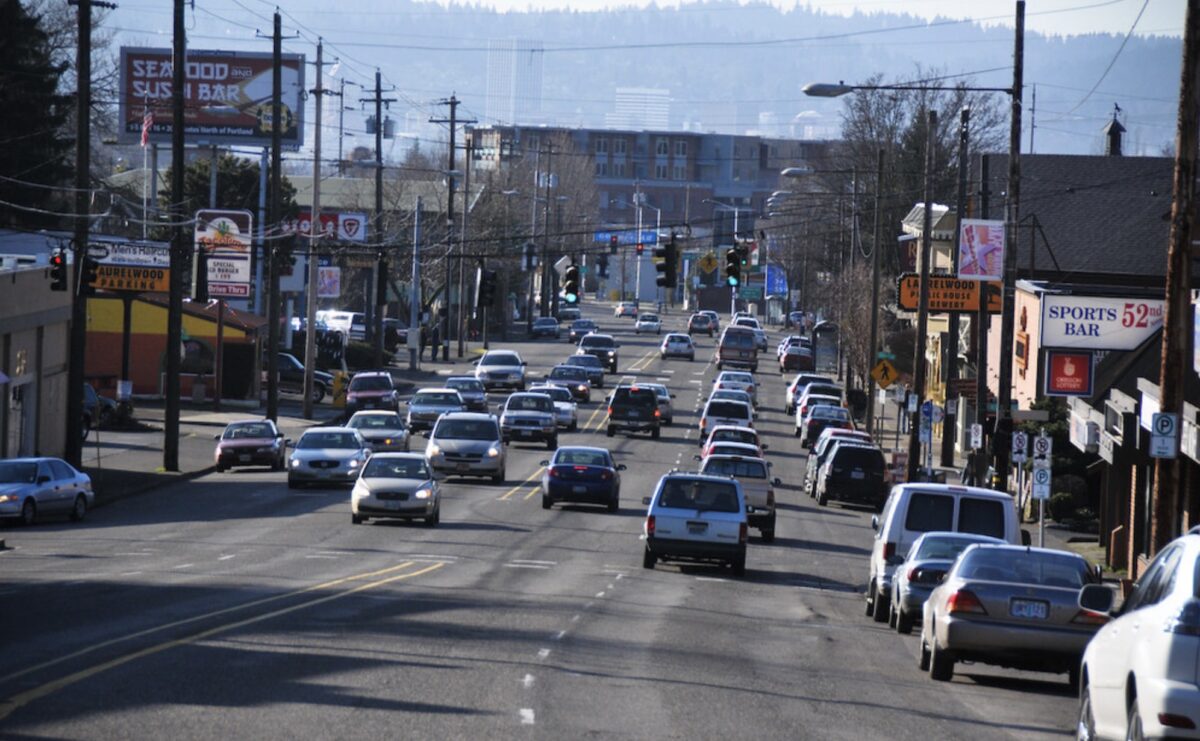
Few streets in Portland have as much potential as Sandy Boulevard. From the Central Eastside to the Parkrose neighborhood, this rare diagonal street cuts through our dense grid and offers quick cross-town trips and direct access to myriad destinations.

Designated as a “civic corridor” in Portland’s Comprehensive Plan and expected to see major growth in housing and jobs in future years, Sandy’s outdated design is currently not up to the task.
Sandy’s traffic lanes only safely accommodate people traveling inside metal-framed boxes with large motorized engines. That’s one reason why, like many other driving-centric arterials in Portland, Sandy has a deadly and dangerous legacy and is currently designated as a High Crash Corridor. That’s also why it was named the “Worst Street Ever” in a 2012 short film.
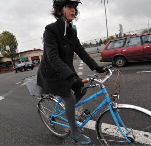
Despite its risks, many bike riders are devoted to it because it offers speed and convenience unmatched by neighborhood greenways.
Unlike other arterials, Sandy is owned by the City of Portland and not the State of Oregon. That means instead of sitting around and begging the Oregon Department of Transportation for updates, we can take action to make Sandy work for the road users of the future: people on bicycles, e-bikes, scooters, and all manner of personal mobility devices.
And that’s exactly what the Portland Bureau of Transportation (PBOT) wants to do.
Advertisement
“The plan will… take a multimodal lens that also considers potential for bicycle facilities along the corridor.”
At their meeting this morning, Portland City Council approved a $300,000 grant application submitted by PBOT to ODOT and the Oregon Department Land Conservation and Development. The grant would allow PBOT to move forward with the creation of a “transportation growth management” (TGM) plan for Sandy Blvd.
The project hasn’t been made public yet, but PBOT has shared an outline with BikePortland.
The working title is Sandy Boulevard Civic Corridor Plan.
If the grant comes through, PBOT planners would create a foundation for future capital projects to transition Sandy away from its, “largely auto-oriented” design (their words, not mine), “widely spaced pedestrian crossings,” and “sidewalk corridor that is disrupted in many locations at large, skewed intersections” and toward a street that will, “accommodate various modes of travel and other uses of the right-of-way.”
Here’s more about the project from PBOT (emphasis mine):
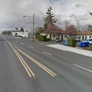
“There is no accommodation for bicycle travel along Sandy Blvd and very few transit priority treatments for the frequent Line 12 bus. Overall, Sandy Blvd is one of the streets in the City of Portland that faces the most conflicting demands for various uses, given that it classified as a “Major” street for every mode (pedestrian, bicycle, transit, freight, traffic, and emergency response) and also has a Civic Main Street classification (suggesting need for curb zone access) in our Transportation System Plan. Sandy Blvd is also a High Crash Network Street, and while some segments have received modest safety upgrades over the years, fatal and serious injury crashes are still a significant issue along the corridor.
Advertisement
… This [plan] will provide direction for future public capital projects along the roadway as well as for private developments that occur along the corridor. The plan will include development and evaluation of multiple alternative design concepts for the corridor with a full investigation of benefits trade-offs for different modes of travel as well as for safety, equity, access, and other criteria. The plan will build on our experience with recent and upcoming transit-related efforts like Enhanced Transit Corridors, the Rose Lane Project, and the Streetcar Study, but will take a multimodal lens that also considers potential for bicycle facilities along the corridor while also ensuring adequate provisions for freight, emergency response, and traffic needs.”
PBOT also notes that the plan will develop concepts to improve walking condition with, “place-making opportunities at the triangular skewed intersections that often occur where the normal street grid meets the diagonal street.”
If the grant comes through, work would begin in fall 2021 and would last about two years.
That’s a long time to wait for a street with so much potential; but at least PBOT is moving forward. Who knows, maybe some outside factor will create urgency to get this work done sooner.
— Jonathan Maus: (503) 706-8804, @jonathan_maus on Twitter and jonathan@bikeportland.org
— Get our headlines delivered to your inbox.
— Support this independent community media outlet with a one-time contribution or monthly subscription.


Thanks for reading.
BikePortland has served this community with independent community journalism since 2005. We rely on subscriptions from readers like you to survive. Your financial support is vital in keeping this valuable resource alive and well.
Please subscribe today to strengthen and expand our work.
Wow…I learned something new today…that Sandy is a PBoT facility…it just looks sooo ODoT in its layout and operational priorities. Glad to know PBoT is planning to add some ‘civilness’ to this “civic corridor”.
So once its done, we can all sing…”Ding Dong the Witch is Dead…” another Mid Century 4 Lane deficient highway arterial has been humanized and made safer!
I still remember the whole planning process when PBOT got Sandy from ODOT (7th to 105th). Local advocates pushed for bike lanes all along Sandy, and ODOT was willing, but the push back came from PBOT, who wanted the road to be a 4-lane arterial, for car traffic flow. The irony now 20 years later is that it has taken an entire generation for PBOT to see sense.
That was also not a very good deal in terms of a jurisdictional transfer. ODOT only provided funding to repave and add pedestrian crossings in the portion from Hollywood to the west. The pedestrian crossings were all inadequate, just median islands with double threats and no signals or beacons, and the entire section east of Hollywood got no improvements.
Yes, the city drove a harder bargain on Outer Powell based on their past failures on Sandy, for the future jurisdictional transfer.
For a long time I’ve dreamed about using Sandy as a case study of the long-term affects of jurisdictional transfer *without* massive investment in an immediate redesign.
The transfer happened before my time in Portland, and I think so did a round of turn-lane repurposing in the early 2000s. I would LOVE to read some of the documents associated with those processes but I’ve never been able to find them online. Has anybody else? Could I get them from PBOT’s library, if it’s ever open again?
All I’ve ever found just through google searching was this: http://efiles.portlandoregon.gov/Record/191835/File/Document
I’m sure there’s more in the City Archives if you want to really dive in.
Thanks! Yeah, not a lot here, but nice to know the year (2003), dimensions (all of Sandy to NE 99th, plus Burnside from MLK to 13th), and the dowry ODOT put up to unload it on the city ($900k over seven years). I appreciate it.
OMG. This would be an absolute game changer for the city.
Hey PBOT, I know that you read these comments. PLEASE take the best parts of what you learned from Foster (Which was a huge improvement, but could have been monumental) and apply said knowledge here, on Sandy. Please use the best parts of Rosa Parks (I love Rosa Parks now) and apply it here.
I HOPE this really does happen and happen fast. I believe in you PBOT. Go!
What was good about Foster or Rosa Parks?
What WAS good? Not much. Foster and Rosa Parks are WAY better/ safer now thanks to PBOT. I hope Sandy gets similar (but bigger) upgrades.
Foster sucks. Waste of space. Just harder to escape this awful city now. Not fun being trapped with so much garbage.
I have ridden Sandy Blvd. for years and have had little to zero issues. The more space the more garbage and tarps.
How about removing the car parking on Sandy? Give it to bikes and buses.
Sandy only got its “Major City Bikeway” designation last year, due in part to some great advocacy by BikeLoud!
THANKS BIKELOUD!!! And thanks Chris Smith for all you do. I hope you win the Metro Councilor seat that you are running for.
Don’t get mad, but I would love to see a *return* of streetcars to Sandy Blvd
I’ve always applauded anyone I saw riding a bike on Sandy. Takes pure guts. Guts that my wild self doesn’t and won’t exhibit on that stretch. I thought Sandy was going to get the Chloe Lane treatment? These lanes really need to come up with a bike facility in mind.
These days my guts are strictly for regular gut-type things, no hero me, but since I’m always late I’ve been taking the lane down Sandy about 1 day in 3. It’s pretty chill and saves about 5 minutes vs. NE Going/Vancouver. Just yesterday I was thinking it’s high time the curvy lane lines and random parking spots got to Take Off! And now I read this! It’s not total wish fulfillment because no doubt it will take the usual 17 months but I’ll take it.
I’ve always thought Sandy’s bark was much worse than its bite, and I’ve found riding on it is always less unpleasant than I expect. That said, I’ve always thought Sandy (and Foster) were prime candidates for upgrading, and I’m glad the time has finally come.
I love plans as much as the next person, but I hope someone at PBOT and/or Parks has got their eye on the full block that used to be Sandy Blvd. between 12th & 13th, Burnside & Couch. Get the parked cars/trucks off and make it a beautiful public square, especially for those filling up the dozen new apartments buildings nearby. All that new construction must be filling the SDC coffers for public space.
Would be a super nice place for a food cart pod in my opinion.
That’s all private property now, and will redevelop at some point. That was part of the deal for the Burnside/Couch couplet project, that it would free up those two blocks for private development. The eastern block just did redevelop.
I rode for two months in New Zealand with no close calls. When I flew into pdx, I unpacked my bike and rode downtown on Sandy. I nearly got hit three times. I thought the city would soon make it safer. That was 1986.
People here have some kind of ingrained negative disposition towards anyone not in a car. My only negative encounters with drivers have been here.
I’m a fairly fearless rider, but after being doored on Sandy biking home from work I now take Ankeny. It takes me a little out of my way, but I no longer feel safe riding that close to parked cars.
Now is the time to do it. With working from home as the new normal we won’t need wide automobile streets like this anymore. Covid put the first stake in to the heart of happy motoring, lets human scale this iconic road running diagonally through the heart of Portland and finish the job.
JM: You said “If the grant comes through, work would begin in fall 2021 and would last about two years.” I want to make sure I understand correctly. The grant is for money to develop the plan. So in the fall of 2023 we’d have a plan, only, right? We have no idea how long the actual build-out will take (assuming it is approved to go froward and funded).
I ask because your next sentence (that’s a long time to wait) implies to me that we know how long we’re going to be wating for actual changes.
Hi Gary B. Yes the grant would only be to develop a plan. And yes it appears PBOT is saying the plan would take up to 2 years go complete. And yes we have no idea when/if any of the projects in the plan would be built.
This is all very typical of how things go with planning. It doesn’t mean nothing can happen on Sandy until 2023. Projects can be built separate from this plan. This is just a plan to help understand how the future of the street should be prioritized.
Plan schman, where’s my paint can? Quick and dirty can’t be worse than some of the so-called shovel ready stuff we’ve seen.
Very often it’s the planning process that creates the momentum and clarity to get grant funding to build a project. That’s how it worked with Foster Rd. Without the plan, there wouldn’t have been a project. That one did take a long time, though, and it would be great to move faster, for example by applying for funding during the planning process so it’s ready by the time the plan is adopted.
This has been brought up by many but consider making Sandy transit and bike only. You don’t need a diagonal vehicular corridor when you have a grid. The irregular intersections are already problematic for sight lines and signal timing. You can maintain existing business access with right-in/right-out lanes where needed. It could be a great multi-modal street. Market Street in SF is the blueprint (obviously different density and scale).
I learned from a Friends of Trees talk that Sandy was originally conceived as a sedate, European-style, tree-lined, multi-modal boulevard. And then the car *really* took off and those plans were scrapped. You can see the traces of this plan in Kerns and Hollywood, or wherever the older buildings are a little further back from the street.
There is quite a bit of commuting for NE Portland residents, and 205 Washingtonians, using Sandy Blvd. for work, especially during rush hour times. We have dedicated Sacramento and Alameda to bikers and walkers. The congestion for drivers going to and from work will lead to frustrating traffic jams. The congestion of traffic at 39th and sandy blvd. to one lane for the freeway is a disaster, and poor planning. Its very dangerous for bikers. if you must do more diversions maybe Broadway would be more practical, for bikers, since it doesn’t go directly to the freeway like sandy does. Residents from SE Portland use 39th ave. to merge with the westbound traffic on sandy now, since it has been made in to one lane to access the freeway.
I think this has been a horrible plan. Drivers pay taxes and should have their rights as drivers respected as well. To divert traffic into neighborhood go arounds is unfair to homeowners in these neighborhoods. People need to get be able to get to work, and hospitals, and out of town. Kids play on the streets in these neighborhoods and parents don’t want cars using their streets as a go through.
Assumptions: Roads are for cars only. We should design our streets for people living elsewhere and driving from long distance. Congestion is not caused by drivers, but by using a street for people of all modes. Residential streets with painted bike marks are where bikes belong. Only drivers pay taxes. Only drivers work. People do not get to work on bikes or by walking. Designing streets for all modes will frustrate people using cars and endanger kids on residential streets.
Does anyone know if there are updates on this? Was it approved? Sandy Blvd is badly in need of a road diet 🙂