![]()
(Photos: J. Maus/BikePortland)
Before last weekend I never knew Larch Pine needles turned gold in the fall. But I got one hell of an education after watching them fall like golden rain through a cold blue forest sky and seeing the wheels of my bike carve a fresh path through miles of them.

Those golden needles were just one of many magical moments forever seared into my head after a truly epic journey through the Mt. Hood National Forest during Our Mother the Mountain’s (OMTM) Holy Mountain ride. In the past few years OMTM has earned a stellar reputation as caretakers of a robust community of unpaved road (a.k.a. gravel) lovers and the routes that keep them stoked. Sunday’s ride will only strengthen their street cred.
OMTM’s third version of the Holy Mountain delivered a route that combined everything I love: roads steeped in history, challenging singletrack, lonely destinations, and statistics that lead to a sense of accomplishment. After eight hours of riding in the shadows of Mt. Hood, I tallied 84 miles and 8,700 feet of climbing.
I’ll soon forget those stats, but not the roads and trails I logged them on.
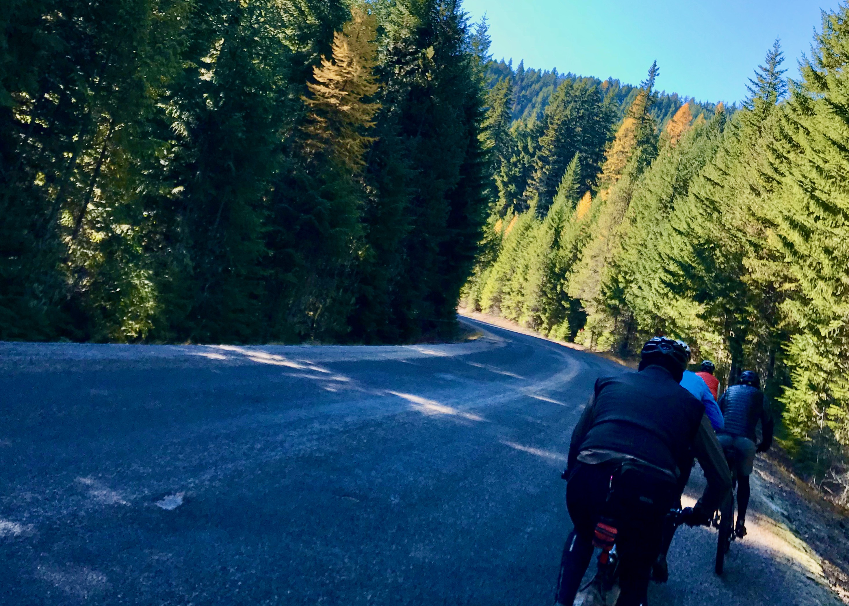
We left Sandy Ridge on Barlow Trail Road, namesake of Sam Barlow, a pioneer who came to Oregon in 1845 and spent $4,000 to carve out a route from The Dalles to Oregon City up and over the Cascade range. Over the course of Sunday’s ride we traversed many miles on pieces of Barlow’s road, which gave passage to hundreds of wagon trains, livestock and settlers between 1846 and 1918.
From there we continued east via Pioneer Bridle Trail and Still Creek Road. The first 26 miles or so was nearly all climbing as we reached the highest point of the day (4,200 feet) near the Pioneer Women’s Grave and got our first big view of Mt. Hood along Forest Road 3530.

Advertisement


At this point I could tell I was just off the pace of the leading group, who were determined to complete the full loop before it got too dark and never stopped to regroup for more than a minute or two.
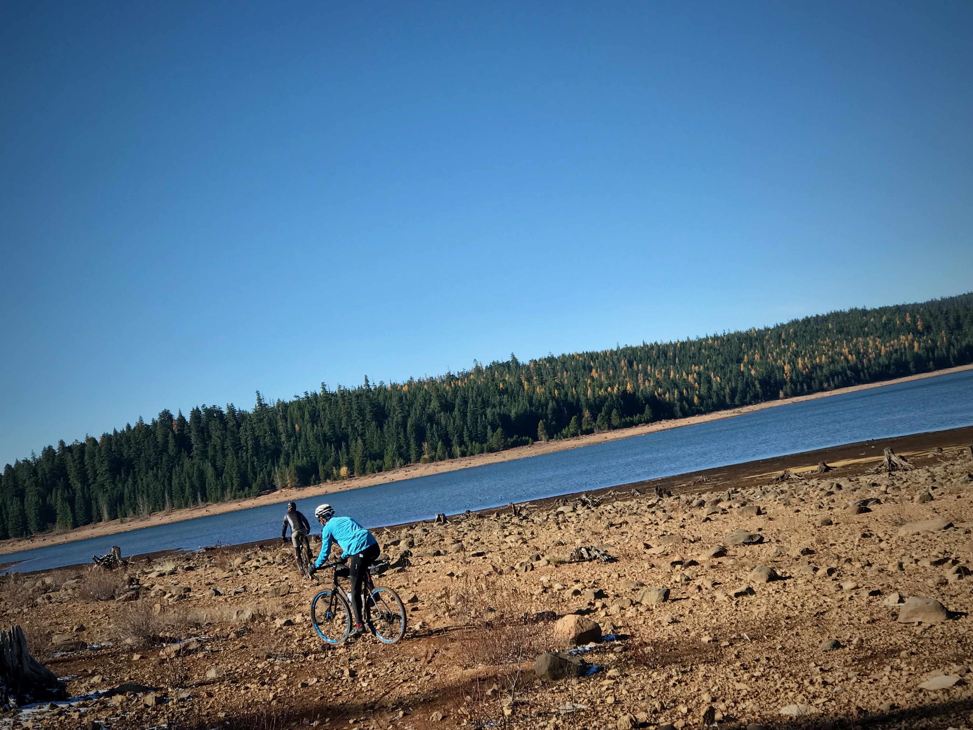
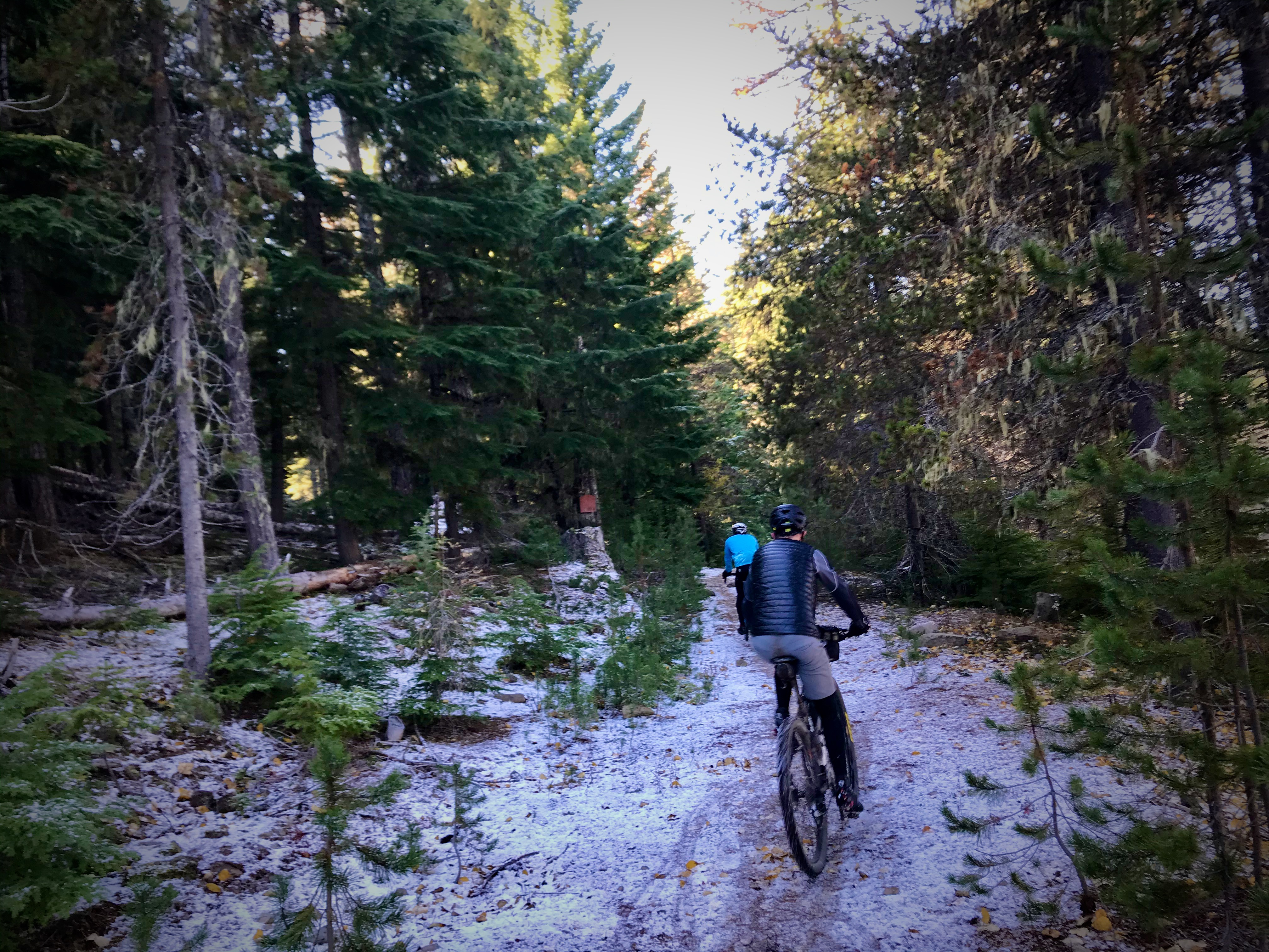
Traversing Barlow Road and then popping out onto the surreal landscape around Clear Lake was another highlight. Two other riders and I lost the lead group at the lake and traversed the low water-line looking for tracks to find the trail again. Once we found the trail there were dozens of fallen trees to hop or hike over. In addition to the logs, we rolled over freshly-fallen hailstones and powdery snow.
At about mile 50, myself and another rider (hi Ron!) made a wrong turn and rode about two miles downhill in the wrong direction. Ron decided to make a new route back and I wanted to climb back up to the official route. We agreed to split up and I was on my own for the remaining 30+ miles back to my car.

(Photo: OMTM)
(Photo: OMTM)
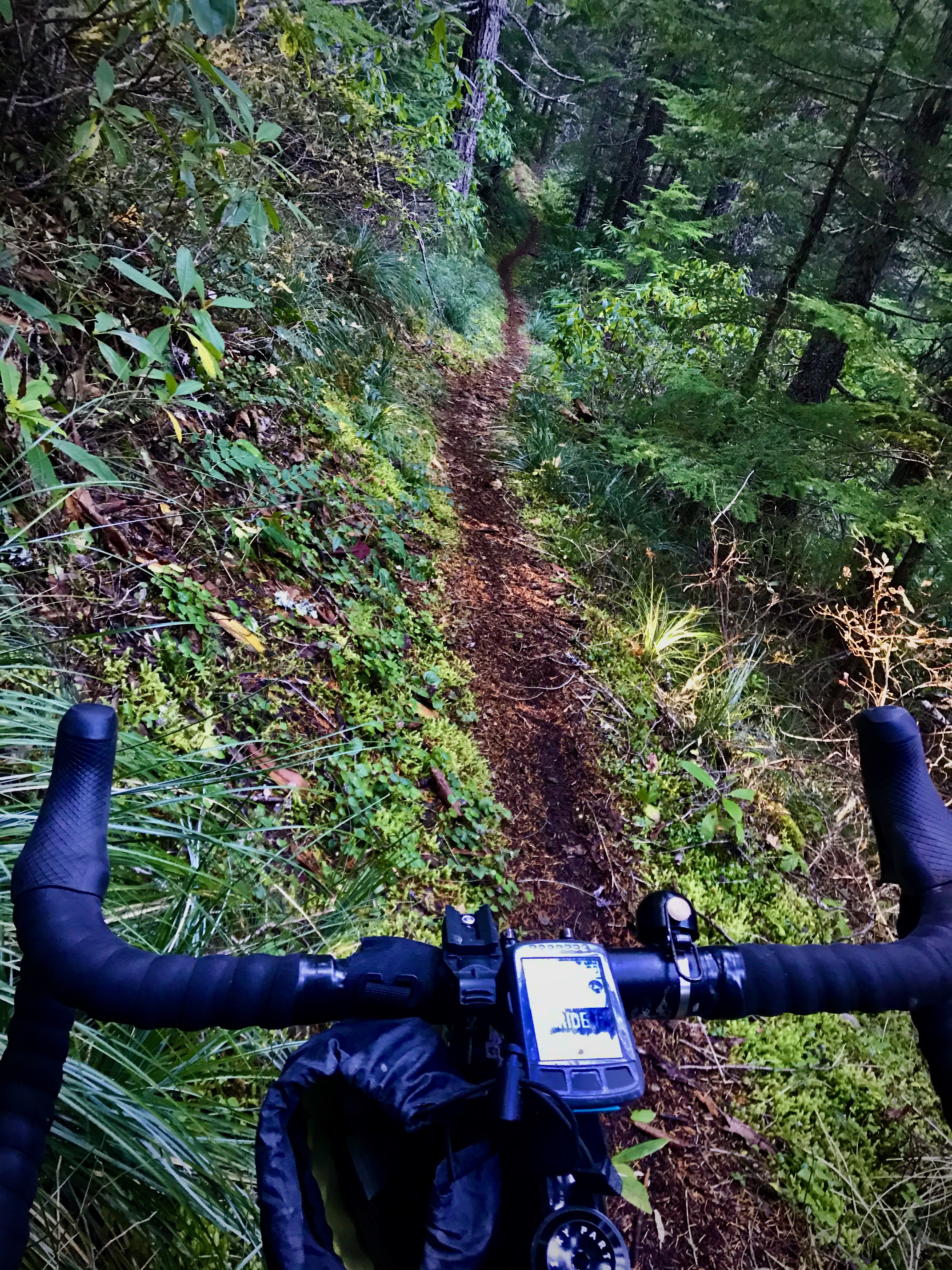
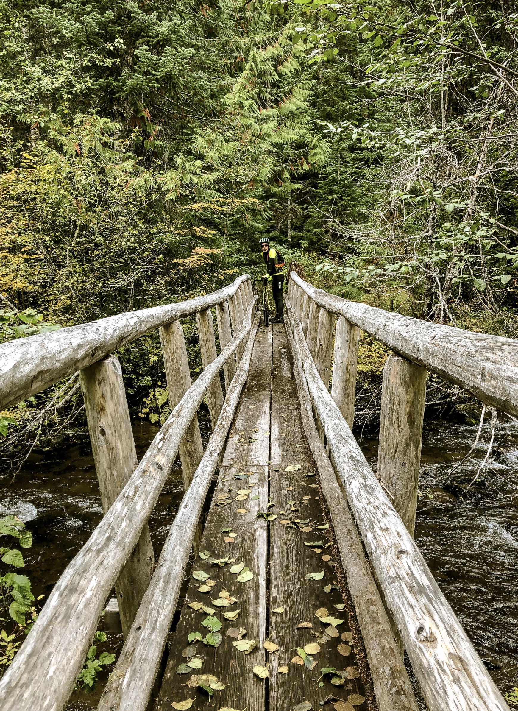
I’m glad I chose the official route because Jackpot Meadows Trail was, well, a jackpot. Narrow, slick singletrack with hidden rocks and roots and sharp switchbacks led me down to the Salmon River. On my own, deep in the forest with waning light, I knew that a mistake at this point would be bad. I tried to stay solid and cautious, while still making good time. After crossing the river on a narrow log bridge, there was a three-mile singletrack climb back to a road that led me to Trillium Lake.
On a day full of new roads and new places, seeing Trillium Lake — a place where I’d camped with family in the past – was a welcome site. I found the bike trail around the lake and started to feel good about finishing before dark. I made my way up to Government Camp and the start of Crosstown Trail #755. From there it was mostly all downhill on Pioneer Bridal Trail back to Sandy Ridge. The trail was tricky and I was glad to have my 650b wheels x 47mm wide WTB Sendero tires which afforded plenty of confidence over the rocky chutes and waterbars.
It was dark when I got back to the Sandy Ridge Parking lot. I quickly changed into warmer clothes and enjoyed a quiet drive home, my mind racing with memories.
— OMTM has also put together 35 and 50-mile versions of this ride. Check them all out
— Jonathan Maus: (503) 706-8804, @jonathan_maus on Twitter and jonathan@bikeportland.org
— Get our headlines delivered to your inbox.
— Support this independent community media outlet with a one-time contribution or monthly subscription.


Thanks for reading.
BikePortland has served this community with independent community journalism since 2005. We rely on subscriptions from readers like you to survive. Your financial support is vital in keeping this valuable resource alive and well.
Please subscribe today to strengthen and expand our work.
Great article and looks like an amazing ride, but Wy’East is not an indigenous name for Mt Hood. It was invented by a German in 1897 and now it’s super widespread. Even Timberline Lodge propagates the myth.
“There are a few names that are mythologized Native placenames. Many people assume that Wy-east is the original name for Mt. Hood, but it’s not. It was invented by Frederic Balch in his 1897 historical fiction book Bridge of the Gods, which became so popular that it was taught as actual historical fact in Portland schools. The native name for such mountains in the Kiksht dialect is Pahto.”
Source: https://ndnhistoryresearch.com/tribal-history-themes/native-place-names/
Edit: Frederic Balch was American-born, not German! Facepalm.
Thanks Alex. I didn’t know that. I will edit the story.
I didn’t know that either until somebody pointed me in the direction of this article last year. David’s website is a great place for indigenous histories of the Pacific Northwest, I highly recommend it. Thanks for updating the story!
Just rode Still Creek Rd for the first time a few weeks back, what a gem. That route looks awesome.
If Wy’East is Pahto, then what is Pahto(Mt.Adams)?
Klickitat?
Old maps dating clear back almost to Lewis and Clark show Mt. Hood named Wyeast (spelled that way). Could Balch have simply changed the spelling to Wy’East? Pahto is Yakama for Mt. Adams.
I would be interested in seeing any old maps with the name Wy-east on them, especially those from the 19th century before Balch’s influence. The name Pahto was a common name for all high mountains, some tribes did have placenames for individual mountains. I have found the Molalla name for Mt. Hood. I would assume several tribes had a name for the mountain in their own language. None of them appear to be Wy-east in any verified records at this time.
Hood, St. Helens, Ranier, Baker are prominent Brit naval guys.
Would you recommend a gravel bike or a mountain bike for that ride? It definitely looks awesome! And do you have a GPX route for it, so I could avoid the getting lost part? 😉
Walter,
There were several people who opted for MTBs and many of the gravel bike had 2.0+-inch tires and 650b wheels. I was on 650×47. I would definitely go on the big side when it comes to tires and I don’t think a MTB is overkill for this route. And you can view the route on RWGPS here – https://ridewithgps.com/trips/41455137
2″ plus is recommended for this route.
That’s a serious effort! Dang.
Wow, sounds like a great ride. I didn’t realize you could legally cross the Salmon River there. I backpacked most of the length of the Salmon-Huckleberry Wilderness (by bus – no car required!) a couple years ago. I remember unexpectedly exiting the wilderness area and finding myself at a trailhead, but assumed I was at a road dead-end.
Knowing there is actually a legal route from the Still Creek/Trillium Lake area down to Clear Lake opens up a lot of riding possibilities I didn’t know about.
I like the route. I’ve done all those roads and trails but never on a single trip. I’ve ridden that Jackpot Meadows trail a couple of times over the last few years. It is a serious trail but relatively short. A hardtail mountain bike works pretty well for that trail and the Pioneer Bridal trail. Without suspension the Pioneer Bridal trail is torture in my opinion.
If you have a mountain bike the Eureka Peak trail off Still Creek road goes to Kinzel Lake road and from there you can take the newish Dry Fir Trail for a bit more trail. Thanks for sharing the adventure!
that is the only way through. The official route is here: https://ridewithgps.com/routes/31303331