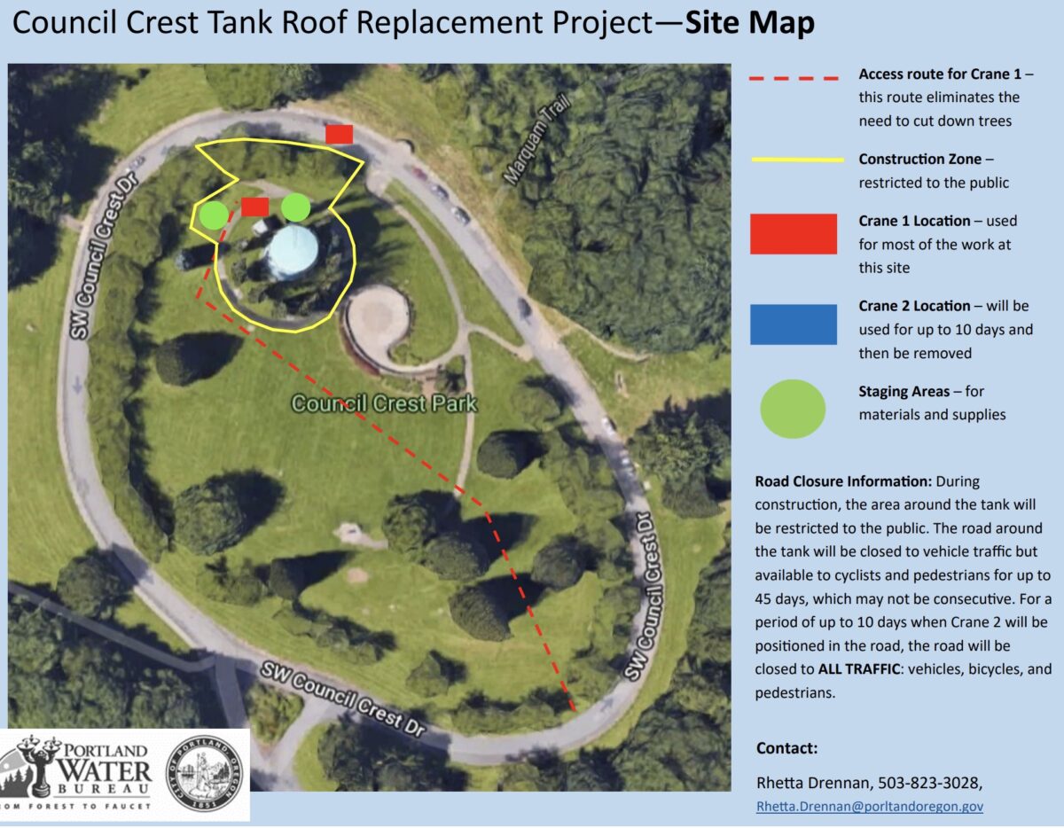
The Portland Water Bureau is about to start a project up in Council Crest Park that will impact the road around the iconic summit lookout.
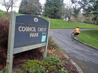
The ride up to Council Crest is a classic (one reader loves it so much he snapped a photo from the top 500 times in four years). What you might not realize is that large water tank on the northwest corner of the summit was built in 1942 and still serves 1,300 customers. Now it’s time for maintenance repairs.
As of late this week or early next week, the Water Bureau tells us heavy equipment will begin staging on SW Council Crest Drive. Once construction starts shortly thereafter (we’ll post dates as they come in), the road will be completely closed to car and truck drivers for up to 45 days. Then, for 10-day window (Water Bureau hasn’t clarified exact dates yet), the road will be closed to all users — including bicycle riders. Throughout this project, bicycle riders and walkers will be able to enter the park, but you will not be able to ride through the full loop of the road. If you ride up to the lookout, you’ll have to walk across the grass to return down the hill.
In general, use caution around this work zone as there will be large cranes at work. And respect the full road closure when it starts.
Learn more at the project website.
— Jonathan Maus: (503) 706-8804, @jonathan_maus on Twitter and jonathan@bikeportland.org
Never miss a story. Sign-up for the daily BP Headlines email.
BikePortland needs your support.


Thanks for reading.
BikePortland has served this community with independent community journalism since 2005. We rely on subscriptions from readers like you to survive. Your financial support is vital in keeping this valuable resource alive and well.
Please subscribe today to strengthen and expand our work.
In case you didn’t know, Council Crest had an amusement park 100 years ago. There was a roller coaster around the top and an observation tower where the water tank now stands. Here’s a 1925 aerial view of the park:
https://www.facebook.com/photo.php?fbid=10153578656368326&set=gm.530753063758348&type=3&theater
And a narrow-gauge trolley to get you up there:
http://www.pdxhistory.com/html/council_crest_cars.html
Many year ago you could find remnants of the old park lying about in the brush and trees around the edges. I found old bottles, rusted carnival trinkets and other metal pieces, a section of rail that was too heavy to lift. It might still be there in the brush between Greenway and Council Crest Drive on the north side. Imagine what’s still buried.
Not that I would ever do this.
But someone who looks a lot like me has recurring fantasies where they burst the side of that thing with an axe, riding the current to the bottom.
but would the water mostly go towards Fanno Creek or north or east?
I mean, at the risk of now being on a watch-list, its fun to think about.
Simultaneous closures of East Bank Esplanade, Williams/Vancouver, Council Crest, and Corn Pass? It’s like there’s a cycling route assassin in these parts (Corn Pass not being a route, but its closure meaning more traffic on bike routes).
This may put a damper on the traditional RondePDX finish. But it will likely be canceled again anyway.