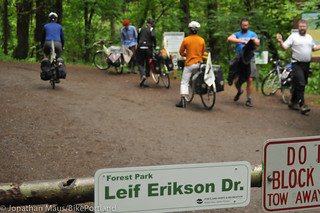
Sorry for not warning you sooner but a portion of Leif Erikson, the main road for bicycling in Forest Park, is closed through the end of this week.
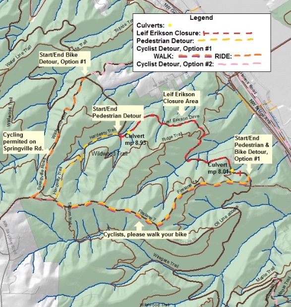
The closure is due to a City of Portland project to replace several culverts between mileposts 8.0 and 9.0. Since the road is completely closed, bicycle riders must detour around it. Portland Parks & Recreation is recommending two different detour routes. The shorter detour (1.9 miles) includes a very steep uphill/downhill where Parks recommends walking your bike for 1.2 miles. The other detour is five miles long and puts you on Highway 30.
Here are the maps (provided by PP&R):
Advertisement
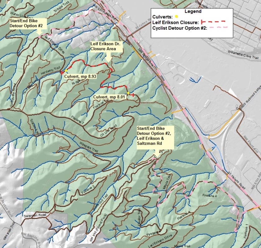
And here’s the text description:
Option 1: Please WALK your bike up Firelane 7A to Firelane 7—CAUTION: STEEP SLOPE. Turn right, continuing to walk your bike, on Firelane 7 to Springville Rd, which is open to bikes. RIDE down Springville Rd to return to Leif Erikson. (Walk: 1.2 mi; ride: 0.7 mi. Total: 1.9 miles)
Option 2: Take NW Saltzman Rd. 1.25 miles to Hwy 30/NW St Helens Rd. Take NW St Helens Rd. 2 miles north to NW Bridge Ave. Turn left on NW Bridge Ave. Turn right on NW Springville Rd. Continue up NW Springville Rd. 0.5 miles to the park gate. Continue up Springville Rd to Leif Erikson. (Within Forest Park: 1.6 mi; outside Forest Park: 3.4 mi. Total: 5 miles)
“We recognize that Leif Erikson is a popular and widely used trail for multiple user groups and this may be an inconvenience for many,” PP&R said in a statement, “However, it also serves as the primary north-south emergency access route in the park; we hope these improvements will serve the park’s users and wildlife well into the future.”
— Download a PDF version of the above maps and detour notice.
")


Thanks for reading.
BikePortland has served this community with independent community journalism since 2005. We rely on subscriptions from readers like you to survive. Your financial support is vital in keeping this valuable resource alive and well.
Please subscribe today to strengthen and expand our work.
FAST BIKES
USE NAITO
BIKE LANE
FAST BIKES
RISK YOUR LIFE
ON US-30.
FAST BIKES ENJOY THE WIDEST SHOULDER IN THE METRO AREA ON US-30
Is that true?
Yep. Next to 50 m/hr traffic.
50 mph? I wish. Make that 60-70.
Will there be a protected detour set up on US-30 for people to safely ride around the closure?
Sorry, that was rhetorical. I already know the answer is no.
The shoulder is basically a protected lane – it is HUGE and the rumble strips are canyon deep. I will say, riding on highway 30 is a solid zero on the “FUN and SCENIC meter” but I’ve never had any problems with auto or truck traffic on that road.
I’m the last to ever advocate for protected lanes, and more often than not I think people should just sack up and ride.
I make an exception for the Dirty 30. The hope is that you never do have an incident there because the combined lane speeds (never mind vehicle weight) are not going to pan out well. Unless there are numbers, like the Ronde, I just avoid it altogether.
I’ve seen a couple riders almost get creamed because of the false safety in numbers of the Ronde. =/
Firelane W is a much more scenic option for bicycles with wider tires.
Wildwood Eh?
I’m glad they are fixing the culverts.
Why walk your bike up FL7? After the crazy sttep part at the bottom which has to be walked it turns into a road. There are truck tracks on the road.
There is no justification for this.
Next time there is a road closure for motor vehicles, perhaps the operators can get out and push their cars uphill on a nearby route instead. Or, in the case of bridge closures, they can simply push their car across the river.
there are AWESOME detours already established. be polite, and ride!
Protest Protest Protest!