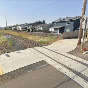
A Clackamas County sewer project will close about one mile of the I-205 multi-use path between Clackamas and Gladstone beginning today. The closure is expected to last through November of next year (*the County had a typo in their initial release!).
In order to install a new sewer pipeline, the path will be closed between SE Strawberry Lane and SE 82nd Drive in Gladstone.
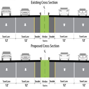
According to Oregon Department of Transportation spokesperson Elizabeth Craig, there will be a signed detour in place. “The signs will direct path users to SE 82nd Drive as an alternate route during the closure.” That segment of SE 82nd has two standard vehicle lanes, a center turn lane, and 4-5 foot wide bike lanes in each direction.
For more information on the project and the path closure, contact Amy Kyle at 503-742-4561 or akyle[at]co.clackamas.or.us.
UPDATE, 9/12 at 11:45 am: This story initially stated that the closure of the path would last through November of next year. However, Clackamas County had a typo in their statement. I’ve edited the story to reflect that the closure only lasts through November of this year and I’ve moved this story to Page Two. I apologize for any confusion.


Thanks for reading.
BikePortland has served this community with independent community journalism since 2005. We rely on subscriptions from readers like you to survive. Your financial support is vital in keeping this valuable resource alive and well.
Please subscribe today to strengthen and expand our work.
My off-the-cuff reaction is that this is not an acceptable detour. Sounds like 82nd Drive is a huge step down from the I-205 path. Would ODOT allow a year+ long closure of a motor vehicle facility for a project like this with only such a dangerous, unpleasant alternative?
They’re closing I-205? Yay! Let’s hope it’s permanent! (Sorry, couldn’t resist because of that headline, Jonathan.)
I was thinking that section has recently been closed while they installed lighting and landscaping along the path. Wasn’t it?
I’ve never biked down there, but 82nd itself looks fairly decent on google street view.
http://maps.google.com/?ll=45.395105,-122.573733&spn=0.00003,0.01869&t=m&z=16&vpsrc=6&layer=c&cbll=45.395363,-122.57353&panoid=fE9tB_R3ksKLciWIGDyCAg&cbp=12,49.94,,0,7.32
The connection at the south end looks dubious, though, with a “freeway exit” style right turn off 82nd Dr. to go north on I-205.
http://maps.google.com/?ll=45.384798,-122.578304&spn=0.00003,0.01869&t=m&z=16&vpsrc=6&layer=c&cbll=45.38478,-122.578444&panoid=g4R0CveQ6TdQUkARCrncyQ&cbp=12,87.09,,0,-1.46
This could be restriped, with dashed lines through the turnout showing the bike lane, and the “Begin, right turn yield to bikes” sign (MUTCD sign # R4-4 as shown in the 2009 MUTCD, p. 793
http://mutcd.fhwa.dot.gov/pdfs/2009/part9.pdf )
If any of you who ride down there aren’t happy with the detour, you should follow ODOT’s directive: “To make riding safer for you and other bicyclists, report unsafe road conditions to local authorities as soon as possible.” (from the Oregon Bicyclist Manual, p. 4. http://www.oregon.gov/ODOT/HWY/BIKEPED/docs/bike_manual.pdf )
Contact ODOT at 888-ASK-ODOT or email them at AskODOT@odot.state.or.us
Ted Buehler
I’ll update the map… it would be nice to get a couple week’s notice so the various abstractions of OSM have had a chance to work the data through their respective toolchains so the data is live for the maximum number of users by the time the closure starts.
HAH, OK, just checked, and looks like one of the OpenStreetMap Interns at TriMet beat me to the punch, citing this article.
I agree with Greg. This same section was closed for several months less than a year ago for the ARRA-funded lighting project. Seems like it could have been coordinated better?
I’ve ridden this detour now about ten times and it bites. There are a lot of trucks and at one right curve I almost got crushed on Thursday by the back half of a semi whose front wheels had not gone wide enough.
Will be glad when bike lane opens and hope I live to see it.