(Photos © J. Maus)
On Saturday I joined my six-year old daughter Danica for a ride to Smith and Bybee Lakes. It’s an easy ride to a beautiful destination that should be on everyone’s list. It’s also a route the benefits from the Bureau of Transportation’s ongoing effort to create a network of low-stress bikeways in North Portland.
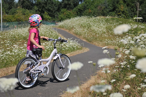
Danica just turned six and she was eager to break in her new bike (a 20-inch Jamis Capri we got from North Portland Bike Works) with a real ride. At about 15 miles for the round trip, it was her longest bike ride ever.
From the Piedmont Neighborhood near Peninsula Park, we rolled out via Bryant Blvd, a low-traffic, neighborhood greenway street with speed bumps, sharrows, and directional signage. We’re pretty spoiled in Portland, as it just so happened that our destination — the Smith and Bybee Lakes Wildlife Area — was printed on a sign about 1.5 miles from the house.
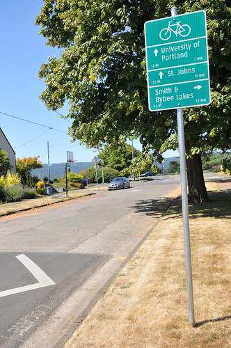
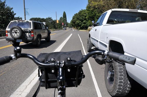
On the way out, I decided to take N. Willamette Blvd., which isn’t the recommended route (the bike lane isn’t super wide and car speeds are on the high side), but it’s the way I’ve always gone. After a brief roll on Willamette, we turned North on Portsmouth, a wide and tree-lined street that leads straight to Columbia Blvd. Once across Columbia, the route is pretty much carfree all the way to the lakes.
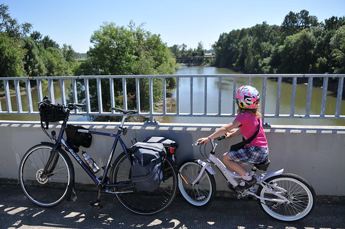
A multi-use path (the Peninsula Crossing Trail that’s part of the 40 Mile Loop) rolls around a wastewater treatment plant (which can be smelly depending on which way the wind blows), up and over the Columbia Slough, and then continues north on Portland Road.
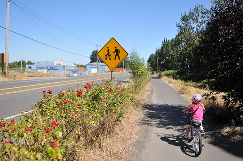
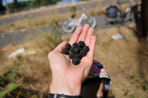
On Portland Rd, we not only had a carfree place to ride, we also picked as many blackberries as we could carry…
The last bit of traffic you’ve got to contend with a crossing of Portland Rd; but thankfully PBOT has installed a crossing treatment that makes things much easier. With overhead signage, zebra striping and a refuge island, cars naturally tend to slow down and stop when people are present.

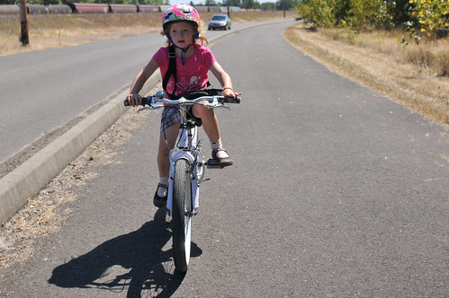
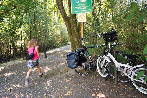
Once across Portland Rd., we spread out and enjoyed a carfree ride into the wildlife area. Bikes aren’t allowed on the paved trails inside the park, so we locked up and walked in the rest of the way.
On the way home, I decided to experience PBOT’s new neighborhood greenway network. But first, with temps well into the 90s, we swung through New Columbia (via N. Fiske) and stopped at the McCoy Park Fountain.
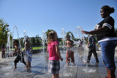
From there, it was easy to find the bike streets. Once on N. Dana, we followed sharrow markings that led to Wabash. Wabash took us back to Bryant, which led us right back home.
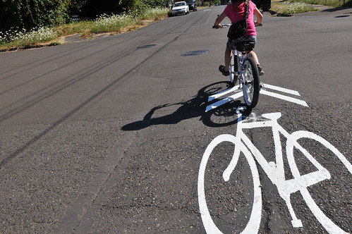
It was the first time I’d tried the North Portland neighborhood greenways. As an alternate to Willamette, I was glad to have the easy of bike signage and the aid of traffic calming on our side.
Smith and Bybee lakes is a great destination. With the aid of low-traffic streets, multi-use paths, and neighborhood greenways, it’s fun and pleasurable for all types of riders — even my six-year old!


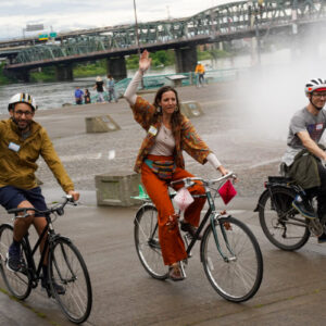
Thanks for reading.
BikePortland has served this community with independent community journalism since 2005. We rely on subscriptions from readers like you to survive. Your financial support is vital in keeping this valuable resource alive and well.
Please subscribe today to strengthen and expand our work.
Great ride!
Great photos!
I live in North Portland, too, and I ride there every week. The pathways were especially important to me last year, after getting hit by a pickup truck, because it took me a while to get used to riding around traffic again. The Slough trail very rough, and is begging for repaving right now (or, alternatively, turn it into some groovy singletrack!), and I can’t wait for them to finally expand the route to the East, where the plans seem to be all drawn up. I don’t know, maybe there’s a right of way issue, but the dike-top route seems like it should be a priority. It’d be a basically car free East-West route across the entire industrial/commercial North and Northeast Portland.
Charley —
“The Slough trail very rough, and is begging for repaving right now”
Call it in to 503-823-SAFE and ask for maintenance. Or, take a photo and email it to safe@portlandoregon.gov
The city relies on citizen requests for much of its trail and street maintenance audits.
Try to give them the exact section that needs maintenance (landmarks, junctions, place names, etc).
Ted Buehler
15 miles – congratulations, Danica!
That first picture with the Queen Ann’s lace is the perfect summer shot. Wish we could hit the ‘pause’ button on this time of year.
I agree with Charley, the dike-top access toward the east will be a great link when finished.
Great guide!
Hooray for The Intertwine!!
thanks for sharing! This is a very fun bike ride from south Vancouver. Once I get healed I’m gonna visit the lakes and kelly point park hopefully before the end of summer. 🙂
Nice pics Maus!
Excellent job as both Dad & chronicler, Jonathan.
Been doing counts in NoPo lately and I use that stretch of MUP by Portland Rd & over the slough every time. With the MUP beside the North Channel below Hayden Island and the Peninsula Crossing Trail, that makes for a >75% car-free route from Vantucky to St. Johns Bridge. If the intrepid Danica likes carousels, maybe you two should plan a ride to Jantzen Beach!
Nice of the white behemoth parked truck to have its mirror folded in, if I’m seeing correctly? Maybe it’s one of those automatic ones, but in any case, he/she should get a smiley faced post-it note parking ticket!
Check Metros website and couple a nice ride with a presentation one of the naturalists @ metro put on during the year. Birdwatching, turtles, stuff like that. And free, which is a biggie to most parents.
I liked this story so much that I shared it with the rest of my colleagues here in Metro’s Natural Areas Program. You can imagine how touching it was for us to read about Danica’s journey when so many of us at Metro have worked so hard to serve the North Portland community with safe places to bike, walk, and experience nature. We feel like our hard work is coming to fruition! For anyone else that’s inspired by Danica’s adventure and would like to experience Smith & Bybee Wetlands themselves, check out this page on Metro’s website for more info: http://www.oregonmetro.gov/index.cfm/go/by.web/id=153.
15 miles! Congrats, Danica! Mrs Dibbly was worried about making the 13 miles of the Bridge Pedal.
A six year old riding a bike with derailleur gears & hand brakes? Awesome! Kudos to Jamis.
Danica is Portland’s version of Lulu-Sophia, for sure.
One of the reasons I like NoPo so much, and what prompted my migration from SE.
The ride to “the lakes” and Kelley Point Park are the gems of NoPo rides. Throw Forest Park into the mix and it’s some of the best rides to be had in Portland.
I jog that path about once a week. A great little North Portland gem. And as you found out, it’s also quite a nice ride.
Love it! And she is sooo cuuute! I rode to Stub State Park thanks to your post. Now I gotta go check this place with my gf!
NICE!
Oberlin is a nice alternative to willamette.
or amherst, west of columbia park.
The connections between the Lakes and North Portland are going to get even better in the next future due to a joint project between Metro and Portland Parks and Recreation. A bridge is being designed that will connect Chimney and Pier Parks over the gully that separates them (where the UP main rail lines run). ODOT is funding the bridge so it will be built in 2 years. Metro is also working on a trails plan for the closed landfill once it is safe to open it up for public use. Stay tuned!
really looking forward to this! It’ll make for a great loop ride – right now you have to ride Burgard/Lombard into st. Johns, with high speed truck traffic – not so good.
Uh, the Peninsula Crossing trail can be Hobo Heavy. Even during the day there are lots of transients on that path. There are long segments that are like a tunnel with highways on either end. It can be a nice group ride but I don’t really like going through there by myself.
Uh, guess that depends on yer definition of “hobo,” Ruthie?
You are a “transient” on that path when you ride your bike down it. Been riding it for years and cannot recall ever seeing even so much as a homeless-lookin’ person there, much less a hobo. Some gang-wannabes smoking & joking a few times, maybe.
In the brush leading into the train slot below the PCT, however, yeah, I have it on good authority that there are actual hobos dwelling (a hobo jungle). Perhaps their survival strategies inform their times of exposure on the trail and I’ve just never encountered ’em (although I’ve ridden it at all hours).
You want “transients”/hobos/homeless, try the Springwater by Ross Island. Never been bothered by them, either. Most of these guys (predominantly a male occupation) just wanna be left alone in those waysides.
How ’bout facin’ yer fear and smiling and singing out a greeting appropriate to the time of day as you sail past? You do not have to stop and have tea with ’em.
Jean-Paul, it is possible to have empathy for the homeless and at the same time be concerned about personal safety. Your comments to Ruthie strike me as condescending. Camping on trails is a well documented problem that negatively impacts people on bikes and people walking. If I was a woman riding alone, I would definitely avoid certain areas. Also, words are important. But while you’re splitting hairs over Ruthie’s use of the word hobo, you are completely missing her point.