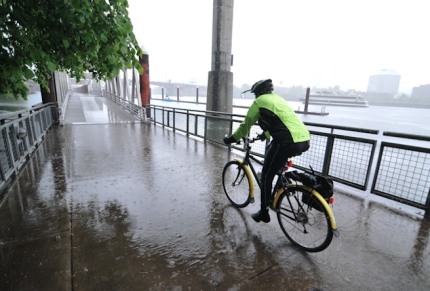
Record snowpack on Mt. Hood and significant and steady rainfall all year has led to a flood warning for the Columbia River. Closer to downtown Portland, the Willamette isn’t nearing flood level, but it’s much higher than usual. For those of us riding bikes on the Eastbank Esplanade and the Steel Bridge, the high water is hard to miss.
Check out how close it is to the lower deck of the Steel…
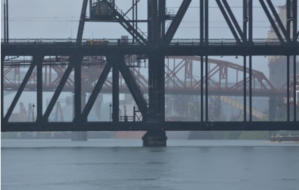
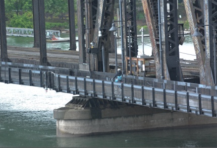
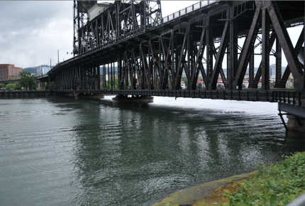
The floating dock portion of the Esplanade (just south of the Steel Bridge) is nearly flat…
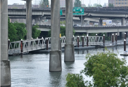
Riding southbound, instead of a downhill onto the dock, I actually had to pedal up a few strokes. Here’s the view looking northbound from the floating dock toward the ramps (which are usually going downhill)…
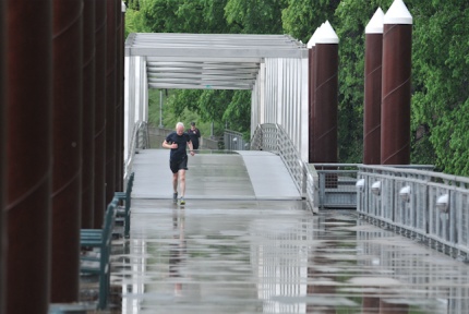
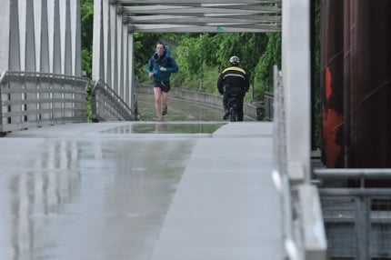
Another thing you might want to keep in mind for your ride home tonight is that the Steel Bridge is being raised very frequently due to the high water. The lifts are causing the bridge operator to yell and get frustrated with people who aren’t heedling lift warnings. I saw a relatively small private boat trigger a bridge lift a few minutes ago… (To avoid the hassle, I recommend taking the main, upper deck of the bridge.)
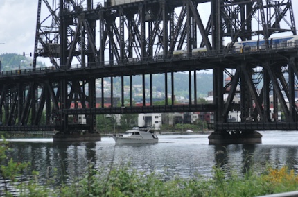
Here’s to hoping the rain lets up for the evening commute. If for no other reason than to improve this guy’s mood…

What else are you seeing out there? Does anyone have a report on the Marine Drive path along the Columbia River? Is it in danger of being submerged completely?


Thanks for reading.
BikePortland has served this community with independent community journalism since 2005. We rely on subscriptions from readers like you to survive. Your financial support is vital in keeping this valuable resource alive and well.
Please subscribe today to strengthen and expand our work.
I’ve never ridden my bike on the upper deck of the Steel Bridge because I’m not a fan of riding around all those tracks and traffic in the Rose Quarter area. One good thing about the Steel Bridge is that it’s raised and lowered very quickly compared to the other bridges……but, yes, people should obey the bridge operator!
Day before yesterday I rode the MUPs by Marine Dr and the water was nowhere near close, but that was two days ago. Will ride down from Cherryville (above town of Sandy) to Vantucky on Saturday (Columbia is supposed to reach max flood stage then), will send pix if interesting.
High water has affected the Willamette further south, too. I take the Willamette Greenway Trail to work, and a large part of it has been flooded near Pendleton Street. Luckily the puddle isn’t too deep to ride through.
when I rode the east-bank last week I had to go up the ramps instead of down and it felt really foreign…
Yeah, it’s really high right now. I noticed that someone installed plastic erosion controls along the Springwater in the places where the path was starting to wash out from this winter’s rains. Sellwood River Front Park is a bit wet right now as well. I shot this photo the other day http://www.flickr.com/photos/offhegoes/5756288639 The dogs were loving it.
Lots of trees under water along the river portion of the corridor too.
The part of the Columbia River waterfront trail in Vancouver is closed but I rode through about 6 inches of water on the trail yesterday.
If I were a bridge operator I would also probably raise my voice if people were not heeding the warnings. That is exactly what the loudspeaker is for. I guess they technically could raise the bridge just a bit with people on it, since the decks just lifts vertically, but I have a feeling that the bridge operator would lose his/her job if they did that.
If people are not respecting the lift warnings they deserve to be yelled at.
I prefer Civil Disobedience over Yelling
That’ll help with those rough joints on the normally inclined part of the floating path, eh?
Awesome. Time to borrow the OMSI sub, maybe race a few bicyclers and the city’s Southern Pacific 4449 steam engine up the Springwater/Willamette Way.
The Columbia would have to raise 8-10 ft to be anywhere near the Marine Drive path.
Just sent the following to shift and safe@portlandoregon.gov…
Hey all,
For those who haven’t been riding the east bank esplanade and seen the water gradually rising, the floating docks which normally are sloped down have a *steep* uphill slant to them on entrance and exit. Quite jarring if you’re not expecting it. I’m cc’ing
safe@portlandoregon.gov, the email address associated with the Transportation Safety and Neighborhood Livability Line. There’s a small bit of paint on the ramp to draw attention to the hazard but I think it could use a bunch more signage.
Here’s a relatively recent bikeportland thread, but I believe the change in the past 24 hours has changed the profile dramatically:
http://bikeportland.org/2011/05/26/photos-high-water-on-the-willamette-near-eastbank-esplanade-53740
Jonathan
I rode this yesterday and the two initial ramps are very steep and it is hard to get up and down it. Go slow, lift your wheel or even hop off the bike and lift it up those portions.
I rode the Esplanade northbound this morning (for the first time since last Thursday) and wasn’t prepared for the bump at the south end at all – my u-lock popped right out of its bracket at the sudden impact.
I appreciated the spray-painted markings and orange tape afterward. 🙁
Go slow out there, folks! Mindful’s suggestion to hop off and lift your bike at those points is a great one.
Can’t wait for the river to go down!