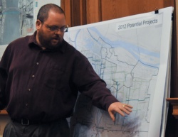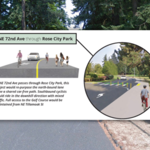
neighborhood greenway projects last night.
(Photo © J. Maus)
The City of Portland Bureau of Transportation (PBOT) released a new list of potential neighborhood greenways last night. The list of projects represents the third phase of implementation in PBOT’s ongoing effort to create a complete network of low-stress, family-friendly bikeways.
Below is the list (and a detailed map) as it was presented to the Portland Bicycle Advisory Committee last night:
- SE Main/Mill — SE 96th to Portland’s eastern border (SE 174th)
- 80s — Powell to Foster
- St. Johns Connection via New Columbia — N Houghton/Dana/Terry
- Holman/Bryant — Dekum and Interstate to Holman/MLK
- SW Maplewood/Gabriel Park
- 77th — Sacramento to Alberta
- 30s — Gladstone to Glisan

– Download PDF (6MB) –
PBOT traffic safety expert Greg Raisman says the list is still not set in stone. He and PBOT staff plan to work over the next month or so with the Bike Advisory Committee and neighborhood groups to refine the it.
If the projects above were to be completed, Raisman pointed out that by the end of 2012, you’d be able to ride a contiguous, low-stress bike route from Pier Park in St. Johns all the way NE 74th and other parts of the bike network. Raisman pointed out how PBOT worked closely with the New Columbia housing community bike committee on the St. Johns route, which will give residents high quality bike access to the popular Fred Meyer store in the area.
Also at the meeting last night, PBOT Traffic Safety manager Mark Lear referred to this third phase of neighborhood greenway development as part of their ongoing strategy to build a “feeder system… the same way TriMet invested in bus routes before they built light rail.”
As for this list of neighborhood greenways, Raisman says once the projects are solidified, construction is likely to start in the summer of 2012 and be completed by the end of the year. Funding for the projects comes from a mix of sources, including state gas tax and vehicle registration fees and PBOT discretionary revenue.
You can learn more and weigh in on these projects at two important neighborhood meetings coming up this month. The East Portland Action Plan Bike Committee meets Thursday, March 17th at 6:30 at Muchas Gracias (1307 NE 102nd) and SW Trails is holding a meeting to discuss their neighborhood greenway projects on March 16th at the Multnomah Arts Center (Room 29, 7688 SW Capitol Hwy) at 7:00 pm.
Watch our short neighborhood greenway animation for another look at past, current, and future projects:
Untitled from Joshua Cohen on Vimeo.


Thanks for reading.
BikePortland has served this community with independent community journalism since 2005. We rely on subscriptions from readers like you to survive. Your financial support is vital in keeping this valuable resource alive and well.
Please subscribe today to strengthen and expand our work.
Is there a picture/map of all of these or them individually somewhere?
This is great news.
I love to hear about the next phases of the Bike Boulevards/ Greenways. The neighborhoods that are getting these can really use them! Thanks for the update.
These proposals, and future ideas, can be seen on the great animation by Fat Pencil Studios for BikePortland are available in animated form. Check it out:
http://bikeportland.org/2011/03/04/how-portlands-neighborhood-greenways-will-transform-our-city-49138
Glad to see some prioritization for neighborhood greenway development in East Portland. I would really like to see the City move forward one of the north/south neighborhood greenways alignments east of I-205 sooner rather than later.
Still don’t see 9th, Holgate to Lombard….
Good luck. Anything past 60th ave will have the libertarians throwing temper tantrums like they always do.
More. Faster.
Very glad to hear Portland is continuing to make great progress on the neighborhood greenways projects! It’s so important for the continued health of our city!
“More. Faster.”
How about just faster.
Many current routes are overly circuitous, have unsignaled intersections with arterials, and are in disrepair. An increasing number of cyclists are taking arterials because the signaling and smooth pavement allows for faster travel. For example, SE 20th sees far more bike traffic (and associated conflicts) than the bike boulevard on SE 16th.
IMO, there is too much emphasis on the creation of ultra-safe bike routes. We should also seek to facilitate efficient and rapid cycling transit. This is especially true for longer connections to outer SE and NOPO.
“…by the end of 2012, you’d be able to ride a contiguous, low-stress bike route from Pier Park in St. Johns all the way NE 74th and other parts of the bike network.”
I would add that the Mill/Main Greenway will allow cyclist a safer route from Portland’s core to Gresham without having to swing south to Holgate or the Springwater corridor. Accessing the west end at 96th you have Lincoln or Ankeny, over or around Mount Tabor, and eastbound on Yamhill to the I-205 bike path and the Pedestrian bridge over the freeway to 96th.
The 80’s Powell to the Springwater (it’s been extended beyond Foster and includes Ellis and Steele E/W connections according to the map YAY!) will be awesome. I will be using it to go get food at Goldingay’s joint on 82nd.